The Hallowed Fortress

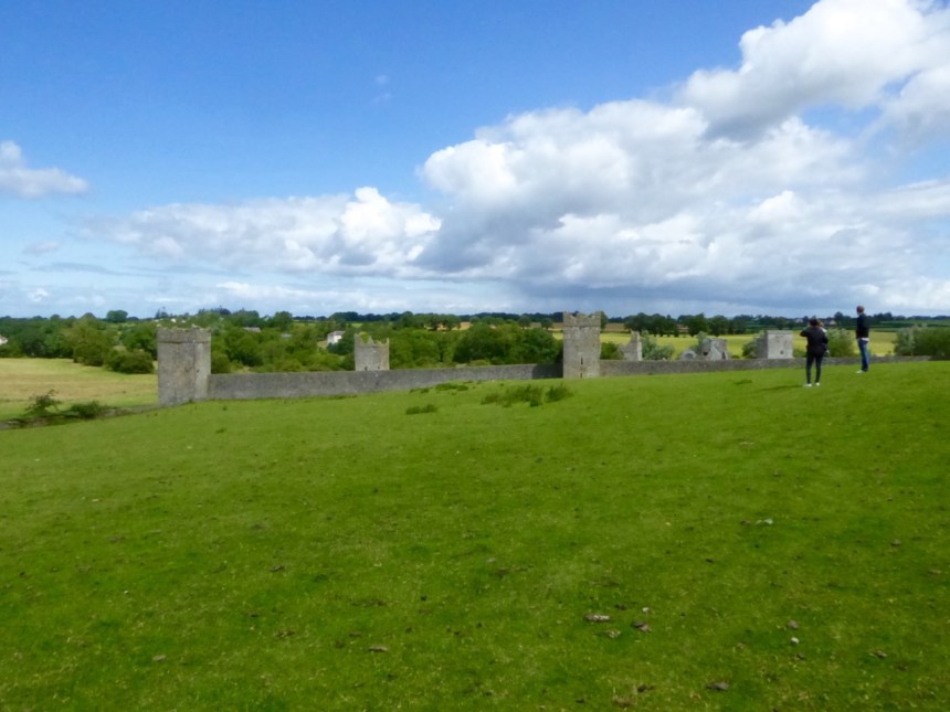
The first sight of Kells Priory is breathtaking

The first sight of Kells Priory is breathtaking

Our West Cork castles, or tower houses, can be impressive, built as they are to be dominant and defensive. But imagine a place where there are not one, but seven tower houses, all connected by a high stone curtain wall with defended gates. A medieval fortress? No – a monastery! Welcome to thirteenth century Kilkenny!
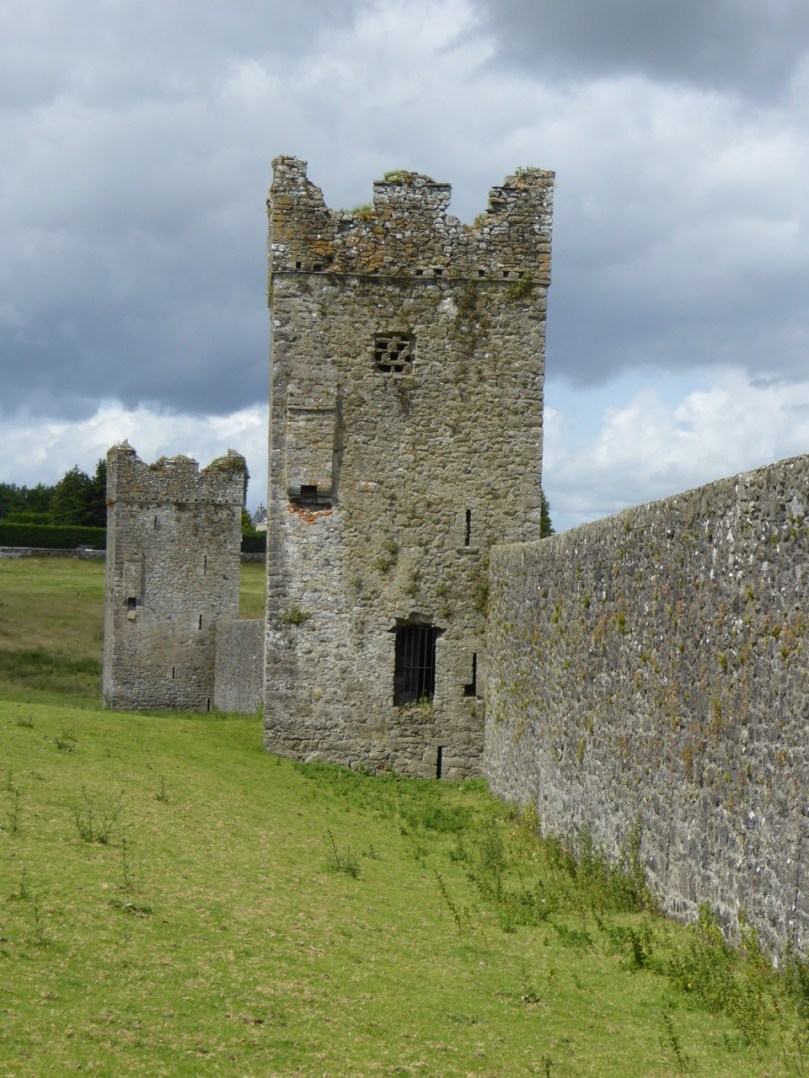
Each one of the 7 towers at Kells Priory is as large as one of our West Cork Castles

Each one of the 7 towers at Kells Priory is as large as one of our West Cork Castles

Kells Priory (not the Kells in Meath that Robert is writing about this week) in Kilkenny is a truly awe-inspiring site. A combination of monastery and walled refuge, it speaks directly to the history of Kilkenny in the 12th to the 15th centuries. This was a time when the Anglo-Normans had established themselves as the lords of Ireland, dividing the land between them. They built castles to establish their military dominance and churches and monasteries to receive the tithes that came with ownership of vast tracts of land – and to save their souls. Although there was probably an older smaller church on the site, the current priory was established when Geoffrey fitzRobert invited Augustinian Canons from Cornwall to settle in Kells in 1193. The Augustinians, unlike the enclosed Cistercians, functioned as parish priests who tended to their congregation, hosted travellers, ministered to the sick, and assisted the local economy by providing mills, and sometimes bakeries and breweries.
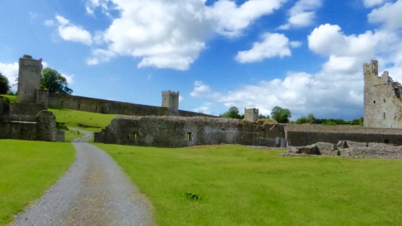
Monastic Precinct. To the right is the Prior's Tower. Over the reredoter is the water tower and far Burgess Court

Monastic Precinct. To the right is the Prior’s Tower. Over the reredoter is the water tower and beyond is the Burgess Court

The initial phase of building included the area now known as the Monastic Precinct. A church, chapter houses, stores, a refectory and a mill were built and added-to over the course of the 13th and 14th centuries. This precinct was surrounded by a wall, which included some mural towers, but it was not primarily defensive. 

The construction of the enclosed area known as the Burgess Court dates to the 1460/70s. Warring factions among the Anglo-Normans, constantly invading each other’s territories, sacking and looting, created a climate of turbulence and insecurity. In the absence of a resident and powerful defender of the people of Kells, the Priory took it upon themselves to provide a refuge.

The Fortified Gate, from the outside (note the machicolation above the arch) and the inside (note arrow slits on either side).

The curtain wall and its mural towers constitute an impressive defensive system. Each tower was based on Henry VI’s ‘£10 Castle’ plan, with stores and administration rooms on the lower floors.  Living quarters occupied the upper floors which had fireplaces and garderobes. The crenellated battlements supported wall walks, and here and there were machicolations, murder holes and copious arrow slits. We can imagine the townsfolk of Kells flocking to the Burgess Court with whatever they could carry as a succession of marauding knights advanced and retreated. The priory was burned and sacked in 1262, and twice in the 14th century.
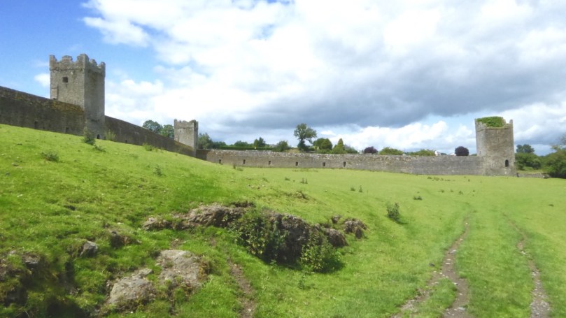
Inside the Burgess Court. The curtin wall had arrow slits all around it, as well as the towers

Inside the Burgess Court. Besides the mural towers, the curtain wall itself had arrow slits all around it

The Prior added a fine new tower for himself around this time too – well crafted and recently stabilised. Improvements and enlargements to the church were undertaken and a new belfry was added. When times were peaceful it must have been a bustling and thriving place, a welcome sight to weary travellers.

The Prior's Tower. Beautifully built, but still emphasising defence against attack

The Prior’s Tower. Beautifully built, but still emphasising defence against attack

Left, a sedile (seat) and piscina (for washing vessels) inside the church. Right, some recent reconstruction demonstrates what the church would have looked like.

The monks had a cloister, of course, for prayer and contemplation. Their refectory was above the store house and featured a lavabo, for hand washing, at the entrance. A small canal from the river provided water for the mill and also carried away the waste from the reredoter, or necessarium – the communal latrine.
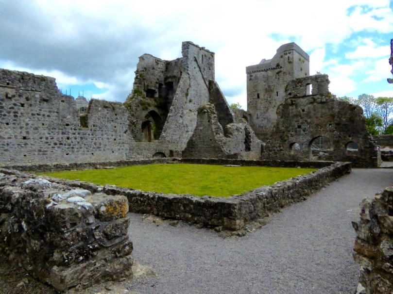
Cloisters

The Cloister. The Prior’s Tower and Cross Tower in the background
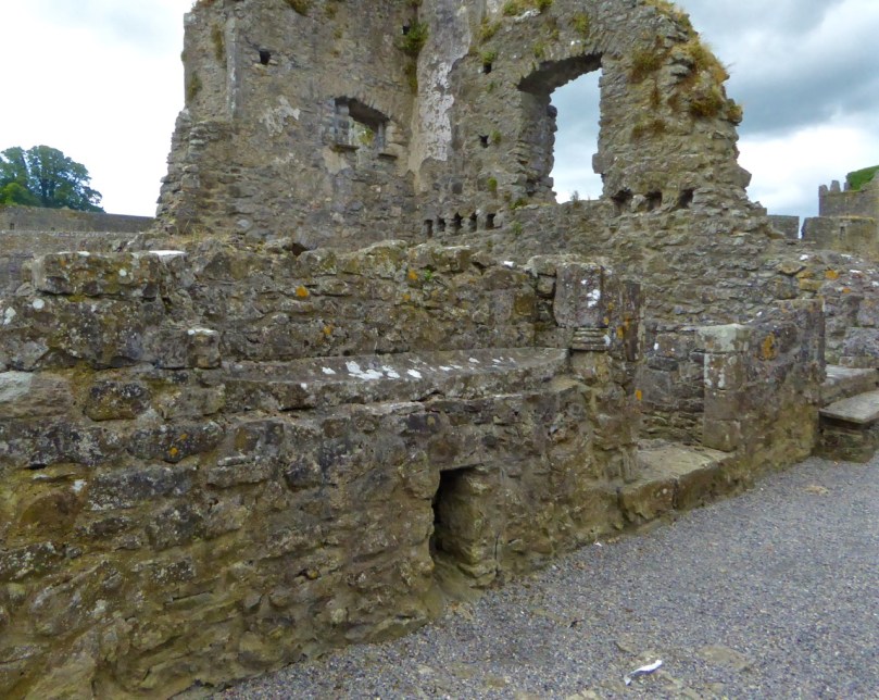
Lavabo. Note the drain.

Lavabo. Note the drain

The Dissolution of the Monasteries in 1540, under Henry the VIII, spelled the end of Kells Priory as an active monastery. All its lands were confiscated and it gradually fell into ruin. Unlike other religious ruins, the walls and towers remained reasonably intact, indicating that they were probably used as farm buildings and perhaps garrisons, over the centuries.
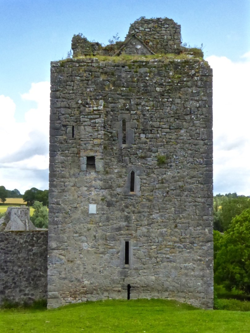
Southeast Tower. Three different windows and a guarderobe chute

South-east Tower. Three different windows, arrow slits, and a garderobe chute

To learn more about Kells Priory, take a tour through this brilliant website. Written by Daniel Tietzsch-Tyler, and illustrated with his plans and drawings, it is a mine of information and a virtual course in medieval history and architecture. I gratefully acknowledge that this post owes much to the treasure trove of detail it contains.
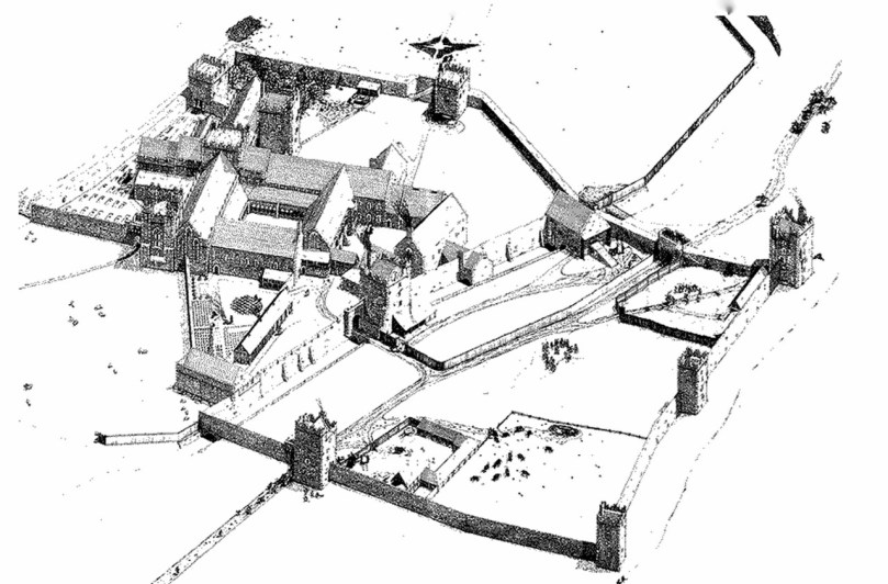
© Daniel Tietzsch-Tyler

© Daniel Tietzsch-Tyler

You’ll find Kells Priory about 10km south of Kilkenny City. It’s well signposted. While you’re there, make a side trip to Jerpoint to see the medieval carvings that Robert illustrates in Medieval Feast. It would make a grand weekend outing from Cork!
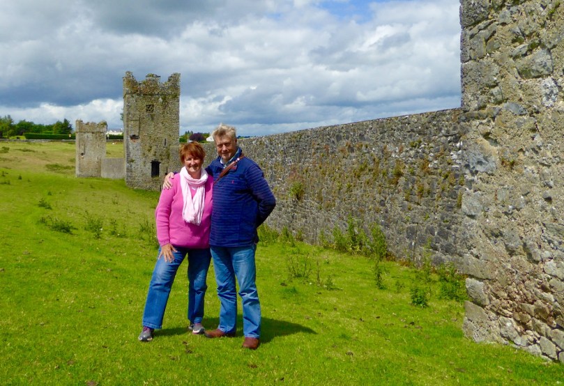
A Grand Outing!
A Grand Outing!

A Medieval Feast

4 weepers

This was a feast for the eyes – a few thousand years younger than Rock Art and far less enigmatic! Our travels took us to County Meath where we explored the monastic city of Kells (where the famed book was written and illustrated), Kells Augustinian Priory – a different Kells but in County Kilkenny (and which Finola has written about in her post) – and Jerpoint Abbey – a Cistercian monastery rife with carved figures – some up to 900 years old.
kells 2

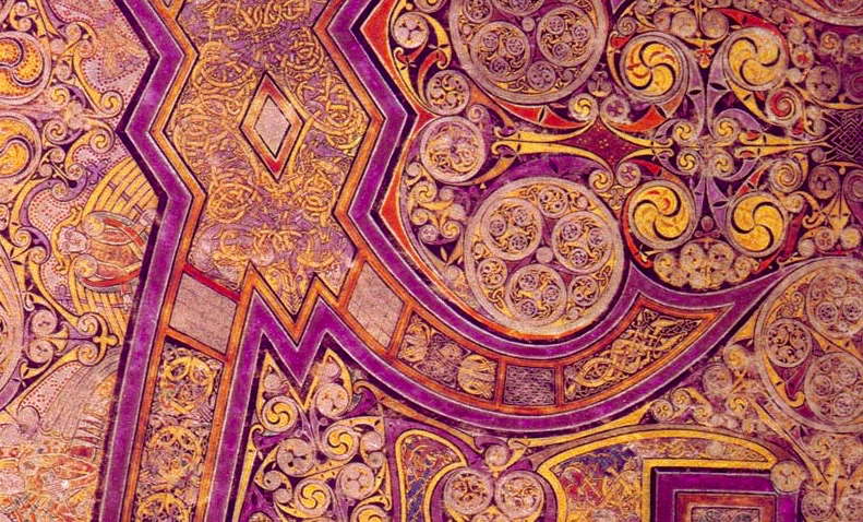
Firstly, the Book of Kells is worth more than a passing mention, especially as some commentators have likened the medieval carvings at Jerpoint and other contemporary monastic foundations in Ireland to ‘illuminated manuscripts cast in stone’ – because of the richness of the characters, the decoration and the detail. The Book of Kells probably dates from the 8th or 9th centuries and may either have been written in its entirety in Kells, or started by St Columba’s community in Iona and completed in the Scriptorium in Kells. That building still exists! In fact it (or something very like it) is illustrated in the book. It’s known as St Colmcille’s House – we went to have a look at it, and were fortunate to have a tour by its guardian.
scriptorium book of kells

A page from the Book of Kells which may be an illustration of the Scriptorium at Kells – and, perhaps, a self-portrait of the writer: see him sitting in the doorway to the house working away with his quill pens…
St Colmcille’s House – in its 21st century context (top left), the keeper of the key (bottom), and the ancient stone roofed oratory (main picture) which is supposedly where the Book of Kells was written – or, perhaps, completed. The upper floor of the building has a small window oriented to focus sunlight on the writing table. St Colmcille’s bed was also kept here – a large and heavy stone slab – until it was stolen in the 1950s! A few hundred years earlier (in 1007)  the Book itself was stolen from Kells and eventually found in a nearby bog. It stayed in Kells until 1654, when it was sent to Dublin for safekeeping: it is now on permanent display in Trinity College.

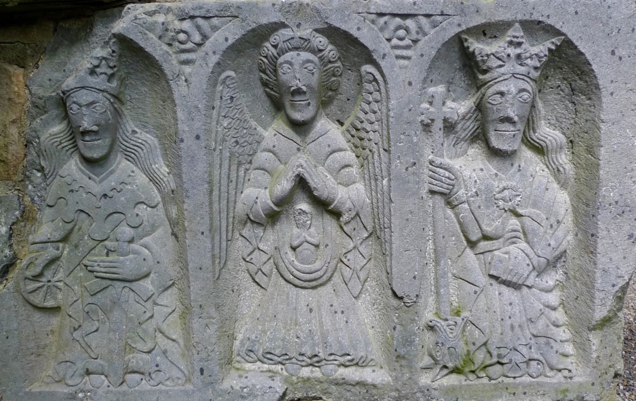
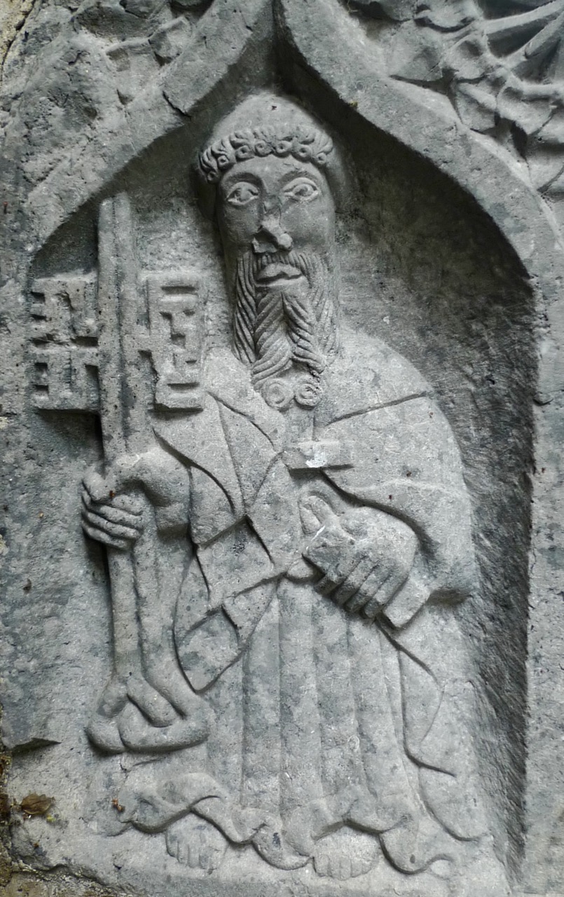
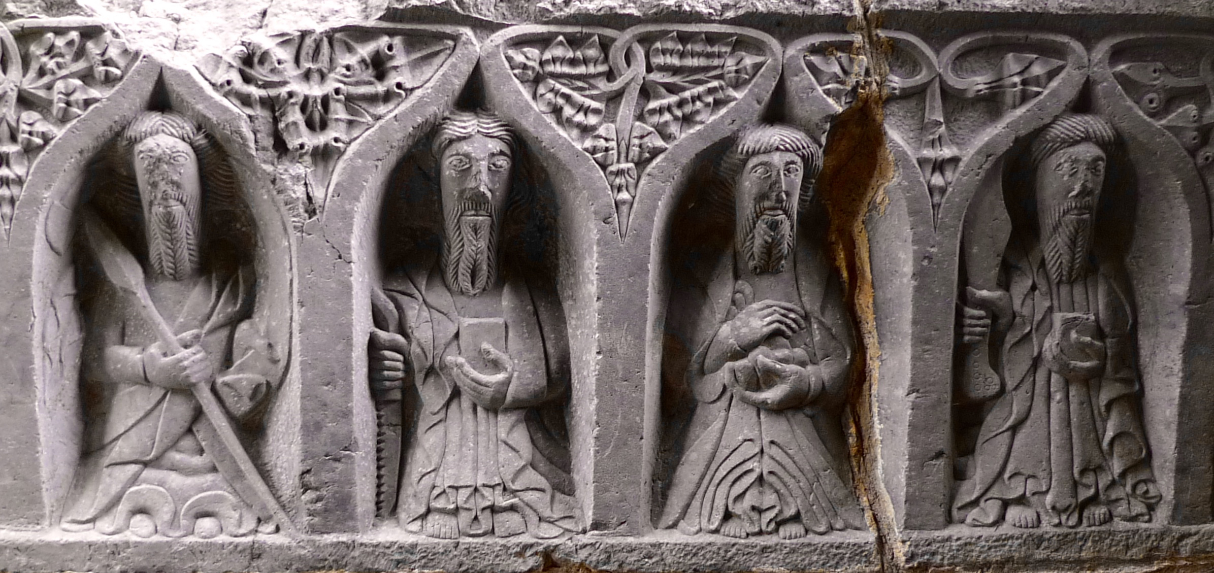
So – back to the feast, and this was centred on Jerpoint (Kilkenny), which has spectacular examples of medieval carving, including at the tomb of Felix O’Dulany, Bishop of Ossory between 1178 and 1202. Adornments on later tombs include ‘Weepers’ – those who might be in mourning for the departed souls. These figures were carved by members of the O’Tunney family – sculptors from Callan who worked in the 15th and 16th centuries. Some of them can be readily identified: St Peter, for example (another keeper of the key), while the trio below are St Catherine – with her wheel, Michael the Archangel and St Margaret of Antioch – who is conquering a Dragon.

trio

The Weepers at the top of this post show how they were martyred: St Thomas with a lance, St Simon with a saw, St Bartholomew holds a skin (he was flayed to death) and St Paul with a sword.

trio 2

Another trio of Weepers: none of the guidebooks identify these, but I’m sure that among our readership there is an expert hagiographer who can help out…

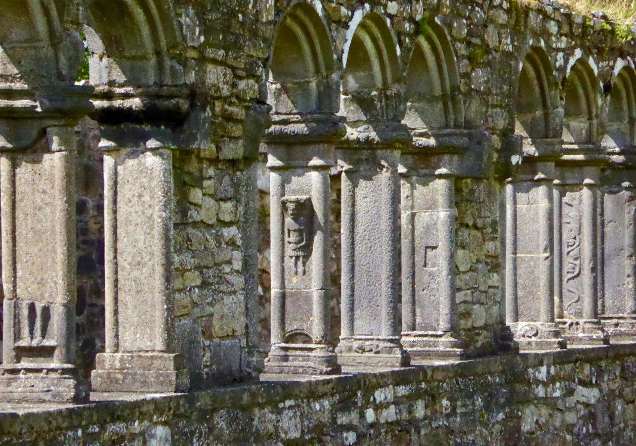
At Jerpoint it’s not just the tombs and the Weepers which fascinate: there is a 15th century cloister which, in its heyday, displayed a riot of carvings both saintly and secular. Some of these are in situ; some are partially destroyed and others have been recovered during archaeological excavations, and placed on display in a little museum. Among them we identified knights, ladies, animals fantastic and real, and ‘ordinary folk’ – including a man with stomach ache!

arches

It’s not easy to do justice to all the carvings at Jerpoint: I could fill many more pages. There are also cross slabs, roof bosses, decorative friezes and capitals…

I can’t leave Jerpoint without recounting one story which I was delighted to discover. You may remember my excitement when I found out that the real St Valentine is interred in the Carmelite Church in Dublin. Here at Jerpoint, Co Kilkenny, is another marvel: the bones of St Nicholas are reputed to be buried here… Yes – the Santa Claus St Nicholas! Tradition has it that a band of Irish Norman knights from Kilkenny went to the Holy Land to take part in the Crusades. As they headed home to Ireland, they ‘seized’ St Nicholas’ remains, bringing them back to Jerpoint, where the bones were buried – some say – under the floor of the Abbey (others say they repose nearby at the old church of St Nicholas).

Cross-slabs commemorating knights at Jerpoint: did they bring back Saint Nicholas from the Holy Land?

…That saint protector of the child
Whose relics pure lie undefiled
His casket safe within its shrine
Where the shamrocks grow and rose entwine…

(from The Bones of Santa Claus by Bill Watkins)

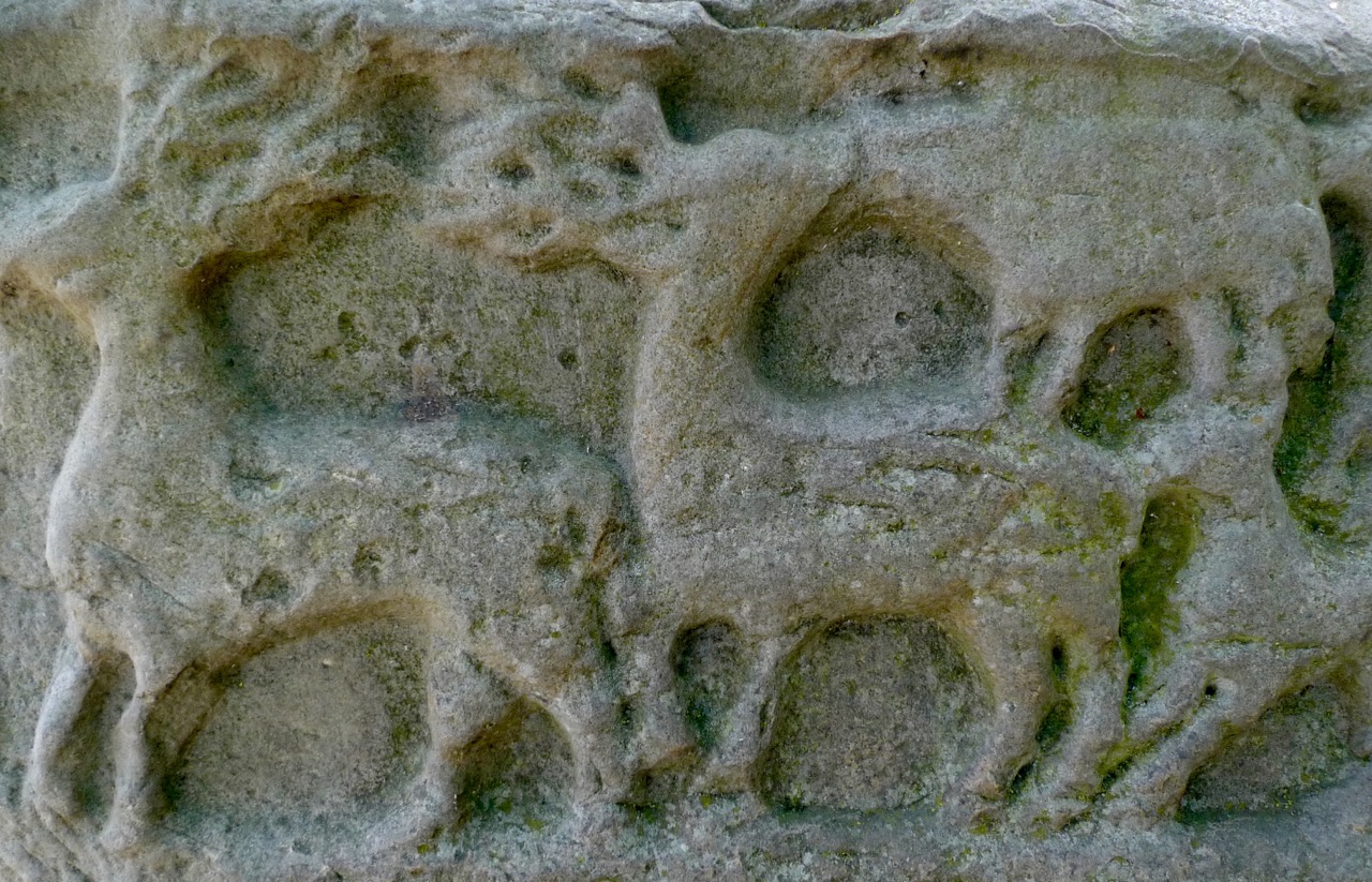
Well, we may or may not have seen – or walked over – the tomb of St Nicholas, but we saw his Reindeer during our medieval feast tour. Or perhaps they were somebody else’s Reindeer… They are carved on to the base of the Market Cross in Kells (Meath), the town which boasts so much history and which has no less than five high crosses and a round tower.

kells deer

Medieval illustrations on the high crosses at Kells, including some enigmatic Reindeer

Finola and I between us have treated you to a horn of plenty this week with our tours of medieval hotspots in Ireland. We know it’s not West Cork! However, these posts demonstrate, again, how easy it is to find history (and legend) wherever you go in this special land. In fact, it’s very difficult to travel far here without tripping over the past. It’s always fairly low-key. Most sites are protected as scheduled monuments; some are in the good care of the Office of Public Works and have guides and visitor centres. Many are remote, open to the wind, rain and sunshine and free for us all to visit: very often you will have the history all to yourself.

st peter


Scratched Stone – Scratched Heads

stone scratches

Aultagh Ogham Stone

One thing always leads to another – that’s something you can be sure of when we are on our archaeological adventures. A case in point was a recent expedition to have a look at Ballynacarriga Castle (not far from Dunmanway, County Cork: 16th century – notable for having a Sheela-na-gig carving built high up into the outer masonry wall, and some unusual carved inscriptions on the internal stonework).

Ballynacarriga Castle (left) with its Sheela-na-gig (right)

Perhaps these various stone scribings turned our minds to the subject of Rock Art (easily done). Our excellent guide on that morning, Margaret Murphy of the Skibbereen Heritage Centre, offered to show us an Ogham stone not too far away, in the townland of Aultagh. How could we refuse?

finding the stone

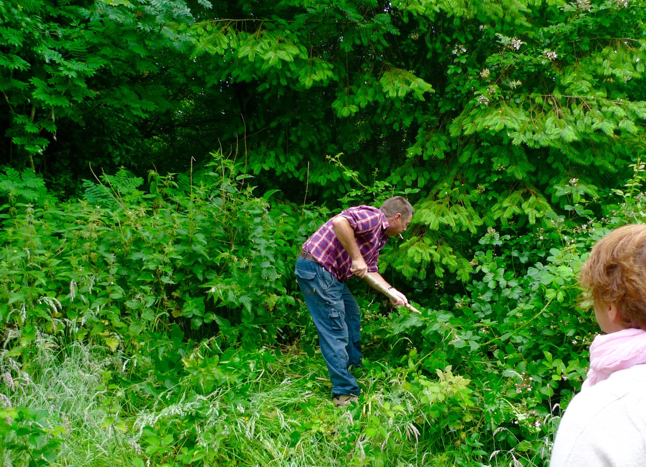
Assistance required in finding the stone!

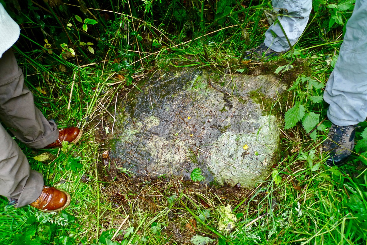
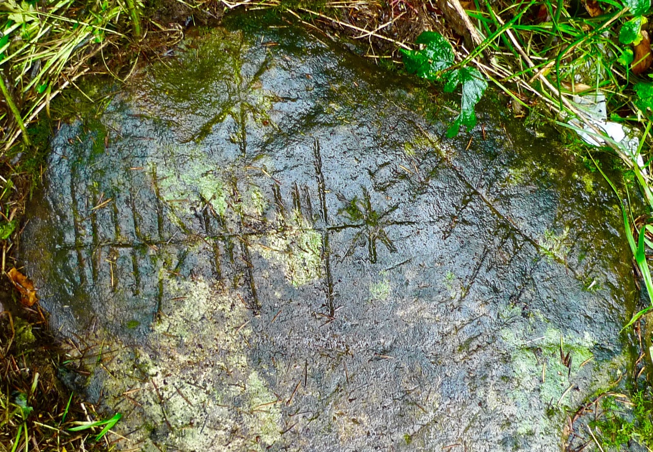
Our goal was beside an ancient track in Aultagh Wood (Coil an Ailtaigh), approached from a private driveway. Margaret knew the owner who readily gave us permission to have a look. In fact, he provided sterling service after we had searched in vain for the elusive rock – opportunely arriving with a pole to clear the thick undergrowth, and soon revealing this modest boulder to our eager gaze.

stone discovered

Stone uncovered…

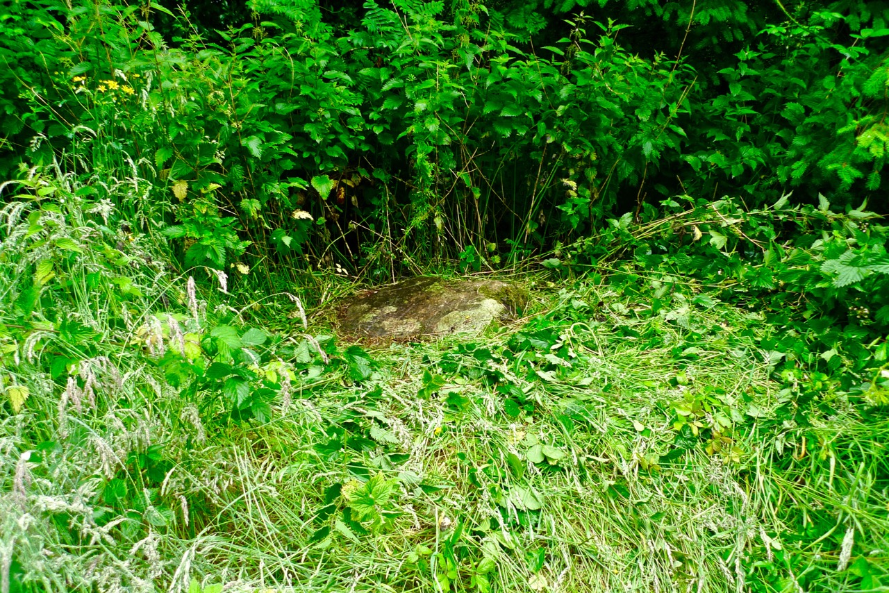
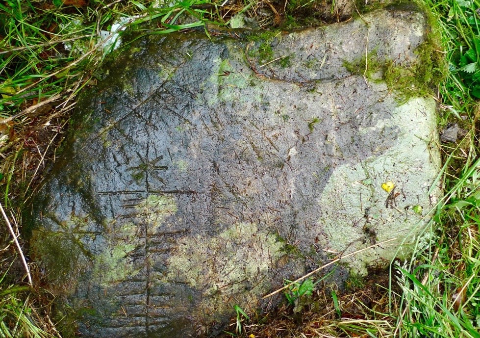
The stone lies close to a drainage ditch and has possibly arrived there from another location at some time in its history. In one area the surface of the rock has been damaged, affecting part of the scribings: it may be that it was once standing – now it is prone with carved marks clearly visible on the upper surface.

stone in context

The Aultagh Ogham Stone in context

The last time I wrote a post about ogham (here it is) I gave a very general overview of the subject. Ogham stones are concisely described by the Irish National Monuments Service as:

…upright monoliths or recumbent slabs, onto which ogham script has been incised. Ogham script consists of groups of 1-5 parallel lines and notches cut along the side or across the edge of a stone to represent the sounds of the Irish language. It is usually read up the left angle. The inscription gives a person’s name (usually male) and immediate antecedent/s or tribal ancestor. The stones may have functioned as memorials, grave markers or territorial markers and date from the late 4th to the early 8th century AD.
Fine examples of ogham stones in Ireland

Here’s the entry in the National Monuments Service records for our Aultagh stone:

Description: On a W-facing slope, in Aultagh Wood. Fallen stone (L 1.1m; 0.7m x 0.3m) with inscription on flat face. According to Macalister (1945, 75) ‘fashioned by an illiterate artificer, copying by rote from a wooden model cut for his guidance’ and reading UBEDABO ALTASI.

MacalisterThat’s quite a bald statement from Robert Alexander Stewart Macalister who was Professor of Celtic archaeology at University College Dublin from 1909 to 1943, during which time he compiled and edited the catalogue of all known ogham inscriptions from Britain and Ireland. Macalister’s theories on ogham are generally out of favour today (some commentators have claimed that his interpretations are gibberish) but he seems to accept the Aultagh stone as being within the early medieval ogham tradition. Yet it seems to me very different from many of the other stones we have seen: it is very sharply incised, obviously with a fine-tipped metal tool, whereas a majority of the traditional or ‘classic’ ogham stones are larger and more robustly carved.

Possible ogham stone at Maulinward, West Cork (left) and others from the Stone Corridor at UCC

When you begin to delve into modern literature on ogham you realise how very many varieties of examples there are, and also how many differing interpretations there are of how to ‘read’ the script. This was monumental writing, labour intensive and time consuming to undertake. For this reason it is generally supposed that ogham was ostensibly reserved for marking important graves or places, and that the inscriptions are all names.

Aultagh Inscribed completeAultagh Ogham Stone – ‘classic’, ‘scholastic’ – or ‘fake’?

There are suggestions that ogham inscriptions for more general – and less monumental – usage were once carved on wood, and might have been language primers for the bardic poets. Later inscriptions are sometimes termed ‘scholastic ogham’ deriving from the fact that the inscriptions are believed to have been inspired by manuscript sources, instead of being continuations of the original ‘monument’ tradition. Hallmarks of scholastic ogham are the median line and scribings being on the flat face of a stone (as at Aultagh) rather than on the edge. Ogham was occasionally used for notes in manuscripts down to the 16th century, and the burgeoning interest in all things antiquarian from the 18th century onwards led to  a popular ogham revival. A typical example, from the graveyard in Ahenny, Co Tipperary, has an English inscription dated 1802 and this in ogham: FA AN LIG SO NA LU ATA MARI NI DHIMUSA O MBALLI NA GCRANIBH, interpreted as ‘Under this stone lies Mary Dempsy from Ballycranna’. Macalister takes the view that this inscription, and others like it, were written “with much more zeal than discretion”, while some scholars have suggested that this more modern usage of the scribing should be termed ‘fake ogham’.

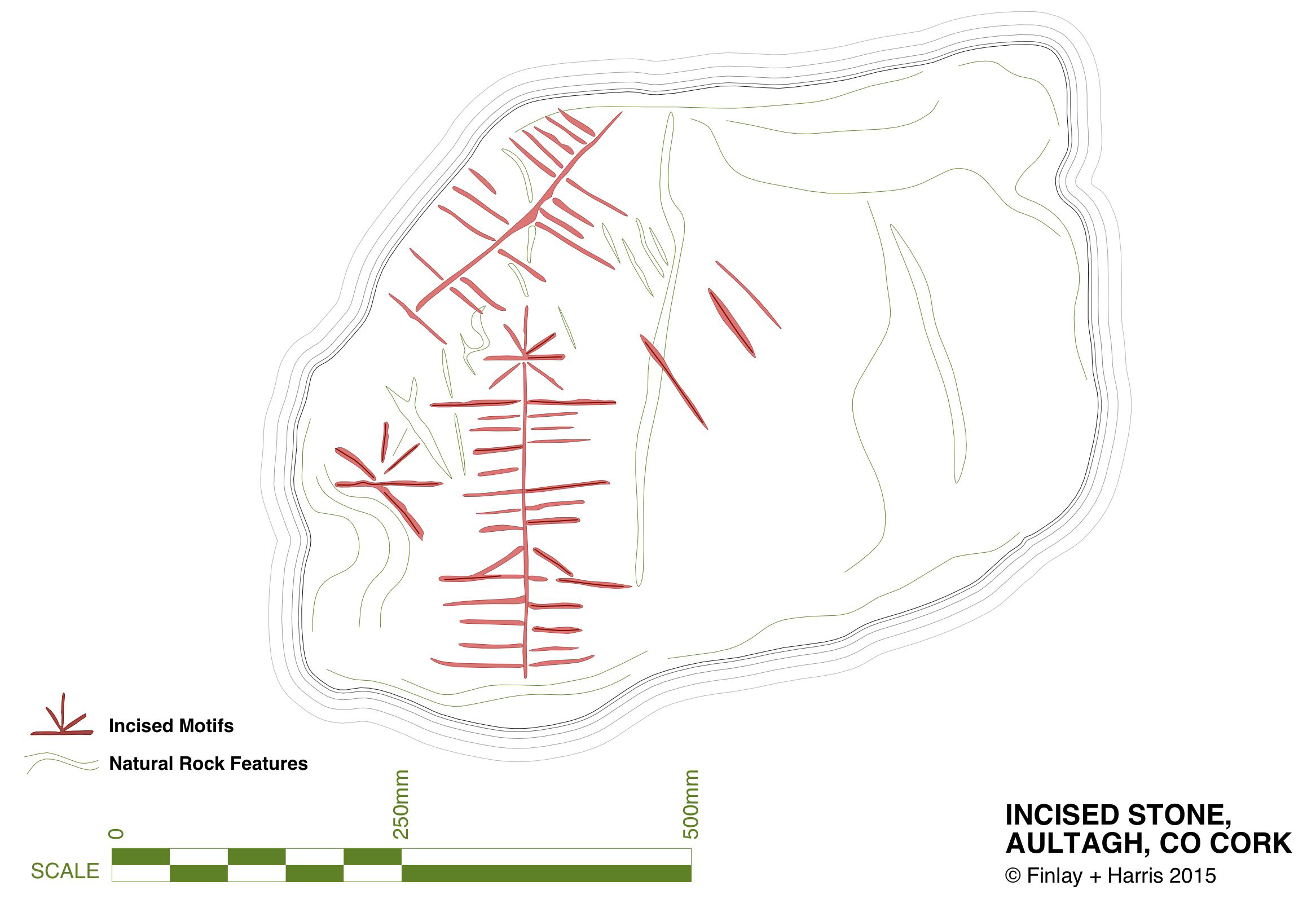
Aultagh Incised Stone

My own drawing of the Aultagh inscribed stone – traced from detailed photographs

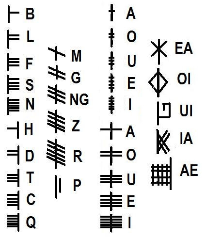
You may like to have a go at translating the inscription at Aultagh for yourself. Firstly you will need to select your decipherer: a quick internet search will show that there are many, and also a whole lot of inconsistencies. But perhaps this is all part of the head-scratching: and also part of the whole fascination of a historical subject where many of the elements can only be guessed at…

ogham-alphabet

A Tale of Four Churches

Kilcoe Medieval Church

Kilcoe Medieval Church

Kilcoe is a magical place. The story of its four churches leads us from the dawn of Christianity in Ireland through turbulent times and many centuries when religious differences and sectarian strife marked all aspects of life in Ireland.

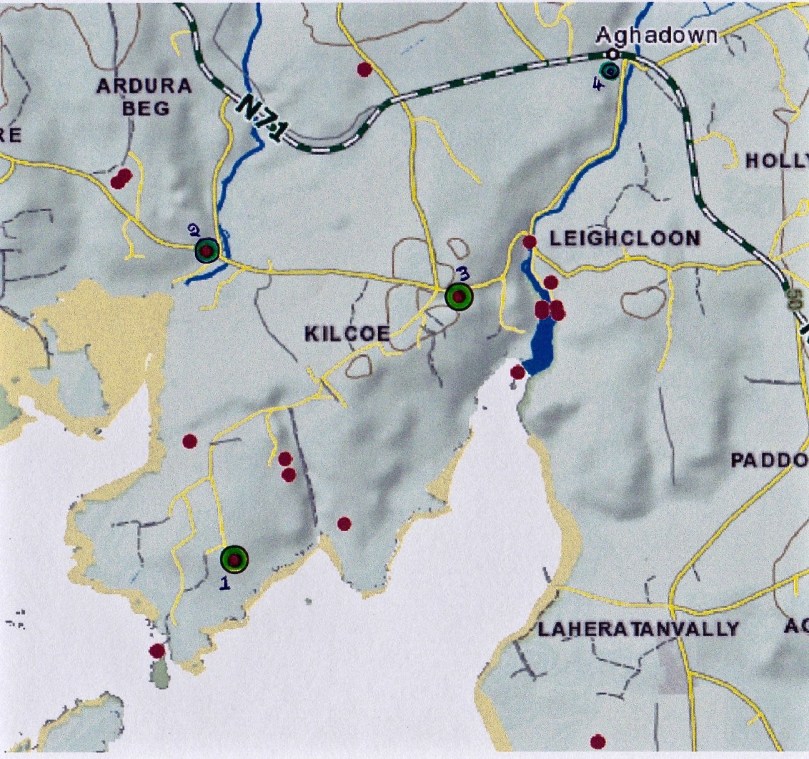
The four churches: 1, Kilcoe Medieval Church  2, Mass Rock 3, Kilcoe 19th Century Church 4, Kilcoe Modern Church of the Most Holy Rosary

The four churches: 1, Kilcoe Medieval Church. 2, Mass Rock. 3, Kilcoe 19th Century Church. 4. Kilcoe Modern Church of the Most Holy Rosary

We love going down to the Medieval church at Kilcoe or wandering the boreens along the Roaringwater River. Those boreens are now part of the Fastnet Trail Network and last weekend, at the Launch, we were treated to a talk about the locality from Fr Patrick Hickey, Parish Priest of Timoleague and a noted scholar of West Cork History. This blog post was inspired by that talk – thank you, Fr Hickey!

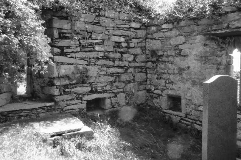
Inside the church, showing the ogival windows, the altar, piscina or stoup, and a small recessed cupboard

Inside the church, showing the ogival windows, the altar, piscina or stoup, and a small recessed cupboard

Kilcoe gets its name from St Coch, a nun said to be a colleague of St Ciarán of Cape Clear, who preached Christianity in Ireland before St Patrick, in the 5th Century. It is possible she founded a church here, but what we do know is that one was built in Medieval times – a building that still exists although the ivy is doing its best to take it over.

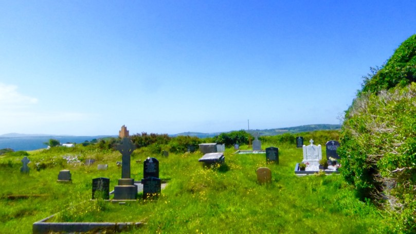
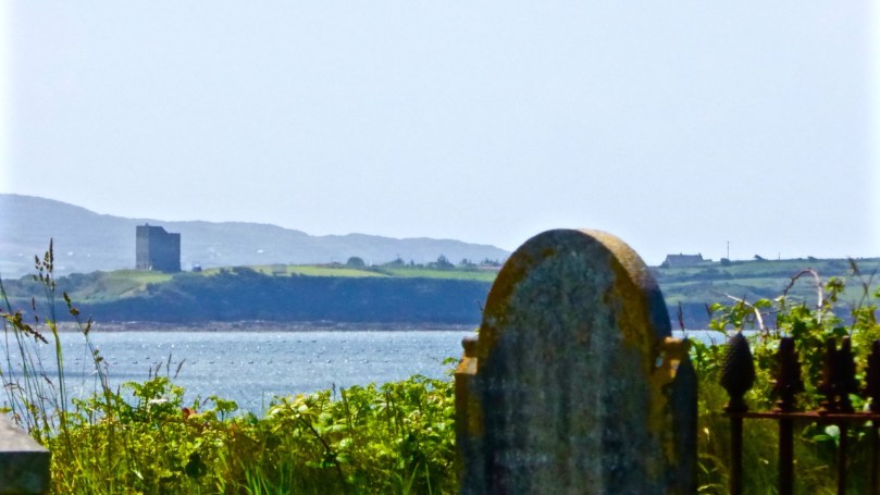
It’s a beautiful and atmospheric place, on the water, overlooking Roaringwater Bay. Two castles are in view: Kilcoe and Rincolisky, a McCarthy and an O’Driscoll Castle respectively. Each has a fascinating history that deserves a post of its own sometime. Some special features remain in this ruined church – windows with carved ogees, a lovely arched doorway, a piscina (for washing vessels) or stoup (for washing hands), a recess for storing vessels and the remains of a possible altar.

We don’t know exactly when this church was built or by whom, but we do know it was in ruins by 1615. Perhaps it was destroyed by the same forces that laid siege to Kilcoe Castle after the Battle of Kinsale in 1601 – a period that marked the end of the Old Gaelic Order in West Cork.

The Medieval church, with Kilcoe Castle in the background.

The Church, with Kilcoe Castle in the background

The rise of the Protestant Ascendancy class in the aftermath of that fateful battle privileged the Church of Ireland (transplanted Anglicanism) over the Catholic faith and a series of new laws, gradually getting harsher, were designed to suppress ‘Romanism’. This culminated in the enactment, in 1695, of the infamous Penal Laws. While attendance at mass was initially tolerated, churches could only be built from wood and away from roads. Eventually, priests were expelled from Ireland and after that mass had to be held in secret, with priests moving from hiding place to hiding place. At Roaringwater Pier Fr Hickey talked of the typical cargo of the smuggling ships that plied their trade from there: each ship to arrive from France would be carrying tobacco, brandy – and a priest!

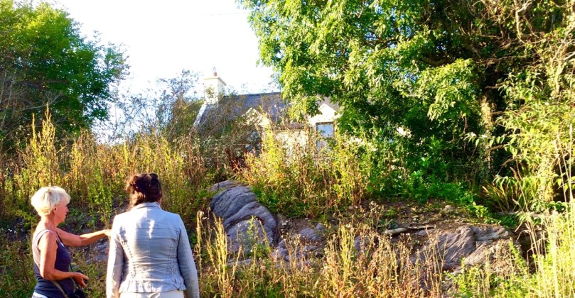
From this period we find the Mass Rocks scattered around rural Ireland, identified on the basis of local tradition. The one at Ardura Beg is just up from a tiny pier that would have offered possibility of a quick escape. Many stories have come down of lookouts warning of the approach of the ‘red coats’ and the miraculous ways in which priests would make their escape. (See here and here for examples.)

Sheona and Amanda examine the mass rock at Ardura Beg

Sheona and Amanda examine the mass rock at Ardura Beg

Places of worship must be located where they are accessible and the first two are close by the sea, which afforded the easiest travel routes in Ireland for most of its history. However, roads were constructed eventually and the next two churches were located along these new routes. The first one, we’ll call it the Old Church, was built along the new road that led from Skibbereen to the Beara Peninsula. After 1778 the anti-Catholic laws were gradually relaxed, although it was not until 1829 that full Catholic Emancipation was won by Daniel O’Connell. The Old Church was probably built around 1800 and was a simple ‘barn-style’ edifice which served an impoverished and famine-stricken populace for a hundred years.

Left, the Old Church near Roaringwater Pier. Right, an example of a simple ‘barn style’ church in West Cork

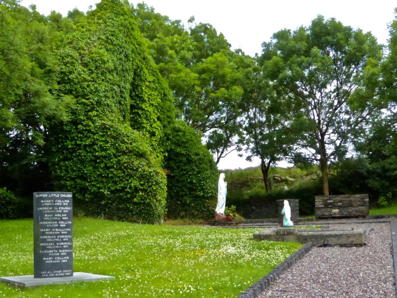
By the turn of the 20th Century it was deemed unfit for purpose. Nowadays it is a gentle green space, lovingly tended and in use as a grotto. Children were buried there – it was not a cillín, but a consecrated graveyard – and a memorial remembers them now.

Grotto and Chirdren Memorial. A place for contemplation

Grotto and Children’s Memorial. A place for contemplation

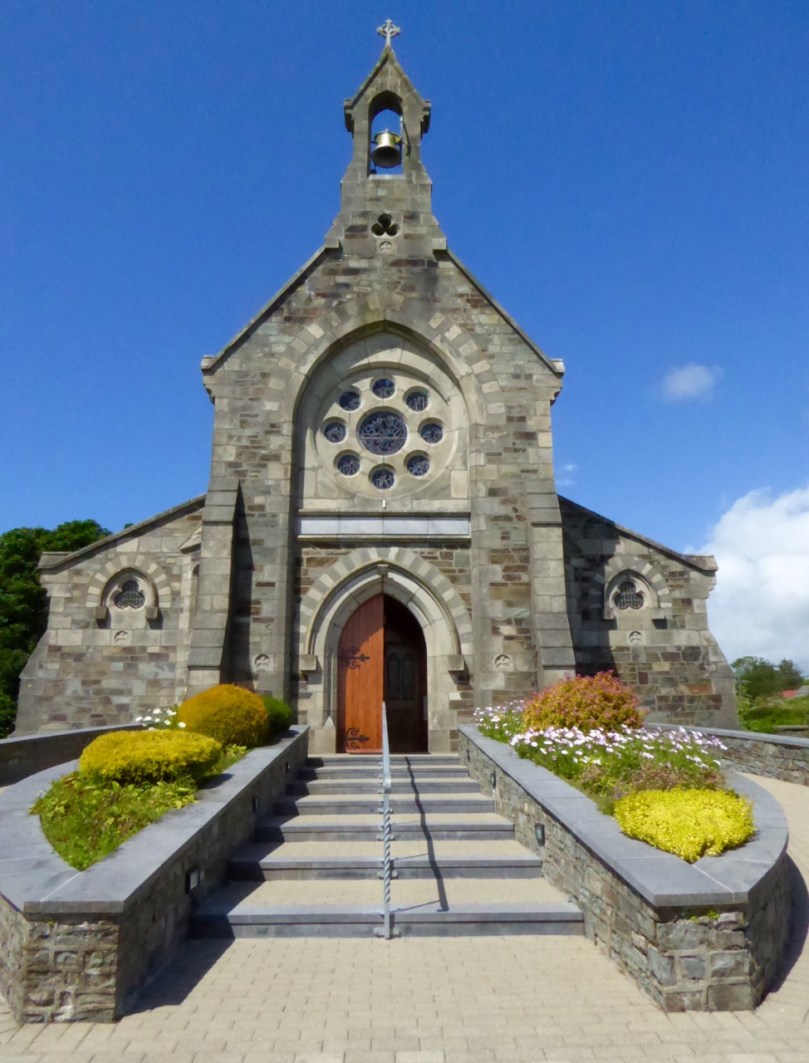
Catholic Emancipation ushered in a long period of church building by the newly-confident Catholic majority. The new road from Skibbereen to Ballydehob was constructed at the end of the 19th century and the New Church was built there in 1905, right beside the bridge over the Roaringwater River.

Kilcoe Church and Bridge

Bridge over Roaringwater River

The two styles of churches common at the time were Neo-Gothic, Influenced by continental cathedrals, and Hiberno-Romanesque which took its inspiration from the Early Medieval Romanesque style of Old Ireland and featured wonderful doorways and round towers. The Kilcoe New Church, the Church of the Most Holy Rosary, was built in the Neo-Gothic style, with a large rose window at the eastern end.

Kilcoe, Church of the Most Holy Rosary

Kilcoe, Church of the Most Holy Rosary

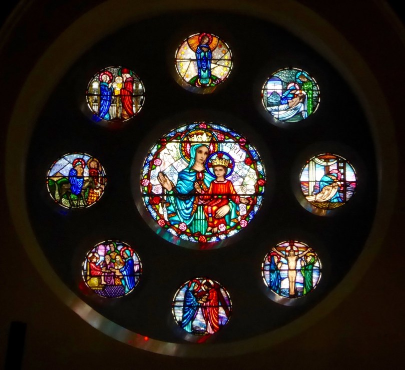
Originally the side-aisles did not have seats – poorer people could stand there for mass, while those who could afford a penny would occupy the pews. As the church fund grew, thought was put into ornamentation and stained glass was commissioned for several windows. The rose window was executed by the Harry Clarke Studios in 1943 and shows scenes from the life of Christ and of Mary.

The Rose Window, by the Harry Clarke Studio

The Rose Window, by the Harry Clarke Studio

The Altar and side windows were the work of Sarah Purser’s Tower of Glass. The choice of stained glass – from Dublin-based Celtic Revival artists rather than the English or Continental firms that supplied most church glass at the time –  was a choice that demonstrates the nationalistic feelings that were rife in West Cork at the time.

Irish History is written large on her landscape. In this one small area – these sites are within a couple of kilometres of each other – we see encapsulated sixteen hundred years of history, starting with St Coch and ending with the latest incarnation of a church at Kilcoe. Their beauty and their peaceful settings have been hard won. They should serve to remind us that peace and tolerance must always be cherished and safeguarded.

Rincolisky Castle from Kilcoe Medieval Church

Rincolisky Castle from Kilcoe Medieval Church

Closer Encounters – Fastnet Trails

The view from Cappaghglass, on the Rossbrin Walk

The view from Ballycummisk, on the Rossbrin Walk

Today (Sunday 28 June) a newly established system of walking trails was formally launched – by longstanding local TD (now retired) Jim O’Keefe – at Aughadown: we were part of the crowd

The Unveiling – from top left: mover and shaker Eugene McSweeney with Jim O’Keefe; Jim and the Fastnet Walk Trails Group Committee cutting the ribbon; on the inaugural walk – Fr Patrick Hickey giving us the low-down on smuggling at Roaringwater Pier; the wonderful Kilcoe National School Band
At Kilcoe Trailhead - the walks unveiled!

At Kilcoe Trailhead – the walks unveiled!

Rediscovering what we’ve only recently discovered… is that the best way of describing our experiences exploring the just launched Fastnet Trails? We have been traversing and driving around the boreens – local lanes and byways – that permeate this beautiful stretch of coastline and country on our own peninsula (Ballydehob is colloquially termed ‘the Gateway to the Mizen’) for the full two years that we have lived permanently here at Nead an Iolair. We have taken in the vistas – from the windows of our car – and appreciated the profuse combinations of sky, sea and mountain as we passed on our way; now, we are seeing everything anew, and in closer focus, because we have started to walk the trails.

Cornflowers

Old Copper Mine at Ballycummisk (Rossbrin Walk)

Old Copper Mine at Ballycummisk (Rossbrin Walk)

Towards Mount Gabriel - Butter Road Walk

Towards Mount Gabriel – Butter Road Walk

It may seem strange that many of these walks are along roads but don’t let that put you off! Remember that here in rural Ireland the old lanes were made to serve farmsteads and are little used today by anything more than very local traffic. I did the hike home from Ballydehob this morning (after my usual excellent coffee break in Budds) on the long route, passing by Ard Glas (Ballydehob Rossbrin Walk): I pootled along for well over an hour and didn’t see a single vehicle in the whole of that time! In fact, a passing car (or bicycle or tractor) is an event: invariably it involves a pause in walking while the time of day is passed in leisurely conversation during which acquaintances are made and news is passed on…

Have you time for a chat?

Have you time for a chat?

P1050062

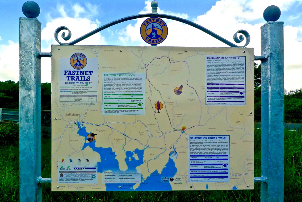
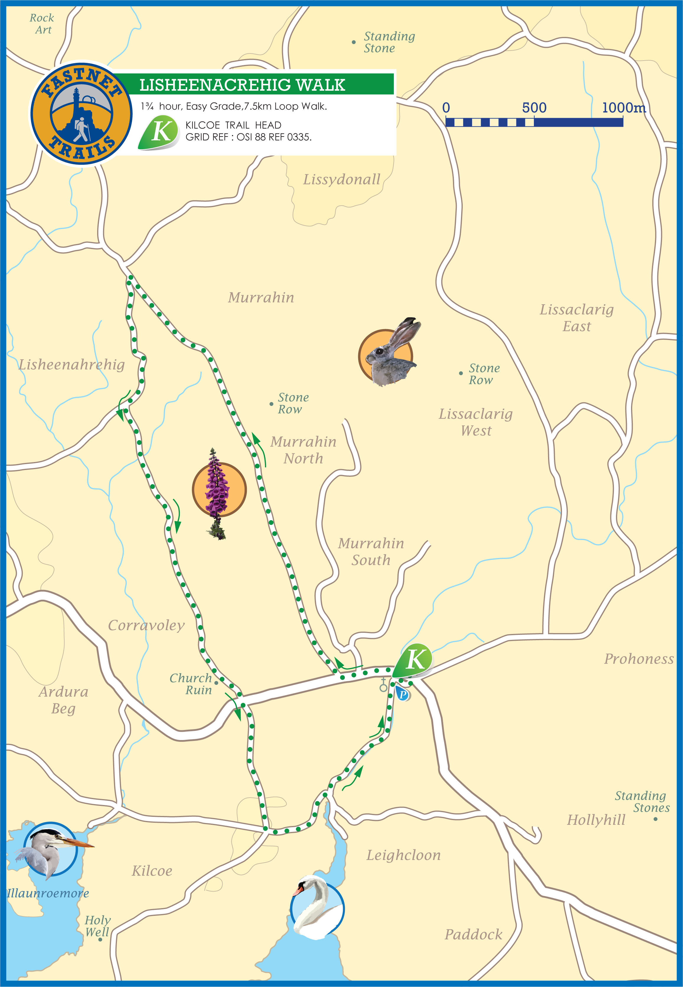
lisheenacrehig map

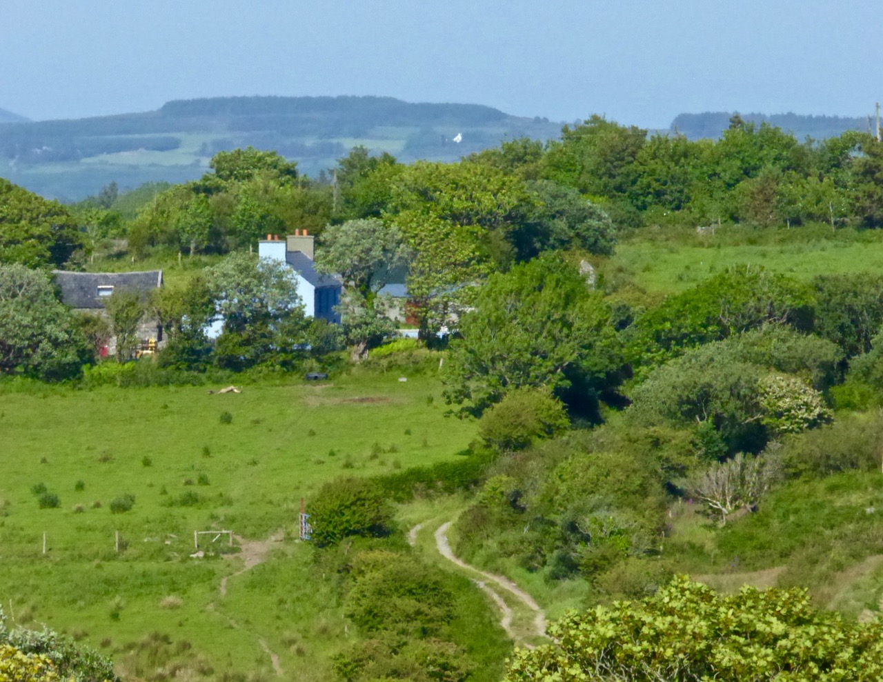
Before the official opening Finola and I undertook one of the walks (Lissheenacrehig Walk, starting at Kilcoe Trail Head): we deliberately chose the one that seemed perhaps the least interesting as it heads north inland and doesn’t pass directly by Roaringwater Bay. I’m not sure what we expected – after all, we had travelled all the little roads on this route by car previously – we are great explorers! In fact, our eyes were opened and we were surprised to be presented with wide views focussing on Mounts Gabriel, Kidd, Corrin and all the rugged uplands in between, and to be given the huge bonus of time to stop and scour inviting rock surfaces for new examples of Rock Art (we didn’t find any). But also it was the closer encounters which we really valued: a wealth (if that really is the right word?) of ruined sheds and cottages; wells, walls and wild flowers; an old burial ground with its memories of lives lived; the tumbling waters and green rocks of the Roaringwater River just before it empties itself into the Bay; archaeology (viewed from a distance on this occasion – the standing stones and ring forts are on private land and – as always – permission should be sought from the owners prior to visiting: that, of course, creating further opportunities for chat and dawdling).

View to Mount Kidd, Rossbrin Walk

View to Mount Kidd, Rossbrin Walk

Butter Road Walk

Butter Road Walk

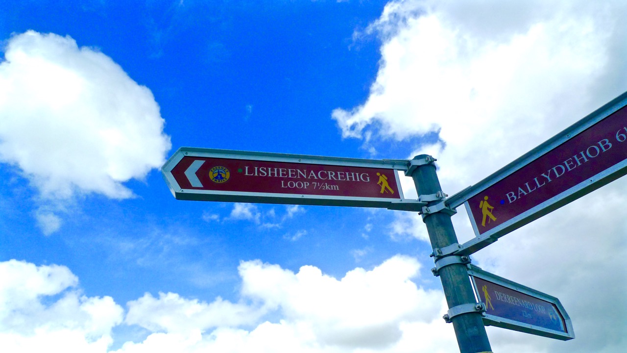
The signage on these walks is clear but discrete – you’d have to try very hard to lose your way. Very occasionally there are information boards: these have been well thought out and attractively drafted. At the end of our sample walk we realised we had taken three hours to do the 7.5 kilometres: the well produced trail information recommends allowing an hour and three quarters! I think that emphasises our predisposition to get diverted in every possible way…

pathsign

Discrete signage on the Butter Road

Signage on the Butter Road

Bucolic

Useful signs along the way…

In all there are 80km of walks set out, from Schull in the west to Lisheen in the east. They are easily accessible, and there is ample parking at all the Trailheads.

gatepost

The one trail which is largely away from surfaced roads is the Butter Walk, running between Ballydehob and Schull. This an ancient way – Finola has written about it and its fascinating history previously. It’s magical to get into the heart of rural Ireland and to immerse yourself in nature and a past writ so clearly on the landscape.

Along the Butter Road

Along the Butter Road

We really believe that West Cork is pulsating with an underlying energy! So much has happened (and is happening) during our time here. Much of it is, of course, down to people who have been working away for years – often behind the scenes and, therefore, unappreciated – but future generations will realise what a debt is owed to these innovators: West Cork has been steadily and deservedly building its reputation as good food capital of Ireland, for example – and the opening of Uillinn in Skibbereen will emphasise the equal importance and historical context of the arts in these remoter landscapes. For music, drama and literature, also, we are always spoilt for choice: the furthest we have to travel is half an hour to see and hear world class performers in all these genres.

Roaringwater River, Lisheenacrahig Walk

Roaringwater River, Lisheenacrehig Walk

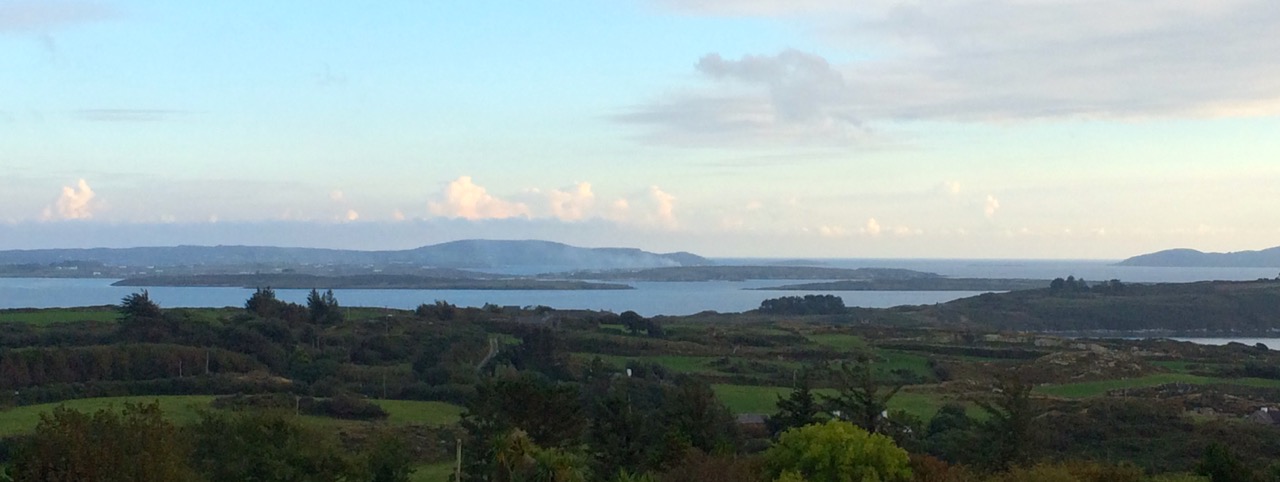
Roaringwater Bay Panorama

The latest asset to bring West Cork to the fore is this – literally – trailblazing one: the establishment of a network of walking routes along the coast, through the countryside and into the wild places. Fastnet Trails has been quietly gestating now for some time: the launch today shows how much work has been undertaken already – and what fruition has been attained. On behalf of everyone locally we thank the organisers for achieving the realisation of their dreams which benefit all of us and the generations to come. A grand start has been made: undoubtedly, more good works will follow.

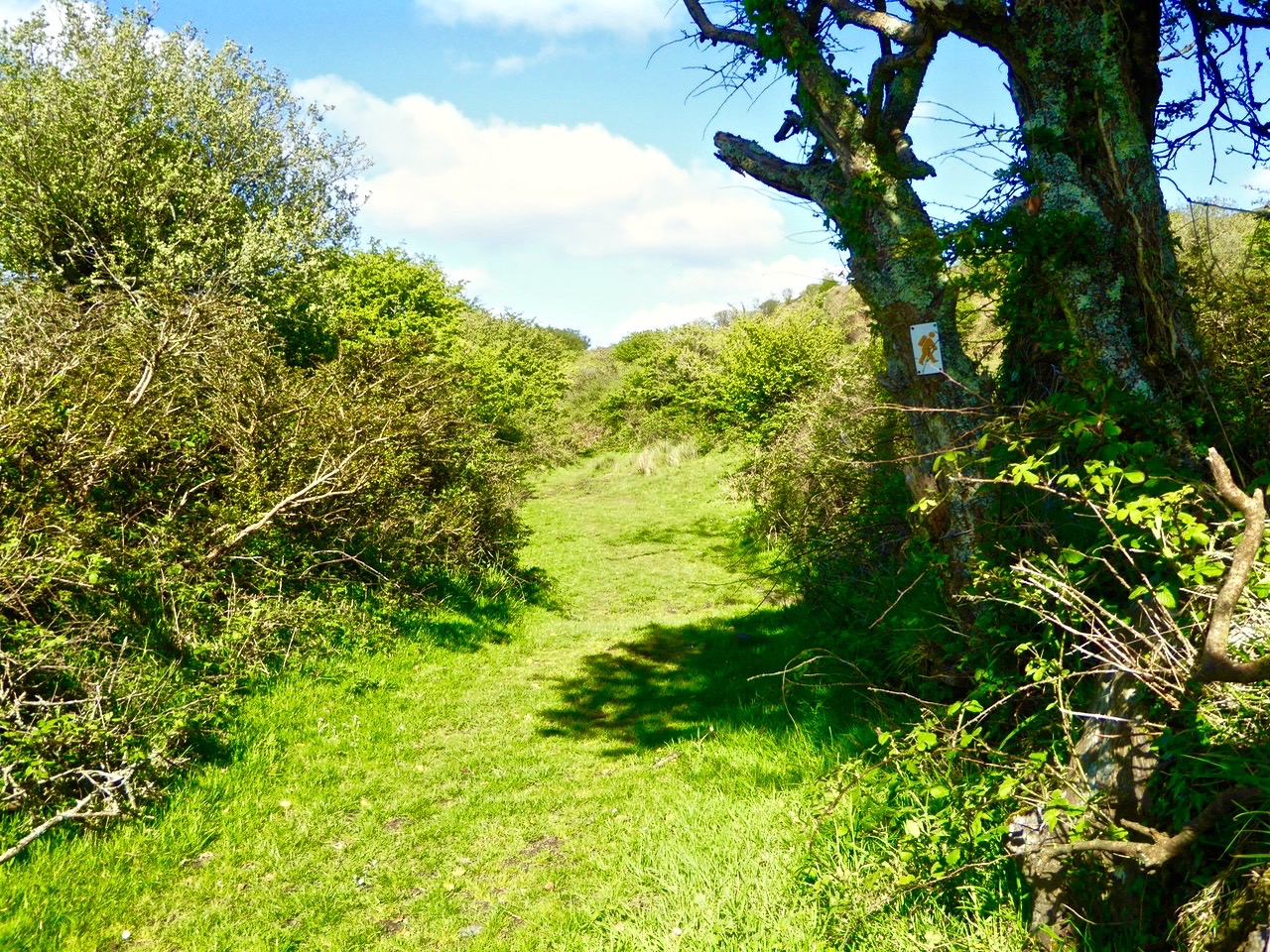
Light and shade: Lisheenacrahig Walk

Light and shade: Lisheenacrehig Walk

Lisheenacrehig Loop

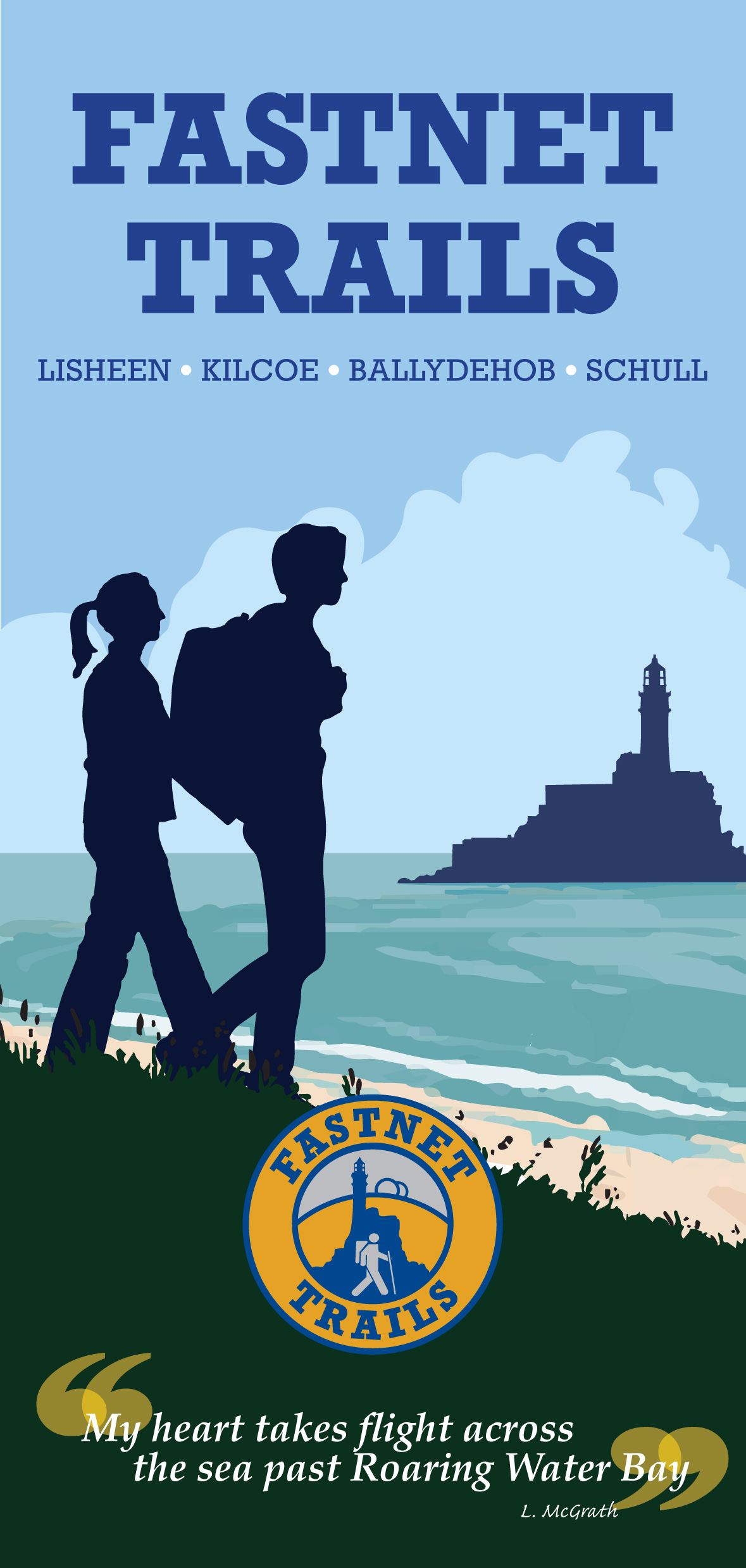
Fastnet Trails are recognised by the National Trails Office and the Wild Atlantic Way: the venture has been organised by The Fastnet Walks Trails Group with the help of the Community Councils of Aughadown, Ballydehob and Schull

fastnet_trails_a3.indd

Amid Unbearable Tragedy – a Model for the World

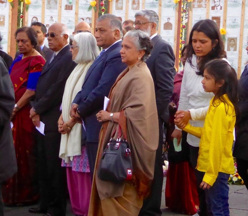
Laying the wreath

Some posts are hard to write. In the case of this one, there are such complex emotions – sadness and anger being the dominant two, but overlaid with pride and gratitude. I will explain.

Youngest

In June 23rd, 1985 – 30 years ago this week – a bomb on board Air India Flight 182, exploded when the plane was just off the coast of West Cork. Everyone on board,  329 people, were killed. One in every 4 victims was a child. Eighty percent were Canadians.

Dignified

The bomb was the work of Sikh extremists, operating out of Vancouver. A botched investigation, jurisdictional disputes, and massive incompetence at many levels has meant that no perpetrator of this heinous crime has ever been convicted for it – a travesty of justice that is a dark stain on Canada’s judicial system and that has left the families of the victims with no sense of justice to this day.

Moment of Silence 2

Members of the victims’ families began arriving immediately after the bombing and, deeply affected by their plight and by their own traumatic involvement in the the recovery operation, the people of West Cork opened their hearts and homes to them. Ahakista residents took on the task of petitioning governments for a memorial garden and of arranging a yearly commemoration service. The memorial is beautiful and perfectly maintained year round. Beginning in 1986 the service has been held every year without fail and family members who come are welcomed, supported and fed, in the Irish way. Many friendship have been forged over the years.

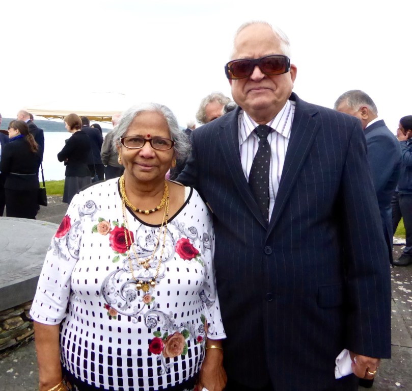
Family Friends

In contrast, it took the Canadian Government a long time to acknowledge that this terrorist attack, in the words of Prime Minister Harper’s official apology ‘…was not an act of foreign violence. This atrocity was conceived in Canada, executed in Canada, by Canadian citizens, and its victims were themselves mostly citizens of Canada.’ This speech was made in 2010. The first Canadian memorial to the victims was erected in 2006 and there are now four. There are no memorials in India.

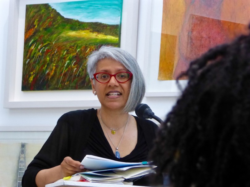
Renée Sarojini Saklikar

Renée Sarojini Saklikar

Because this was the 30th anniversary this year’s ceremony was a large one, with dignitaries from Canada, India and Ireland in attendance and about twenty family members. For us, it started the night before, with a poetry reading in the West Cork Arts Centre in Skibbereen. Renée Sarojini Saklikar is a Canadian poet who lost an aunt and uncle in the disaster. She read from her book Children of Air India, and also some new pieces. Deeply influenced by the opacity of official documents, by memory and loss, her poems carried a quiet power that seeped into our souls almost without our noticing. She elicited our participation in one poem – a piece made up entirely of acronyms – and she spoke to us about the process of writing poetry from trauma and invited our stories and comments. It was a deeply emotive experience – a good preparation for the following day’s ceremony of remembrance.

The Irish Navy ship and Coast Guard Fly Past

The Irish Navy ship and Coast Guard Fly Past

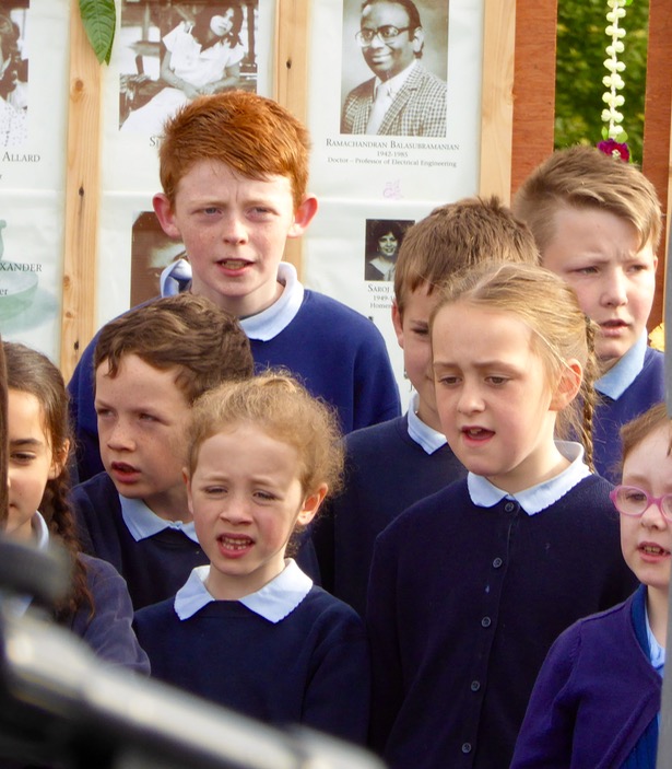
The ceremony timing mirrors the events of the original June morning when the bomb exploded in the plane, with a minute’s silence at 8:12AM, broken by chanting by family members. The Irish Navy were on hand to signal the moment with a siren blast, and a Coast Guard helicopter performed a formal fly past. A choir of children of the local National School sang and there were speeches and wreath-layings. I was pleased to see Canada’s Minister for Justice, Peter McKay, in attendance as well as the Canadian Ambassador to Ireland.

Dignitaries

Speaking to the family members brought home to me as nothing else could do the enormity of the tragedy and the still-raw emotions at the core of this event. Saroj lost her father, a teacher. “He was  a proud Canadian,” she said. “He loved Canada and taught Canadian children in Newfoundland. He cared so much for his new country, but when he died, suddenly in the eyes of Canada he was no longer a Canadian but an Indian.” Saroj had sat through many days of the Vancouver trial of the accused bombers (who were eventually acquitted) and still could not get her head around the outcome when the evidence was so clear.

Dr. Padmini Turlapati was the spokesperson for the families. She lost her two sons. They had just finished school and were going to India for the summer to see their grandparents. She showed me their photograph – two merry kids, laughing and carefree. Because they were visiting their grandparents they had taken with them their albums of mementoes and photographs – Padmini had to piece together a few photos from their school and friends. Sanjay’s body was recovered, but Deepak is still out there, and so she comes back every year to the place which has become a focus for her grief. In her speech she encompassed all the emotions that the families still feel – unspeakable sadness, anger and – gratitude.

Over and over speakers spoke about the warmth, the generosity and the support of the West Cork people who had been there for them in their despair when it seemed that their governments had abandoned them. Several used the same phrase.  Addressing themselves to the people of Ahakista, to the fisherman and coast guard volunteers, to those who built and maintain the memorial and who organise each year’s ceremony. “You”, they said, “are a model for the world.”

As a Canadian who listened nightly to the reports of the Vancouver trials I can have an inkling of the unfathomable well of loss and anger that these families feel. As an Irish person who is now living in West Cork I am proud of how our neighbours and friends stepped in to support and comfort these devastated families.
Children Sing

Perhaps the best way to end is with one of Renée’s poems. I will try to reproduce it faithfully on the page.

In the home-house, in the basement, there is the mother — she is singing a sweet song.

It is before —

June                       1984

                                Of her name, there are redactions.

                                Of her mother tongue, there is no record —

                                                       this is the life of a woman, made in India,

                                                                                living in Canada.

In the home-house, in the basement, there is the mother

                   And she is absent, sister

Memorial in Winter