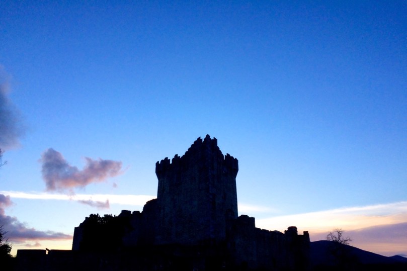
Ross Castle, Killarney
Can you distinguish between a crenellation and a machicolation? How about a bartizan and a barbican? By the end of this tutorial on the architecture of tower houses you will amaze your friends at dinner parties by casually dropping such terms into the conversation. (Of course you might also be labelled as a hopeless nerd.)
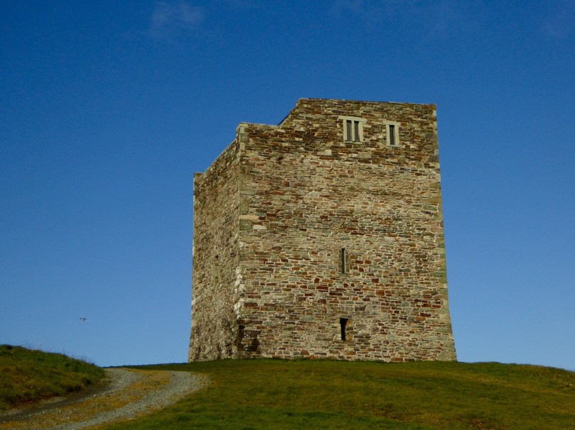
Rincolisky or White Hall Castle in West Cork – a good example of a basic tower house
Start by reading, or re-reading, When is a Castle..? It goes over the basics of how the tower houses of West Cork were constructed and lived in. Essentially tall, square stone dwellings, they were built more for defence than comfort. Let’s look more closely at how exactly Medieval architecture coped with making such massive structures stable and workable. We’ll start with the outward appearance – walls, windows, roof and bawn. (In Part 2 we’ll go inside.)

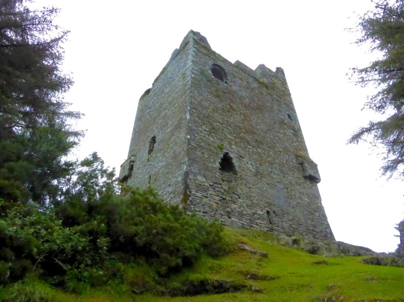
Like many West Cork Castles, Castle Donovan is built on a rocky outcrop
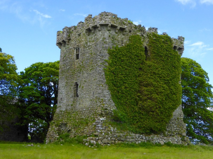
In West Cork, there’s a noticeable preference for building tower houses on rock outcrops. Since these are massive, heavy structures, building on rock is a good idea. The downside of that has been well expressed by Peter Somerville-Large in The Coast of West Cork: “Contrary to what may be written in Holy Scripture, buildings on rock have little in the way of foundation, and when they fall down or are swept away there is nothing left of them except a memory.” Somerville-Large reminds us that there were once castles at Ballydevlin, Castlemehigan and Crookhaven of which no trace now remains.
Ballinacarriga Castle. Note the splayed base batter and the unusual second floor bartizans
To support the tall walls, the lowest level was the thickest, splayed outwards in what is termed a base batter. The walls were constructed of stone and mortar. The mortar was lime-based – it wasn’t totally impermeable so these tower houses were damp places. Generally speaking, the cut stones were reserved for the outer and inner facings of the walls in fine castles, and in more basic ones they were reserved for quoins – the stones that were used in the angles or corners.
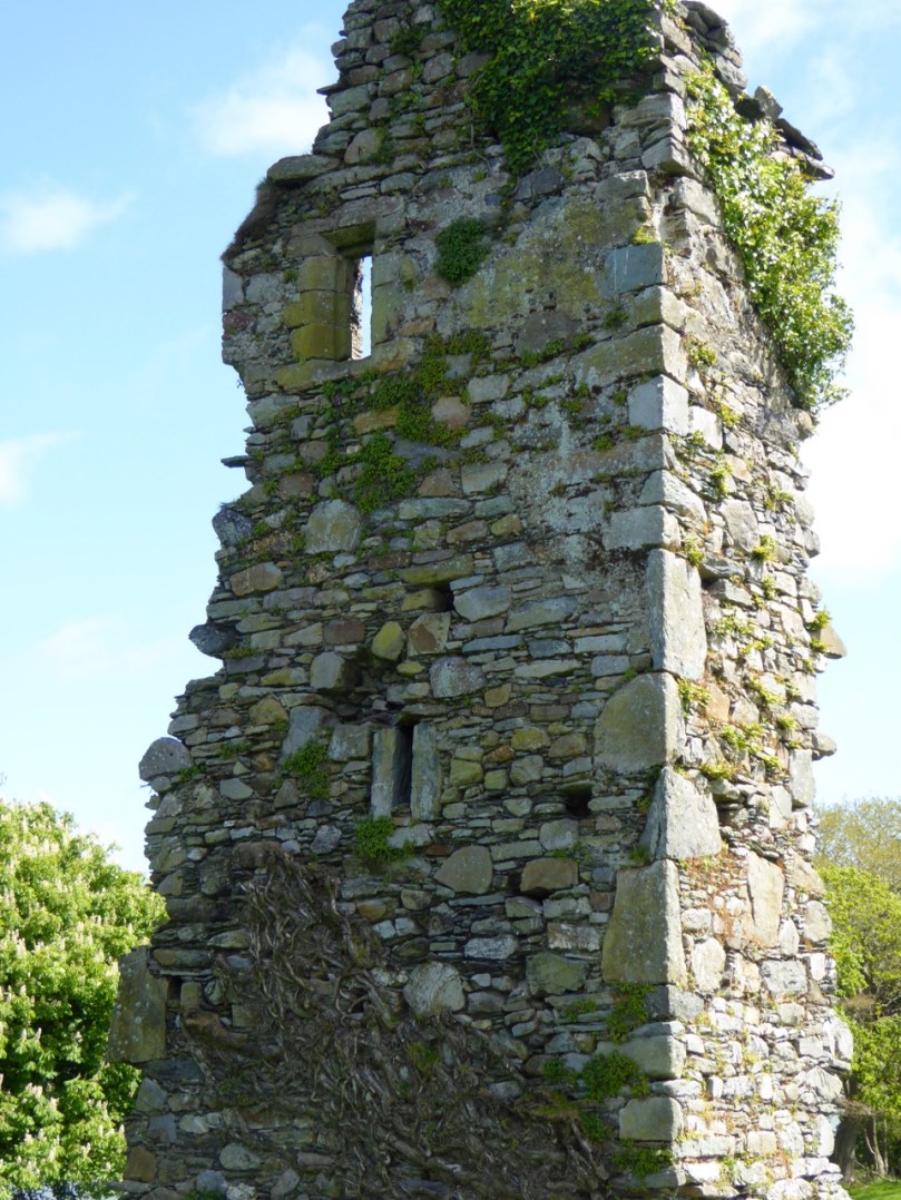
A vestige of a tower house at Abbeymahon, near Courtmacsherry, shows the best cut stones reserved for the quoins
Where walls have collapsed it is often obvious that the interior of the wall could be filled with rubble, with the best stones with the flattest faces, or the cut stones, being reserved for the outside. Cut stones were, of course, prized and many have disappeared over the intervening years, adding to the potential instability of some tower houses.

At Carriganass Castle most of the quoins have disappeared
The walls were rendered with plaster on the outside. They could be whitewashed, which made them visible from afar. One of our local castles is known as White Castle, another as White Hall – perhaps these were originally whitewashed. The plaster could also be tinted to produce various colours – Kilcoe Castle is a good example of a tinted render based on research into this practice.
Glashare Castle in Kilkenny still shows the rendering on the outside. Note the unusual corner and cross-shaped arrow loops
The walls were pierced at various points with opes – a technical term that simply means an opening of any kind. Opes came in three varieties: doors, windows and loops. We talked about doors (raised entrances) and windows (smallest at the lowest levels, largest at the top) in When is a Castle..? Loops, arrow loops or musket loops, were always small from the outside, presenting a tiny target to attackers and preventing anyone from squeezing through (think about the origin of the word ‘loophole’). Muskets had totally replaced longbows and crossbows by the end of the 16th century so any castle built after that time had gun loops, and some even had larger cannon loops.
Carriganass Castle has many loops – the tiny one in this pictures seems too small to be useful
Inside, the loops were deeply splayed to allow the head and shoulders of the archer/shooter into the space, or embrasure. Loops could appear in the walls of the castle, or of the bawn.
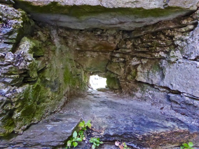
A deeply splayed gun embrasure at Carriganass
At the top of the tower was the roof and the battlements. The roof was made of various materials – slate, wood or even thatch. Between the roof and the outside wall was a wall walk, protected by a parapet.
Dún an Óir, or the Fort of Gold, on Cape Clear Island. The wall walk can be clearly seen*
In Ireland, this parapet most often took the form of what became known as Irish Crenellations. These were stepped or ‘toothed’ battlements, with tall parts (merlons) behind which defenders could take cover and shorter parts (crenels) for shooting from.
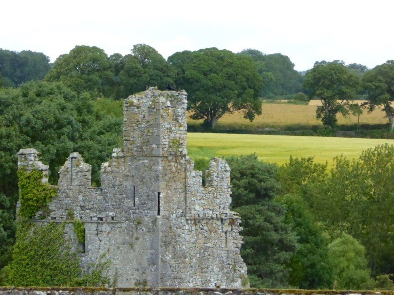
A good example of Irish crenellations from Kells Priory in Kilkenny
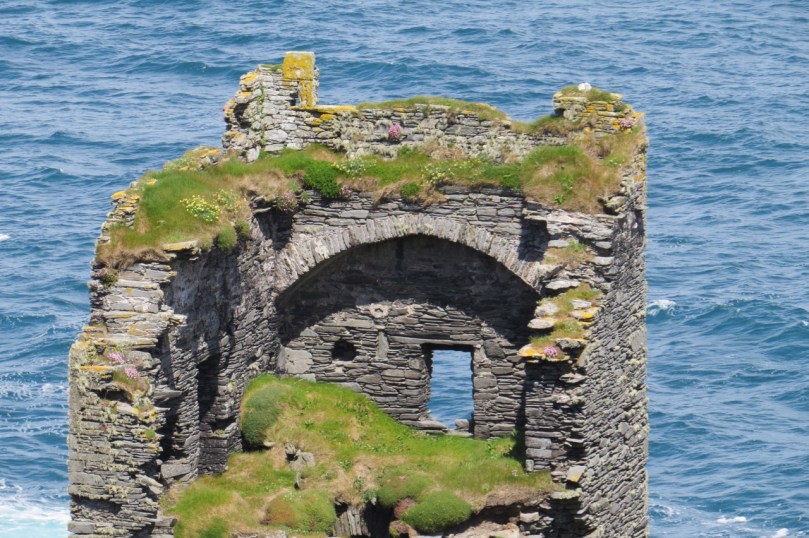
Another defensive feature was a platform that projected away from the walls, called a machicolation. Defenders used the opening between the wall of the machicolation and the castle wall to hurl things down on attackers. Machicolations are often located above doorways, but also at corners which afford a view of two sides. When they are on corners they are called bartizans.
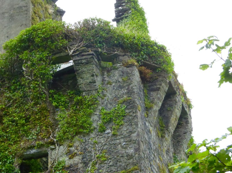
Corner machicolation, or bartizan, at Togher Castle, north of Dunmanway
The machicolation was supported by corbels which could be simple triangles or carved stone elements.
Shrule Castle in Mayo has decorative carved corbels. Note also the rounded corners of the castle which did away with the need for quoins
The bawn is the courtyard immediately surrounding the tower. Bawns could be restricted in size – little more than the immediate courtyard of the castle – or extensive. They are sometimes known as wards. The bawn wall was often fortified with loops and a wall walk.
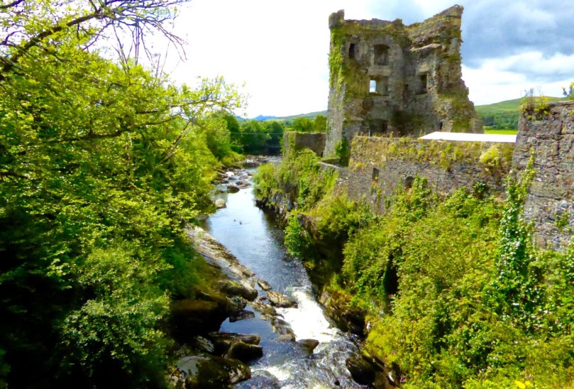
The bawn wall of Carriganass Castle at Kealkill hovers picturesquely over the river
Bawn walls are often called curtain walls, but this term is also appropriate when the wall does not actually enclose a bawn, as at Dunlough Castle at Three Castle Head. Because the towers are situated between the lake and an impregnable cliff the curtain wall provides a barrier behind which defenders can shelter.
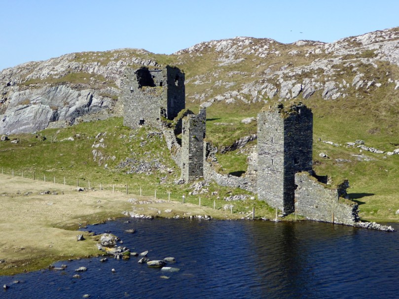
Dunlough, or Three Castles: the curtain wall presented a formidable barrier to attackers
In the next tutorial we will cover the inside of the tower house. Meanwhile, here’s a pop quiz. Take a look at this photo of Ross Castle and see how many features you can identify.
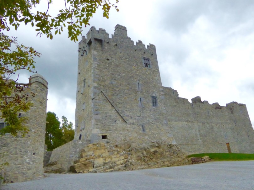
So – how did you do?
*Thanks to Lisa Scarff for the Dún an Óir photograph.