Elizabethan Map of a Turbulent West Cork

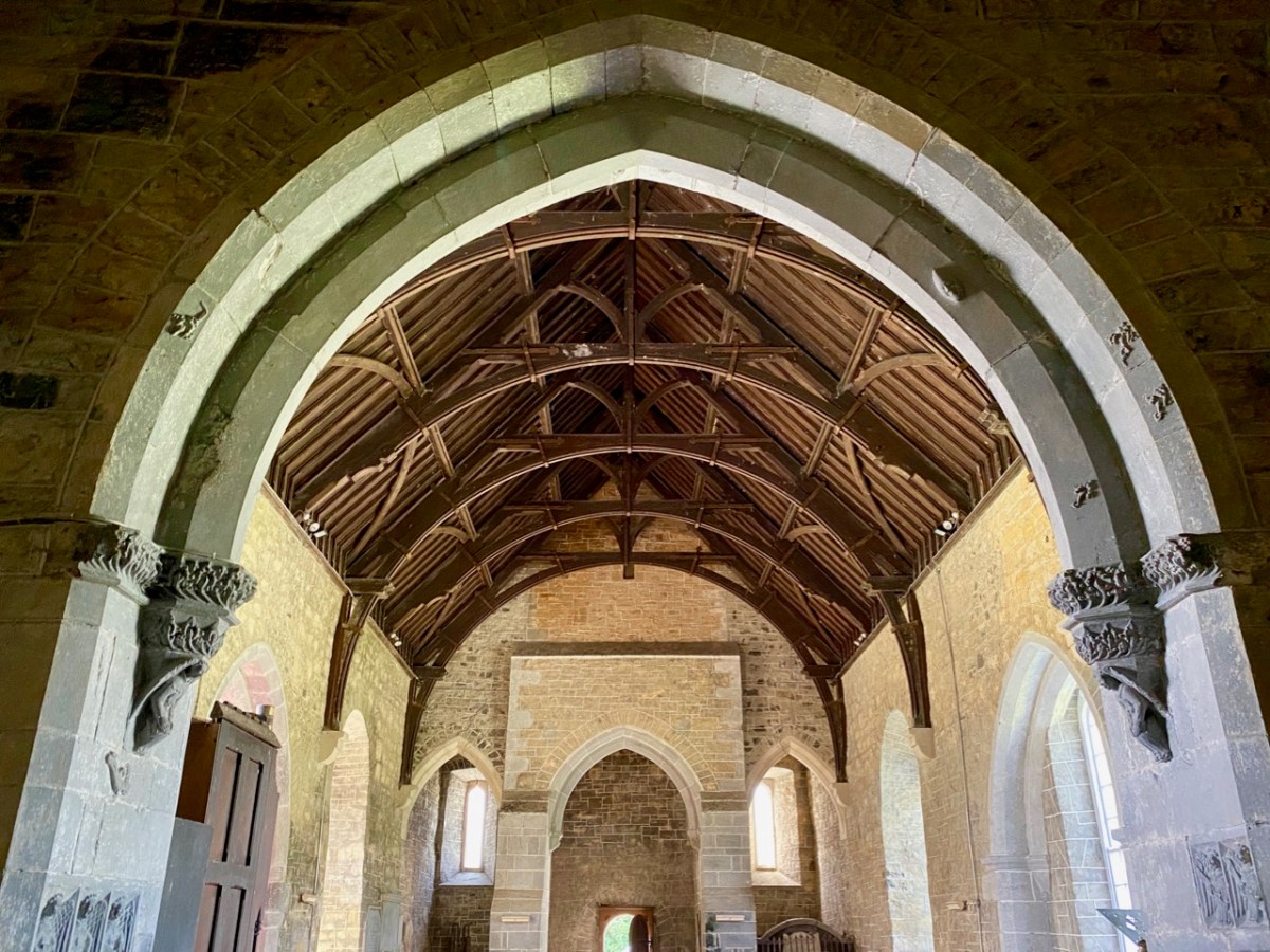
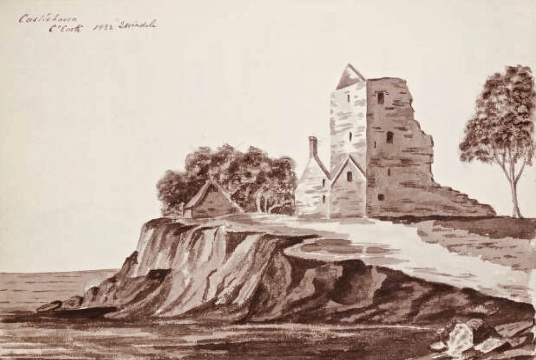
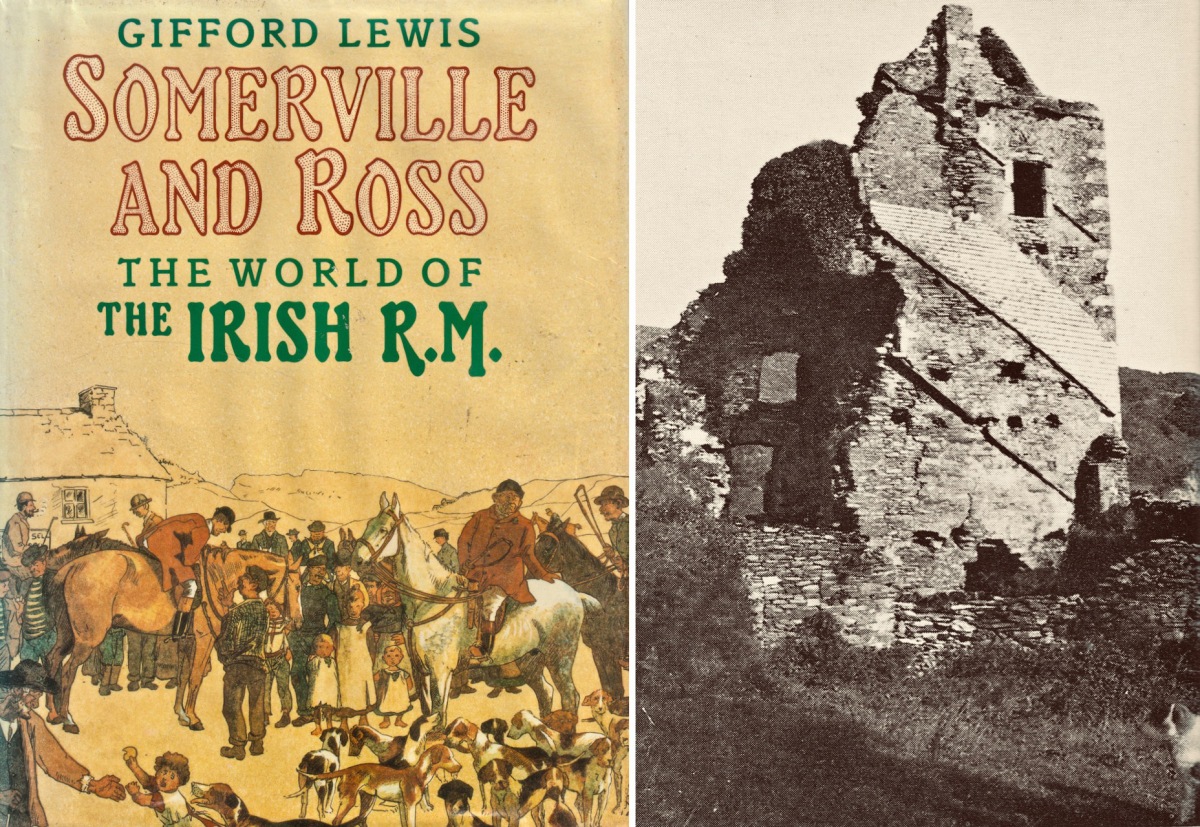
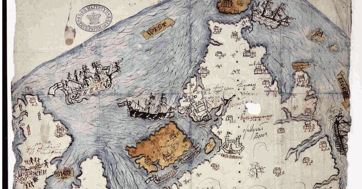
The Elizabethans were map-makers, especially if they needed information for the purpose of wars and conquests. I was first alerted to this extraordinary map of West Cork by a reference in the O’Mahony Journal (subscription needed) and then to a piece written on it for the Journal of the Cork Historical and Archaeological Society in 1958 by P O’Keeffe who labelled it a Map of Beare and Bantry. Neither of these sources had a good image of the map and so, intrigued, I sent off a request for a digital copy to the British National Archives. It arrived by return email, at no charge. What a service! (Irish national repositories take note.) Here is the complete map.

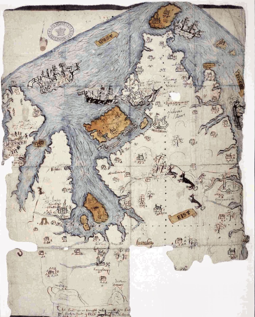
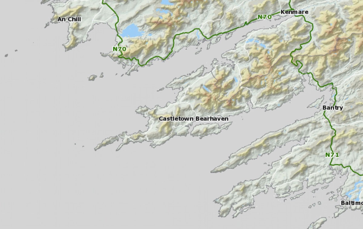
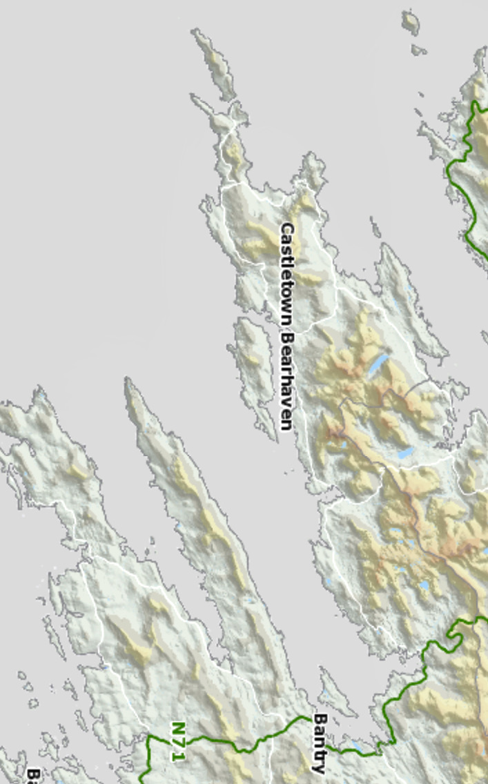
While it is clear that this map dates to the Elizabethan period, there are many questions about it: who did it, for what purpose, exactly when? For this post I want to go through elements of the map and identify, as far as possible, what it depicts. A subsequent post will deal with what is actually going on – that is, what are the actions that are being chronicled. Let’s start with the fact that the map is quite accurate. It depicts the three peninsulas of West Cork – the Mizen, the Sheep’s Head and the Beara – and the inlets in between them. It is oriented east-west rather than our modern convention of north-south, but the cardinal points are clearly identified. The map is drawn on paper, with the sea coloured in blue and the islands in brown. I have provided maps below of the same area, the first in our typical north-south orientation and the second as it is orientated in the historical map.

The sea is shown teeming with ships – warships and galleys. Taking a closer look at the two north of Bear Island we see two different ships, one light and one dark. Each is in full sail, with men on the riggings and in the look-outs. They have cannons emerging from the hull, a trumpeter aft and a bugler on the bow-spit.

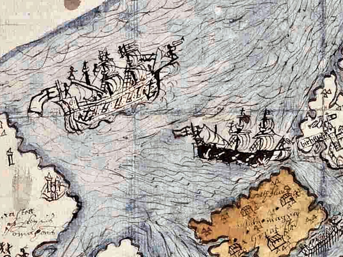
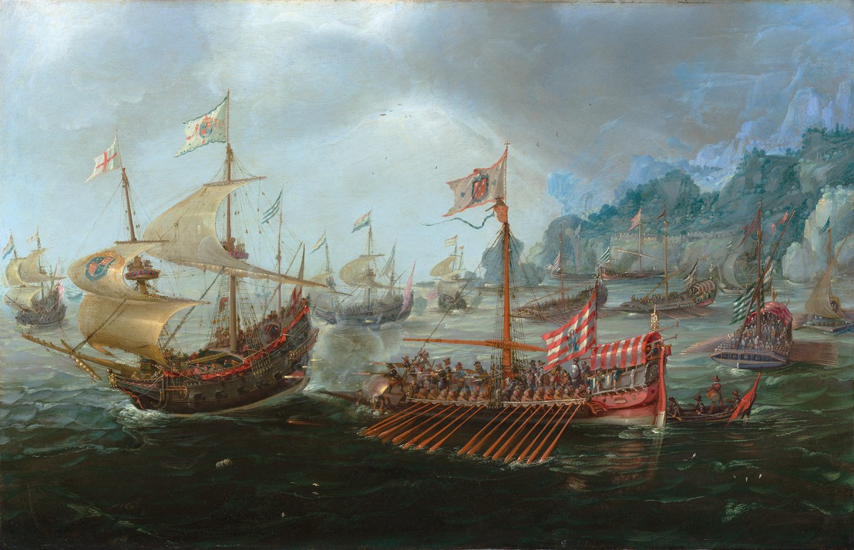
As a reference, here is a painting by Andries van Aervelt showing the kinds of ships that were engaged in The Battle of the Narrow Seas (1585) – both the full-sail warships are shown as well as galleys.

Galleys were also deployed here, shown between Bear Island and the mainland (below). The lead galley has a trumpeter on the bow, while the second galley shows a man blowing a horn in the stern and what looks like a drummer on the bow (like those ramming speed scenes in Ben Hur). The rowers were often convicts and the life of a galley rower was brutal. This map shows a single row of oars. Galleys essentially provided platforms upon which armed soldiers could shoot, and had the advantage of being more stable than sailing ships and often faster, depending on wind and swell. 

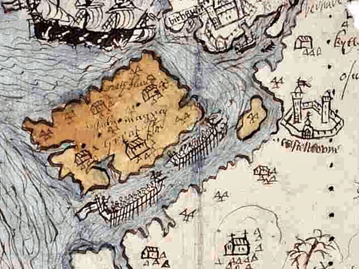
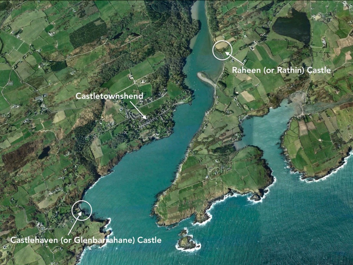
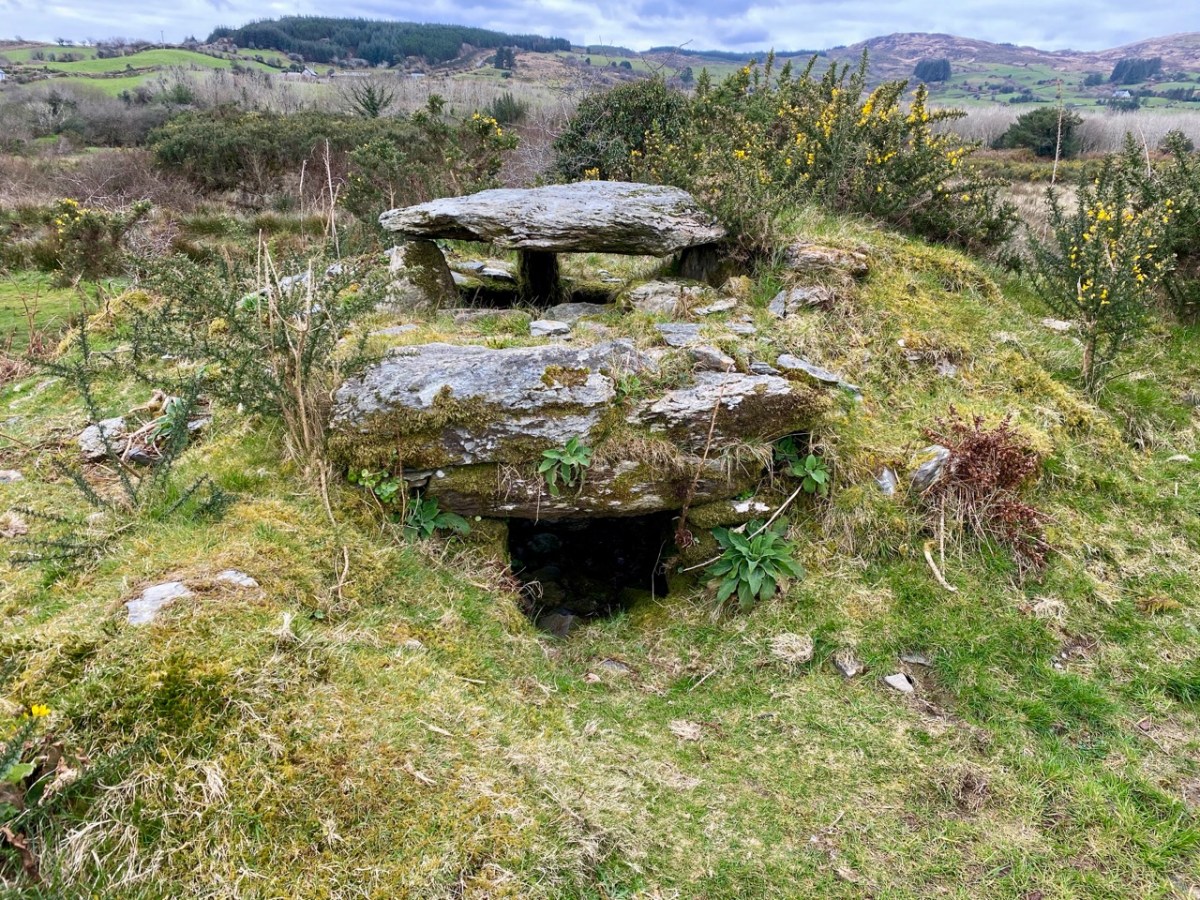
Another warship (below) is rounding the tip of the Beara , heading for Dursey Sound. Dursey Island has both a church and a castle on it. There isn’t much trace of this now, but there was an O’Sullivan castle on a small grassy peninsula on Dursey, described as two rectangular buildings with a rectangular enclosure in the National Monuments records. It was destroyed in 1602 (more about that in the next post) along with what was then left of the church, known as Kilmichael, which was already in a ruinous state. At the right, in this section of the map, are two rocky islands, one with a set of steps leading up to a church. Could this be Skellig Michael? The other candidate is Scariff Island, off Lamb’s Head, which had a monastic settlement and hermit’s cell on it.

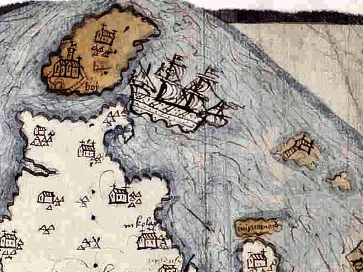
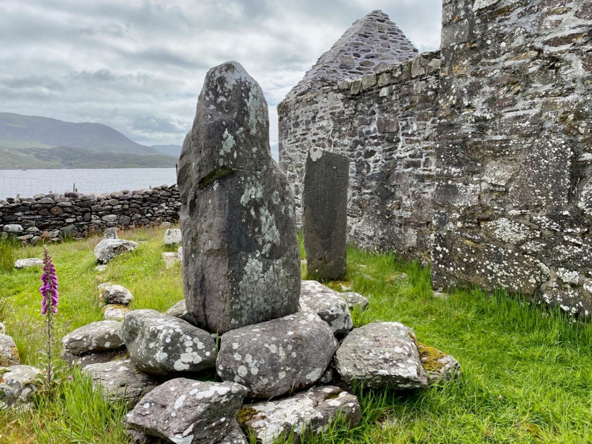
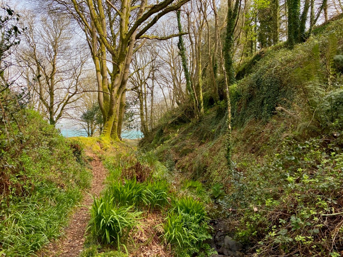
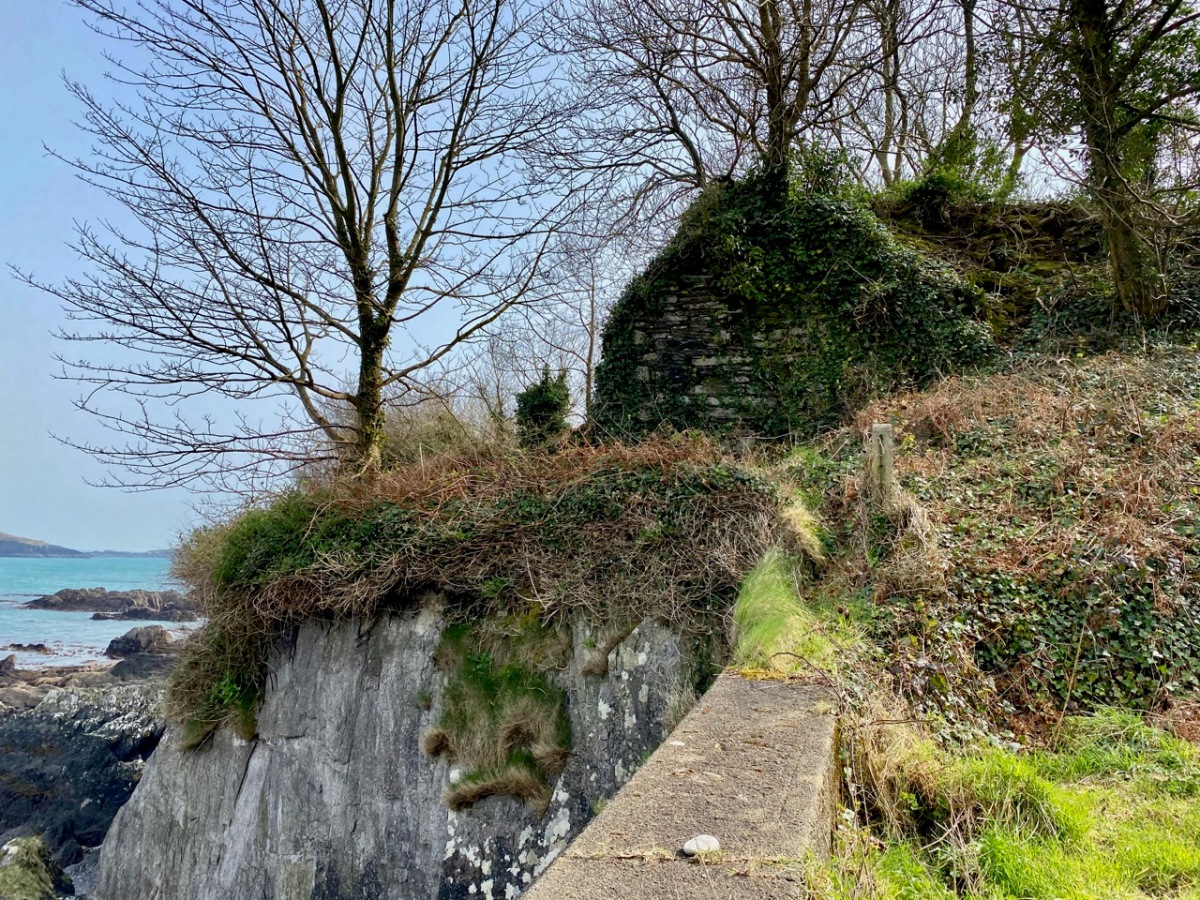
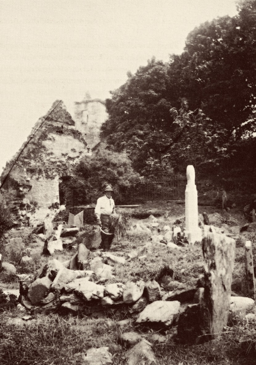
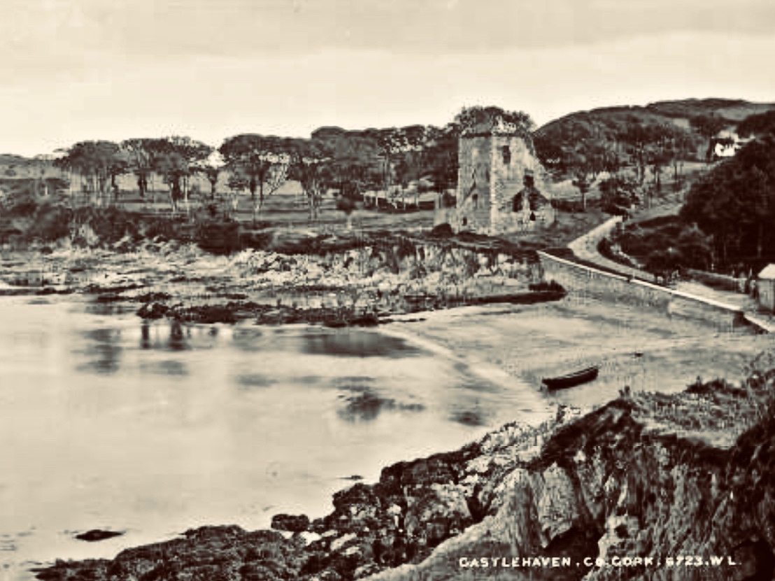
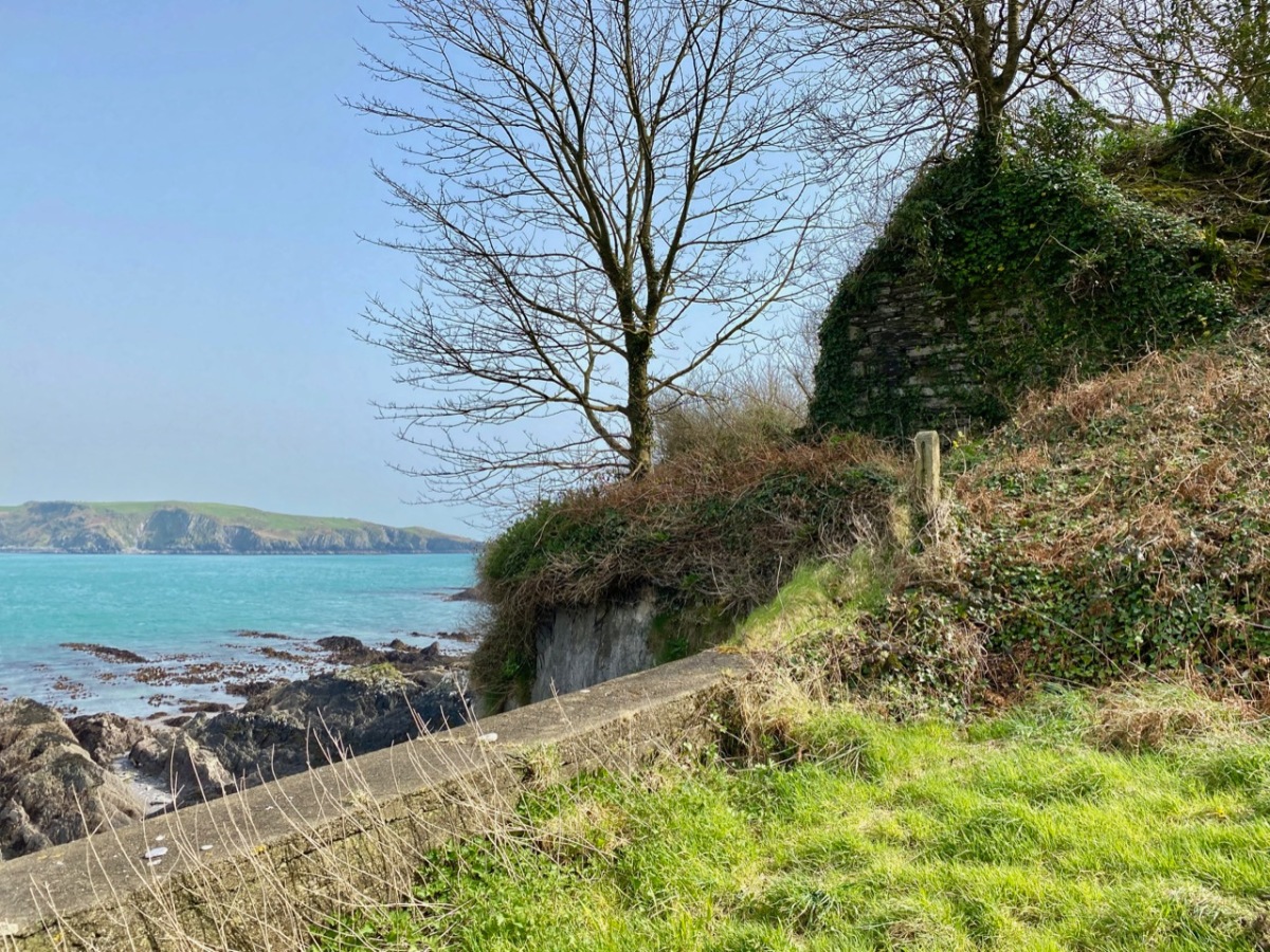
Let’s take a look now at the area around Bantry (below). The large church is of course the Franciscan Abbey that stood here, where the graveyard is located There is a church shown on the aptly-named Chapel Island between the mainland and Whiddy (no trace if it now remains), and both a church and a castle on Whiddy.

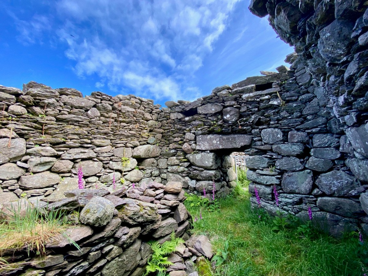
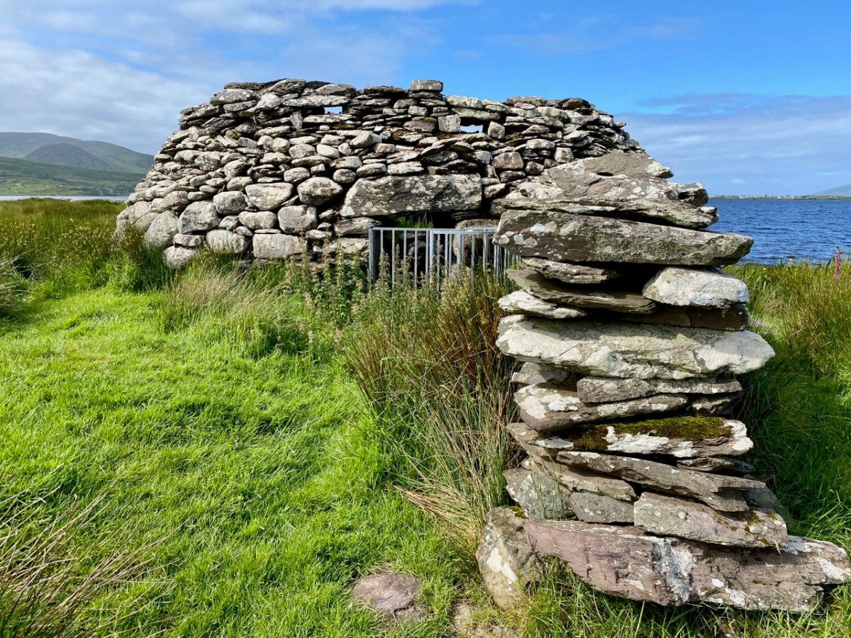
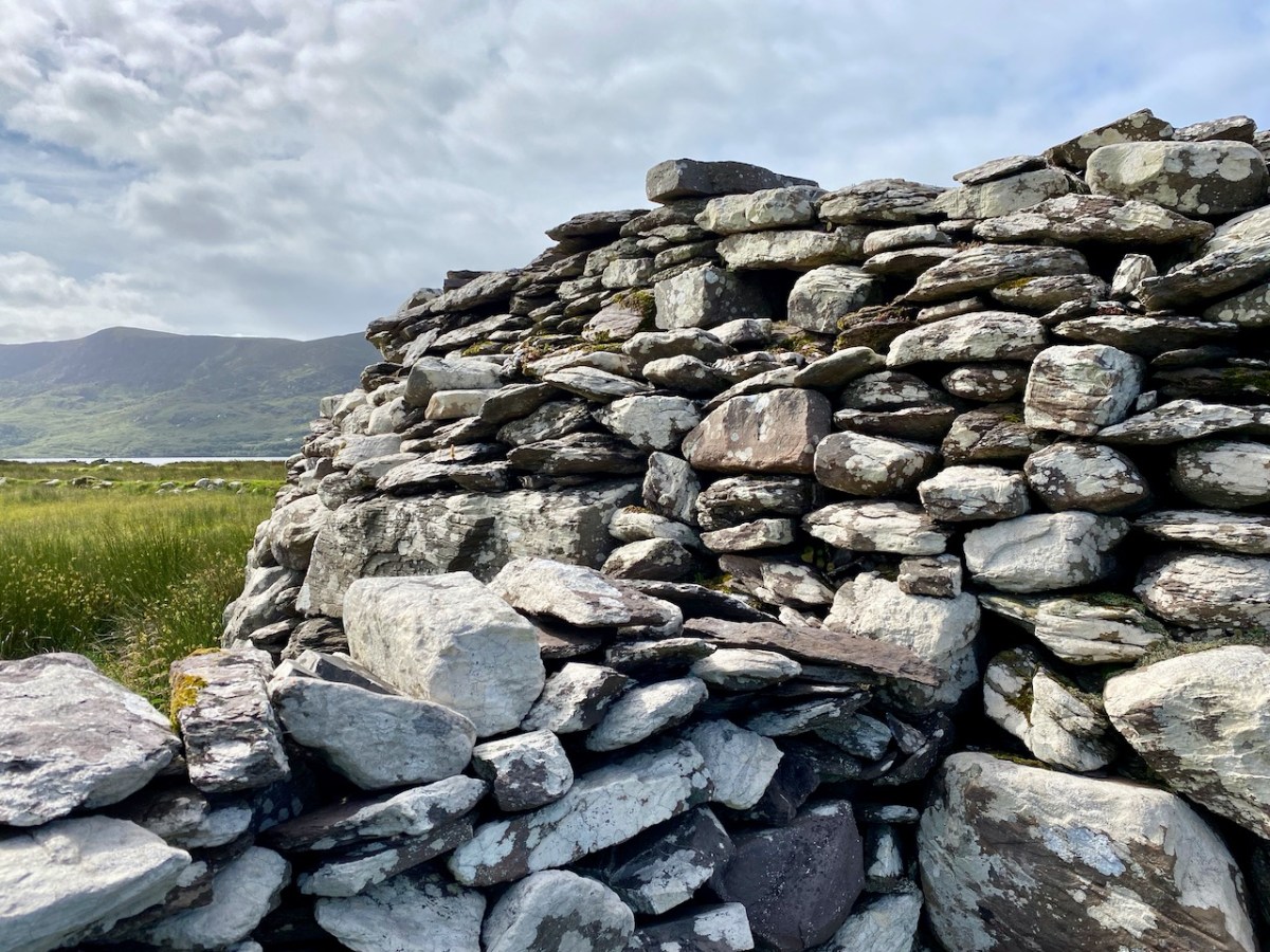
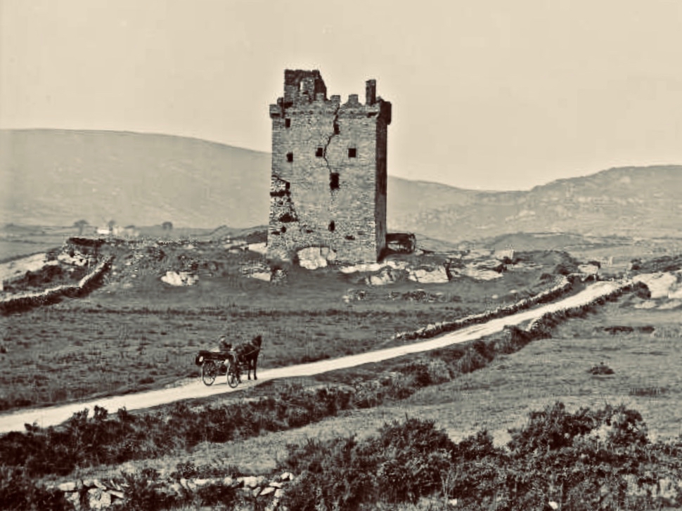
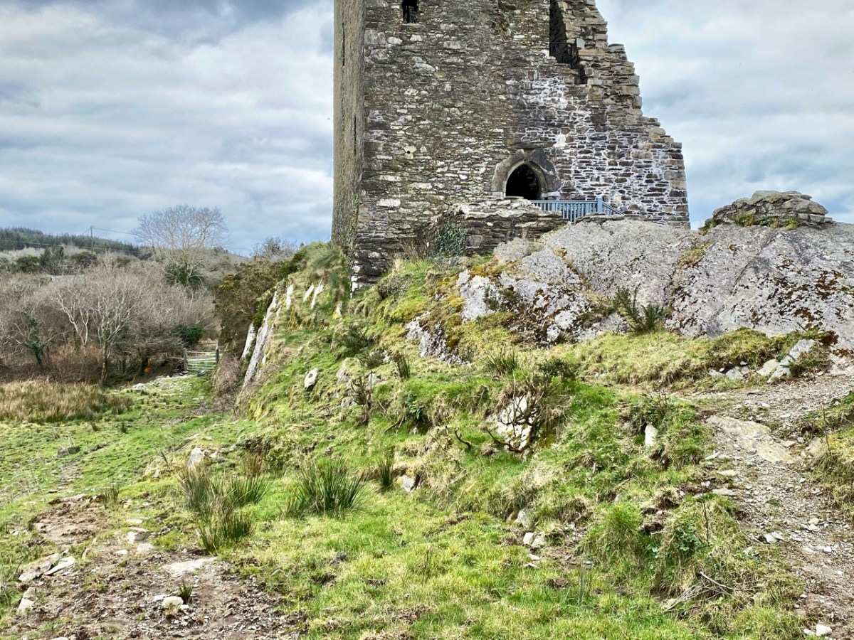
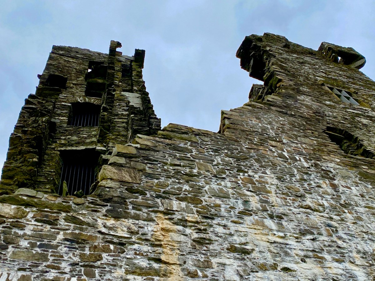
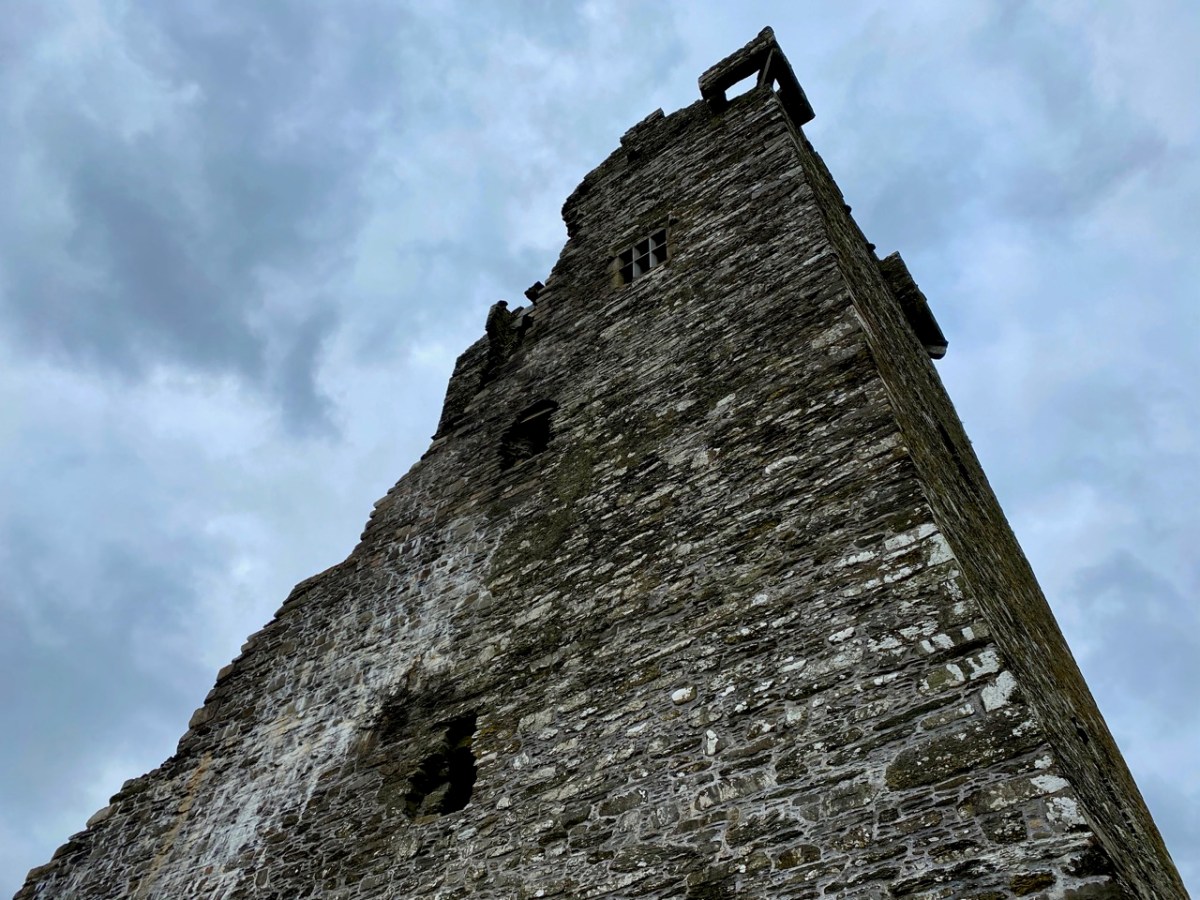
The fragmentary remans of an ecclesiastical enclosure can still be seen at the graveyard on Whiddy, while the O’Sullivan Castle has only one wall still partly standing. That’s it, below.

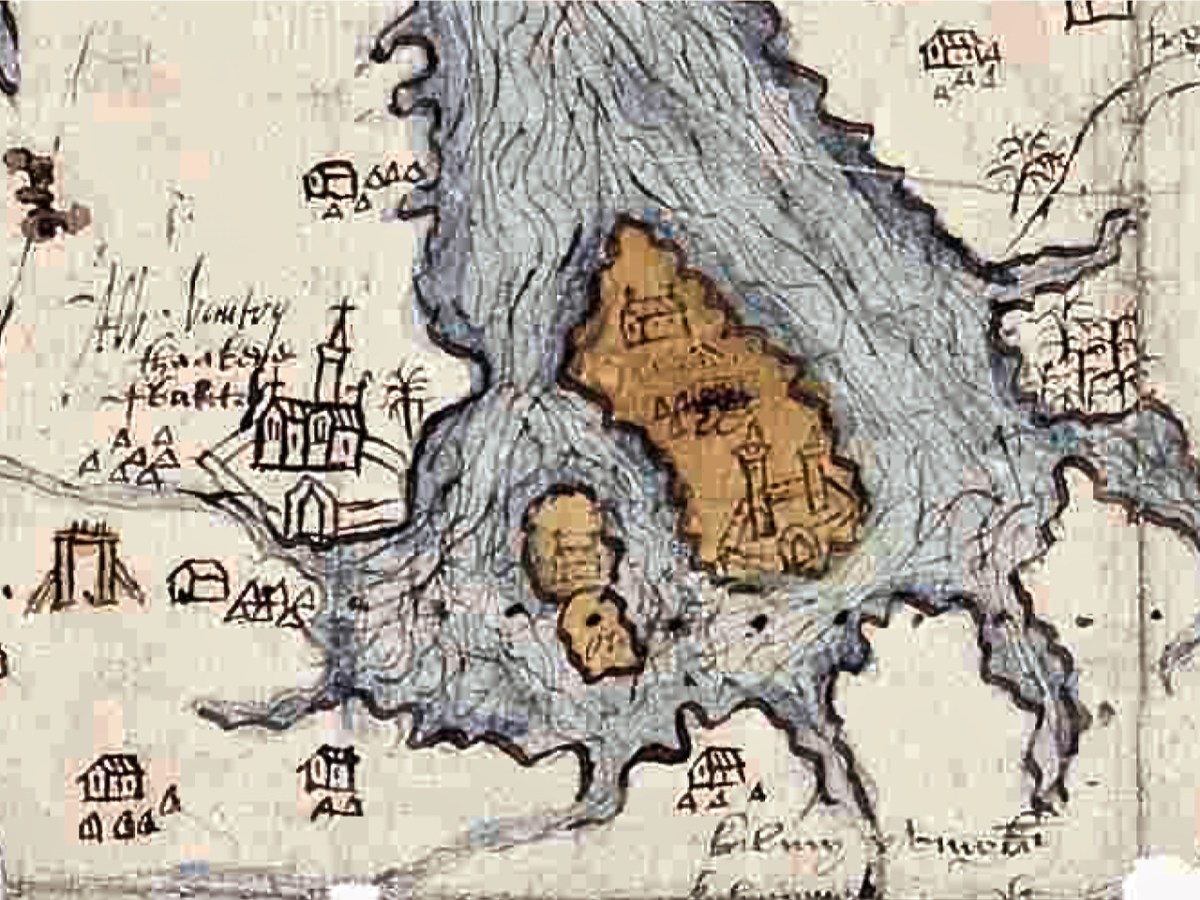
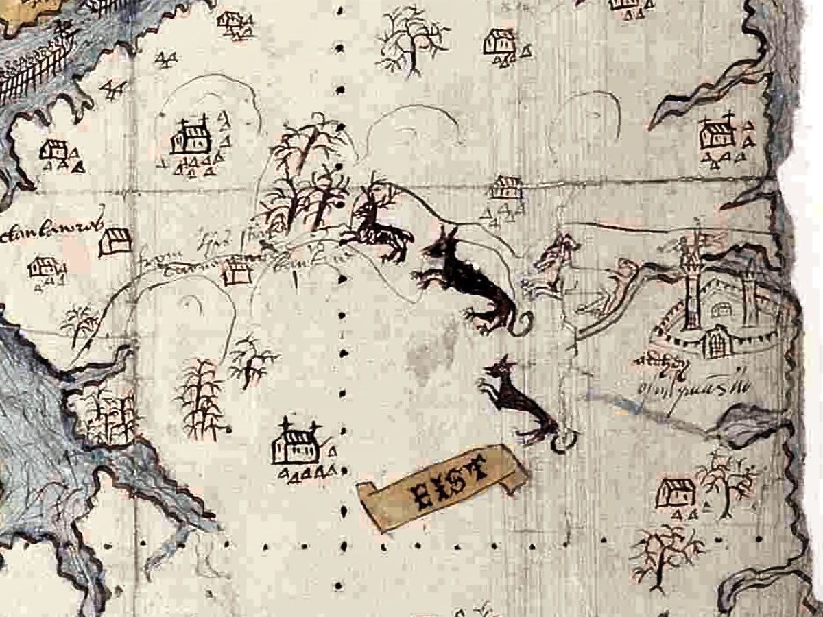
The hinterland of the Beara is shown with trees and animals. Either this is a hunting scene with dogs chasing a stag, or it is meant to show the wildness of the interior, with wolves and deer. Settlements are indicated by churches surrounded by a cluster of cabins (not that different from Irish villages up until recently), and there is a castle labelled Ardhey and O Sulyvans Ho. This is likely to be the ruined casted of Ardea, which actually stands on the other side of the Kenmare River – the Iveragh side rather than the Beara side.

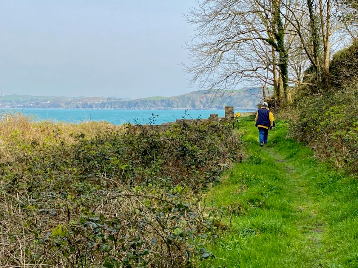
The final depiction I want to highlight is of the Mizen. Several towers dot the  landscape as well as two substantial castles, one of which is under siege. 

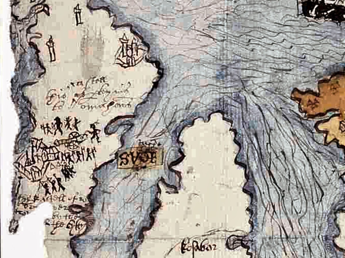
Which castles are these – especially the one being attacked? Tune in next week!

Half a Kerry Day

Kerry is an Irish county rich in history and archaeology. Our day was spent in the company of the ‘Saints’ – a term given to devout men and women who set themselves apart, leading small communities in the remotest of places, dedicated to order, prayer, knowledge, and the contemplation of humanity. Traces of these medieval ecclesiastical sites abound in Ireland, (sometimes described as The Land of Saints and Scholars), and we are always eager to search them out.

The header and the picture above are from Church Island, formerly known as Inis Uasal (meaning Island of the nobles), on Lough Currane near Waterville. The Lough – also known as Loch Luioch or Leeagh – is a substantial body of water, about 1,000 hectares in area. It is fed by the Cumneragh River in the north, Isknagahiny in the east, and drains to Ballinskelligs Bay at its south-western end. This Aerial view (below) shows the Lough in context, while the 6″ OS map extract dates from the 1840s.

We were fortunate to be taken to the island by Tom O’Shea. He is the owner of the island today, and a mine of information on its history and traditions associated with it. He is also a Ghillie – anciently the attendant of a Gaelic chief, whose job it was to carry the chief across a river or lake – but in the present day an organiser of fishing or hunting expeditions: Lough Currane is one of Ireland’s premier sea trout fisheries. We hired Tom to carry us across the water to this ancient sanctuary which had been occupied by saints and monks for over a thousand years!

That’s Tom ferrying us across the lake in the upper picture – only two at a time due to Covid restrictions. Above is my picture of the rest of our group on the island, with Tom in the centre explaining the geography and history of this remarkable place. The day was organised by our good friends Amanda and Peter Clarke, and we had along with us friends from Kerry – David and Janet, all of us discovering this gem for the first time.

The monastic foundation on Church Island was set up by Saint Fionán Cam in the sixth century. Cam means ‘bent’ or ‘squint-eyed’, and it is significant that the name already gives us a picture of the man – a picture which has survived in local tradition for more than fifteen hundred years. One of the most impressive aspects of this island is that some of the historic structures date from the time of the saint – the one above is known as his oratory, or ‘cell’. This is a ‘gallurus’ type of oratory, and would have been roofed completely in corbelled stone: the upper part of the roof has fallen. Archaeologists do not agree over the dating of the structure, but local tradition is clear that it was built by the saint himself, and his community. At its eastern end is a low doorway with two roof boxes above, while opposite is a small, rectangular ‘squint’. It has been noted that the opes of this oratory align with the sunrise at midsummer. As that is almost upon us as I write, it is appropriate that we should have visited at this time of the year. The old photograph is courtesy of the National Library of Ireland Lawrence Collection, dating from the late 1800s. Below is the same view today: the ivy and creeper growth has been removed, revealing the roof box ‘slots’.

Fionán Cam was an important figure in Kerry: he is regarded as one of the three coinnle – or ‘candles’ of the Múscraighe, and descended from Conaire Cóem, High King of Munster. His birth was miraculous, his mother Beagnad – a virgin – having conceived while swimming in Killarney Lake, with a salmon. There are numerous dedications to this Fionán in the west of Ireland, but most traditions link him to Lough Currane and he is reputed to be buried beneath one of the three Leachta – or shrines – on the island, within the enclosure of the Romanesque church at its eastern end.

The OPW took over the archaeology of the island in 1880 and this illustration (above) from the Duchas information board shows pilgrims paying their devotions at the Leachta in 1000 AD. Nearly a century and a half on, the OPW has not yet completed their work on the island! There were plans to restore the west doorway of the twelfth century church (below), but this has not happened.

One of the Leachta (shrines) in the church enclosure. This probably marks the burial place of a later saint (or holy man) – Anmchad Ua Dúnchada – described as ‘anchorite of God’ in the Annals of Inisfallen, which states that he was buried here in 1058. Close by this shrine, and shown in the photograph above, is an inscribed slab on which can still be read the inscription to him:

The eleven stone slabs – mentioned on the Duchas information board – are beautiful examples of this medieval craft: some are displayed now within the church building, although still open to the elements. Nevertheless they are surviving reasonably well.

One carved stone from Church Island is very unusual, being a rare representation of a musician. Known as ‘the fiddler’ the figure is clearly playing a stringed instrument with a bow. It is thought to be a lyre, an instrument which came to Europe in the eleventh century. This is the only known early representation of a lyre found in Ireland. In fact, the stone that we saw is a replica (on the left, below), which has become very weathered: the original (right) is being conserved in museum conditions.

There are other early buildings on the island, including the base of a ‘beehive hut’, said to have been the home of the early saint.

Some quite fine examples of graffiti by visitors to the island, on the Romanesque church walls: some of it dates from the nineteenth century.

Our visit to Church Island only occupied half of our Kerry day. We had more treats from medieval times – and earlier – in our explorations later on. These will have to wait for another post, but here are some tasters:

Back to Clonfert

Clonfert is only a couple of counties over from us: we just have to skip through a bit of Cork and Tipperary and there we are in Galway – a tiny corner of it that is shaped by the River Shannon. So, on a Thursday afternoon at the beginning of June, we found ourselves tripping along dead straight boreens – narrow for the most part – taking us through lush dairy lands – on a quest to revisit Clonfert’s medieval Cathedral, and its associations with one of Ireland’s most famous saints: Brendan the Navigator.

As we approached the little settlement of Clonfert, our empty road ahead was interrupted by a small white car, which seemed to travel erratically from one side of the lane to the other, and our arrival made little difference to its progress. As we got near, we realised that there was a wiry Jack Russell ambling along the road in front of the car: it was clear that the terrier was having its daily walk, with the owner driving along protectively behind it, regardless of where its fancy might take it. Ah, sure – we were in no hurry, so we joined the procession and waited as the dog sniffed and shuffled its way back home: eventually, dog, car and owner vanished through a gate, and we had the road to ourselves once again . . . This is life in Ireland, and it’s good!

Clonfert’s grandly styled ‘Cathedral’ is so important historically, yet it could hardly be more remotely situated. From the east (upper picture above) it looks like many another Church of Ireland building, maybe not worth a second glance – unless, like us, you can’t resist examining every unturned stone because there is invariably something unexpected to be found under it. Just turn the corner and have a look at the west entrance door:

That doorway, with its exquisite decoration dating probably from the 12th century, has been described as ‘the supreme expression of Romanesque decoration in Ireland’. The carvings, although suffering from hundreds of years of wear and tear from the Irish elements, still display an extraordinary richness and variety: we can only wonder at the inspiration, skill and knowledge of the carver, who must have been deeply immersed in both lore and craft. Tadhg O’Keeffe, current Professor of Archaeology at University College Dublin, suggests a date of c1180 for this doorway. Records state that the church was burnt during a Viking raid in 1179, the same year in which a synod was held there by St Laurence O’Toole; installation of this imposing entrance may be connected with these events. Finola’s post today also explores Romanesque carvings not too far away, at Clonmacnoise. She has also written on Clonfert’s architecture in her Irish Romanesque series.

St Brendan lived from 484 to 577. We saw his birthplace in Fenit, Co Kerry, a few years ago. He founded many monasteries in Ireland but arranged for his body to be taken secretly to Clonfert Cathedral for burial as he didn’t want his remains to be disinterred by relic hunters. His grave is a stone slab just outside the great west door. On it are said to be the marks of cats’ paws – interestingly linked, according to folklore, with the many carvings of cats’ heads on the doorway arches.

When we first visited Clonfert, many years ago, the cathedral itself was closed and we went away with the impression that we had seen all the wonders that the place had to offer by our explorations of the outside of the building and its setting. We were wrong: on this occasion the door was unlocked and there were unexpected treats hidden for us in the interior.

Further carvings decorate the church walls: they vary in date and style, but all are fascinating. Here is a selection – notice the seemingly random arrangement of heads and animal features on the great 15th century chancel arch, above.

Angels, cross-slabs, a wyvern and, astonishingly, this fine mermaid complete with comb and mirror. I have found very little information to identify why these various carvings are found here in the Cathedral, apart from general legends which suggests links with Saint Brendan.

The carved stone head was found ‘in the ceiling’ when restoration work was carried out in 1985. It is said to date from around 1500, while the ancient and beautiful font is attributed to the thirteenth century. We could linger and feast on further treasures inside the church, but we need to look at the surroundings, which reveal yet more history.

This extract from the 25″ OS map – late nineteenth century – shows the cathedral and some of the landscape features associated with it. We came here a few years ago, when we were researching Ireland’s waterways, following in the footsteps of English writer L T C Rolt. In his book ‘Green & Silver’ we read of his admiration for Saint Brendan, and his determination to find the grave at Clonfert, which he did in 1946. His book is illustrated with photographs taken by his wife Angela, and the one picture from Clonfert which is used in the book is this one of the ‘Yew Walk’ which was laid out as part of the gardens of the Bishop’s Palace, which you can see marked on the map.

Our own photo of the Yew Walk at Clonfert was taken a few days ago. You can see that it survives, although neglected today. Some of the yew trees are said to be up to 500 years old. From the map you can also see that the Yew Walk connected the Cathedral to the 16th century ‘Clonfert Palace’, and was set out as an ornamental cruciform route, suggesting the path that might have been taken by the monks a thousand years ago. When we explored previously, we discovered the ruins of the Palace at the end of the Yew Walk, and wondered why it has been left in this state (since 1954, as we subsequently learned). The answer to that is fascinating, and I urge you to read my full account from that first visit, here. Below is a photo dating from c1950, showing the Palace at that time (with thanks to Dr Christy Cunniffe). My own photos from this week’s visit follow.

Clonfert might have been a very different place today if Queen Elizabeth had been listened to:

 . . . We are desirous that a college should be erected in the nature of a university in some convenient place in Irelande, for instruction and education of youth in learning. And we conceive the town of Clonfert within the province of Connaught to be aptlie seated both for helth and comodity of ryver Shenen running by it . . .

Queen Elizabeth, Letter to the Bishop Of Clonfert, 1579

The Queen’s advice was not taken up, and Trinity College Dublin was established instead – in 1592 – becoming Ireland’s first University.

The site at Clonfert is so interesting – and covers so many periods in Ireland’s history – right up to the 20th century. It was well worth revisiting – and will merit further visits in the future, too. I’ll leave you with one aspect that probably impressed us most this time around. It’s the Bishop’s Throne which is hidden in the shadows of the Cathedral chancel. Carved from oak, most likely in the 19th century, it is a wonderful representation of Saint Brendan himself, surrounded by the Four Evangelists, crafted in the style of the Book of Kells. Look at him, also, on the header. Here is the Irish saint who set sail out on a voyage into the unknown – seeking Paradise – and discovered the World!

Castlehaven – The Haven

The word ‘haven’ is said to have a Norse origin: hǫfn. This translates simply as ‘harbour’. Does this mean that the Vikings visited West Cork and gave Castlehaven its name? Dictionary definitions include ‘a safe haven in times of trouble’ – refuge, retreat, shelter, sanctuary, asylum . . . The word conjures up something a little magical, and our exploration last week of the secretive valley that leads inland from Castlehaven – at the southern end of a significant West Cork cove – was certainly an enchanting experience. We traversed it on the greenest of days at the arrival of spring:

The header is a nineteenth century engraving, and shows a possibly idealised view looking across The Haven, towards the open waters of the Atlantic. In the foreground is the castle of Raheen, or Rathin. Castlehaven itself is at the far end, and the old tower house there – now all but vanished into the lush undergrowth – was strategically important, particularly during the Nine Years’ War between Gaelic Irish lords and the English. Spain also took an opportunistic interest in intervening in matters between Ireland and England. There are many accounts of the skirmish that occurred here on 6 December 1601, all of them varying to such a degree that we can have no real idea, even, of who was victorious! I like this version, penned by a contributor to the Duchas Schools Folklore Collection. It’s part of an extensive essay about the history of the area, which we will revisit in due course:

. . . Beside the Cemetery at Castlehaven stood, about ten years ago, the ruins of Castlehaven Castle, described by Don O’Sullivan in connection with the war of O’Neill & O’Donnell. “Porto Castello”, as it is called by O’Sullivan, played a very important part in connection with the Battle of Kinsale. Both O’Sullivan & Carew give accounts of a battle fought in the harbour, and while the former claims that Admiral Levison and his ships were driven off with loss of some vessels at the harbour’s mouth, Carew claims victory for the British fleet. Local tradition says that inside Reen Point, on the eastern side of the harbour lies a Spanish Vessel laden with gold, but that misfortune is sure to follow anyone who seeks the treasure. Castlehaven Castle was fortified by a combined garrison of Spanish and Irish and withstood the assault of Admiral Levison of the British fleet. The ruins of this castle were in a fair state of preservation about fifteen years ago, but the lower portion of the wall showed signs of weakness, and the great pity was, that nothing was done to prevent the collapse of the entire ruin a few years later. It is ‘said’ that stones had been removed for road metalling many years ago and this vandalism could certainly bring about the unfortunate collapse which only left only a confused pile of stones . . .


Seán Ó Donnabháin – Teacher, Baile an Chaisleáin School, Castletownshend 1936
Upper – a view of the now-vanished tower of Glenbarrahane Castle at the entrance to the Haven by Cork antiquarian John Windele, 1801 – 1865 (courtesy National Library of Ireland) and lower – the vestigial stone walls that remain today beside the grey sands of Castlehaven

Among our inherited collection of West Cork books in the library at Nead an Iolair is this volume by Gifford Lewis, published in 1985 by Penguin Viking. Ostensibly relating to the writings of Somerville and Ross, it is illustrated with a well-researched collection of old photographs which include some of the castle at The Haven still standing.

This photograph (above) is particularly valuable. It is also from the Gifford Lewis book and is captioned as follows:

. . . A very early plate by Sir Joscelyn Coghill (c. 1865) showing the old Castlehaven church and above it the Castle in which the Reverend Robert Morrit lived, and before him the Reverend Thomas Somerville. The Tithe War had its effect. Eventually, the Tithe Commission Act of 1838 moved the burden of supporting the Protestant clergy from the peasants to the landowners. The Catholic/Protestant confrontation in Ireland came with the influx of Elizabethan English, the first after the Reformation of the English Church. Those who came to Ireland as Protestants were much less likely to be assimilated than those who came before the Reformation, like the Martins. The ousting of the topmost layer of native Catholic society by a new Protestant one is audible in the list of Rectors of Castlehaven church from 1403 to 1640: O’Driscoll, O’Callaghan, O’Driscoll, Cormac/Basse, Pratt, Stukely . . .

Gifford lewis, Somerville and Ross – The World of the Irish R.M. 1985

The aerial view shows the inlet of Castle Haven guarded by its O’Driscoll castle at the southern end. In the upper reaches of The Haven is a further castle, properly known as Raheen (or Rathin), sited above the natural spit of The League: the juxtaposition of castle and land-spit was probably deliberate, to create a defensive barrier against any invaders infiltrating the upper waters of The Haven. The mid-19th century 6″ Cassini OS map (above) shows the location in detail. James N Healy (The Castles of County Cork, Mercier Press, 1988) well describes its situation: “. . . It is a remarkable sight, tall and dignified in its quiet isolation . . .” and attributes it to the O’Donovan family, associated with Castle Donovan on the Ilen River – which we visited recently. Raheen was attacked from the water by Cromwell’s army in 1649 and remarkably survives in that breached condition today.

The coloured postcard above is based on a view probably taken around the turn of the 19th and 20th centuries. The viewpoint is identical with that in the header engraving, and The League can be clearly seen in both representations. Because the whole inlet is known as Castlehaven, we have to be careful when reading references or captions, as the two castles – which I always endeavour to refer to by their original names (Glenbarrahane and Rathin) are often both known as Castlehaven Castle. And, of course, we also have the castle at Castletownshend itself to further confuse the issue, although the structure there now is relatively late (the present building dates mainly from the 19th century, although an earlier Bryans Fort on the same site was probably 17th century).

Here is a very fine painted view of Rathin Castle by contemporary West Cork artist Donagh Carey (thank you, Donagh!) You can find his works here: we are pleased to have some of them hanging at Nead at Iolair. I can’t resist including this photograph taken in the 1930s (below) – from the Adrian Healy postcard collection – showing Rathin, with the added bonus of a 1936 Ford 10 in the foreground!

This view (above) is an enigma. It is referred to as ‘Castlehaven Castle’ and is a pen-and-watercolour drawing by Charles Vallancey (1721 – 1812). If the written caption is ‘Castlehaven Mouth’, then it must be Glenbarrahane (although the foreground topography should surely have shown the old church and graveyard?); if it is fact ‘Castlehaven North’, then it would more likely be Rathin – and it is certainly visually closer to this castle. However, then the mouth of the Haven is not in the right place at all. Vallancey was a British military surveyor who had been sent to Ireland in the mid 18th century: he became fascinated with the country and its topography and settled here as a self-styled historian and antiquarian. An extract of his work follows, from a report on West Cork:

. . . There was only one road between Cork and Bantry; you may now proceed by eight carriage roads beside several horse tracks branching off from these great roads; from Bantry the country is mountainous and from the high road has the appearance of being barren and very thinly populated; yet the valleys abound with corn and potatoes and the mountains are covered with black cattle. In 1760, twenty years ago it was so thinly inhabited an army of 10,000 men could not possible have found subsistence between Bantry and Bandon. The face of the country now wears a different aspect: the sides of the hill are under the plough, the verges of the bogs are reclaimed and the southern coast from Skibbereen to Bandon is one continued garden of grain and potatoes except the barren pinnacles of some hills and the boggy hollows between which are preserved for fuel . . .

Charles vallancey – A Report on West Cork, 1778, British Library

Vallancey was noted for obtaining the Great Book of Lecan (Leabhar Mór Leacáin), a medieval manuscript written between 1397 and 1418 in Castle Forbes, Lecan, Co Sligo. He passed it on to the Royal Irish Academy, where it resides today. Sadly, his work apparently only garnered the poorest of appraisals – as an example, here is the 19th century Quarterly Review:

. . . General Vallancey, though a man of learning, wrote more nonsense than any man of his time, and has unfortunately been the occasion of much more than he wrote . . .

The Quarterly review, London, John Murray

In my Extreme Green post I promised a ‘salacious scandal’ associated with Castlehaven. Alas – we have this week run out of time and space . . . Keep watching!

Extreme Green – Castlehaven

There are many places in West Cork that deserve more than one visit. Our enforced confinement close to home focusses us on that thought. March went out like a lamb and – on the first day of April – we went off to enjoy the stirrings of spring in one of our favourite spots: Castlehaven.

Here’s that spot seen from above. It’s accessed from a boreen that goes nowhere else, and is to the south west of Drishane, just outside Castletownshend. In the view you can see the little cove and an old burial ground which surrounds the ruin of the original church of St Barrahane, probably built on medieval foundations but disused by the 1600s. This benign place has bathed in some momentous historical events but is now forever peaceful and seems far removed from our material world.

The 25″ OS map – dating from the late nineteenth century – marks the main features of Castlehaven: the ‘Grave Yard’, Rectory (based on an older house) and ‘Toberbarahane’ – a holy well. One of our favourite walks begins just to the south of the graveyard and wends its way up to the well, – and beyond – following a small stream which has ferociously gouged a channel through the rock formations in ancient glacial times. Today I can only describe the experience as ‘Extreme Green’ because our eyes are drawn to a riot of spring growth and exotic flora. In fact, Finola described it as a rainforest path when we first visited a few years ago.

The Holy Well is still revered, evidently, especially by sailors who need protection while at sea. The saint was known as Bearchán, and most likely came from the Corca Laoighde family  (the Annals describe the O’Driscolls as kings of the Corca Laoighde in the twelfth century), although we can find very little of his life. According to Pádraig Ó Riain’s A Dictionary of Irish Saints, Bearchán’s pattern day is not known, but Amanda gives it as 3rd December in Holy Wells of Cork & Kerry, something which she must have gleaned from local knowledge.

The Holy Well is easy to find and involves crossing a stout timber bridge to the left of the path. On our previous visit, three years ago, a tree had fallen across the path and the bridge was damaged, but this has now been put right.

Finola is coming back along the holy well path, and the bay of Castlehaven is immediately beyond her. The colour of the sea is stunning azure at this time of the year. Just beyond the gate, and sited right above the strand, is all that is left of Castle Haven, a strategic tower house which saw action on 6 December 1601, during the Nine Years’ War between Gaelic Irish lords and the English. The O’Driscolls, who held the castle then, had welcomed in a small convoy of Spanish munition ships. The commander of the English naval forces based at Kinsale, Admiral Leveson, was ordered to “. . . seeke the Spanish fleete at Castlehaven, to take them if he could, or otherwise to distresse them as much as he might . . .” I’ll leave the rest of this story as a cliff-hanger, to be completed in a future post, but we will return to the castle which gave Castlehaven its name.

The old photograph dates from the late 1800s and is from the Lawrence Collection, courtesy of the National Library of Ireland. My photo shows all that remains of the castle today: a section of stone walling close to the cliff face. Its downfall occurred in 1926 and we know this because:

. . . Edith Somerville recorded that while taking a walk on 26 February 1926 she heard a loud rumble and in looking towards the direction of the old tower found that it had collapsed. Nowadays only a mere stump remains, and that covered with briars and weeds. The castle stood on the side of the harbour of Castlehaven, to the immediate south of the stony grey beach, and the decayed church, graveyard and holy well of St Barrahane, the local patron saint who gives his name to the nearby glen and castle. The castle and haven was known as Cuan-an-Chaisleán to the Irish, as Castlehaven to the English, and El Puerto Castello to the Spanish, but they all mean the same thing . . .

The Castles of County Cork by James N Healey, The Mercier Press, 1988

In the next post I’ll be telling you more about the pivotal sea-battle at Castlehaven between the Irish – Spanish alliance and the English forces; and setting out a case of mistaken identity. We will also be exploring another Castlehaven Castle, and looking into a salacious scandal that led to a beheading or two in 1631. There’s much to look forward to…!

O’Donovan Country (Sweet Ilen – Part 6)

Here’s a forerunner to Roaringwater Journal (above)! Philip Dixon Hardy lived from 1794 to 1875 and described himself as a poet, bookseller, printer, and publisher. He was the first to use a steam-powered printing press in Ireland and was the editor of The Dublin Penny Journal which was published every Saturday between 1832 and 1836. If you scroll through the contents you will see articles on all aspects of Irish life and accounts of many of his travels through the Irish countryside, including a series of ‘Rides through County Cork’. He was undoubtedly a man after our own hearts!

Continuing our own series of travels, exploring the Ilen River, we can’t help comparing our impressions of Castle Donovan (above) – which overlooks the Ilen after it has cascaded down from the summit of Mullaghmesha and broadened out to cross the plains of Cork County – with those that are recorded by Philip Dixon Hardy as he journeyed over the same terrain in 1828, almost two centuries ago.

The upper picture is taken from the Ilen plain looking north, with the castle tower set against the high mountains beyond. Above is our earliest known photograph of the castle: it comes from the Lawrence Collection, National Library of Ireland, and could date from the 1880s. Juxtapose this with the Dublin Penny Journal view, 50 years before that, shown under our header at the top of the page. Bear in mind that Hardy carried out most of his travels on foot:

. . . We will now suppose the the tourist who rejoiceth in the splendour of a wheel carriage has proceeded without any interruption to Bantry. We will act in the charitable capacity of guides to the humbler pedestrian. Him we would advise to select the old, or northern road, leaving Dunmanway to the west. Thence it proceeds to the lofty hill of Mielane, and surmounting a rising ground beyond this eminence, the vale of Castle Donovan (which forms the subject of our sketch) opens on the sight. It is hard to conceive of any thing more wild, more desolate, more lonely, than this savage vale. … I reached the eminence which commands it from the east, about two in the afternoon of a warm sunny day. Trees there are none in this district, and the heathy covering of the hills was incapable of showing any marks of the advancing season. In the centre of the vale beneath me, was the tall, castellated tower; an extensive marshy meadow lay beyond it, bounded by the steep rocky hills of Mullaugh-Nesha, and its peaked brethren. . .

Philip Dixon Hardy, 1828, from The Dublin Penny Journal

The Castle itself has a fairly well recorded history, although its origins are unclear. James N Healy – The Castles of County Cork, The Mercier Press 1988 – suggests that the first fortification on this site dates from the early 13th century, but the present building is more likely to be 16th century. There is a carved stone in a window embrasure on an upper floor which bears the date 1626, but Healy suggests that this marks a later restoration of the castle, and gives a probable date of construction between 1560 and 1584.

The castle was traditionally the seat of the Clann Cathail sept of the O’Donovans, and was first named ‘Sowagh’. I can’t find any origin for this name. Healy gives an intriguing story:

. . . A local story is told of how O’Donovan and his ally MacCarthy Duna hanged a protestant woman at the castle in 1641, as a result of which the curse of a corroding drip from the main arch was placed on the building. This would not cease until the demise of the last of the family: the castle does not appear to have been lived in again.

James N Healey – 1988 The Castles of County Cork

It is recorded that Cromwell’s officers attacked the castle and it was left in ruins. Returning to The Dublin Penny Journal, Philip Dixon Hardy describes his exploration of the remains:

. . . I diverged from the road to examine the old castle; it is founded on a rough rock whose surface, forming the floor of the vaulted hall of the castle, retains all its original inequalities. Strange notions of comfort must our ancestors have had! Here were men, possessed of a large tract of country, sufficiently wealthy to build several castles; and in this one, the constant residence for many years of a principal branch of the family, the floor of the hall is bare rock, which never has been levelled, and which is intersected with two or three ridgy indentations, nearly two feet in depth, and extending almost the whole length of the apartment!

PHILIP DIXON HARDY, 1828, FROM THE DUBLIN PENNY JOURNAL

This is what Hardy is referring to – in fact it’s not ‘the vaulted hall of the castle’! It’s the lowest floor – at ground level – and was in all likelihood a store or cattle shed. It might even have been a dungeon. The main ‘hall’ of the castle is on an upper level.

The castle structure was stabilised by the OPW and public access to the grounds was granted in 2013. Restoration works included the replacement of key elements of the masonry to prevent further decay. The ‘peep-hole’ above allows a view by a sentry located just inside the entry door of who might be standing outside: perhaps an undesirable character (below). Actually, rather than a peep-hole, this little tunnel through the wall was for a chain that secured an outer iron gate called a yett.

When you visit Castle Donovan, look over the low wall to the west of the tower itself. You will see an archaeological feature which is quite rare today, but was once common all over Ireland from early times: a cereal-drying kiln (also called a corn-drying or grain drying kiln).

What is a cereal-drying kiln? Here is a good summary, from Irish Archaeology. It looks almost megalithic – and the earliest one dated so far goes back to the Bronze Age, but there are many that are medieval, and this one at Castle Donovan is likely to be contemporary with the castle itself. The structure has a fire-pit (below) and trays of cereal were placed above the fire, and in this case under a capstone, presumably protecting the corn from wind and rain.

This extract from the 25″ Ordnance Survey map (late 19th century) shows the castle overlooking the Ilen River and, to the south, the bridge and the old school. To finish off this episode in the Ilen series, we will pause at this bridge. There’s plenty to see – good views back to the castle from the arches of the stone bridge; the site of the old National School. There is no sign of the building today, but there is a memorial stone:

This is from the Duchas Schools Folklore Collection, dating from 1937:

. . . Walkers: it was no uncommon thing for people to walk to and from Cork in olden times – often carrying baskets. Tradition has it that a woman Magg Hourihan of Deelis did the double journey on foot in one day (approximately 90 miles). Biddy Regan of Castledonovan is credited with the same feat – The occasion in both cases being the payment of Rent (which at that time was often paid through Cork butter factors). Herewith is a direction given to people who were unacquainted with the road – Bí ag dul soir, soir, soir – go bfeidir séipéal ar thaobh do láimhe deise ni fada uait Corcaig annsan.


Seán Ó Súilleabháin, múinteoir Deelish Co Cork

Previous episodes in this series: Sweet Ilen : Sweet Ilen – Part 2 : Sweet Ilen – Part 3 : Sweet Ilen – Part 4 : Sweet Ilen – Part 5