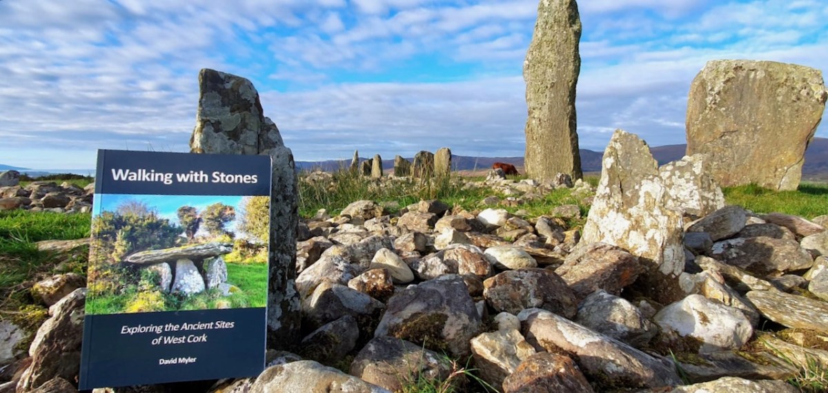
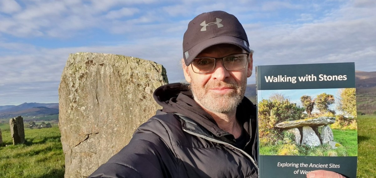
If you live in West Cork, or if you love to visit it, your Christmas present dilemma is solved! Here comes Walking With Stones, the new book on West Cork archaeological sites written by David Myler.
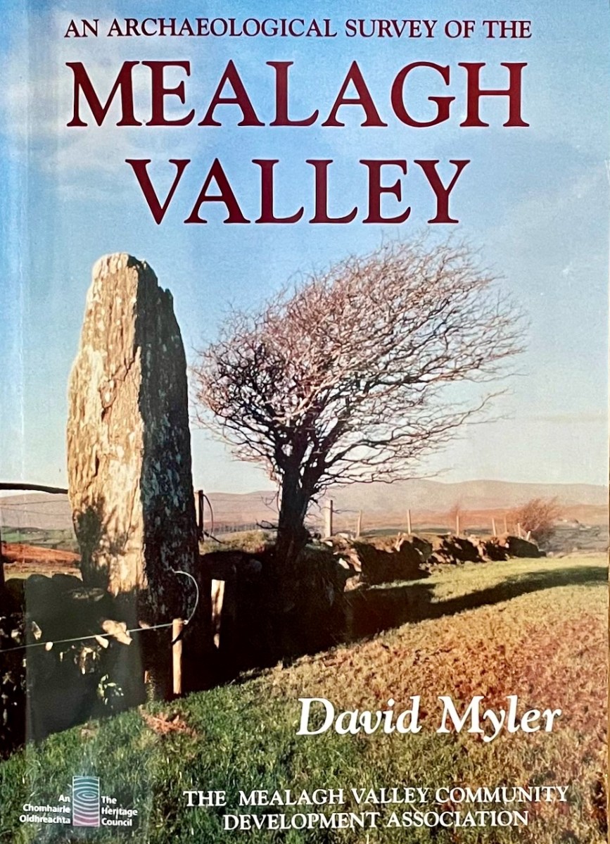
David has been sharing his passion for West Cork antiquities in an online Facebook Page/blog which he called Walking with Stones. But even before that, he wrote An Archaeological Survey of the Mealagh Valley – a book we have had on our bookshelves for years and turned to often.
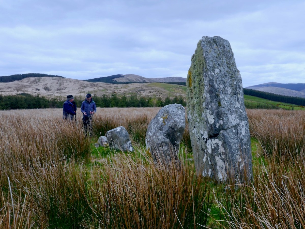
Once we saw Walking With Stones pop up on our Facebook feed, we knew we had found a fellow traveller. We had to meet – and meet we did, along the way discovering many shared interests and even a relative in common. Our first meeting was a field trip where David showed us this stunning stone row in the Mealagh Valley.
On that same trip we saw my first ever Four-Poster Monument – they are very rare, with only four in West Cork – as well as a spectacularly-sited wedge tomb that David had discovered.
David’s book is a very welcome addition to our bookshelf. Perhaps I should declare right away that he asked me to write the Introduction and I was delighted to do so. Now that I finally have my own copy, I am thrilled to be associated with it, in this small way.
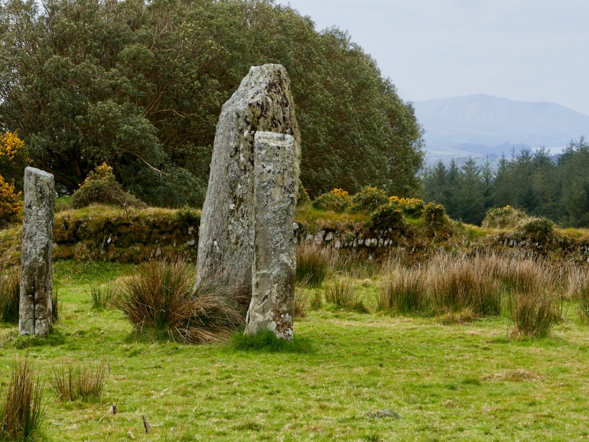
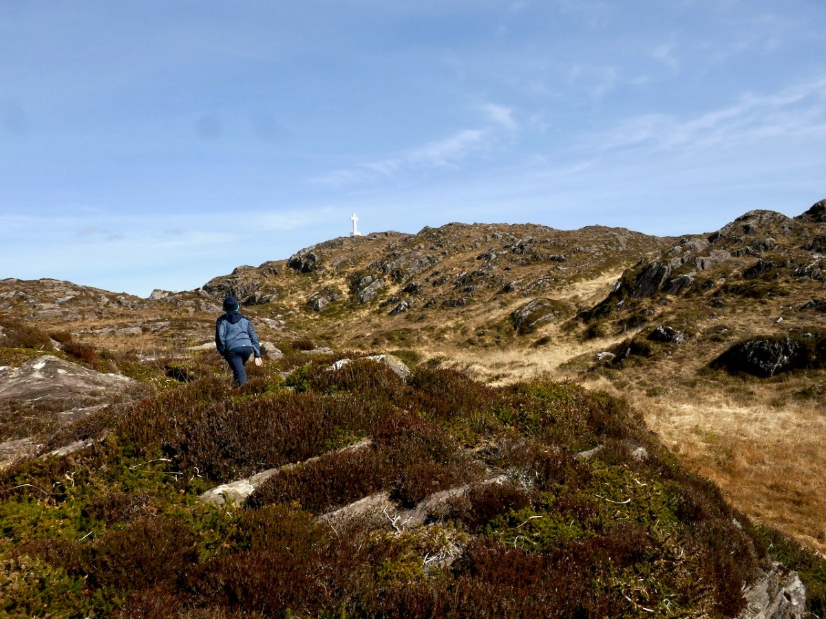
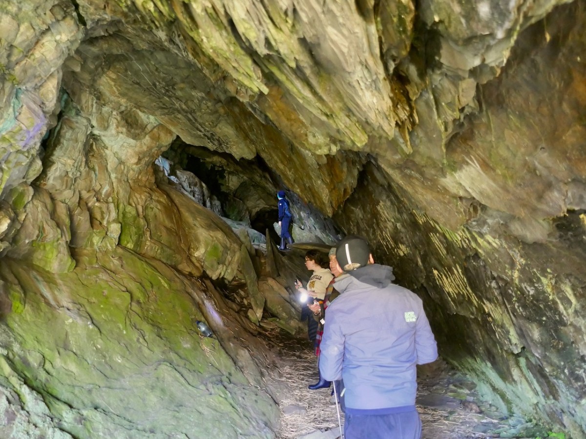
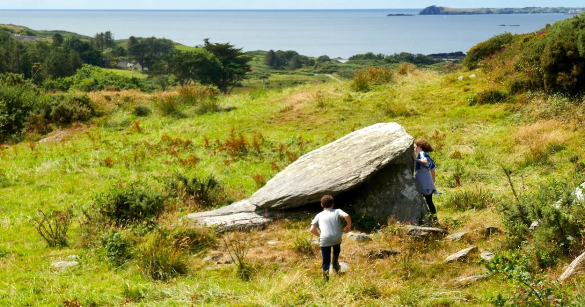
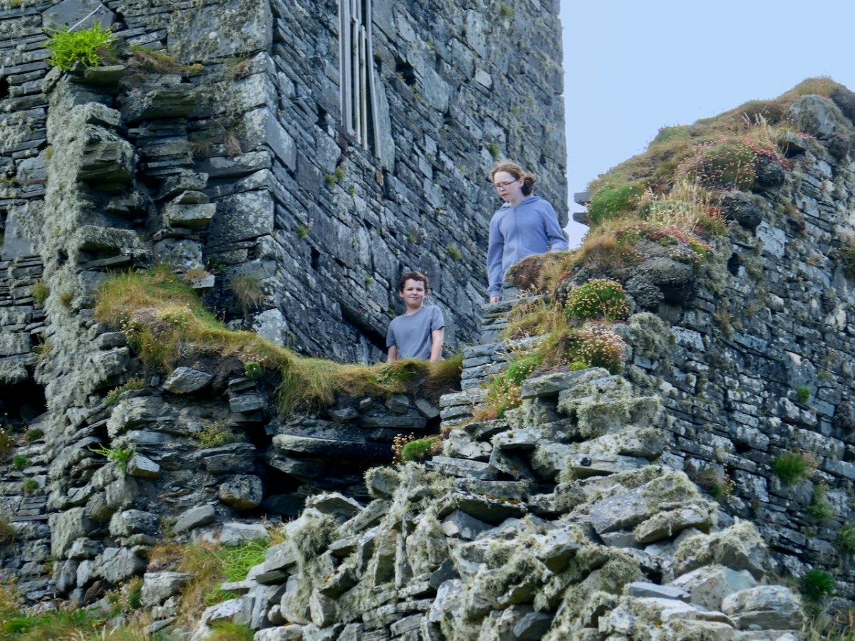
David’s favourite companions on his walks are his kids and one of the real strengths of this book is the sense that all these places can be enjoyed with family. Having young people along, with their curiosity, their need to really explore, and their chatter, brightens any walk. Just make sure you go equipped with food and bandaids. What follows are a few photos of joint field trips we have taken with them.
The only comparable book we can think of is Jack Roberts’ Exploring West Cork, first published in the 1980s and updated and re-published a couple of times. We treasure all of Jack’s books, especially for their marvellous black-and-white drawings, as accurate as they are charming.
While Jack tried to be fairly comprehensive in his coverage, David’s selection is personal – this does not pretend to be a gazetteer, but a guide and companion. Many of the sites have been chosen because they are accessible and can be enjoyed as part of a good walk through the countryside. Restricting the number of sites also allows David to write more about each one and use his own photographs to illustrate important features.
The best place to have David’s book is in your car, your bicycle carrier, or your backpack. You can buy it online here or here. Look out for it in local bookstores, if you live in West Cork – David is doing the legwork now of getting copies to them.
Congratulations, David! Given that you work full time and have a family to look after, this is an amazing accomplishment and one we are all grateful for.
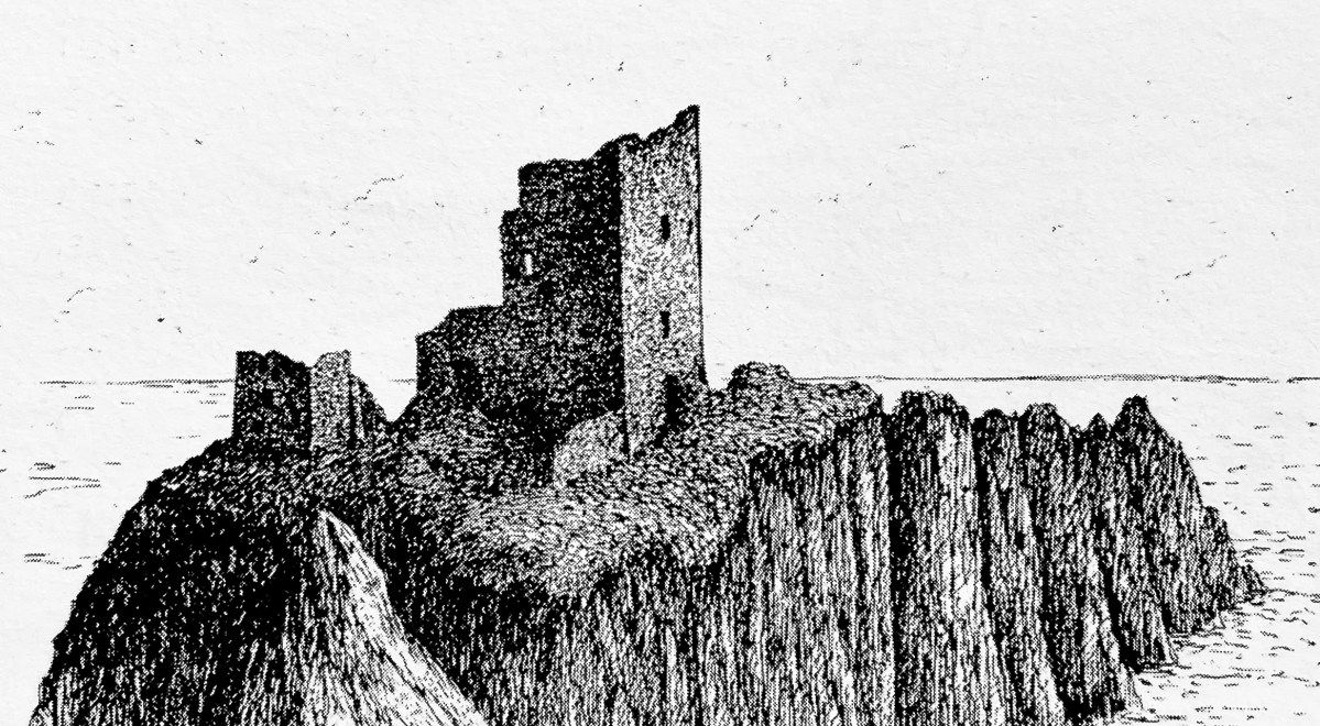
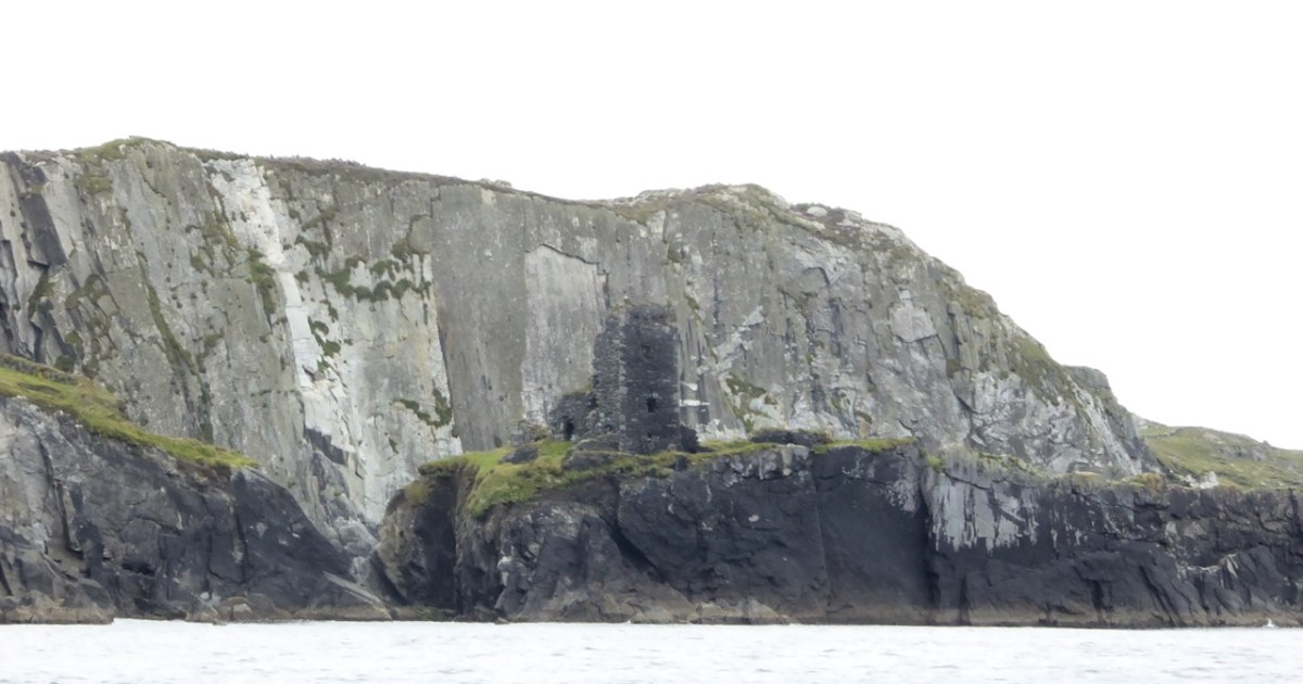
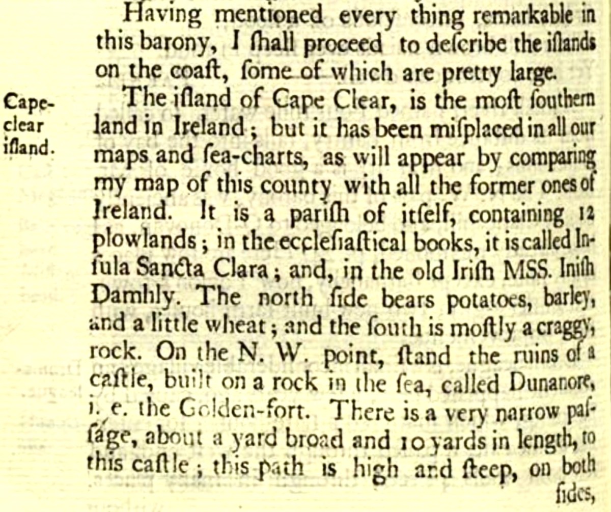
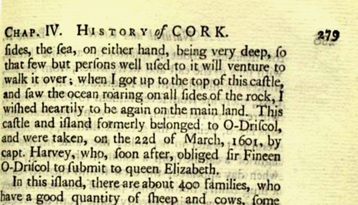
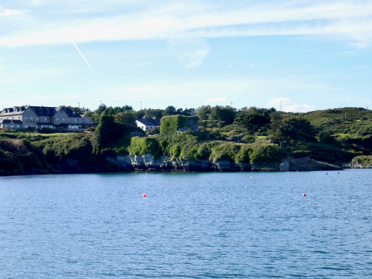
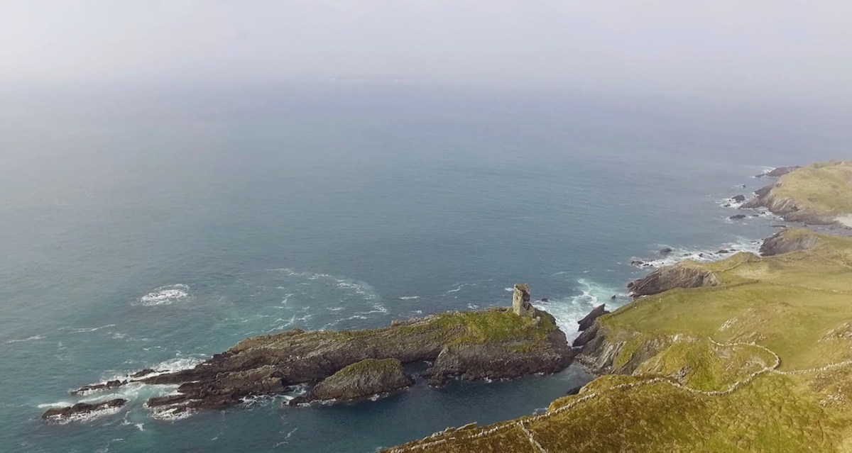
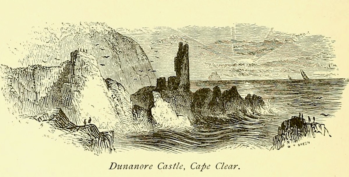
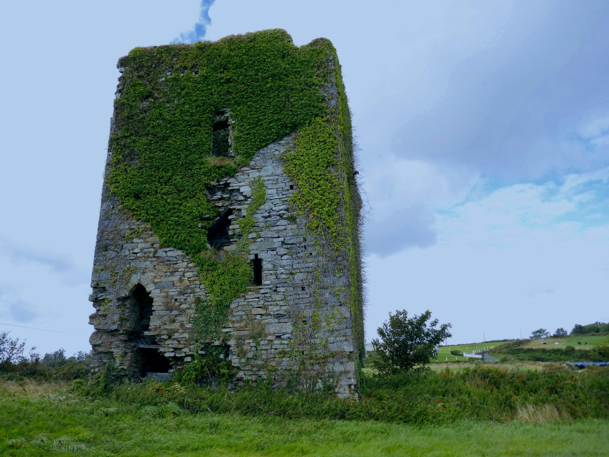
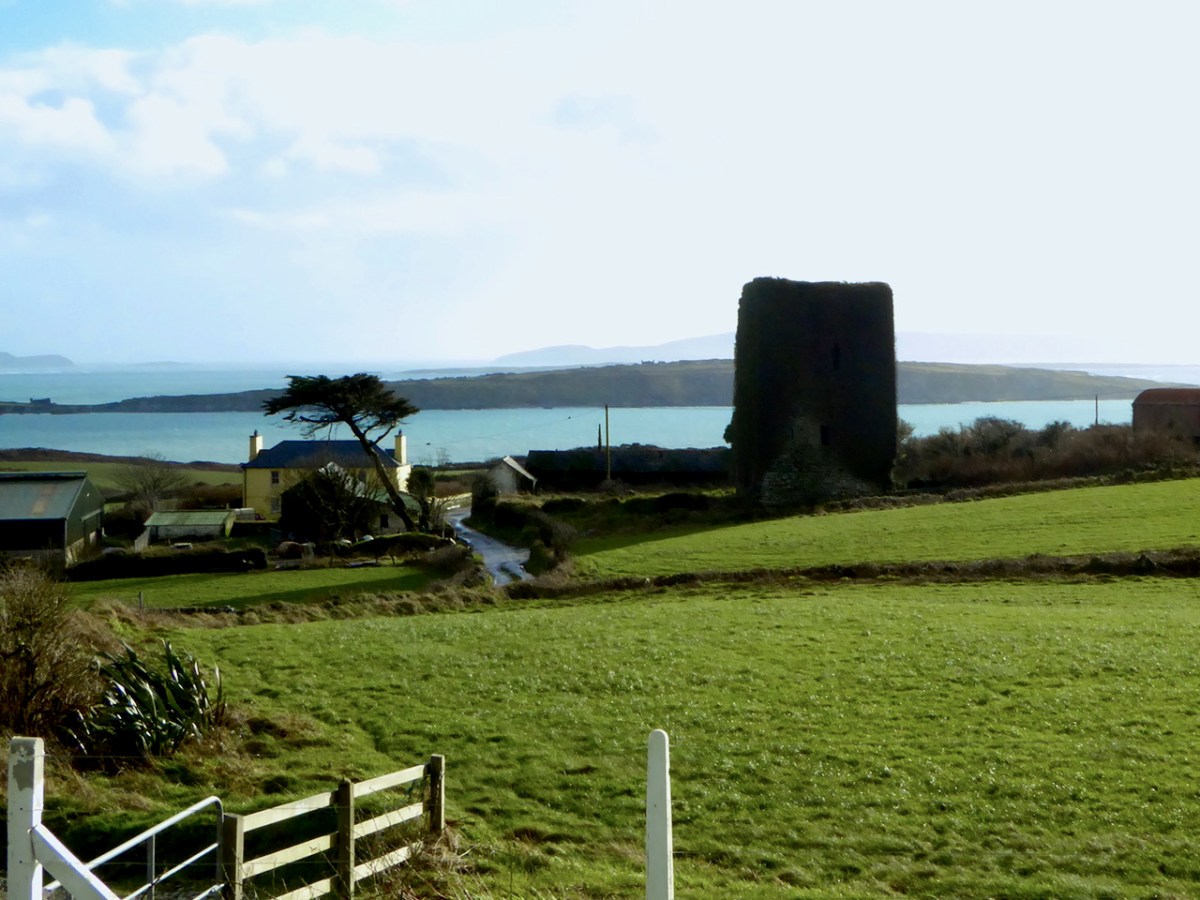
I have been gifted with a marvellous set of photographs of Dunanore, or Dún an Óir – an O’Driscoll Castle on Cape Clear. The gift came from one of our readers, Tash, and I am very grateful indeed. Regular readers know that I like to use my own photos, and I do have some that I took from the sea (like the one below) but I have none of Dún an Óir from the land, let alone from the castle itself!
And that’s because, as you can see from the drawing by Jack Roberts at the top of this post, this castle is situated in a very perilous location, on the edge of a cliff, on a small island, essentially, making access a hazardous scramble up from a rocky beach. It was once connected to the rest of Cape Clear by a narrow causeway but this has long collapsed. It was still there in the 1770s when Charles Smith visited. In his The Ancient and Present State of the city of Cork Vol 1, he wrote:
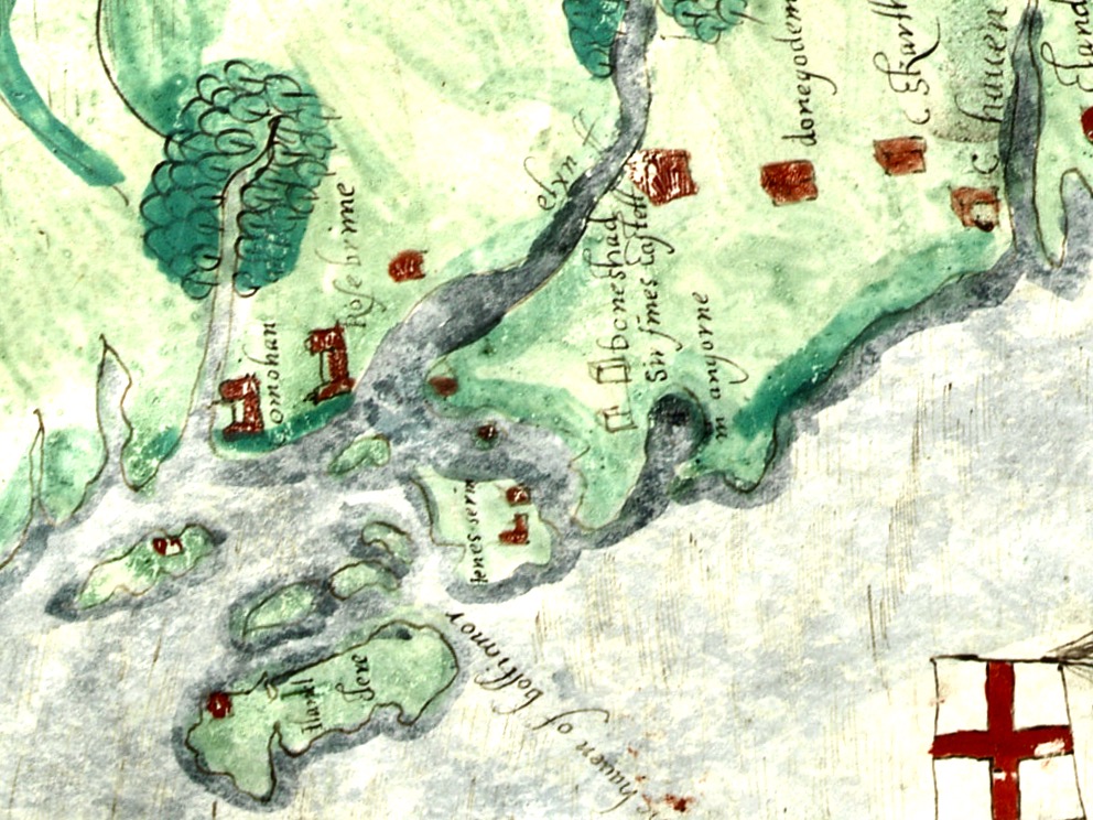
And this brings us to the name – Dún an Óir. It means, of course, Fort of Gold, and some of the old legends about this place talk about the name coming from stories of buried treasure. But in fact, this has been the name of this fort since the first maps of this area were made in the fifteen hundreds and it speaks to the wealth of the O’Driscoll clan who built it. Remember, their other stronghold, now called Baltimore, was Dún na Séad, or Fort of Jewels (on at least one map given as Castle of Perles). On Sherkin, their castle was Dúnalong – or the Fort of the Ships – that’s it as it is now, below.
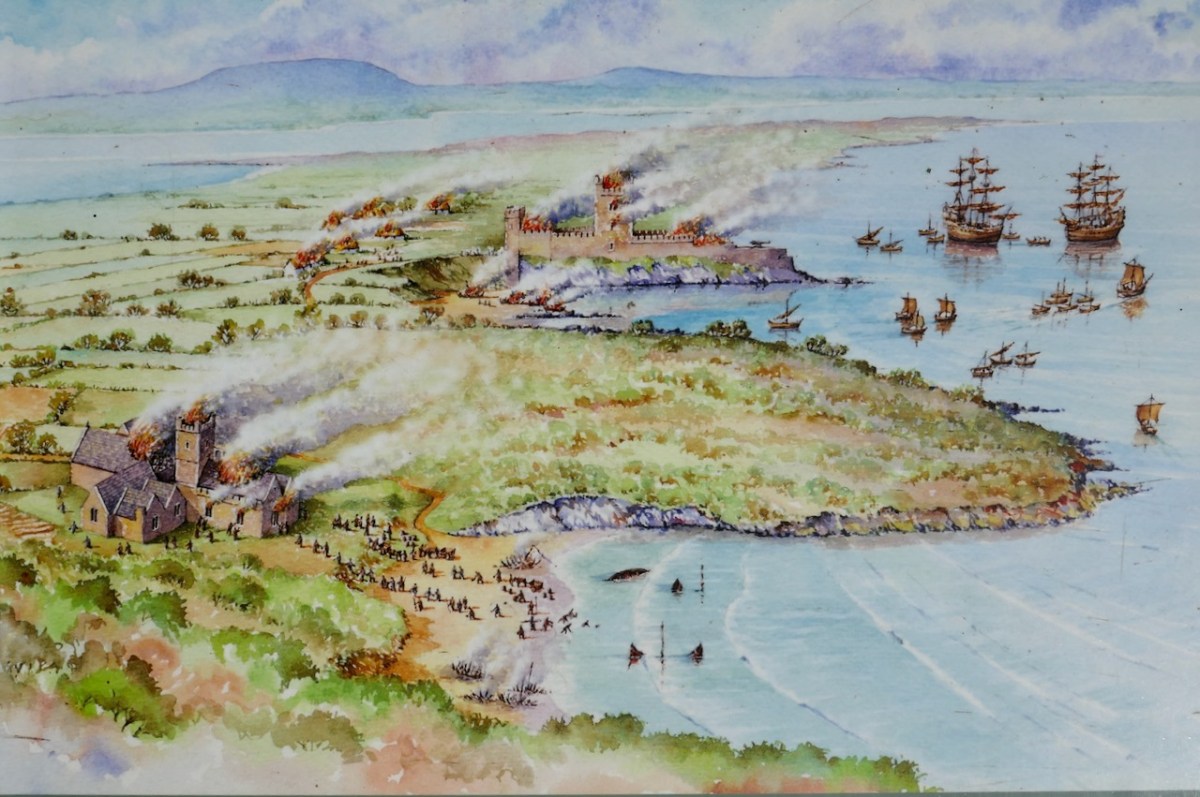
There are many accounts of their fleets of ships, and the battles they waged against the Waterfordmen in which they came out the worst for wear when Dunalong was attacked. The scene below, from an information sign on Sherkin, shows the Battle of the Wine Barrels, 1537, with both Dunalong and the Friary on Sherkin in flames
Dún means ‘fort’ but seems to be especially applied to promontory forts in the southwest. Before the castle was built, therefore, it is likely that the O’Driscolls fortified the headland, which may date well back to the Early Medieval period (400-1200) or even to the Iron Age (500BC to 400AD, or 500BCE to 400BC for those who prefer the secular version). The Illustration below is taken with permission from Dún an Óir Castle: an uncertain future, by Dr Sarah Kerr, and shows the present state of the castle, marooned on what was once a promontory connected to the Island.
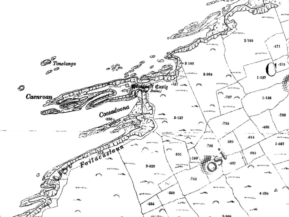
Our Promontory Fort man is Thomas Westropp (see here and here), and he wrote about Dún an Óir in his 1914-16 paper for the Royal Irish Academy, Fortified Headlands and Castles in Western County Cork. Part I. From Cape Clear to Dunmanus Bay. He visited the site, but like many a good explorer before and after him, did not venture out onto the promontory, but satisfied himself with what he could see from the high ground above it. That included the promontory and ruined castle, the rather ominously named Tonelunga (The sea-bed of the Ships), the end of the promontory called Caenroan (quay of the Seals), the inlet between the promontory and the cliffs, Coosadoona (the Little Harbour of the Fort) and the high cliffs behind the fort, Foilacuslaun (Cliffs of the Castle). All of these are marked on the 19th century twenty-five inch map.
Westropp writes about Dún an Óir as one of three Promontory forts on Cape Clear Island, although in fact there are more than that, as identified by the National Monuments Record – each yellow dot below is one.
Here’s one of them (below), Lios Ó Móine (the Fort of the Meadow – lios is usually used to designate an earthen ring fort): the description and then the photo are by National Monuments Service (NMS). In the photo you can see the narrow neck of land leading out to the promontory. This is likely what the spit leading out to Dún an Óir may have looked like.
Description: In rough pasture, at the foot of a steep N-facing slope on Stuckaunfoilnabena, a headland on the NW coast of Clear Island. A narrow eroding neck of land (Wth 3m; L 15m) leads to the roughly anvil-shaped headland. Across this neck of land are the remains of three earthen banks and the shallow remains of three fosses. Further examination of the remains was not possible for safety reasons.
Curiously, the NMS does NOT identify Dún an Óir as a promontory fort – here is what it says:
Description: The location of the tower house ‘Doonanore Castle’ (CO153-015002-) on a promontory, on the NW shore of Clear Island, suggested that it may have been built on the site of a promontory fort. However, there are no visible surface traces of an earlier defences across the promontory. The promontory is now isolated at high tide but was connected to mainland by causeway until 1831.
However, it has this to say about the earthwork identified on the high ground:
In pasture, on a steep N-facing slope to the E of the tower house known as Doonanore Castle . . . An earthen bank . . .extends upslope in a S to SW direction from a modern E-W field boundary wall on the cliff-top at N and ends at a large outcropping rock on the edge of another cliff. This bank appears to have formed part of the defences on the land approach to the castle from the E. The bank has three contiguous linear stretches [and] there is an entrance near the N end. There is a possible hut site near the centre of the enclosed area. The short promontory on which Doonanore Castle stands is a possible coastal promontory fort.
So, as you can see, although the NMS declines to label it a promontory fort because there are no longer any signs of banks or walls, it does concede that it is possible. It also extends the defences of that fort to the higher ground above it.
Back to Westropp – He quotes:
the poem of O Huidhrin, before 1418, tells how “0 hEidersceoil assumed possession of the Harbour of Cler.” It was of some importance to the foreign traders in wine and spices, and so figures in all the early portolan maps. Angelino Dulcert, in 1339, calls it Cap de Clar ; the subsequent portolans, Cauo de Clara, 1375 and 1426 ; Clarros, 1436 ; C. d’Clara or Claro, 1450 and 1552, and, to give no more, Cauo de Chlaram, in 1490. The 0 Driscolls’ Castle probably dates between 1450 and the last date. It was probably on an earlier headland fort, as it is called Dunanore. In 1602 it surrendered without resistance to the English, who burned it.
Westropp goes on to say
Dr. O’Donovan, in his ” Sketches of Carbery,” gives a few notes on the later history. He says there was a garrison at the Castle in Queen Anne’s time, and mentions the huge iron ring-bolt, set in the rock, to which the O Driscolls formerly moored their galleys in the creek. The last is improbable, even to impossibility: no one could moor galleys in the dangerous wave-trap, open to the most stormy and unsheltered points. The islanders regard the ruin as haunted, and tell of the singing of ships’ crews in its vaults. One “Croohoor” (Conor) O’Careavaun (Heremon’s grandson) lived as a hermit there in the eighteenth century. Another legend tells how, in 1798, the inhabitants painted the Farbreag Rocks and pillars so as to resemble soldiers in uniform to keep away the French ! If any truth underlies this, it is probably based on the idle act of some revenue or other officers, in the endless leisure of their island station.
In the map above, of the southwest end of the Island, you can just make out the name Firbreaga, almost covered by the O of OSI. Fir Bréaga means The Lying Men, an apt translation given Westropp’s story. No doubt the name is older than 1798, and may refer to the cliffs at that end seeming to be less dangerous from the sea than they actually were. Note also the two yellow dots for two more promontory forts- Doonthomas (Thomas’s Fort) and Coosfoilaskehaun (the Small Harbour of the Knife-Edge Cliff).
Westropp’s description of the promontory upon which Dun an Óir sits is poetic:
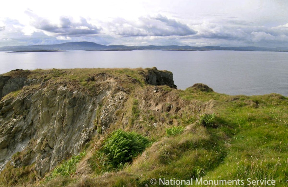
The path runs up a very slight ledge, flaking away and high above the creek, along the face of a cliff of polished silvery slate. The low neck joined it to the mainland, and the nearly perpendicular strata make the dock-like creek of Coosadoona, fort-cove, to the south Beside this cove, opposite to the castle, an enormous precipice rises high above the tower top. In the other direction is a noble view across the wide, porpoise-haunted bay, and its low islands to the blue, many-channelled Mount Gabriel, and on to Mizen Head.
In fact, very little is known about the history of Dún an Óir before the Battle of Kinsale in 1601. We can deduce from its strategic location that the O’Driscolls used it to keep an eye on every ship that sailed in and out of Roaringwater Bay, to exact fishing dues before the rival O’Mahonys could get to the incoming vessels, to curb the power of those O’Mahonys, and to establish their dominance over the land of Cape Clear Island. (See this post for more on the map above.) Because the castle would have been rendered, probably in some shade of white or near-white, it would have been visible from all around Roaringwater Bay, and have represented a potent statement of supremacy.
After the Battle of Kinsale the Castle was seized by Captain Harvey, as described in Pacata Hibernia:
‘While these things were on doing, Captain Roger Harvy sent a party of men to Cape Clear,the castle whereof being guarded by Captain Tirrell’s men, which they could not gain, butthey pillaged the island and brought thence three boats; and the second day following therebels not liking the neighbourhood of the English, quitted the castle, wherein Captain Harvy placed a guard. At this time Sir Finnin O’Driscoll came to Captain Harvy and submitted himself.’
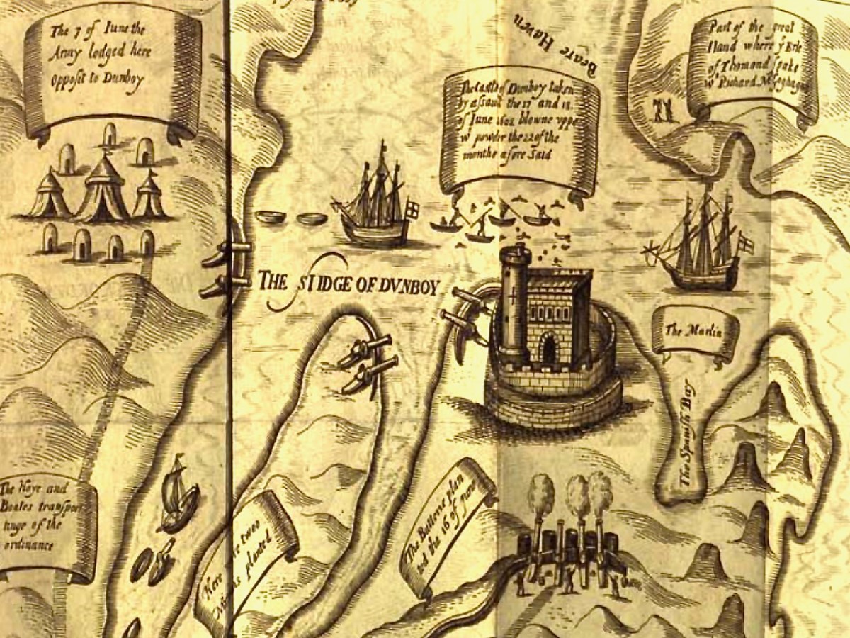
This illustration, from Pacata Hibernia, is of the siege of Dunboy Castle, the stronghold of O’Sullivan Beare, on Beara Peninsula. The destruction of Dún an Óir is described by James Burke in his article Cape Clear Island in the Journal of the Cork Historical and Archaeological Society Journal of 1908. Rather than Harvey simply taking over the castle, Burke relates the following:
Its central arch and the steps leading to its upper portion remain; but the huge pieces of its eastern wall now lying about show how severely it has suffered from the havoc of war. This wholesale destruction occurred when Dunanore Castle, together with the island, was captured on the 22nd of March, 1601, by Captain Roger Harvey, following on the defeat of the Spaniards at Kinsale. By means of the artillery he planted on the high ground adjoining it, he battered down the eastern wall and compelled the garrison to surrender, for which and other services (as Dr Donovan writes in his “Sketches of Carbery”) he was granted at the time a commission by Lord Deputy Mountjoy as Governor of Carbery.
It is far more likely that the ruined state of the castle is a result of the natural passage of time than the ‘havoc of war.’ For one thing, it would have been a monumental task to deploy artillery overland on Cape Clear. Any cannon fire would have come more naturally from the English warships we know were in use during this period and therefore, the damage would have been to the seaward side of the castle – but this side is actually intact.
A romantic view of the ruins of Dún an Óir above, by W Willes.* Next week we will look at what is left of the castle and what we can tell from that. I’ll be using the marvellous photos from Tash in that post.
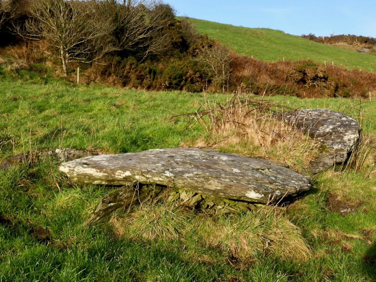
We had, unknowingly, driven past this wedge tomb many times. It’s located on rising ground overlooking the Barley Cove wetlands, in the townland of Ballyvogebeg. The townland name (according to logainm.ie) translates as the Little Place of the O’Buadhaighs, a very scattered clan sometimes translated as Bogue, or Bowe.
The wedge tomb here was formally recorded by archaeologists de Valera and Ó Nualláin in their Survey of the Megalithic Tombs of Ireland in the early 1980s. They provided the scale drawing, below.
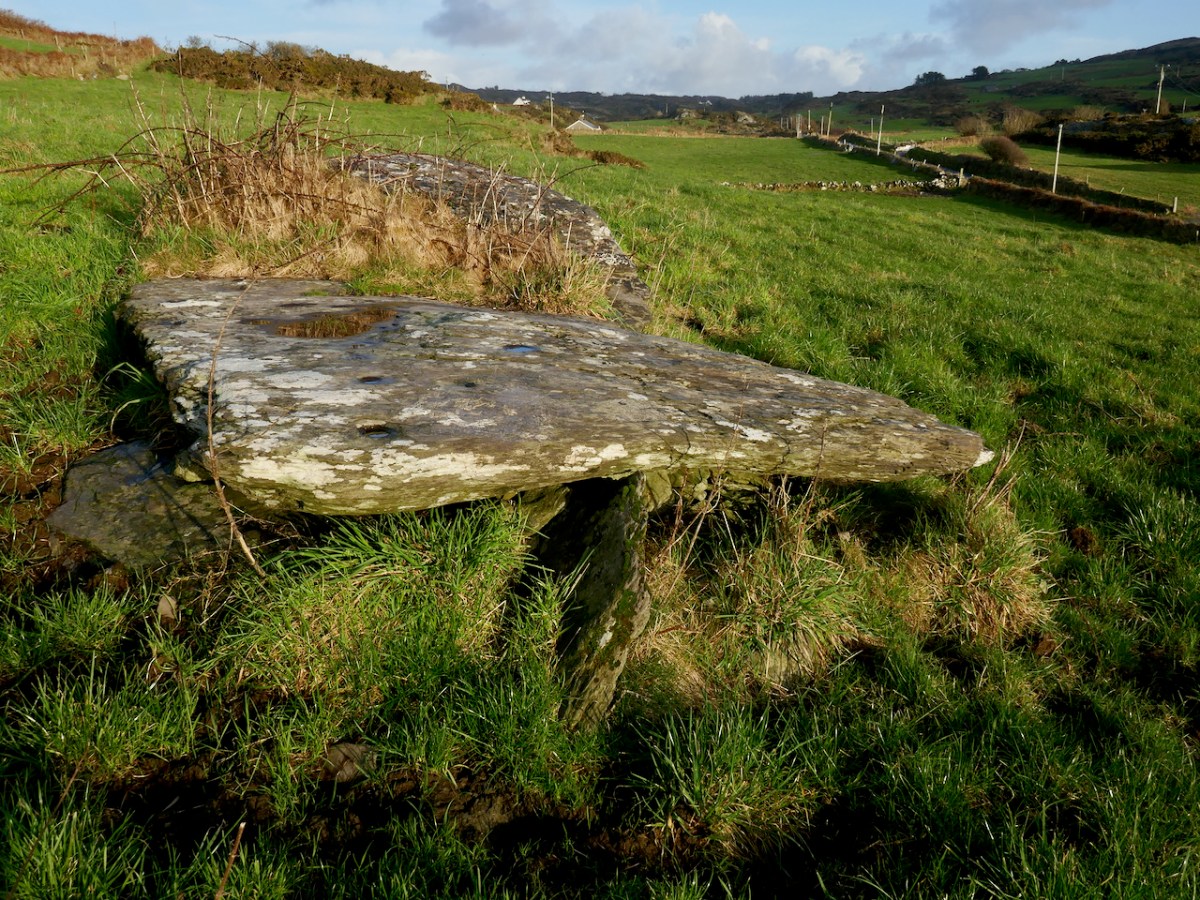
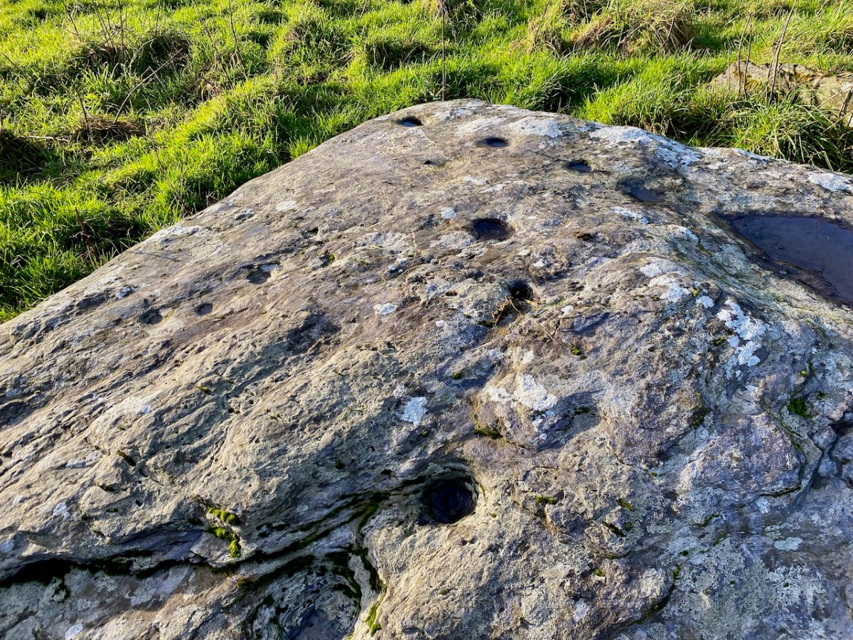
It was next surveyed by the Cork Archaeological Survey Team in the early 90s. Oddly, neither of these reports contain any reference to one of the most striking aspect of this megalithic tomb – the cupmarks on the capstones.
The next person to record it was Jack Roberts for his Antiquities of West Cork series, and his drawing clearly shows the cupmarks.
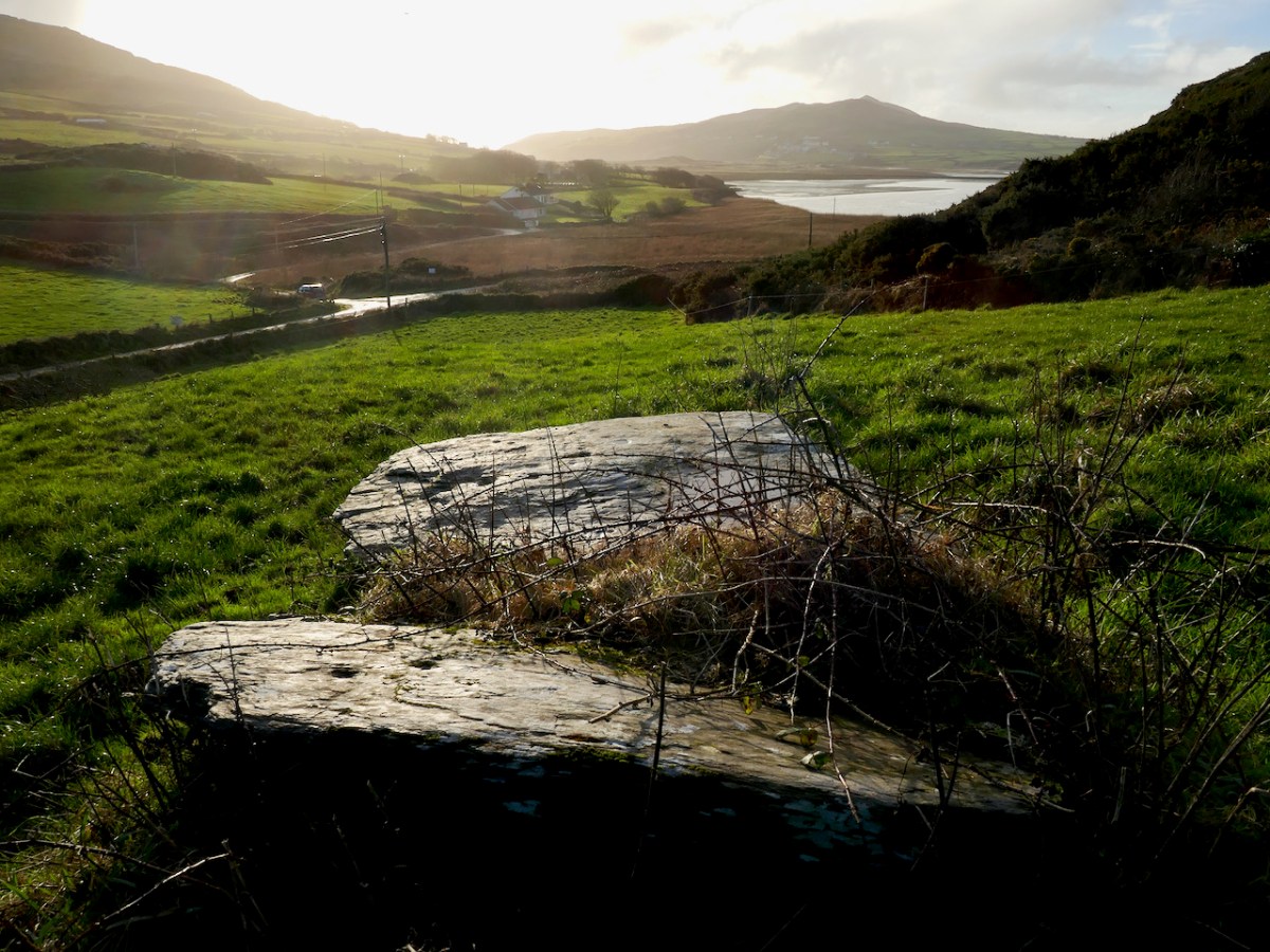
If you are new to this series on Mizen Megaliths, or to megaliths in general, you can catch up with a quick read of my post Wedge Tombs: Last of the Megaliths. This wedge tomb, Ballyvogebeg, fits the pattern, although its ruinous state doesn’t allow us to observe much detail. The side stones have collapsed under the weight of the two large capstones, although you can still see them underneath, leaning at a perilous angle.
De Valera and Ó Nualláin noted that there was no indication of a surrounding mound, which seems to be typical of West Cork wedge tombs. It likely dates to the Copper or Bronze Age, making it around 4,000 years old.
Cupmarks are normally found on open air rocks and boulders, not associated with any monuments and are the most frequent element or motif in Rock Art. However, they are found occasionally on Wedge Tombs and Boulder Burials, so while their occurrence on the Ballyvogebeg wedge tombs is uncommon, it is by no means unique. Intriguing, though! If the tomb had been covered by a mound, they would not have been visible, leading to the conclusion that it was the act of carving them that was important.
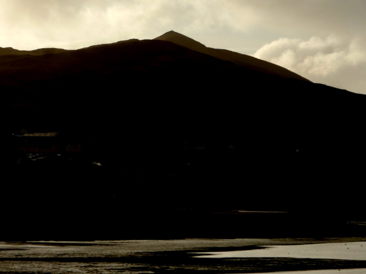
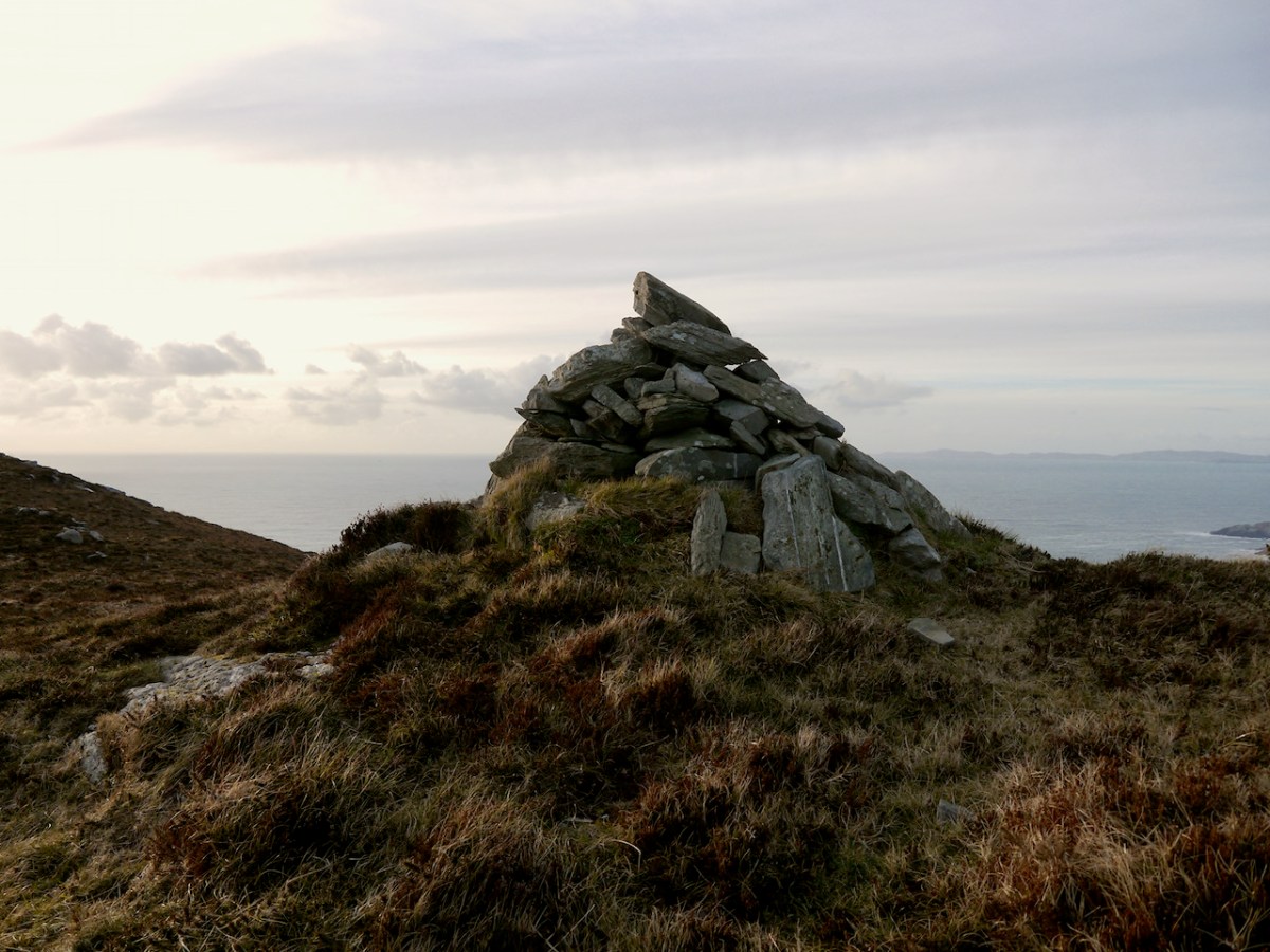
Like all of our West Cork wedges, it is oriented towards the west and the setting sun – that is the ‘entrance’ or tallest and widest end, faces the west. The most striking feature of the view is the pyramid-shaped Mizen Peak. What gives the Mizen Peak its distinctive point is a small cairn on its summit.
I haven’t yet been up to this cairn, although I am hoping to get there one of these days. So I am relying on the generosity of our friend Michael Mitchell, of theWalking to the Stones Facebook Page, for the photograph below. Like us, he has been struck by the fact that Mizen Peak seems to be visible from many sites, saying, It’s obviously a very important hill. It seems to be a focus for various megaliths, even some that are not on the Mizen peninsula itself. Michael points out that the cairn does not have the appearance of being ancient but more like a marker cairn.
Curiouser and curiouser, because there is very ancient folklore indeed about this cairn, which, in fact, gives its Irish name to Mizen Head – Carn Uí Néid, or the The Cairn of the Grandson of Néid. Which grandson are we talking about here? Néid had a son, Elathen, who in turn had five sons – the Daghda, Oghma, Bres, Alloth and Delbaeth – all of them figure prominently in Irish Mythology as members of the Thuatha Dé Danann.
Bres is the grandson in question, but Bres was his nickname. He was really Eochaid bres – that is Eochaid the Handsome, because everything comely and handsome that is seen in Ireland, ’tis to Bres it is likened. I am getting my information here from a piece written by J. F. L. in the Journal of the Cork Historical and Archaeological Society of 1912 (available online).
The Dinnshenchas of Carn Uí Néid has been translated by Dr Whitley Stokes
Bres, son of Elathan, died there; ’tis he that in the reign of Nechtan Fairhand. . .King of Munster, demanded from every rooftree in Ireland a hundred men’s drink of a hornless dun cow, or of the milk of a cow of some other single colour. So Munster kine were singed by Nechtan with a fire of fern, and then they were smeared with a porridge of the ashes of flaxseed, so that they became dark brown. . . And they also formed three hundred cows of wood, with dark brown pails on their forks in lieu of the udders. These pails were dipped in bog stuff. Then Bres came to inspect the manner of these cattle, and so that they might be milked in his presence . . . All the bog stuff they had was squeezed out as if it was milk. The Irish were under a geis to come thither at the same time, and Bres was under a geis to drink what should be milked there. So three hundred bucketsful of red bog stuff are milked for him and he drinks it all.
JCHAS Notes and Queries Carn Uí Néid, by J. F. L. 1912, Vol 18, 96, Ps 211-213
Of course it’s a huge and unreliable leap from mythology to a wedge tomb, but I can’t help thinking how great it would be if the Ballyvoguebeg wedge tomb was indeed the tomb of Bres, brother of the Daghda, handsome King of Munster, dead from a surfeit of bog stuff.
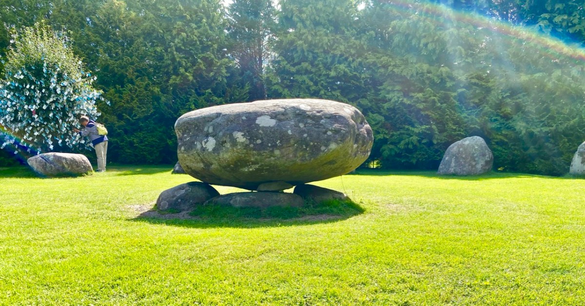
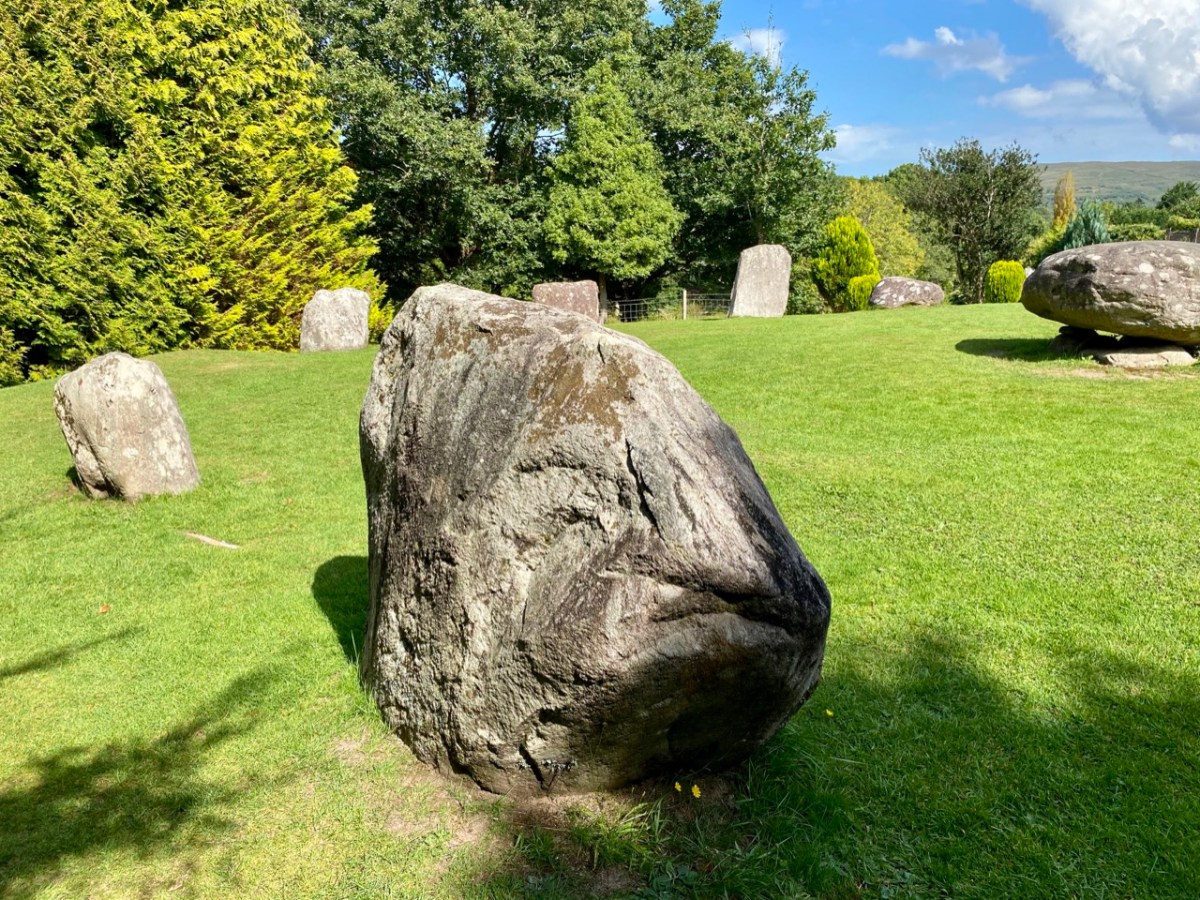
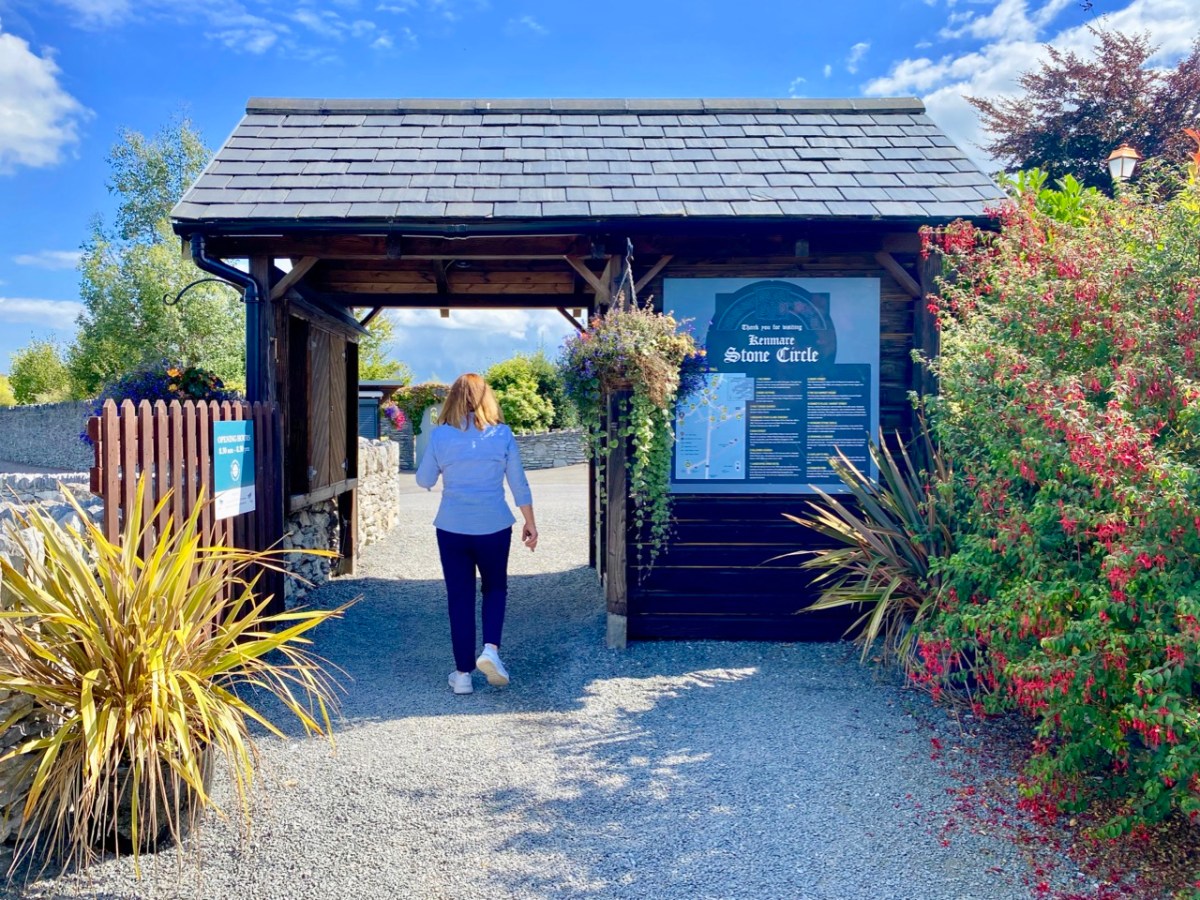
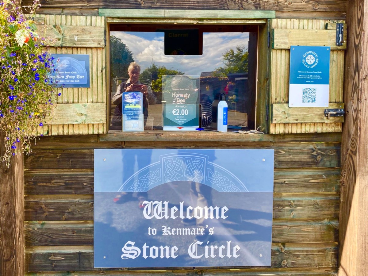
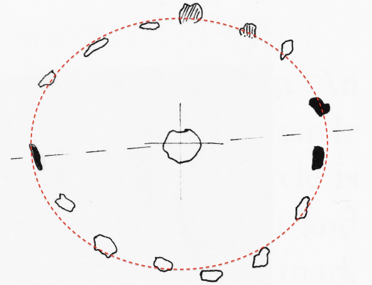
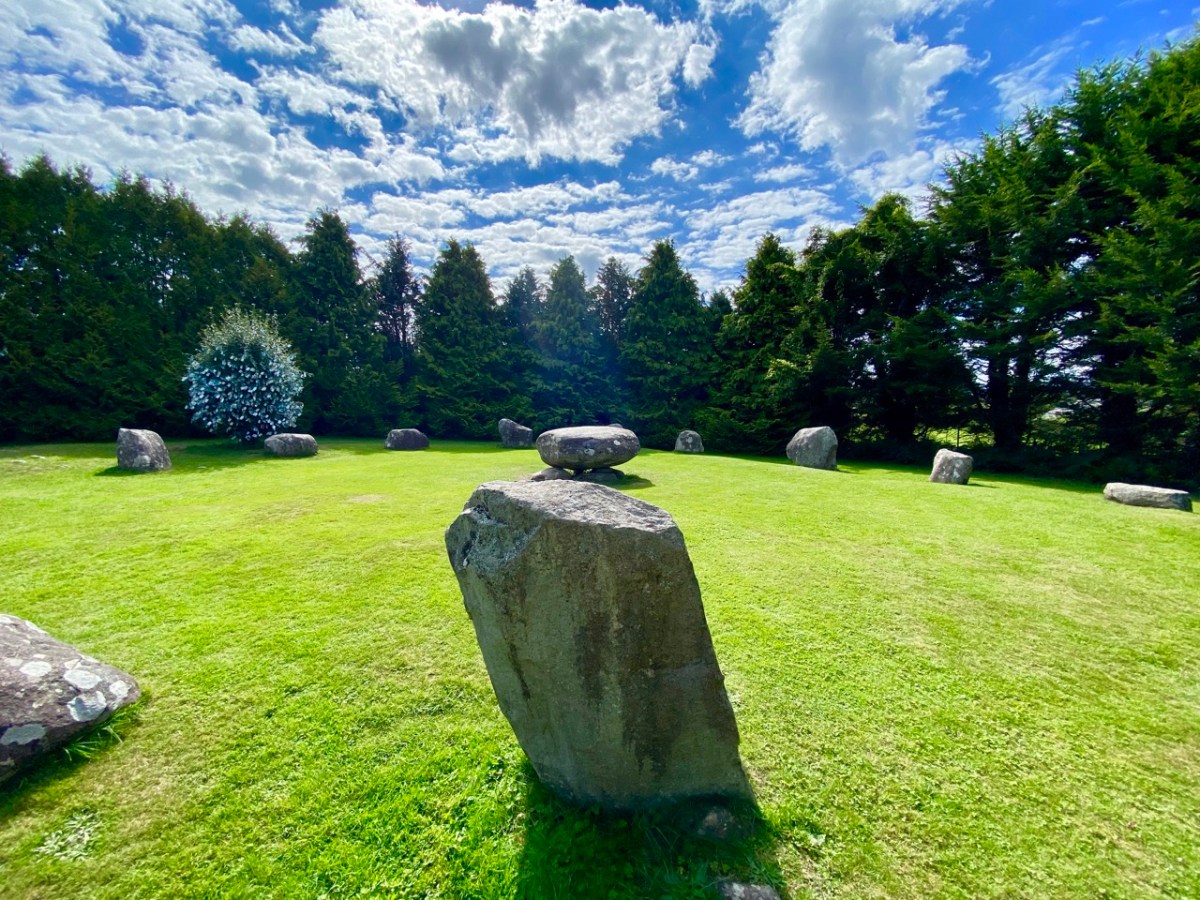
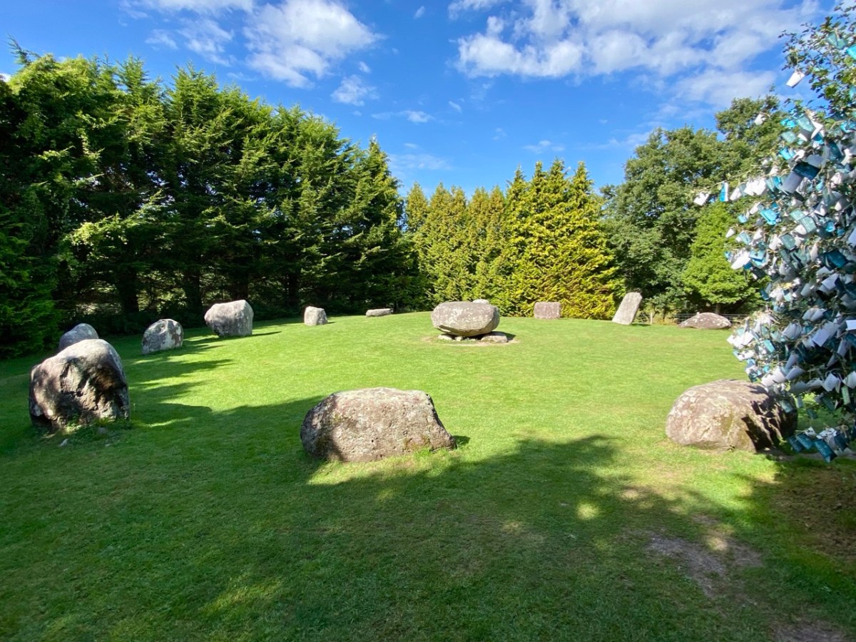
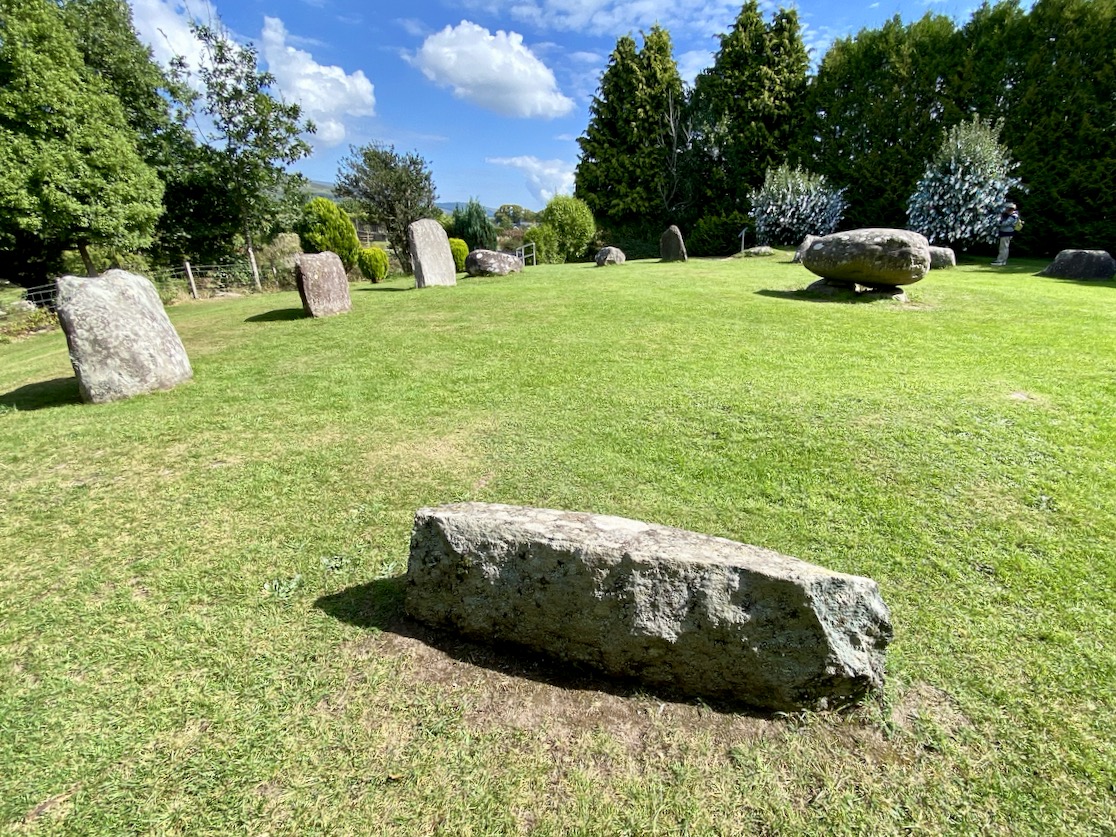
The significant stone circle at Kenmare is an unusual monument in several respects. It is said to be the largest stone circle in the south west of Ireland, oval in shape and measuring 17.4 x 15.8m. It seems intact: I found no record of any intervention or ‘improvement’ to the circle, which consists of an oval ring of 15 stones with a central ‘boulder burial’. Although situated very close to the main streets of this Kerry town, it has often been described as ‘hard to find’. I can remedy that – here’s a present-day location map:
The site is just a few minutes’ walk from the centre of Kenmare and now has its own dedicated car park beside it. The circle is very ‘tidy’ and well looked after. A nominal entrance fee is requested, the funds being put towards the maintenance of the area.
While the circle is fairly well enclosed nowadays by a ring of tall trees, the vista would previously have been more open with extensive views. Quarrying has taken place in the vicinity in past years. Here is the historic 6″ OS map showing the site as it was around the late nineteenth century.
The archaeology.ie Historic Environment Viewer gives a brief, sober description of the site:
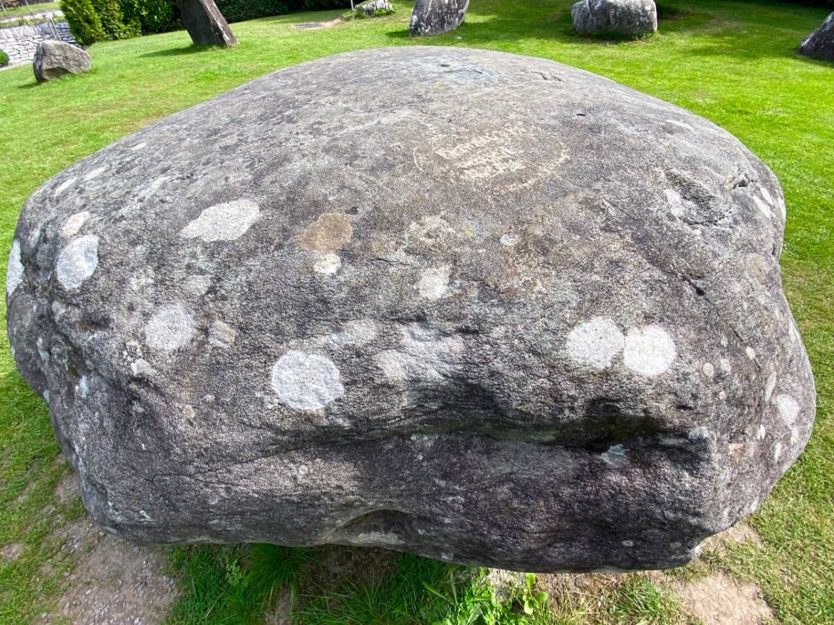
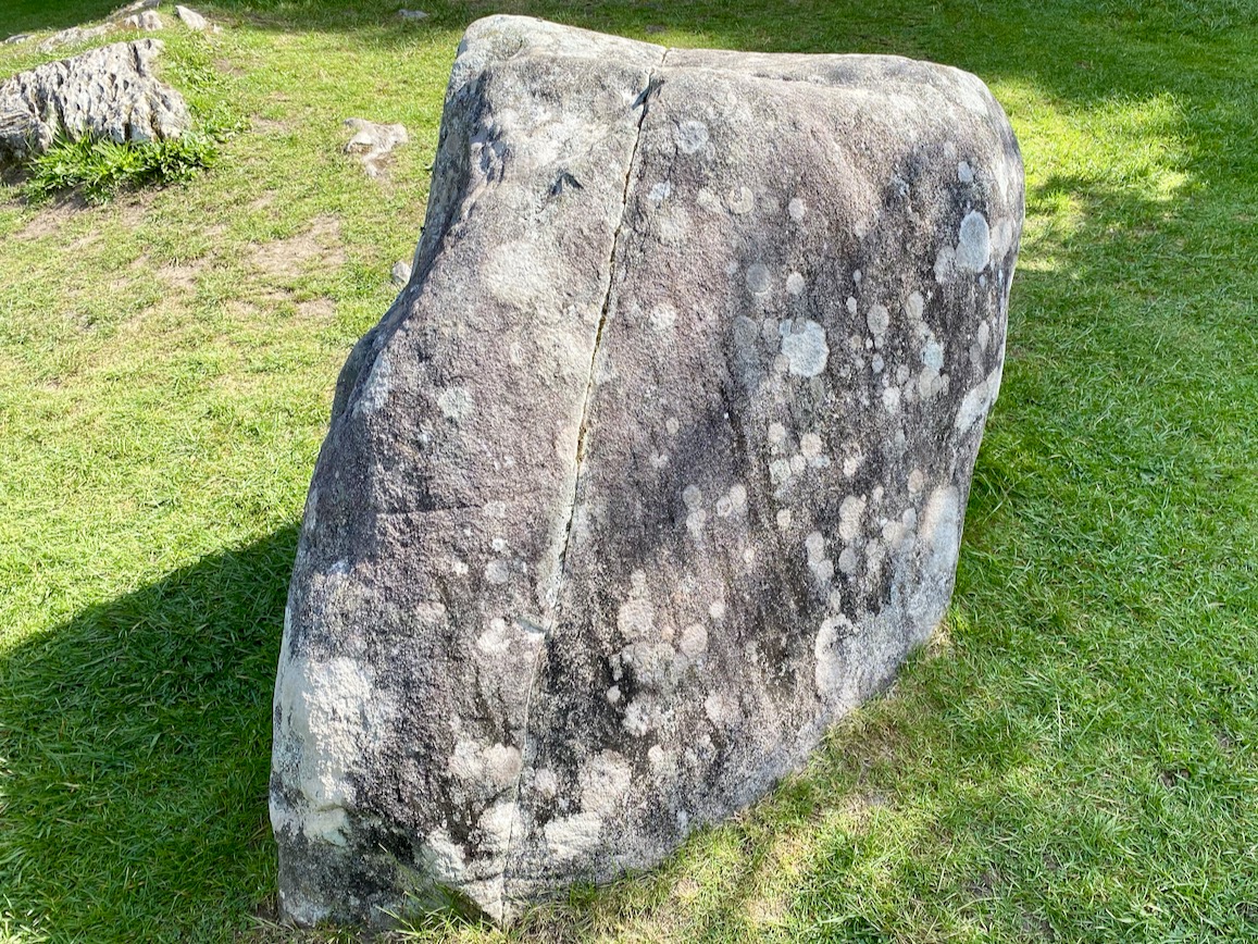
. . . In level pasture, on the SW outskirts of Kenmare town. A subcircular area (17m E-W; 15m N-S) is enclosed by fifteen stones (L 0.8-1.6m; T 0.2-0.7m; H 0.3-1.2m), two of which are prostrate. The axial stone is the lowest and is a regular flat-topped slab contrasting with most of the other stones, which with one or two exceptions, are of boulder type. A boulder-burial (KE093-032002-) occupies the centre of the stone circle. (Ó Nualláin 1984a, 26, no. 41) . . .
Archaeology.ie KE093-032001
I was disappointed in my search for an antiquarian’s account of this circle: Ó Nualláin (quoted above) and others have included it in general lists of such monuments. I was hoping for some speculation on its significant size, and on the large central boulder, itself a slightly unusual feature within a stone circle.
. . . Boulder Burial – A large boulder or capstone of megalithic proportions, resting on a number of supporting stones, usually three or four in number, which, in most cases, do not form a recognisable chamber structure. Excavations suggest a Bronze Age date for this burial monument (c. 2400-500 BC) . . .
Archaeology.IE Monument Classification
Finola has pointed out, however, that there is no conclusive evidence for assuming that these ‘boulder burials’ are – well – principally burials.
. . . William O’Brien [Professor of Archaeology UCC] excavated three boulder burials in the late 1980s and found no evidence of burials. In his book, Iverni, he comments in an understated way, “The absence of human remains at Cooradarrigan and Ballycommane does pose some questions as to their use.” His findings dated the sites to the Middle Bronze Age, between 3000 and 3,500 years ago . . .
Finola Finlay, Roaringwater Journal
So, should we perhaps call them ‘elevated stones’? Visually, they are certainly always striking. This one at Kenmare is said to weigh around 7 tons. Bearing in mind the stones in this circle are likely to originate some few miles distant, we can imagine the efforts required to assemble them. O’Brien dates the boulder burials he studied to 1000 or 1500 BC. This would tie in with the general thinking that stone circles were Bronze Age also.
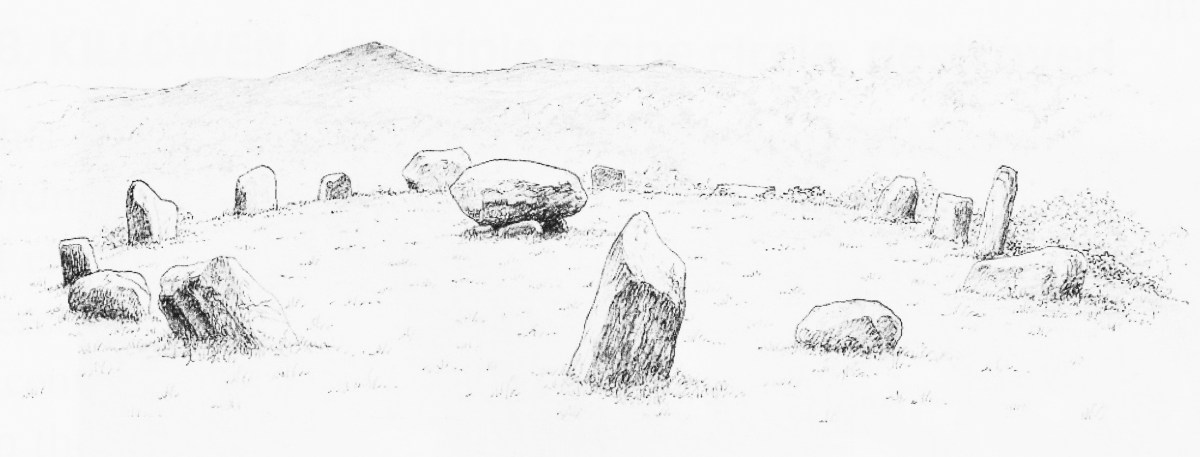
The two drawings above are from Jack Roberts. On his survey (top) I have superimposed an oval template which confirms the suggestion that the Kenmare ‘circle’ is egg-shaped. In the lower sketch view – probably dating from the 1980s – the stones appear to be out in the open, free from the present-day tree shielding.
While it is generally implied that all the stones in this monument were placed at the same time, there is always the possibility that there might have been an evolution in its construction. By that I mean that we could speculate that the ‘boulder burial’ stone was placed first and the circle came afterwards – perhaps to enhance its setting. Or vice versa.
This photograph clearly shows the recumbent stone. Many of the circles in south west Ireland are known as axial circles, where a ‘recumbent’ stone (seemingly placed on its long edge) may provide a horizon viewing point when observed from a ‘portal’ of two stones at the opposite side. The orientation axis created by this observation is usually from north east towards south west (as is the case here). Where a stone circle has a clear horizon (such as Drombeg, in West Cork) it has been noted that this alignment faces the setting sun at midsummer solstice.
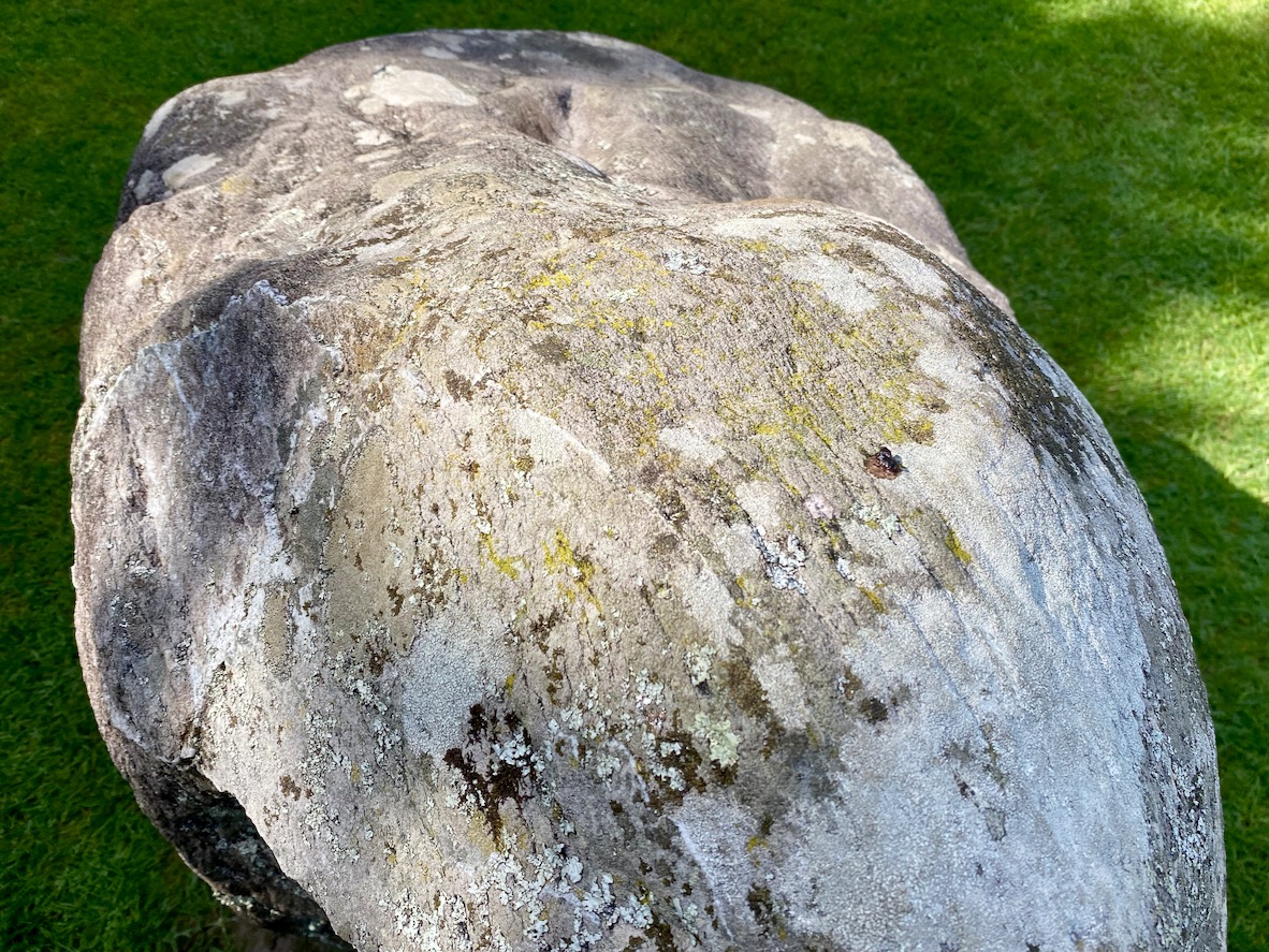
As you can see from these close studies of some of the individual stones (above) there are quite significant differences in their shape and character within the circle. It has been suggested (elsewhere) that the shapes and the relative placing of the stones is significant. ‘Male’ and ‘female’ stones have been suggested – but this is yet more speculation.
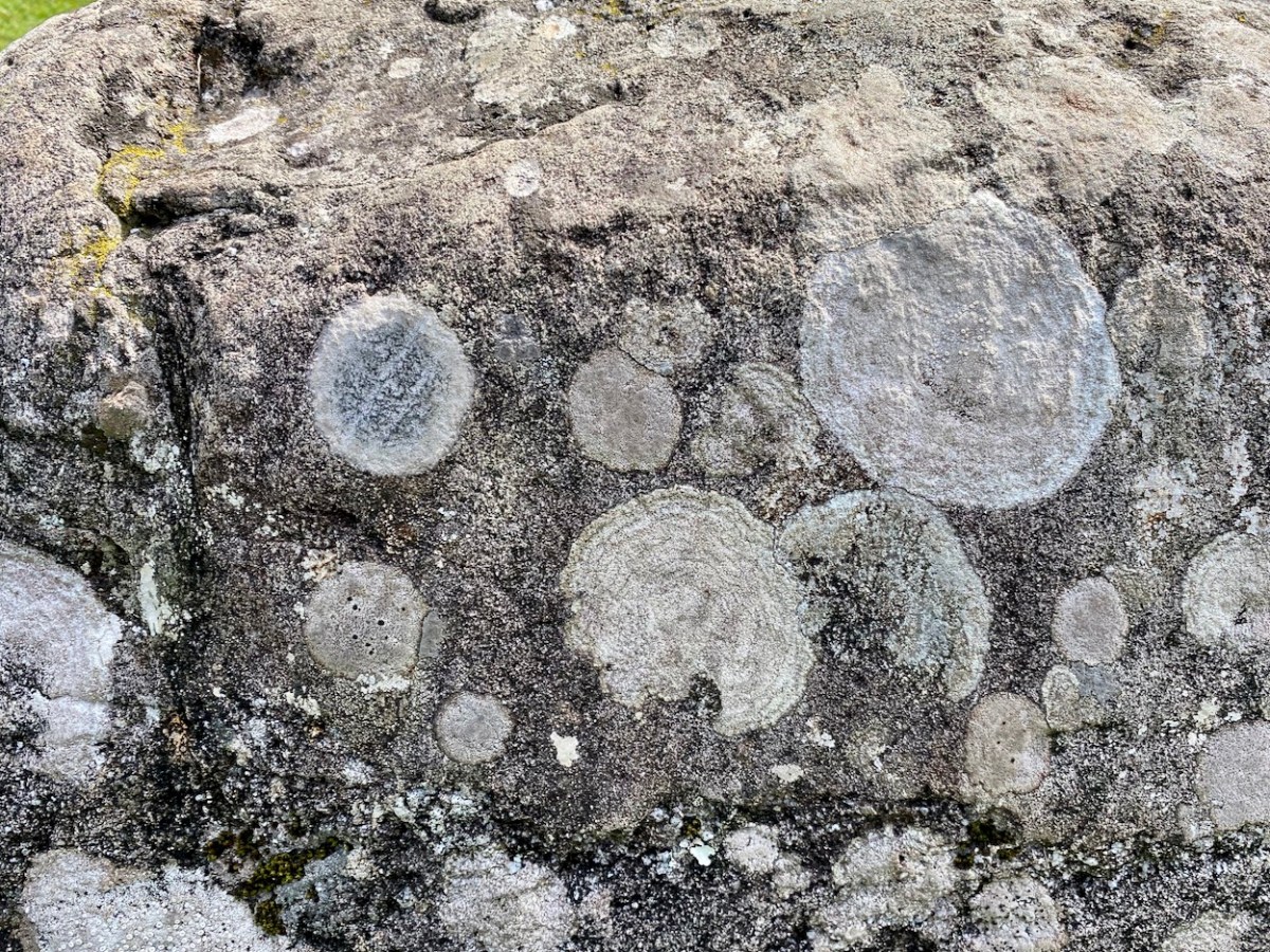
As far as we can see there are no ancient markings on the stones at Kenmare (except for a possible single cup-mark on the upper surface of the boulder burial), but I am fascinated by the lichen shapes and textures on one particular stone (above). This is ‘nature’s art’, of course.
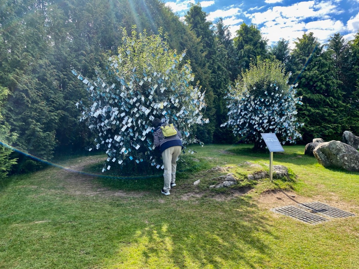
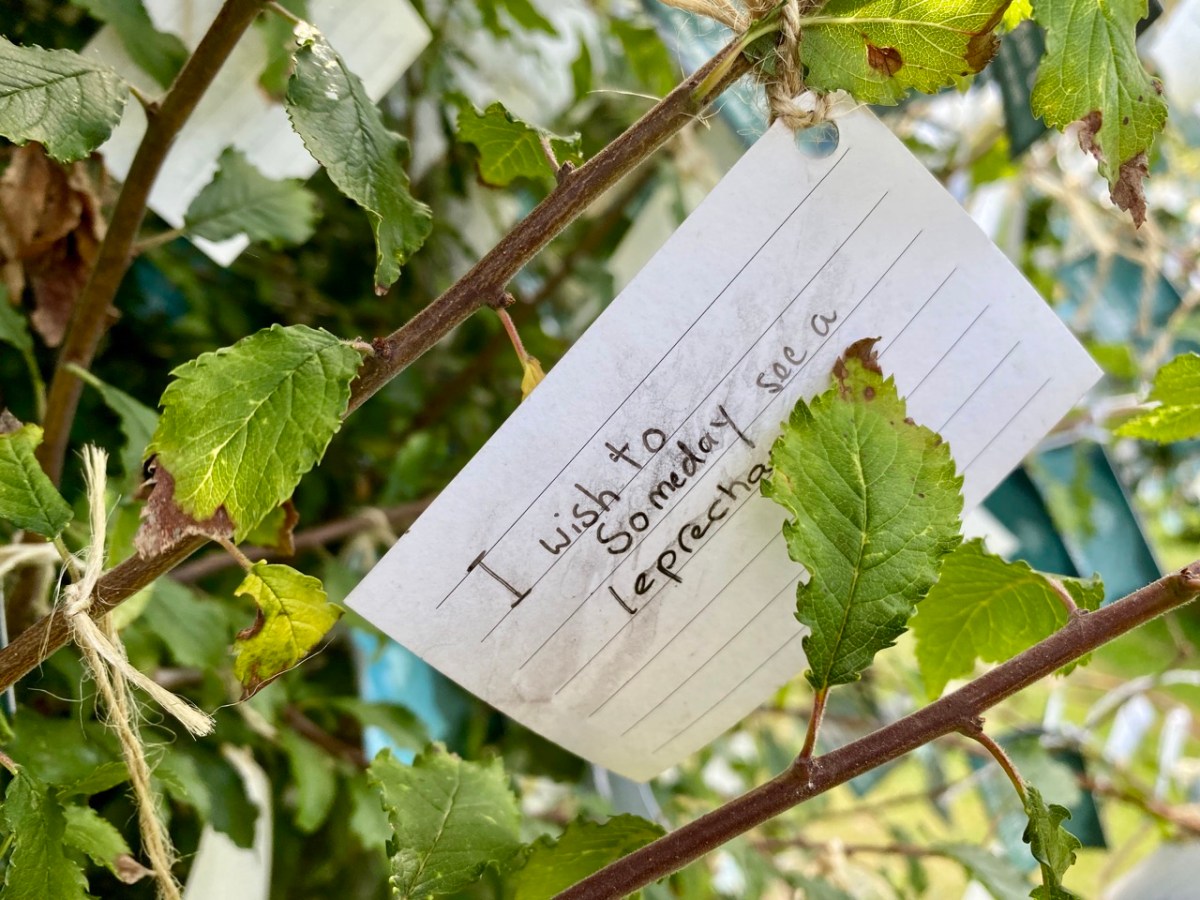
It’s impossible to ignore the two ‘fairy’ hawthorn trees that have been established within the vicinity of the stones. In my opinion it was an inspiration to exploit the idea of visitors purchasing ‘message cards’ from the site kiosk and writing down their own thoughts and personal wishes, which are then tied on to the branches. That’s Finola, above, being affected by the rainbow fairy vibes. She has written her own post today specifically on this aspect of the place. My favourite message is this one, below:
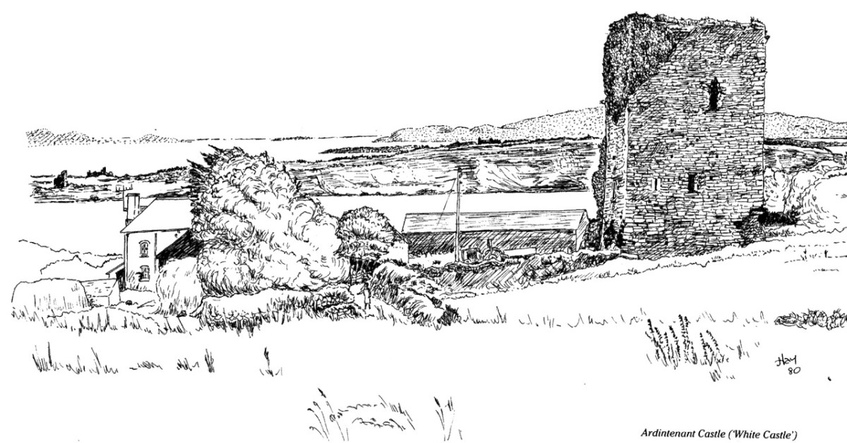
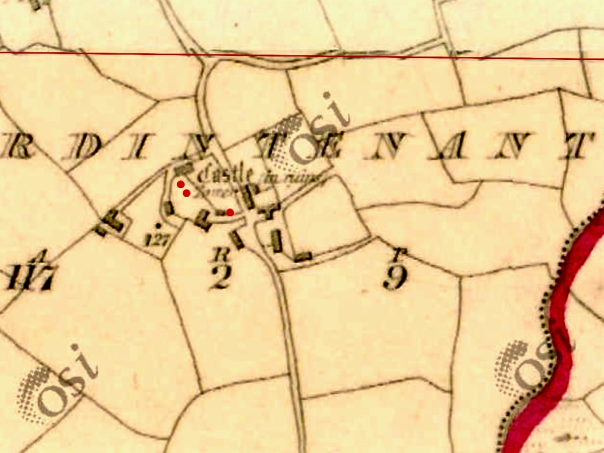
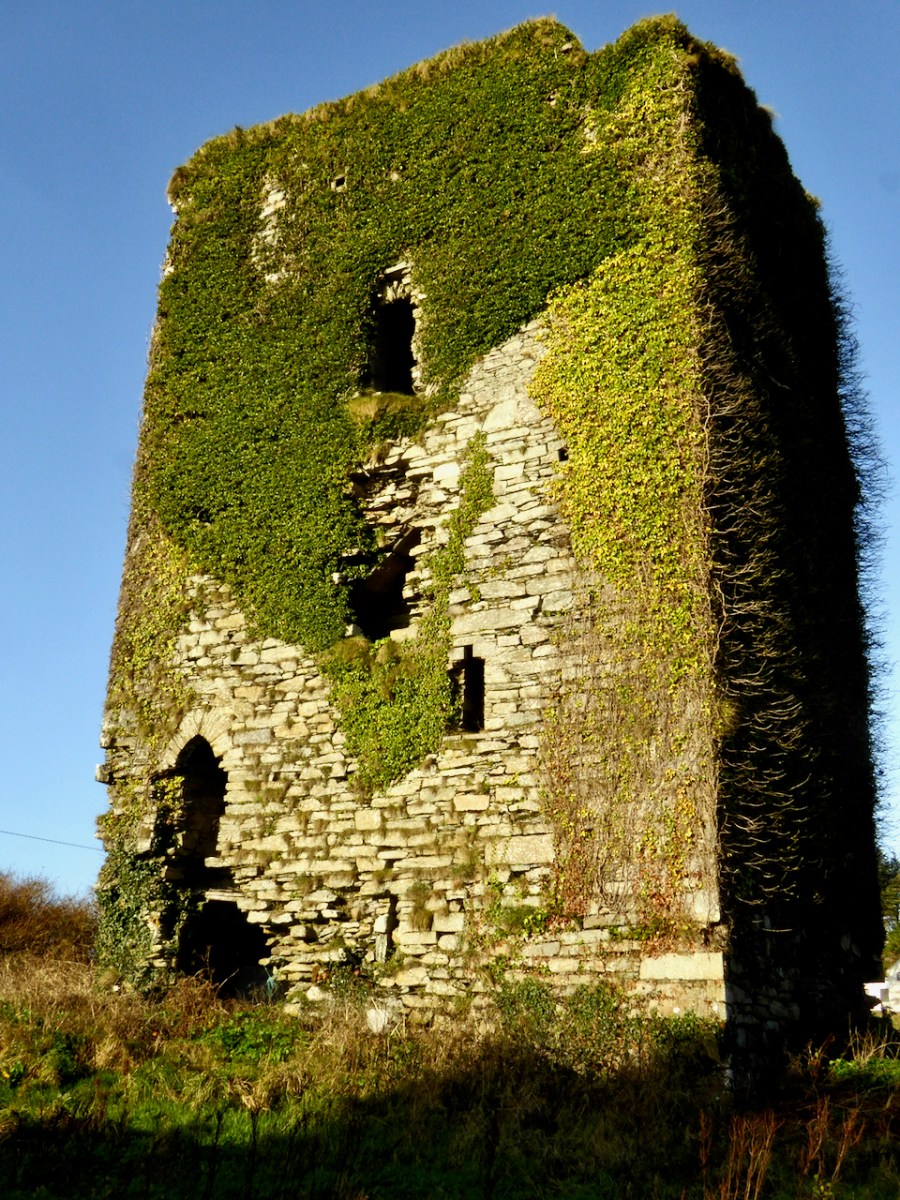
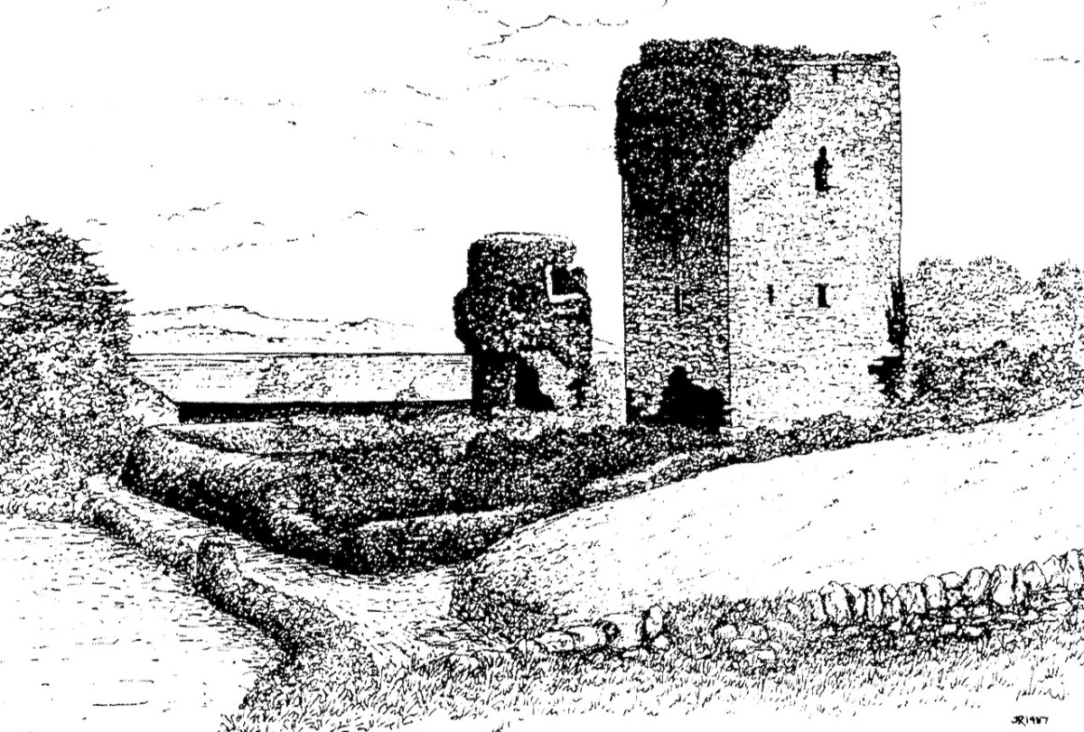
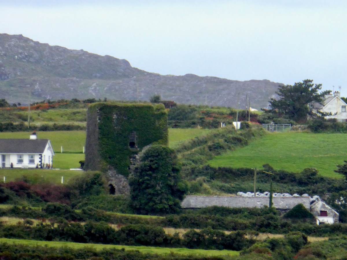
Home of the Taoiseach, or Head of the Clan, Ardintenant was one of the most important of the O’Mahony Castles of Ivaha (or what we now call The Mizen). Fortunately, it is relatively intact and we can observe and record much about it. The drawing above was done by James N Healy for his magnificent book on The Castles of County Cork. This post is another in my series on The Castles of Ivaha.
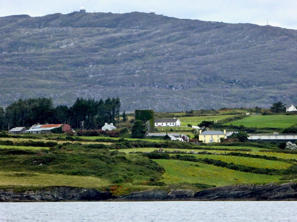
First the name – Ardintenant has been variously interpreted as coming from Árd an Tine (Ord on Tinneh, Height of the Fire), Árd an tSaighneáin (Ord on Tye-nawn Height of the Flash, or Beacon) or Árd an Tiarna (Ord on Teerna, Height of the High Chief). Any of these would be apt, since tower houses by the sea like this one (viewed from the sea, above) could be used as navigation beacons, possibly with a fire on the battlements. We also know that it was the residence of the head of the O’Mahony Clan, even though it was not the largest or most elaborate of the O’Mahony castles. Locally, it is also known as White Castle, which may refer to the white render that once made it stand out in the landscape (for more on render and castle colours, see the discussion on Kilcoe Castle). The photograph below demonstrates that it was prominent on the landscape and close to, although not right on, the sea.
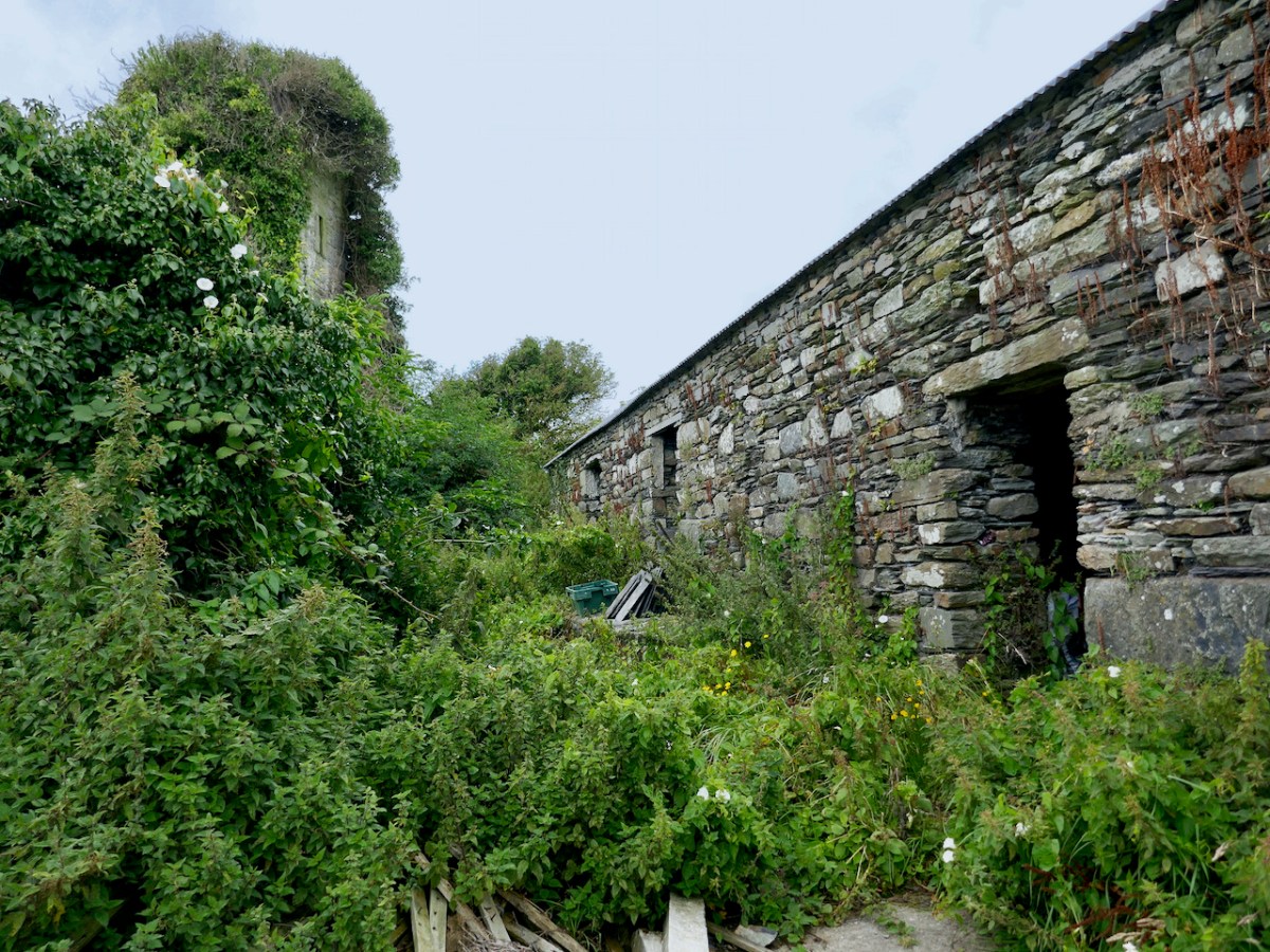
It now stands in the middle of a working farm, surrounded by stone buildings that are picturesque and notable in their own right.
Ardintenant is typical of castles built during the 15th century by Irish clan chiefs – wealthy and powerful and anxious to assert their claims on land and sea.
Dermot Runtach (the Reliable) succeeded in I400; his life and the lives of his sons spanned the Fifteenth Century. He was celebrated as a ‘truly hospitable man, who never refused to give anything to anyone’ . . . The period of 1400 -1500 was the most peaceful and prosperous period in the history of the clan. The Ivagha peninsula was protected by the sea on three sides and the family became wealthy from the exaction of dues from the continental fishing fleets; trade also enriched them, causing long-standing enmity with the citizens of Cork. Tradition relates that the majority of the O’Mahony tower houses in Ivagha were built by or for the sons of Dermod Runtach. The date of Dermod Runtach’s death is recorded in the Annals of Loch Cé as 1427.
THE TOWER HOUSES OF WEST CORK MARK WYCLIFFE SAMUEL, 1998
Dermot Runtach’s sons were the castle builders. Conor Cabaicc succeeded his father in 1427 and remained Taoiseach for 46 years, embarking on an ambitious program of construction to provide castles for his sons and brothers, beginning with Ardintenant. He died in 1473, by which time probably all of the castles of Ivaha were built and occupied by various members of his derbfine (extended family). Cabaicc means of the exactions (or forced tributes), although it is possible that Conor was more benignly known as Cabach – meaning talkative. His brother, Fineen, the Táiniste (heir-in-waiting) built Rossbrin Castle, about which Robert has written, and which is the castle in our view at Nead an Iolair. Rossbrin and the remains of a small tower on Castle Island are both visible from Ardintenant.
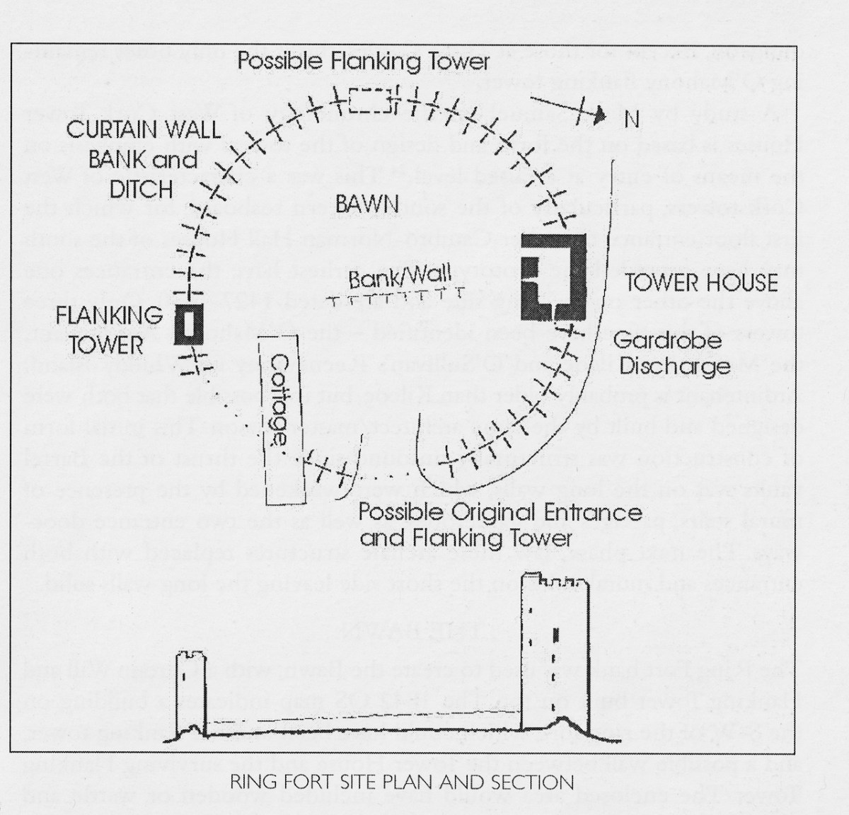
While there is evidence that other O’Mahony castles were built on pre-existing fortifications such as promontory forts (see Three Castle Head, for example) or ring forts, this is most visible at Ardintenant, where the ring fort can still be seen as a circular rampart around the tower house. You can make out part of it in the photo above. Another unusual feature is the survival of a single flanking tower, along the line of the ring fort and across from the tower house, although there may have been more than one originally, since the 1840s OS map shows what could be a second one – the leftmost building on the line of the ringfort below. Note that farm buildings also dot the site even at this early stage.
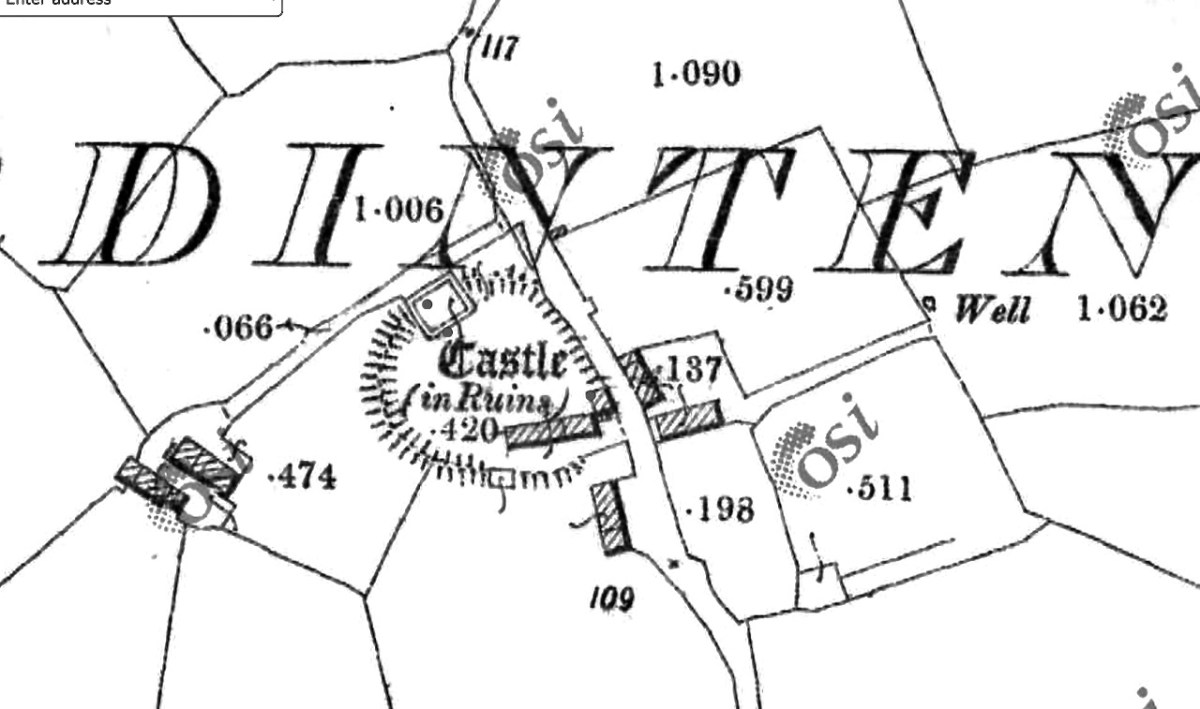
The possible second flanking tower had disappeared by the time the next series of maps were produced, around the 1890s. The farm buildings have changed as well.
In his marvellous paper on Ardintenant Castle in Mizen Journal 11, 2003, John Hawkes investigates the history and construction of the castle and provides elevation and plan drawings. I am grateful for his scholarship and thoroughness, which has informed the following description of what is left at this site, as well as provided illustrations.
The presence of the ringfort raises an intriguing prospect since it appears that instead of the usual rectangular bawn, surrounded by a stone wall (see the illustration in this post), we have a round bawn, with the stone wall built on top of the bank of the ringfort. Although that stone wall is not obvious now, it is noted in the description of the ring fort in the National Monuments survey. Thus, what we have here is a hybrid ring fort/tower house – a sensible adaptation of a pre-existing fortification and a continuation of the site as a high-ranking residence. The National Monuments survey also refers to an external fosse, although traces of it are hard to see on the ground. If it was originally a substantial ditch, another possibility is that the bank was surrounded by a moat.
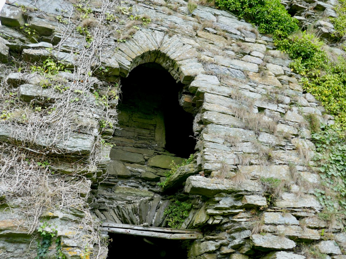
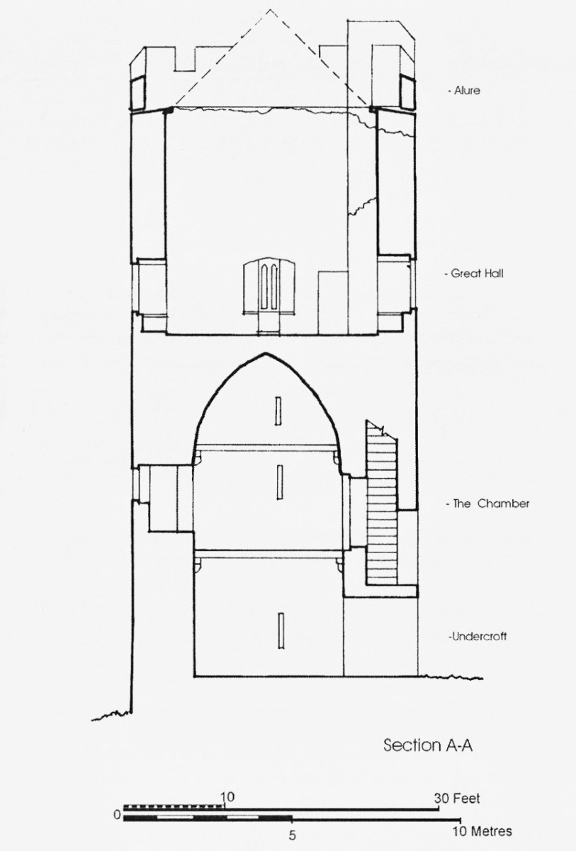
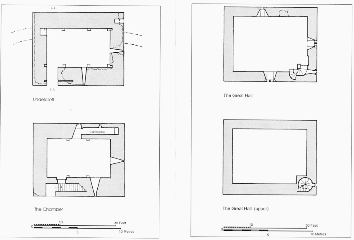
As with all of the O’Mahony Castles, Ardintenant is the type of tower house known as Raised Entry, that is, the ground floor door allows access to the public areas of the castle, while the door above it, originally accessed via a wooden stairway, gives on to a set of steps up to the private area.
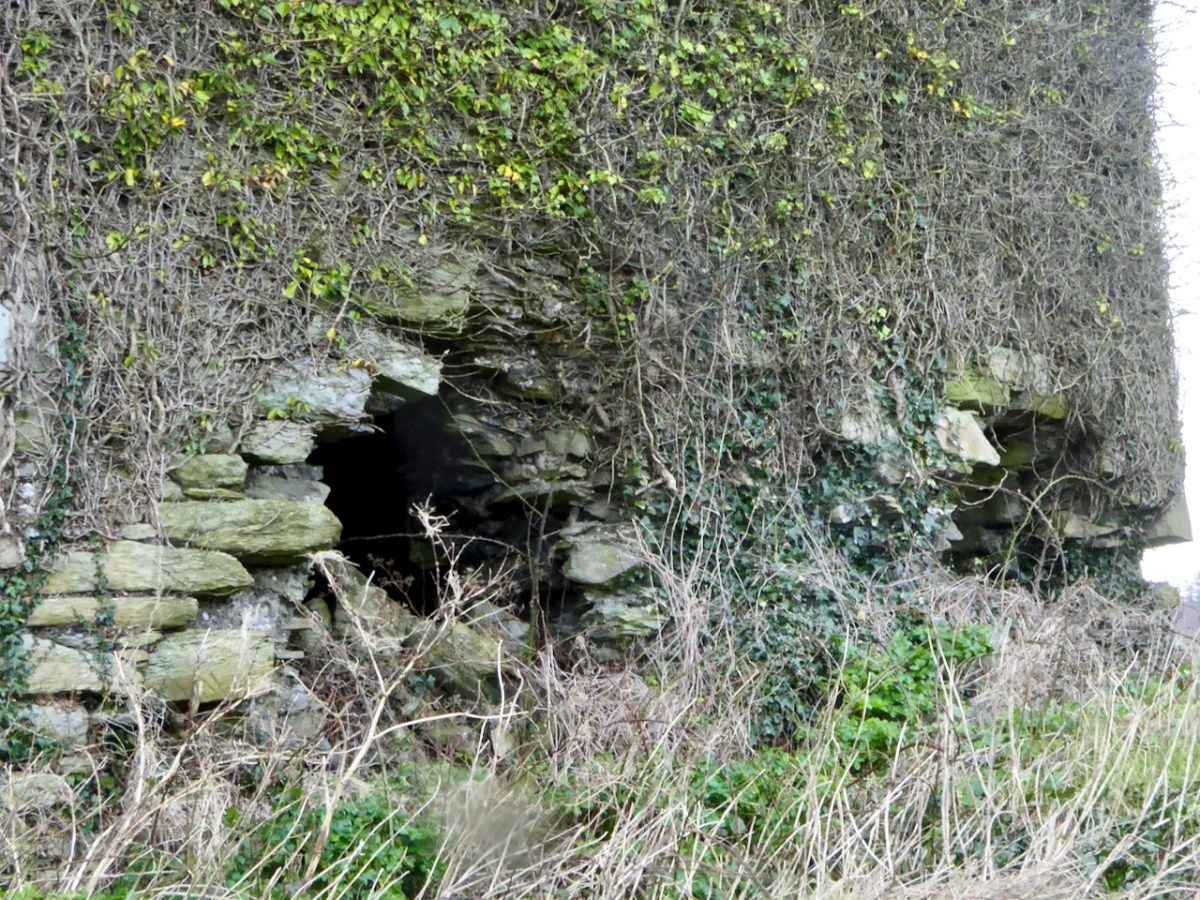
The first two-and-a-mezzanine floors are covered by a vault. This set-up was partly defensive – the upper floors could only be accessed through this raised doorway and staircase – and partly for security, in that the vault was a barrier should a fire break out on the lower floors. The doorway to the left leads to a garderobe, while on the right are two deeply splayed window embrasures.
At Ardintenant, as with Dunmanus, the ground floor has been in use as a cow byre. It is normally impossible to access the upper floors, although those who have done so report that it is in good condition. That floor is reached by means of a mural staircase that rises from the raised entry.
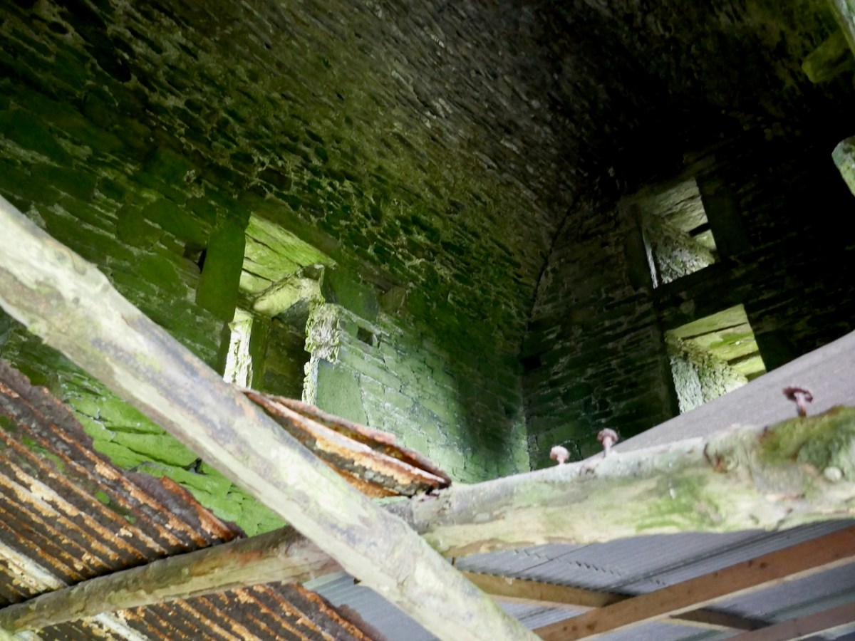
A second staircase, in this case a spiral, gives access from the upper floor to the wall walk. This was not a castle built for comfort – in common with the other 15th century O’Mahony castle it had no fireplaces and very few windows.
Above the vault was what Hawkes calls the Great Hall. One large room, accessed via the mural staircase, the only notable feature of which is are deeply splayed window with seats in the embrasure. Picture the Lady of the house seated here, trying to catch whatever light she could as she bent over her handwork.
In one corner of the Great Hall, the spiral staircase led up to the wall walk (what Hawkes calls the Allure). While nothing remains of these battlements now, we can assume that there was a walkway around the roof, perhaps with Irish crenellations and a sentry box.
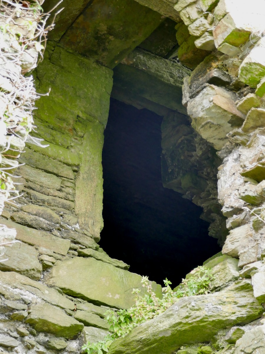
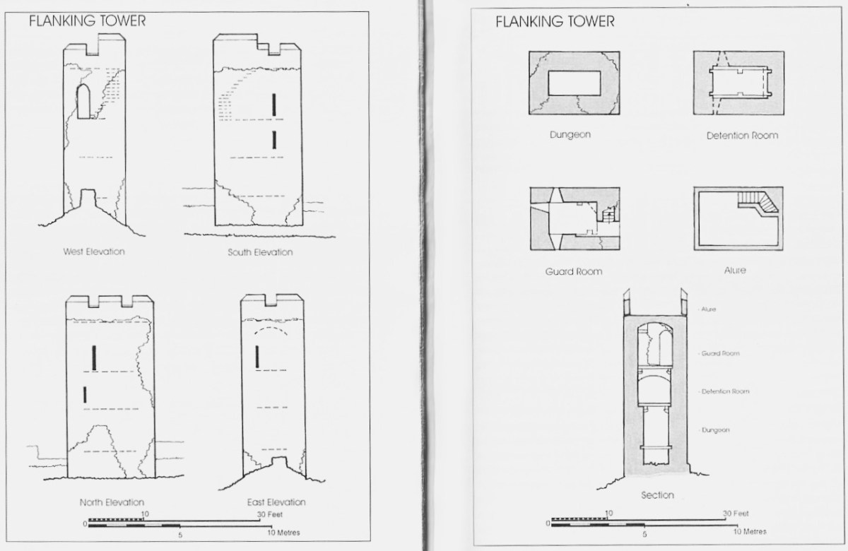
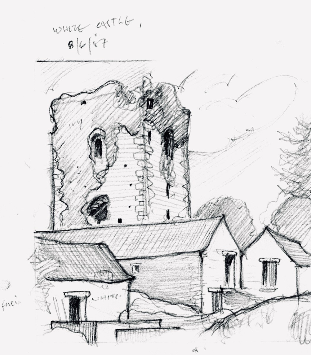
It’s much smaller than the castle, rectangular, and three stories high. The illustration above, by Jack Roberts, indicates the relative sizes. The way in was from the level of the curtain wall and each floor was connected by a ladder, except for the wall walk/allure, reached by a spiral stone stairs.
Hawkes tells us that “its function appears to have been to accommodate hostages.” He bases that on the absence of a ground level entry (the current hole on the ground level having been broken through in more recent times), so that the ‘dungeon’ was accessed through a trap door from the room above, which in turn he calls a ‘detention room.’ See my post on Dunmanus for a discussion of possible functions for rooms like the ‘dungeon.’
Ardintenant is still standing and intact, but a lot of the base batter – the broad stone base that gives it its strength and stability – is missing and holes have been punched through the walls in the past.
Along with the other extant O’Mahony castles, its continued survival cannot be taken for granted. It’s a listed monument on private land, and Ireland’s complicated heritage laws means that it can’t be deliberately damaged, but conversely, there is no onus on the landowners to conserve it at their own expense. All fingers crossed that it remains standing for ages to come.
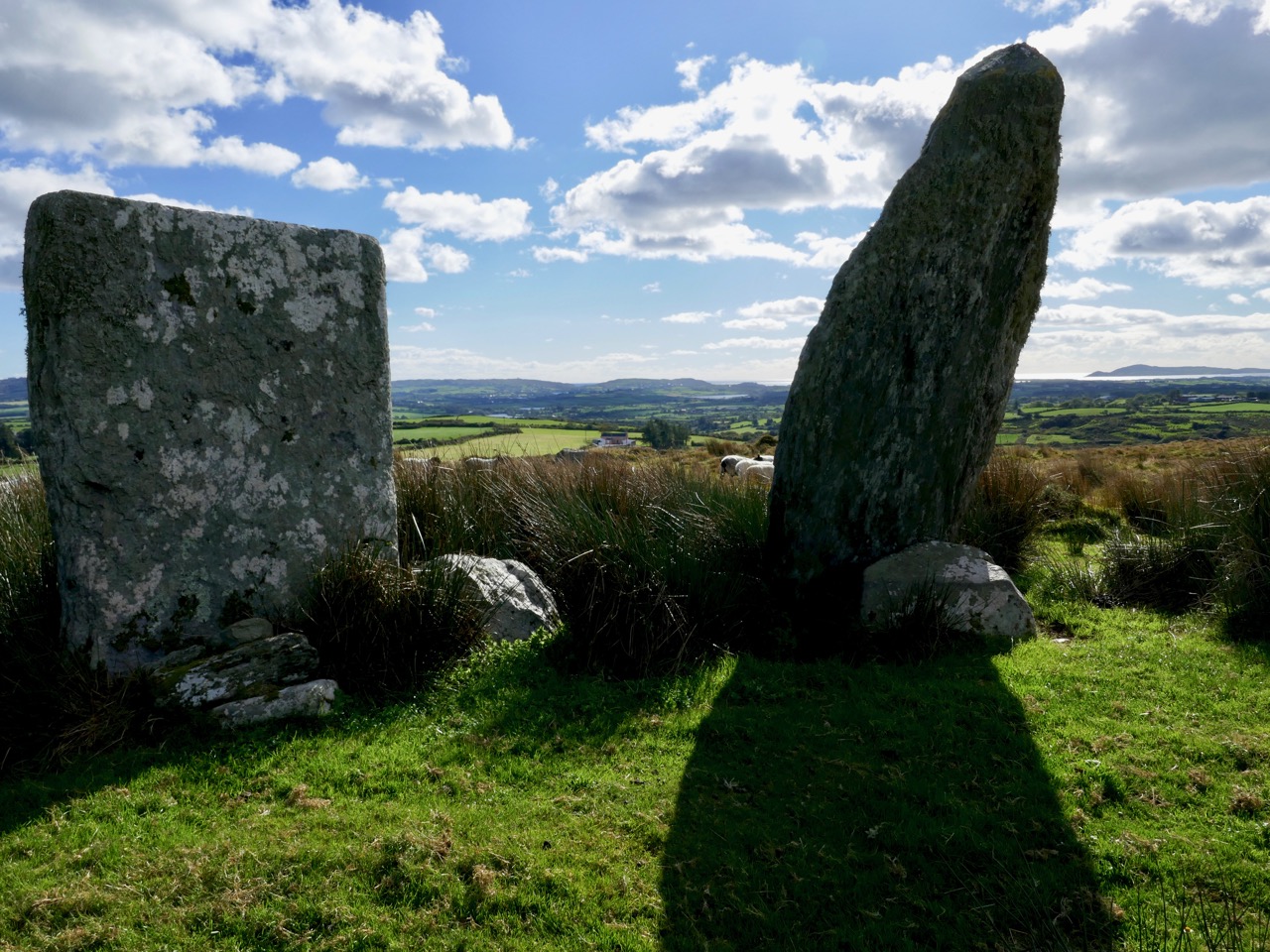
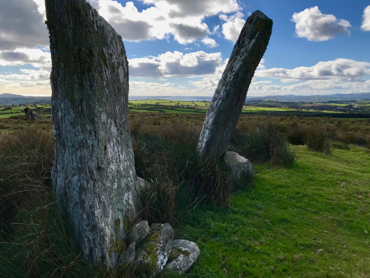
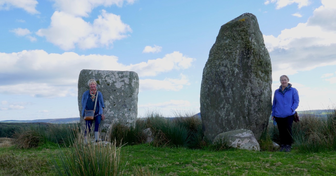
An unexpected delight – a trip on a Sunny October afternoon to visit a very fine standing stone pair in Foherlagh, just north of Kilcoe Church and School on the N71, between Skibbereen and Ballydehob.
The trip was suggested by Amanda who was, of course, looking for a holy well, said to be associated with a mass rock. All of these – the standing stone pair, the holy well and the mass rock – were grouped in one place so we had to undertake this expedition! Thus we found ourselves knocking on the door of the genial farmer, Dennis Minihane, who donned wellies right away and took us up the hill behind his house.
The view from the top of the hill
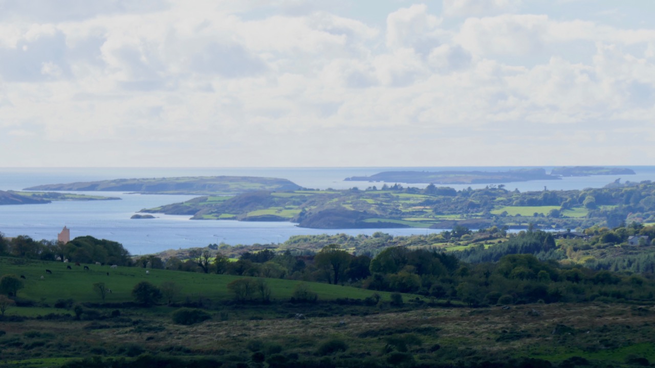
We had no idea what would greet us, but as we ascended it dawned on us that the views were pretty spectacular. The standing stone pair came into view, and it was obvious they were enormous. When we reached the top we were greeting by a complete 360 degree panorama – south to the islands of Roaringwater Bay, west to Mount Gabriel, east to Baltimore and north to the hinterland. Kilcoe Castle glowed gently in the foreground, while far away we recognised the distinctive pyramid shape of the Mizen peak at the end of the Peninsula.
Looking toward the end of the Mizen Peninsula
Standing stone rows and pairs are a phenomenon of south west Ireland, and this part of West Cork has many examples. While there are about seventy rows of three to five stones (such as the Fingers at Garranes near Castletownsend, or the Maughnasilly row), there are over a hundred stone pairs, of which Foherlagh is a particularly fine example. Invariably their long axis (that is, standing at one endand looking along the row or pair) is oriented northeast/southwest. Typically the stones are graded in height, with the taller stone (or tallest, in the case of a stone row) at the southwest end.
Garranes stone row, known as The Fingers, near Castletownshend
Upper: The Kealkill complex of monuments; Lower: the Coolcoulaghta standing stone pair (and the most unsympathetically situated electricity pole in Ireland) from which the Dunbeacon stone circle (now sadly coralled by a wooden fence) can be seen
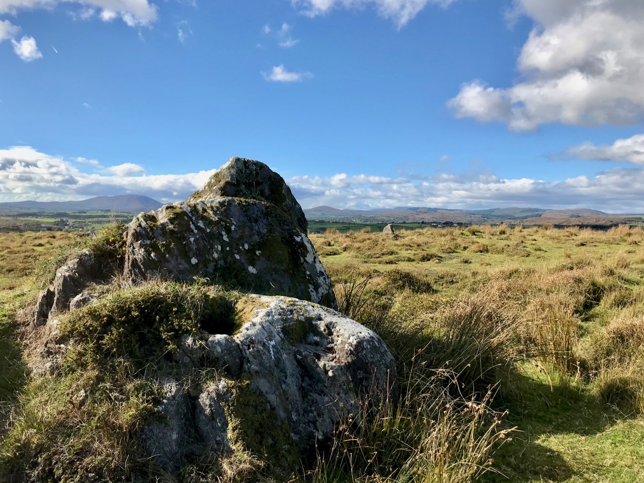
In Foherlagh, however, there are no other prehistoric monuments apart from a single standing stone a few fields away. What there is, is a pointed outcrop which local tradition has identified as a mass rock – see our post Were You at the Rock? for more on this type of monument. The mass rock had a scoop-out in it that may have functioned as a wart well. Amanda was pleased to find this and no doubt will do her usual thorough write-up on Holy Wells of Cork.
The standing stone pair is clearly oriented northeast/southwest. Depending on where you stand, the axis may point to the Mizen Peak (as does the Altar Wedge Tomb further down the Peninsula) or to Mount Gabriel (as do most of the examples of rock art we have examined in this region). Wherever the line points, it is clear that the expansive views are to the south west.
In his examination of stone rows and pairs*, Seán Ó’Nualláin says “The stone rows and pairs then, like the stone circles, are built so that their long axes indicate a general alignment on the sector of the heavens in which the sun roses and sets, and both series tend to group in a position indicating a winter rather than a summer position for the sun.” He might have added that this is also true for the sector in which the moon rises and sets – Maughnasilly row, for example is associated with lunar, rather than solar, orientations.
Maughnasilly stone row on a dramatic day
Ó’Nualláin, based on excavated examples and clear associations, gives a likely Late Neolithic to Early Bronze Age date for stone pairs and rows. That would mean they were erected 3,000 to 5,000 years ago.
Jack Robert’s‘ drawing of the Foherlagh pair, from Exploring West Cork
But what was their function? Perhaps they were yet another element of the calendrical systems that seem to have been a vital part of this early agricultural society. They may also have been used as territory or routeway markers, or as memorial stones for individuals. Some archaeologists have suggested an anthropomorphic element, in that some pairs may represent male and female figures. The pair at Foherlagh were certainly chosen to be very different in shape, although I am left wondering which –the tall more rounded one or the shorter very square one – might be the more female or masculine figure.
Thank you to Amanda and Peter for suggesting the expedition, Carol for providing the oohs and aahs of a first-time visitor to Ireland, and Dennis for so generously sharing his land and his stories with us.
Amanda and Carol provide scale
* Seán Ó’Nualláin, Stone Rows of the South of Ireland, in Proceedings of the Royal Irish Academy: Vol. 88C (1988), pp. 179-256. Available on jstor.org
Welcome to the UCD Library Cultural Heritage Collections blog. Discover and explore the historical treasures housed within our Archives, Special Collections, National Folklore Collection and Digital Library