Amid Unbearable Tragedy – a Model for the World (Updated)

Originally posted in 2015. Re-posted now, 8 years later with an update at the end.

Some posts are hard to write. In the case of this one, there are such complex emotions – sadness and anger being the dominant two, but overlaid with pride and gratitude. I will explain.

Youngest

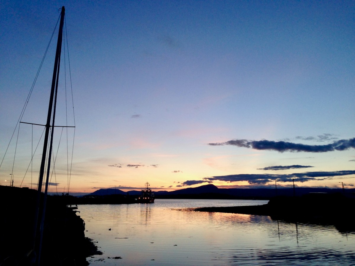
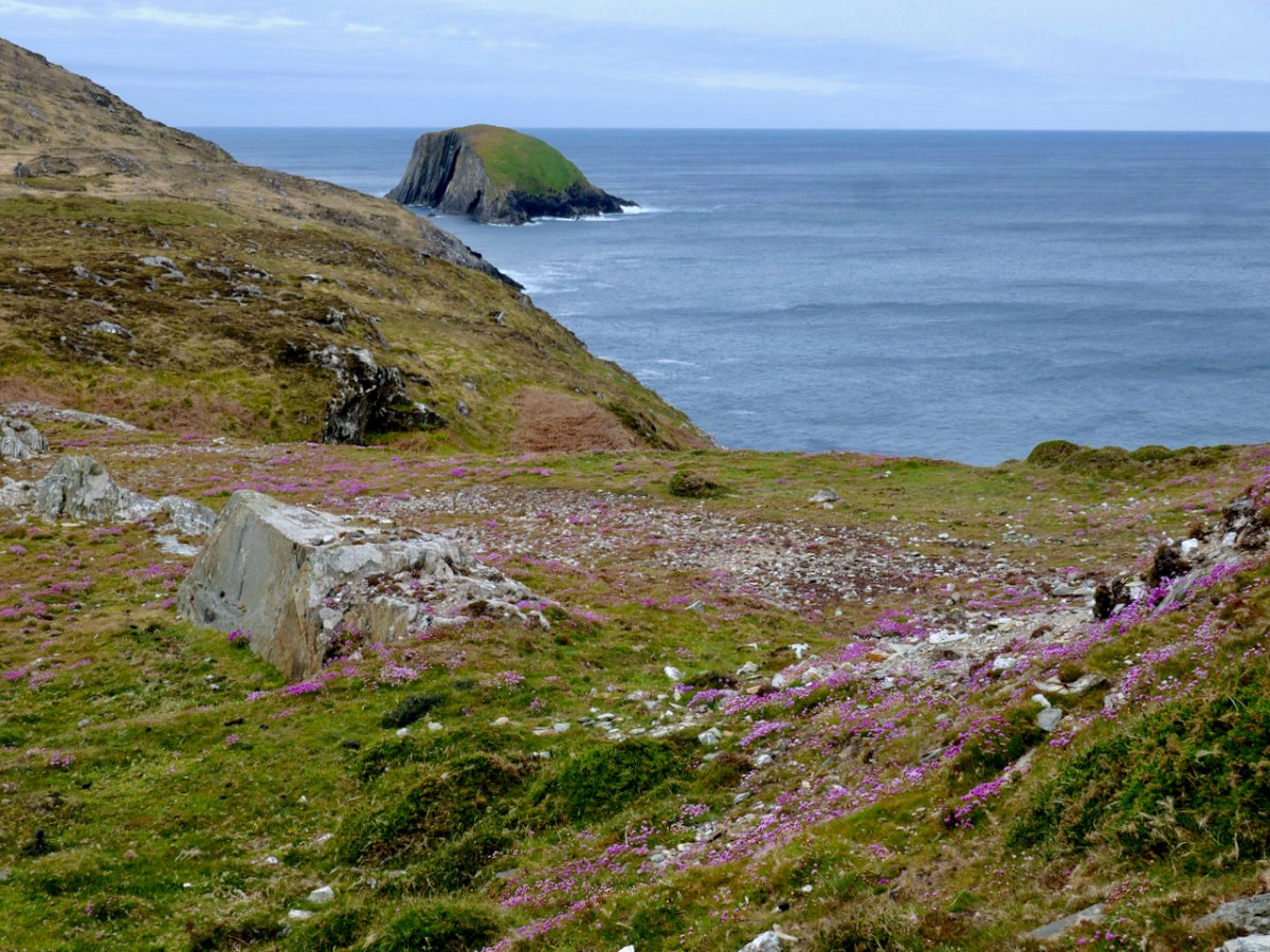
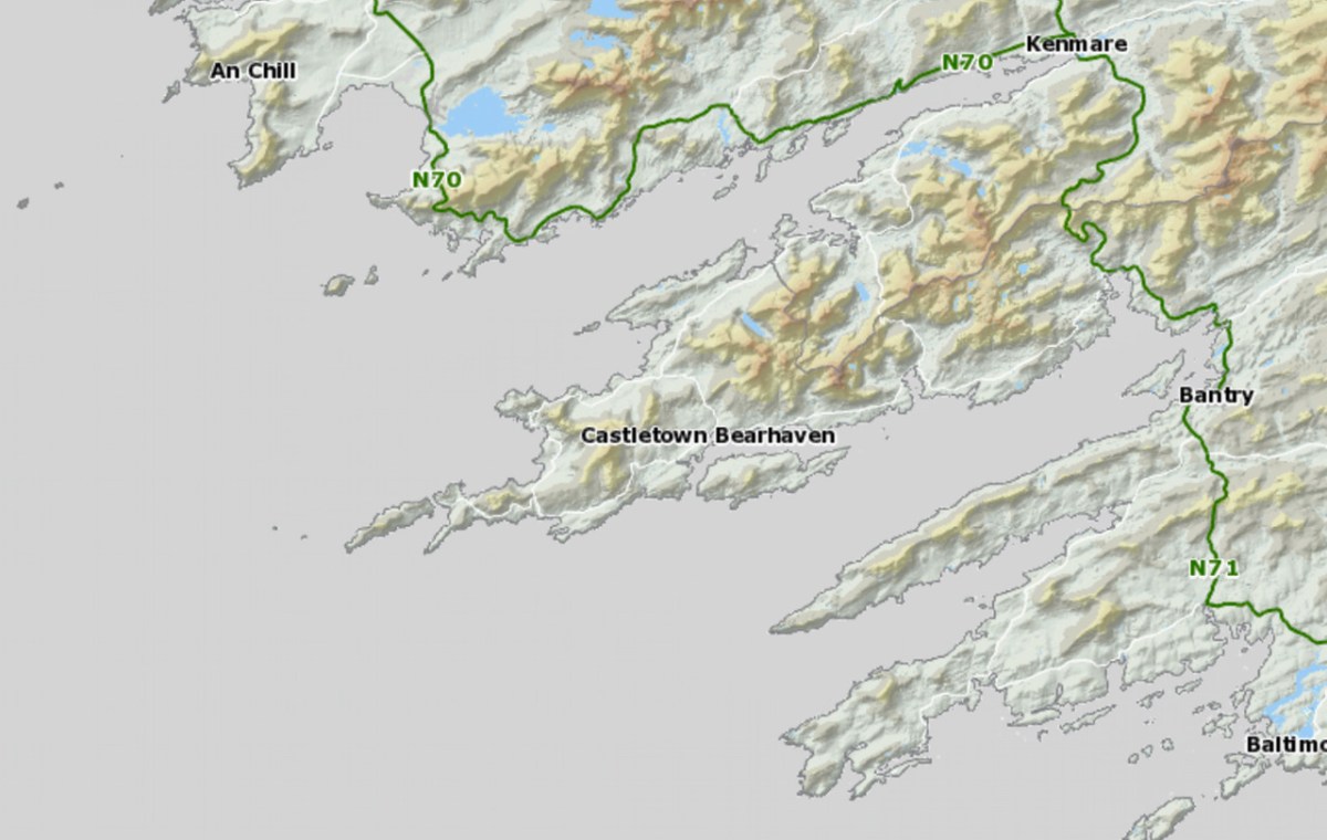
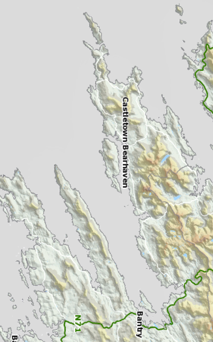
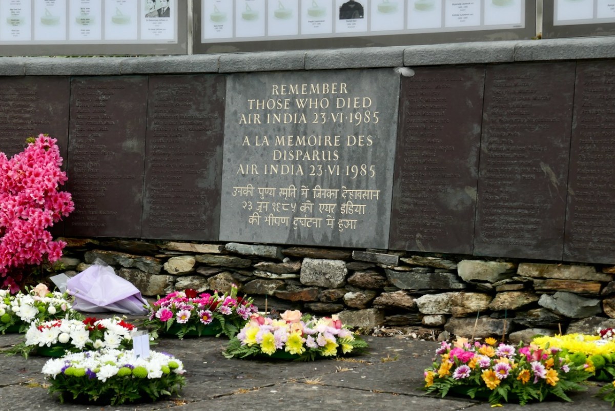
On June 23rd, 1985 – 38 years ago this week, but 30 years ago when this post was originally written – a bomb on board Air India Flight 182 exploded when the plane was just off the coast of West Cork. Everyone on board,  329 people, were killed. One in every 4 victims was a child. Eighty percent were Canadians.

Dignified

The bomb was the work of Sikh extremists, operating out of Vancouver. A botched investigation, jurisdictional disputes, and massive incompetence at many levels has meant that no perpetrator of this heinous crime has ever been convicted for it – a travesty that is a dark stain on Canada’s judicial system and that has left the families of the victims with no sense of justice to this day.

Moment of Silence 2

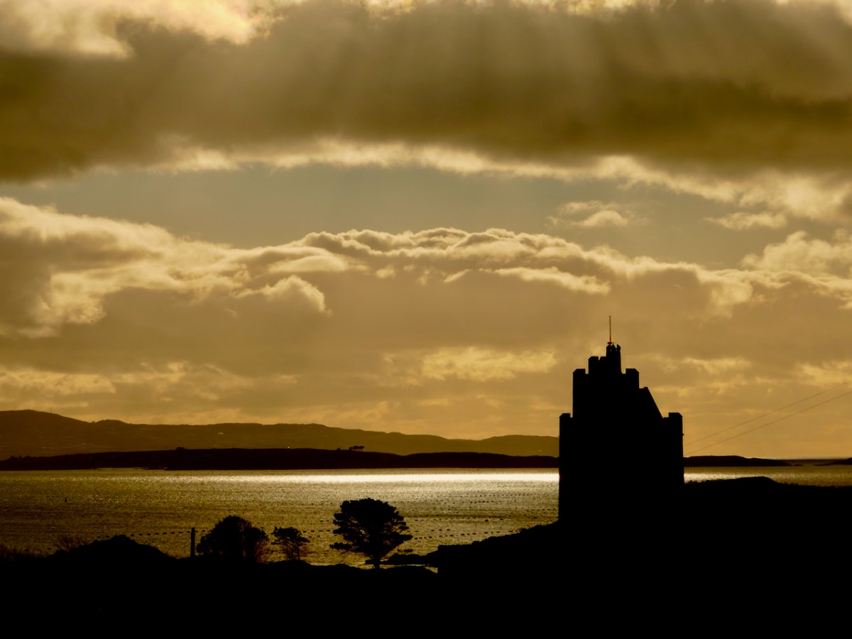
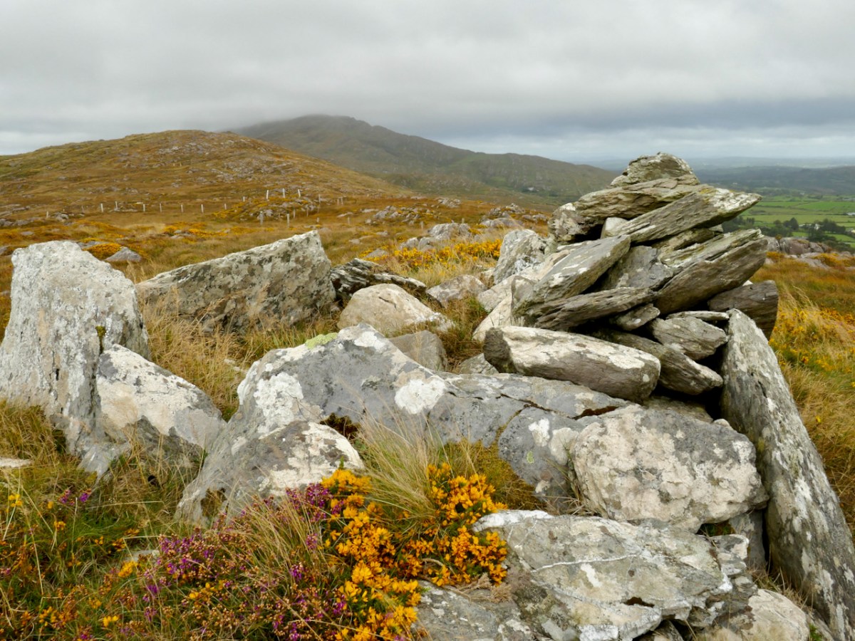
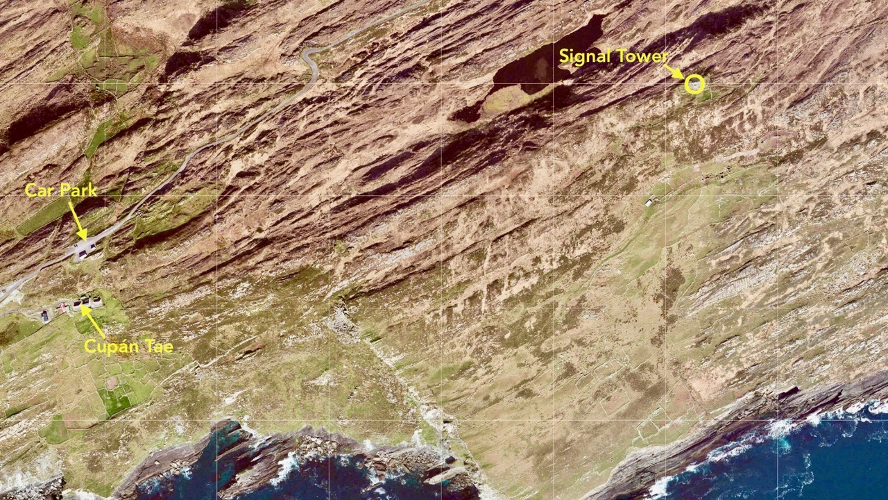
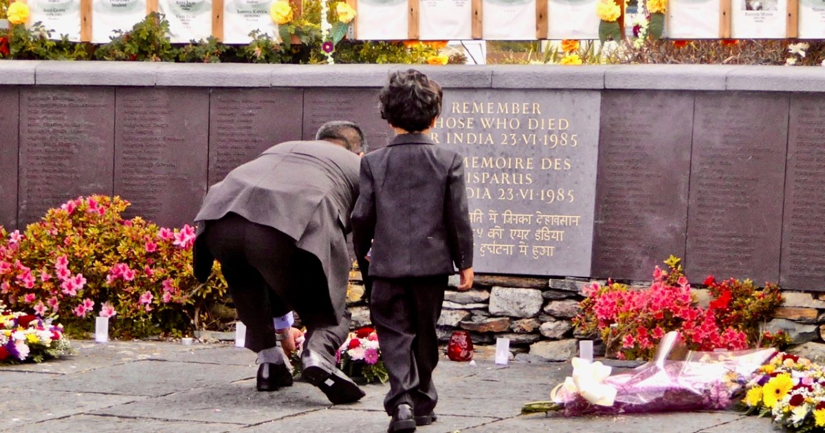
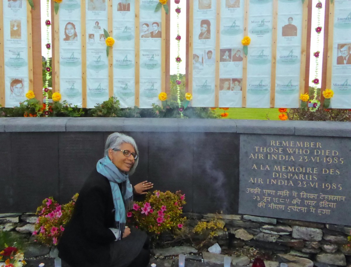
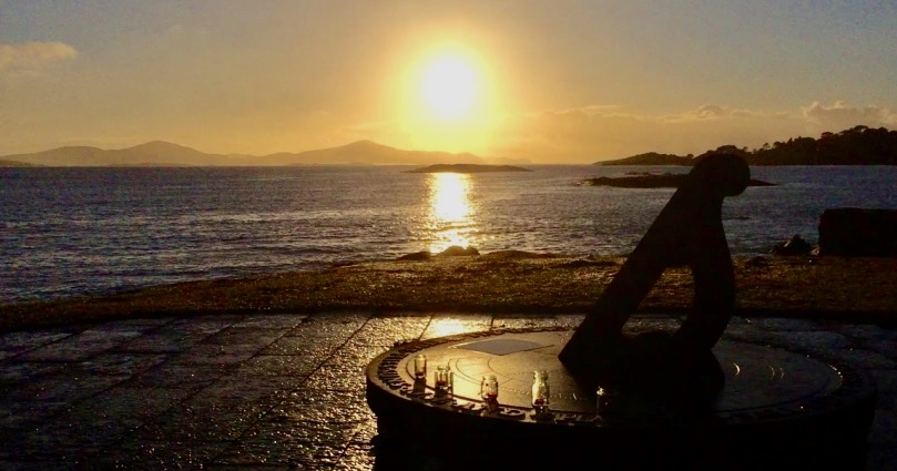
Members of the victims’ families began arriving immediately after the bombing and, deeply affected by their plight and by their own traumatic involvement in the the recovery operation, the people of West Cork opened their hearts and homes to them. Ahakista residents took on the task of petitioning governments for a memorial garden and of arranging a yearly commemoration service. The memorial is beautiful and perfectly maintained year round. Beginning in 1986 the service has been held every year without fail and family members who come are welcomed, supported and fed, in the Irish way. Many friendship have been forged over the years.

Family Friends

In contrast, it took the Canadian Government a long time to acknowledge that this terrorist attack, in the words of Prime Minister Harper’s official apology ‘…was not an act of foreign violence. This atrocity was conceived in Canada, executed in Canada, by Canadian citizens, and its victims were themselves mostly citizens of Canada.’ This speech was made in 2010. The first Canadian memorial to the victims was erected in 2006 and there are now four. There are no memorials in India.

Renée Sarojini Saklikar

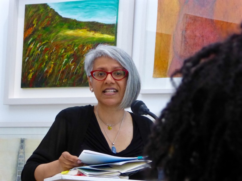
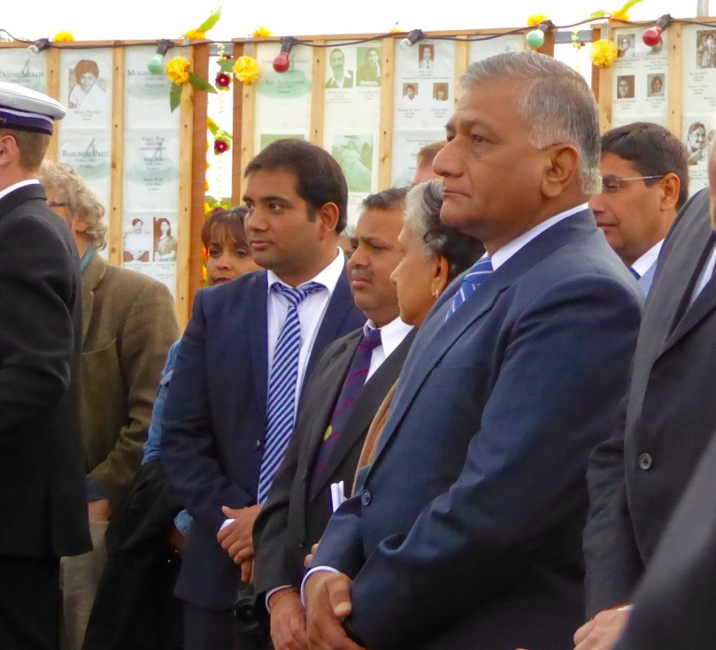
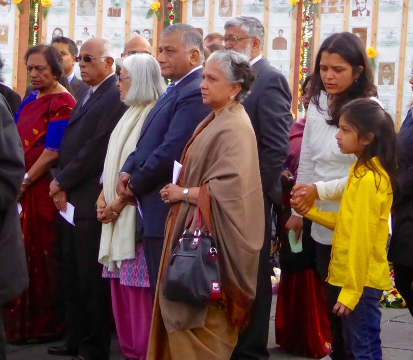
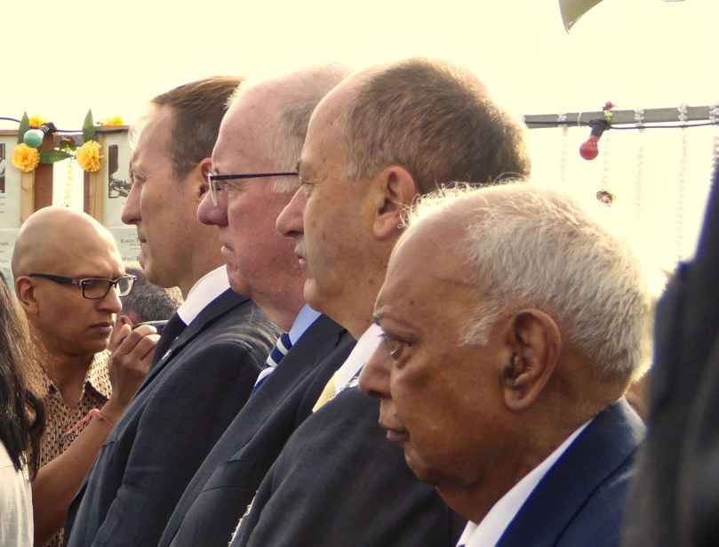
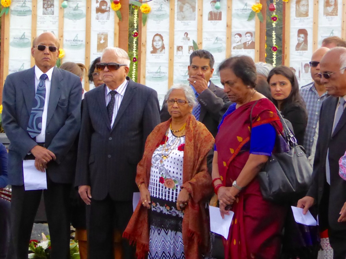
Because 2015 was the 30th anniversary the ceremony was a large one, with dignitaries from Canada, India and Ireland in attendance and about twenty family members. For us, it started the night before, with a poetry reading in the West Cork Arts Centre in Skibbereen. Renée Sarojini Saklikar is a Canadian poet who lost an aunt and uncle in the disaster. She read from her book Children of Air India, and also some new pieces. Deeply influenced by the opacity of official documents, by memory and loss, her poems carried a quiet power that seeped into our souls almost without our noticing. She elicited our participation in one poem – a piece made up entirely of acronyms – and she spoke to us about the process of writing poetry from trauma and invited our stories and comments. It was a deeply emotive experience – a good preparation for the following day’s ceremony of remembrance.

The Irish Navy ship and Coast Guard Fly Past

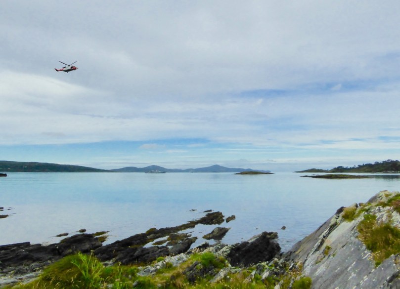
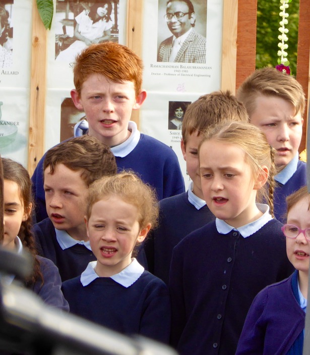
The ceremony timing mirrors the events of the original June morning when the bomb exploded in the plane, with a minute’s silence at 8:12AM, broken by chanting by family members. The Irish Navy were on hand to signal the moment with a siren blast, and a Coast Guard helicopter performed a formal fly past. A choir of children of the local National School sang and there were speeches and wreath-layings. I was pleased to see Canada’s Minister for Justice, Peter McKay, in attendance as well as the Canadian Ambassador to Ireland.

Dignitaries

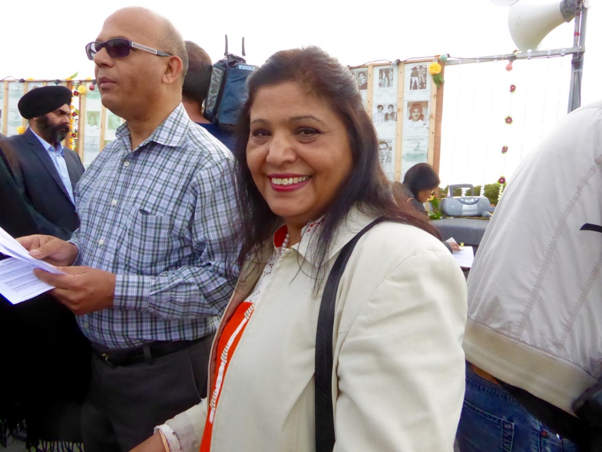
Speaking to the family members brought home to me as nothing else could do the enormity of the tragedy and the still-raw emotions at the core of this event. Saroj lost her father, a teacher. “He was  a proud Canadian,” she said. “He loved Canada and taught Canadian children in Newfoundland. He cared so much for his new country, but when he died, suddenly in the eyes of Canada he was no longer a Canadian but an Indian.”

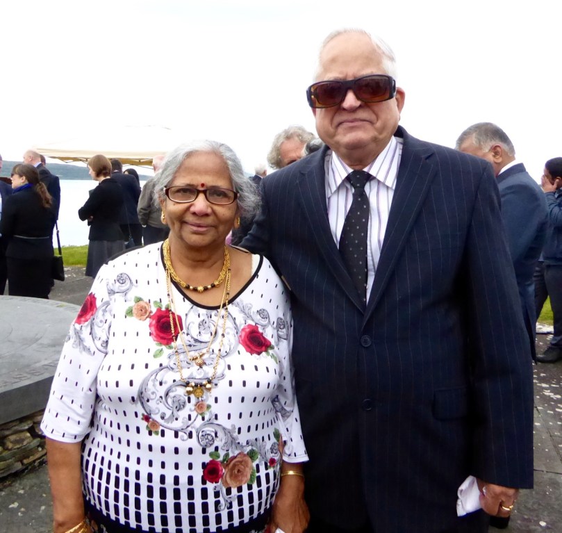
Saroj (below) had sat through many days of the Vancouver trial of the accused bombers (who were eventually acquitted) and still could not get her head around the outcome when the evidence was so clear.

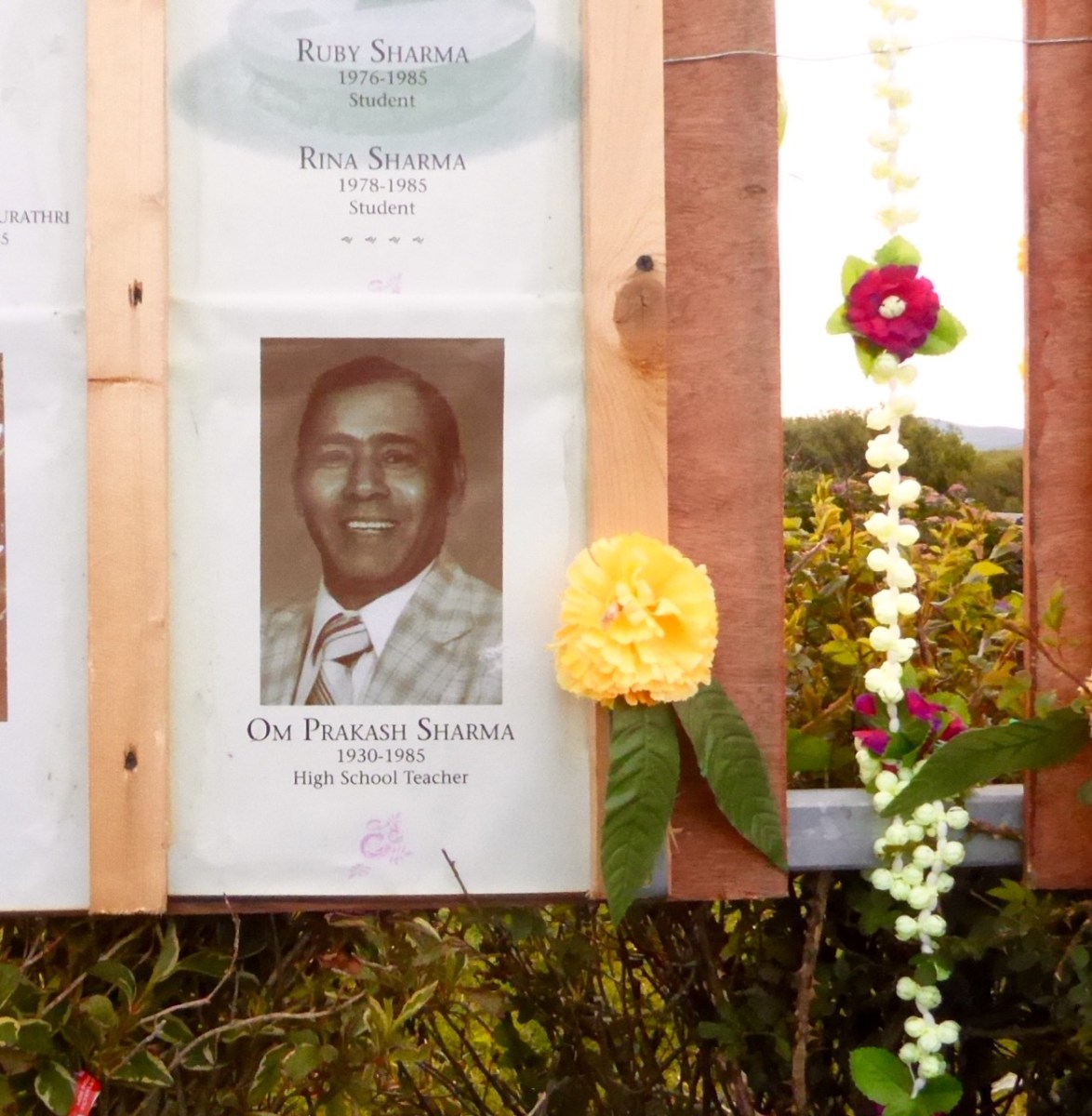
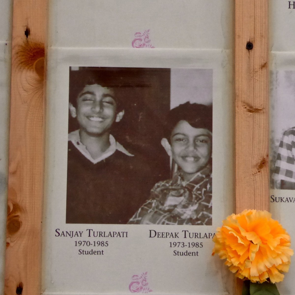
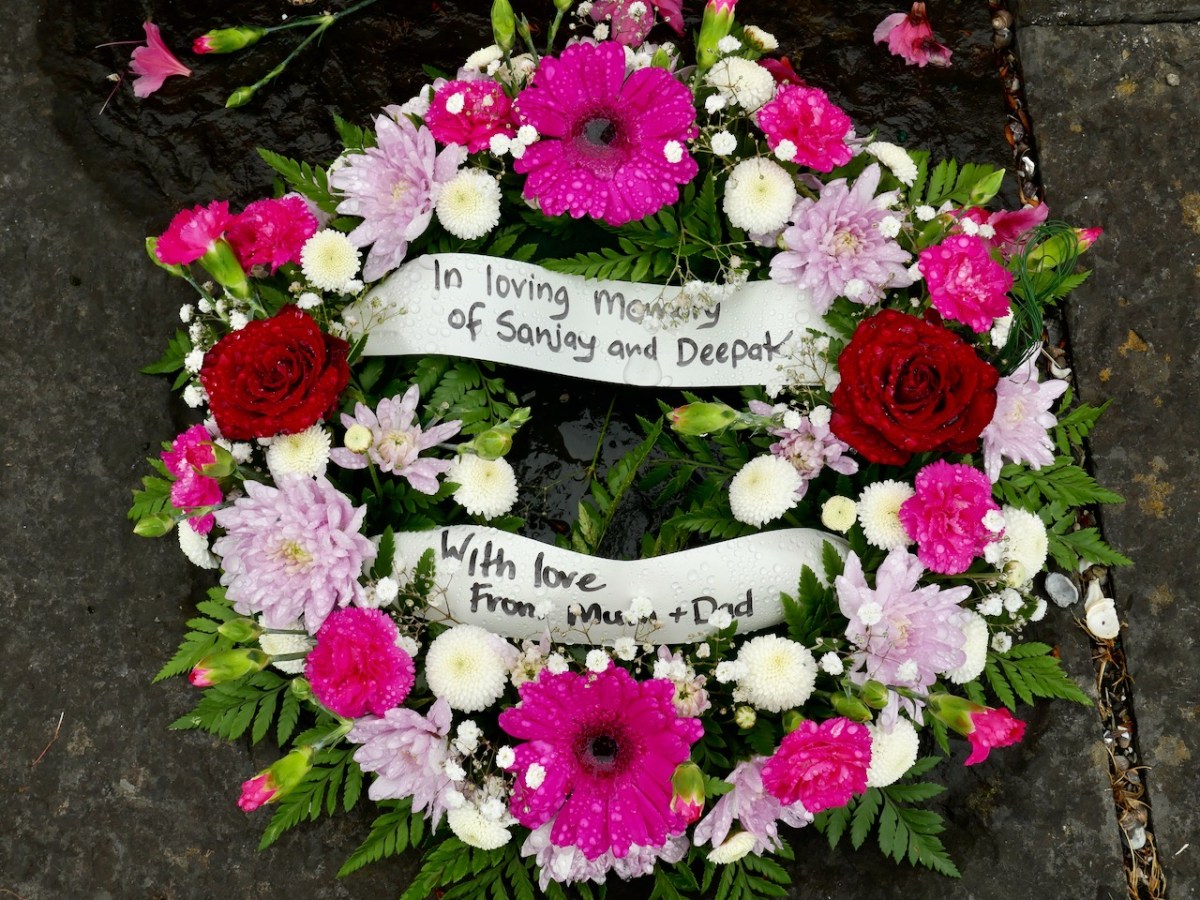
Dr. Padmini Turlapati (in the sari, below) was the spokesperson for the families. She lost her two sons. They had just finished school and were going to India for the summer to see their grandparents.

She showed me their photograph – two merry kids, laughing and carefree. Because they were visiting their grandparents they had taken with them their albums of mementoes and photographs – Padmini had to piece together a few photos from their school and friends. Sanjay’s body was recovered, but Deepak is still out there, and so she comes back every year to the place which has become a focus for her grief. In her speech she encompassed all the emotions that the families still feel – unspeakable sadness, anger and – gratitude.

Over and over speakers spoke about the warmth, the generosity and the support of the West Cork people who had been there for them in their despair when it seemed that their governments had abandoned them. Several used the same phrase.  Addressing themselves to the people of Ahakista, to the fisherman and coast guard volunteers, to those who built and maintain the memorial and who organise each year’s ceremony. “You”, they said, “are a model for the world.”

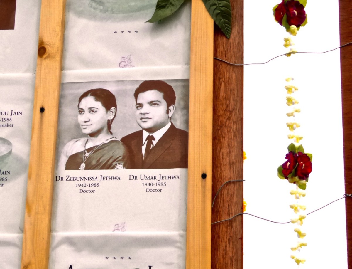
Renée was there, honouring her aunt and uncle, both doctors, both contributing enormously to Canadian society.

As a Canadian who listened nightly to the reports of the Vancouver trials I can have an inkling of the unfathomable well of loss and anger that these families feel. As an Irish person who is now living in West Cork I am proud of how our neighbours and friends stepped in to support and comfort these devastated families.

Perhaps the best way to end is with one of Renée’s poems. I will try to reproduce it faithfully on the page.

In the home-house, in the basement, there is the mother — she is singing a sweet song.

It is before —

June                       1984

                                Of her name, there are redactions.

                                Of her mother tongue, there is no record —

                                                       this is the life of a woman, made in India,

                                                                                living in Canada.

In the home-house, in the basement, there is the mother

                   And she is absent, sister

Update, 2023

We visited the memorial this week, on Friday the 23rd. The ceremony had taken place, as always, in the morning and the site looked beautiful despite dismal weather. Fresh flowers had been laid, including, most poignantly, for Sanjay and Deepak.

Nothing has changed for the families. The man who was tried and acquitted in the infamously botched trial in Vancouver, Ripudaman Singh Malik, was shot dead last year in what appeared to be a targeted gangland-style killing. Although two men were charged for the murder, the trial has yet to be held. Malik had many enemies and had earned more by a recent turn-about in his support for the Indian Government, and nobody has linked his murder to the Air India Bombing. In the last few days, another prominent Canadian Sikh activist, Hardeep Singh Nijjar, has also been murdered in a similar way. It is speculated that his, and other recent deaths, are linked to the movement for a Khalistan state as a Sikh homeland.

In High Places

Here is a collection of photographs taken in West Cork from some of the high places: ridges, peaks, mountain paths. The pics were all taken around ten years ago, and haven’t been used in our blog posts previously. They serve to show stunning landscapes, of course, and hopefully illustrate the variety of the country which surrounds us here. The header is taken from the peak above Three Castle Head.

The upper pic is looking down on Bantry town from the high ground to the south, while the lower one reminds you of the evening view from Bantry at sea level.

If you leave your car at Galley Cove Beach and walk up the steep track towards Brow Head you will come across this enormous stone row – and you will look back to the peninsula of Crookhaven. Don’t be fooled by the stones: they have been placed on this site fairly recently. They are impressive, nevertheless.

And here is a closer view of Crookhaven.

While turning from this spot and looking west, you will see the end of the coastline at Brow Head. This stone is likely to be more anciently placed. In the distance is Mizen Head with its Napoleonic era signal tower at Cloghane.

Contrasting light effects seen on the footpath that follows the ridge on the Sheep’s Head Way. That’s the spit of land that runs from east to west between the Mizen Head and the Beara Peninsula. There are cairns on the summits, with the remains of a wedge tomb and a Marriage Stone to be seen along the way.

The view north from the heights of the Sheep’s Head takes in the Beara Peninsula and – seen above – the high point of Hungry Hill dominating the distant rugged landscape.

You are never far from the coastline in West Cork. Look out for wild seas constantly sculpting the rocks over millennia.

From our home in Cappaghglass we look out to our own ‘high place’ – Mount Gabriel. This enigmatic tract of land dominates the area and is imbued with legends and folklore. It is also one of the most atmospheric of our peaks at all times of the year.

Another local view for us (above): we face out to Rossbrin Cove on the Mizen Peninsula. Finally, the celestial spectacle (below) finds its pot of gold on the shores of the Mizen.

Our Favourite Photos You Never Saw – Finola

Rabbit Island

The traditional continues, with a twist. This year, instead of photos we’ve already published, we’ve gone through our albums and chosen the ones we didn’t use this year (2021) but want to share now. It’s a fairly random collection – our guiding principle was personal preference or something that jogs a pleasant memory for us, all taken in West Cork in 2021. Some of them are similar to images we have used, but that’s because we take so many! So, as every year, although we’ve provided links to relevant posts, we’ll keep the writing to a minimum – all you have to do is scroll!

A stone row shown to us by the marvellous Walking With Stones.
Nothing lifts the spirits in spring like the exuberantly flowering Blackthorn
And nothing concentrates the mind as this look, noticed in the act of climbing over a gate
Thank you to John Kelly for the treat of a visit to Reen Farm Sculpture Garden
Dunlough Lake, at Three Castle Head – the lake rather than the equally iconic castle
An Early Purple Orchid, spotted at my favourite graveyard
Couldn’t resist the delicate tracery of those wings!
Readers know my love of gates – this fabulous example appeared after I had written my two posts on vernacular gates, here and here
On the Sheep’s Head – taken during our Dander
In Castlefreke Woods – we love walking in woodland in the spring, when the bluebells are out
Inchydoney Beach – Robert wrote about it in his post Inchydoney – And Virgin Mary’s Bank
The magnificently restored Kilcoe Castle at sundown
A mysterious megalithic tomb – we’re not quite sure what type it it – on a mountain in West Cork. We haven’t written about this one yet, but getting to it was quite an adventure.
Muscle beds and a castle – quintessential West Cork! This one was taken from Roaringwater Pier.
The traces of lazy beds can still be discerned on this isolated patch at Lackavaun, on the north side of the Mizen
Early in the new year we clambered around Mount Gabriel, looking for the fabled Cauldron Pool. We found it, with Schull stretched out below.
I think I might have used this one in my Dander on the Sheep’s Head post – but what the heck, I love it so here goes again
Looking across to the Beara from the Sheep’s Head
Great drifts of Thrift at the old mine site at Dhurode, on the North Side of The Mizen

Elizabethan Map of a Turbulent West Cork

The Elizabethans were map-makers, especially if they needed information for the purpose of wars and conquests. I was first alerted to this extraordinary map of West Cork by a reference in the O’Mahony Journal (subscription needed) and then to a piece written on it for the Journal of the Cork Historical and Archaeological Society in 1958 by P O’Keeffe who labelled it a Map of Beare and Bantry. Neither of these sources had a good image of the map and so, intrigued, I sent off a request for a digital copy to the British National Archives. It arrived by return email, at no charge. What a service! (Irish national repositories take note.) Here is the complete map.

While it is clear that this map dates to the Elizabethan period, there are many questions about it: who did it, for what purpose, exactly when? For this post I want to go through elements of the map and identify, as far as possible, what it depicts. A subsequent post will deal with what is actually going on – that is, what are the actions that are being chronicled. Let’s start with the fact that the map is quite accurate. It depicts the three peninsulas of West Cork – the Mizen, the Sheep’s Head and the Beara – and the inlets in between them. It is oriented east-west rather than our modern convention of north-south, but the cardinal points are clearly identified. The map is drawn on paper, with the sea coloured in blue and the islands in brown. I have provided maps below of the same area, the first in our typical north-south orientation and the second as it is orientated in the historical map.

The sea is shown teeming with ships – warships and galleys. Taking a closer look at the two north of Bear Island we see two different ships, one light and one dark. Each is in full sail, with men on the riggings and in the look-outs. They have cannons emerging from the hull, a trumpeter aft and a bugler on the bow-spit.

As a reference, here is a painting by Andries van Aervelt showing the kinds of ships that were engaged in The Battle of the Narrow Seas (1585) – both the full-sail warships are shown as well as galleys.

Galleys were also deployed here, shown between Bear Island and the mainland (below). The lead galley has a trumpeter on the bow, while the second galley shows a man blowing a horn in the stern and what looks like a drummer on the bow (like those ramming speed scenes in Ben Hur). The rowers were often convicts and the life of a galley rower was brutal. This map shows a single row of oars. Galleys essentially provided platforms upon which armed soldiers could shoot, and had the advantage of being more stable than sailing ships and often faster, depending on wind and swell. 

Another warship (below) is rounding the tip of the Beara , heading for Dursey Sound. Dursey Island has both a church and a castle on it. There isn’t much trace of this now, but there was an O’Sullivan castle on a small grassy peninsula on Dursey, described as two rectangular buildings with a rectangular enclosure in the National Monuments records. It was destroyed in 1602 (more about that in the next post) along with what was then left of the church, known as Kilmichael, which was already in a ruinous state. At the right, in this section of the map, are two rocky islands, one with a set of steps leading up to a church. Could this be Skellig Michael? The other candidate is Scariff Island, off Lamb’s Head, which had a monastic settlement and hermit’s cell on it.

Let’s take a look now at the area around Bantry (below). The large church is of course the Franciscan Abbey that stood here, where the graveyard is located There is a church shown on the aptly-named Chapel Island between the mainland and Whiddy (no trace if it now remains), and both a church and a castle on Whiddy.

The fragmentary remans of an ecclesiastical enclosure can still be seen at the graveyard on Whiddy, while the O’Sullivan Castle has only one wall still partly standing. That’s it, below.

The hinterland of the Beara is shown with trees and animals. Either this is a hunting scene with dogs chasing a stag, or it is meant to show the wildness of the interior, with wolves and deer. Settlements are indicated by churches surrounded by a cluster of cabins (not that different from Irish villages up until recently), and there is a castle labelled Ardhey and O Sulyvans Ho. This is likely to be the ruined casted of Ardea, which actually stands on the other side of the Kenmare River – the Iveragh side rather than the Beara side.

The final depiction I want to highlight is of the Mizen. Several towers dot the  landscape as well as two substantial castles, one of which is under siege. 

Which castles are these – especially the one being attacked? Tune in next week!

A Signal Success in Irish Engineering – Part 2: Ballyroon Mountain

Following on from last week’s account of Kedge Point signal tower, our second foray in search of Ireland’s coastal communication stations dating from the early years of the nineteenth century takes us to the Sheep’s Head Peninsula in West Cork. The waymarked trail that passes the now ruined Ballyroon Mountain signal tower is on the Sheep’s Head Way and is fully accessible from the parking area at Fáilte Faill Bheag (if walking from east to west), or from the Cupán Tae tea-room parking area at the very end of the road (if walking from west to east). Although there is very little of this signal tower left standing – it was largely destroyed by a storm in 1990 – the walk itself is a visually stimulating experience, not to be missed! As with the majority of the remaining signal station sites, the location here is on high ground with prominent panoramic views in all directions.

When walking the off-road Sheep’s Head Way trails, please remember that dogs are not allowed: this is one of the conditions that have been agreed with landowners when the trail routes were negotiated, so it must be respected by all users.

These two aerial images show the remote setting of this signal station. The site was developed a little over two hundred years ago, and one of the necessities was providing a firm trackway along which to bring building materials, and also to provide efficient access to and from the signal tower when in use. In the top image, also, you can make out a substantial walled field to the south of the tower: this would have been used to pen ponies or donkeys and – possibly – a goat for milk.

The track that served the signal station in its heyday has become the ‘green road’ that takes you there today. In bad weather it’s a bit wet underfoot in places, but otherwise it is a joy to walk and, on a good clear day, provides spectacular views in all directions. Look out for the other signal towers that can be seen from this site: Cloghane on Mizen Head, Mallavoge on Brow Head, Derrycreeveen on the Beara Peninsula, and Knock, which is an inland site near Lowertown, Schull.

In the upper picture here you are looking back towards the vestigial Ballyroon signal tower from the higher ground on the footpath from the Cupán Tae tea-room, while the lower picture shows the ‘pimple’ on the horizon which is the Cloghane signal tower at Mizen Head seen from Ballyroon.

The upper picture shows the Mallavoge signal tower at Brow Head (more about that site here), while the Knock signal tower is seen in the middle picture, which was taken close to the start of the Ballyroon Mountain trail. Both these photographs have the benefit of a modern zoom camera lens, but imagine how good the optics of the telescopes needed to be for those who manned the towers in the early 1800s. Not only did these silhouettes have to be clearly defined, but the flag and ball signals that were put up on the associated masts had to be readable. The lower picture looks north across Doo Lough towards Bere Island, where there were extensive fortifications in Napoleonic times, including a signal tower. Below is a photo of the Malin Head signal station, Co Donegal, dating from 1902 (National Library of Ireland Collection). There the station was kept in use for strategic purposes long after the Napoleonic era and became the site for one of Marconi’s telegraph stations. While the flags in this picture are not from the earlier times, it gives you some idea of what had to be picked out from a great distance. By eye, put the scale of the tower in this photo to the scale of the distant towers in the images  above: it’s hard to fathom how accuracy was possible yet messages were dispatched and received successfully. It evidently took about four minutes to put up a message on the mast: allowing for reading and deciphering, I would expect a message to be sent from Sheep’s Head to Cork via 11 towers in about an hour, or all the way to Dublin via 33 towers in three hours. This would depend on daylight and good visibility at all times.

The most comprehensive map of Ireland’s signal tower distrIbution that I have found so far is this one drawn for the authoritative book on the subject Billy Pitt had them built: Napoleonic towers in Ireland by Bill Clements, The Holliwell Press 2013. This clearly shows that invasion was expected to come from the west or south, rather than from the more naturally protected north-east coast.

The selection of photographs above shows the state of the ruined tower at Ballyroon Mountain today (2020). Although there’s not much of a structure left it’s still a poignant memorial to those who built and operated this and all the other links in the communication chain that substantially encircles the coastline of Ireland. It’s a legacy well worth celebrating, and we are fortunate in Cork County that we have so many examples of the building type, some of which, like this one, are accessible to visitors. We will be exploring more of them in due course. To neatly finish off this post, here is an exquisite drawing of the Ballyroon tower executed by our friend Peter Clarke who writes the Hikelines series. It’s a lovely sketch which, for me, captures the slightly edgy romanticism of this beguiling location. Thank you, Peter.

Next time: Signal Towers Part 3 – Walking into history!

‘Will the Hare’ – and the Mizen Olympics!

street market

…In ancient Ireland the festival of the beginning of the harvest was the first day of Autumn, that is to say, it coincided with 1 August in the Julian calendar. This has continued in recent tradition, insofar as Lúnasa or Lammas-Day was still taken to be the first day of Autumn; the gatherings and celebrations connected with it were, however, transferred to a nearby Sunday, in most parts of Ireland to the last Sunday in July, in some places to the first Sunday in August… The old Lúnasa was, in the main, forgotten as applying to the popular festival and a variety of names substituted in various localities, such as Domhnach Chrom Dubh, Domhnach Deireannach (Last Sunday), Garland Sunday, Hill Sunday and others…

making the stack

All the photographs in this post are from the collection of Tomás Ó Muircheartaigh who travelled and photographed the west of Ireland during the 1930s, 40s and 50s and is an invaluable documentary of the times in which he lived. Generally, the locations of the photographs are not noted, and very few are likely to be specific to the Mizen: they do however record life as it would have been lived at that time in all the rural areas

Today we celebrate Lúnasa – the festival of the bringing-in of the harvest. Kevin Danaher (The Year in Ireland, Mercier Press 1972) wrote (above) about what he observed in the middle of the last century, when things were already changing and many of the old customs were, as he notes, ‘in the main forgotten’, although still talked about. What changes do we see in Ireland, a few generations on?

seascape

Northside of the Mizen by Patrick McCarthy and Richard Hawkes was written in 1999 (Mizen Productions) and is a collection of memories and stories still being told then about traditional life in this westerly part of of the country:

…The heat of the summer was eased by the cooling breezes from the Atlantic. It was busy on land and sea, with seine fishing by night and fish curing and farming by day, but there was always time for scoriachting, games and dance, sometimes on Carbery Island or across Dunmanus Bay…

…Once in the year Carbery Island was the location for a dance and in settled weather the Northsiders could shout across and give the signal to the people of Muintir Bháire to meet at Carbery Island. As many as forty-five people in three boats would cross Dunmanus Bay to the White House, and a good crowd of men and women from Bear Island would also come to the dances. They were great hearty people. Ann Daly from Kilcrohane and Agnes O’Donovan of Dunkelly played the melodeon…

I like the idea of the Northsiders shouting across the water to the residents of the Sheep’s Head, two miles away! I wonder if they would be heard nowadays?

horse race

…There were competitions at Dunmanus for swimming, running, jumping and weight lifting, and you could be sure that the Northsiders were well represented in each of the events. ‘Will the Hare’ (William McCarthy of Dunkelly Middle), was good at the long jump and the running races and would often win and bring great honour to the Northside. It was said that ‘Will the Hare’ got his name by catching a hare on the run! It was also said that when you blew the whistle to gather the men for seining, by the time you had finished, ‘Will the Hare’ would be at Canty’s Cove waiting!

boat race

…Wild John Murphy would take the lads to the Crookhaven Regatta which was held on The Assumption (15th August). It was a long pull around the Mizen but a good time was had by all. The Northsiders were great with the oars, but it was hard to beat the Long Island crews in the boat races…

(Danaher): …In very many localities the chief event of the festival was not so much the festive meal as the festive gathering out of doors. This took the form of an excursion to some traditional site, usually on a hill or mountain top, or beside a lake or river, where large numbers of people from the surrounding area congregated, travelling thither on foot, on horseback or in carts and other equipages… Many of the participants came prepared to ‘make a day of it’ bringing food and drink and musical instruments, and spending the afternoon and evening in eating, drinking and dancing…

picnic

…Another welcome feature of the festive meal was fresh fruit. Those who had currants or gooseberries in their gardens, and this was usual even among small-holders in Munster and South Leinster, made sure that some dish of these appeared on the table. Those who lived near heather hills or woods gathered fraucháin (‘fraughans’, whortleberries, blueberries) which they ate for an ‘aftercourse’ mashed with fresh cream and sugar. Similar treatment was given to wild strawberries and wild raspberries by those lucky ones who lived near the woods where these grow… A number of fairs still held or until recently held at this season bear names like ‘Lammas Fair’, ‘Gooseberry Fair’, ‘Bilberry Fair’…

market in town

One interesting custom was the driving of cattle and horses into the water. This is mentioned in the 1680s by Piers in his Description of the County of West-Meath:On the first Sunday in harvest, viz in August, they will be sure to drive their cattle into some pool or river, and therein swim them; this they observe as inviolable as if it were a point of religion, for they think no beast will live the whole year thro’ unless they be thus drenched; I deny not but that swimming of the cattle, and chiefly in this season of the year, is healthful unto them…

at the fair