Wicklow by the Sea

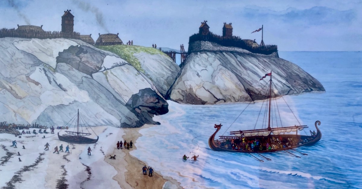
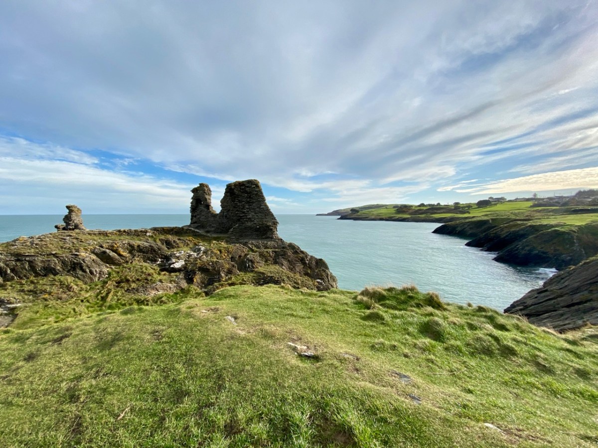
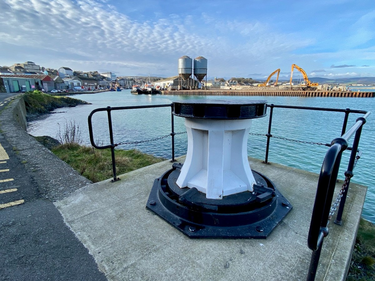
If you can’t be in West Cork – what’s the next best place? Why – County Wicklow of course! It’s also full of wonderful scenery and imbued with Irish history. That’s Wicklow Town, above, in Viking times: there had already been a Bronze Age settlement on this site. In the twelfth century the Normans arrived, led by Strongbow, who we have encountered before, and Black Castle was built (below). They were wild times, and the castle was attacked and destroyed completely in 1301 by local chieftains, notably O’Byrnes and O’Tooles. There were several subsequent revivals, and the gaunt remains we see today probably date from the 17th century.

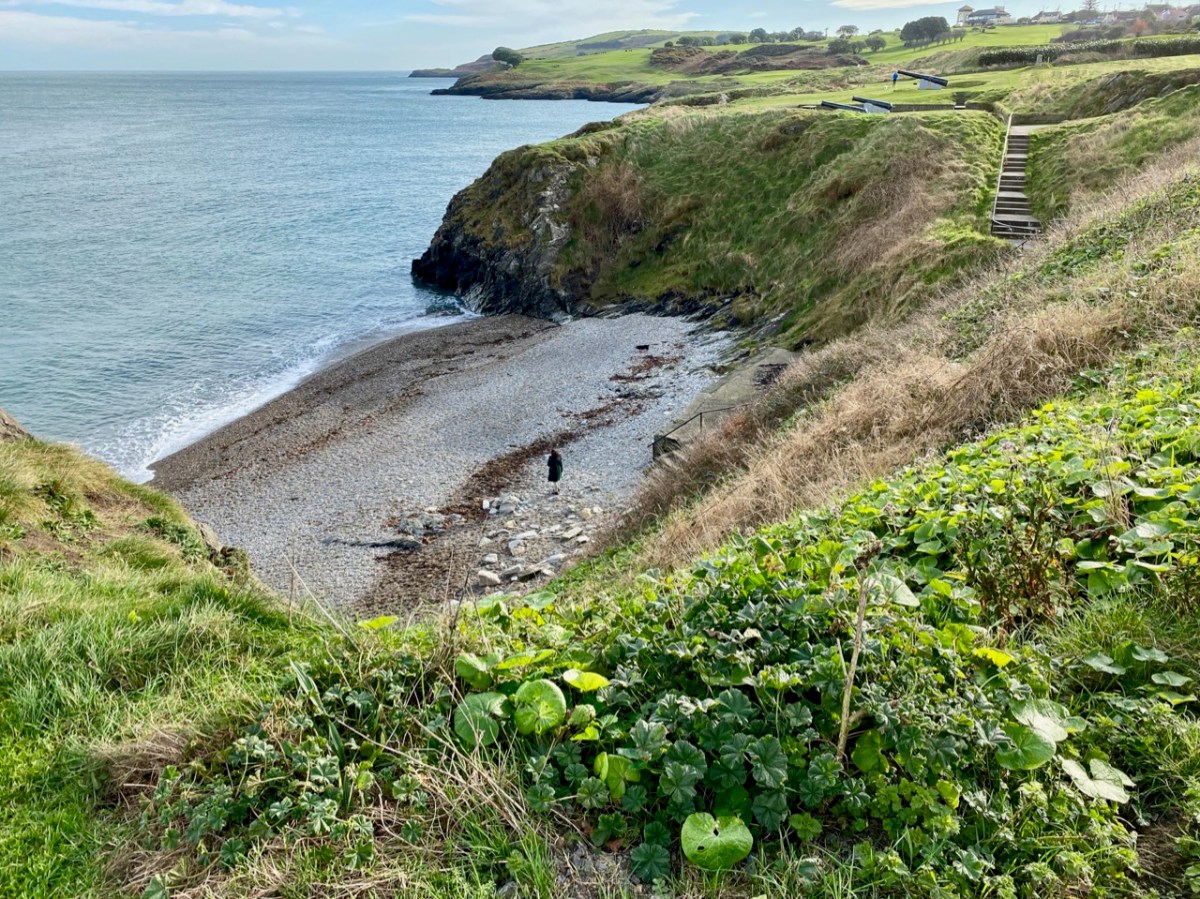
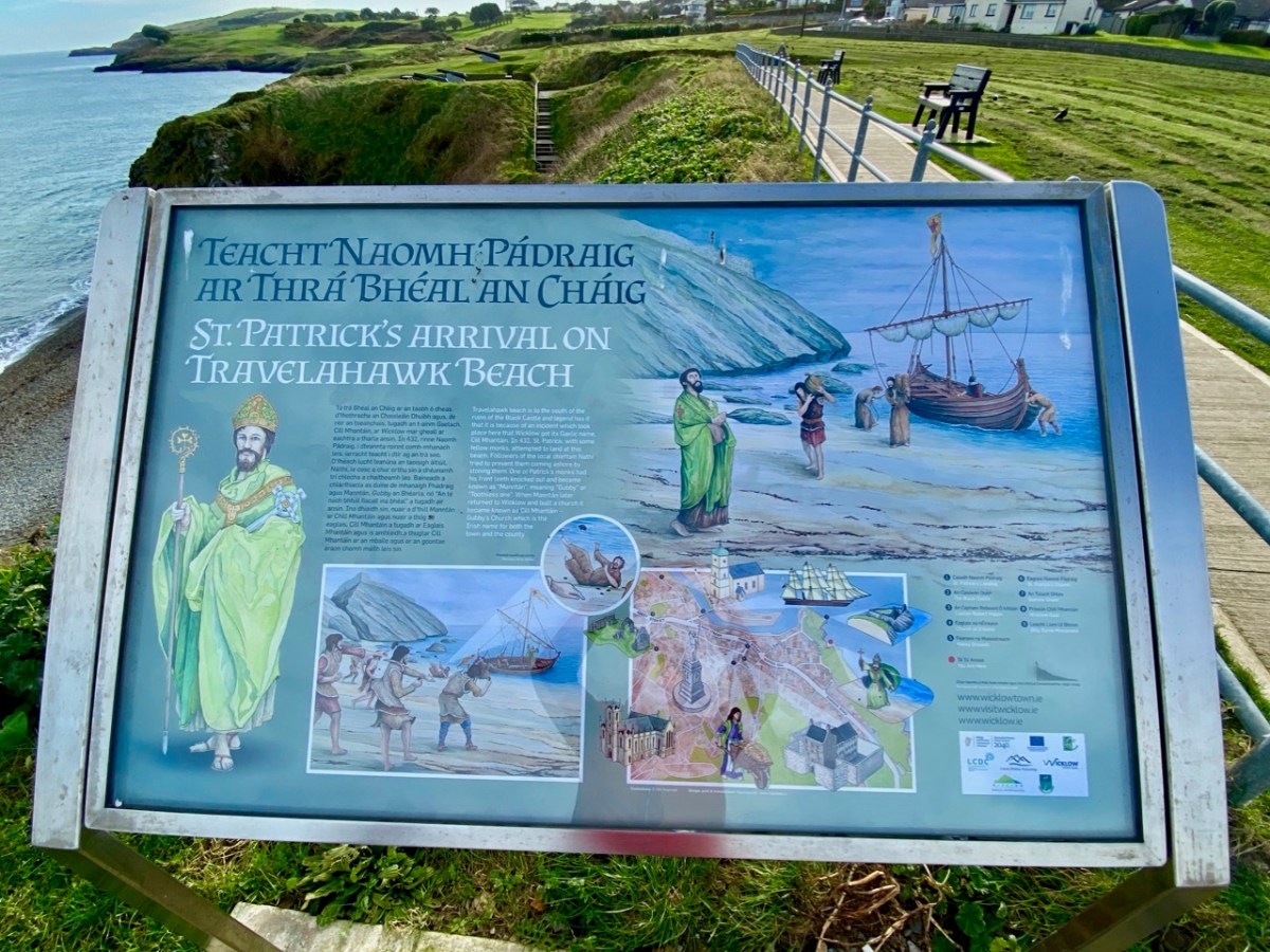
While at this site, have a look down at the inlet on the coast to the south: that’s Travelahawk Beach, the scene of a bit of Wicklow history that’s sure to stick in the mind. It was there that St Patrick first landed in Ireland!

I have to admit that the beach is only one of several sites on the east coast that lays claim to this historic occasion, but I like the associated story of Travelahawk which tells how the local people, suspicious of this stranger, threw rocks at St Patrick and his crew. One of them hit the saint’s companion, and he lost his front teeth. He was known ever after as ‘Gubby’ or ‘Gap-toothed’ which is translated in Irish Mhantáin. Hence the old name for Wicklow is ‘Chill Mhantáin’ – the Church of Gubby. Today’s name for the town, Wicklow, is of Viking origin, and means ‘Bay of the Meadows’.

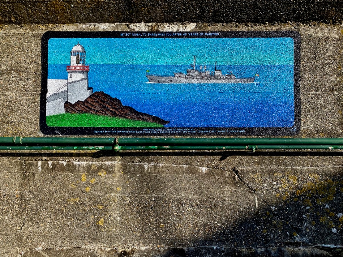
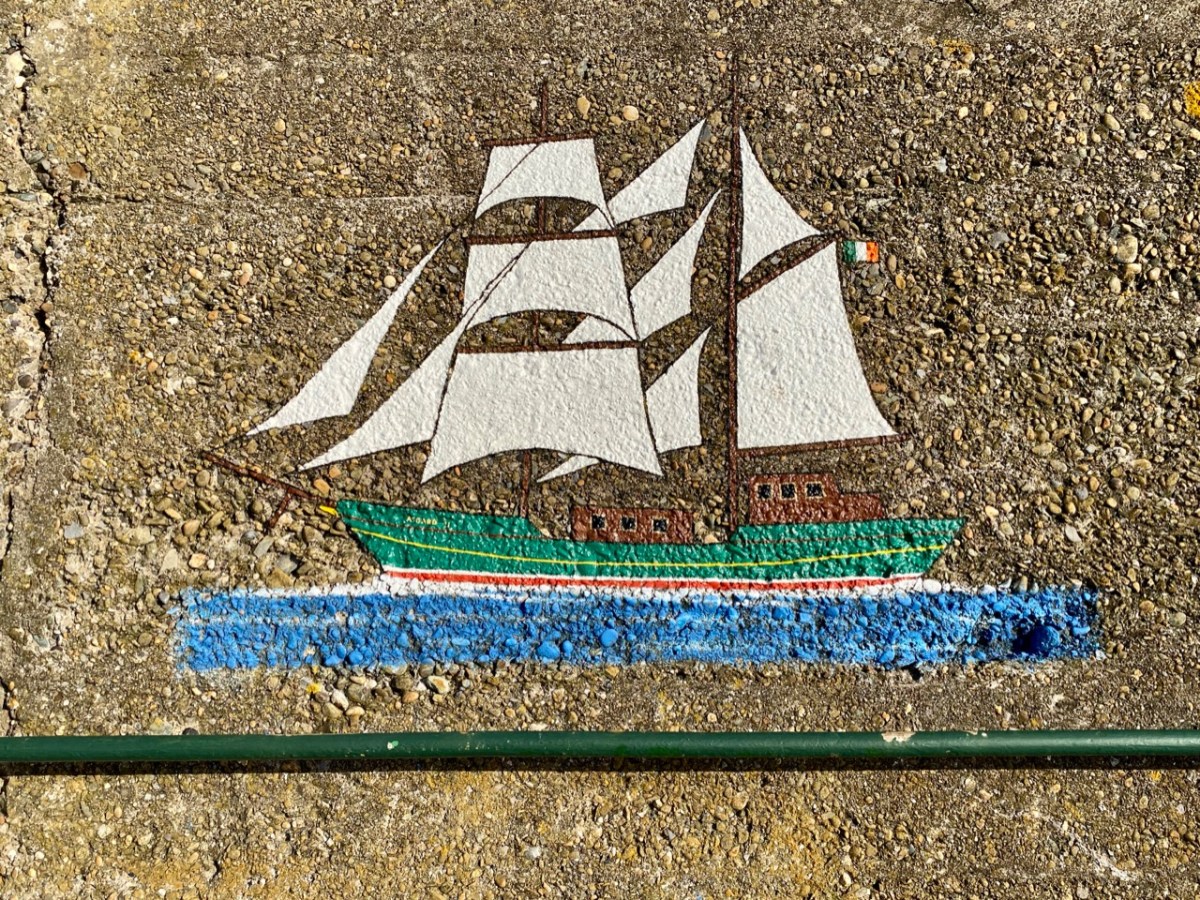
We popped over to Wicklow on a mild February day for a change of scene – and to absent ourselves from Nead an Iolair while some upgrading works were taking place. I was impressed: I had never explored the town before. Finola, however, was brought up in County Wicklow, and her impressions of the county town today were embellished with memories of times past. There’s much about the place that’s picturesque: I was taken with the number of painted murals about the place. The pier has, appropriately, a whole series of ships on the breakwater wall. There is an example, above . . .
. . . And here’s another. In fact, this one is the 50th mural to be painted by Pat Davis, who is the local postman. Each one depicts a vessel which has visited the harbour. It’s a wonderful and colourful record of one aspect of the maritime town’s history.
Here’s Pat at work. The image is courtesy of Ceaneacht O Hoctun, and appeared in the Wicklow People newspaper in 2020. Pat started painting the ships in the 1970s.

This one will be familiar to West Cork folk. It’s the Saoirse, a 42ft ketch built in Baltimore in 1922 for her designer, Conor O’Brien.

. . . This unique sailing ship was also a maritime inspiration for the new Ireland, uncertain of itself in an uncertain world. For this was Conor O’Brien’s characterful 42ft ketch Saoirse, which he designed himself, and with which – between 1923 and 1925 – he pioneered the round the world route south of the Great Capes, an ocean voyaging “first” which was forever written into world sailing history. . .
Afloat.ie

When O’Brien returned from his record-breaking voyage in 1925 he made his first landfall in Ireland in Wicklow Harbour. O’Brien designed a larger version of Saoirse to be the inter-islands communications vessel for the Falkland Islands: this – the Ilen – was also built in Baltimore. Back in 2015 we visited Oldcourt boatyard on the Ilen River to see the restoration of the larger ketch, which was then underway. That work was completed in 2018, and the same team embarked on a complete rebuilding of Saoirse, which had been wrecked in Jamaica in 1979. Our own West Cork photographer, Kevin O’Farrell has beautifully documented these projects at Oldcourt in his book, published in 2020.

The Asgard, above, was famous for gun-running at Howth by Irish Volunteers in 1914. Below is an Irish Navy vessel, LÉ Gráinne – a mine sweeper. Gráinne was a legendary princess who was promised to Fionn Mac Cumhail but ran away with his young follower Diarmuid. The ship was decommissioned in 1987.

We found that the town of Wicklow has so many maritime associations – everywhere you look there are reminders. But also it’s a thriving commercial centre and we were impressed by what is on offer there: great eateries, and a most wonderful bookshop. I think there might be another post in the making . . .
A Signal Success in Irish Engineering – Part 10: Toe Head

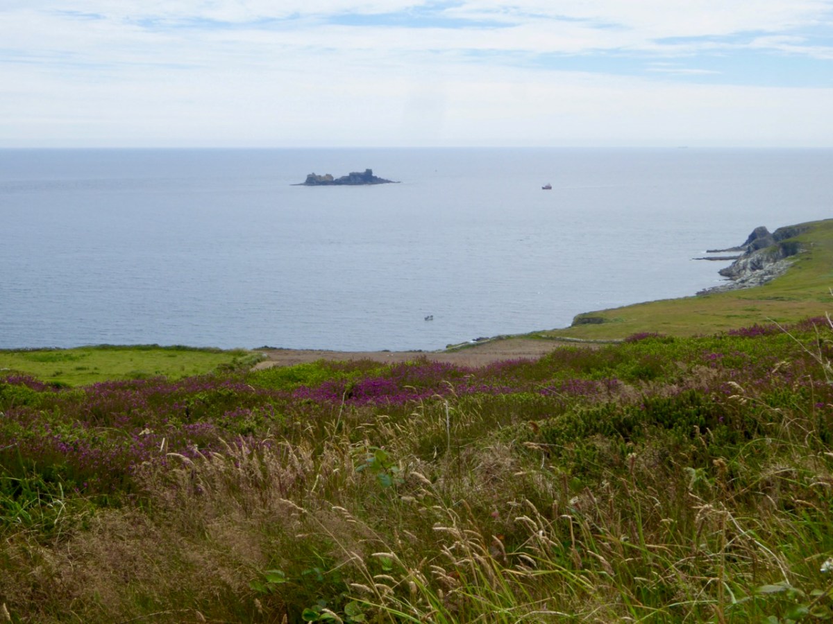
Here’s the latest episode in our series about Napoleonic-era signal towers in West Cork. There are links to the earlier posts at the bottom of this one. That’s Toe Head above – in the far distance, and that view is taken from the signal tower site at Kedge Point, Spain, to the east of Baltimore.

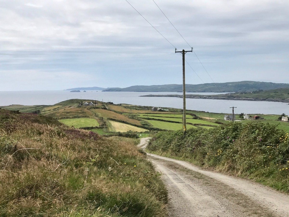
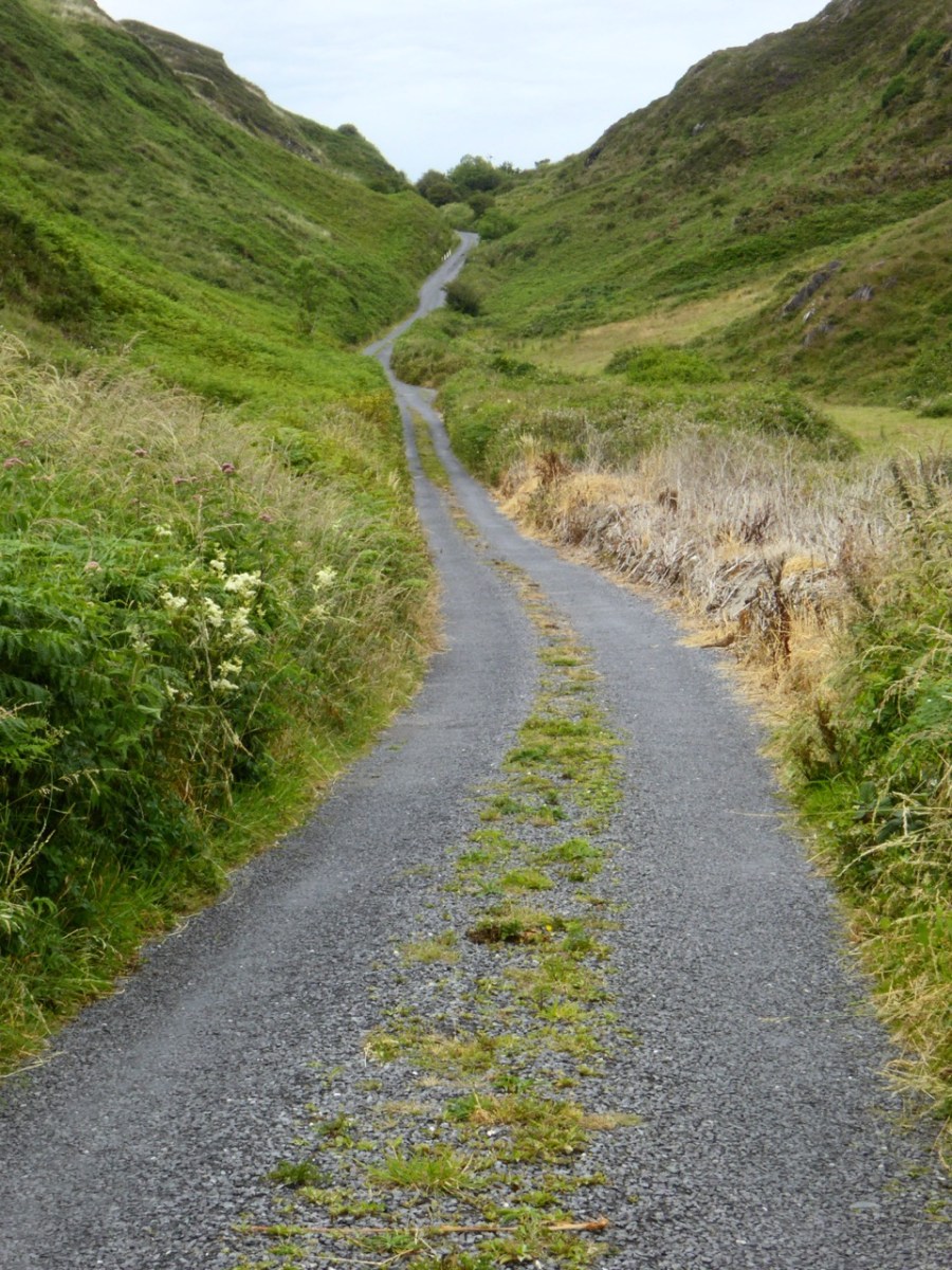
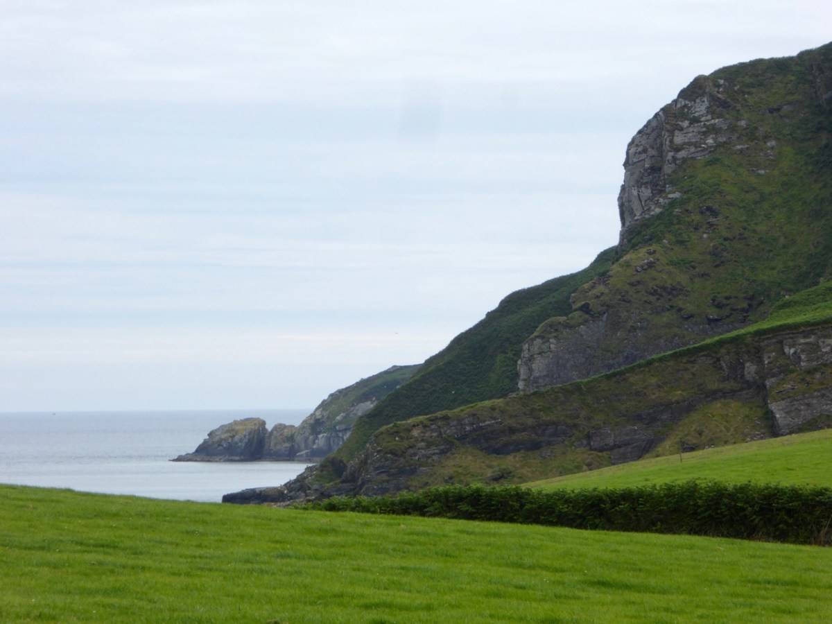
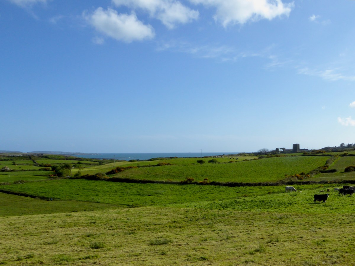
Toe Head itself is a spectacular setting in West Cork: the views, above, show the nature of the terrain, the boreens, and the seascape in the area. So far I have written accounts of nine signal towers: this is the tenth. I’d like to tell you how many of these structures are in West Cork, but that would mean that I would have to geographically define ‘West Cork’. I can’t do that, as there is officially no such area: we are all part of County Cork! All I can do is to let you know that there are nineteen signal tower sites located in the whole County. I have another nine to cover, after this one. But I assure you – Toe Head is definitely in our West Cork!!

Here’s the Toe Head tower – in a sea of black bales. If you have followed the series so far, you will have noticed that each tower is fairly basic, and generally offers the appearance of a medieval castle. But they were all built at the very beginning of the nineteenth century, to provide a system of surveillance and signalling around the coast of Ireland, from Malin Head in the north to Pigeon House Fort, Dalkey, on the east coast. Each signal tower is within view of one – or two – others, depending where it lies on the chain. In the first post in the series, here, I explain the logic and geometry of the project.

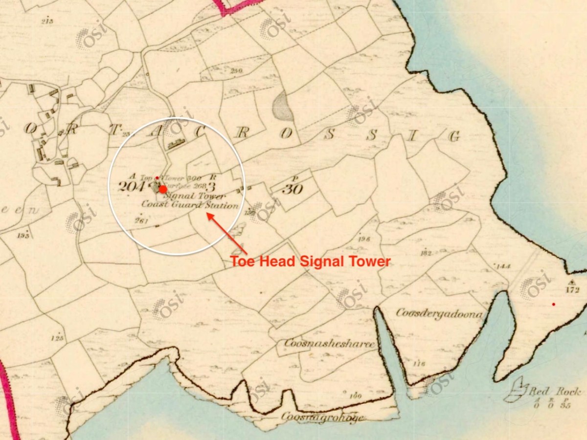
The 6″ Ordnance Survey map extract in the upper picture dates from 1842. By this time the use of the tower for signalling had ceased – the Napoleonic invasion threat lasted only through the first few years of the century: many towers became disused after this and some have vanished altogether, although many ruins do remain because of their remote locations. In the case of Toe Head, the building was adapted to incorporate a Coast Guard Station. I am assuming that, originally, the tower was a simple square structure , and the extension to the rear was added to provide additional accommodation for the Coast Guard service. The current aerial view shows newer farm buildings and an access road close by.

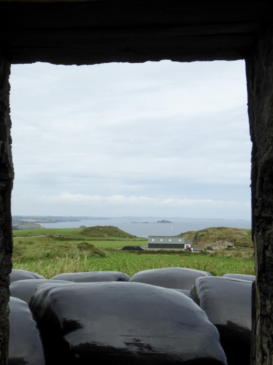
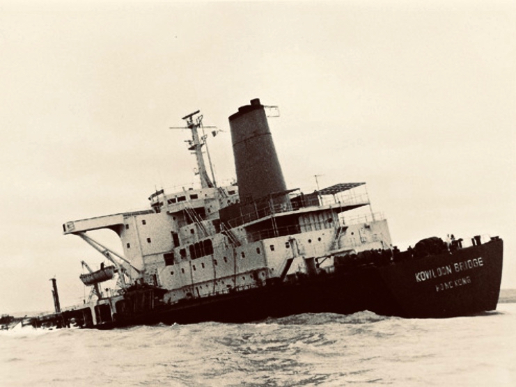
If you look at previous posts in this series, you will see that the Toe Head tower is architecturally simpler, with no bartizans or other ornamentation – it’s more like a small Anglican church tower than a ‘castle’. Like many others, it’s clear to see that this building was slate-hung: this form of weather-proofing was probably added at a later date – possibly when the Coast Guard service took it over. At the centre of the view from the window above you can see the Stag Rocks which in the 1980s became the graveyard of the 900ft long Kowloon Bridge, a bulk cargo carrier travelling from Quebec. The ship was disabled by a storm and then abandoned, drifting on to the Stags. A detailed account of the event was posted in the Irish Examiner 30 years later.

The abandoned Wreck of the Kowloon Bridge close by the Stags in November, 1986 (centre picture). The lower picture shows the wreck underwater today (courtesy Aquaventures.ie): she drifted out of control towards the rocks before running aground on the reef. The resulting fuel spill spread out over the Irish coastline causing extensive damage to local wildlife, and financial losses for the local fishing fleet. Apparently, no-one was ever held to account for the environmental disaster.

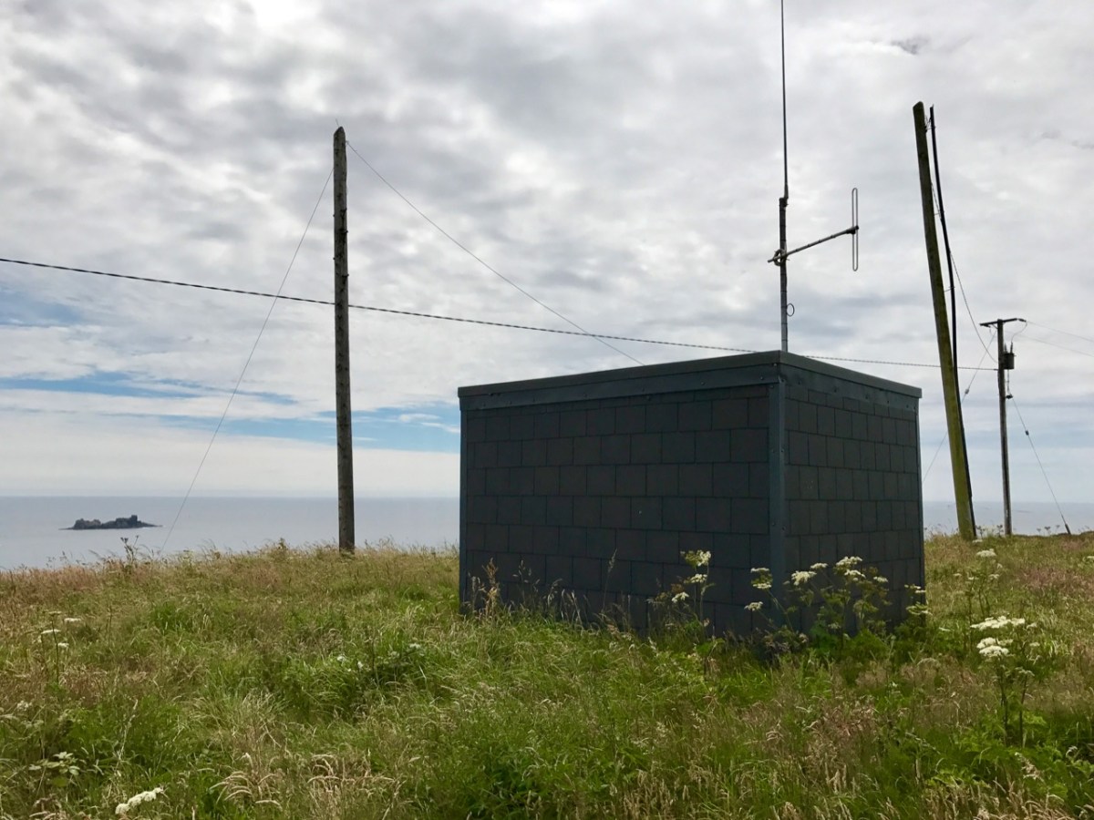
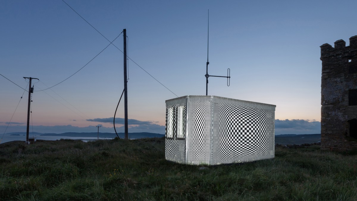
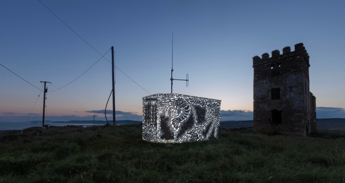
The Stag Rocks can be seen in my picture above, which shows the current incarnation of a World War II Lookout Post that was put in place close by the older signal tower in 1942. You can read more about these lookouts in this post: they were designed by Howard Cooke RIBA of the Irish Office of Public Works at the outbreak of that war (during which Ireland remained neutral). I mentioned in that same previous post an art installation project carried out in 2014 by Tim Schmelzer of Vienna. His work at Toe Head is particularly impressive, and here are some still shots to illustrate the nature of the artworks, which were created on-site using high-powered projection equipment.

The signal tower ruin today is gaunt and desolate. Nevertheless it’s an atmospheric place to visit. On the slopes below the building is an EIRE sign (officially number 28), also dating from the World War II years, when Irish neutrality had to be spelled out to the warring powers flying overhead. I came across an interesting comment from Anne Wilkinson in 2018, giving a slightly different take on the EIRE signs:

. . . These EIRE signs were also to alert German Pilots and crew who were conscientious objectors and who had overflown the UK, to ditch and parachute to safety. Many airmen lived at the Curragh Camp. They were allowed freedom during the day, eg. they often cycled the lanes and roads to enjoy the peace and quiet and then returned to the Curragh Camp for their curfew hour . . .
http://eiremarkings.org/the-map/

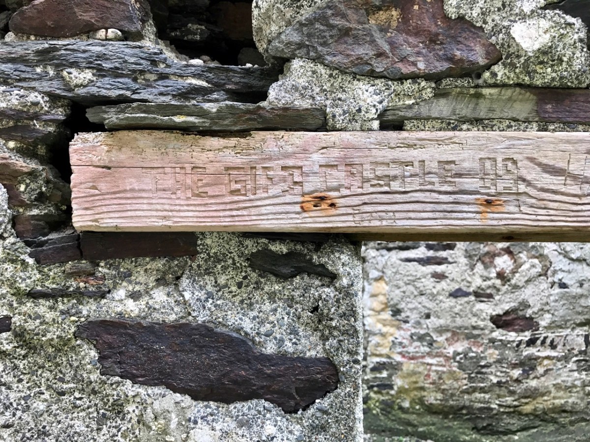
And here’s a little enigma to finish off the post (above). It’s graffiti carved on a timber lintel over one of the openings of the signal tower buildings. It’s probably quite recent – dating from ’89 or’99 – but what does it spell out? And why is it here? It’s tempting to say THE GIFT CASTLE but that ‘T‘ after the GIF doesn’t ring true . . . There’s a story there somewhere: perhaps one of our readers can give us a clue! Finally, here’s a distant view of the signal tower, looking across Toe Head.

The previous posts in this series can be found through these links:

Part 1: Kedge Point, Co Cork

Part 2: Ballyroon Mountain, Co Cork

Part 3: Old Head of Kinsale, Co Cork

Part 4: Robert’s Head, Co Cork

Part 5: Downeen, Co Cork

Part 6: Dunnycove

Part 7: Cloghane, Mizen Head

Part 8: Brow Head

Part 9: Glandore Head

Ardintenant Castle

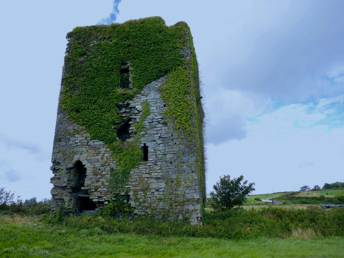
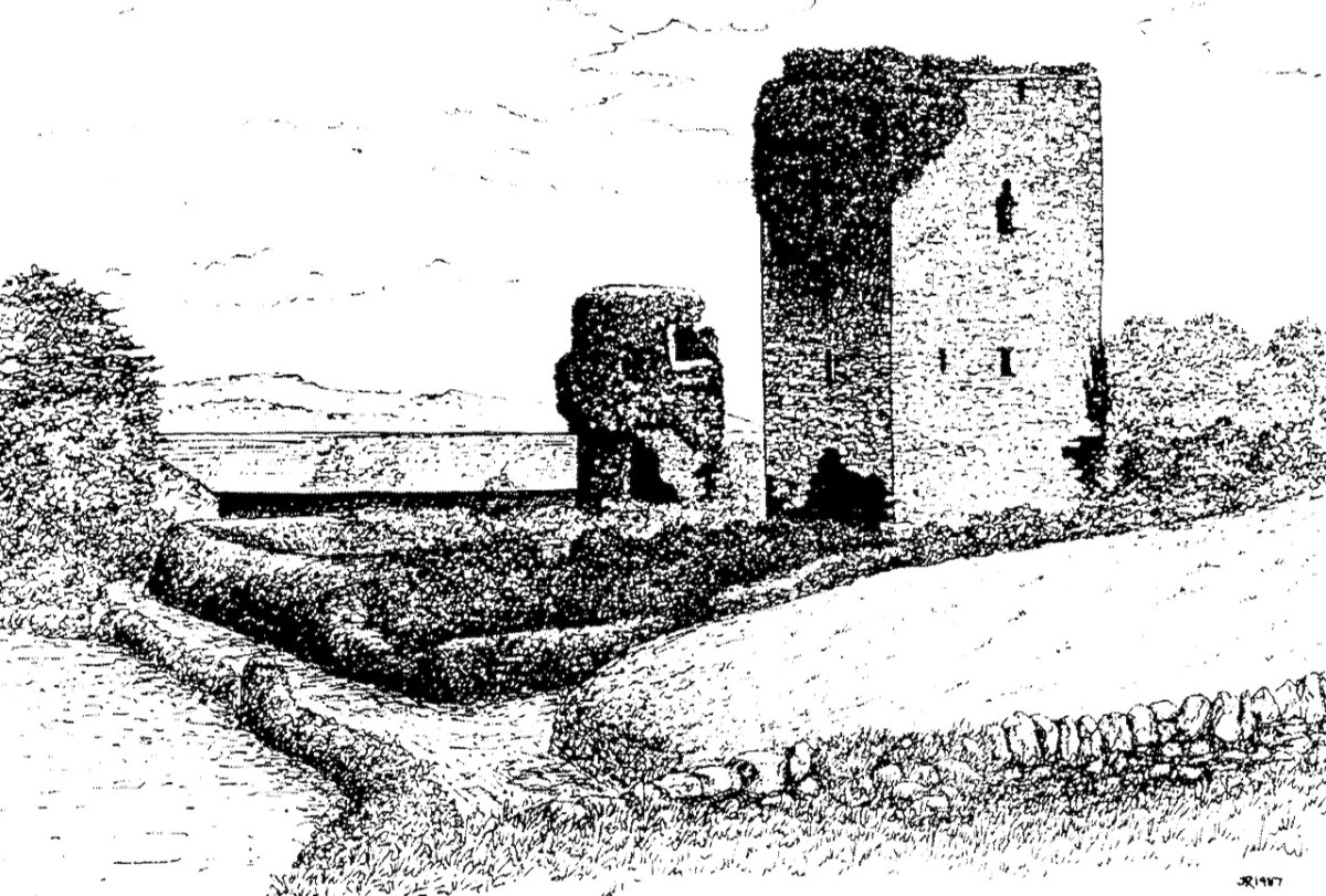
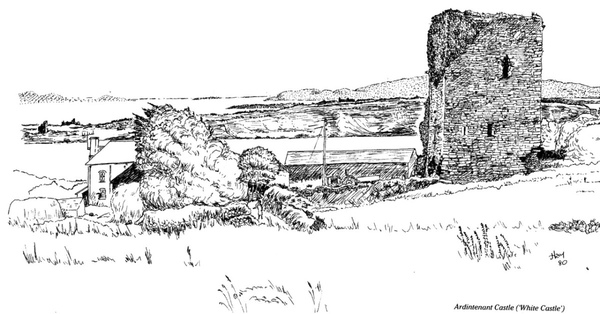
Home of the Taoiseach, or Head of the Clan, Ardintenant was one of the most important of the O’Mahony Castles of Ivaha (or what we now call The Mizen). Fortunately, it is relatively intact and we can observe and record much about it. The drawing above was done by James N Healy for his magnificent book on The Castles of County Cork. This post is another in my series on The Castles of Ivaha.

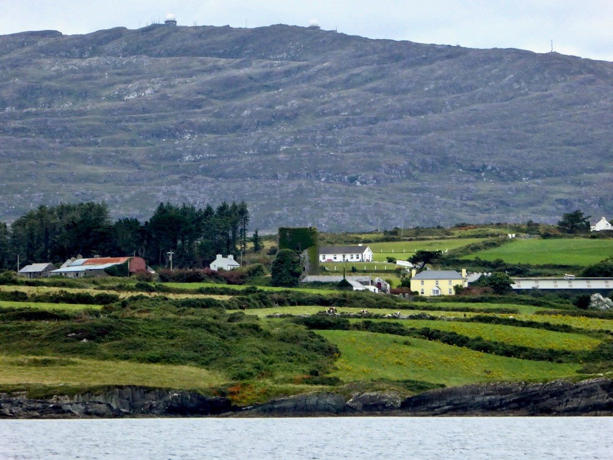
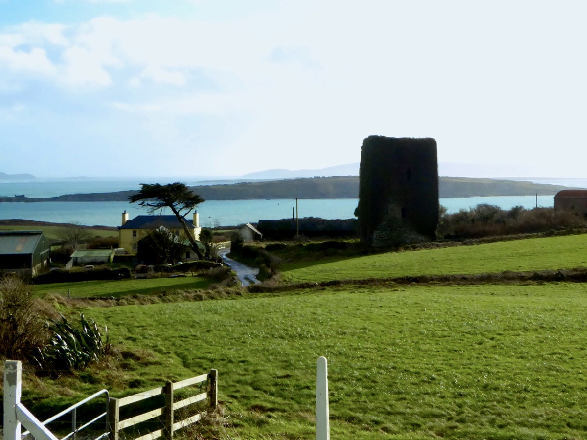
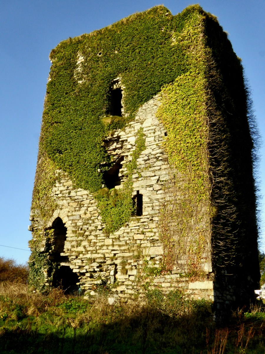
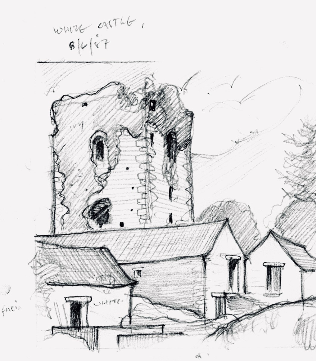
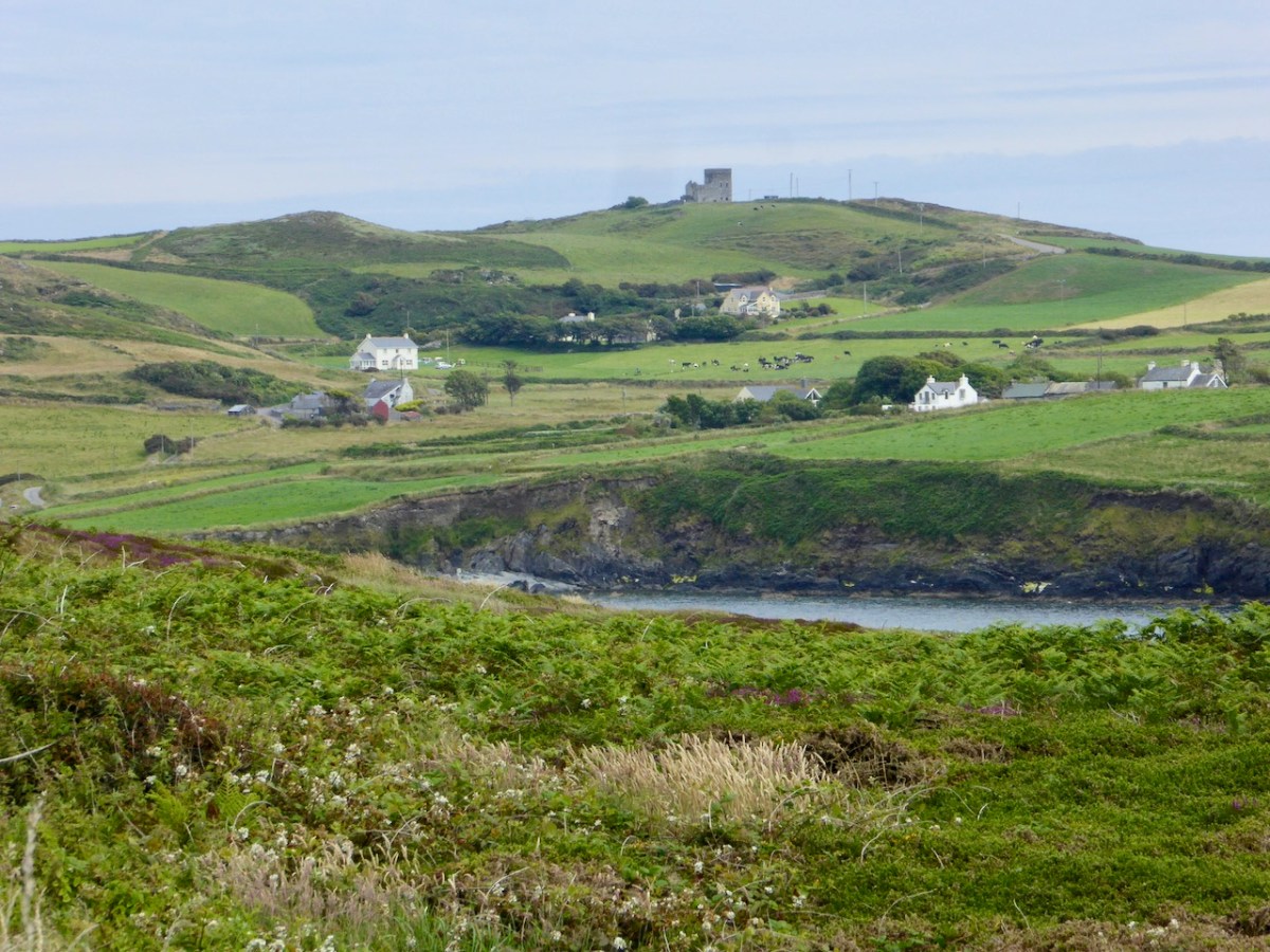
First the name – Ardintenant has been variously interpreted as coming from Árd an Tine (Ord on Tinneh, Height of the Fire), Árd an tSaighneáin (Ord on Tye-nawn Height of the Flash, or Beacon) or Árd an Tiarna (Ord on Teerna, Height of the High Chief). Any of these would be apt, since tower houses by the sea like this one (viewed from the sea, above) could be used as navigation beacons, possibly with a fire on the battlements. We also know that it was the residence of the head of the O’Mahony Clan, even though it was not the largest or most elaborate of the O’Mahony castles. Locally, it is also known as White Castle, which may refer to the white render that once made it stand out in the landscape (for more on render and castle colours, see the discussion on Kilcoe Castle). The photograph below demonstrates that it was prominent on the landscape and close to, although not right on, the sea.

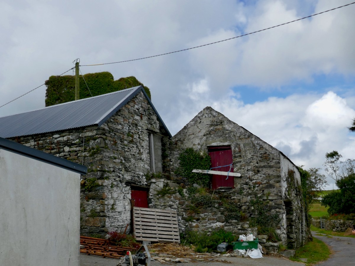
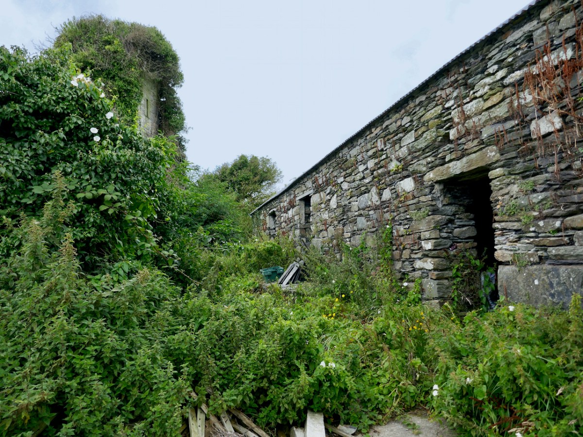
It now stands in the middle of a working farm, surrounded by stone buildings that are picturesque and notable in their own right.

Ardintenant is typical of castles built during the 15th century by Irish clan chiefs – wealthy and powerful and anxious to assert their claims on land and sea.

Dermot Runtach (the Reliable) succeeded in I400; his life and the lives of his sons spanned the Fifteenth Century. He was celebrated as a ‘truly hospitable man, who never refused to give anything to anyone’ . . . The period of 1400 -1500 was the most peaceful and prosperous period in the history of the clan. The Ivagha peninsula was protected by the sea on three sides and the family became wealthy from the exaction of dues from the continental fishing fleets; trade also enriched them, causing long-standing enmity with the citizens of Cork. Tradition relates that the majority of the O’Mahony tower houses in Ivagha were built by or for the sons of Dermod Runtach. The date of Dermod Runtach’s death is recorded in the Annals of Loch Cé as 1427.


THE TOWER HOUSES OF WEST CORK
MARK WYCLIFFE SAMUEL, 1998

Dermot Runtach’s sons were the castle builders. Conor Cabaicc succeeded his father in 1427 and remained Taoiseach for 46 years, embarking on an ambitious program of construction to provide castles for his sons and brothers, beginning with Ardintenant. He died in 1473, by which time probably all of the castles of Ivaha were built and occupied by various members of his derbfine (extended family). Cabaicc means of the exactions (or forced tributes), although it is possible that Conor was more benignly known as Cabach – meaning talkative. His brother, Fineen, the Táiniste (heir-in-waiting) built Rossbrin Castle, about which Robert has written, and which is the castle in our view at Nead an Iolair. Rossbrin and the remains of a small tower on Castle Island are both visible from Ardintenant.

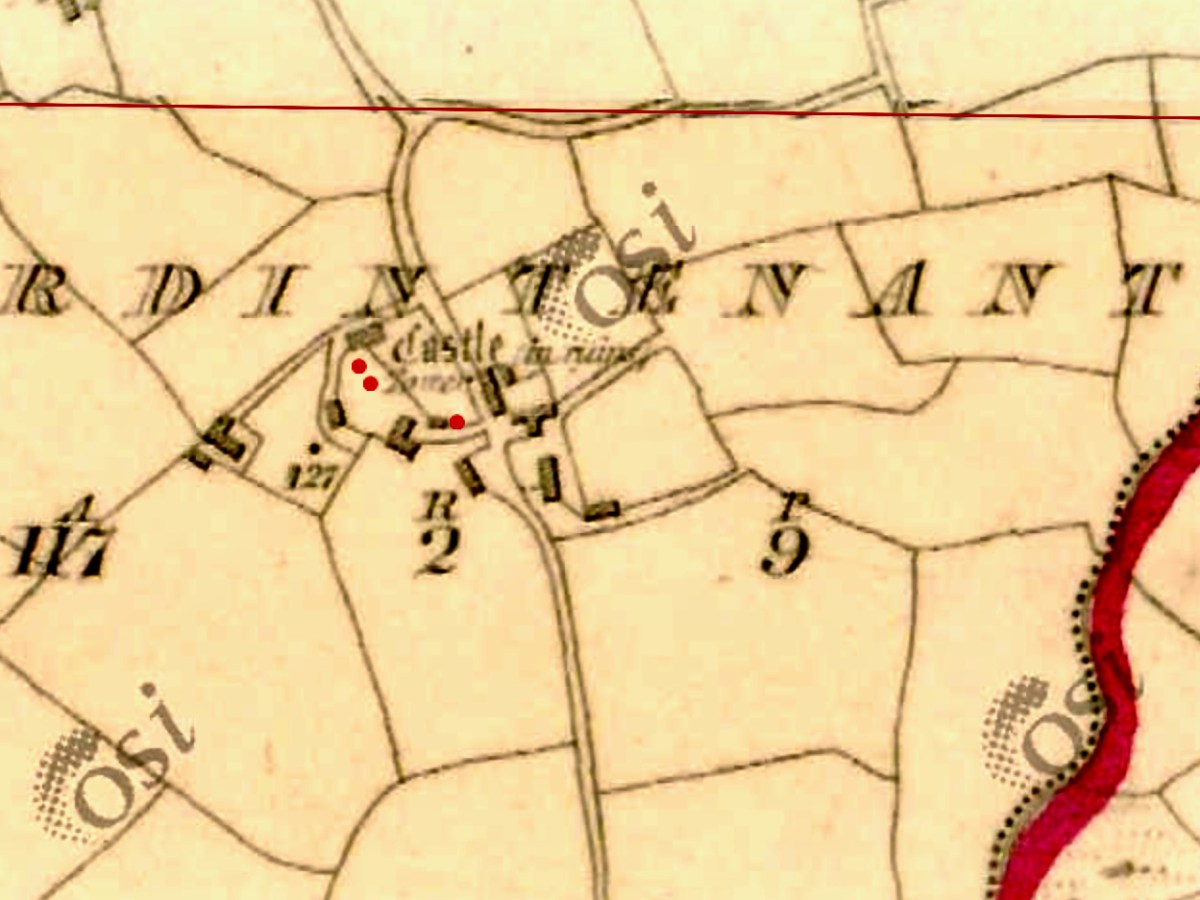
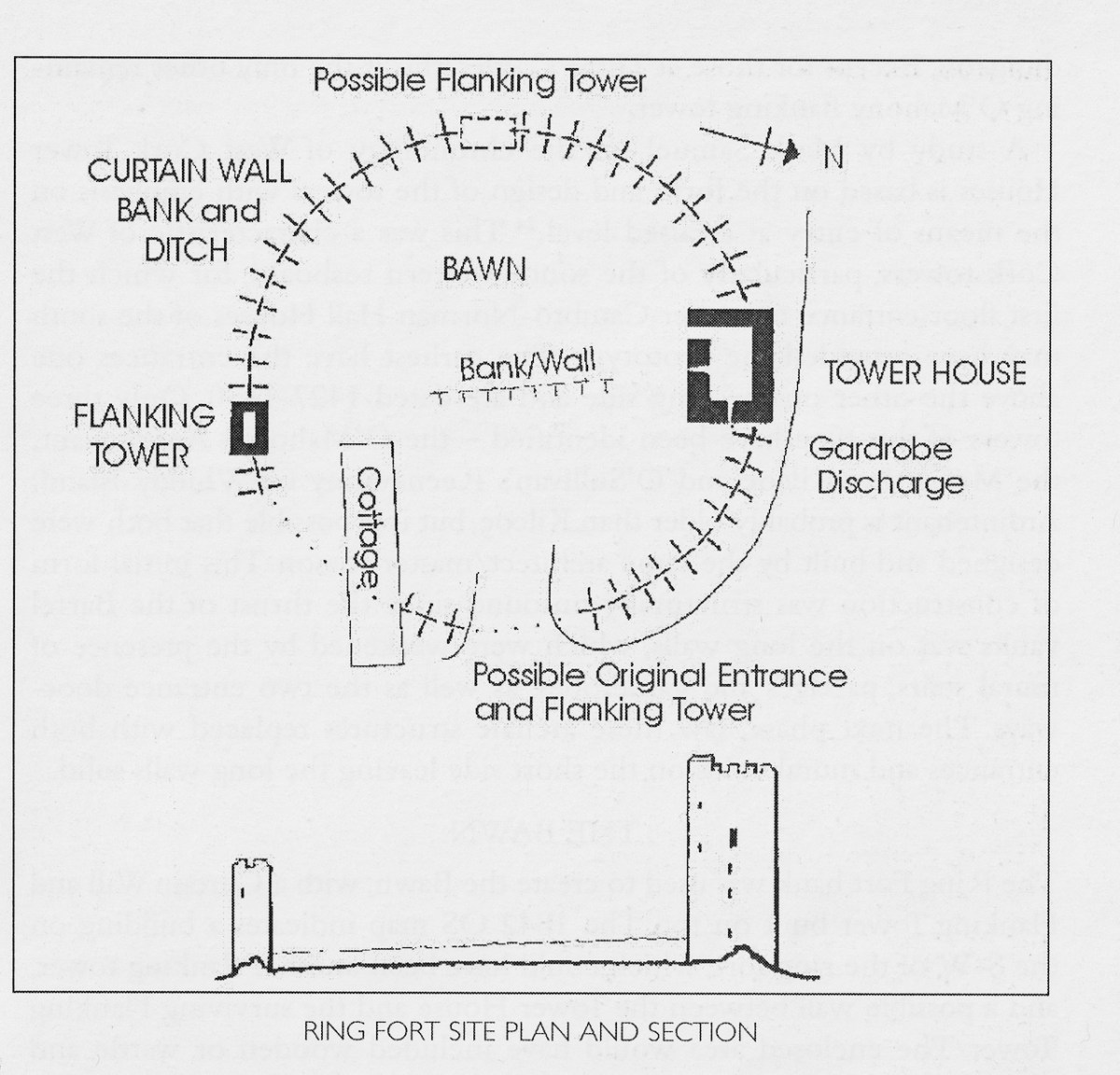
While there is evidence that other O’Mahony castles were built on pre-existing fortifications such as promontory forts (see Three Castle Head, for example) or ring forts, this is most visible at Ardintenant, where the ring fort can still be seen as a circular rampart around the tower house. You can make out part of it in the photo above. Another unusual feature is the survival of a single flanking tower, along the line of the ring fort and across from the tower house, although there may have been more than one originally, since the 1840s OS map shows what could be a second one – the leftmost building on the line of the ringfort below. Note that farm buildings also dot the site even at this early stage.

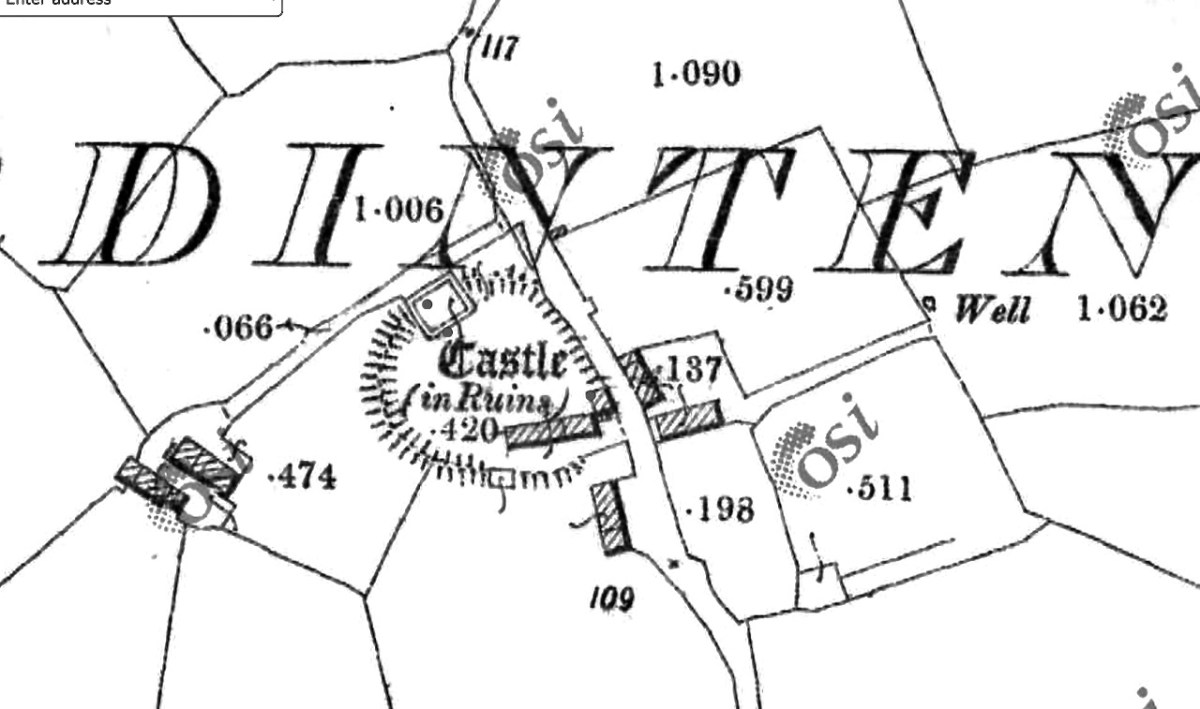
The possible second flanking tower had disappeared by the time the next series of maps were produced, around the 1890s. The farm buildings have changed as well.

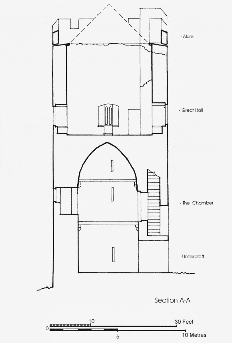
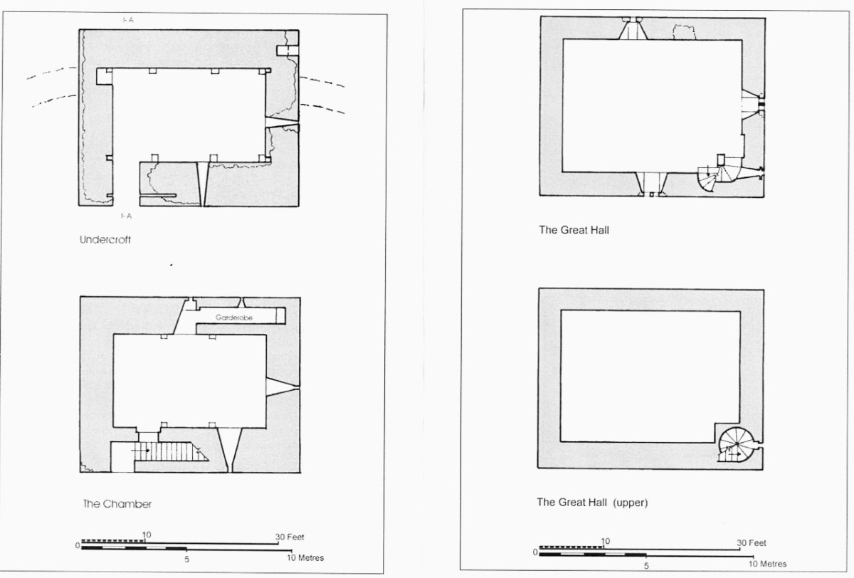
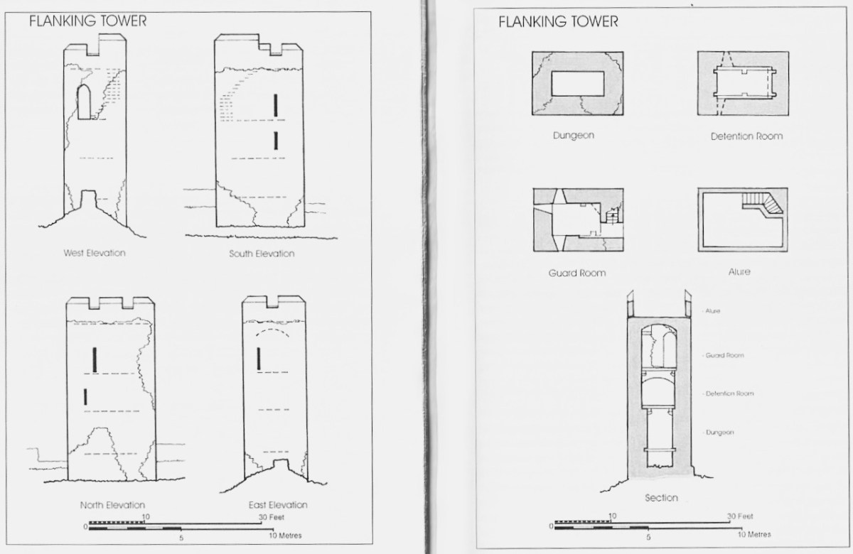
In his marvellous paper on Ardintenant Castle in Mizen Journal 11, 2003, John Hawkes investigates the history and construction of the castle and provides elevation and plan drawings. I am grateful for his scholarship and thoroughness, which has informed the following description of what is left at this site, as well as provided illustrations.

The presence of the ringfort raises an intriguing prospect since it appears that instead of the usual rectangular bawn, surrounded by a stone wall (see the illustration in this post), we have a round bawn, with the stone wall built on top of the bank of the ringfort. Although that stone wall is not obvious now, it is noted in the description of the ring fort in the National Monuments survey. Thus, what we have here is a hybrid ring fort/tower house – a sensible adaptation of a pre-existing fortification and a continuation of the site as a high-ranking residence. The National Monuments survey also refers to an external fosse, although traces of it are hard to see on the ground. If it was originally a substantial ditch, another possibility is that the bank was surrounded by a moat. 

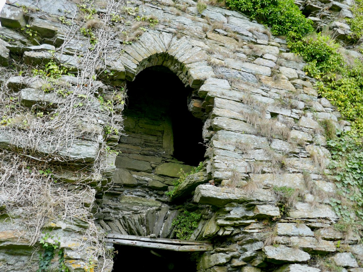
As with all of the O’Mahony Castles, Ardintenant is the type of tower house known as Raised Entry, that is, the ground floor door allows access to the public areas of the castle, while the door above it, originally accessed via a wooden stairway, gives on to a set of steps up to the private area.

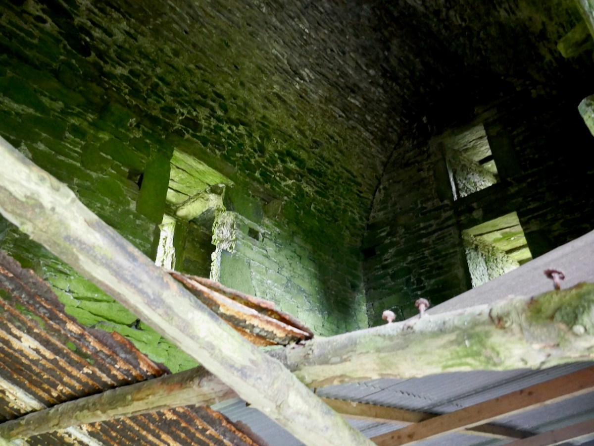
The first two-and-a-mezzanine floors are covered by a vault. This set-up was partly defensive – the upper floors could only be accessed through this raised doorway and staircase – and partly for security, in that the vault was a barrier should a fire break out on the lower floors. The doorway to the left leads to a garderobe, while on the right are two deeply splayed window embrasures.

At Ardintenant, as with Dunmanus, the ground floor has been in use as a cow byre. It is normally impossible to access the upper floors, although those who have done so report that it is in good condition. That floor is reached by means of a mural staircase that rises from the raised entry.

A second staircase, in this case a spiral, gives access from the upper floor to the wall walk. This was not a castle built for comfort – in common with the other 15th century O’Mahony castle it had no fireplaces and very few windows.

Above the vault was what Hawkes calls the Great Hall. One large room, accessed via the mural staircase, the only notable feature of which is are deeply splayed window with seats in the embrasure. Picture the Lady of the house seated here, trying to catch whatever light she could as she bent over her handwork. 

In one corner of the Great Hall, the spiral staircase led up to the wall walk (what Hawkes calls the Allure). While nothing remains of these battlements now, we can assume that there was a walkway around the roof, perhaps with Irish crenellations and a sentry box.

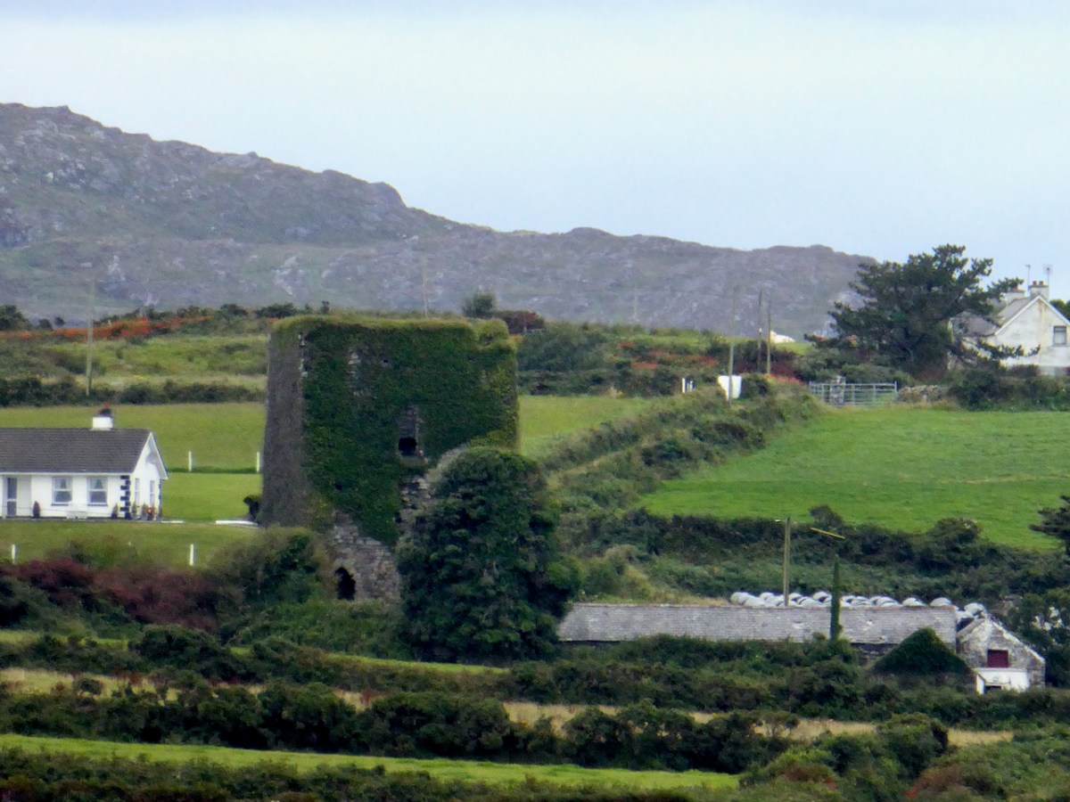
The flanking tower (above) is covered in ivy, so it’s hard to make out details. It may have looked a bit like the one Westropp called The Turret, at Dunlough.

It’s much smaller than the castle, rectangular, and three stories high. The illustration above, by Jack Roberts, indicates the relative sizes. The way in was from the level of the curtain wall and each floor was connected by a ladder, except for the wall walk/allure, reached by a spiral stone stairs. 

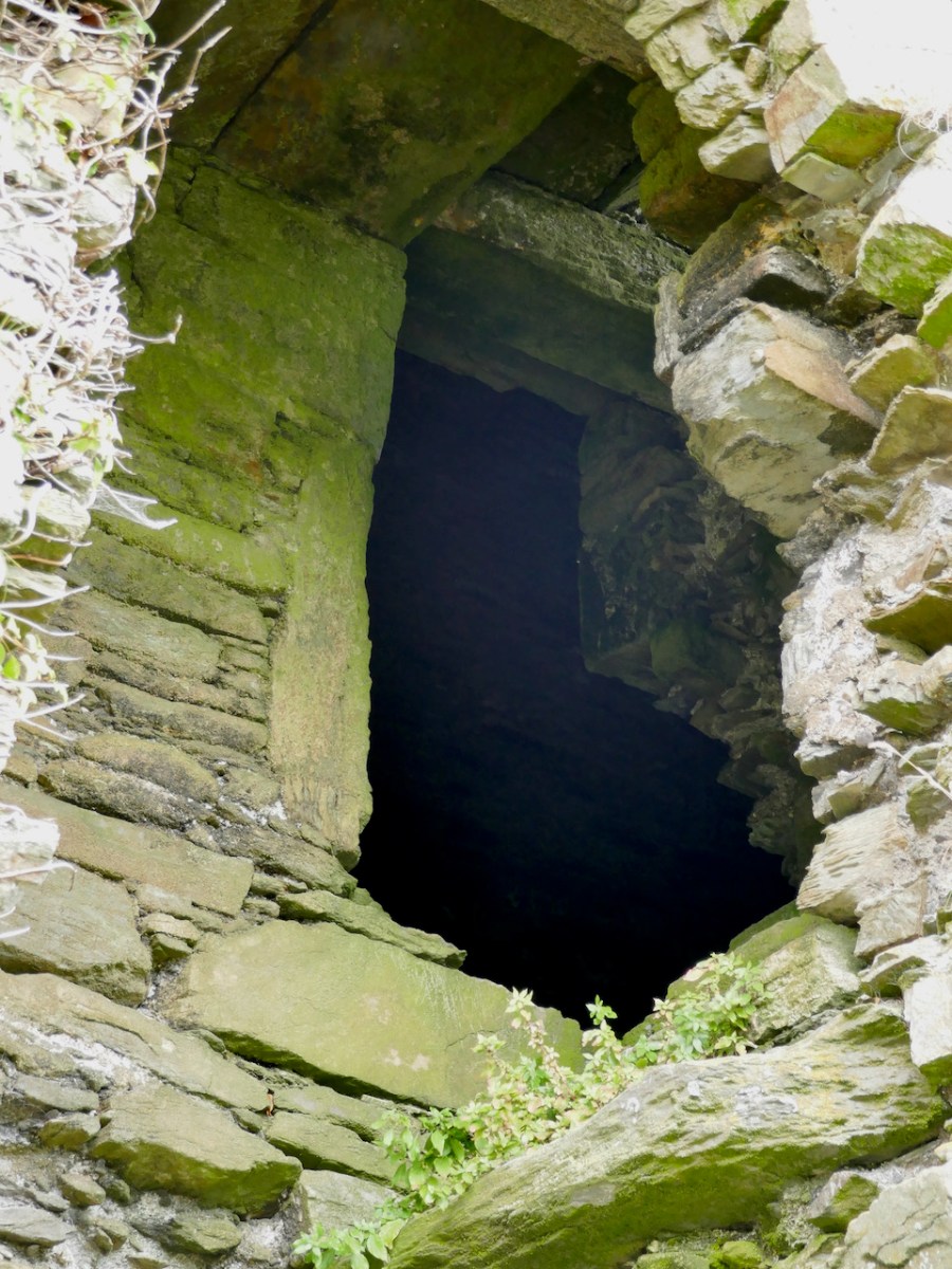
Hawkes tells us that “its function appears to have been to accommodate hostages.” He bases that on the absence of a ground level entry (the current hole on the ground level having been broken through in more recent times), so that the ‘dungeon’ was accessed through a trap door from the room above, which in turn he calls a ‘detention room.’ See my post on Dunmanus for a discussion of possible functions for rooms like the ‘dungeon.’

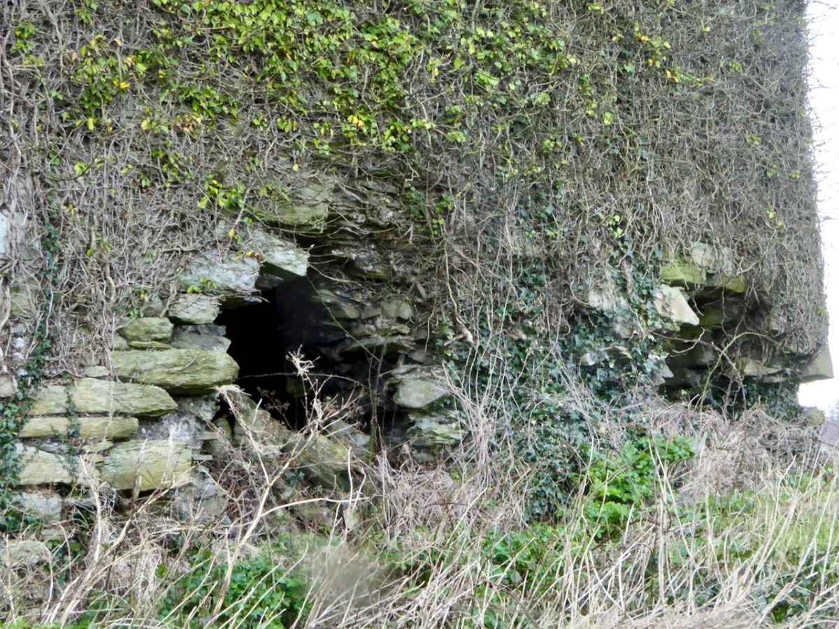
Ardintenant is still standing and intact, but a lot of the base batter – the broad stone base that gives it its strength and stability – is missing and holes have been punched through the walls in the past.

Along with the other extant O’Mahony castles, its continued survival cannot be taken for granted. It’s a listed monument on private land, and Ireland’s complicated heritage laws means that it can’t be deliberately damaged, but conversely, there is no onus on the landowners to conserve it at their own expense. All fingers crossed that it remains standing for ages to come.

Brian Lalor’s sketch of Ardintenant Castle from 1987, from his field notebook

Castleruddery Stone Circle

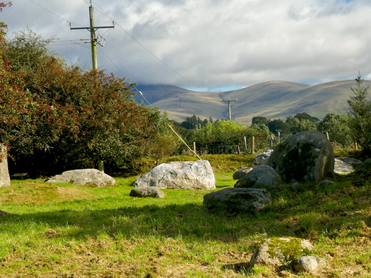
Our travels are always attuned towards our particular interests, be they history, stained glass, art or – as in this case – archaeology. We go out of our way to take in sites we have never seen before – and there are so many. When we were ‘holidaying’ in Wicklow last week we searched out this stone circle in the townland of Castleruddery Lower. It was well worth the journey.

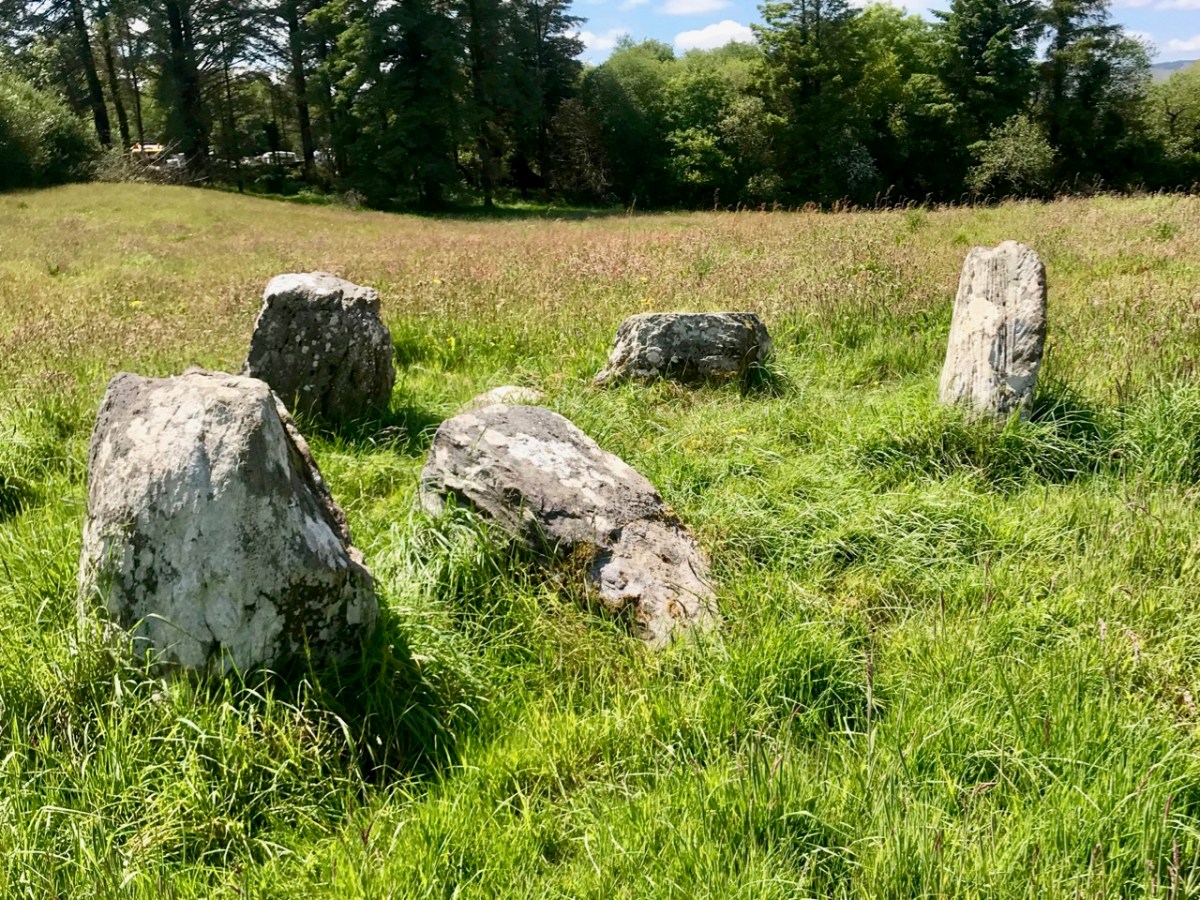
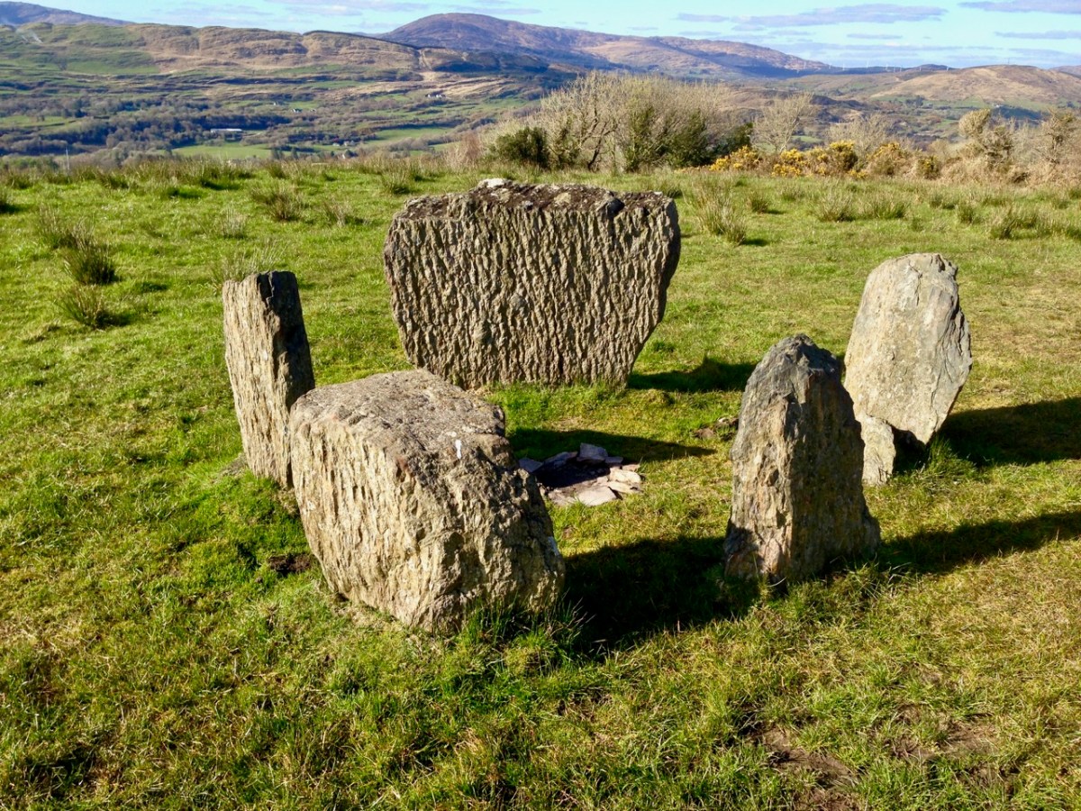
. . . Neglected, knee-high in grass and surrounded by round-crowned hawthorns whose May blossom speckles the bank, it is difficult to appreciate how important Castleruddery must have been early in the Bronze Age when Beaker copper prospectors and the Wicklow mountain goldminers passed by its brilliant entrance. It is not properly a stone circle but a henge, with a stone-lined interior. It was constructed on the summit of a hill just east of the valley into which the Little Slaney flows. Six miles north is the lovely Athgreany stone circle and only two miles to the south is the Boleycarrigeen ring, its stones embedded in a low earthen bank . . .

Aubrey Burl, Rings of Stone, France Lincoln Publishers, 1979

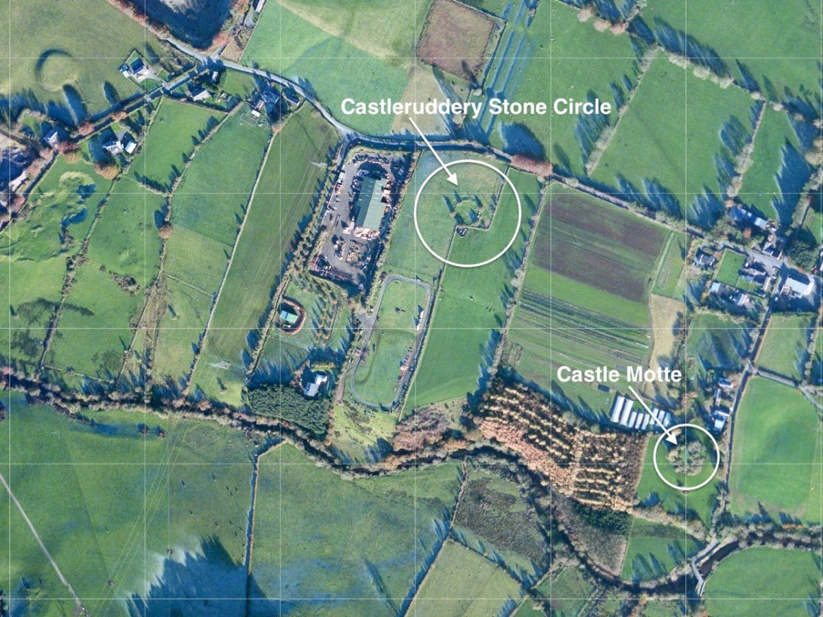
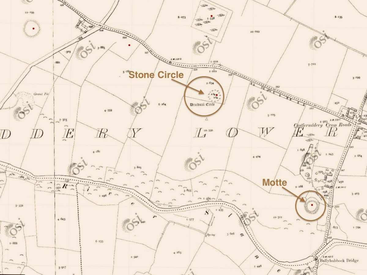
The aerial view, and the extract from the 25″ Ordnance Survey map (above) show the monument in the context of the surrounding landscape. Nearby is a medieval ‘Motte’, very much younger than the ‘Druidical Circle’ – thus named on many early maps. The local Irish name – Chaisleán an Ridire – translates as Knight’s Castle, which might make you think that there is some medieval connection between the circle and the Motte, but in fact Castleruddery stone circle is likely to date from the late Neolithic, around 2,500 BC, marking it as one of the earliest of this monument type in Ireland.

We noted this little figurine by the entrance gate to the circle: it made me wonder what folklore or traditions might be associated with the site today. I could find only one reference to Castleruddery in the Duchas Schools Folklore collection, dating from 1936:

The informer here was Michael Murphy, aged 68 – a ‘labourer’ from Colliga, Co Wicklow. The School collector was from Baile Dháithí, Dunlavin, Davidstown, Co Wicklow. There was no doubt in Mr Murphy’s mind that the stones could only have been placed there by supernatural powers!

The two quartz portal stones at the east side of the circle are remarkable: deliberately chosen, no doubt, to emphasise the importance of the orientation. The circle has 29 significant stones still standing today, but there were probably more. There is evidence of attempts to break up and remove some of the stones, which would have made good building or fencing material for someone who did not share respect for the integrity of the circle.

The two views above show iron ‘drill’ markings: these were made to try and separate sections of stone to be taken away for re-use. In the upper picture one section has been removed, but the operation was unsuccessful for the remainder of the boulder. One has to wonder whether otherworldy forces intervened – and meted out some form of ‘bad luck’ to the perpetrators.

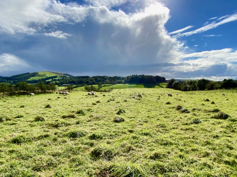
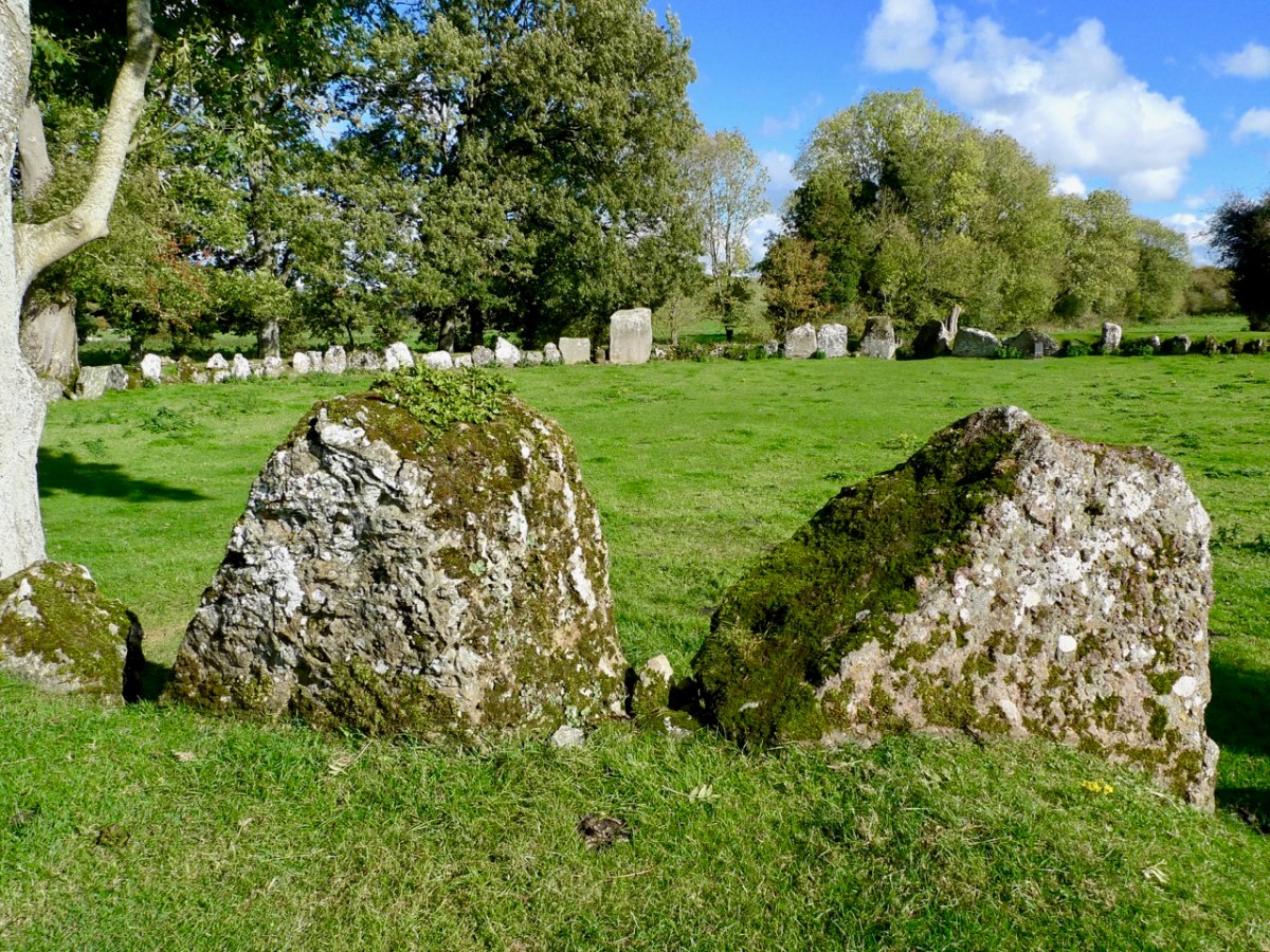
In the present day it’s territory for sheep, and they seem to be unconcerned about any ancient associations or supernatural influences interrupting their tranquil grazing. The archaeologists tell us that this is more of a ‘henge’ monument than the type of stone circle we are familiar with in West Cork. It’s certainly larger, and crop marks have shown that the 29 stones surmount an earthen ring, approximately 30 metres in diameter, and there is a further ring which was once supported or reinforced by timber. Comparisons are made with a henge circle at Grange, close to Lough Gur, Co Limerick, which we visited in 2016. There the ring of at least 113 stones has an internal diameter of 46 metres. We took the two photos below at Grange.

The Grange circle was excavated in 1939 by professor S P Ó Riordáin, and the Duchas board at the site states:

. . . The excavation indicated that the enclosure was constructed purely for sacred or ritual purposes. The bank may have provided a stand where an audience could observe ceremonies within the enclosure . . . One of the stones is known as Rannach Cruim Duibh. This suggests that the circle became associated with the festival of Lughnasa, traditionally the first Sunday in August, and a celebration of the harvest. Crom Dubh, meaning the Dark Bent One, was credited with bringing the first sheaf of corn to Ireland . . .

Duchas, Grange Circle

There must surely be connections, and common purposes, between the many similar circle monuments all over Ireland. We always want to know What was it for…? probably, we never will, but it’s part of the whole romance of archaeology to wonder about such places. We must be grateful that so much remains for us to explore.

East Coast Archaeology

We often find time to visit the east side of the country – where we see everything from a different perspective! But we are just as interested in history and archaeology over there as we are here in our own West Cork. Today I am bringing together three sites from three different eras – all equally fascinating, and all within a stone’s throw of each other, hovering on the borders of South County Dublin and County Wicklow.

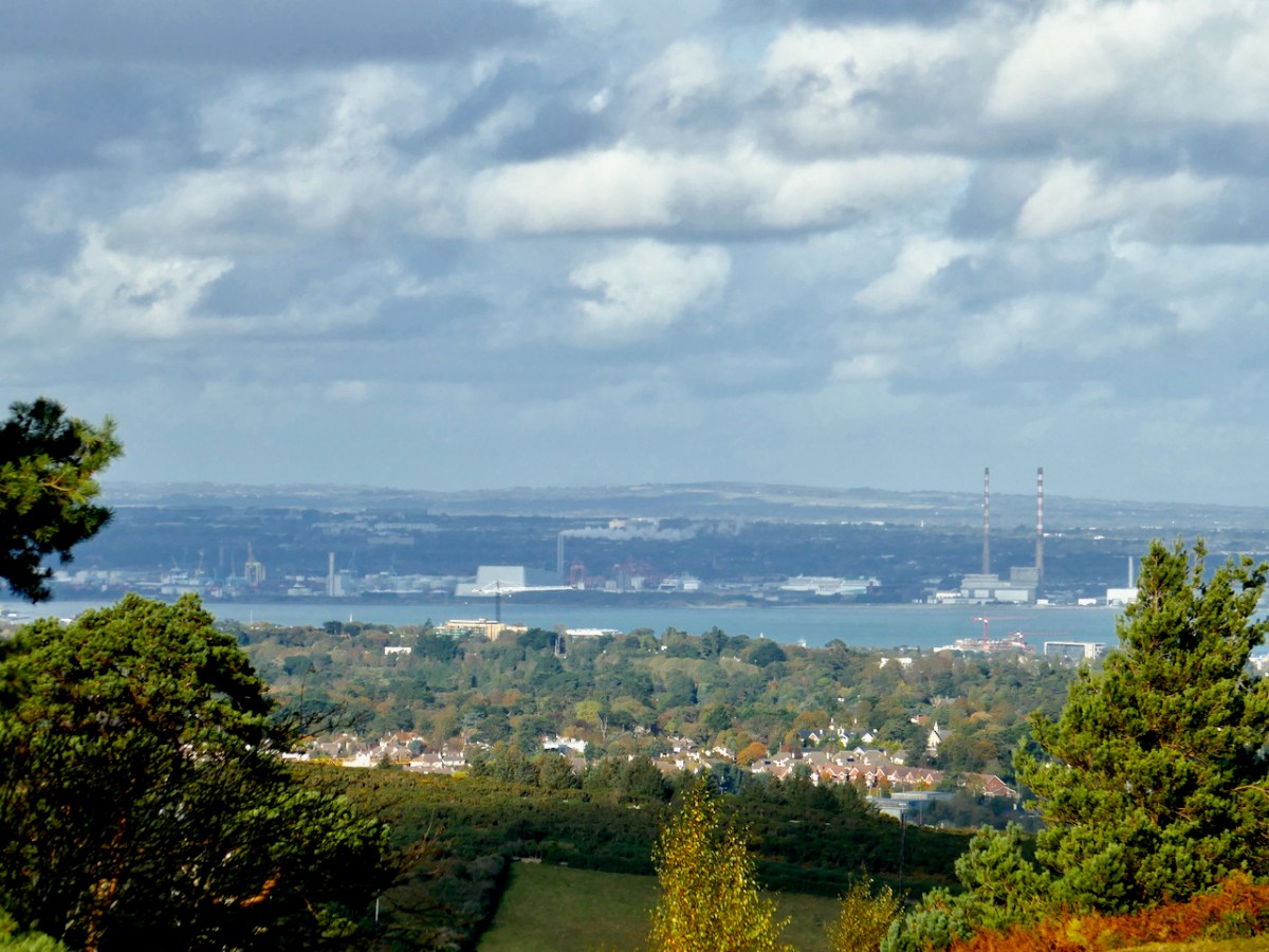
From the high ground in these two counties you find stunning views to the north out across Dublin Bay, with Howth in the distance. The twin striped chimneys on the right of this picture are protected historic structures: they date from 1971 and were built to serve the Poolbeg electricity generating station. At 270m they are amongst the tallest artificial structures in Ireland and are a visible feature on the skyline from many parts of the city. The power station closed in 2010.

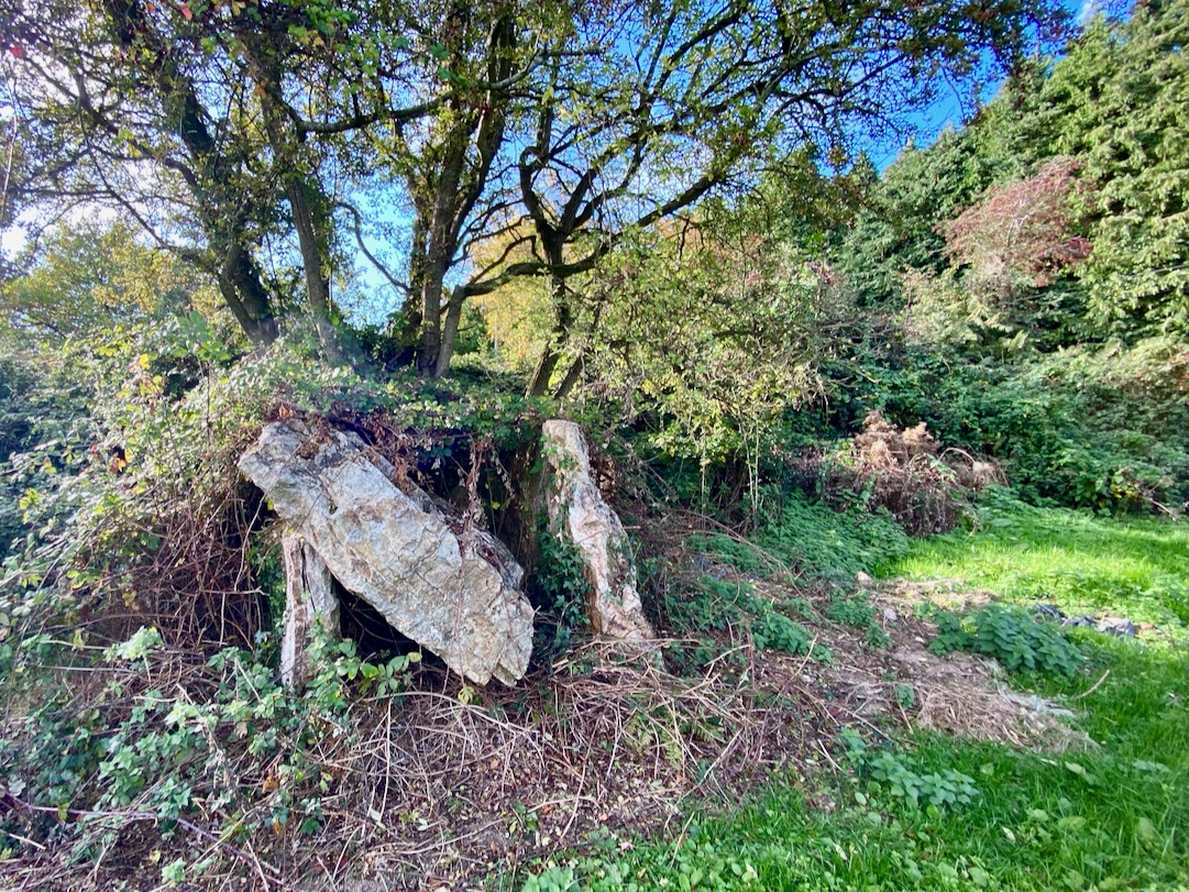
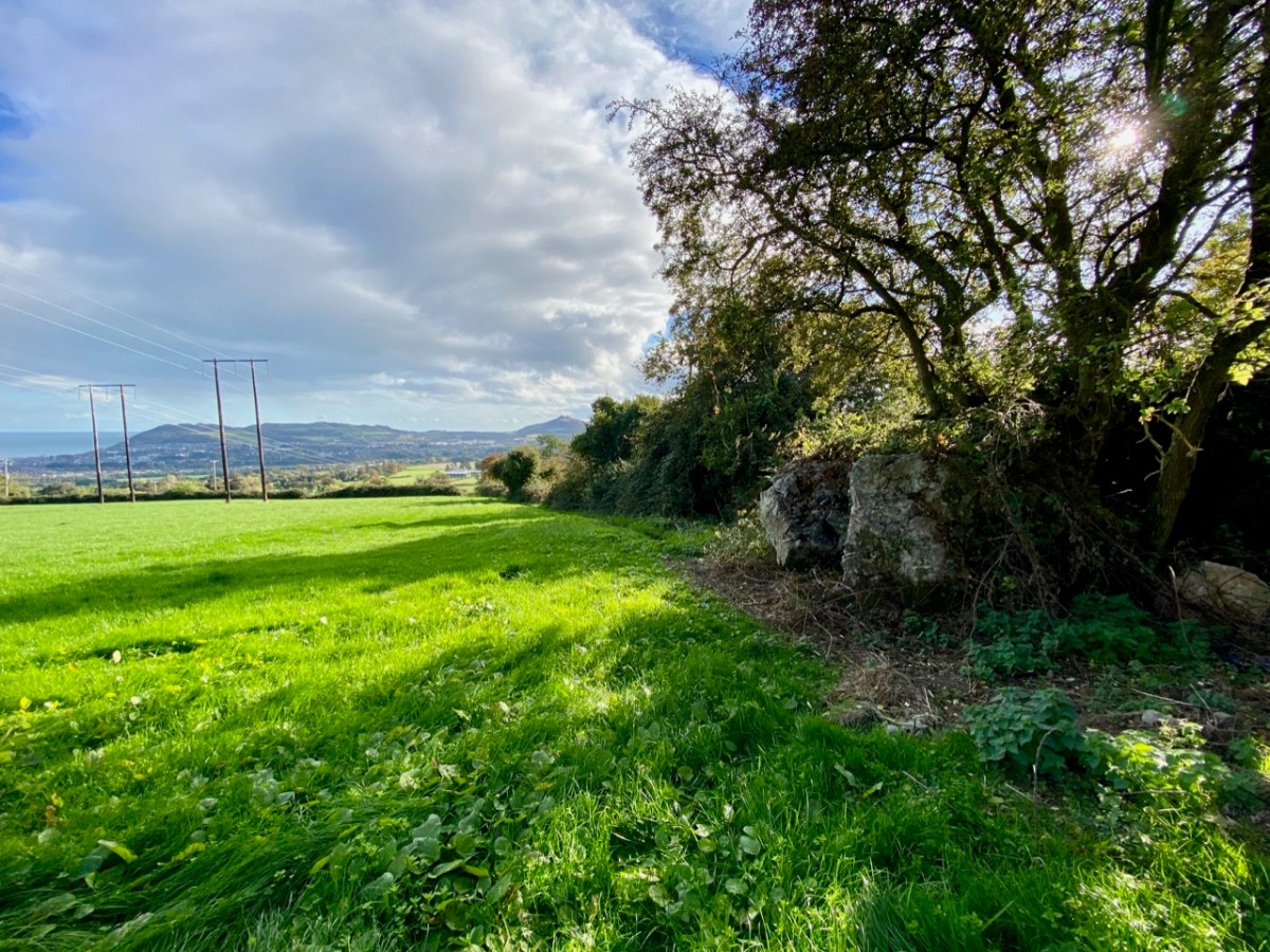
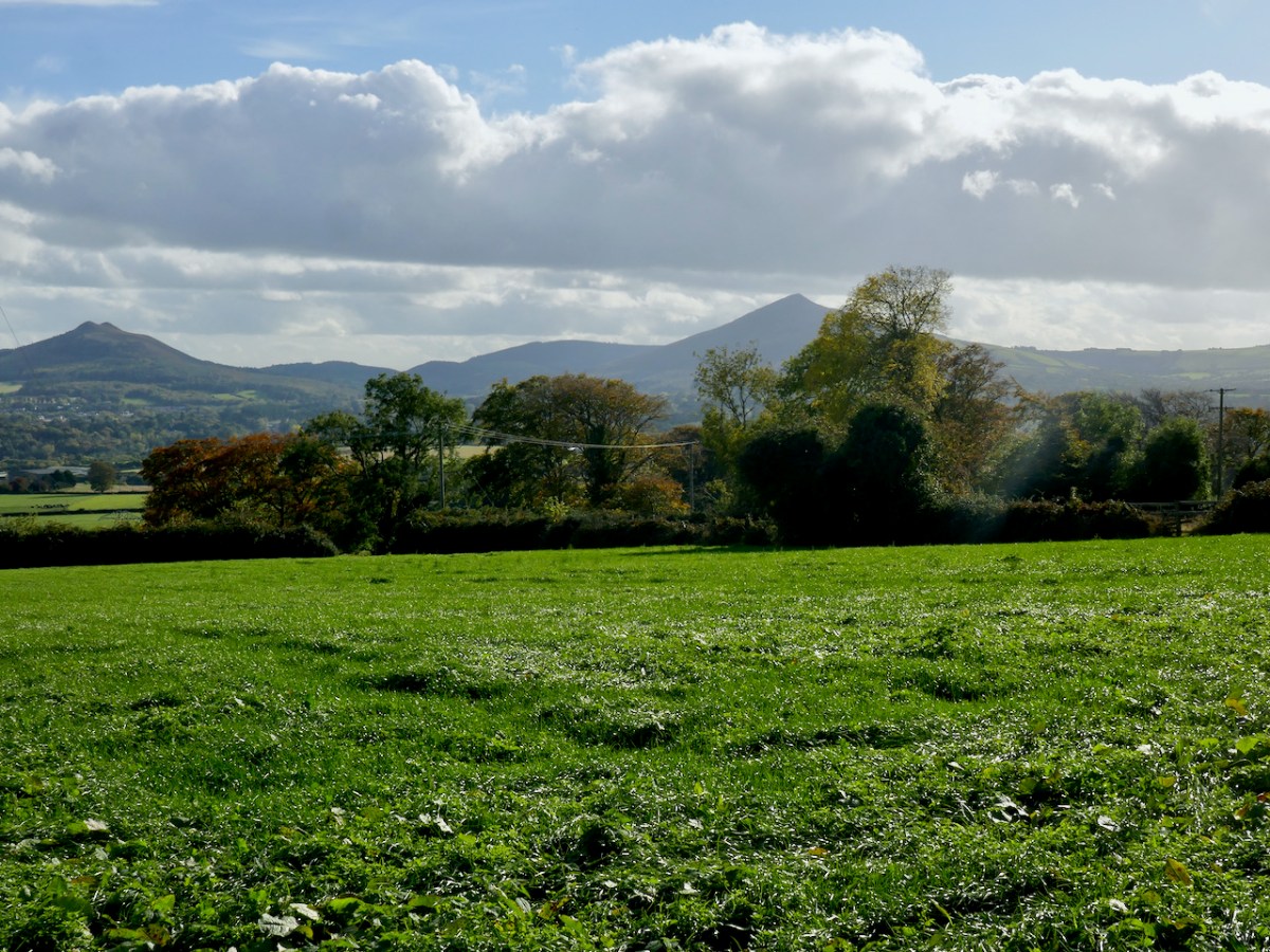
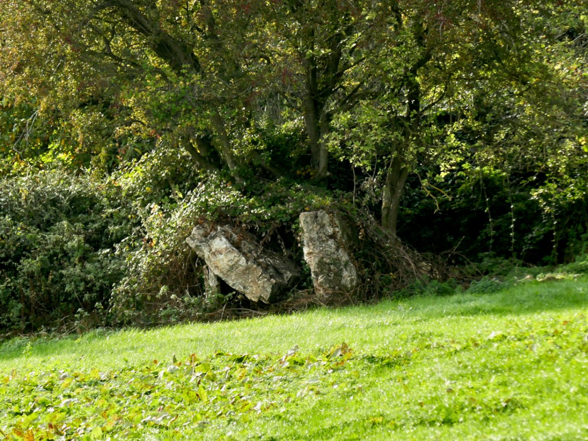
The first site we are visiting in this little tour is the wedge tomb in Shankill townland, County Dublin. It lies below Carrickgollogan hill, and commands distant views to the two distinctive Sugar Loaf peaks, which are situated in County wicklow. Or – let’s say – it should command those views, but it now reposes in a rather neglected state, engulfed by a modern hedge boundary, which you can see below.

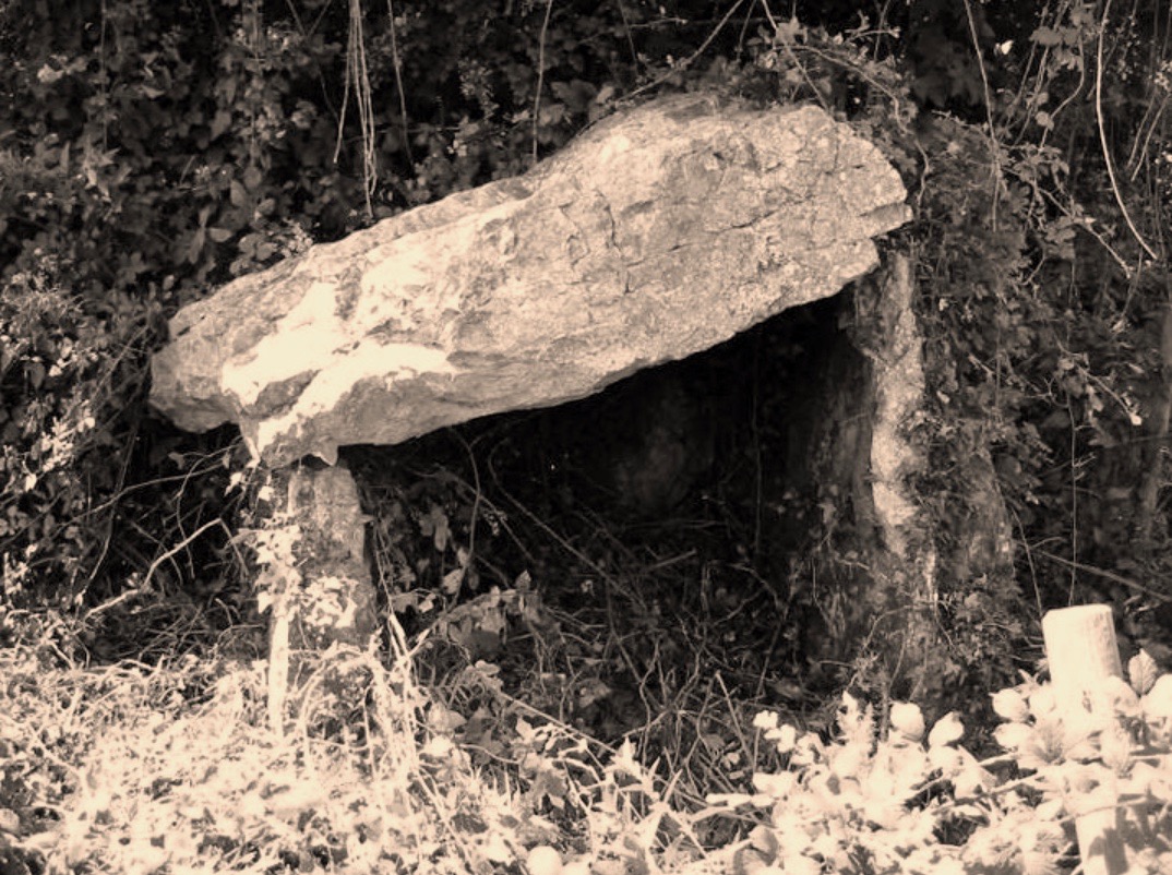
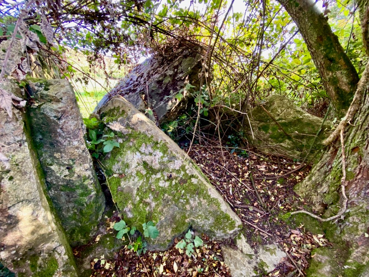
The picture above is taken a little to the west, to show the full skyline profile. The monument is not in good shape: the photo below (courtesy Ryaner via The Modern Antiquarian) shows the tomb in 2006, when the capstone remained intact on its supports. In less than two decades the capstone has fallen, as you can see from our photos taken a few days ago.

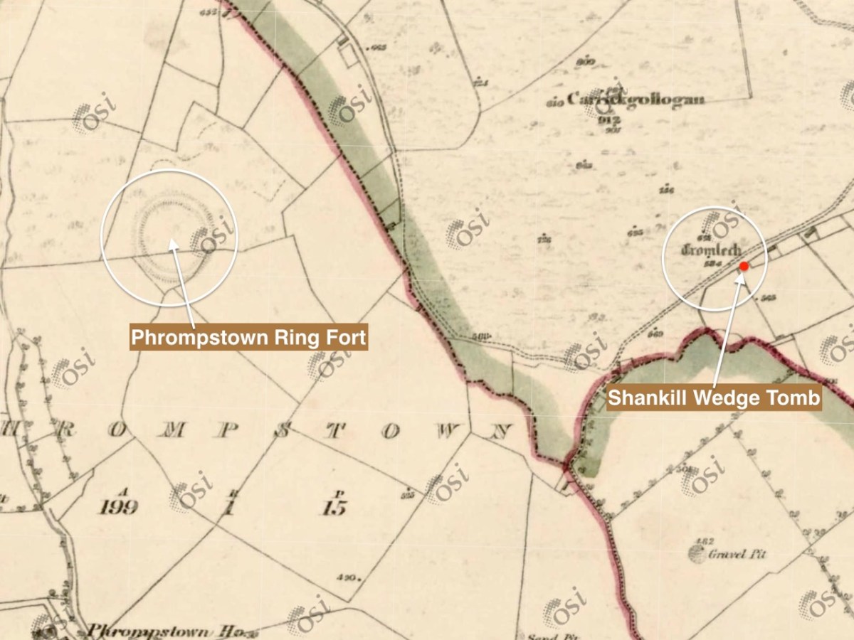
It is quite difficult to penetrate the undergrowth to see what remains of this structure, which probably dates from between 4,000 to 5,000 years ago. It seems a shame that such an ancient survival is not cared for in any significant way by our State. The tomb was recorded (as a ‘dolmen’) by the archaeologist William Borlas in 1897. Just over a century later, it has significantly deteriorated. The extract (below( from the first edition 6″ OS map gives it the title ‘Cromlech’ – and also shows nearby a substantial ring-fort: there is no trace of that remaining today.

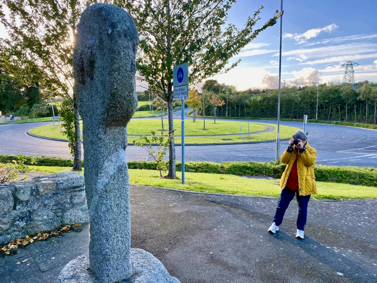
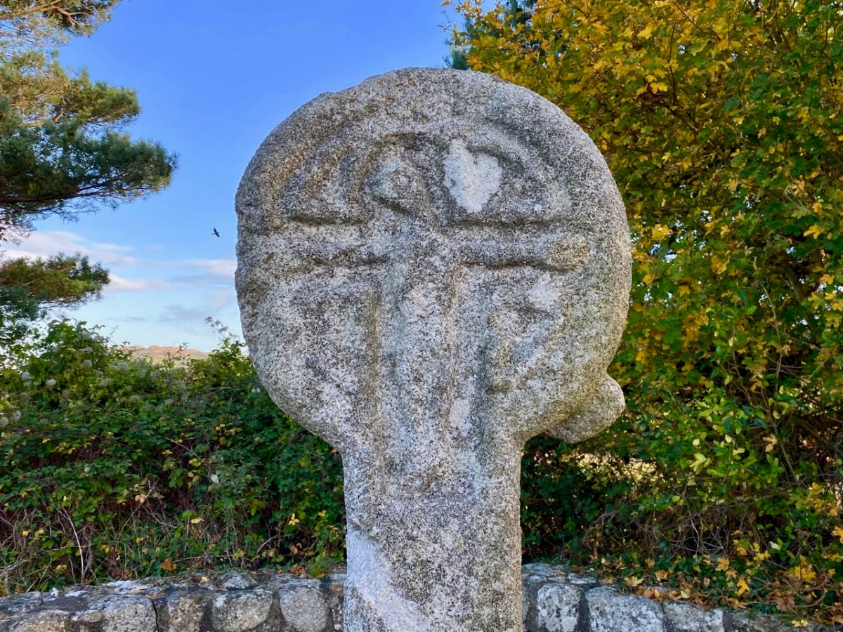
We leap forward about three thousand years for our next archaeological site, but we are only a short distance away as the crow flies – in Fassaroe, Co Wicklow, less than half a kilometre. This was a great discovery for me: a very fine carved cross, likely to date from the 12th century. Although it has been moved from its original site, it is cared for, and easily found right beside a strangely deserted modern traffic roundabout with little sign of habitation nearby.

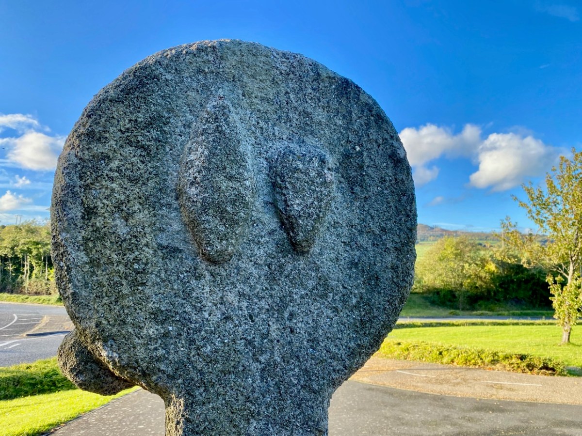
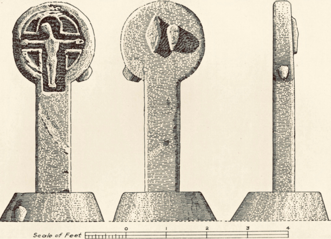
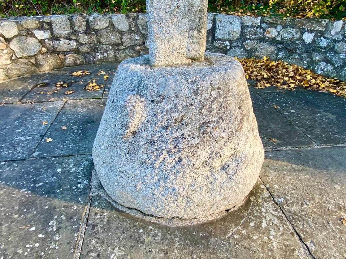
The granite cross face is carved with a crucifixion, but there are also ‘bosses’ on the back, sides and base stone. These are believed to be heads, well worn now but in good light some features can be seen: a pointed ‘ceremonial’ head-dress, and beards.

The clearest view of the carvings (above) is illustrated in The Journal of the Royal Society of Antiquaries of Ireland, Volume 88, 1958. An article by P Ó hÉailidhe discusses this cross and others nearby. The carving is popularly known as St Valery’s Cross as it purportedly came from the nearby demesne of that name. Some archaeologists theorize that it was originally brought to that estate from elsewhere.

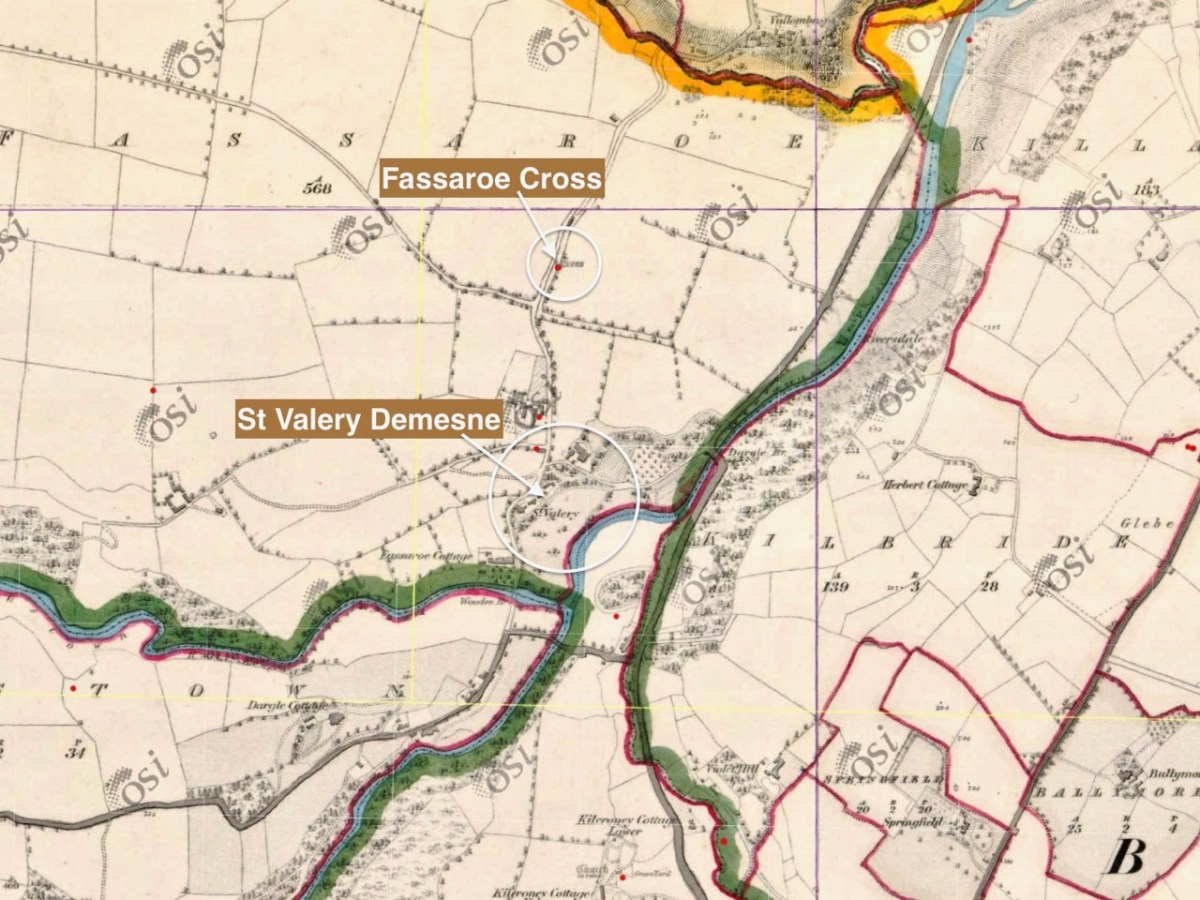
This extract from the first edition of the 6″ Ordnance Survey map (c1840) shows the location of the cross, not far from St Valery.

It’s about 7km from the Fassaroe Cross to the last stop on our journey. We have to head north on a road that takes us through The Scalp.

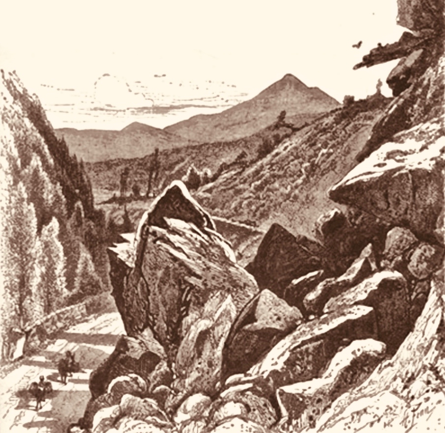
. . . Within an easy drive of Bray is a wild ravine known as the Scalp. The road runs over a shoulder of Shankhill Mountain and through this ravine; it presents a very wild appearance, enormous masses of granite being heaped up in grand and picturesque confusion on either side. It looks as if nature, in order to spare man the trouble of blasting a road, had by some mighty convulsion torn a rent through the mountain just wide enough for a high road . . .

Irish Pictures Drawn with Pen and Pencil, Richard Lovett, 1888

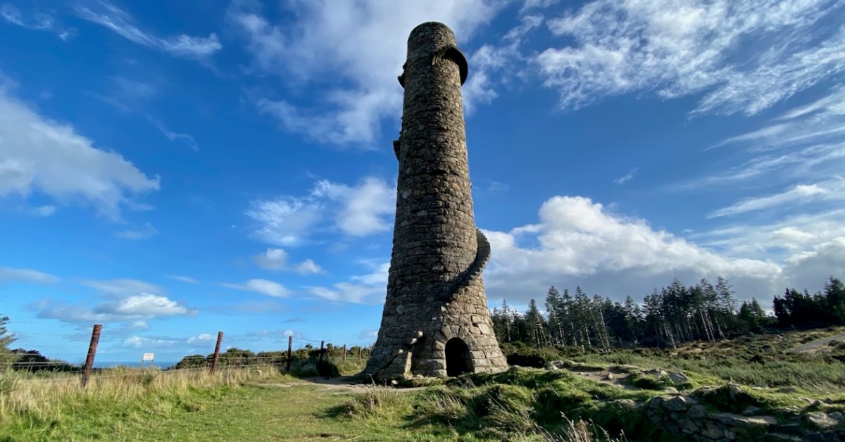
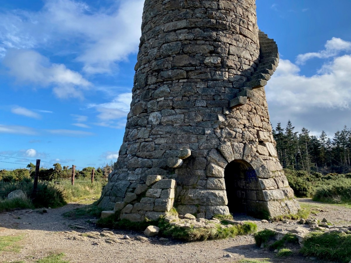
The view above accompanies Richard Lovett’s 1888 account. In spite of the topological interest of the Scalp road, our journey took us on and forward a few hundred years to our last stop – the lead workings on Carrickgollogan hill, Ballycorus townland. The hilltop mine chimney which forms our header picture is a well-known landmark in this part of the country.

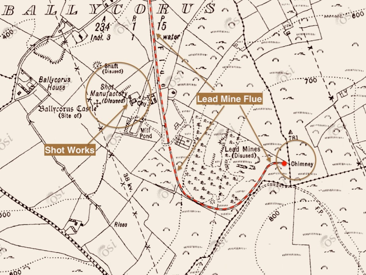
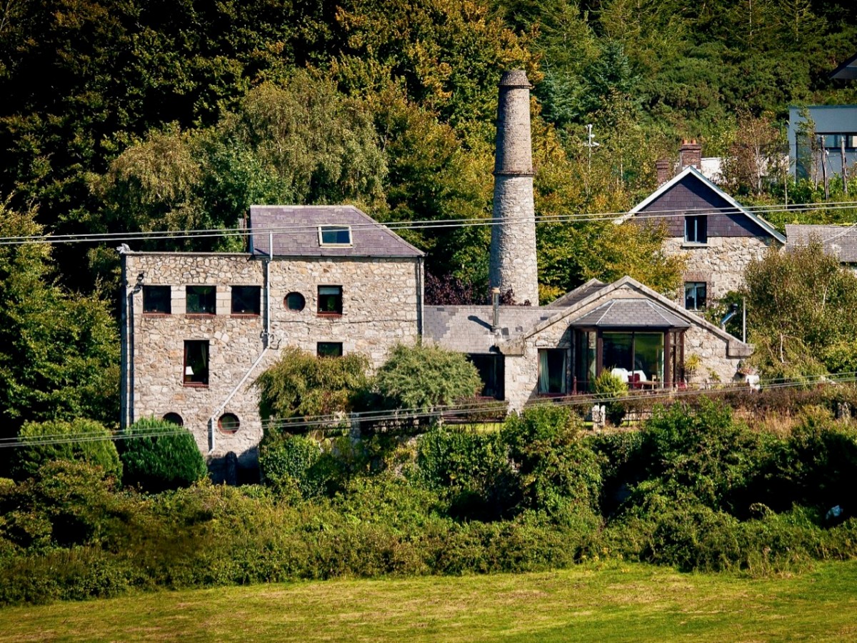
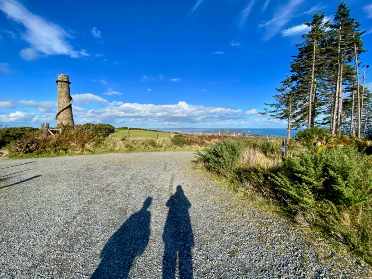
The mine was established in the early nineteenth century. Many of the lead works buildings remain today in the valley below the landmark chimney, mainly converted to modern dwellings: the photo above (courtesy Joe King via Wiki Commons) shows a distant view of the converted buildings and ‘shot tower’. The ‘Shot Works’ can be seen on the 25″ OS extract, above. This also show the location of the Lead Mine flue and chimney, which was the destination of our archaeological journey. That’s us (below) climbing the hill towards the chimney that’s on the 220m contour line, and offers views towards Dublin Bay.

Open-cast mining commenced in 1807. The Mining Company of Ireland took over the site in 1826 and began to carry out underground extraction. A 2 km long flue (shown in red on the map above) was laid out from the smelting facilities to the great chimney at the summit of the hill. You might think this was an acknowledgment of the poisonous fumes which lead working released, and an attempt to divert those fumes from the main site – but no!

. . . A process had been discovered in the 1770s whereby additional quantities of lead could be extracted from the fumes emitted by reverberatory furnaces if the vapours could be trapped long enough to precipitate the lead. To this end a flue 2 kilometres long running from the lead works and terminating at a chimney near the summit of Carrickgollogan was constructed in 1836. The precipitated lead deposits were scraped out of the flue by hand and many of the workers subsequently died of lead poisoning, giving the surrounding area the nickname “Death Valley”. . .

Wikipedia

The lead mine chimney remains – although a brick upper section was removed in the twentieth century for safety reasons (see lower picture) – and so does much of the enclosed flue. A public trail follows its course to the top of the hill. The remaining chimney is a fine granite structure, in reasonably good condition. It’s certainly much visited: Finola – who grew up in Bray – has fond memories of cycling out there with her two brothers, and finding ways to climb part way up the spiral staircase which accessed a viewing platform, in spite of key parts of the stair structure being missing!

All three examples of archaeology we have studied today have one thing in common: they are constructed of local granite. Thousands of years separate the oldest and the most recent, but the inherent strength of the material has ensured survival, at least in part. As with West Cork and all other parts of Ireland, the temporal history is rich, and much of it is largely intact. We have so much more to explore!

Portobello

We have been spending a little time over on the east side of the country, not too far from Dublin. We like exploring, and the built-up areas have much to offer in terms of history so I’m returning – for a brief moment – to one of my favourite subjects: the canals of Ireland. You may remember my forays back in 2016 to seek out the journeys taken by L T C Rolt seventy years before that, and recorded in his classic book Green & Silver. You can find all those posts here. Earlier this year I added a further post to the series, examining in greater detail the meeting of the waters of Grand and Royal Canals, within Dublin. Today I’m simply concentrating mainly on one place, to the south of the city: Portobello.

This wonderfully drawn map (the two extracts above) dates from 1797, and was complied by William Faden (1749-1836) and Samuel John Neele (1758-1824): it was published in London and Dublin. You can see from it that the Grand Canal at that time virtually created the southern boundary of the city, with the canal basin at Portobello being a significant location to serve the growing conurbation south of the River Liffey.

This extract from the 6″ first edition of the Ordnance Survey shows Portobello Harbour with its significant warehouses, the ‘City Basin’ and a lock and bridge – known as La Touche Bridge. We have encountered the La Touche family in an earlier post – Glen of the Downs – and learned there that the family had built a big house – ‘Bellevue’ – on their estates near Greystones and Delgany.

The bridge (photo courtesy of excellentstreetimages.com) was named after William Digges La Touche (1747–1803), a director of the Grand Canal Company. The waterway was, of course, an important business venture in its heyday, contributing to the prosperity of the city merchants. Prior to its construction the area was farmland, and the name Portobello is said (curiously) to have come from the Irish Cuan Aoibhinn, meaning ‘beautiful harbour’. Note the ‘City Basin’ marked on the OS map: this was used from 1812 to provide a drinking water reservoir for the south side of the city. In the 1860s the water was found to contain a high concentration of sulphuric acid, and this source was eventually superseded by the new reservoir at Dartry, in Co Wicklow.

This is a fine early print of the Harbour, showing the Grand Canal Hotel designed by James Colbourne and opened in 1797. In the foreground is a passenger or ‘packet’ boat. We might forget how important the transport of people was in the early days of canal transport, before the advent of railways (see Trollope’s account in my post here): roads were often in a poor state and the boats provided a smooth – if not exactly speedy – way of getting about.

…the company’s hotels were simply the posting houses of this water-road …There was considerable interchange of passenger as well as goods traffic at Shannon Harbour. Travellers changed here from the Dublin passage boats into Bianconi’s ‘long cars’ which operated between Birr, Shannon Harbour and Athlone in connection with the boats. Alternatively they might board the paddle steamers The Lady Lansdowne or The Lady Burgoyne which plied between Killaloe pier head and Athlone, calling at a jetty on the river near the mouth of the canal. Smaller craft sailed from Killaloe pier head to the transatlantic port of Limerick, and so the Grand Canal became a link in the route between Dublin and America…

L T C ROLT, Green & Silver, 1949

The hotel at Portobello was one of five constructed along the length of the Grand Canal: all were fine buildings – probably state-of-the-art in terms of accommodation for travellers by water. You will find a post which I wrote about them here. On the header picture is a view of a packet boat at Harcourt Lock, and you can see a stage-coach there waiting to transfer passengers. The Portobello hotel closed in 1835 but the building has survived to the present day through many incarnations.

This is a great photo if you are a transport history enthusiast! It must date from the 1940s, as the Dublin tram system declined at that time, the last one in the city being phased out on 9 July 1949. The bridge and former canal hotel are clearly seen.

Portobello House – the canal hotel in the 1960s. Some fine classic cars in this picture! At this time it was a nursing home: one of its elderly residents was Jack B Yeats, the celebrated Irish painter who currently has a major exhibition in the National Gallery.

The former canal hotel was completely refurbished in 1972 (the photograph above dates from that year) and survives today – in good order – as a private educational establishment. Here it is again (below), as you’ve never seen it before – through the eagle-eye of Google Earth!

I can’t resist finishing with this plate from from The Graphic, a British weekly newspaper set up to rival the popular Illustrated London News. Published on May 13, 1882, this shows “. . . the lighting of tar-barrels in Portobello Harbour, on the Grand Canal in Dublin, to celebrate the release from prison of Charles Stewart Parnell and two colleagues . . .”