Labbacallee

rookery

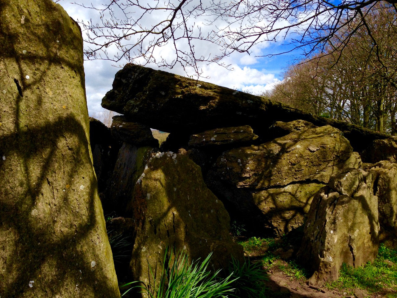
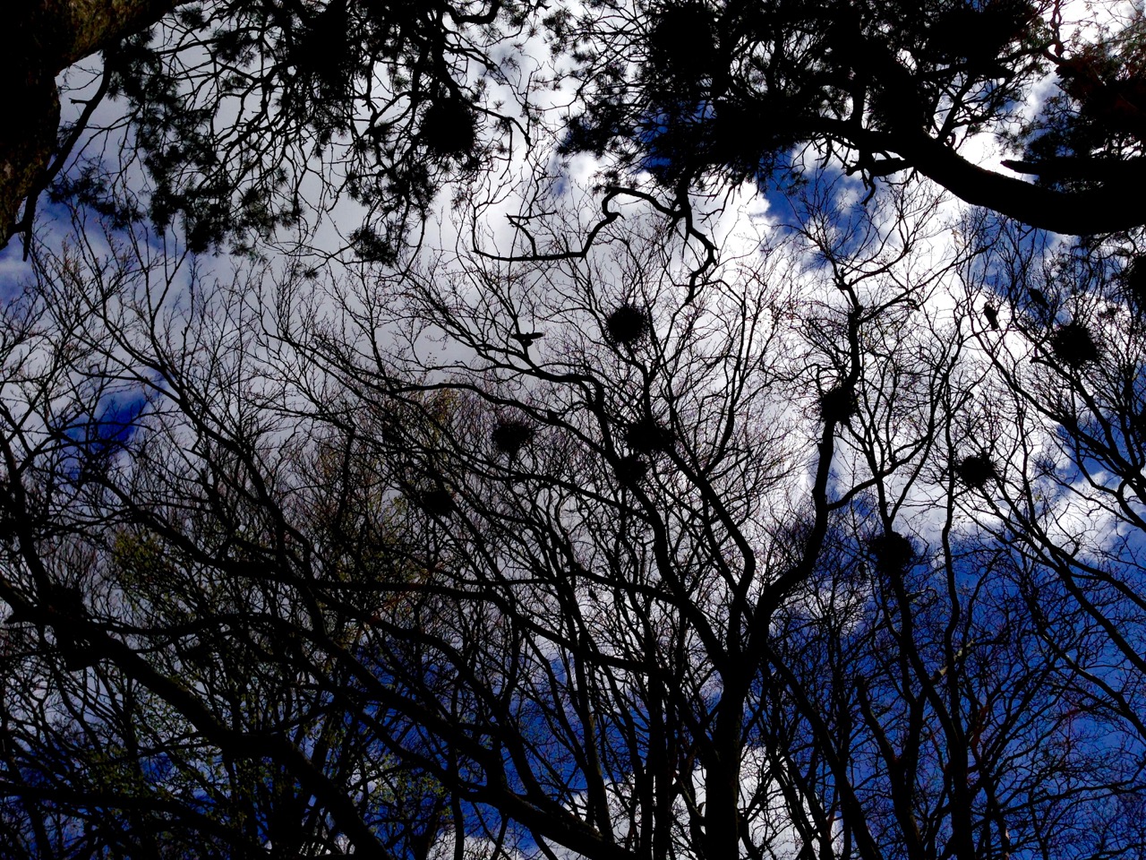
My strongest memory of our visit to Labacallee wedge tomb, Co Cork, earlier this summer was the rookery above it. Our presence seemed to make this multitude of large black birds restless: there was a constant movement over our heads – a mixing up of flapping feathers, wind in the still bare branches and screeching protests. These are the unpaid guardians of this monument, apparently the largest of its kind in Ireland, with a long documented history and a wealth of folklore.

labbacallee view

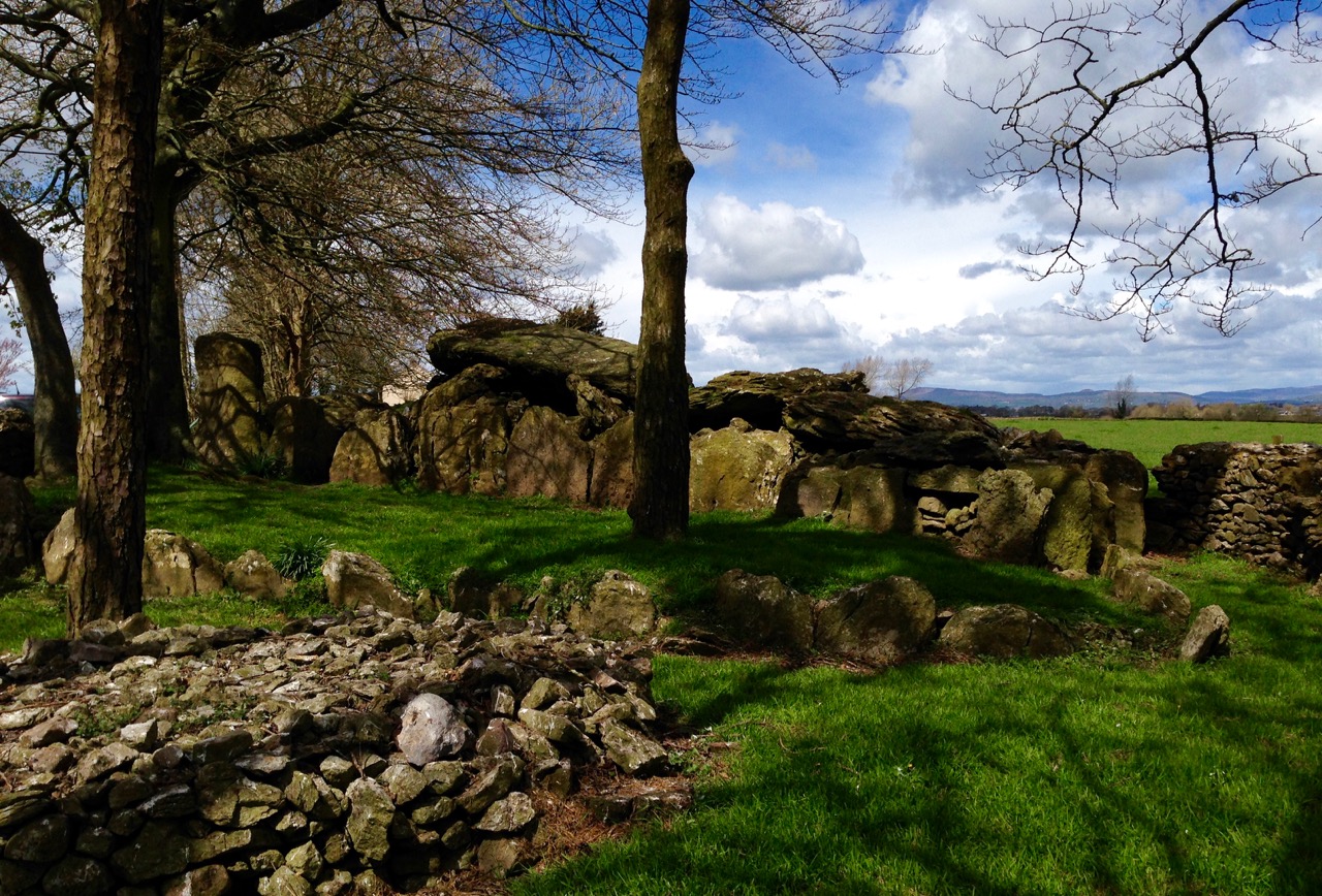
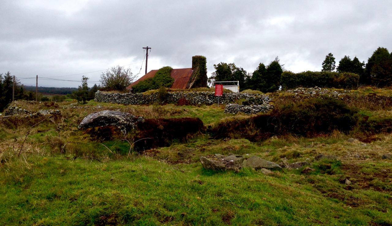
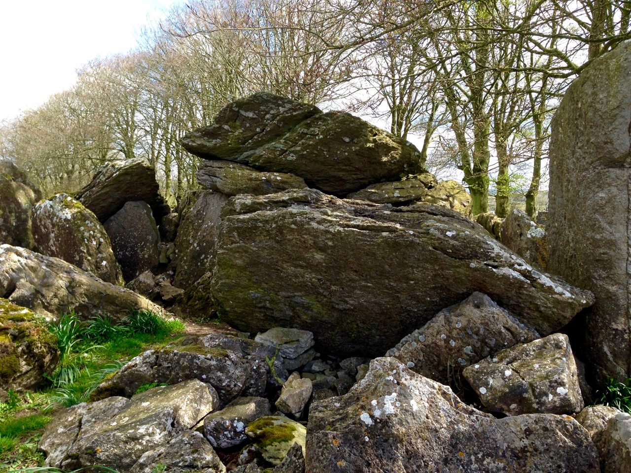
Labacallee today: it must once have been an impressive and dominant feature on an open landscape. Now it has been closed in by fields, trees and a byroad running north out of Fermoy. In the foreground is a cairn, possibly made in relatively modern times from material excavated from the monument

Finola has written about wedge tombs. She calls them The Last of the Megaliths: court-tombs, portal-tombs and passage-tombs are slightly earlier constructions, built before c2000 BC, while wedge tombs date from some 500 years after this. According to the Archaeological Inventory of County Cork Volume 1 (Stationery Office Dublin 1992) …The more numerous and widespread wedge-tombs are relatively small and simple constructions, so called because of an increase in height and width from the chamber rear to the entrance front. They generally face in a south-westerly direction, an orientation they share with stone circles and stone rows…

labbacalle back end

The east facing – and narrower – end of the wedge tomb

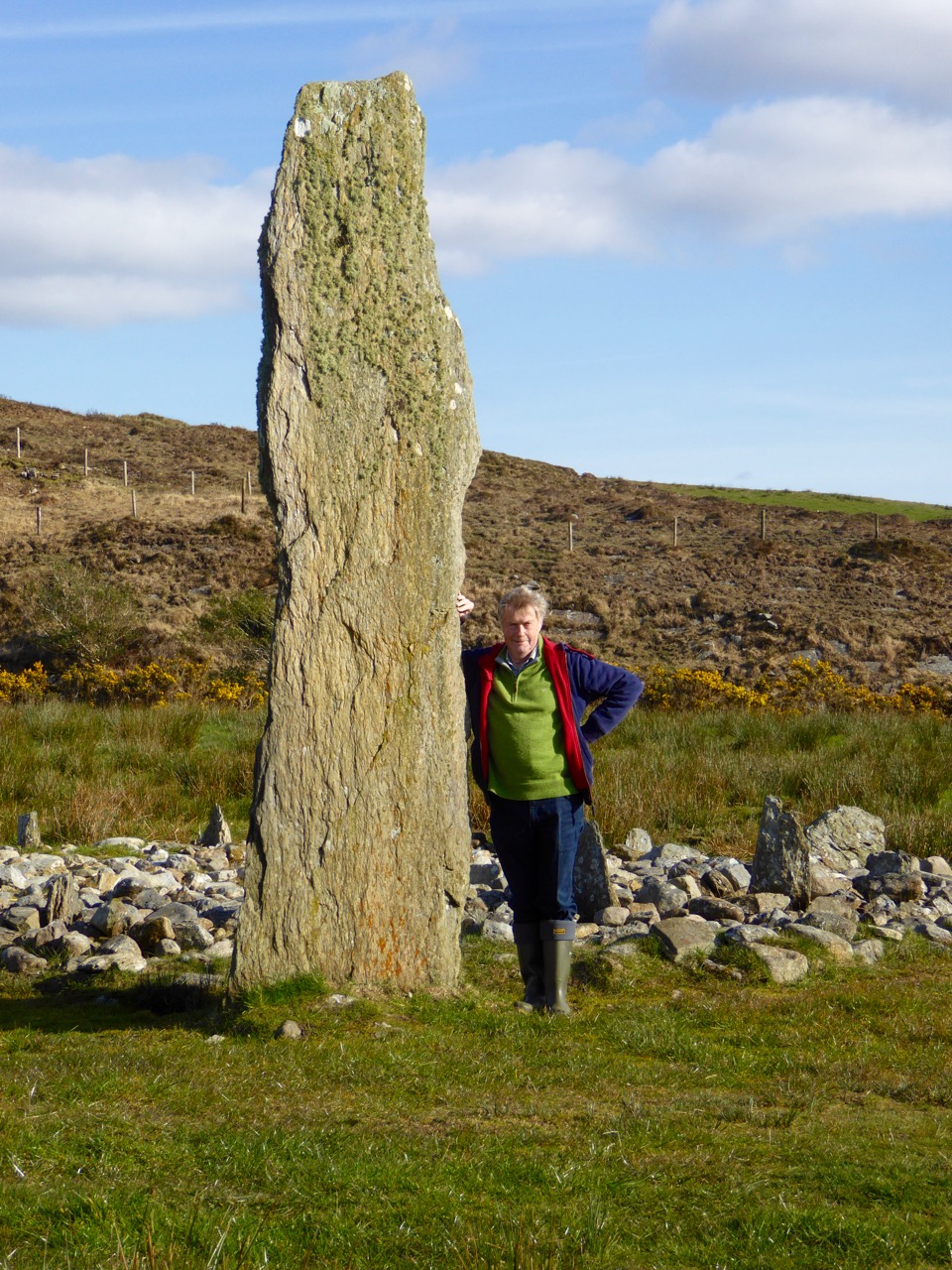
Labacallee is enormous, especially if you are only familiar with examples such as Altar, west of Goleen (itself sizeable) or our own more domesticated version at Kilbronogue, a neighbouring townland:

kilbronogue-wedge-tomb

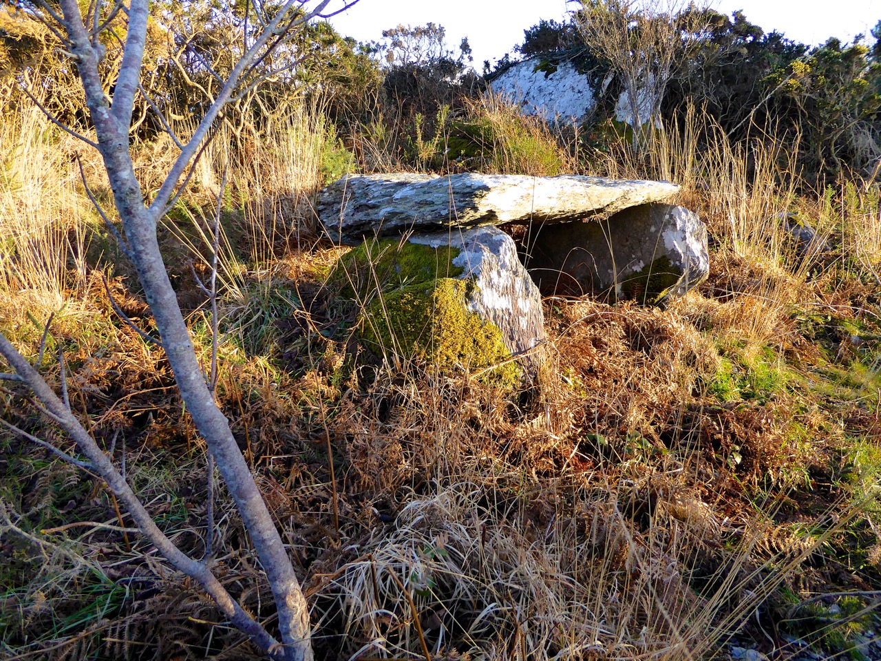
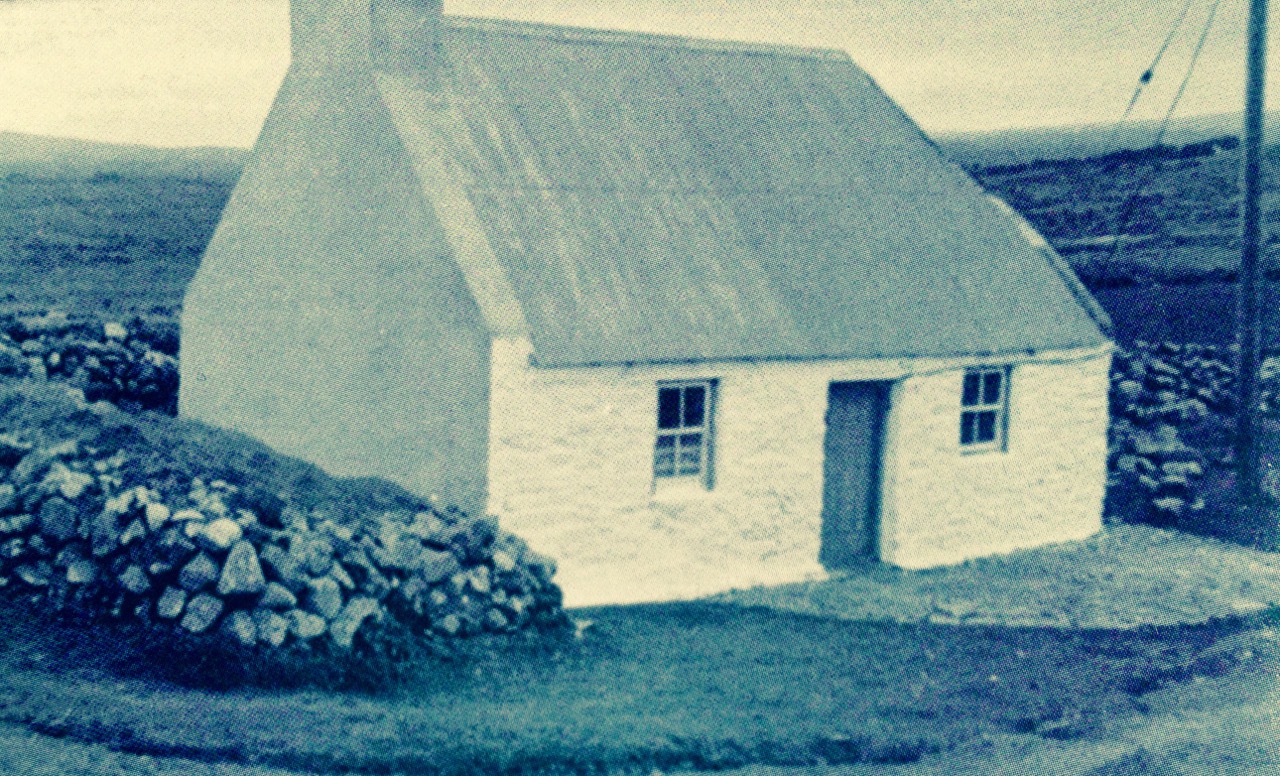
A more ‘human scale’ wedge tomb at Kilbronogue, West Cork: many thanks to Stephen Lynch, a near neighbour, for looking after this example and allowing us access

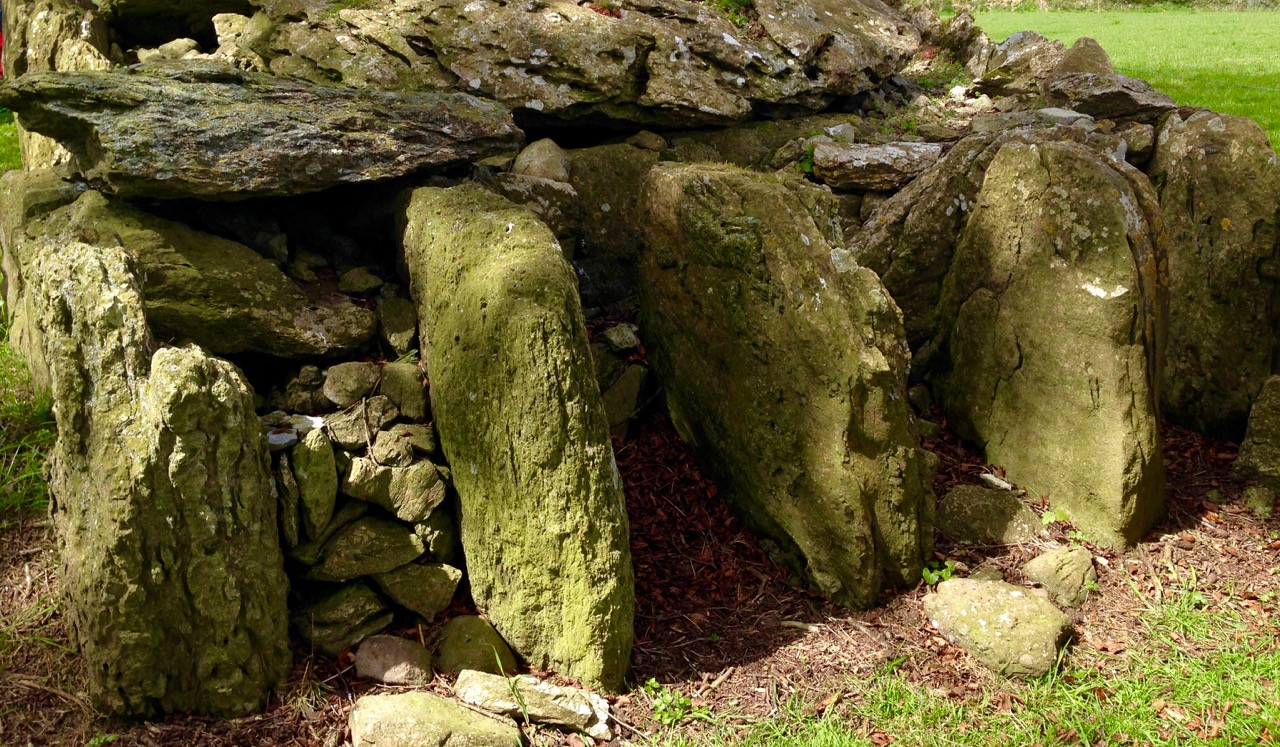
Labbacallee – the name seems to be from the Irish Leaba Caillighe – ‘the bed of the witch’ – measures some 14 metres by 8 metres overall. It has a series of upright stone ‘walls’ supporting three capstones. The largest of these measures 5 metres by 2.5 metres and is a metre in thickness: it must weigh at least 10 tons. These stones house three ‘chamber’ enclosures.

tomb plan

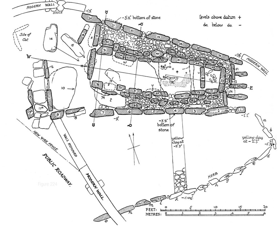
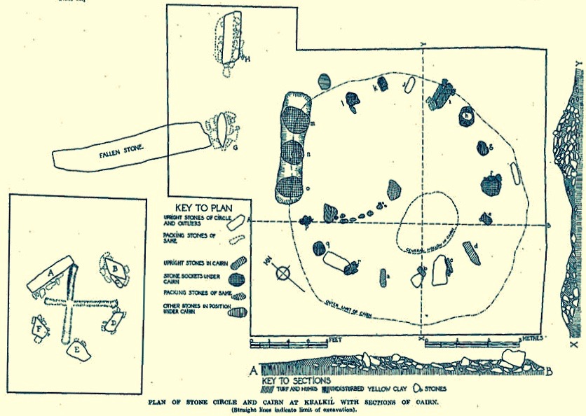
Plan of Labbacallee wedge tomb drawn following the excavation by H G Leask and Liam Price in 1934, from Proceedings of the Royal Irish Academy Volume 43

The tomb has been recognised as an important site in British and Irish archaeology over a long period. English antiquary John Aubrey, who lived from 1626 to 1697 (and who was incidentally described as “Shiftless, roving and magotie-headed…”) is recognised as one of the first serious recorders of historic sites. He was also a keen collector of folklore and, like me, felt that the stories that local people told about the monuments around them were valuable insights into perceived history.

John Aubrey and a drawing of Labbacalle  he published in 1693. While you can see in the drawing the principle of a chamber constructed of upright stones and roofed with large slabs, there is very little resemblance in the drawing to the structure itself (which was anyway in a ruinous state in Aubrey’s lifetime). It has been suggested that Aubrey obtained the sketch – or a verbal description of the tomb – from a Mr Gethyng who lived close by it
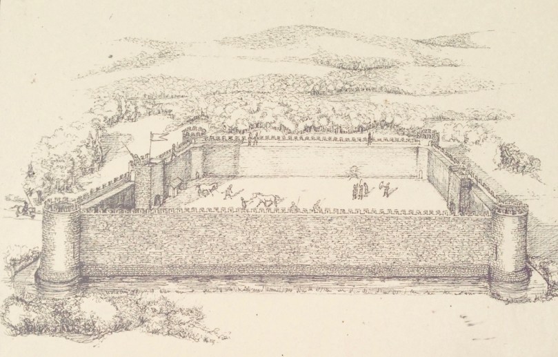
A drawing from the1897 work The Dolmens of Ireland, their Distribution, Structural Characteristics, and Affinities in Other Countries; together with the folk-lore attaching to them and traditions of the Irish people by William Copeland Borlase 1848 -1899. This Cornish antiquary and politician spent part of his life in Ireland so it is likely that he did visit the tomb. Certainly the drawing is more true to life than Aubrey’s. After what has been described as ‘high living’ Borlase died in disgrace, having been involved in scandal and bankruptcy
Artistic interpretations of a subject: views of Labbacallee dating from 1827 (top), 1844 (below left) and 1845 (below right by George Wilkinson)

The first full scientific examination and excavation of the tomb was carried out in 1934 under the supervision of H G Leask, using workers paid one guinea per week as part of a government unemployment relief plan. According to the excavation report, at this time the smallest chamber was filled to the top with rubble, including earth, stones, ash and the bones of animals and humans. When these were cleared a skeleton of a woman was exposed, together with a bone pin which might have fastened a garment or shroud. The woman’s skull was missing but later found upright (as though on display?) in the large main chamber. One of the leg bones of the skeleton was deformed: this led to the speculation that her handicap may have set her apart in life, giving her a status that was either feared or revered: she might have been ‘marked out as a witch’.

labercalle excavators

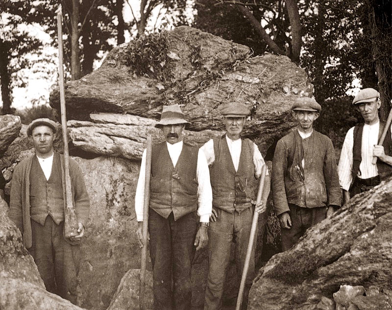
Leask’s excavation team in 1934 (top) and (left) his drawing of the headless skeleton as found; (right) the separated skull of the ‘witch’

I am fascinated that ‘folk’ or oral traditions survive through generations, centuries and even millennia. In the case of Labbacallee, we know that the name existed back in Aubrey’s time – over three hundred years ago – and was undoubtedly well established by then. Could it be that the name – ‘bed of the witch (or hag)’ – was the persisting memory of the interment of an important person, perhaps a priestess or shaman, from very ancient times?

hag's bed

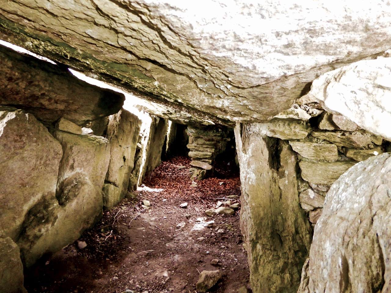
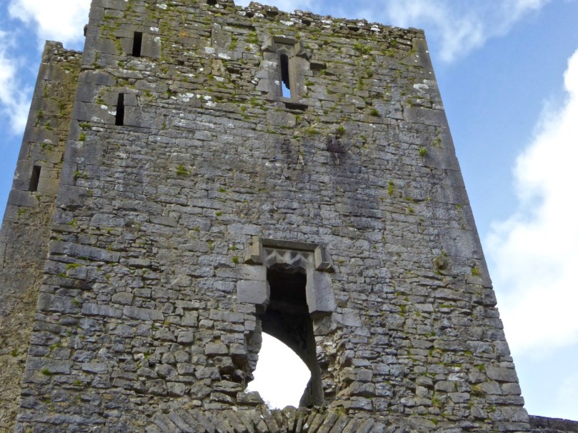
The Hag’s Bed – the main chamber in the monument, where the skull was found

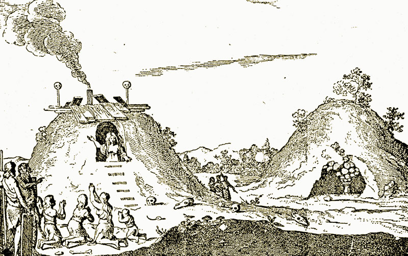
While the excavators were exploring Labbacallee they found evidence to suggest that the tomb (or part of it) had been an occupied dwelling at some point during its history. The notion that some historic and prehistoric monuments were (or are still) the dwelling places of the Old Ones, or The Other Crowd – supernatural beings possibly descended from ancient invaders of Ireland – or had in fact been used in some way by practitioners of magic – is not unknown. Borlase’s 1897 work on The Dolmens of Ireland… included this illustration (albeit from the Netherlands) of ‘A ‘White Woman’ (wise woman or witch?) prophesying from a dolmen-mound’. It’s not a big leap to the idea of a witch being buried in a wedge tomb.

whiteWoman borlase

Legends specific to a ‘hag’ of Labbacallee suggest that she was married to a druid, Mogh Ruith, who ‘had an eye’ for the hag’s sister. In a fit of jealously the hag chased the druid towards the River Funchion. He reached the water and started to cross it: the hag threw an enormous boulder which struck the druid, toppling him and pinning him down under the water. As far as we know, he’s there to this day!

labbacallee stones

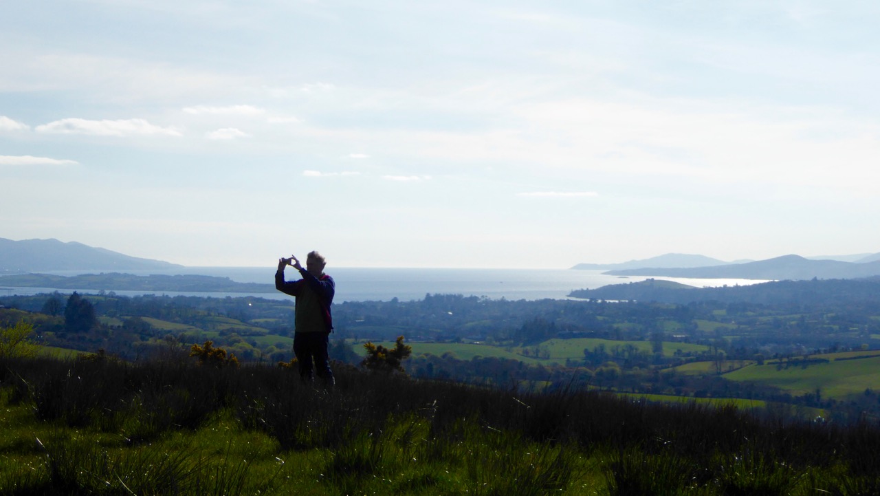
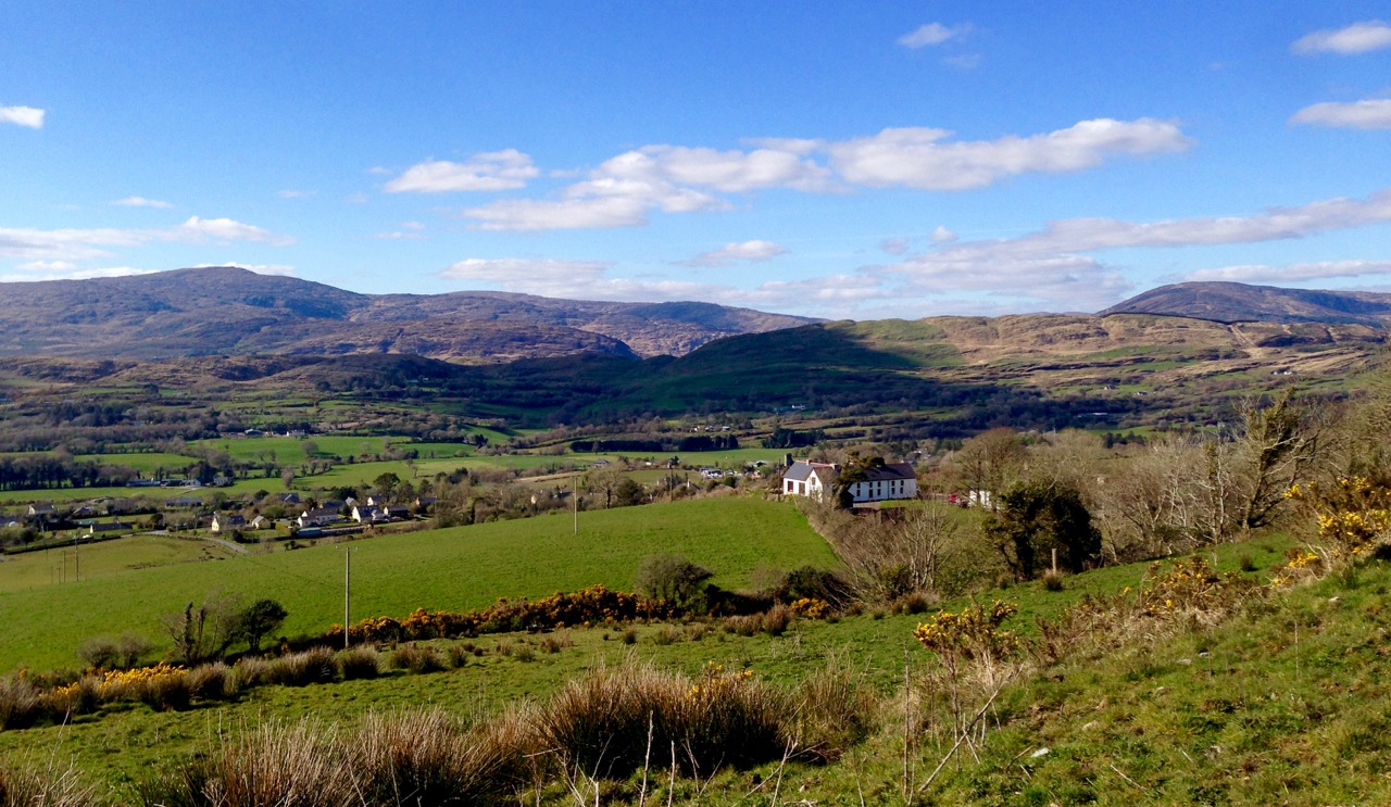
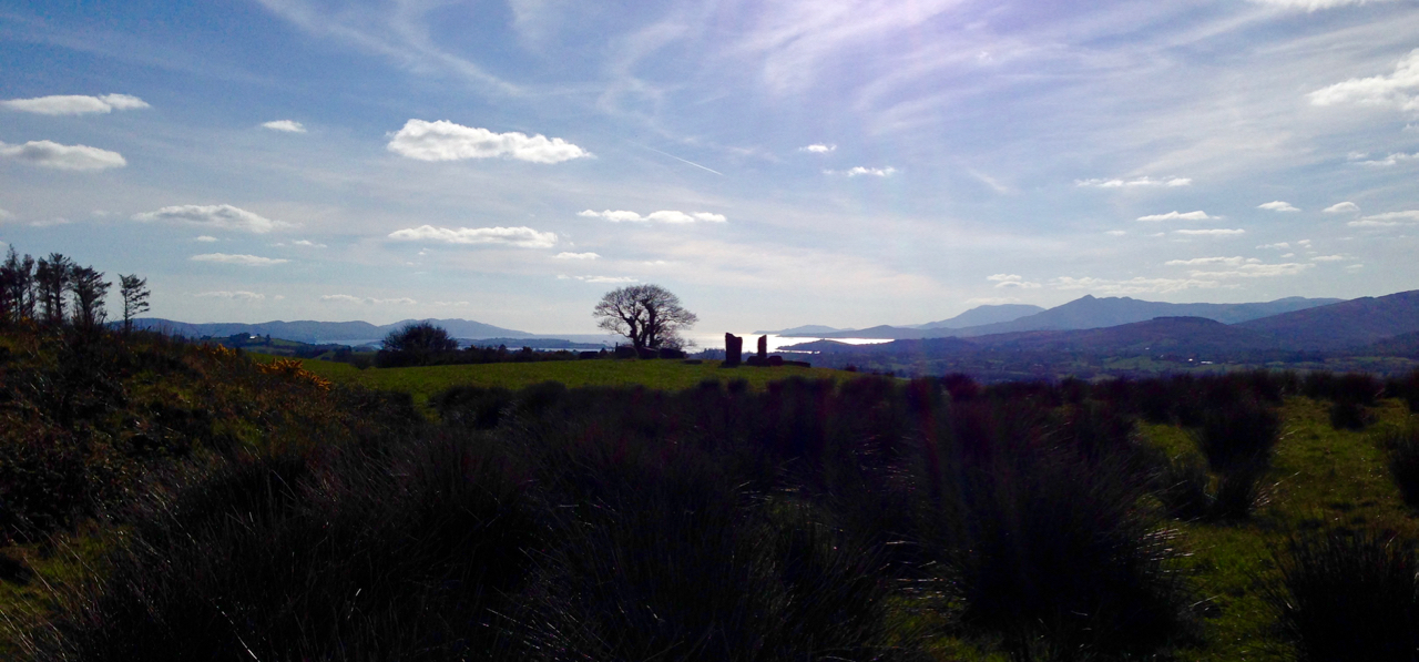
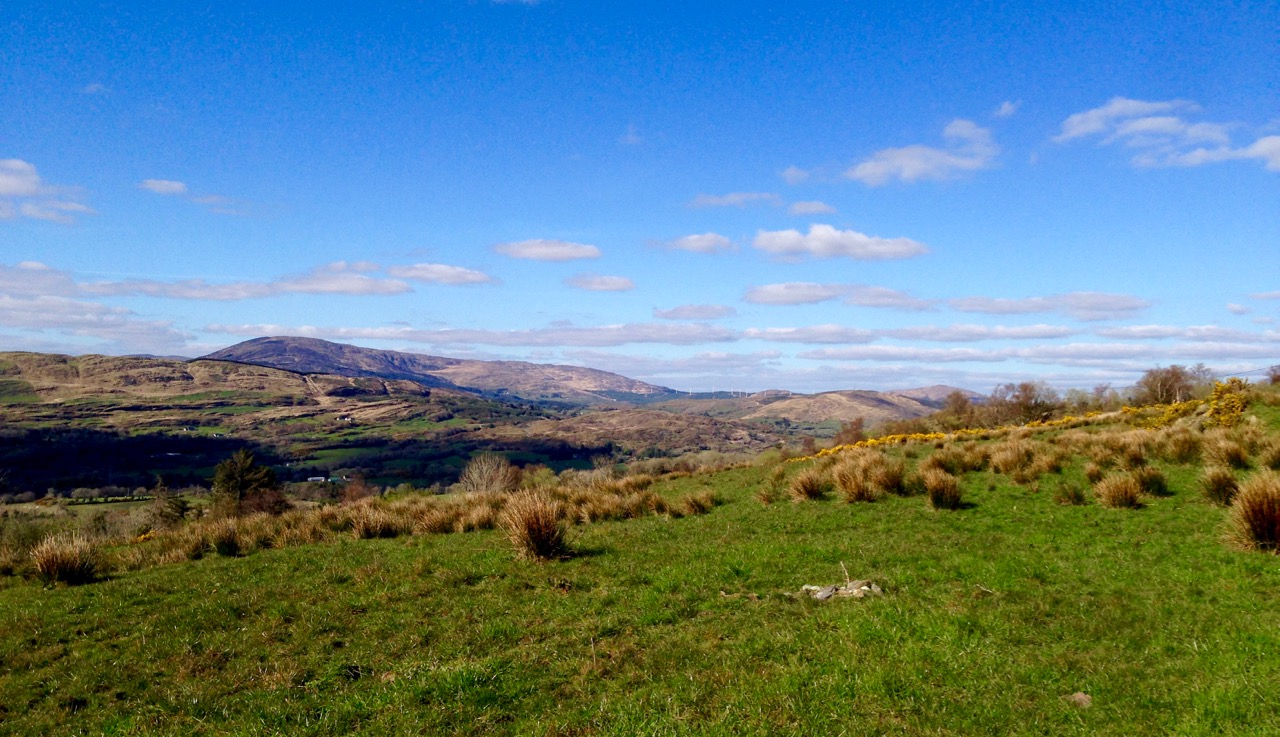
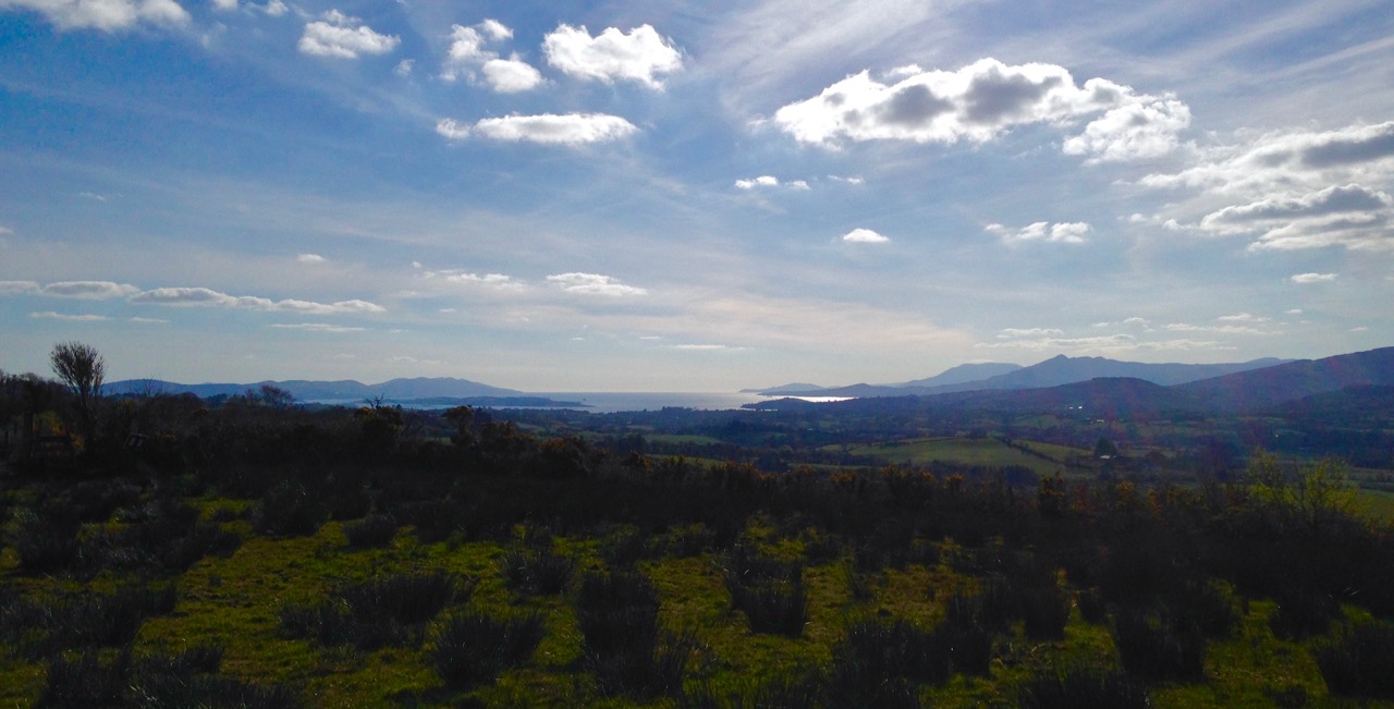
Stories in stone: Labbacallee landscape

Another story specific to Labbacallee also involves a drowning – and a warning! This version is from theirishplace.com:

…Whatever the provenance and history of the remains found in the Labbacallee Wedge Tomb, there is no doubt that it is a site around which legends abound. One of the most pervasive legends tells that one day, very long ago, four local men went to the tomb in the middle of the night, with the aim of digging for the treasure that they had heard was buried there. As they started to dig, it is said that an enchanted cat appeared, fire bursting from its tail, terrifying the men, who were dazzled by the light emitting from it. Panicking, they ran screaming from the scene, and in the ensuing panic one fell into the nearby river (Funchion) and drowned. The remaining men lived to tell the tale, and their experience stood as a stark warning to others that they should never, under any circumstances, disturb the resting place of the long dead at this most mysterious of megalithic sites…

labbacallee shadows


The Big Sing

Caz addresses

Doesn’t a Big Sing sound like the greatest thing ever?

And that’s what it is – a group singing experience that will leave you feeling lifted, restored, and – well, just plain happy. The Big Sing is the brainchild of Caz Jeffreys, the director of the choir I belong to, AcapellaBella. Caz is amazing – she has perfect pitch, she teaches us our parts without any requirement to read music (or even be a good singer), she can give us our notes on the fly if we’re wobbling, she plays several instruments and has great rhythm.

Sopranos

She also has a philosophy about singing and community – one that emphasises inclusivity and the joy of participating in a choir. As they say in West Cork – ah sure, you know yourself, like, you can’t come away in a bad mood from an evening’s singing. Caz directs several choirs around West Cork and last year she got the idea to bring them together for a community event she called The Big Sing. It took place in Bantry as part of the Feel Good Festival. You’ll get a good idea of how that went and see an interview with Caz by watching this videoThis one, the second Big Sing, was yesterday in Clonakilty – indoors because it was too wet for the scheduled town square – and it helped to wrap up Wellness Week.

Everybody’s getting in the spirit of the Big Sing

We started with a choreographed dance from West Cork Inclusive Dance. I’ve mentioned this group before, when I wrote about the moving and excellent performance of Bridge in Ballydehob. The WCID group includes both able-bodied dancers and those with intellectual or physical disabilities.

The dance begins

The dance started in a circle, with the dancers stirred to life by a breeze – breeze music was supplied by The Happiness EnsembleOne by one they came alive until the whole circle started to move in unison. Uniting in a tight group, except for three dancers, they moved forward into the audience, as if intent on a single purpose.

Dance movement forward

The three dancers left behind sought them out.

Three dancers

Finally the whole group came together, first low on the ground and then rising up to their final triumphant stance. It was beautiful and we hooted and hollered and applauded while the dancers hugged and high-fived.

Hands raised

For the Big Sing that followed, several of Caz’s choirs had come from various communities – Ballydehob, Kinsale and Ballincollig, as well as the choirs from Dunmanway and Castletownbere with their leader, Jane Goss (another of the Big Sing project facilitators). But it wasn’t just the choirs – the dancers joined in and the audience too, and lots of people from the local community groups that Caz worked with to support their involvement in the project. It was uplifting and energising to be in such a large group with everyone singing their heart out and Caz up front encouraging us all and giving us our cues and keeping us on key and on the beat. The music for the Big Sing was provided by a drumming group from the National Learning Network.

Caz and Jane

Caz gives us our cue, with Jane Goss leading the singing from the stage

She had chosen the music well – several of the songs related to all our struggles to stay cheerful in the face of both everyday trouble and the huge challenges that face the world. It was emotional  – lots of tears by the time we’d finished Stand By Me – but ultimately inspiring and cheering.

Singing!

They LOVE to sing!We LOVE singing!

Read more about Caz and her approach to music on her website – and if you live in West Cork and love to sing, consider joining one of her choirs. There’ll be another Big Sing in October, so even if you don’t have the time for a regular commitment, you could come and learn the Big Sing songs with us before the event. Just get in touch with Caz. 

After a practice, I promise you that you’ll go home in a good mood!

Young members

Just like this little dancer!

The City of Shrone – and a talking cow!

shrone walls + gap

It’s May Day, and we’re in Ireland, so it’s no surprise that we should encounter a talking cow. We are in Kerry County and it’s a Kerry Cow that’s doing the talking. This is an ancient breed of cattle – probably the oldest in Europe – so our cow has a lot of stories to tell.

city cow

We found the cow – or, at least, the story she has written – in the City of Shrone. What sort of a metropolis is that, you wonder? It’s a pretty diminutive one: it’s almost certainly the smallest city in the world. It has no skyscrapers and no traffic jams…

no parking

Shrone does, however, have a long, long history. According to the local expert on this subject, Dan Cronin, …Historians have satisfied themselves that The City was one of the first places in Ireland to be peopled. It was here on a barren elevated site that the Tuatha Dé Danann had their base established, naming the mountains at whose base they had settled, Dhá Chich Danann, The Two Paps of Dana…

in the shadow

Dan’s book (published in 2001 by Crede, Sliabh Luachra Heritage Group) is the definitive work on The City, The Paps, and the life and traditions of the Sliabh Luachra – which is the name given to the mountains and rushy glens on the borders of Cork, Kerry and Limerick. It’s an area which has long been famous for its traditional music: at our own Ballydehob Fastnet Maritime and Folk Festival – coming up in June – two of the most notable musicians carrying that living tradition, Jackie Daly and Matt Cranitch, will once again be in residence.

Jackie Daly and Matt Cranitch

Matt Cranitch and Jackie Daly in Ballydehob, at last year’s Fastnet Maritime and Folk Festival

Meanwhile, back in the City, we have deliberately timed our visit for the First of May: this is Shrone’s big day! The City is 50 metres in diameter – it’s a very ancient stone cashel or ring fort. The Irish name for it is Cathair Crobh Dearg, meaning ‘Mansion of the Red Claw’. On the western side of the finely preserved four metre thick stone walls is an entrance (known as the gap), and anyone coming in that way has to pass by a holy well. Today is the Pattern Day for the well, and elaborate rounds are performed, culminating in taking the holy water. There is much to do with cattle at this site: the Tuatha Dé Danann are said to have originated in Boeotia – the Land of Cattle – in Greece, and the well water is notably good for cattle, especially on this day. The well was formerly in another site nearby and there cattle were driven around it to ensure good health and fertility for the herd. Farmers still take water from here and sprinkle it on their animals.

shrone aerial

Satellite view of The City of Shrone: the circular cashel wall is clear. On the left is ‘The Gap’ and the holy well. Beside ‘The Gap’ and inside the city is the ruin of Paddy Quinihan’s House (below and bottom): in the 1930s he was the deerhough (caretaker) of the holy well

keeper's house

the house

Today is Lá Bealtaine (pronounced Law Byowl-tinneh): the Irish word might refer to the ‘Fires of Baal’, reflecting a tradition of lighting fires on hilltops or in sacred places. In Ireland it was important to drive cattle through, or by, the flames as a purification ritual. As May Day was usually the first day that the animals were brought out of byres and sent to the summer pastures (booleys), it makes sense that the purification would have taken place at this time. So we have the various seasonal elements of water and fire connected with cattle and their health and fertility: it’s no wonder that our commentator at Cathair Crobh Dearg is a cow!

The holy well water at Shrone is good for animal health and fertility: Robert gives it a try!

The City of Shrone is below the Paps. According to Cronin, the early celebrants – the Danann – …were wont to go up to the top of the Paps for the fertility and immortality rituals. Fragments of ancient pagan altars still remain to this day. Petitions were made to the gods for fertility for man and beast, good return from the land, good crops and fodder. Even today, 4000 years later, several small offerings are placed on ledges near the ruins of pagan altars on top of the Paps Mountains for health of the family and of cattle and for fertility… Many of those acquainted with this old pagan custom have remarked on the peculiarity of its perseverance and continuity… I would like to explore those high parts but, ‘on the day that’s in it’, they are not even visible, and it would be unwise to venture into such a shrouded domain when, at this turning point of the year, the spirits of the hills might be abroad…

way to the paps

The way to the Paps: it’s unwise to venture there when you can’t even see the summits of the sacred mountains…

Cronin again: …So the May Day or Lá Bealtaine festivities were held each year and the years rolled by. On May Day, The City and its surroundings were a hubbub of activity. The music of pipes and fiddles re-echoed from the hills and valleys, and the lowing of cattle mingled with the sweet music of the harp. Jesters and jugglers plied their respective trades, with everybody trying to make themselves heard. It is very evident that ale was brewed here in plenty. Champions were performing feats of valour, while throngs of admirers looked on… What will we find happening today, May Day, at the smallest but most ancient city in the world?

mary and walls

Setting Up

Our Lady of the Wayside guards the sacred site now (above) while (below) preparations are made for the Bishop’s visit

It’s still a sacred site and the crowds still come. But it’s Our Lady of the Wayside who looks out over the City walls now. A Mass is performed within the Cashel on May Day afternoon. This year the Bishop of Kerry is in attendance, as is a devouring Kerry mist. I listen in vain for the echoes of harp, pipes and merrymaking. The City of Shrone on a cold, damp First of May seems a desolate place – yet an absolutely fascinating one. The pilgrims visit and the curious passer-by (like me) pauses to drink from the well. As always here in Ireland, history is writ large on the landscape, and continuity is assured both through holy ritual and piseogs…

making the mark

Pilgrims leave their marks on a ‘Neolithic altar’ under the statue of Mary

Another record of the day at The City can be viewed on Louise Nugent’s page, here. Amanda has covered the holy well at Shrone here. Voices from the Dawn website published an interview with Dan Cronin, who wrote In the Shadow of the Paps.

Liscarrol: Cork’s Keepless Castle

Liscarrol walls and towers

As soon as the Normans arrived in Ireland (1169) they set about building enormous fortifications, the like of which had never been seen in this country before. Dublin Castle was typical, but not a lot remains to be seen of the original shape. More accessible is Limerick Castle – a space enclosed by imposing stone walls with corner towers and a strong gatehouse. Few of these very early castles remain. Leask, in his Irish Castles, termed them keepless castles, since they had no central tower houses or keeps. (Regular readers of Roaringwater Journal will recall several earlier posts about castles – these refer almost exclusively to the much smaller tower houses, most of which date to the 15th century and later. See When is Castle…? Tower House Tutorial Part 1 and Part 2, and Illustrating the Tower House.)

Trim Castle with Keep

Trim Castle in Co Meath is one of our best examples of an early Norman castle with a central keep

Alongside the keepless castles, and gradually taking over in popularity, were built those in which a tower, or keep, was the dominant feature located inside those high curtain walls. These great Norman castles were the predominant form during the late 12th and early 13th century. However, in the late 13th century, for some reason, keepless castles experienced a resurgence and several were built around the country. Most of these are in a ruined state and of course some have entirely disappeared or been so altered as to be unrecognisable.

Liscarrol front elevation

In the middle of the village of Liscarrol in North Cork – this!

But there’s one (and only one) in Cork and it has has retained all its magnificent features. On a recent trip to Duhallow (mostly looking for holy wells with Amanda and Peter of Holy Wells of Cork) we rounded a corner on a country road approaching the village of Liscarrol and there it was – as unexpected as it was jaw-dropping!

bawn walls

Note the splayed base batter of the walls, providing a solid foundation

Liscarrol Castle was probably built in the mid-13th century by the De Barry family but eventually passed into the possession of the Percevals in the 17th century. It was besieged by an Irish army of loyalists in 1642, but was eventually subdued and retaken by the parliamentarians under Sir Hardress Waller, whereupon it was again occupied by the Percevals who owned it into recent history.  James N Healy, in his magisterial The Castles of County Cork provides a detailed account of the back-and-forth sieges of the 1640s, as well as a charming sketch of the castle as it was in the early 1980s, when the key could be obtained from a local pub.

Liscarrol by Healy

It was extensively repaired and stabilised by the Office of Public Works (OPW) on several occasions in the 20th century. The sad state of the walls can be seen in a picture from The Illustrated Dublin Journal of 1862.

Liscarrol from Illustrated Dublin Journal

The Illustrated Dublin Journal is available online through the kindness of the University of Illinois

There are several older illustrations of Liscarrol Castle and they show two features that are no longer obvious today. The first is a moat, which must have been drained a long time ago as the ground is dry around the walls.

Liscarrol Castle drawing

The second is an outermost fortification known as a ravelin – a triangular projection that would have been the first line of defence in front of the entry tower.

OLYMPUS DIGITAL CAMERA

Both illustrations above are courtesy of the National Library

Rubble Construction

A section through the wall showing the rubble construction between outer facings of worked stone

How did a keepless castle work? Quoting Prof Tadgh O’Keefe of DCU, the description of Roscommon Castle (another of the keepless castles) has this to say:

Earlier on in the 13th century, two Royal castles in Ireland at Dublin and Limerick were built- the first castles in Europe that were built as keepless castles with an encircling wall that included towers. The emphasis in castle design here was on the encircling curtain wall. This wall included large barrel towers used as storage and partly living space, with emphasis on a residential gate house.

postern gate

The enclosure of these castles then contained further buildings, possibly built from wood or mud. The move to a keepless castle design seems meaningless to us today until we start thinking about the difference this would have made in terms of castle defence.

castle behind bars

The interior of this enormous enclosure is now home to some bullocks

In a castle with a keep, the attacker would have stormed and overcome the walls first, and then attacked the keep where all defenders would have withdrawn to now. Defending the keep was dependent on a single gate/ door holding up, and the bawn then had to be re-captured as well. In a keepless castle, defenders withdrew into the super thick walls themselves, supported by food storage and living space in the towers. The walls contained arrow loops facing both sides of the walls, meaning both the bawn AND the outside of the castle could be defended at an advantage. So, in fact, the move to a keepless castle design was an ingenious innovation providing super safe castles.

Entrance tower

The entrance tower would have provided living space for the De Barrys and the Percevals. Note the garderobe chute high on the walls, and the entrance off the battlements

The entrance is one of the most impressive aspects of the castle. Many defensive features were deployed, including murder holes and a portcullis.

Liscarrol entrance

liscarrol signSome modifications to the earlier structure are visible here and there, although on the whole it remains truly a thirteenth century stronghold.

Later window features

Windows were widened, probably in the 15th century – the ogee heads are a dead giveaway

The only problem with Liscarrol Castle is that it is accessible solely on the outside – the inside was occupied by a small herd of young cattle. Given the amount of public money that has been spent on it, this seems an immense pity. Duhallow and its towns and villages are doing a great job at putting together interesting tourist experiences: Liscarrol Castle, unique and awe-inspiring, could be a jewel in its crown.

keepless castle pic

And to finish off in good old Irish tradition – there is, of course, a tune called The Walls of Liscarrol. Have a listen.

Boulder Burials: a Misnamed Monument?

Rathruane Boulder Burial

The term boulder burial was coined in the 1970s by Sean O’Nualláin, an archaeologist with the Ordnance Survey, to describe a class of monument that was quite prevalent in the south west, consisting of a single large boulder sitting on three or four support stones. The support stones lift the boulder off the ground and provide a small chamber-like area under the stone. Previously, this type of monument was known as a dolmen, a boulder dolmen or a cromlech, but O’Nualláin was convinced that the main purpose of these boulders was to mark a burial.

Lisheen Cromlechs by Jack Roberts

Illustrations from Jack Robert’s book Exploring West Cork

He based this belief partly on his extensive experience with other megalithic monuments, but also on the findings of the excavation of the Bohonagh complex, where Fahy found fragments of cremated bone in a pit under the boulder.

Bohonagh Boulder Burial
The Bohonagh complex includes a multiple-stone circle, a boulder burial and a cup-marked stone. A standing stone stood close by but has disappeared. Note the quartz support stone

However, William O’Brien excavated three boulder burials in the late 1980s and found no evidence of burials. In his book, Iverni, he comments in an understated way, “The absence of human remains at Cooradarrigan and Ballycommane does pose some questions as to their use.” His findings dated the sites to the Middle Bronze Age, between 3000 and 3,500 years ago.

Lisheen Lower boulder Burial

A boulder burial from Lisheen Lower

What is unquestioned, though, is that they are predominantly found in the south west, especially in Cork, and that, while most occur alone, they are often found in groups, and/or in association with stone circles or standing stones.

rathruane boulder

This one is at Rathruane More, close to a significant rock art site and with views of Mount Gabriel and Mount Corrin

A boulder burial is a striking and unmistakable sight. Often situated on a high point or ridge it can be seen silhouetted against the sky – a large glacial erratic standing proud in the landscape. There are lots of examples around us here and most of them command extensive and often panoramic views. These are monuments that were built to be seen and to see from.

dunmanus boulder burial

An exception to the high ground location is found at Dunmanus on the north side of the Mizen Peninsula. This boulder-burial is so low-lying, in fact, that one can only reach it at low tide

Ballycommane Bouder Burial quartz

Ballycommane – the boulder is of white quartz

William O’Brien has pointed out that quartz is a feature of West Cork prehistoric sites and this is particularly evident in the case of boulder-burials. At Bohonagh, for example, some of the support stones are of gleaming white quartz, while at Ballycommane, Cooradarrigan and Cullomane the boulder itself is quartz. The sun was low in the sky when we visited Ballycommane and the sight of the quartz boulder gently gleaming was truly memorable.

Mill Little Complex 2

The Mill Little complex

Boulder burials often occur in groups and in association with other monuments. Mill Little is a good example of this: three boulder burials are in a line with a standing stone pair at one end and a five-stone circle at the other. See our post Family-Friendly Archaeology Day for more photos of the Mill Little Complex.

Cullomane boulder burial

This photograph shows the Cullomane boulder burial in the foreground, and a ‘penitential station’, in the background. This ‘station’ was part of a pilgrim round that involved prayer and penance – see Holy Wells of Cork for more detail on this site

At the Cullomane site, east of Bantry, the quartz boulder is surrounded by a variety of other monuments: a small stone circle, an ‘anomolous’ group of stone, a stone row, and standing stones all lie within a few fields of each other. Intriguingly, this site has seen continued ritual use through the millennia – there are also ring forts, burial grounds, a holy well and a ‘penitential station’ within the same small area.

Ballycommane boulder burial and standing stone pair

The Ballycommane boulder is in close proximity to a standing stone pair

Breeny More 4

At Breeny More, near Kealkill, four boulder burials in a square pattern lie inside what remains of a large multiple-stone circle. This is an awe-inspiring site – you feel you are on top of the world with mountains all around and stunning views out to the end of the Beara and Sheep’s Head Peninsulas. See Robert’s post Walking the Past for a sense of what this site offers.

Kenmare Stone Circle and boulder burial

The Kenmare stone circle, above, has a boulder burial in the middle of it, while the Gorteanish stone circle on the Sheep’s Head, below, has at least one and possibly two boulder burials

Gorteanish

So – if they weren’t tombs, or weren’t solely tombs – what was the purpose of these striking boulders? Their association with stone circles and rows provide evidence that they fit the calendrical pattern that we find in so many monuments of this era. Mike Wilson, the archeo-astronomer of the Mega-What site, has surveyed many of the West Cork boulder burials and has this to say: This survey shows that boulder-monuments were functional objects marking astronomically important places in the landscape. They cannot generally define an azimuth as accurately as a stone row or circle but capstone shape and orientation are usually significant, helping to indicate directions of interest.

Breeny More

At Breeny More the square layout of the four boulder burials within the stone circle provide many possible alignments

In several of the boulder burials we have observed, capstone shape and direction certainly seem to be a deliberate feature of the monument.

Rathruane boulder Burial Orientation

Robert checks the orientation of the long axis of the capstone at Rathruane More

But perhaps the best example we have of how a boulder burial can have an orientation was drawn to our attention by local historian Brigid O’Brien – and she even sent us the evidence! If you stand at Bawngare, your attention is immediately drawn to the spectacular views to the west and north west – views that include Mount Gabriel, Mount Corrin and between them, faraway Hungry Hill on the Beara Peninsula, as well as the Sea in Roaringwater Bay. Interestingly, one of the support stones has several small shallow cupmarks (cupmarks are found on the capstones of several boulder burials).

Barngare Boulder Burial and view

The view west from Bawngare boulder burial

However the capstone with its distinctive long furrow holds the real secret, and Brigid’s persistence in braving the cold to visit at exactly the right time has unlocked that secret for us now.

Bawngare boulder burial general

From the other side the long furrow can be seen running the length of the capstone

Brigid visited it last year at the winter solstice and took this photograph of the setting sun. It seems the capstone was deliberately positioned to mark this alignment.

Bawngare boulder burial winter solstice sunset

Brigid’s photograph, taken on December 21st, 2015

Perhaps it’s time to go back to calling them something other than burials – I rather fancy the old term boulder dolmens. What do you think?

Walking the Past

Robert taking a picture

How fortunate are we? We are free to spend our days wandering the world’s most beautiful landscapes, here in Ireland: landscapes which have changed relatively little over the last five thousand years. They have changed, of course, but the human hand has had less impact in this country than in many other developed nations, especially in these wilder parts. That is why we relish our explorations: we are walking the past.

breeny landscape

Top picture: Robert taking in the setting of the monuments at the Kealkill complex. Above: the view towards Kealkill village from Breeny More

Every expedition requires a little pre-planning. This week we were keen to catch up with a group of monuments known as ‘boulder burials’. Finola tells me that, when she was first studying archaeology, they were known as ‘boulder dolmens’: I prefer that term – perhaps because it has a touch of the antiquarian about it – and, in any case, the use of the word burials implies a definitive function which has not been universally borne out with the examples that have been excavated. But I will leave Finola to delve into the specifics of that subject in her post Boulder Burials: a Misnamed Monument?

workspace

Blogging in progress: prequel to an expedition…

First, we look to the available information: William O’Brien’s Iverni – A Prehistory of Cork (The Collins Press 2012) is an essential primer on the pre-Christian era in this corner of Ireland since the first human foot was set on its shores. Then there are maps to be consulted: the Ordnance Survey Office was created in 1824 to carry out a survey of the whole island for land taxation purposes. The original survey at a scale of 6 inches to 1 mile was completed in 1846 and Ireland thus became the first country in the world to be entirely mapped at such a detailed scale. From the outset, known historic sites and monuments were recorded and the present Discovery Series at 1:50,000 scale provides a wealth of information to the fingertips of historians and adventurers.

kealkill OS map

One of our bibles: the Discovery Series of the 1:50,000 Ordnance Survey maps – well used and well worn! The monument sites are marked in red

Before setting out we usually consult with the Archaeological Survey Database of the National Monuments Service: this gives us the fine detail on where to find recorded historic sites. Yet in the end the most valuable information often comes from knocking on doors. Farming families here often go back through many generations and local knowledge is always passed down through them. It’s here that you sometimes pick up the ‘stories’ that are associated with ancient sites – for me, these are just as interesting as any formal records.

Breeny More landscape

View to Bantry Bay across the Breeny More archaeological site

This week our travels brought us to the Breeny More and Kealkill complexes, high up in the hills above Bantry, heading towards the wonderfully named Cnoic na Seithe – the Mountains of the Spirits. This was on a perfect spring day: the views all the way down the bay with the Beara on one side and the Sheep’s Head on the other can only be described as spectacular.

kealkill landscape

view west

Two views from the Kealkill complex

It can’t be accidental, surely, that these ancient sites occur in places like this, that make the senses reel? In many cases there are long views in all directions, often taking in prominent horizons, hilltops, the sea, inlets and islands. ‘As far as the eye can see’ is an expression that truly comes into its own: these vistas must have had special meanings to the ancestors who were here in the Neolithic and Bronze ages. Were they trying to define it in some way by building such impressive large-scale structures, most likely for some ceremonial purpose? It was certainly not construction work which could have been undertaken lightly or frivolously. Here’s O’Brien in Sacred Ground, Megalithic Tombs in Coastal South-West Ireland (NUI Galway 1999):

…Antiquarian interest in Ireland dates from the visit of Edward Lhuyd at the end of the 17th century and was encouraged by the discovery of great megalithic centres like the Boyne Valley in Co Meath and Carrowmore in Co Sligo. The early antiquarians were to link these ‘Giants Graves’ to invaders or colonists from the East, to Scandinavian incursions and eventually to the events and characters of early Irish literature…

boulder cluster

The Breeny More complex:  no less than four boulder burials, a multiple stone circle and a (much later) ring fort, all on one superbly located site

Robert Kealkill Complex

A cause for wonder: the tall standing stone at the Kealkill complex. A stone circle lies to the west while a radial cairn is behind (to the south of) the stone pair

So, it’s Finn McCool and the Tuatha de Danaan that we have to look to, perhaps, for explanations as to why we find these incursions on our natural landscape standing as solidly and unchangingly as they did a few millennia ago. Perhaps not quite unchangingly, in fact: archaeologists have had a hand in the present day appearance of some of them. In the photo above you can see me wondering at the 4.6 metre high megalith which is part of the Kealkill complex. When the site was explored by Sean P O’Ríordáin in 1938 that stone had broken off and had fallen: O’Ríordáin re-erected the remaining part of the menhir. The original would have been at least a metre higher than what we see today.

kealkill excavation report

kealkill diagram

From O’Ríordáin’s published report of the excavation of the Kealkill complex: top, the taller standing stone being re-erected and, below, a survey diagram of the findings. From the Journal of The Cork Historical Archaeological Society, Volume XLIV ,1939

The Breeny More site and the Kealkill complex are near neighbours. Both contain various artefacts: standing stones, stone circles and boulder burials. Kealkill also has a radial cairn. Both are set against a background of moorland, mountain and bay. Kealkill is easily accessible although boggy.

Most sites are on private land and permission should always be sought to visit, unless it is obvious that access is welcomed, as here at Kealkill

Our second archaeological adventure this week was also boulder burial orientated. This was close to home in the townlands of Rathruane, Lisheen Lower and Bawngare. Again, Finola has detailed the findings in her post, but I was struck at each of these sites that the their settings, too, were on high ground with excellent distant views. In each case, mountains were prominent. I couldn’t help thinking that the boulders could have been placed where they are specifically because of the visibility to the various peaks. Might it even be that territories were marked out by these huge stones? Boundaries have always been important to human strategies: we have been identifying and ‘naming’ the land before records began to be written. Field names, townland names, parishes, baronies… A whole lot more to be researched, visited and recorded. Our long walk through Ireland’s past has barely begun!

Robert at Kealkill