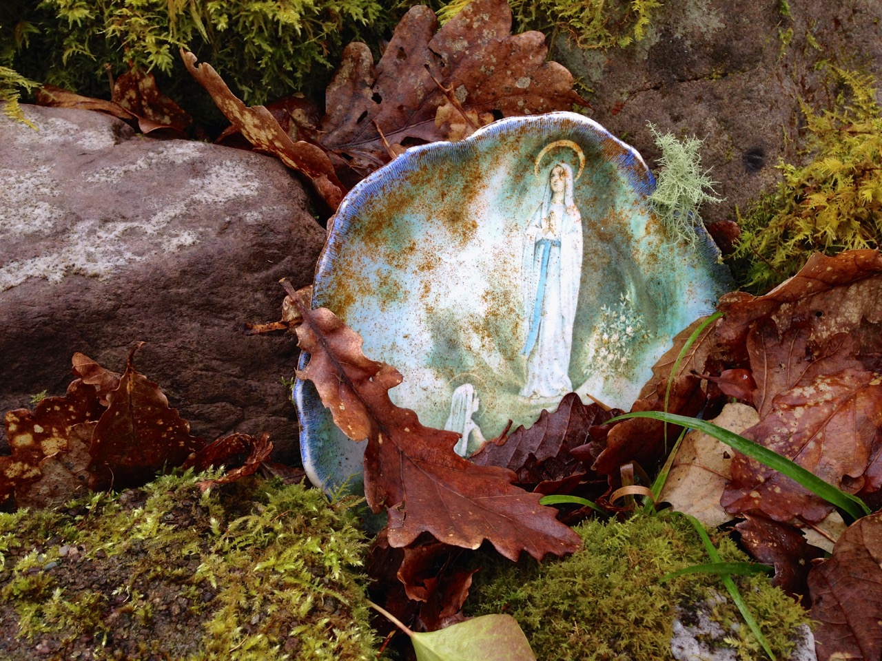
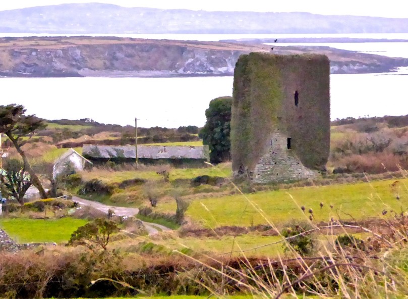
Leamcon Castle (Black Castle)
…not a castle?
Answer: When it’s a Tower House. Maybe.
Harold Leask first published his classic Irish Castles in 1941, and it was subsequently revised and reprinted several times. My own copy was bought in the late 60s and accompanied me to Canada and back. Leask’s book was the first comprehensive work on the subject – a work of erudition but thoroughly readable with charming pen-and-ink illustrations.

My battered copy

Illustration from Leask’s Irish Castles
Leask insisted on the use of the term tower houses for small simple castles and described them thus:
They are simple oblongs with four walls, subtly battered, rising sheerly from a bold base-batter, to parapets which are crenellated in the Irish fashion. A small turret, at one corner, generally above the staircase, rises to a greater height than the rest of the building, while within the parapets are the two gables of the roof. Very often a small machicolation projects from the parapet and commands the entrance doorway below…
Ardintenant Castle (White Castle). It sits on top of an earlier ring fort.
In researching for this post the other main source I consulted was a doctoral thesis by Mark Wycliffe Samuel, The Tower Houses of West Cork. More recent (1998), it concentrated on the castles of this area and is packed with detail about the ones we see around us here in Roaringwater Bay and on the Mizen Peninsula, from Baltimore (Dún na Séad) in the east, to Cape Clear Island (Dún an Óir) to the south and Three Castle Head (Dunlough) to the west.

Dunlough Castle, at Three Castle Head
These simple towers were quite different from the enormous and elaborate military castles that cemented Anglo-Norman power all over Ireland after the invasion of 1169, such as Trim in County Meath, or Cahir in Tipperary. Tower houses were built in what Leask calls a ‘great building revival’ from about 1440 into the 1600s. In what may be the forerunner of the European Grants system, Leask says many of the earliest ones were built as ‘£10 Castles’. A statute of 1429 offered every liege man of our Lord the King…who chooses to build a castle or tower sufficiently embattled or fortified..to wit twenty feet in length sixteen feet in width and forty feet in height or more, that the Commons of the said counties shall pay to the said person to build the said castle or tower ten pounds by way of subsidy. Although this statute seems to have been applicable only in certain counties (mainly around the Pale) it established a pattern for tower building which was adopted, with variations, all over Ireland.

Dunmanus Castle
The Roaringwater Bay and Mizen towers fit this pattern very well. They were not, however, built by the Anglo-Normans – West Cork was too remote and beyond their reach. They were built by the great Irish chiefs of the O’Mahoney, the McCarthy and the O’Driscoll clans and probably replaced earlier strongholds such as promontory forts (as at Dunlough), large ring forts (Ardintenant) and stone forts/cashels (such as the one at Knockdrum). These chiefs became wealthy through their control of the fisheries, through piracy, and through tribute exacted from those who occupied their traditional territory. At least one of them (Rossbrin) became famous as a centre of learning and scholarship during this time. Of the ones I will describe in this post, all are situated at the sea. or close to it, with commanding views over their territory and sometimes within sight of each other.
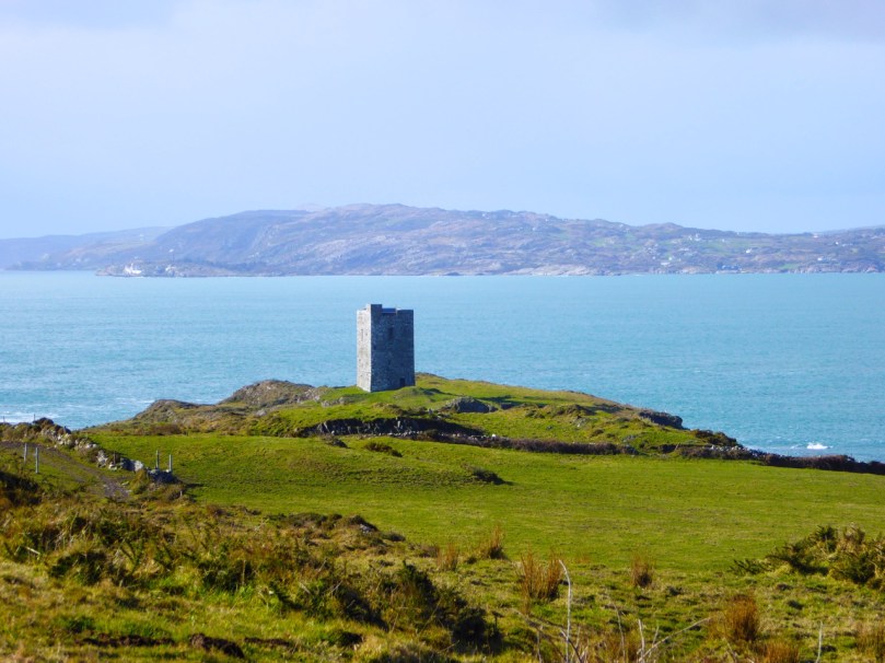
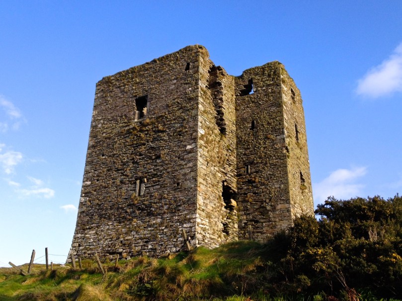
Leamcon, known as Black Castle. Notice the base-batter in this picture and the first one below. The lowest level is the widest (battered) with the walls sloping in above this base
The power of these great Irish households lasted until the 1601 battle of Kinsale when the Irish forces under Hugh O’Donnel and Hugh O’Neill (with Spanish help) were defeated and an enormous re-conquest and re-colonisation began under Elizabeth and continued unabated under the Stuarts and, most disastrously, under Cromwell.

Leamcon, first floor (raised) entrance directly aboove ground floor

Dunmanus, the first floor entrance is offset, or staggered.

Wide enough for a cow: Dunmanus ground floor entrance
Each tower in this area was built in the same manner, which Samuel refers to as the Raised Entrance type of tower. There were two entrances, one on the ground floor and one on the first floor. The ground floor room was for cattle and the doorway was therefore as wide as would admit a cow.

A glimpse inside the raised entrance at Ardintenant
The raised entrance (directly above it, or staggered to the left or right) was only wide enough to admit one person at a time – a defensive feature. This entrance either led into the first floor room or (since the ground floor room could have a lofty ceiling) onto a landing where a staircase led up to this room and then continued up through the wall (usually the thickest wall of the tower) to the upper floors. The first floor room was mainly used for storage and had either no windows or very small slits.
Dunmanus, with its base-batter and additional turret. The top windows were always the largest
The second floor room was often the principle chamber, where all the main activities of the family took place – living, eating, meeting, administrating, celebrating (music and poetry were highly prized by these chieftains). If there was a third floor it contained the solar, or private chambers for the women of the household.

Barrel vaulted ground floor room at Dunmanus. Note access to stairwell.
Construction techniques varied – some were superbly constructed of cut stone while others used a lot of rubble to build up the insides of walls. Putlogs, or holes where scaffolding timbers were insert, are clearly visible in several of the towers. The lowest floors were of course the thickest – the base-batter provided a solid foundation and the walls sloped inwards from it. The top of the tower allowed for thinner walls, and therefore also bigger windows (although none were large).

Leamcon: putlogs visible in the wall.

Leamcon windows first and second floors
A garderobe (toilet) was a feature of the top two floors, with a chute out to the outer walls. In towers with additional turrets (Kilcoe, Dunmanus, Leamcon) the garderobe and sleeping chambers were sometimes contained in that turret, or the spiral stairs wound up through it. While most towers had stone spiral or straight staircase, some appeared to access each floor by means of ladders – there is no evidence for permanent wooden staircases.

Ruins of Rossbrin, showing the stairway cavity and a large press

Dunmanus window embrasure

Smaller tower at Ardintenant: excellent cut stone work and a double arched window embrasure
The ground floor room (the byre) was often vaulted and this feature is still clearly visible in the most intact towers. Above that, the floors were of timber, sometimes with trapdoors for lifting up supplies. Presses (cupboards) consisting of niches in the walls may have contained lanterns or have been used to store valuable items.

Two smaller towers: Rincolisky

and Oldcourt
There were no fireplaces in these towers. Fires were lit on flagstones laid on the wooden floors and the smoke rose to the tall ceilings and escaped out the small windows. In addition to this level of discomfort there is a contemporary account (quoted by Leask) which describe the primitive living arrangements in some of the towers: They have little furniture, and cover their rooms with rushes, of which they make their beds in summer and straw in winter. They put rushes a foot deep on their floors and on their windows [embrasure floors?], and many of them ornament their ceilings with branches.

Dunbeacon: strategic location

Dunbeacon: all that’s left
But not all chieftains lived in a primitive way. Samuel uses the available evidence to construct a picture of life at Togher, one of the towers he studied, and it’s not hard to picture Fineen O’Mahoney, Scholar Prince of Rossbrin, in such a setting.
We can form a picture of the principal chamber in use: Tadhg an dúna or Togher’s principal chamber was probably furnished with imported furniture, pewter plate and cutlery and was panelled with ornately carved timber. His family, his bard, …clerk, lawyer, priest and physician, as well as members of the derbfine [extended clan] such as cavalrymen could eat there. They could sit with the chieftain to one side of the principal salt cellar, while others sat ‘below’ it… Servants prepared food out of sight ‘below stairs’. Bardic musicians, soothsayers, gamblers and others would be admitted as honoured guests, but the household ward and servants ate in the kitchen/ward room.

Although its name means Fort of Gold, today Dún an Óir on Cape Clear Island looks remote and forbidding
Similarly, Dún na Séad (Fort of the Jewels) Castle in Baltimore, seat of the wealthy O’Driscolls (they also had Dún an Óir (Fort of Gold) on Cape Clear Island), was
…a centre of administration for trading activities and collection of taxes from foreign traders frequenting the port. In the middle and later-middle ages therefore, the O’Driscolls enjoyed a prosperous lifestyle. Lavish gatherings took place in the ‘great hall’ of Dún na Séad castle and a well-documented feast in 1413 is said to be one of the earliest records of people dancing in Ireland. This documentary evidence is supported by archaeological finds from recent excavations of the Dún na Séad site, which reveal the presence of late twelfth to fourteenth century pottery from the Saintonge region of France, and reflect the lucrative trade links between Baltimore and Europe at this time.
Dún na Séad Castle, Baltimore. Note corner machicolation.
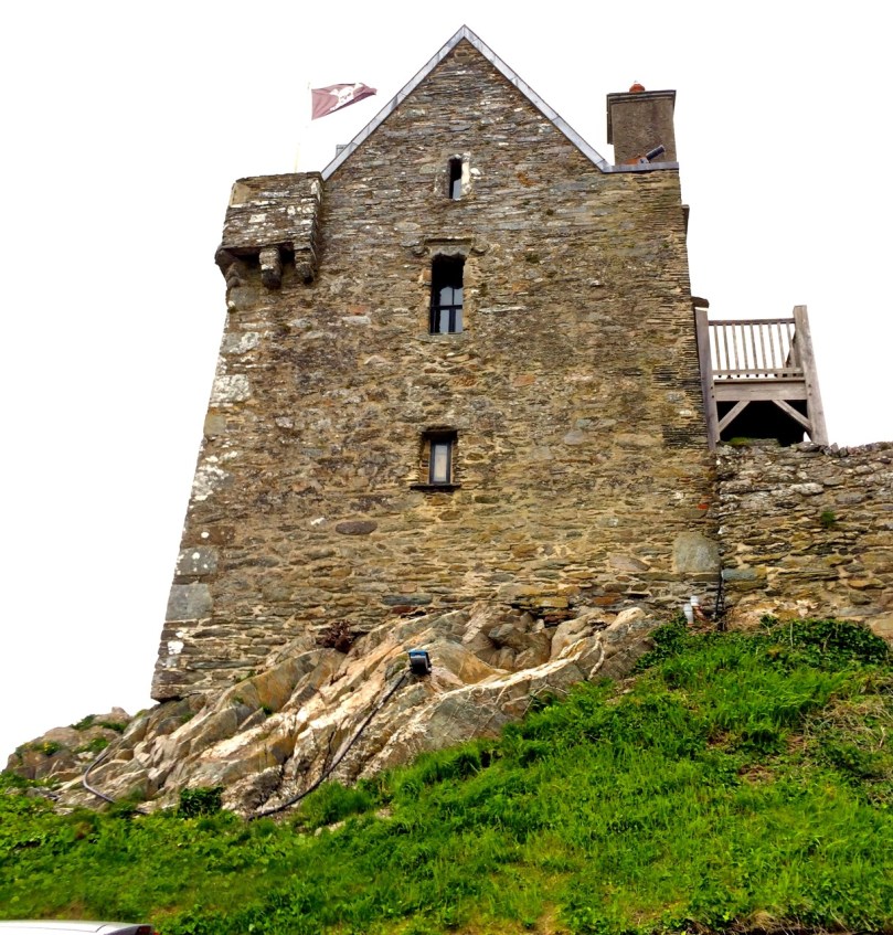
Defensive features were built into all the towers. Besides raised and restricted doorways and hard-to-manoeuvre narrow or spiral staircases, all had a roof ‘wall walk’. Three of the towers (Dún an Oir, Kilcoe and Leamcon) are either inaccessible or accessible by a bridge and there is evidence that connecting ground was deliberately demolished to accomplish this. Windows were small and could be boarded up. Projecting machicolations, especially above entrances or at corners were used, as can be seen at Dún na Séad Castle in Baltimore. Crenellations (notched or serrated ramparts) look like our traditional ideas of battlements. At Kilcoe they may have helped that castle withstand over a year of attack and siege after the Battle of Kinsale.

Kilcoe Castle. Note crenellated battlements and pitched roof
So, should we call them Tower House, or Castles? How about £10 Castles? Archaeologists and historians prefer the more exact phrase tower houses, but castles they are on the maps and in our everyday speech. And if, like us, you are lucky enough to have one in your view, castles they are in our hearts and minds.
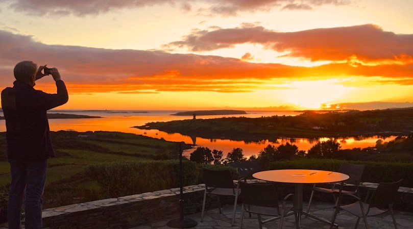
Our view to Rossbrin Castle
Email link is under 'more' button.