Sliding into Kerry

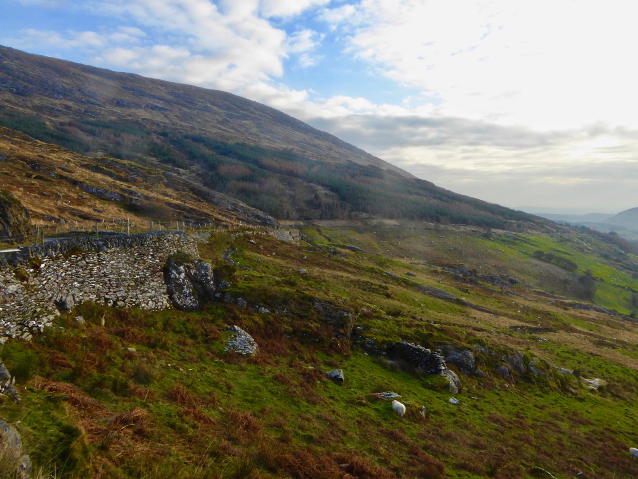
view from the road

My musical acquaintances might think that this post is all about Kerry slides – lively tunes which get aired sometimes at our session: here are some fine examples played by Éamonn O’Riordan, Tony O’Connell, Brian Mooney and Gearóid Ó Duinnín…

But they would be mistaken: this is the tale of a little wintry but sunlit exploration which Finola and I undertook on the eve of St Gobnait’s feast day. It involved crossing the border into Kerry, something which is not lightly done by Corkonians because of traditional rivalries (mainly on the Hurling and Gaelic Football fields). So we had to ‘slide’ over into the Kingdom and hope that none of our friends noticed our temporary absence.
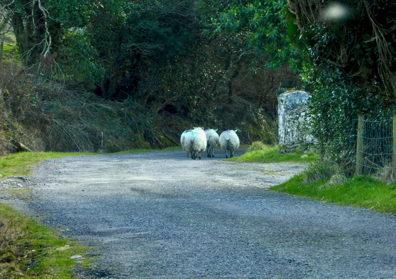
Sheep flock on road

We had things to do in Kenmare (have a look at Finola’s post), but afterwards we took to the byways. We knew there is a remote, lonely and very beautiful road winding up over the mountains, shared only by a few wandering sheep, and determined that would be our way home. We headed off to the tiny settlement of Kilgarvan and there saw a signpost that said Bantry 25: we turned on to the boreen that follows the Roughty and Slaheny Rivers and immediately entered another world.

Macaura's Grave signpost

We hadn’t gone very far along the road before we were intrigued by a brown signpost – beckoning us along an even smaller boreen. Macaura’s Grave: neither of us had any idea who Macaura was, so we had to go and investigate. After about ten minutes of twisting and turning and trying to guess which of the unmarked and unsigned lanes to take whenever we came to a junction, we found ourselves back on the road we had just left! By now we were determined that Macaura was not going to get the better of us, so we flagged down a young lad who was in charge of a fine red tractor. He was very forthcoming, and told us that the grave was well worth a visit, then proceeded to give us a set of instructions that involved turning this way and that – signifying to the air which ways these were. Not a little confused, we drove off again.
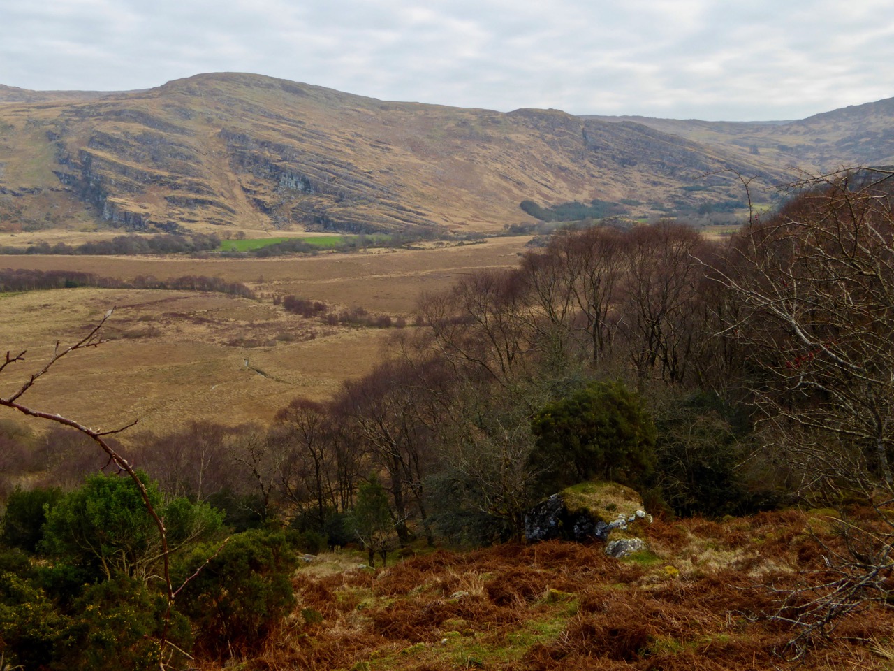
View from near grave

It was no hardship to be exploring the magnificent countryside in south Kerry: the views were breathtaking and the variety of colours on the mountains in sunlight and shadow this early spring day was astonishing. A bit more head scratching and a few more twists and turns down a stony trackway and we were there!
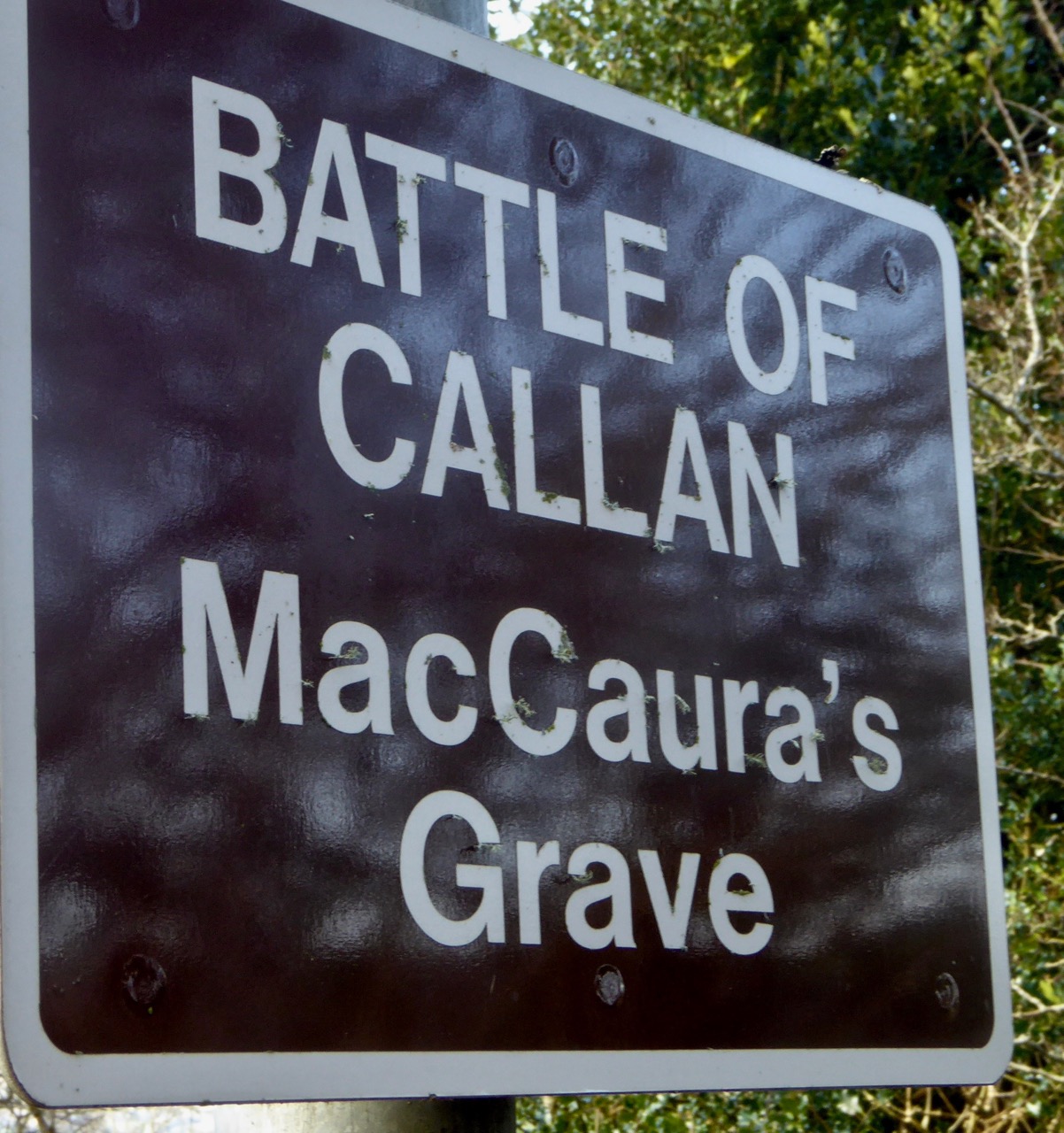
Modern sign

Now we knew. Not only had we found the grave of Macaura – that’s the old Irish way of saying McCarthy – but we had come across the site of one of the most significant battles in Irish history! The Irish chieftain, Finín McCarthy (named as the ‘King’ of Kerry – and that’s why Kerry is known as The Kingdom), joined up with the O’Sullivan Beare from West Cork and the O’Donoghues from Ross Castle to rout the Normans, who were led by Sir John Fitzgerald. This battle took place in 1261. 1261! Over eight hundred years ago… This confirms my thesis that you can’t go anywhere in Ireland without stumbling over history. The Anglo-Normans had claimed their stake in Ireland from 1169 when Strongbow (Richard de Clare) arrived with the blessing of Henry II (and the Pope – who saw the Irish church charting its own course and not following Rome!). Reasonably, the Irish chieftains objected to the Norman invaders, hence this confrontation.

Grave Inscription

In the Journal of the Cork Historical and Archaeological Society, 1961, Volume 66, there is a comprehensive – but not entirely enlightening – article by Diarmud Ó Murchadha on The Battle of Callan:

…Finghin Mac Carthy had learned much from his opponents during his years of conflict, while he had the added advantage of knowing intimately the territory over which he fought. At Callann he chose his battleground, at a spot where a mountainy river called the Slaheny joins the Ruachtach, close by the castle of Ardtully. No doubt he reckoned that here the heavily-armoured cavalry of the invader could be used to the least advantage. Battle was then joined and Finghin mac Domhnaill mic Charthaigh emerged victorious… Unfortunately no details of the conflict – apart from the names of those slain – are available. Incidentally, the fullest account of the battle is given, not by the Munster annals, but by the Annals of Loch Ce and Annals of Connacht:

AD 1261 – A great war was waged, and numerous injuries were committed in this year by Finghin, son of Domhnall Mac Carthaigh, and his brothers, against the foreigners.There was a great hosting by the Geraldines into Desmond, to attack Mac Carthy, but it was Mac Carthy attacked them, and defeated them…

The Annals go on to record the fact that Finghin followed up his victory at Callan by attacking and destroying every Norman castle and stronghold in Munster. As the sign over Macaura’s Grave tells us: …he liberated the Kingdom of South Munster from Norman domination forever…
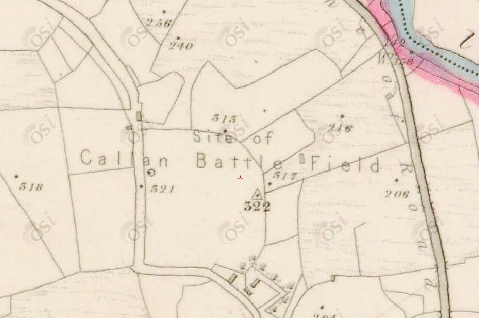
battle-of-callan-site

But who is it that the Macaura Grave celebrates? ‘Donal, Chieftain of the McCarthy Fineens’… Presumably this is not the Finghin, who, according to the Annals, went on after the battle to rout the Normans out of Munster: the Finghin who is known as mac Domhnaill mic Charthaigh – ‘son of Domhnaill MacCarthy’. Could it be his father (Donal is an Anglicisation of Domhnaill)? In which case it was the clan chieftain who died in the battle and his son who went on to clear the Normans out of Kerry. There are a few accounts of the battle, but none of them clarify this. It all happened a long time ago, of course, and memories fade. In fact this site was all but lost: an article in The Kerryman takes up the story, illustrated by this photograph:
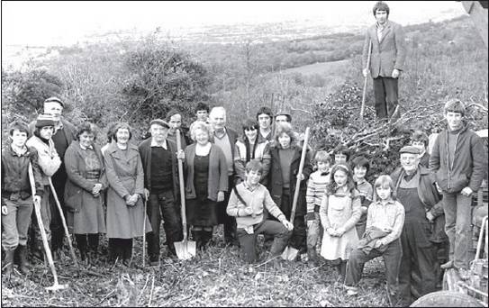
1981-clearing-the-site-of-the-grave

…The men of Kilgarvan were busy in November 1981 – making a road fit for a king! The king in question is Finín McCarthy who died in 1261 after being the first Irish king to defeat the Normans, thus giving Kerry the name of the Kingdom… Legend has it that after the battle, McCarthy stood on a ditch to survey the battlefield, when a dying Norman killed him with an arrow. McCarthy was buried on the spot, and a large slab was used as a headstone. The grave now lies on a narrow little road in Callan beside Tom Healy’s farm. When retired Dublin civil servant Frank Shanley spent a recent holiday in Kilgarvan he went looking for the grave, which was buried by shrubs and bushes… He decided to organise a meeting of the local men to try and get them to improve the grave and access to it…. It was Dan O’Sullivan, Down, Tom O’Donoghue and Michael Teehan, who were slaving away widening the roadway from eight feet wide to 16 feet, when he visited in November 1981… Apart from the narrow roadway and the briars and trees, there was also a steady stream of water running over the grave, but the men got the pipes to divert the water in another direction. There was no actual inscription on the grave that the men could read, but there were a series of lines and crosses on it, which they hope will be examined by an expert…. They hope that when they have the roadway to the grave cleared, they can erect signposts to the grave, and notices around the grave telling the history of McCarthy’s death in the battle of Callan…
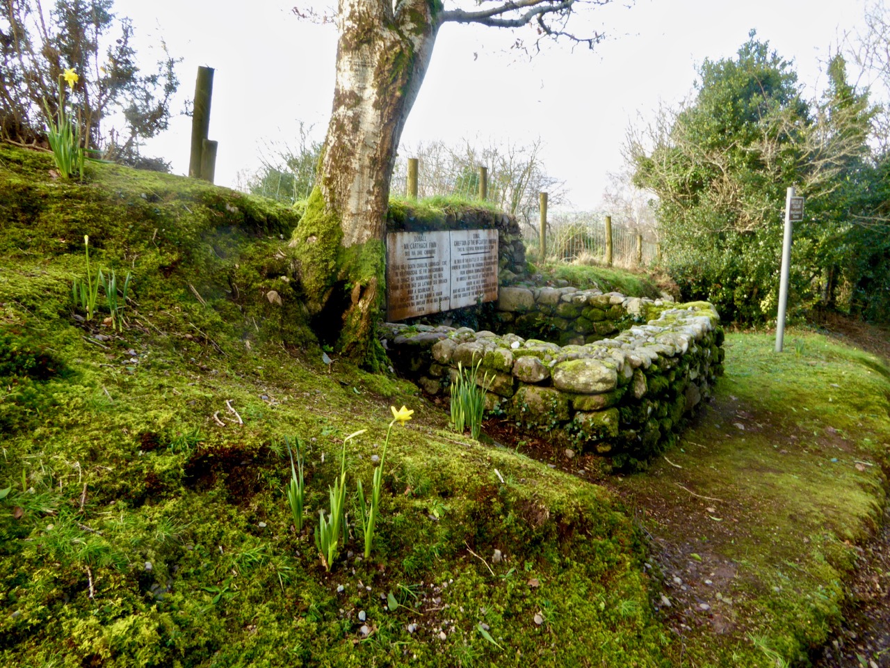
Macaura's Grave

So we have the ‘men of Kilgarvan’ – back in the 80s – to thank for leading us to this now tranquil but historically turmoiled and fascinating spot. There is still the puzzle of which McCarthy is commemorated: perhaps we’ll never know for sure. But it’s not bad to have access to a story which has survived for the best part of nine hundred years – just about within living memory by Irish standards! After this excitement we continued our journey over the spectacular Coomhola road through the mountains towards Ballylickey and gently slid back into West Cork. If you can cope with very narrow roads (it’s not so bad – we only saw two other vehicles, both local farmers, in the whole 25 kilometres!) it’s one of the great road trips of Ireland – with the added bonus of a history lesson to be taken in.

Beyond the tunnel

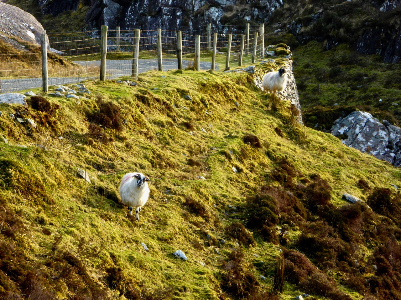
Sheep on the edge

The Winding Road

Tiny Ireland

Bunratty Castle

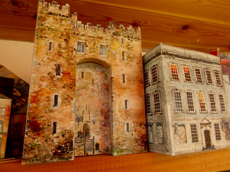
If you live around here or have visited Ireland you’ve seen them in all the best gift shops: Tiny Ireland – those intriguing paper models of Irish buildings and towns that make the perfect gift.

Top photograph: Bunratty Castle. Above: Skibbereen, the model and the real thing, and Tiny Cobh

They say that a true craftsperson makes it look easy. But this week we visited Tiny Ireland in her studio and found out first hand just how much talent and research and imagination goes into every single detail.

Anke with boxed Gallarus

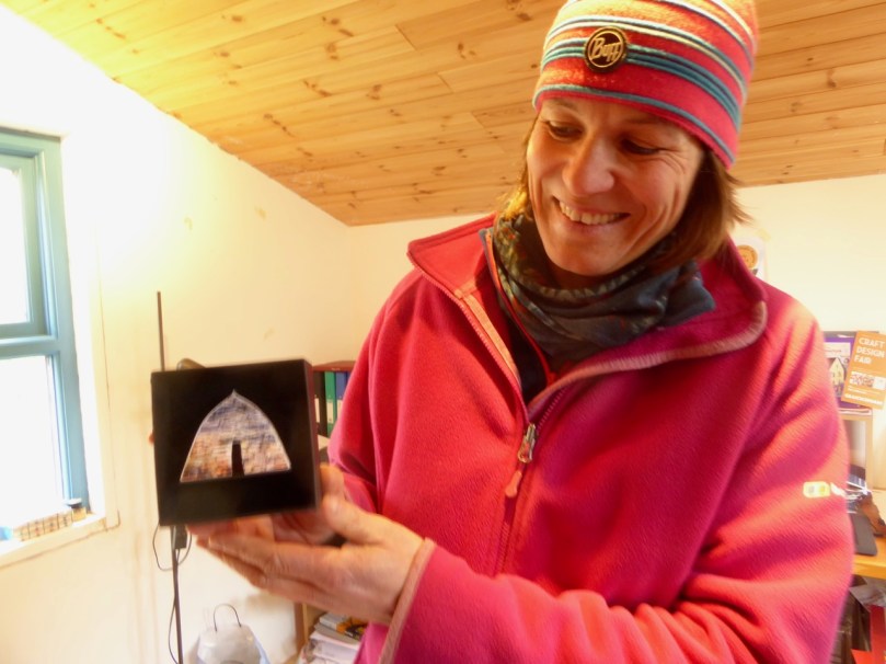
Anke shows us her Tiny Gallarus

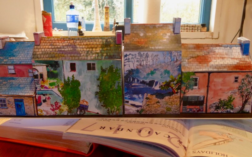
And who is Tiny Ireland? Meet Anke Eckardt. She’s lived here in West Cork since she was a little girl, plays a mean tin whistle, is an artist, a master joiner and boat builder and joint owner with Rui of West Cork Boats. The idea for Tiny Ireland came to her when she made some paper models with and for her son Fionn to complement his train set. That was ten years ago. She has been making models ever since, but devoting herself seriously to it for the last five years.

Designer at work – Anke in her studio. Full marks for anyone who can guess the pub she’s working on.

Anke starts with familiarising herself with the town or village. She wanders round with her camera, talks to everyone, gets a feel for the place, and then does extensive research on the history of the area. In the case of West Cork, like any other native she already knows every inch of it – the stories, the atmosphere, the iconic buildings, the colours and contours of the landscape. She tries to capture that same sense of place wherever she goes.

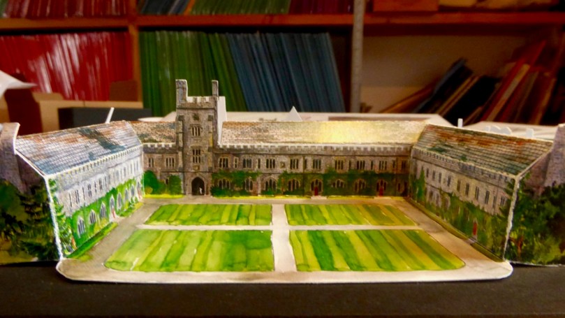
UCC

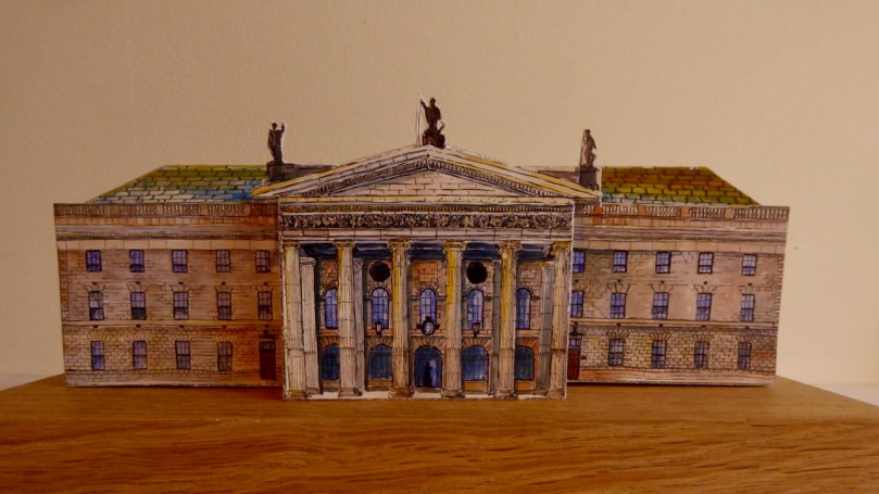
GPOTop: Both Anke and I went to University College Cork and the Quad holds a special place in our hearts. Bottom: Anke’s contribution to the 1916 commemorations – the General Post Office in Dublin

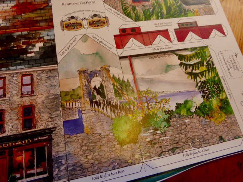
Back in the studio she decides on which buildings to use and starts drawing and painting and figuring out what should go where on the model and what extra details to include. Each building occupies one sheet in the kit. Anke wants each sheet to be a beautiful object in itself, to be poured over before you even start the scoring and cutting process. Can you imagine the cleverness it takes to construct even one building? Add to that all the little details that go into making it unique and contributing to its cultural and geographic character.

Glucksman Gallery in box

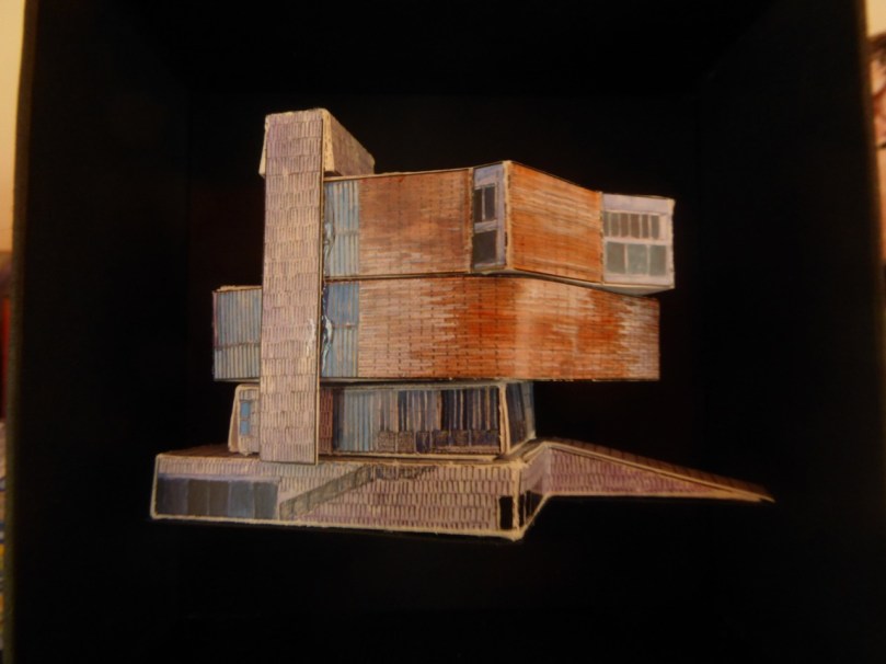
Not just traditional buildings! Here is the ultra-modern Glucksman Gallery at UCC

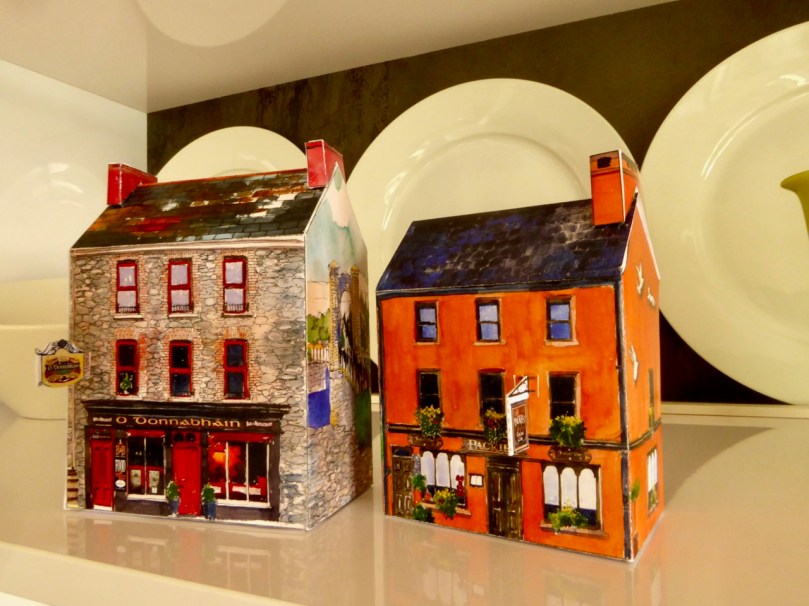
We came home with a Tiny Kenmare kit so that we could experience the assembly process first hand. Not only was this great fun but it gave us additional insights into both the craft of model making and the lovely additional details that Anke has inserted into each piece – details that extend the model into little bits of history.

Robert assembles Packie’s Pub

The second Kenmare building we assembled was O’Donnabháin’s pub and guest house (pronounce it O Dunn-eh-vawn’s). Look around the side – Anke has added the image of a funeral coming over a suspension bridge. Curious, I looked up what this was all about and found that Kenmare did indeed have the first suspension bridge ever built in Ireland – read an amusing account of its history here – and that the funeral was a real one, that of an IRA man murdered by the Black and Tans in 1921.

Kenmare Funeral

On the shelfKenmare is as scenic and colourful as any town anywhere has a right to be. It’s a great shopping town too, with wonderful cafes and pubs, and right on the justly-famed Ring of Kerry.

Colourful Kenmare 1

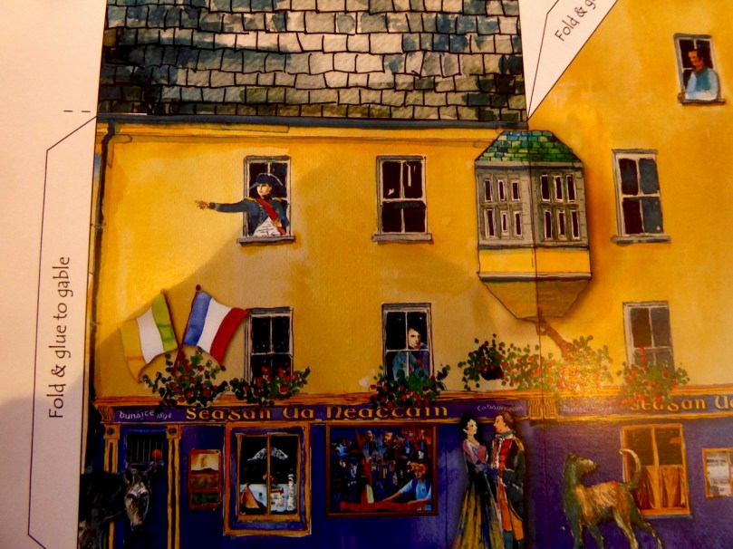
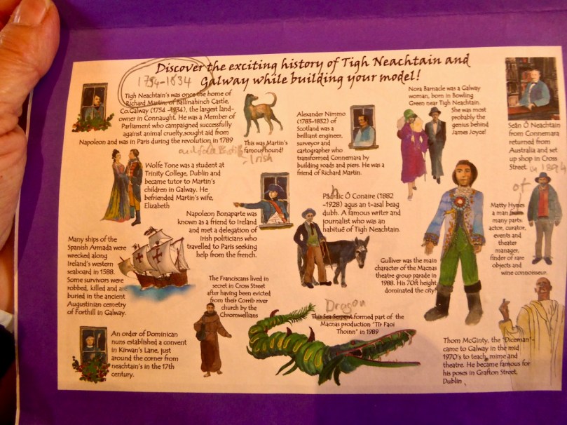
Every model Anke makes is unique and delightful. Individual pubs, shops, castles, etc are often made at the request of the owner. Here’s one for Tigh Neachtain in Galway. Anke showed us a draft of the Explanation sheet that goes with it. It’s an object lesson in how one building can encompass the story of a town. Richard Martin, by the way, is better known to history as Humanity Dick.

Tig Neachtain

Tig Neachtain ExplanationFor tourists, Tiny Ireland models make the perfect gift, light and packable and chock full of the real Ireland. For all of us, making one engages us in a creative act that comes out of the rich imagination and artistic talent of Anke Eckardt.

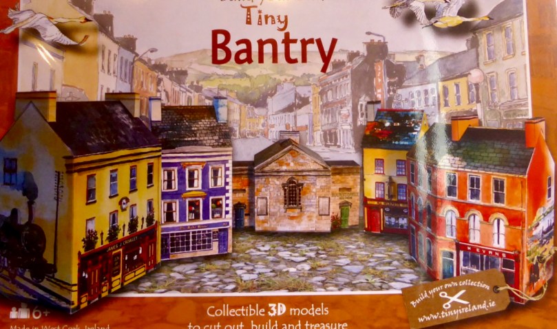
Tiny Bantry

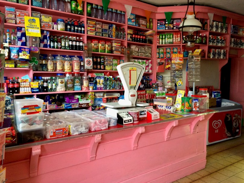
Evans InteriorTiny Bantry – note Miss Evans traditional shop on the right. Here’s what it’s like inside. For more on this and other traditional Irish shops, see Shopping for Memories

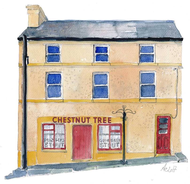
And it’s not just models. Recently Anke has started to produce charming watercolours of the traditional shops and pubs she loves. We in Ballydehob have loved her posts on our wonderful old shopfronts. Here’s an example – Just drive down our main street and you can’t miss The Chestnut Tree.

chestnut-tree

Happy cutting and glueing!

Around the back

Nest of the Eagle

eagles over nead

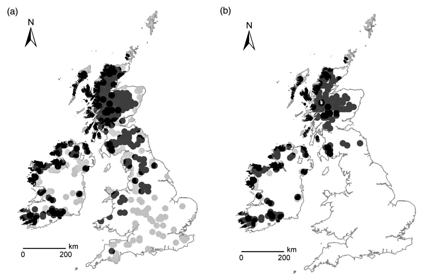
Nead an Iolair – that is the house we live in, here in the townland of Cappaghglass, West Cork. That’s it, in the picture above, with a pair of eagles flying overhead… We don’t see them very often. Well, in truth, we haven’t seen them at all – this is a bit of photographic magic – and wishful thinking. Nead an Iolair – our Irish readers will know that this means Nest of the Eagles – is a perfect name for the site, suspended way up above Rossbrin Cove – a good lookout with higher ground behind: exactly the right environment for the big birds. There were undoubtedly eagles here once – and in various other parts of Ireland – but when and how many? As with most things nowadays, someone has carried out the research and there’s a study available online. It’s worth a read, but I can summarise the main points: analysis of place-names and documentary evidence from the last 1500 years enabled the following diagrams to be drawn up:

eagles data

Data from The history of eagles in Britain and Ireland: an ecological review of placename and documentary evidence from the last 1500 years – Evans, O’Toole and Whitfield, RSPB Scotland 2012. Diagram (a) is 500AD and diagram (b) is 1800AD. The dots show Golden Eagle locations in dark grey, White-tailed Eagle locations in light grey and overlapping of both species in black

The diagram shows that White-tailed Eagles have lived here on the Mizen Peninsula 1500 years ago, and both species have been located a little further up the west coast as recently as 200 years ago. In 2001 fifty young golden eagles were released in Glenveagh National Park, Donegal, in an attempt to reintroduce the bird to Ireland. In a similar project to reintroduce white-tailed eagles,  one hundred of the birds were brought from Norway to the Killarney National Park between 2007 and 2011, and up to September 2016 thirteen chicks have survived. The aim is to get at least ten chicks flying from their nests each year. Six white-tailed eagle chicks have flown from their nests in Ireland in 2016, making it the most successful year yet; one of these chicks was born near Glengariff, which is only just over the hill from us in terms of an eagle’s range. So we remain ever hopeful that the white-tailed eagles (sometimes known as white-tailed sea eagles) will soon make their way down here to Nead an Iolair – attracted, perhaps, by the name. We’d be very pleased to see them circling overhead – they are the largest birds on Ireland’s shores. Already our bird feeders attract avians of all shapes and sizes, and they generally get along fine with each other, although the smaller birds do make themselves scarce when Spioróg turns up!

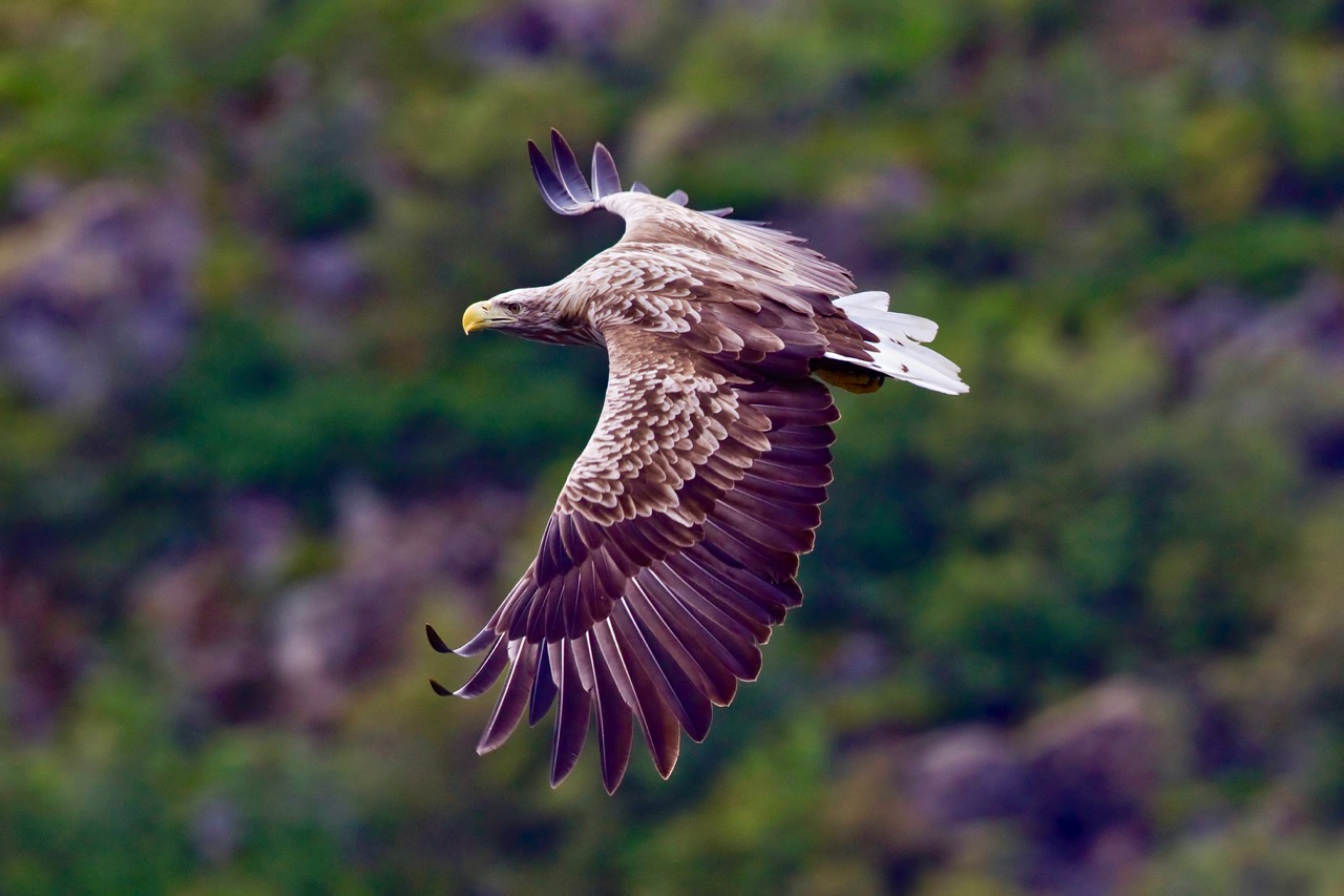
White-tailed sea eagle

A superb photograph of Haliaeetus albicilla – the white-tailed eagle or white-tailed sea-eagle, by Yathin S Krishnappa (via Wikipedia Commons). This was taken in Svolvaer, Norway – geographical source of the birds that were reintroduced into Killarney National Park within the last decade

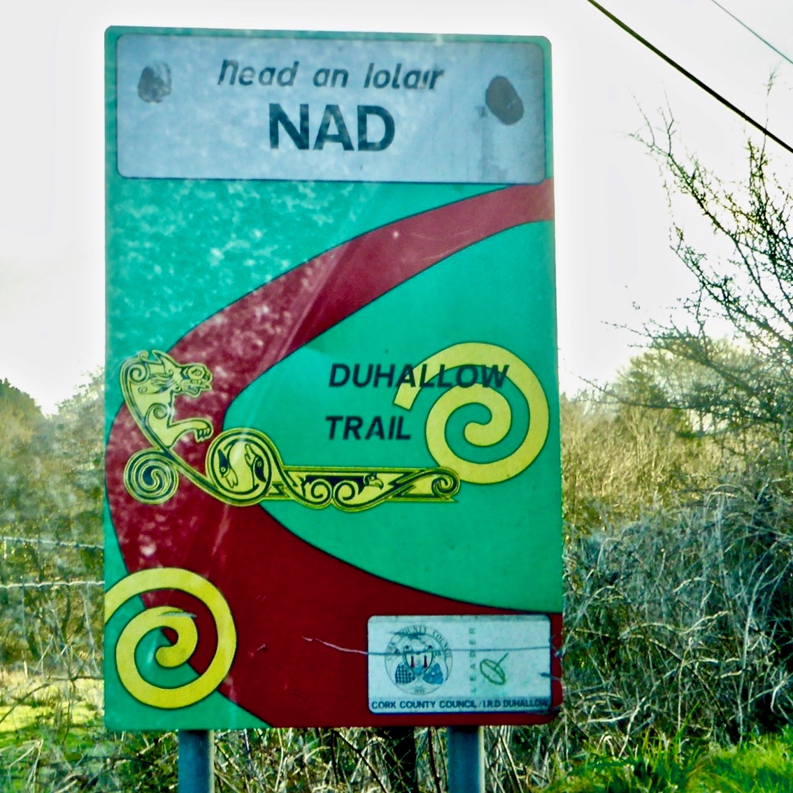
Whenever we are on our travels we look out for the word Iolair (eagle) in place-names. We found one in Duhallow, a Barony in Cork County, just north of the wonderfully named Boggeragh Mountains. In fact we were alerted by signposts directing us to Nad or Nadd (nest) and found ourselves in a tiny settlement which was determined to point out its links with the eagles.

nad road sign

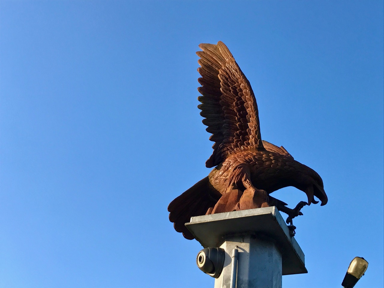
eagle on post 2

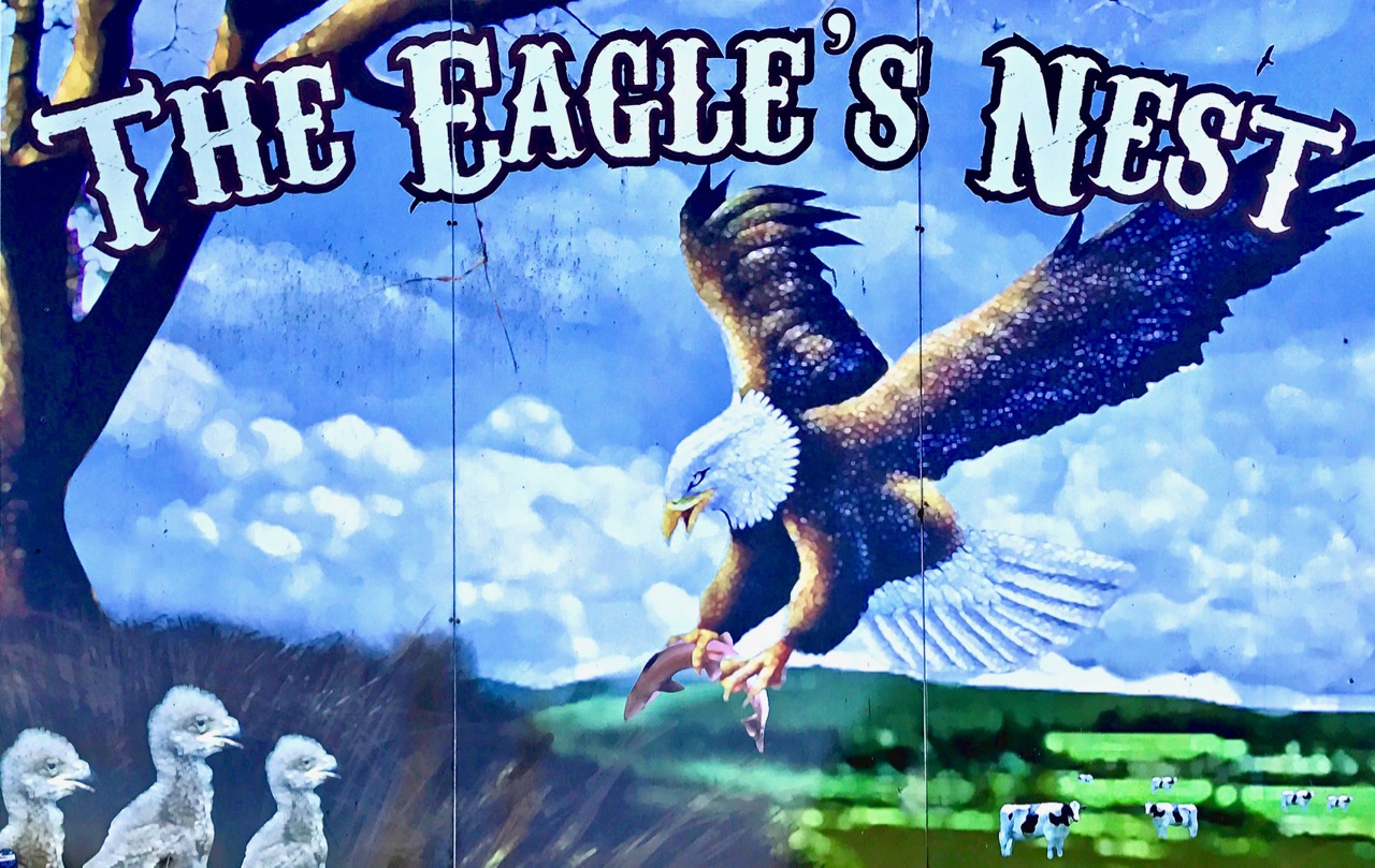
large eagle's nest sign

The village of Nead an Iolair in Duhallow, North Cork makes its associations with eagles very clear. The pub is named The Eagle’s Nest, and there is a fine sculpture of the bird sitting Nelson-like on a column beside it

Besides these features the village has a poignant memorial dating from the struggle for independence: a reminder of harsh realities still within living memory. The words that stand out are May God Free Ireland.

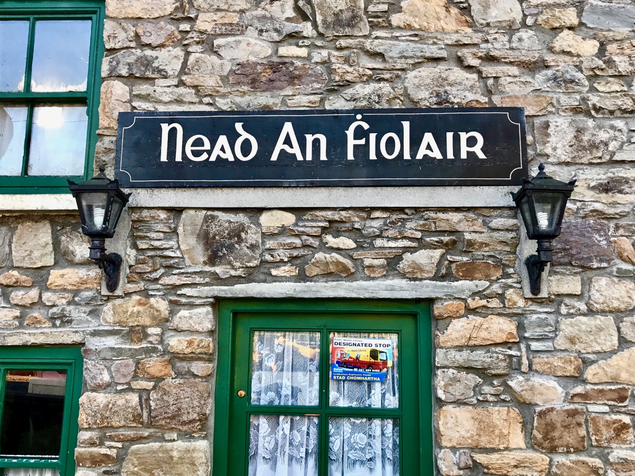
Back to the eagles and – in an interesting diversion into semantics – we noticed that the name over the door of the pub is in old Irish script and has introduced an additional character to the word Iolair – it looks like an ‘f’. Finola tells me that the use of the accent over that ‘f’ – which is known as a búilte – serves to silence the letter. In modern script it would be converted to ‘fh’: so fhiolair would still be pronounced ‘uller’. But we can’t find any precedent for using the word in this form. Perhaps an expert in Irish language can help us here…?

nead an fiolair

Regular readers will be aware that I am always on the lookout for links between Cornwall and the West of Ireland (and there are many). Interestingly, Nead an Iolair is one of them. Just outside St Ives, on the north coast of Cornwall, is a superb house, also called Eagle’s Nest. It was the family home of Patrick Heron, one of the influential St Ives School artists. When I lived in Cornwall I frequently passed by the house and was always impressed with its location – like us now, it is high up above the coast with a commanding view over the myriad small fields and out to the ocean. I always thought I would like to live there, because of that view… Now I have my own Eagle’s Nest – and I couldn’t be more content.

eagles Nest cornwall

Looking across the Cornish moorlands near Zennor, towards Eagle’s Nest – photographed by the artist Patrick Heron, whose home this was

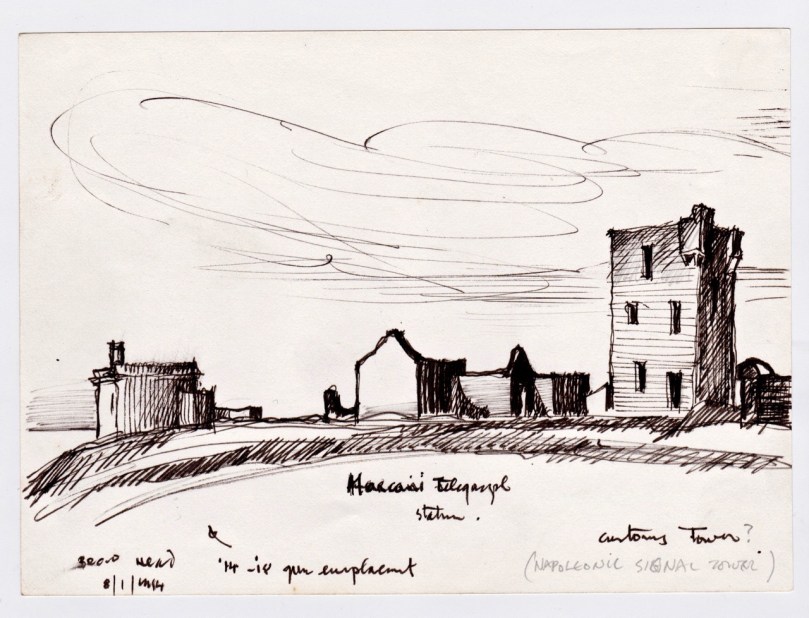
Brian’s Sketchbook: The Signal Towers

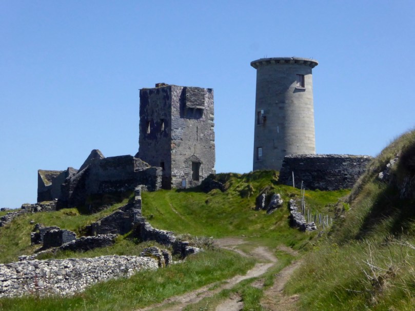
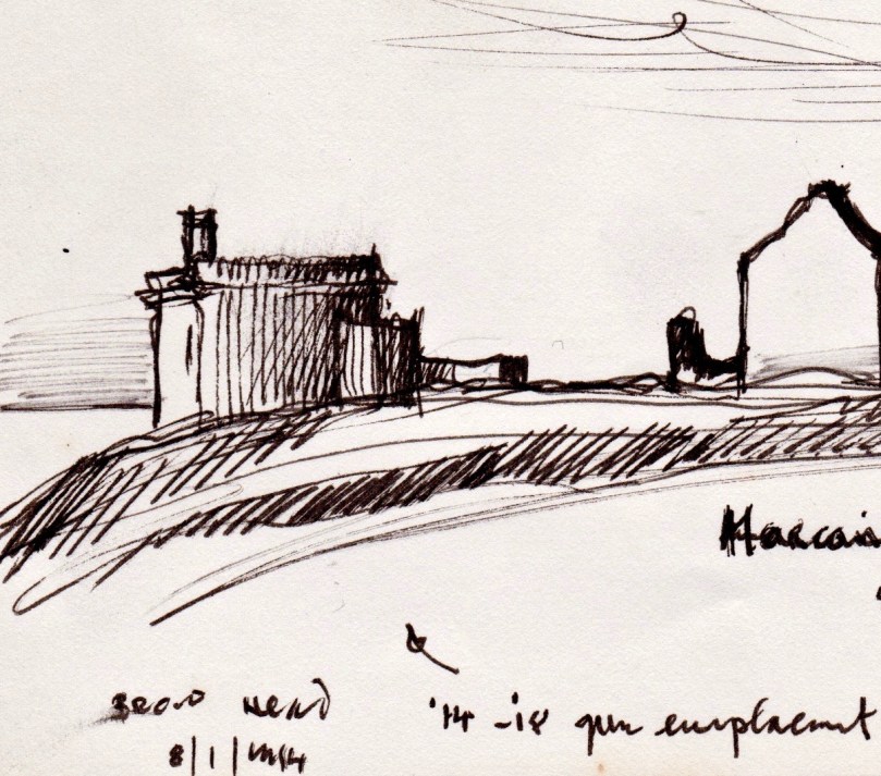
Brow Head Buildings

We have received a unique and treasured gift – a sketchbook from the 1980s of prehistoric and historic sites around West Cork. It’s the work of our good friend, and national treasure, Brian Lalor, artist, writer and printmaker. For an overview of his style, check out the retrospective of his work at Graphic Studio Dublin. Or browse the long list of his books, including the magnificent Encyclopaedia of Ireland, which he edited.

Marconi Station, Brow Head

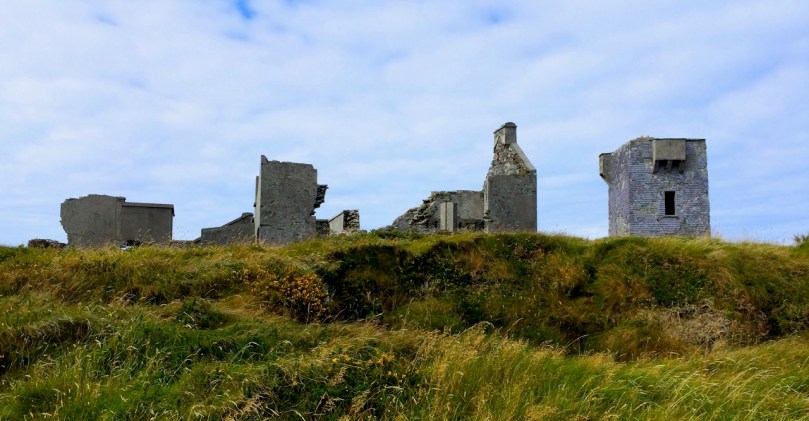
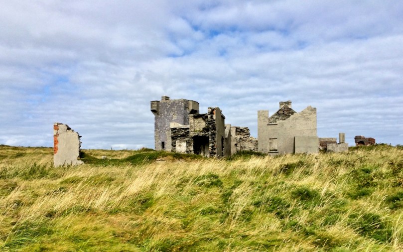
Brow Head: (above and below) on the right is the Napoleonic-era Signal Tower; the other buildings date mainly from the time of the Marconi Telegraph Station, taken from a different angle than the sketch above

Brian has studied both architecture and archaeology and to that adds the keen observant eye of the artist. As a result these sketches, although, as he explained, often hastily done during a brief visit to a site, are accurate, detailed and charming in equal measure. They were made on field trips with the Mizen Archaeological & Historical Society in the 1980s. This was an active society, publishing a well-regarded journal from 1993 to 2004 and leading regular field trips for members.

Brow Head ruined building

The sketches, just over 50 of them, were made for the most part between 1980 and 1987 so besides their intrinsic artistic value, they also constitute an important record of the state of the site 30 years ago, allowing us a comparison with its current condition. My intention is to visit (or re-visit) a lot of the sites, with his sketches in hand and show our readers both how beautifully Brian captured the structures or artefacts at the time and whether there are any changes visible from then to now. I decided to start with the Signal Towers on Cape Clear and Brow Head, and a third tower on Rock Island that may or may not be contemporaneous.
Wolfe Tone front

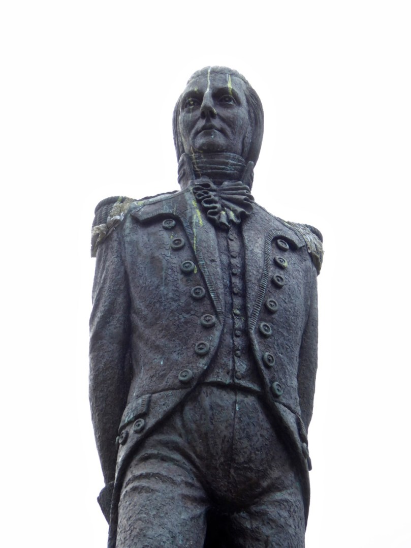
Theobald Wolfe Tone – detail of the statue in Bantry town square

In 1796 the French navy, partly at the invitation of Wolfe Tone and the United Irishmen, staged an unsuccessful invasion of Ireland, sailing into Bantry Bay. Several raids followed in 1798. Although all were quickly quashed, a panic about the possibility of a French invasion spread throughout Britain and Ireland. A series of Napoleonic-era fortifications and viewing towers were constructed around the coast in locations with panoramic views, and within sight of each other, to spot foreign shipping activity and raise the alarm. On the east coast, these mainly took the form of Martello Towers and were stocked with heavy armaments, but here in the south west defensible Signal Towers were built not to house artillery but as advanced-warning stations. Here and there they were complemented by batteries and other fortifications – but that’s a story for another day.

Cape Clear Signal Tower

The Cape Clear Signal Tower

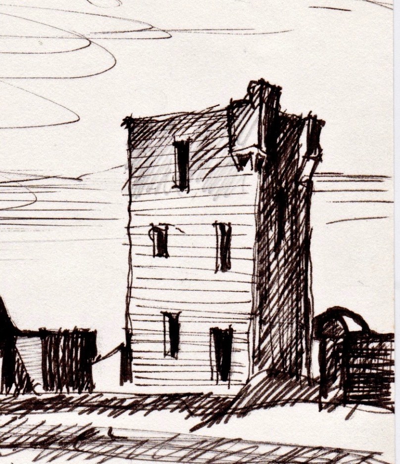
Signal towers were built around the coast to the same plan – tall square towers with first-floor entrances and machicolations. From a distance, they look like the medieval tower houses I have posted about on several occasions but up close they are shorter and the windows are bigger. Internal staircases and partitions were made of wood, not stone and have generally not survived, so the signal stations are essentially shells. in both the Cape Clear and Brow Head example, the exterior slate cladding has survived remarkably well.

Brow Head Detail - signal tower

Brow Head Signal Tower – detail from Brian’s sketch

In his excellent article for the Irish Times, Nick Hogan describes the towers, how they were staffed, the accommodation provided and how the signalling was done:

The signalling system, referred to as an optical telegraph, required that each signal station be visible to its counterparts on either side. Sending a message involved raising and lowering a large rectangular flag, a smaller blue pendant and four black balls in various combinations along a system centred on a tall wooden mast. The stations also communicated with ships.

Cape Clear Towers

Signal Tower and Original Fastnet lighthouse, Cape ClearTop: Brian’s sketch of the Signal Tower and Lighthouse on Cape Clear Island, done in 1982; Below: how it looked in June, 2016, 34 years later

While many signal stations are lonely and isolated buildings glimpsed on distant headlands, abandoned since the mid-1800s, both the Brow Head and Cape Clear buildings had further phases of use. In Cape Clear a lighthouse was built in 1818 – a forerunner of the Fastnet Rock Lighthouse. It was so often shrouded in fog that it was abandoned in the 1840s. The buildings attached to the signal tower, built of brick and concrete, probably date to this period of occupation. The signal tower is built of stone, using techniques not far removed from medieval construction methods. The lighthouse provides a wonderful contrast, being built of cut granite blocks expertly measured, shaped and fitted. 

Cape Clear Deatil - Lighthouse

Cape Clear Lighthouse, detail from sketch

In June of 2016, when we visited, it looked exactly as it had to Brian and the Mizen field group – an indication, perhaps that somebody is looking after the site and that the few visitors who come (it’s quite a hike to get there) respect the heritage. [Edit: Since I wrote this, Brian has pointed out that in the Cape Clear Signal Tower there is a porch under the machicolation in his drawing that has since disappeared. The outlines of the porch can be clearly seen in the photographs of the signal tower.]

Cape Clear Lighthouse

Brow Head is easier to access, and as a result there is more graffiti in evidence, but the changes to the site since Brian’s sketch are more the result of time and climate than any damage by humans. This is a complex site with multiple periods of occupation. The signal tower is there, of course, looking exactly as it did in the 1980s. Beside it is a network of buildings dating from the the early years of the 20th century: this is what remains of the Marconi Telegraph Station. Read all about this in Robert’s piece on Marconi, In Search of Ghosts. Besides the Marconi Station a Second World War Look Out Post was occupied here in the 1940s – little remains of this small concrete building except the characteristic half-round shape and a section of wall.

Brow Head octagonal?

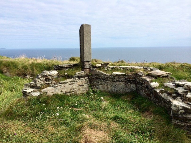
Finally, on Brow Head there is a mysterious building that Brian labels ’14 – ’18 Gun Emplacement. This building no longer exists, and the ruinous remains that litter the ground seem robust enough to fit this inscription. Or do they? So – a mystery, and obviously  more research needed on our part. If any of our readers can help – let us hear from you!

Brow Head Detail - gun emplacement

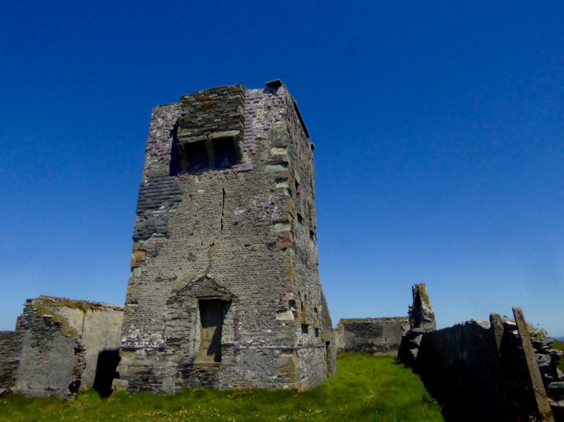
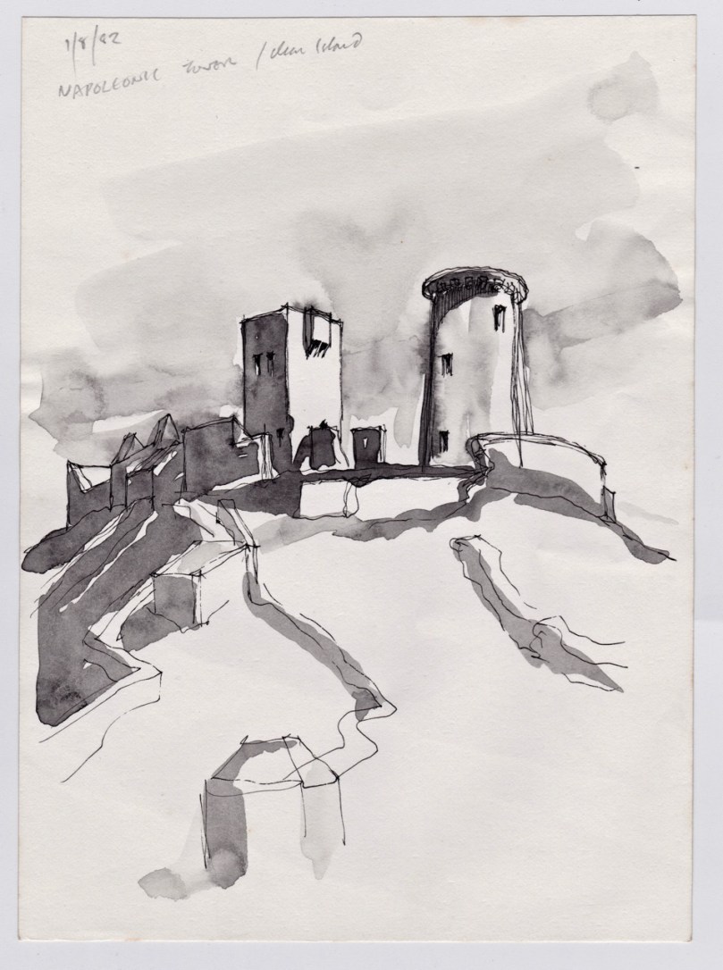
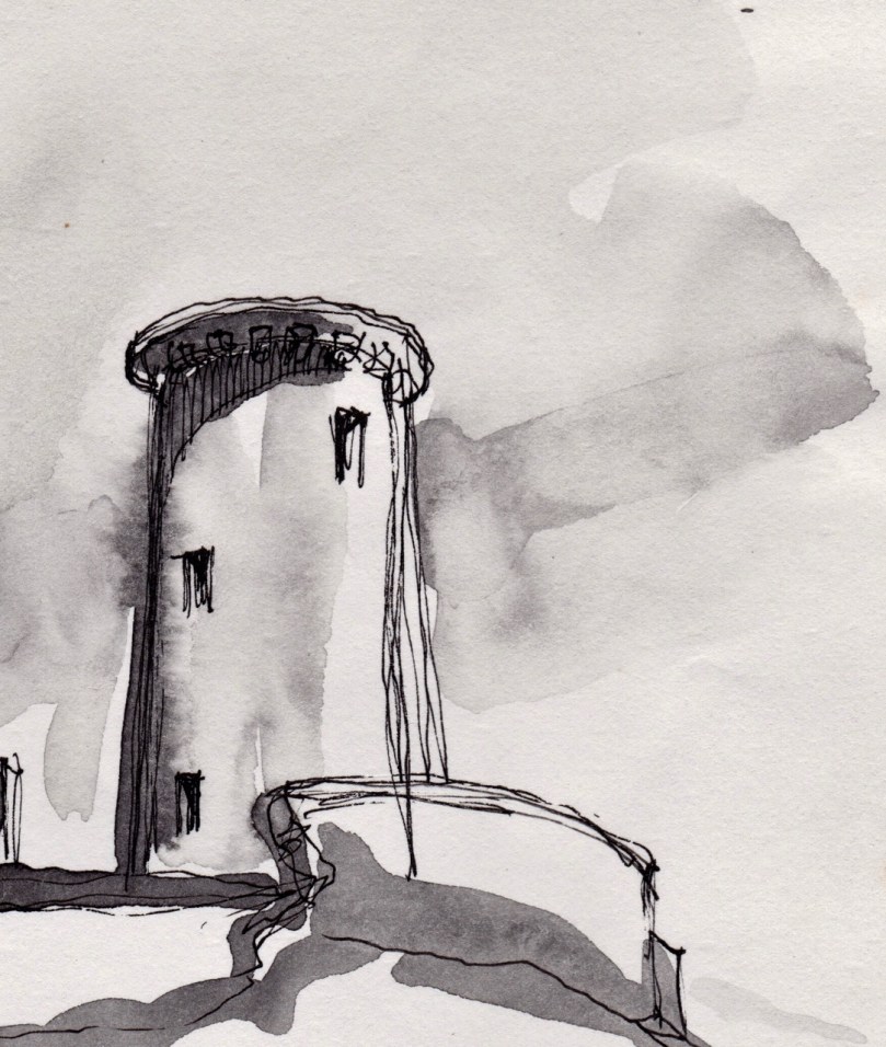
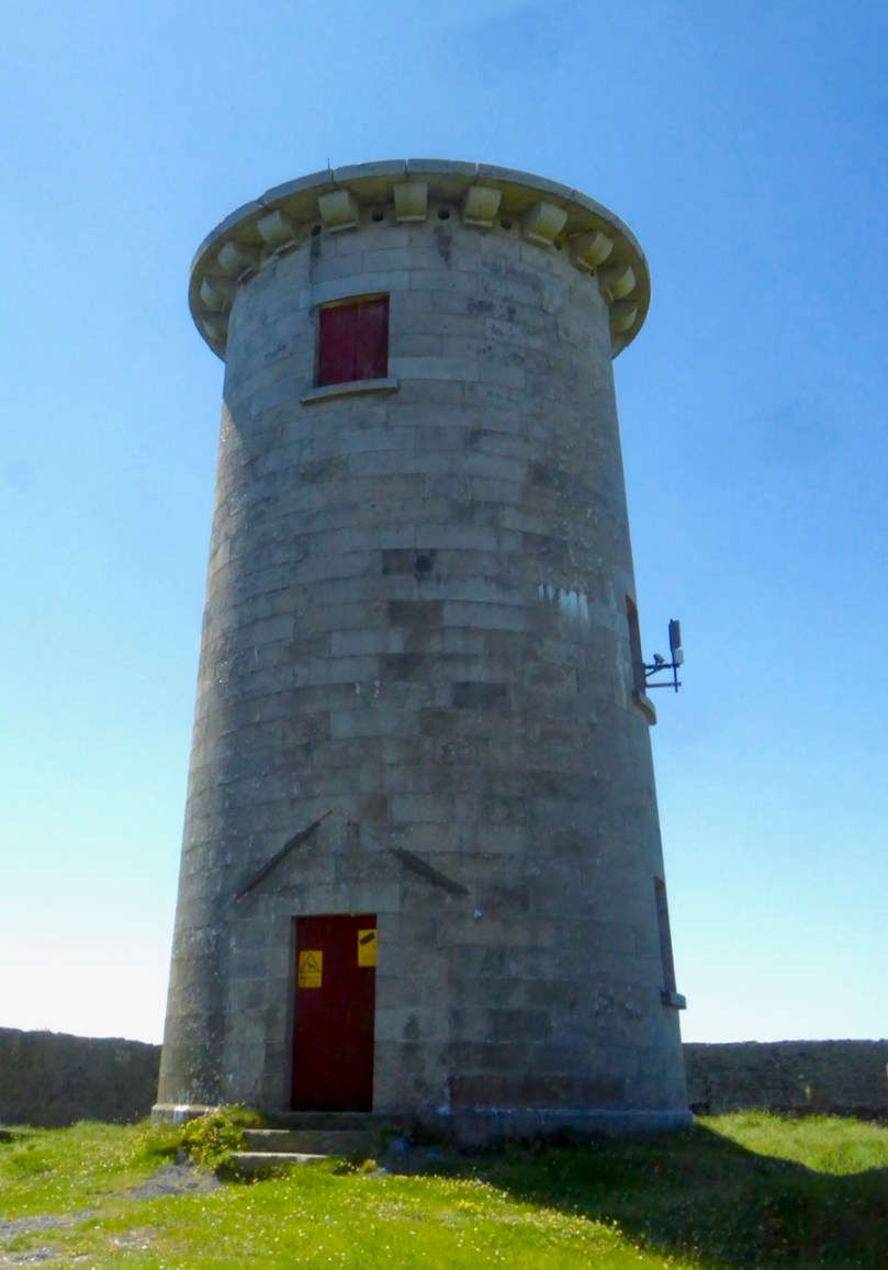
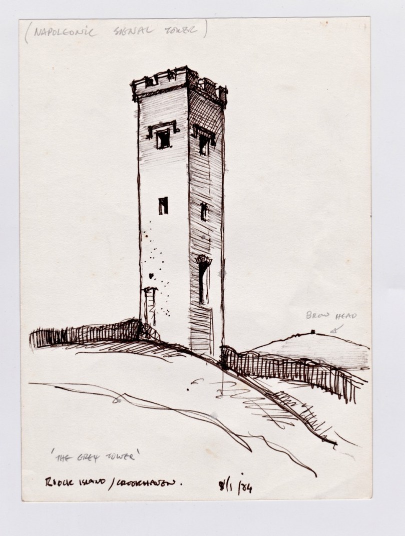
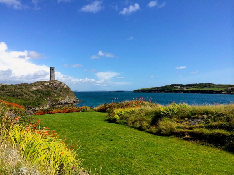
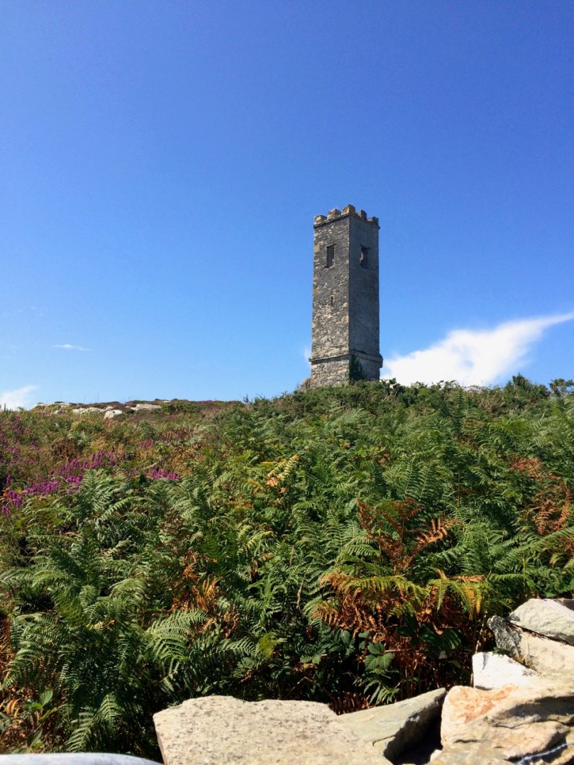
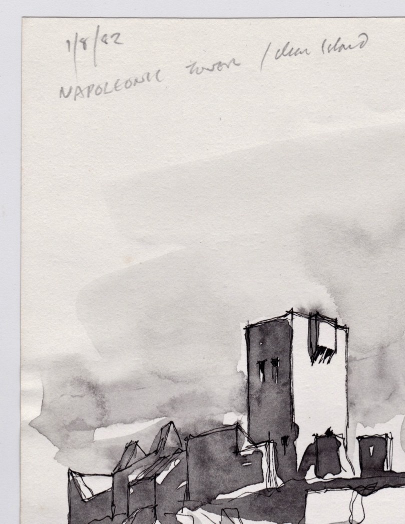
The last tower is on Rock Island. It is clearly visible from the Brow Head Signal Tower ( a requirement for the placement of signal towers) but, strangely, it is one of two very similar towers on Rock Island, and while they are similar to each other, they are quite different from the classic signal tower design. However, both the National Monuments site  and the National Inventory of Architectural Heritage listings name them as Napoleonic-era Signal Towers, and perhaps that is indeed what they are.

Rock Island Tower

Brian’s sketch of the Rock Island Signal Tower

However, in discussion with Brian, he pointed out that most of the buildings on Rock Island were developed as part of a major Coast Guard installation around the same time as the Marconi Station, and we wonder if there might be a connection – that is, that these are Coast Guard-related Watch Towers, rather than Napoleonic-era Signal Towers. Once again – more research needed! [Edit: See comment from Navtell in comment section, below.]

Rock Island Signal Station

Rock Island Second TowerThe two towers on Rock Island: similar to each other but quite different from the classic Signal Tower on nearby Brow Head

This is only my first foray into Brian’s Sketchbook. Look out for more posts in the future and in the meantime, join with me in being grateful that a precious resource like this survived numerous moves and that we have the opportunity to learn from it.

Cape Clear Detail - Signal Tower

The Cape Clear Signal Tower

Molaga of the Bees

bees!

I know I’ve said this before – but, wherever you find yourself in Ireland there’s history on the ground, and a story to be found! Recently we ventured into North Cork: so large is this county that it is a good half a day’s journey from Nead an Iolair, here in the far west, to Mitchelstown, beyond which lie the wild frontiers of Tipperary and Waterford. The purpose of our journey was exploration – archaeology, history, folklore – and we found ourselves drawn back into the time of the Saints.

1400 AD

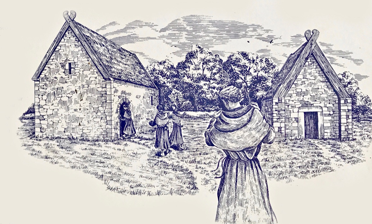
Artist’s reconstruction of the site at Labbamolaga as it might have looked in 1400 AD: the smaller building on the right is the saint’s original oratory, dating from the seventh century. Note the antae – the projecting stone walls on either side of the entrance, supporting the huge verges. These features represent the builders’ wish to recreate in stone the very earliest timber churches: in every age of Christian church building the aspiration was to hearken back to ‘the time of the Saints’, whatever era that might have been . The building on the left is a later medieval Parish Church known as Templemolaga (image from Dúchas – The Heritage Service)

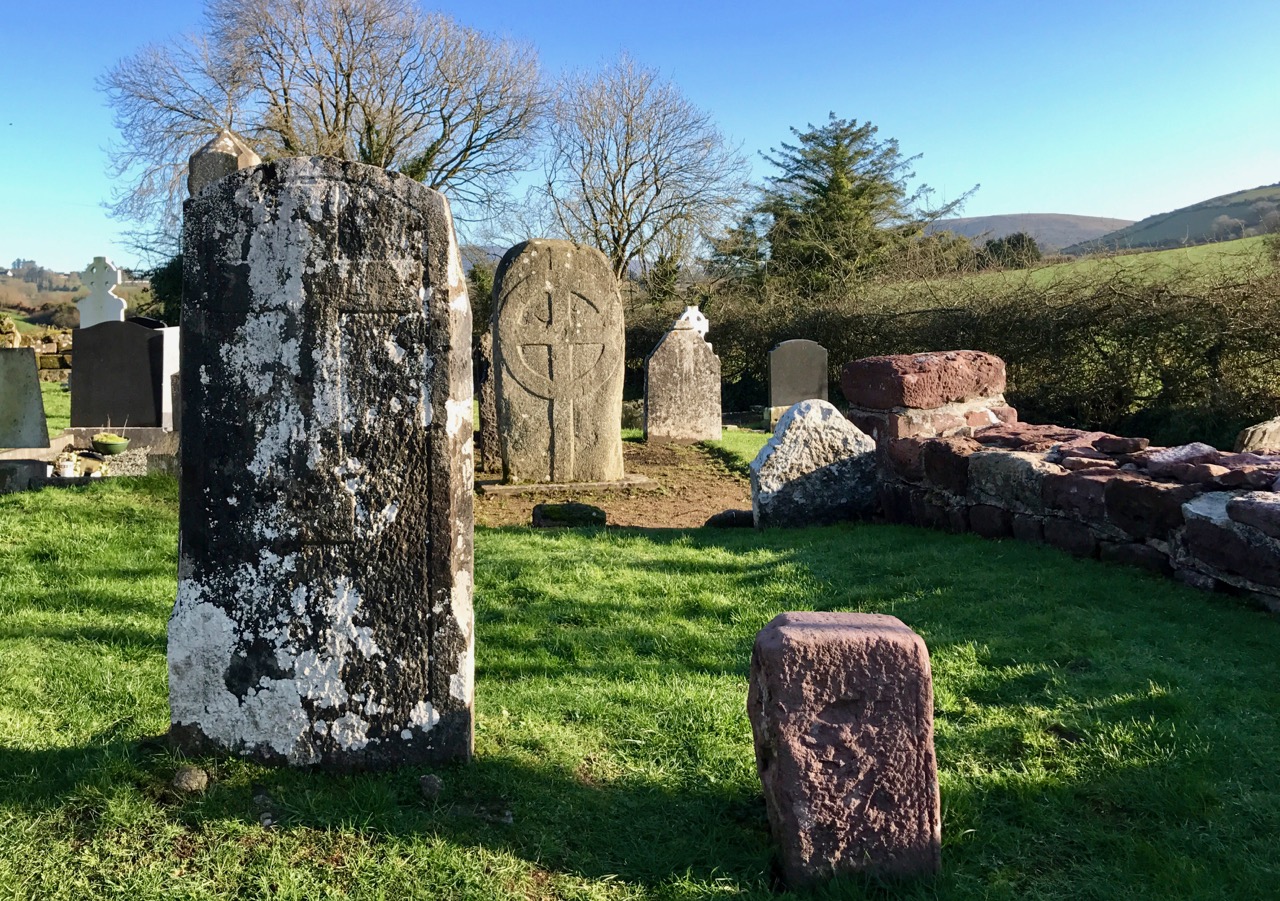
Well off the beaten track we found ourselves at an ancient site known as Labbamolaga, in the townland of Labbamolaga Middle. Labba Mollaga: it means ‘the bed of Molaga’, who was a saint living in the 7th century. He is said to have founded a monastery on this site and the earlier building here could have been his original church.

7th c entrance detail

through the portal

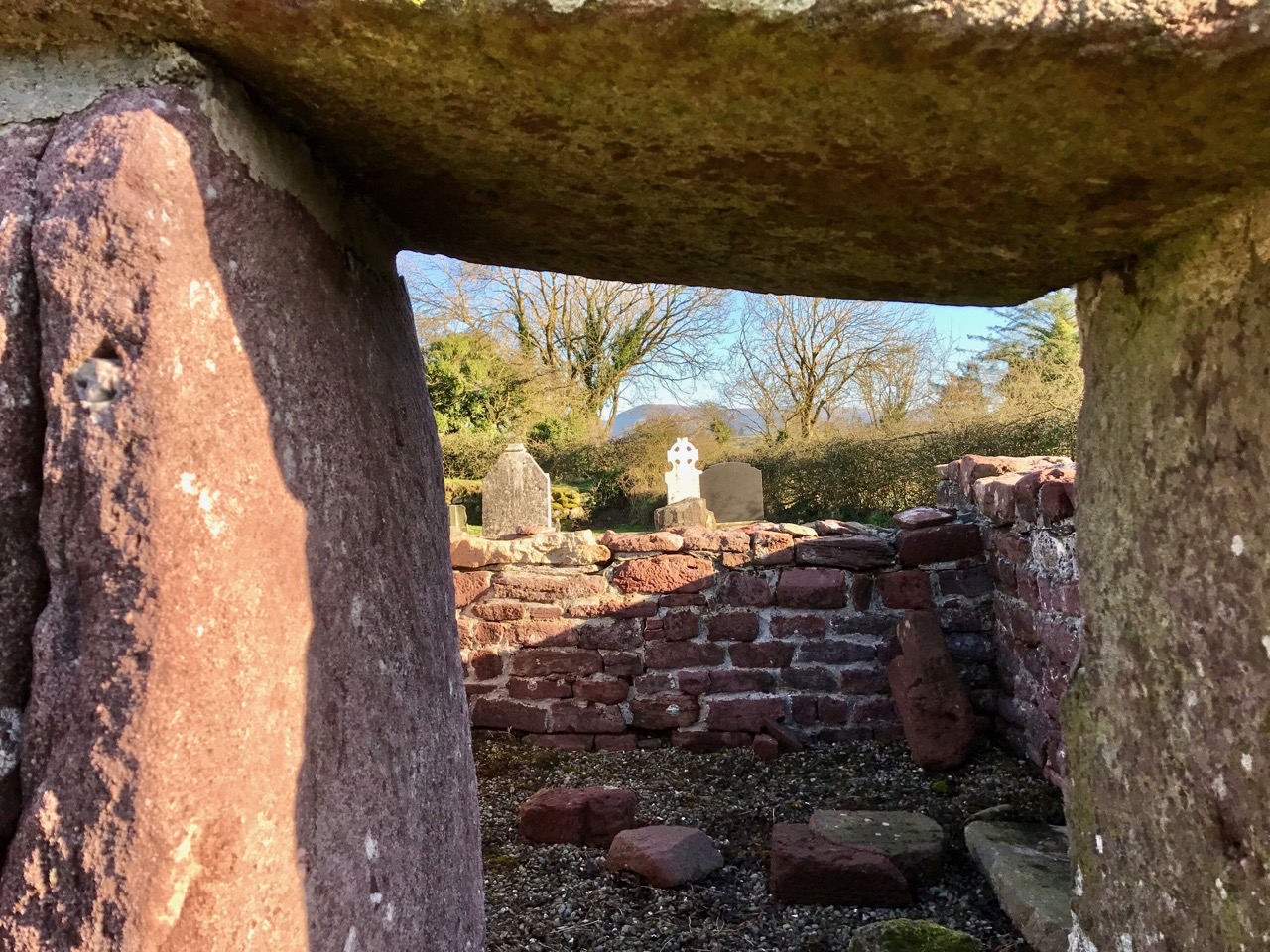
A seventh century oratory? Upper picture shows the entrance elevation with its pronounced antae, and the doorway which seems to be constructed from monoliths. It has been suggested that these stones could have been robbed from the megalithic monument which lies in a field to the south of the site. The middle picture looks through the entrance to the prostrate stone against the south wall: this is known as Molaga’s Bed: tradition states that the saint would lie on this stone at the end of each day’s work. It is also said to be his burial place and has curative powers, particularly for rheumatism. The lower pictures show the saint’s bed in 1905 (left) and in the present day (right) with its strange carving, which has been described as a volute

The architecture is fascinating: here we have one of the few examples remaining in Ireland of this most ancient church form, albeit in a ruinous state. In 1975 a similar ruin in Connemara was reconstructed to its likely original form at St MacDara’s Island, Carna. This gives us some idea of what St Molaga’s oratory could have looked like.

The oratory on St MacDara’s Island – early photograph (left) and 1975 reconstruction (right)

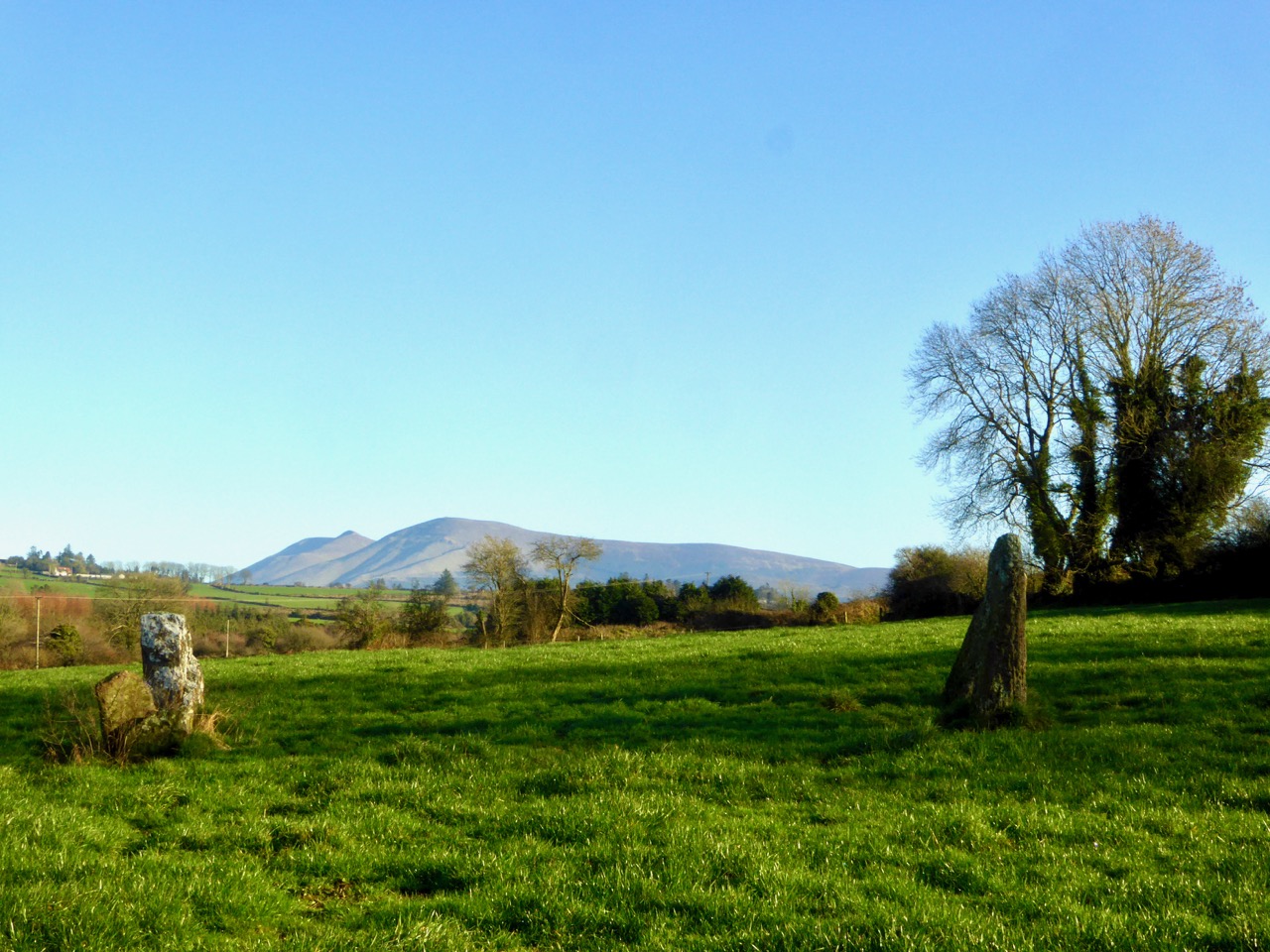
The site at Labbamolaga has much more more to attract the curious. There are the nearby megaliths: we would assume they considerably predate everything else, yet local lore tells us that they are four villains who stole the chalice and holy relics from the saint’s oratory but were caught in mid-flight and were turned into four pillars of stone by him! A further legend noted by John Windele, the Cork antiquarian and historian, in the 19th century relates to a holy well which once existed – some say under the saint’s bed:

…There was formerly a beautiful well of clear spring water here, but one day an old woman profanely washed her clothes in it; that night the well disappeared and was seen never more…

stone alignments

stones in graveyard

Upper picture: four standing stones in a field (known as Parc a Liagain, ‘Swardy Field of the Pillar Stones’ to the south of the ecclesiastical site – supposedly petrified villains who robbed the monastery. Lower pictures: the monastery site has become a burial ground – strange and fascinating stones abound. The centre stone is an ancient looking Celtic cross; the circular pile is an enigma – burial vault or old well house? The site also once contained Cursing Stones, but these are said to have been removed

What of the saint himself? He has a recorded history: born in Fermoy of parents who were well past child bearing age (a miraculous sign), he travelled to Scotland and then to Wales, where he became a follower of St David. Returning to Ireland he founded monasteries at Timoleague, West Cork (the name means House of Molaga), and at this site in North Cork. Sources say that in Wales he learned the craft of bee-keeping, and a colony of bees attached itself to him on his journey back to Ireland: the same sources credit him with introducing bees to Ireland, but the earlier Saint Gobnait – patron saint of bees – also has this reputation. Some mixing of hagiographies here, perhaps. Also confusing is the information given in catholicireland.net which gives the name St Modhomhnóg as ‘Irish Saint of the Bees’ and tells a similar story, although this saint returned to Ireland from Wales (with bees) and set up a community in Bremore, near Balbriggan, County Dublin – today known as the Church of the Beekeeper but also connected with St Molaga, who is there said to have procured his bees from St Modhomhnóg. To add to the confusion, the feast day of Saint Gobnait is on 11 February, while that of Modhomhnóg is on 13 February.

molaga

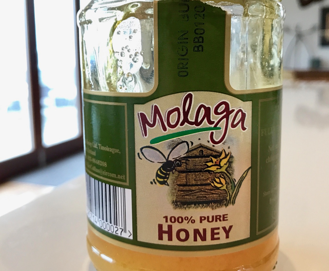
We hadn’t realised until we unearthed these stories that we have the saint’s name in our larder! Our favourite honey is known as Molaga – we get it from our local supermarket. There is nothing on the jar to explain the name (this is one of various spellings), but the honey is distributed from Timoleague (the house of Molaga) in West Cork. There is much more to the story of this slightly elusive saint, perhaps to be told another day.

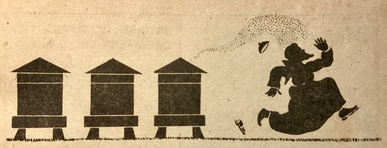
Many thanks to Brian Lalor for gifting us his copy of The Capuchin Annual 1944. It is wonderfully illustrated with cameos of monastic life drawn by ‘Father Gerald’: the header is one of these. The 1983 postage stamp illustration below is by Michael Craig

postage stamp

Cloondara Mill

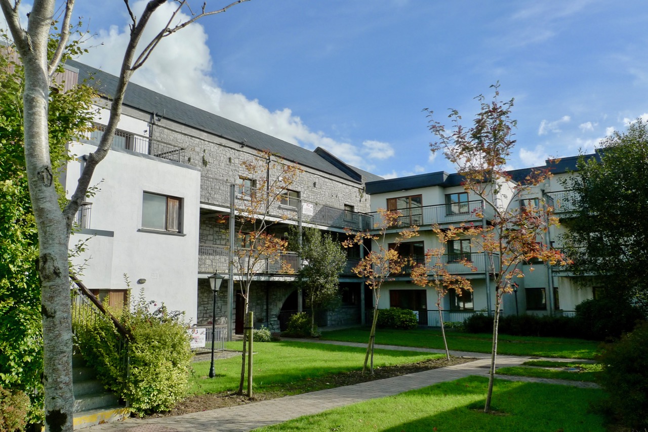
The Mill apartments

…Across the canal bridge there was a large corn mill which had seen better days but which I was pleased to see was still at work. Moreover it was not, as our few surviving [British] watermills are, relegated by the milling combine to grinding cattle meal. Cloondara Mill was grinding 100 per cent extraction flour for the village bakeries of the district. As we walked over the bridge a small water-turbine was churning merrily, driving the dynamo which provided electric light for the mill and the miller’s house. But the great undershot wheel which drove the mill from the waters of the Fallan River, a tributary of the Shannon, was still and silent. I knew why because, from somewhere in the dim recesses of the rambling stone building I could hear the chip chip of a mill-bill tapping away like some busy woodpecker. This Irish miller, like the English country millers who I have been fortunate enough to meet, was obviously proud of his mill and was delighted by our interest. Having assured himself that the stones being dressed were out of gear, he insisted upon opening the sluice for our benefit, setting the giant wheel revolving with a rumble and surge that wakened the mill and which, via a complex of wooden gearing, shafts and pulleys, set screens and sieves shaking and revolving to the very top of the building…

(L T C Rolt Green & Silver George Allen and Unwin, London 1949)

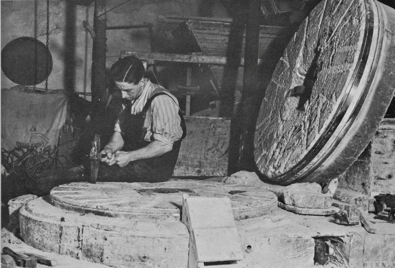
millstone dressing

…There were four pairs of stones, two sets of ‘Peaks’ for meal and two sets of French Burrs for wheat. The runner of one pair of Peaks had been swung off the bedstone, and the dresser sat on a sack, legs astraddle, as he tapped away at the worn furrows with his bill. I had expected to find that the language of the miller’s craft was different in Ireland, but this was not so. Thus the stirrup and shoe which feeds the grain into the eye of the runner stone and whose cheerful clink clack contrasts with the rumble of the stones, our miller, like his fellows in England, called the ‘damsel’. In an earlier book I described how the miller of Minshull Mill in Cheshire used apple wood to renew the teeth of the wooden mill gearing. Here beech wood was used for this purpose…

Header photograph: Cloondara Mill, Richmond Harbour, 2016; above, photographs from Windmills & Watermills (John Reynolds, Hugh Evelyn, London 1970) showing a miller and his bills, working much as Rolt described in his book

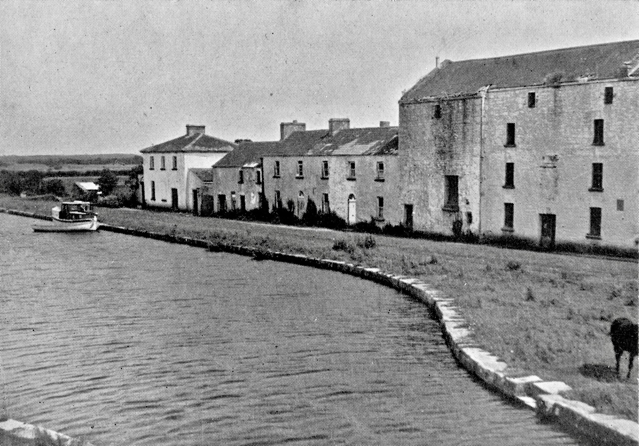
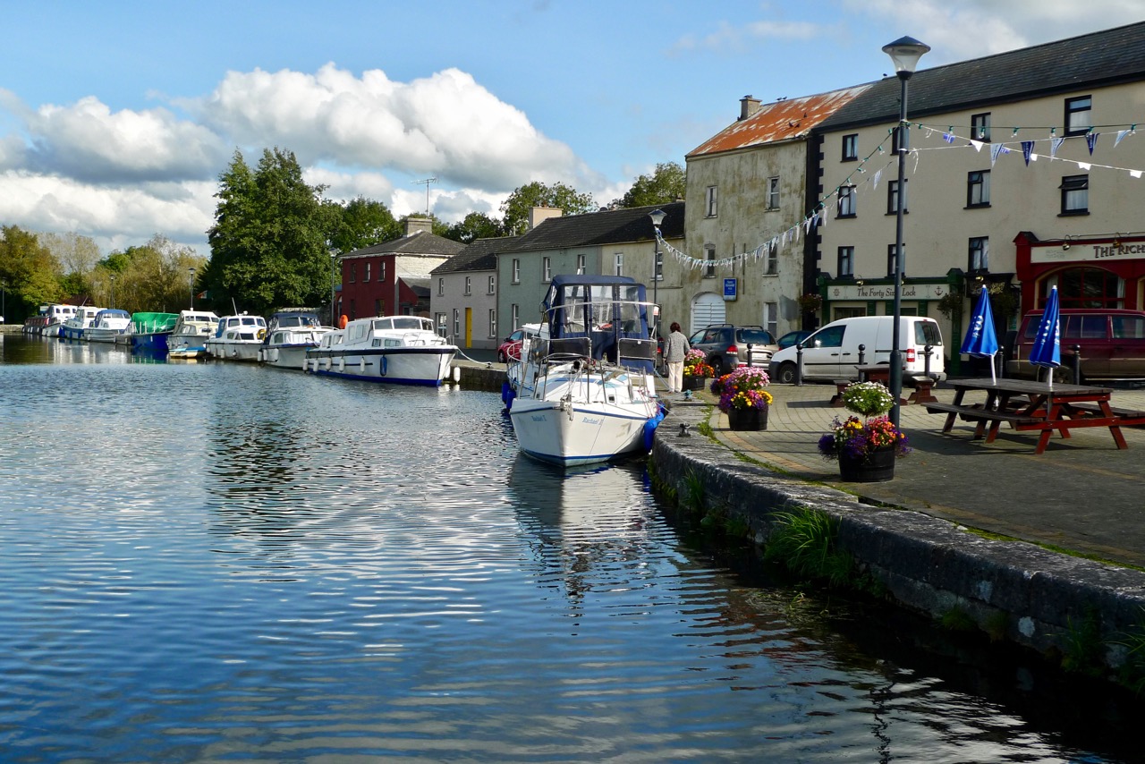
We spent some weeks in the summer exploring the waterways of Ireland, following in the wake of Tom and Angela Rolt who had made a pioneering voyage in 1946, when the canals were in a state of decline. In fact, the Rolt’s boat Le Coq was the last to make the complete journey through the Royal Canal, which became derelict and finally closed in 1961. When they passed through Richmond Harbour in County Longford – the junction of the Royal Canal with the River Shannon – they paused to visit the corn mill at Cloondara: this mill ceased operations in the 1950s, not long after the Rolts’ visit.

Cloondara Richmond Harbour 1946

Richmond Harbour 2016

Upper photograph by Angela Rolt: Richmond Harbour in 1946 – the single boat is Le Coq. Lower photograph shows the same scene in 2016, seventy years later; the Royal Canal (which closed in 1961) has been fully restored, re-opening in 2010

We found Richmond Harbour to be a thriving small community; a boating centre which has benefitted from the restoration of its canal. Comparing the two pictures above – separated by a span of seventy years – the architecture of the place has hardly changed: only the buildings on the right seem to have been significantly updated, although they retain the structural form of their predecessors.

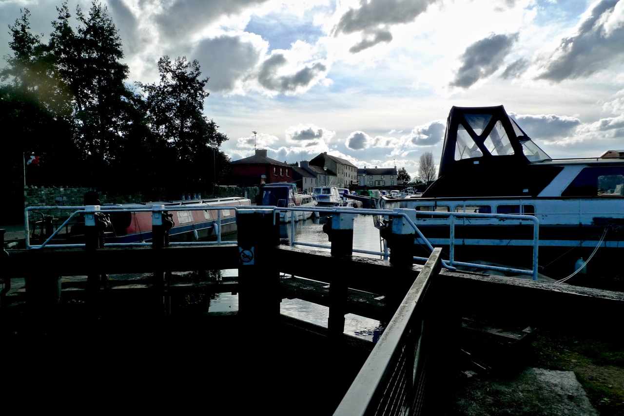
lock and mill

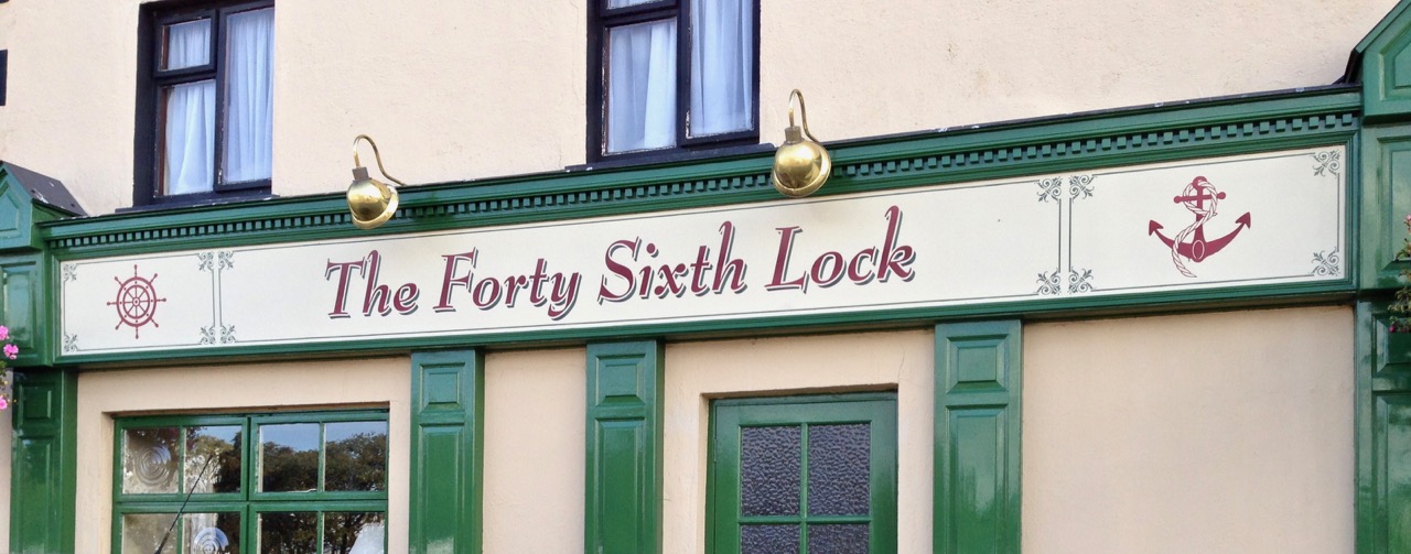
Forty Sixth Lock

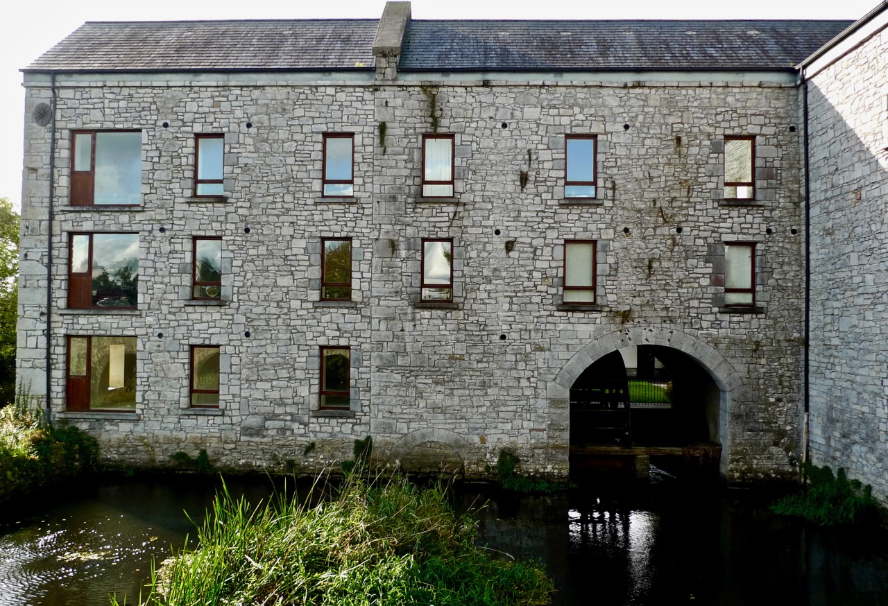
The settlement retains its focus on the water, and there is evidence of some economic activity based around the canal harbour. I was particularly keen to see what had happened to the mill which Rolt describes in such detail; it remains, converted to an apartment complex. This seems to be an ambitious undertaking within such a small community: there are vacant apartments and signs that maintenance is falling behind in places, but it has to be a good thing that the project has respected and built on to the original industrial architecture. The impressive building is largely intact and continues to hold its original character, while some of the machinery has been retained to provide historical visual references.

apartment complex

This series has given me a fascinating project to research and record (there’s more to come!). I only wish the Rolts were still around – I would like to discover their own reactions to the evolution of Ireland’s waterways system in the years since they travelled here.