The Murdering Glen

On the walk

The long valleys that run eastwards from Bantry are filled with antiquities – Discovery Map 85 is dotted with red circles of places we want to tramp around. We have been particularly intrigued by the ‘Murdering Glen’, labelled on the map: can you see it?.

Murdering Glen Map

Today we got a chance for a thorough exploration of the Murdering Glen, on the invitation of our friend Bridget, who lives there and is a keen explorer herself. After a wonderful lunch supplied mainly from her garden we set out up the road towards the Glen, with Bridget assuring us that the place appeared peaceful enough these days and not to worry.

Murdering Glen

The Glen is indeed dramatic, with steep sides and an enormous overhanging rock – just the kind of place for a brigand to lurk. In this case the brigand (and his mother) were locals, by the name of O’Kelly, who would lay in wait for travellers and murder them for their gold, before throwing them into the Butcher’s Pool.

Murder Rock

In  the 1930s schoolchildren in every National School in Ireland were asked to write down the stories they heard at home and these were recorded, in their own writing, by the National Folklore Commission. Here is the outline of the project, as presented on Duchas, the website that now stores that collection:

For the duration of the project, more than 50,000 schoolchildren from 5,000 schools in the 26 counties of the Irish Free State were enlisted to collect folklore in their home districts. This included oral history, topographical information, folktales and legends, riddles and proverbs, games and pastimes, trades and crafts. The children recorded this material from their parents, grandparents, and neighbours. The scheme resulted in the creation of over half a million manuscript pages, generally referred to as ‘Bailiúchán na Scol’ or ‘The Schools’ Collection’.

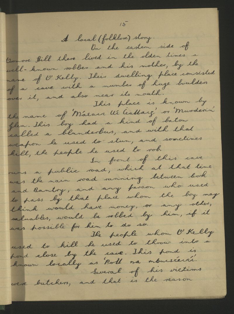
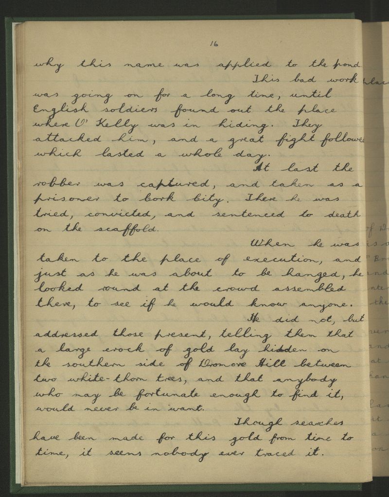
To my delight, I was able to find the original story in the collection – and here it is, in the handwriting of schoolboy Michael Keohane from Dromore National School. I think you will agree he has done a magnificent job of telling the local legend.

murdering-glen

murdering-glen-page-2Before we left the murderous spot Bridget led us up to the mass rock, on a ledge on the side of the valley. It was a block of sparkling quartz, with holes to collect water, into which you can dip your warts in hopes of a cure.

Bridget shows us the mass rock

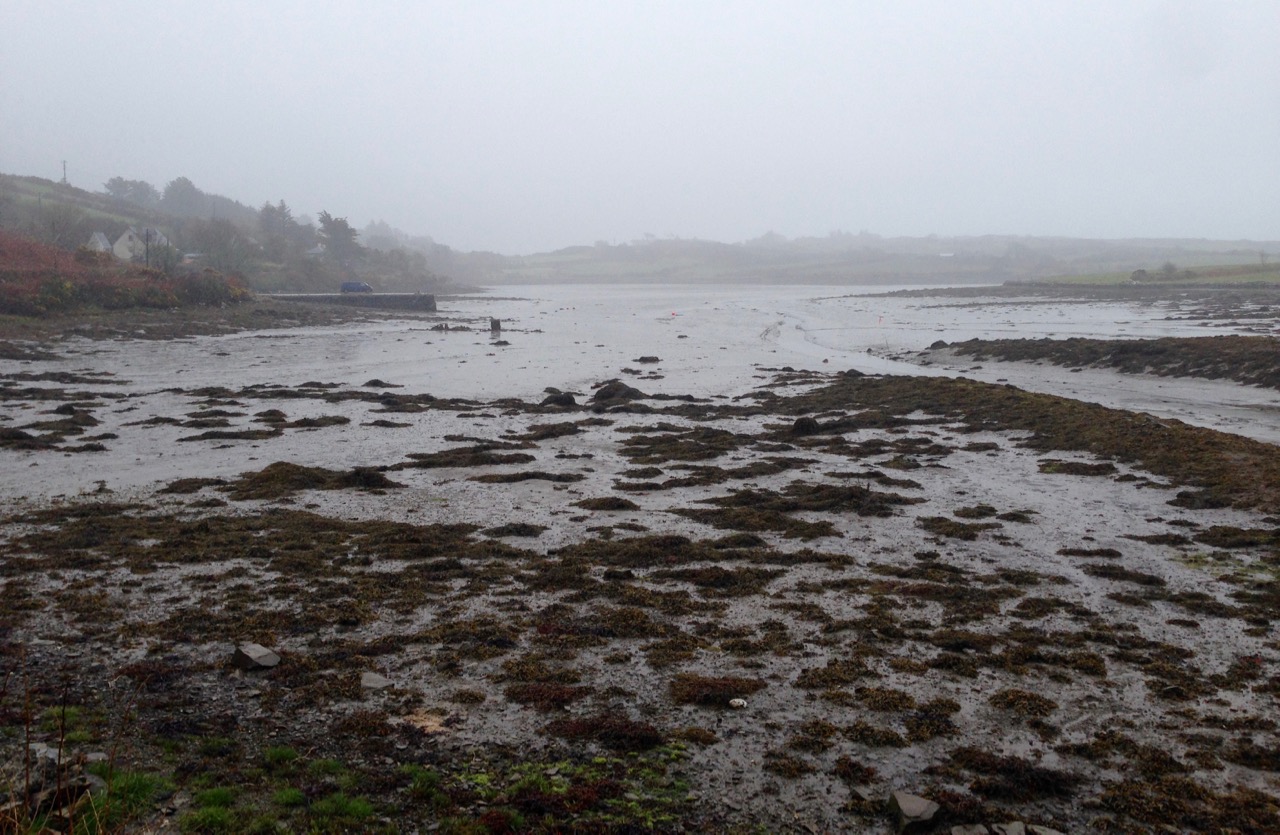
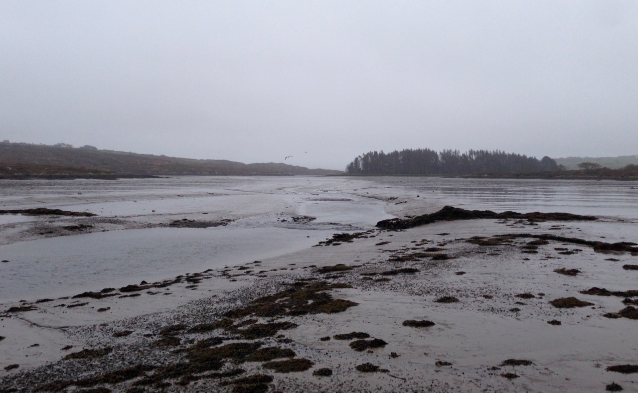
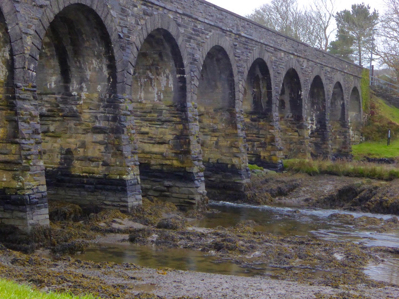
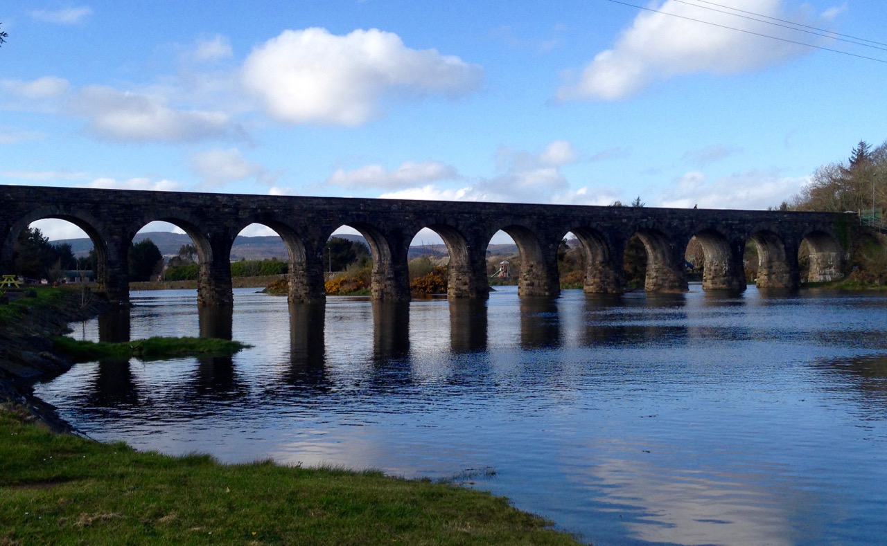
We  walked then towards the Trawlebane Bridge, where Robert and I had joined the walk two years ago to honour and remember Chief O’Neil. Robert’s post, The Chief, will take you back to that day and show you the spot where, before we started the walk, participants decided to put on an impromptu display of Crossroads Dancing, just as local people would have done on a fine summer evening in the old days.

Trawlebane Crossroads

There was more, much more to see, just in the immediate neighbourhood. We spent time in a Cillín first, in the middle of a field, with a magnificent blackthorn tree to mark the lonely spot where unbaptised children were traditionally buried. Read more about this practice in my post Unknown Souls.

Cillín

Blackthorn TreeA little five-stone circle was next – a classic of its kind, with four stones set on edge and a recumbent stone marking the axial alignment. (See more examples of them in my post Family-Friendly Archaeology). Besides three sites in nearby Kerry, these small stone circles are only found in Cork. They mirror exactly the larger multiple-stone circles, just with fewer stones – an efficient variation requiring fewer resources to erect but accomplishing the same outcomes.

Five stone circle

Unfortunately, this five-stone circle has been filled with field debris, creating the appearance of a mound

We also passed numerous ringforts and several standing stones. Looming over us as we walked was Dromore hill, on top of which was erected, in the Marian Year of 1954, an enormous cross, now rather improbably lit up at night. The cross is clearly visible from the stone circle and the standing stones, presenting opportunities to ponder on the juxtaposition of what is considered sacred in its own day, and what communities will expend precious resources to erect at different times over millennia.

Cross above circle

CrossOn  our trip to Sligo recently Robert and I were sensitised to the phenomenon of monuments seemingly echoing or imitating the topography behind them – see his post Discovering Carrowmore for more about this. I was struck by one of the standing stones – the top did seem to echo the hill behind it. Coincidence?

Standing Stone shape

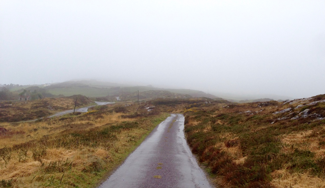
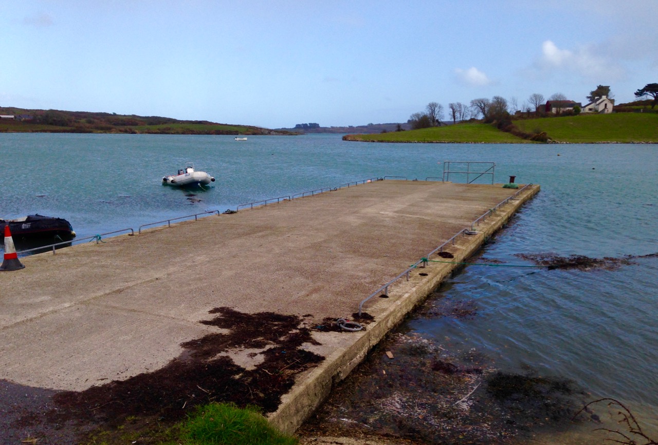
October in West Cork can feature some of the best weather and walking conditions of the year. Today did not disappoint, with blue skies and crisp air.

Tree

Thank you, Bridget, and our other exploring companions Amanda and Peter, for a marvellous day of Murder, Mythology and Megaliths.

At the rabbit ears

Late Bloomers: Invasive, Naturalised and Native

Creeper on white cottage wall

This is my last wildflower post! You must be getting tired of my wildflower obsession by now. So, no more after this one. (Well, at least not in 2016.) The thing is, I had assumed that there was nothing left to see at this point. We are in October after all, and autumn is coming early this year after a cool and misty summer. But a walk today put flight to that notion.

Bee on Ivy Flower

Bracken undergrowthThe ivy flowers are alive with bees right now (above) and the bracken is putting on its winter coat

The predominant colour of the countryside is changing now as the brackens take on their winter amber-brown. The ivy is in full flower. Stand near a patch and you will be instantly aware of the hum. Our little black Irish bees are gathering while they still can and depend on this late flowering and ubiquitous plant for the last remaining nectar. Ivy honey is darker in colour and can smell a little rank, but it has a great reputation as a soothing cure for coughs and colds (especially if mixed with a little whiskey).

Bee on Ivy 2

Red Admiral on IvyThe bees and the Red Admiral Butterflies depend on this late flowering ivy

The trees haven’t quite started to turn yet, but brambles and creepers are in brilliant autumn reds. On our walk today this white cottage wall with its scarlet creeper caught my eye.

Creeper on cottage wall

A couple of surprises awaited us today. The first one was to come across a stand of Indian Balsam. This alas, is an invasive species, introduced as far back at 200 years ago from the Himalayas. The distribution map at the Botanical Society of Britain and Ireland does not show it in West Cork, but I guess I can now say it’s here. In fact, I submitted a report to Invasive Species Ireland – anyone can do this via their Alien Watch Program. Although it is certainly beautiful, it’s a divil – read all about its negative impacts on the Invasive Species Ireland website. Among its other attributes, it has a explosive seedpod that can throw seed up to six metres!

Indian Balsam

Indian Balsam – Invasive Species Ireland lists it with Rhododendron, Japanese Knotweed and Giant Hogweed as the most damaging invasive species

So  what’s the difference between non-native plants that are labelled invasive versus this that are called simply naturalised? Although it can be a matter of debate and perception, in the main we use the term invasive for those non-native plants that spread to such a degree as to exclude native species from the habitat they favour, or cause damage to the environment or the economy. Happily, the only invasive species we encountered on our walk was the Indian Balsam. However, we did come across lots of non-native, naturalised flowers too.

Greater Periwinkle

The Greater Periwinkle – seen a few days ago on The Mizen

The first one (actually seen a few days ago) is this beautiful Greater Periwinkle. It’s not a native plant but has been here a long time. It’s supposed to have great medicinal properties, especially as a laxative and, in an ointment it’s good for, er, piles. According to Zoe Devlin’s Wildflowers of Ireland (my go-to guide) The 17th century herbalist, Nicholas Culpeper wrote ‘that the leaves eaten by man and wife together, cause love between them. Ooh – think I might head back to where I saw it…

Ivy-leaved Toadflax

Ivy-leaved Toadflax

Another non-native species is the Ivy-Leaved Toadflax – not an attractive name for a very pretty little creeper found commonly on rock walls. During the 1600s, wealthy Brits started to import Italian marble into England in the form of building material and statuary. The Toadflax came along for the ride and is now so completely naturalised that few people realise it’s not a native plant. They look wonderful on rock walls but it’s not usually necessary to plant them yourself. According to one source I read, seeds, complete with a starter-pack of organic growing medium, are usually delivered by birds.

Pink Sorrel

Pink Sorrel

The final non-native flower we saw today was the pink sorrel. I thought at first it was Herb Robert, which is a native plant that grows everywhere and is still blooming, but closer examination revealed  a deeper pink, a more massed growth pattern and very different foliage. It’s a garden escape, now naturalised across the south and south east of Ireland.

Fuchsia on bare branches

Actually, I suppose I also have to add the fuchsia to the naturalised non-native list, even though we think of it as the quintessential West Cork flowering shrub. It’s still hanging in there, even though most of the leaves have dropped already.

Creeping Buttercup

Tormentil

The native plants still bravely blooming to delight us tended to be tiny, but bright enough among the grasses, brambles and bracken to immediately catch the eye. We saw Herb Robert, Prickly Sowthistle, Tormentil and patches of what might be Sea Radish (or perhaps not). 

Prickly Sowthistle

Prickly Sowthistle

Herb Robert is such a hardy little flower – it seems to peep out and last longer than almost everything else in the hedgerows. Birds love the seeds of the Prickly Sowthistle – it has guaranteed its survival by appealing to them and providing food when other sources are fading.

Herb Robert

Sea Radish

Herb Robert (top) and possibly Sea Radish

As  a member of the cabbage family, the leaves of the Sea Radish are edible, if a little peppery. Interestingly, it normally finishes flowering in July, so the ones we found today must be in a particularly sheltered spot. But this also raises the possibility that this is a different plant. Can anyone help identify it?

Tormentil Patch

And finally the strangely named Tormentil – it sounds like it may cause pain but in fact it’s the opposite. There are all kinds of medicinal uses for this little flower and its parts, some of which relieve the ‘torment’ of pain. It also, according to this website,  imparts nourishment and support to the bowels and the fresh root, bruised, and applied to the throat and jaws was held to heal the King’s Evil. You heard it here first!

Ballycummisk Coppermine and Gabrial

Our walk today, along one of the Fastnet Trails, took us past the old Ballycummisk mine site and gave us distant views of Mount Gabriel

Cycling the Sheep’s Head

Group at Ahakista

The joy of cycling! The fresh air! The wind in your face! The sun on your back! The sights, the sounds, the smells! Wait – those killer hills! The wobbly legs, the burning lungs! No problem – we have Kalkhoffs!

Is  that enough exclamation marks for any decent blog post? And what on earth is a Kalkhoff?

DSC_0073

Sheeps Head light
Above, a Kalkhoff electric bicycle and below, the Sheep’s Head – the perfect combination

Earlier this year we cycled the length of the Sheep’s Head and back, all of us on electric bicycles, mostly Kalkhoffs. The day was organised by Patrick Murray and Helen Guinan of City View Wheels in Cork, and a masterpiece of organisation it was, featuring stops for coffee, lunch and a pint at the end of the day, followed by a lovely dinner in the Maritime Hotel in Bantry.

stopping for the view

Riding an electric bike has revolutionised cycling for me and for many others. Let’s face it, West Cork is nothing but hills, and huffing and puffing up one of them, pushing a bike, can take the joy out of a day’s adventure. But with some battery-powered help, you can stay on the bike and arrive at your destination still able to breathe.

The Old Creamery at Kilcrohane is a great place for lunch

It’s like having the wind at your back, giving you a gentle push when you need it. It’s still a work-out (you don’t stop peddling) but it just makes the whole venture doable. No, more than doable – pleasurable!

Lighthouse Loop

Sheeps Head LighthouseAbove: This is as far as you can drive or ride on the Sheep’s Head – after this, it’s a goodly walk to the lighthouse (below)

The Sheep’s Head is the perfect destination for a day’s cycling – incredibly scenic, lots of places to stop for refreshment, lots of things to see and do along the way, and relatively flat. Note that word relatively – if you start at Durrus and cycle along the south side to the end of the road and back, you don’t climb over any mountains but you do gain considerable altitude – enough to ensure that you deserve lunch by the time you reach Bernie’s Cupán Tae.

up the last hill

The good news is that it’s mostly downhill all the way back to Durrus.

Leaving Cupán

It  was a congenial bunch and the day was full of chats and laughter. As the ‘locals’ in the group, it was lovely to be able to show off West Cork. We made a detour down to Lake Faranamanagh and told everyone about the Bardic School and the King of Spain’s sons.

sheeps head view


Lake Faranamanagh
The Sheep’s Head , Lake Faranamanagh

When you’re cycling with a group you can’t really stop to take photos whenever you want, so the photographs in this post are a mixture. Photos of the day itself were taken either by Patrick (thank you, Patrick!) or by me, while general photographs of the Sheep’s Head come from my own collection and were taken at various times of the year. They will give you a feel for what’s to do and see along the way.

Air India Memorial Site


Top: The beautiful and moving Air India Memorial site at Ahakista; bottom: Critters encountered along the way

We were blessed with a lovely day for our bike trip. But then, as you know, the sun always shines in West Cork. And sure, if it doesn’t, you can hole up in a pub and sing, or stay home and cook up some fresh eggs from the happy hens at Faranamanagh.

eggs

If  you love to get out on a bicycle but aren’t the iron-man type, fear not – there is life after lycra!

road into Durrus

And if you just want to explore the Sheep’s Head, bike or no bike, take a look at our post on Walking the Sheep’s Head Way or head on over to Living the Sheep’s Head Way, the website of the Sheep’s Head and Bantry Tourism Co-operative, for lots of information the peninsula and places to stay. Or take a browse through The Sheep’s Head Way for all the walking routes – it’s the website of the voluntary committee that takes responsibility for the way-marked trails.

convoy

rainbow over mizen from Sheep's Head

Anomalies

The cairn

What’s an archaeological anomaly? When the National Monuments Survey was being undertaken, some stone structures didn’t quite fit the description of a particular class of monument. They may have been ancient – but how ancient, and what exactly were they? The term chosen for such mysterious piles  was ‘anomalous stone group’. Here’s the definition: A group of stones, usually standing, which cannot be classified as any other known archaeological monument type on present evidence. They may be all that remains or is visible of a partially destroyed or obscured archaeological monument which may date to any period from prehistory onwards.

cupmarked rocks?

Just a leaning rock?

But it’s not the only term used for uncertain monuments: enclosure is a vague term that can mean a multitude of things, and an ‘unclassified cairn‘ can be defined simply as a heap or pile of stones. In the last few months our explorations of the Sheep’s Head have turned up several anomalies. The only thing they all have in common is their spectacular siting, leading to an ultra-rewarding field trip.

Heading towards the cairn

Hiking to the cairn

Perhaps the most magnificently situated of all is the unclassified cairn on the mountain ridge above Kilcrohane. It’s right on the way-marked Sheep’s Head Way, so it’s easy to find. While it’s described as a cairn in the National Monuments inventory, it could be as humble an object as a turf storage platform or as wonderful as a passage grave. We’ve been to it several times and always puzzled over it, but on our last visit we were alerted to a new element by Amanda and Peter.

Amanda investigates

The ‘new element’ – you have to really look!

A couple of stones had shifted, possibly in storms, and we could now delve deeper into the pile of rocks and see that one of them had a large circular opening in it. Very strange – I had never seen anything like it – and very intriguing.

Curious ‘holed stone’ at the bottom of the cairn

We noted that the highest point on Cape Clear was visible across the water, the hill on which a ‘real’ passage grave sits. Only excavation is likely to reveal the exact nature of this anomaly.

What's the orientation?

This one is called an ‘anomalous stone group’

Not too far away, in the same townland but on lower ground, is an anomalous stone group. This is a strange one indeed because half of it looks for all the world like a stone circle – identical to the numerous recumbent or axial circles that dot West Cork. The other half? It’s the rock face that the stones obviously came from.

Is it a stone circe?

Could swear that’s a classic recumbent, but where’s the other half of the circle?

It’s like a work in progress. If it is a stone circle, the builders decided that half a one would do the job just fine. Indeed the owner of the land has noted several significant  sunset alignments.

possible alignments

There seem to be several alignments – this one to the Beara Peninsula

But when I asked for comments on an archaeological social network site the general consensus seemed to be that it was unlikely to be a stone circle, since the stone face obscured half the horizon. But that same stone face would have provided shelter, so the speculation in the discussion centred on this being a hut site, with only some of the stones of the outside wall remaining.

radial cairn?

This area of rough ground to the right of Robert, Peter and Amanda is labelled an ‘Enclosure’

The third site we’ve explored is described as an enclosure. The description of the site states: A circular area (diam. 10.5m) is defined by the remains of a stone wall (T 1.3m; H 0.5m) displaying traces of an inner and outer row of large stones with a fill of smaller stones. A stone slab (H 1.15m; L 0.5m; T 0.4m) narrowing as it rises stands on the external perimeter at E. There is also a standing stone a few meters to the south.

inner row?

Difficult to make out what’s here, but it seems like there’s a lot going on

This could be a radial cairn – take a look at the one at Kealkill to see what we mean. But equally, the description hints, it may have to do with field clearance. It’s almost impossible to tell a lot from the general jumble of stones and the furze and brambles that grow all over the site. Once again, however, we were rewarded with panoramic views to the Beara Peninsula. Another one where only an excavation will reveal the truth.

View east from the enclosure

And these views of the farms to the east, lit by a shaft of slanting sun

Finally, we trekked out on the Lighthouse Loop Walk at the very end of the peninsula in search of possible cupmarks, discovered by Peter and Amanda’s son.

Lighthouse trail, looking back

On the lighthouse loop trail, looking back

The cupmarks turned out, we’re pretty sure, to be natural solution pits. There were lots of them, of varying sizes, and some could only be viewed by lying on your back.

The pitted boulders

The ‘cupmarks’ are on the underside of the leaning rock

Instructive, though, as we have certainly seen cupmarked stones that don’t look a whole lot different than these ones – there’s a type of shaley sandstone in West Cork that laminates in a very similar manner when carved.

Solution pits

pits all aroundSolution pits – and modern graffiti 

In West Cork, monuments that don’t fit into satisfying categories abound – and it’s just as much fun exploring them as it is the ‘normal’ type!

tough to take

This kind of field trip is tough to take!

Tide’s Further Out!

cove gray day“Donn Fírinne was in the clouds last evening – today would be bad…” Donn Fírinne was a Munster fairy-king always connected with weather omens: …the people said that Donn collected the clouds on his hill (Cnoc Fírinne, Co Limerick) and held them there for a short while to warn of approaching rain, and from the reliability of this sign came his name, Donn of Truth… (from The Festival of Lughnasa, Máire MacNeill, University College Dublin 2008)

Only a month ago I wrote a post about a very low tide: I hadn’t realised that we were heading for an exceptional event, the lowest tide of the century! So I felt that our readers deserved to have this circumstance recorded as well, even though it involved braving what was probably the least hospitable weather that the spring has come up with so far! I should have taken notice of the omens from Donn, but instead I went out into the cold, pervading rain.

high road gray day

Out into the weather: the high road at Cappaghglass at its wettest

The day was last Thursday, 7th April, and the tide prediction was a low of 0.00, just after noon. 0.00! You can’t get much lower than that. But we have to remember that  tide predictions are just that – predictions. It’s a bit like weather forecasting – there are so many factors which can affect the outcome. Tides can vary from the predictions because of winds, atmospheric pressure, even the salinity and temperature of the sea, evidently. However, although I can’t vouch for the 0.00 (wouldn’t that mean that the sea was empty?) I can confidently state that the shoreline had receded further than I’ve ever seen it before.

ballydehob bay gray day

12 arch low tide 2

Top: Ballydehob Bay just a mud flat – Bottom: the 12-arched bridge has lost its river

I followed the coastline all the way from Ballydehob Bay to our own Rossbrin Cove. Sure enough, whenever you could glimpse the sea, it wasn’t to be seen! But that might have had something to do with the all encompassing fog that had descended.

Sunken wreck

Is it a wreck? Or some debris discarded in the Cove?

The modern quay in Rossbrin Cove seemed stranded and pointless, but Fineen O’Mahony’s tower house still managed to catch a reflection as the tide began to turn.

the quay gray day

Rossbring through rain

Rossbrin Castle – Fineen O’Mahony’s tower house – seen through a spotted lens

Of course, what goes down has to come up and – in the evening – I ventured out again to see the ‘high’ of 3.30.

high tide 12 arched bridge

rosbrin pier high tide
Evening high water in Ballydehob (top) and at the quay in Rossbrin (below) – note the improvement in the weather!

This is Ireland, so the day that was in it had changed completely with the tide: now we enjoyed clear blue skies and (watery) sunshine. Walking the shoreline was a pleasure! To be honest, you have to find your pleasure here from taking to the trails whatever the weather (as many of our occasionally bedraggled visitors might testify). It’s fine, as long as you have a good fire in the hearth to come home to…

the road to julian's house

Above – when the tide goes up, the road to Julian’s house goes under! Below – a hot fire to come home to…

hot fire

Priests and Poets, Part 2

BVM

Last week we concentrated on Father James Barry and the poetry he could well have inspired. But there’s a lot more to Stouke graveyard and this post will cover some of the other history revealed  by a wander round this atmospheric place.

IMG_0988

This graveyard is the traditional burial site of many from the islands of Roaringwater Bay. There’s a poignancy to the place names on the headstones – many of these islands are now uninhabited, so these are the last headstones that will bear such inscriptions. As with many West Cork graveyards, much of the ground is scattered with rough, uninscribed, stones, while other graves have modern memorials with full inscriptions. It is customary to visit graves on anniversaries, or at certain times of the year, and always you will find that a few graves still have fresh flowers or other evidence of recent visits.

IMG_0987

The old Irish name for this place is Cillín Stuaice, or Little Church of the HeightThere is a suggestion that somewhere in the graveyard is the site of an early church, but if it is here, there is no evidence of it. Except for one thing – a bullaun stone. Robert has written before about the folklore and beliefs associated with bullaun stones, but what exactly are they? Bullaun is an Irish word for bowl – these are bowl shaped depressions in rocks, sometimes portable, sometimes carved into rock outcrops. Although some may date to prehistoric times, many are believed to have originated in the medieval period for the purpose of grinding (acorns, for example) or for crushing ore. Whatever their origin, they are often found in association with medieval churches or other sacred sites such as holy wells, and have assumed their own sacred mantle of meaning. The water that collects in them is often believed to be curative.

P1110096

The bullaun stone in Stouke graveyard is known, according to the Historic Graves account, as the Bishop’s Head. The informative plaque erected by the Fastnet Trails folk tells us that an older name for the townland is Kilaspick Oen, meaning Church of Bishop John. Perhaps this was the Bishop for whom the bullaun stone is named. The story goes that during the time of the penal laws the Bishop was confirming children nearby when the redcoats got wind of his activities and came to arrest him. He was beheaded. The bullaun stone commemorates this act and has been a focus of devotion locally, with people leaving coins and tokens to pay respect and perhaps ask for consideration for special intentions. Additionally, rounds were performed here on St John’s Night – although I am not sure if this tradition has persisted.

Money jars

But last week I promised you more poetry! Inside the gate is a grave of the McGrath family, including the ashes of Liam McGrath who emigrated to Australia but never forgot growing up in Skeaghanore, near Ballydehob.

Although he was active on a number of fronts, his delight was to remember the old times and to capture his memories in verse. He was a true ‘folk poet’ – recalling the past with nostalgia and trying to capture what he saw as the golden scenes of his young life in rural West Cork. Over the years, several of his poems were published in the Southern Star. Local historian Teresa Hickey generously shared with me those she has collected over the years – a real treasure since they are not available online.

Teresa Hickey and poems

Liam McGrath cuttingsTeresa’s personal favourite is Three Bells. It describes the sound of the bells on Sunday morning from Ballydehob’s three churches – Catholic, Church of Ireland and Methodist. Sounds, of course, trigger deep memories, and this poem captures Liam’s recollections of traditional Sunday mornings in the village. Sadly, the Methodist Church has fallen into ruin, so those bells will never again peal over Ballydehob.

Ballydehob showing church on hill


St Matthias CoI Ballydehob

Above: The Catholic Church dominates the skyline of Ballydehob. Middle: St Matthias Church of Ireland. Below: The Ballydehob Methodist Church, gradually falling into dereliction

The one I’ve decided to reproduce here is called One more Score and it’s about the unique West Cork pastime of Road Bowling (rhyme bow with cow). For Liam, it was a precious memory, made all the sweeter by a recitation of the roads and locations where the game was played. 

McGrath Poem Just One More Score

The sport of Road Bowling – the object is to get the bowl down the road to the target in as few throws as possible

No doubt I will drop by Stouke Graveyard many more times in the future. I wonder what further history lessons will be revealed…