Here Be Pirates!

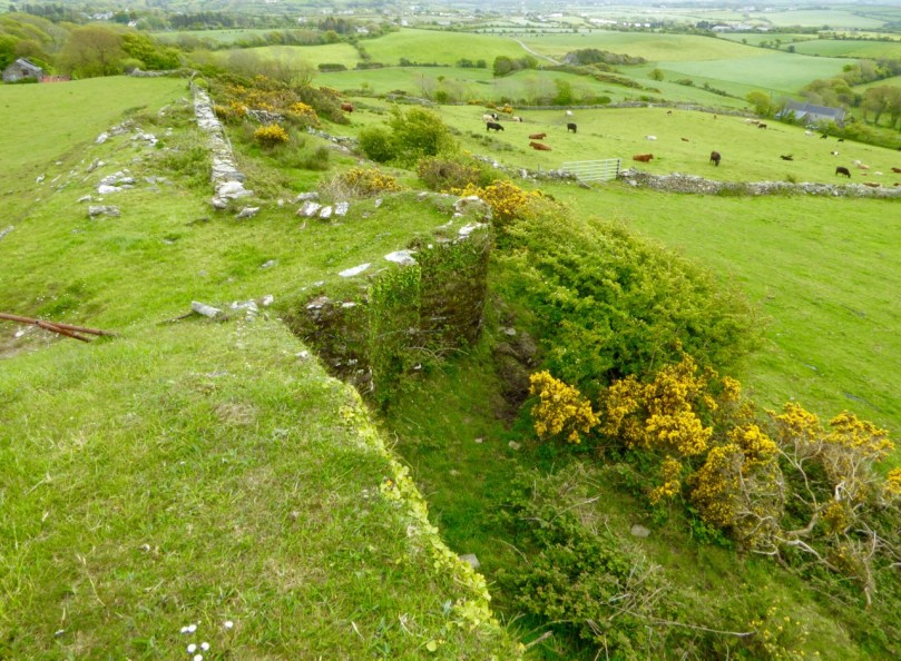
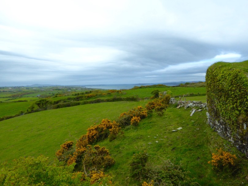
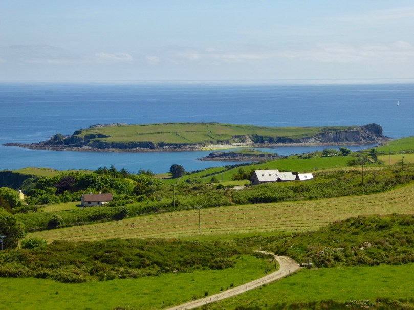
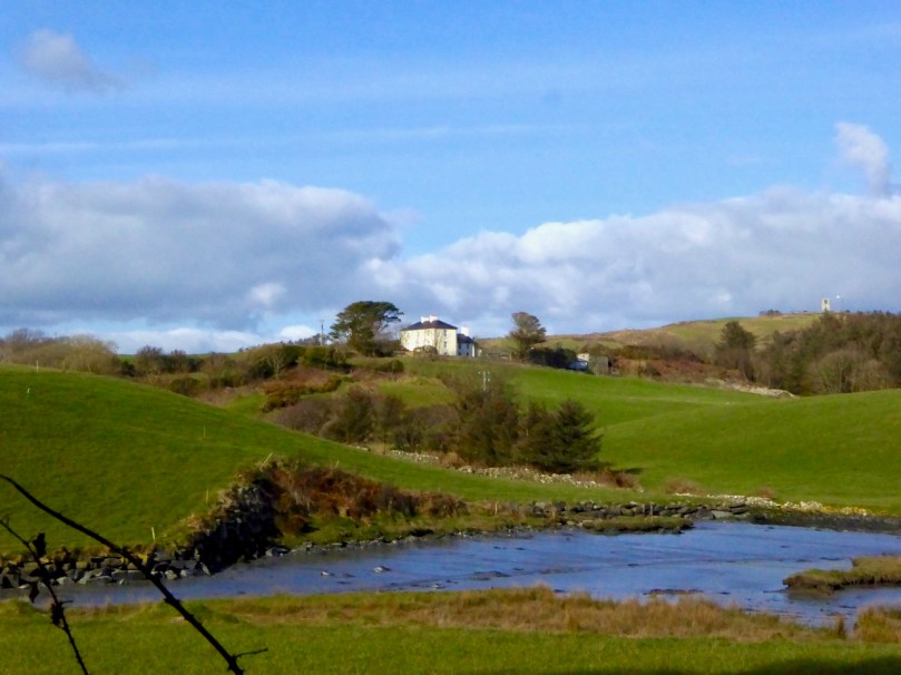
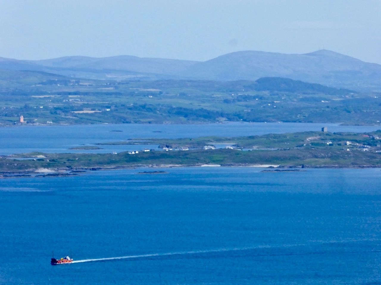
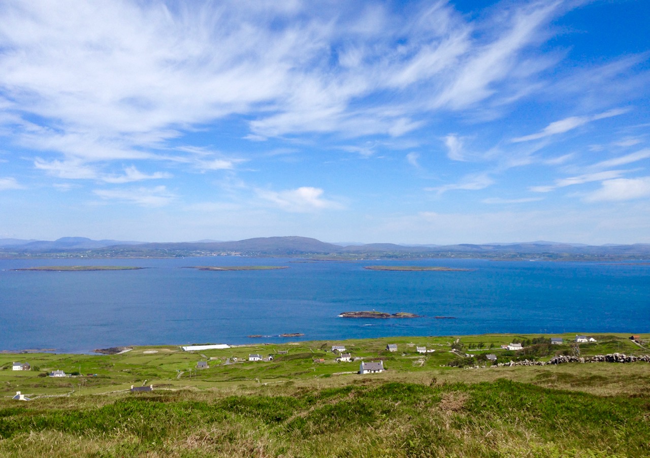
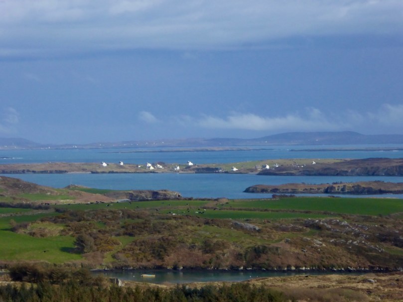
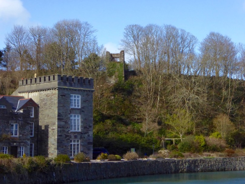
Crough Bay in the townland of Leamcon – one of the sheltered and hidden moorings which became known as a pirates’ nest in the late sixteenth and early seventeenth centuries. This is a view of part of the former estate of Sir William Hull who, as Vice Admiral of Munster, was charged with routing the pirates but in fact connived with them for his own financial gain

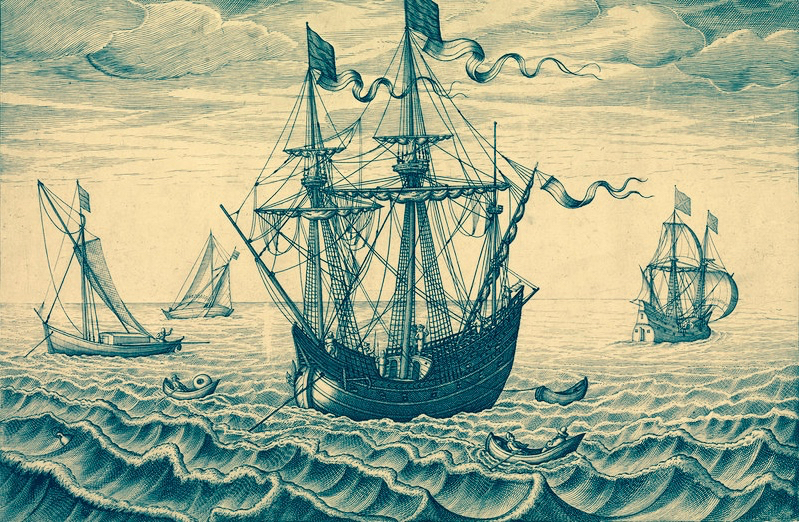
…Ireland may well be called the nursery and storehouse of pirates… wrote Sir Henry Mainwaring in a manuscript now in the British Museum (A Discourse of Pirates, on the suppression of piracy 1618). He had first-hand knowledge: this adventurer who was born in the time of Elizabeth spent most of his life at sea, survived the English Civil War – although on the losing side – and had been privateer, pirate and Royal Naval captain. He died at the age of 66 with his feet on dry land, although in poverty and exile in France.

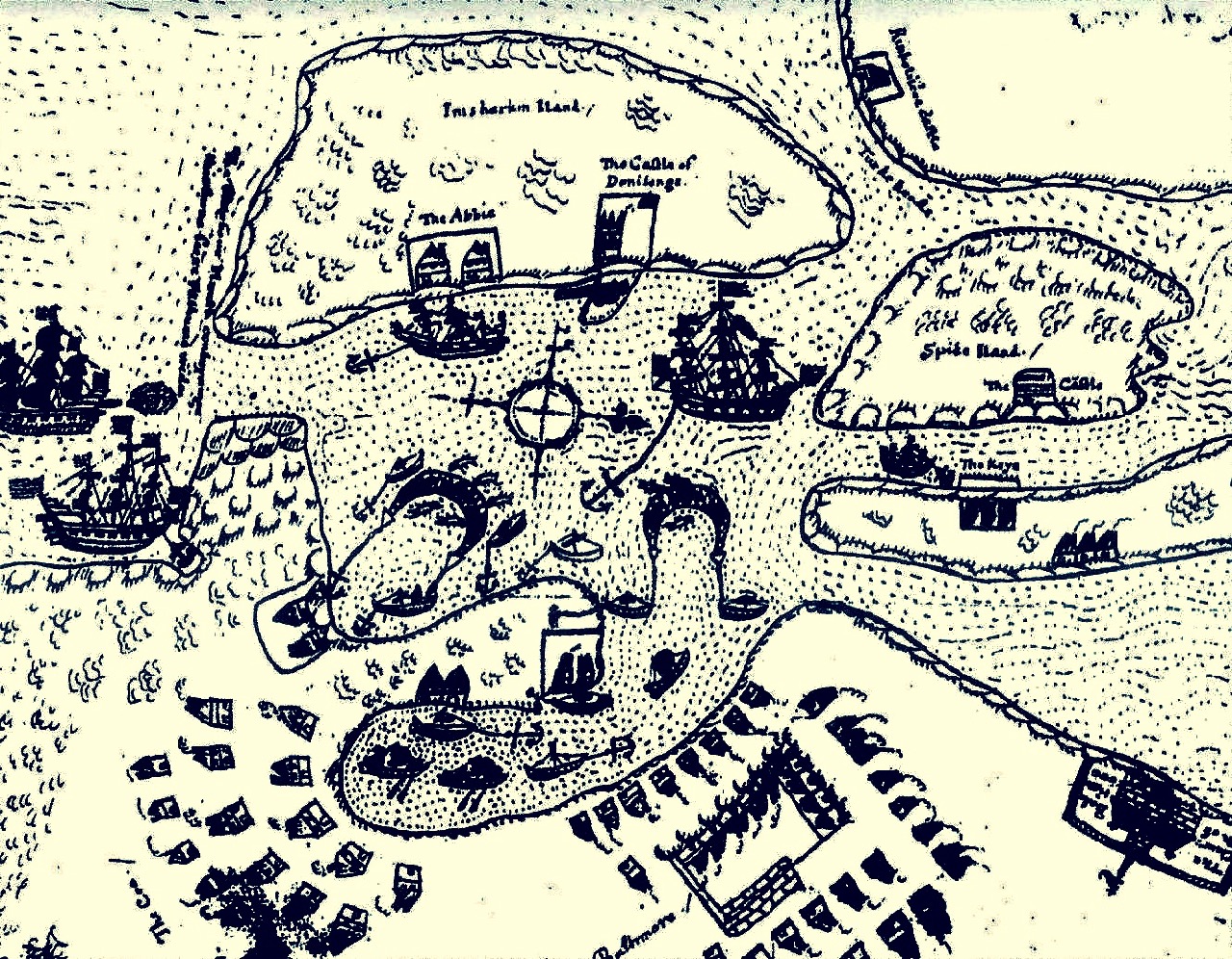
map of baltimore

The Earl of Cork’s map of Baltimore,1628 –  following well-founded fears of ‘Turk’ raids he petitioned the Admiralty to fortify the coastal settlements. He was ignored and in 1631 the town was sacked and burned by Barbary pirates who carried away over 100 of the residents to the slave markets in Morroco

My possible ancestor Captain James Harris of Bristol died with his feet in the air: he was hanged at Wapping, in the estuary of the Thames, with 16 other pirates in December 1609. They had been captured in Baltimore, in sight of Roaringwater Bay. Why was it that Ireland – and, in particular, this coastline of west Cork was the notorious harbourer of pirates from all over Europe?

behold leamcon

According to Mainwaring, the west of Ireland was enticing because food and men were abundant; fewer naval ships patrolled the coast [than in England]; many of the local inhabitants were willing to trade with the pirates; and there was a …good store of English, Scottish, and Irish wenches which resort unto them… 

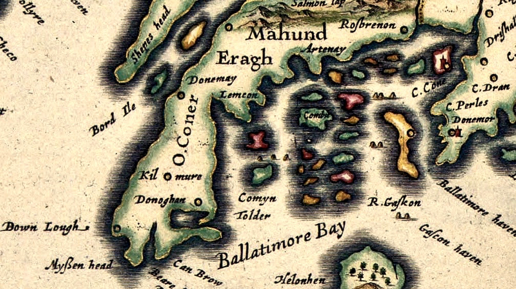
1611 John Speed map – Roaringwater

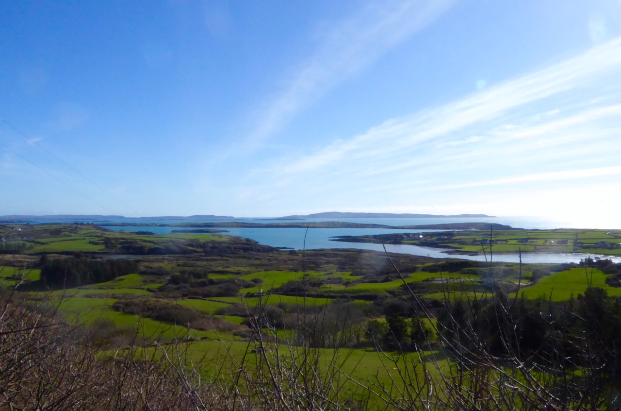
John Speed’s map of 1611 which portrays ‘Ballatimore Bay’ and Carbery’s Hundred Islands – ideal territory for concealing pirates. Note the curious geography, the names of the Irish clans and some of the places we recognise today: Rossbrenon (Rosbrin); Lemcon; Shepes Head and Myssen Head

The coast of west Cork, in particular, was eminently suitable for sheltering ships in need of careening and victualling: bays, coves, inlets and estuaries abound and Carbery’s Hundred Isles (in fact many more than a hundred but it depends on what you count as an island) offer refuges a-plenty. In Captain Harris’s time there was only one naval ship patrolling the whole area from Kinsale around to Bantry and beyond – and this was the Tremontane – an ancient leaky pinnace which could be easily outrun by any respectable pirate crew. All the more unfortunate, then, for my forebear and his band who fell into the hands of the authorities, no doubt through some act of treachery or double-dealing.

Captain Harris’s family paid to retrieve his body from the gallows at Execution Dock (above left) and gave him a Christian burial. It was more usual for the bodies to be immersed by ‘three high tides’ before being disposed of. In particularly notorious cases the corpses were tarred and then hung in gibbets (iron cages – above right) to remain in public view. Captain Kidd was displayed this way for at least forty years after his death in 1701.

pirate ship

…The Irish folk surreptitiously colluded with pirates. When a captain needed supplies, he sent word of his needs. The reply to his note told him where he might find “so many Beeves or other refreshments as he shall need” on a specific night. When he and his men came ashore, they were to fire upon those who tended the herd, which allowed the herders to claim that they had been forced to hand over the cattle. Later on, he secretly landed “the goods or money in exchange, which by custom, they expect must be 2 or 3 times the value” If the pirates desired arms and/or ammunition and the Irish had any, they traded those items, too… (from Pirates and Privateers – The History of Maritime Piracy – an excellent online resource compiled by Cindy Vallar).

If you would like to learn more about Pirates in west Cork (and to listen to some great music) come along to the Fastnet Maritime + Folk Festival in Ballydehob this weekend 17th – 19th June: Robert is giving an illustrated talk on William Hull and the Leamcon Pirates’ Nest on Saturday 18th at 2.30pm in the Old Bank Building

Cape Clear: The Stone That Moved

along the roadThe enigma begins around 1874, on Cape Clear – the southernmost piece of inhabited soil on the islands of Ireland. Land here is hard won, and the stony fields are laboriously cleared using human power and – most likely – donkey power to improve prospects for grazing and tillage. In this year a narrow field in the townland of Croha West is being improved: the farm belongs to Tom Shipsey. His men – Dónal O Síocháin and Conchúr O Ríogáin – turn up a stone with strange markings on it, reportedly together with ‘shards of old incised pottery’, although these latter have never been traced.

Header: looking towards the townland of Croha West, where Thomas Shipsey and his men discovered the travelling stone. Above left – records from the Shipsey family dating back to the 1800s. Above right – possibly the earliest drawing of the Cape Clear Inscribed Stone, included in Michael J O’Kelly’s article of 1949  in the Cork Historical and Archaeological Society Journal

At this time the Curate on Cape is Revd John O’Leary. We might reasonably assume that he takes an interest in the stone and has it set up somewhere to show off its curious and undoubtedly historic decoration. We do know for sure that, when he leaves Cape Clear in 1877 to take up the curacy of neighbouring Sherkin Island, the stone goes with him and becomes a feature in his garden there. It does not, however, accompany him to Clonakilty whence he is transferred to become Parish Priest and Monsignor in 1881: instead it languishes on Sherkin, benignly fading into the undergrowth. Years later – in 1945 – the stone is ‘accidentally rediscovered’ by the then incumbent, Rev Fr E Lambe. Presumably recognising its probable significance he has it shipped off to University College Cork where it is received by Professor Seán P Ó Ríordáin.

Cork Exhibition

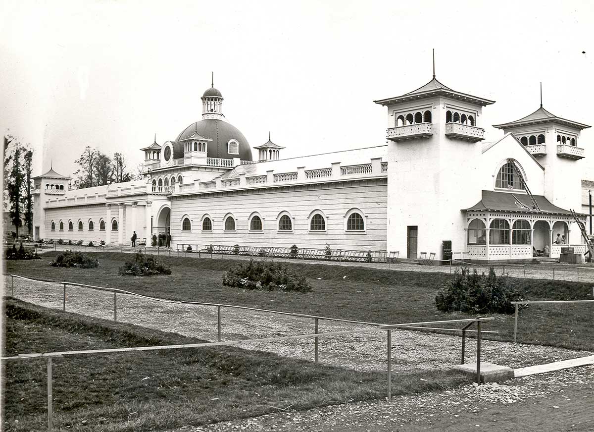
1902 World’s Fair, Cork – now Fitzgerald’s Park and the setting for Cork Public Museum

Close to the University grounds in Cork is a residence built by Charles Beamish in 1845 at the cost of £4,000 on land purchased from the Duke of Devonshire. Beamish has the grounds laid out with a variety of shrubs and trees, and due to their density the grounds become known as The Strawberries and the house as The Shrubbery. In 1901 the house and grounds are taken over by Incorporated Cork International Association and used as the venue for the great World’s Fair of 1902. Following this the grounds – now known as Fitzgerald’s Park – are donated to Cork Corporation for recreational use by the public. Eventually The Shrubbery is converted into Cork’s Public Museum which opens in April 1945, under the auspices of UCC: the first Curator is Michael J O’Kelly. The Cape Clear Inscribed Stone completes its travels (for now) and is on permanent display in the Museum.

View from sea

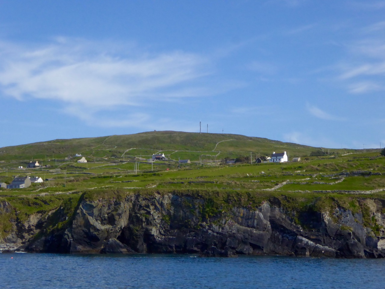
The highest point on Cape Clear is Quarantine Hill – the trig point can be seen as a ‘pimple’ in this photograph, taken from the north side of the island

There’s a prequel to this story of the travelling stone. We have seen that it was unearthed on Farmer Shipsey’s land in 1874. Apparently this isn’t where it started out. O’Kelly (who became head of the Archaeology Department at UCC in 1946) wrote a monograph on the stone for the Cork Historical and Archaeological Society in 1949 (volume 54 pages 8 – 10):

…The motifs clearly belong to the passage-grave group of carvings and can be paralleled at Newgrange, Bryn Celli Du [Wales], Gavr’ Inis [Brittany] and elsewhere. The stone is therefore an important discovery and because of this, the lack of information about the nature of the site on which it was found is all the more disappointing. At this stage only a few vague traditions concerning its finding could be gleaned in the district. The statement of one old man that ‘a mound of stones was being cleared from a field’ may possibly indicate a cairn and if such were the case, the decorated stone may have formed part of an underlying tomb chamber. There is also some reason to think that fragments of pottery were found, though none has survived. This may be a further hint that the stone was associated with a burial. With reserve, it might therefore be assumed that the structure, whatever its exact nature, was erected by a group of passage-grave folk who either by accident or design came to land on this island off the coast of Cork…

This little narrative sowed the seed that the stone might be connected to a passage grave. If so, this would probably date the carving to some five thousand years ago. But, surely, there should be some trace of the passage grave itself if this is the case? No such traces could be found in the townland of Croha West.

View from PG

looking north
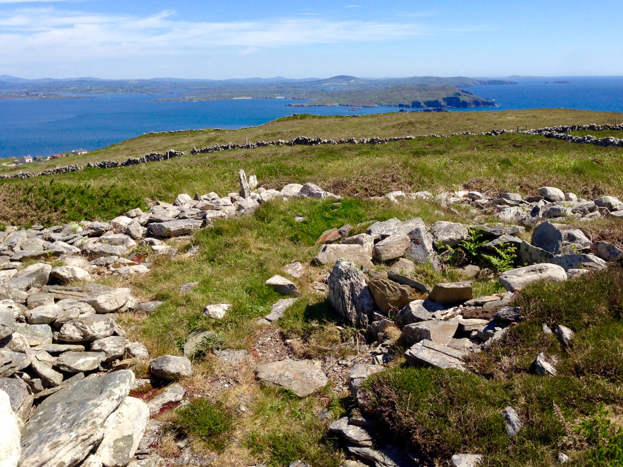
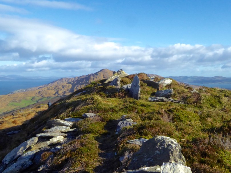
Spectacular views from the prehistoric site on Cape Clear, both looking north towards the mainland

We move forward to 1984 when four archaeologists (Barra O Donnabhain, Mary O’Donnell, Jerry O’Sullivan and Paddy O’Leary) explored the wider area and discovered, on the very summit of the island, the ruins of a prehistoric structure. This site, 533 feet above sea level, is in the townland of Killickaforavane and is known locally as Quarantine Hill. At this time the island was investigating the possibility of producing electricity by wind power: hitherto electricity to some properties was provided by a diesel generating system which had been in place only since 1969. The obvious efficient place for wind generation was the highest point and plans were laid for setting up two SMA Regelsystem Gmbh 33w turbines (which began operation in 1987). In preparation for this installation an archaeological survey of the immediate area was carried out by Prof Peter Woodman and Dr Elizabeth Shee. Paddy O’Leary and Lee Snodgrass were also present at that time. The collective view seemed to indicate that the structure could, indeed, have been a small passage grave.

chamber closer

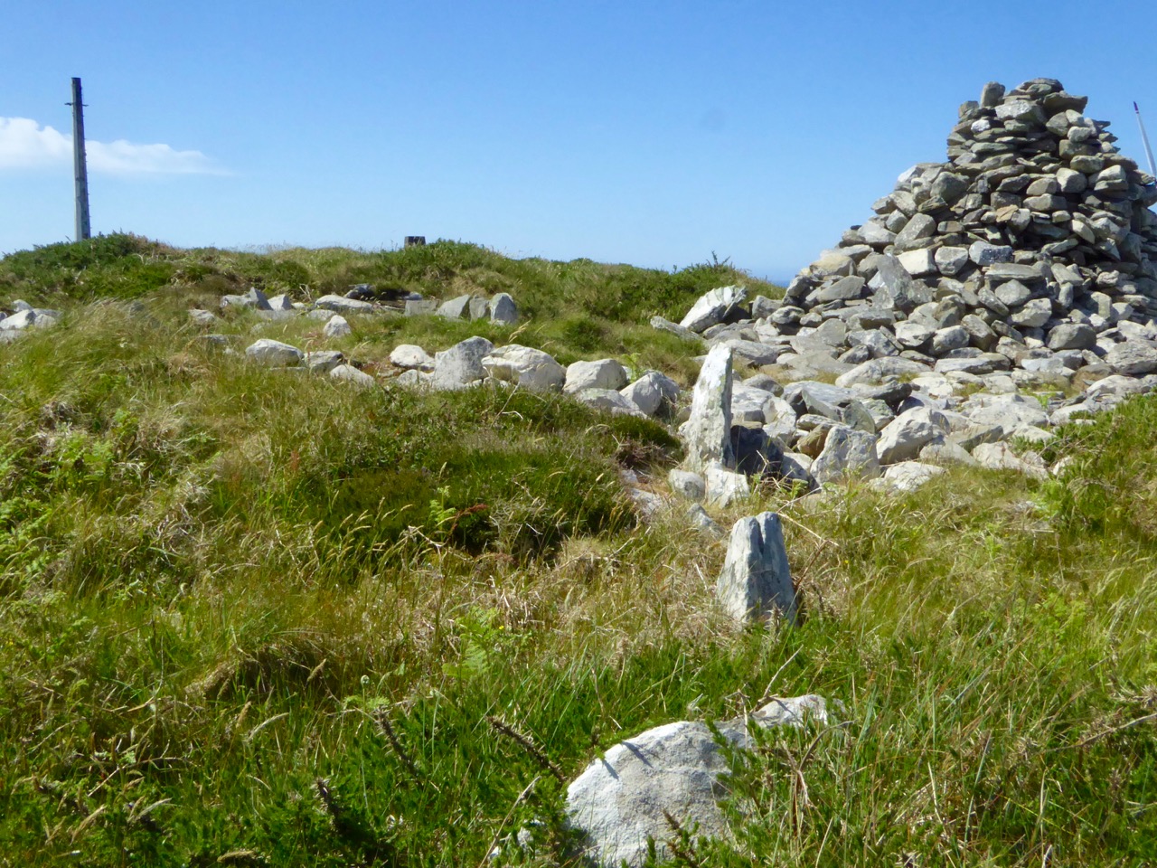
Probably the chamber of a 5,000 year old passage grave, Killickaforavane, Cape Clear

The wind turbines were sited a little distance from the prehistoric remains and have themselves become archaeology of a more industrial nature. While in use they generated 90% of the island’s demand during favourable winds (force 3+). The corrosive effects of the Atlantic climate – in particular the wild south-westerly gales – rendered the mechanisms beyond repair after some ten years; a submarine cable bringing electricity from the mainland (8 miles away) arrived in about 1995. For a short time the systems operated in tandem and produced sufficient power to feed back to Ireland’s National Grid. According to a letter to the Irish Times by Séamus Ó Drisceoil, who was manager of the island Co-op at the time of the installation …the Cape Clear system is credited with providing the first concrete evidence for the viability of wind energy in Ireland…

Tomorrow’s archaeology: the pioneering – but now defunct – wind generating system on Quarantine Hill, overlooking the passage grave site

Once the concept of the island supporting a five thousand year old passage grave on its summit has been digested, then the question has to be asked – did the Cape Clear stone now in the Cork Public Museum originate at this site? It was found a good half mile away, in a different townland – but this might suggest that an earlier antiquarian (or interested observer) discovered it on the hill and had it moved to Croha West for safekeeping, display, or even because it was thought it might have some value. No-one on the island seems to have any knowledge of this distant event. As O’Kelly says – it’s disappointing that there is no ‘story’: one might almost expect a tale of the person moving one of the ‘old stones’ having met with an unfortunate fate because of interference with the domain of The Other Crowd

the way through

Kerb and passage

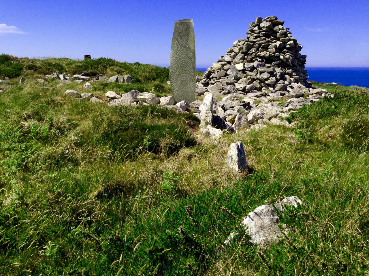
Top: looking towards the summit of Quarantine Hill – there is no clear path up there, and the traveller can be waylaid by gorse and brambles… Below: the prehistoric site – we are probably looking at the orthostats of a passage, which has a summer solstice orientation, and a kerbstone. On the right is a modern cairn while to the left in the background is the remains of one of the turbine towers

There is, surely, a strong likelihood that the Cape Clear Inscribed Stone did originate in the hilltop passage tomb, in which case we have completed the tale of its travels, up to the present day. The tomb is in ruins, although enough remains to show its shape and probable orientation. Paddy O’Leary tells the story of his investigations with Lee Snodgrass in an article for Mizen Journal, Volume 2, 1994:

…We were convinced that it was a passage tomb and that it was orientated on the rising sun of the summer solstice… We planned a two night vigil for June 1993 and were buoyed up by a good weather forecast. Saturday afternoon was sunny and we transported our equipment direct to the top of Quarantine Hill from the boat. We set up our cameras and, taking advantage of the sunny weather, took photographs, especially during the late evening, when there was a lovely sky. On Sunday morning June 20th we rose shortly after 4am to prepare for dawn. It was very cold but the sky was clear. A dull grey cloud began to show to the northeast, we set our cameras and waited for the sun. Shortly after 5am it peeped above the horizon, nestling in the gap between Carrigfada and the hill to its north… Gradually it rose in a 40 degree angle, flooding the sky with first light and mirroring its golden red orb in the brightening sea… A perfect sunrise perfectly recorded. The warmth was now penetrating almost numb fingers and feet. The line of the orientation was exactly as expected, directly along the supposed line of the passage, into the centre of the chamber… The most southerly point of Ireland had its passage tomb, with a summer solstice sunrise orientation; a nice counterpoint to the Newgrange winter solstice sunrise…

cairn and view

Quarantine Hill, Killickaforavane townland, Cape Clear. The view looking east – towards the summer solstice sunrise – from the prehistoric site on the summit

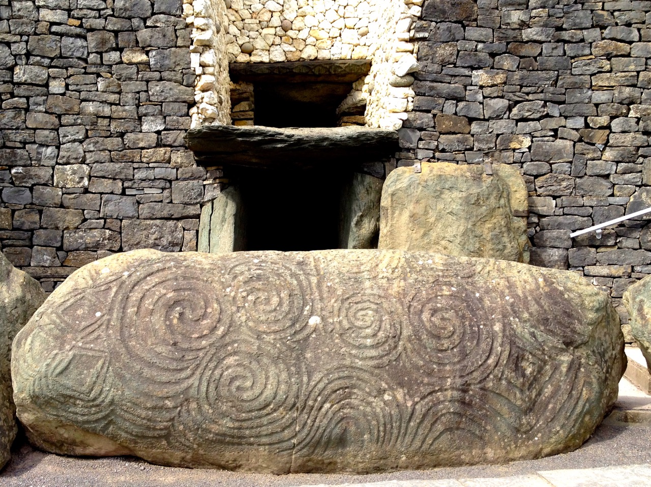
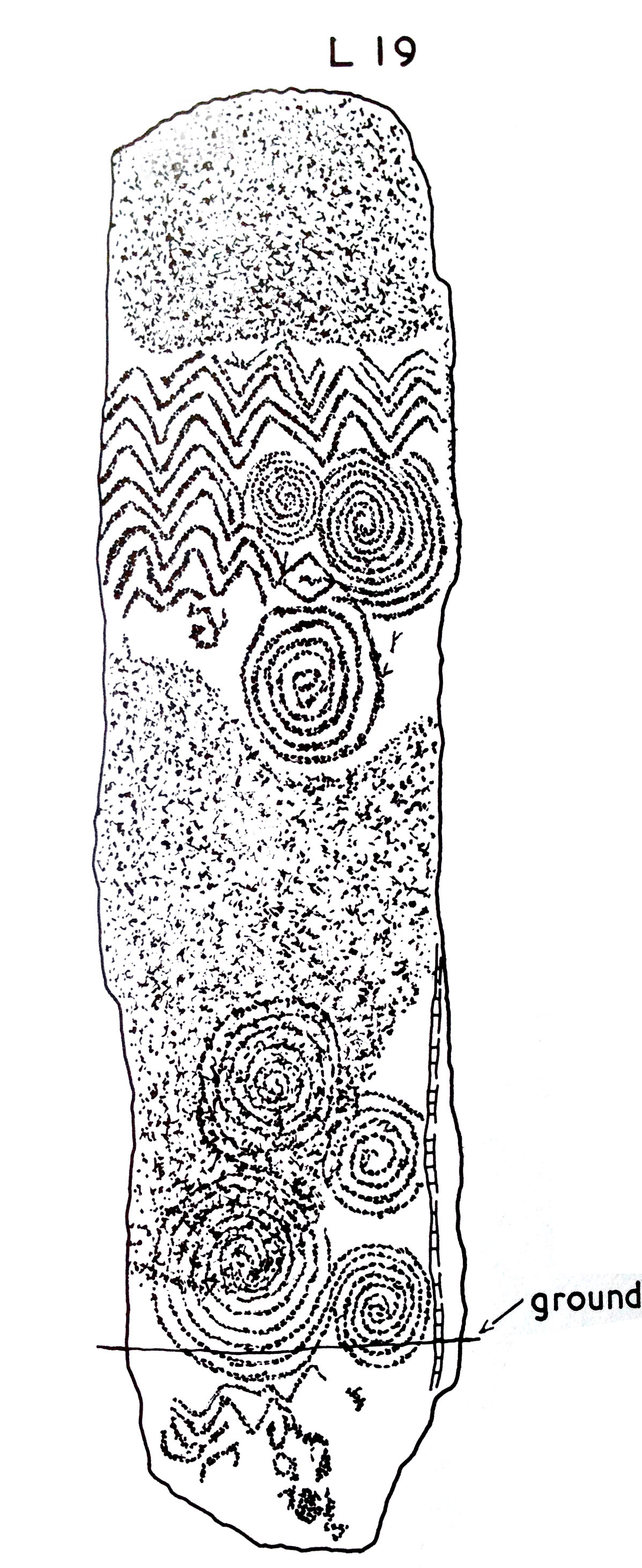
If the inscribed stone was, indeed, incorporated into the Cape Clear passage tomb, where might it have been placed? There are parallels in its design with some of the lintel stones at Fourknocks, but also I am drawn to similarities with stone L19 from Claire O’Kelly’s Corpus of decorated stones included in Michael J O’Kelly’s Newgrange – Archaeology, Art and Legend (Thames + Hudson, London 1982). This one is a standing stone – perhaps our well travelled stone was standing also.

Newgrange

Newgrange entrance stone

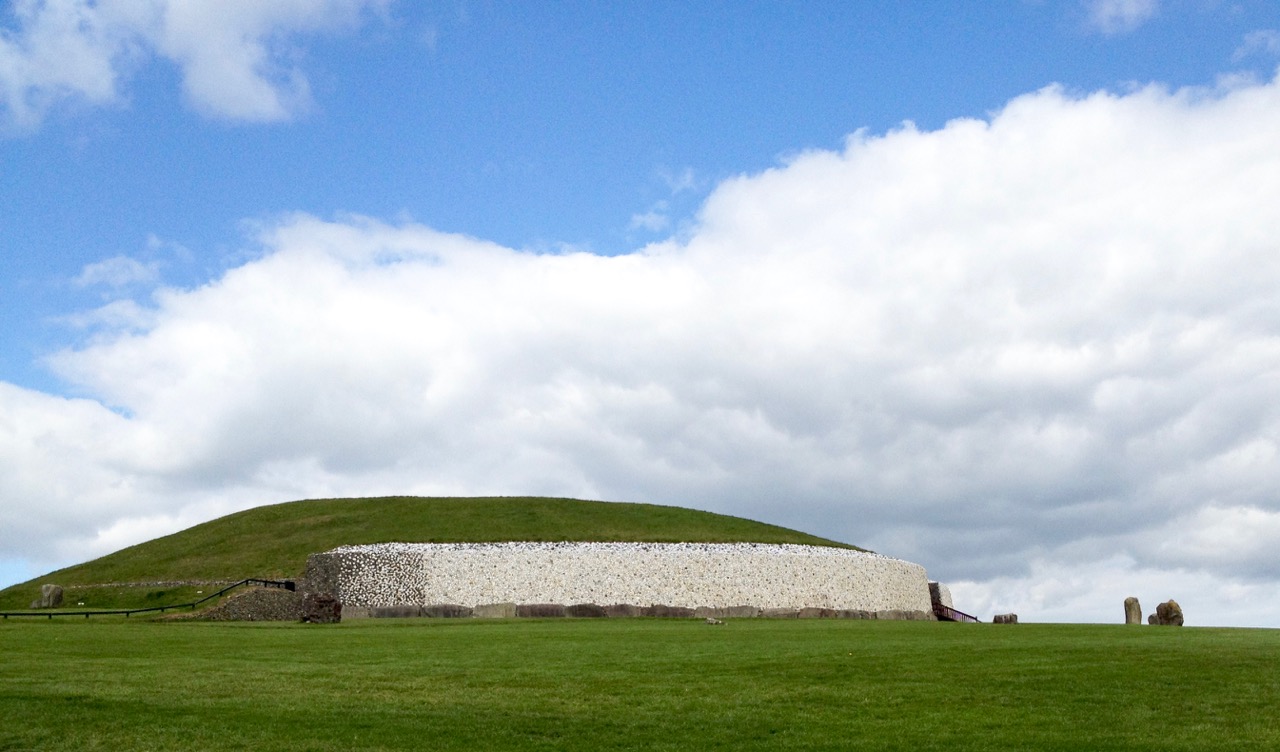
Iconic passage tomb in Meath, Ireland – one of the greatest monuments to the Neolithic people in the world: the top picture shows the east face of the great mound as reconstructed by Michael O’Kelly using the white quartz stones which were revealed during the excavations (Finola took part in these digs!); the lower picture shows the entrance stone to Newgrange – the Cape Clear inscribed stone must be related to this type of prehistoric art, although situated a very long way away…

Here’s a suggestion – probably considered heretical in some quarters: why don’t we complete the travels of the Cape Clear Inscribed Stone by taking it out of the Cork Public Museum and (with some suitable ceremony) transporting it back across the sea to Cape Clear and setting it back up there for all time? For me, museums – while obviously providing safe keeping – sometimes lack the reality of true context… Alright then, if that is considered as inconceivable an idea as I suspect it would be, let’s make a very good replica and send it up to the top of Quarantine Hill. At the same time we could re-establish a pathway to attract people up there: our own pilgrimage to this very special site involved making heavy way through gorse and brambles.

looking towards west

Below: Newgrange Stone L19 from Claire O’Kelly’s Corpus of decorated stones included in Michael J O’Kelly’s 1982 book on Newgrange

claire stone

With acknowledgements and thanks to those quoted above and the following sources, which have enabled me to pull together the story of this site: Paddy O’Leary and Lee Snodgrass (Mizen Journal Vol 2 1994 and personal communication), Michael J O’Kelly (Cork Historical and Archaeological Society Vol 54 1949), Chuck Kruger (Skibbereen and District Historical Society Journal Vol 6 2010)

Island Hopping

Long Island Sound

Long Island, with some of Carbery’s 100 Isles 

Carbery’s 100 Isles, they call them, the islands of Roaringwater Bay – and there really are 100, and more, if you count all the islets.  J F Collins, in a paper in the 2015 Journal of the Skibbereen and District Historical Society, has an interesting account of the various ways islands were counted in Roaringwater Bay  – by the Ordnance Survey, by Admiralty charting, and through Griffith’s Evaluations – they all came up with different numbers. Whatever the final count, this week we visited three, each one special and unique.

Long Island Ferry heading back to Colla

The Long Island ferry on its way across Long Island Sound to Colla Pier

The Fastnet Film Festival has just finished – this is the amazing little festival that manages to attract world-class movies in a town with no cinema. We took in several of the events, and watched many of the shorts, but a highlight for us every year is the Long Island Trip. Read about the festival and the Long Island event here, an account from two years ago. To be whisked off to this hidden spot, to be provided with wine and popcorn and invited to go down to the ferryman’s bedroom to watch an hour of excellent cinema – well, who could resist it? Long Island (permanent population: 7) has some interesting ecology and we have promised ourselves a proper trip and wander later this summer.

Cape Clear Ferryman

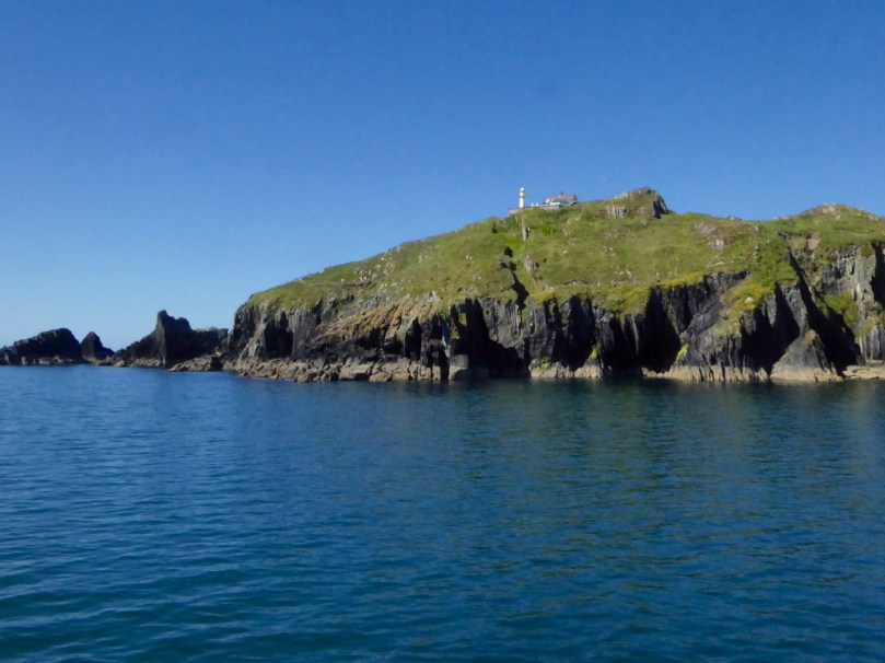
An overnighter to Cape Clear Island came mid-week – a birthday treat for Finola. We’ve been to Cape Clear before on day trips, and Robert has written about it – but this was something special. First of all, the weather was amazing the whole time – warm and cloudless. Secondly, our time-frame gave us the opportunity to do some serious exploring. Thirdly, the seas are alive at the moment with whales and basking sharks!Sherkin Lighthouse

When the weather is fine the ferry takes the outside route around Sherkin Island. Along the way we pass the Sherkin lighthouse and many treacherous rocks, threading our way, in this instance, through shark-infested waters

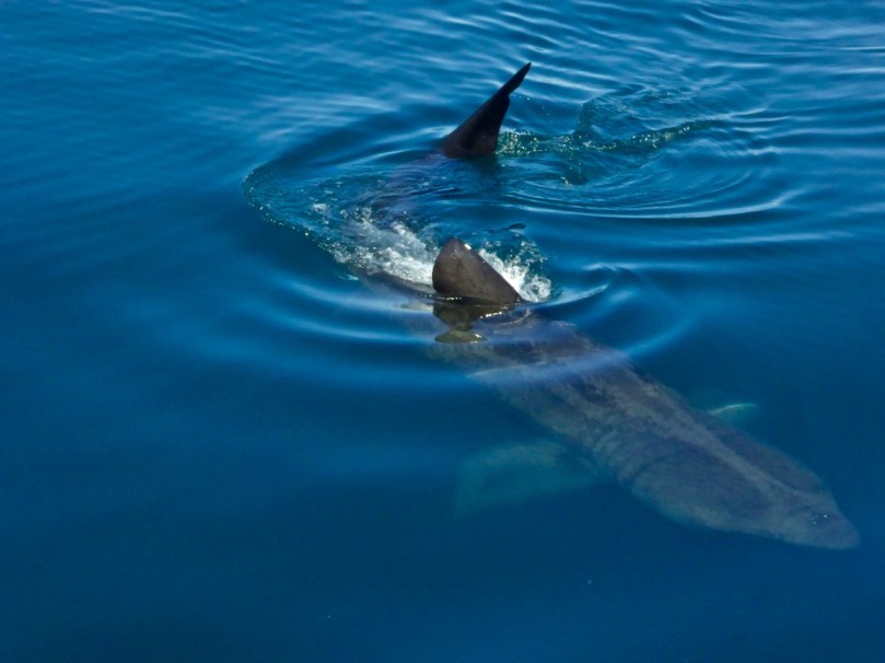
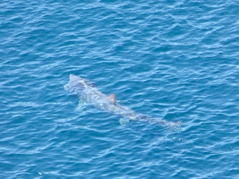
The ferry to Cape Clear takes about 40 minutes normally. We were a little longer this time because the ferryman slowed and diverted to allow us time to photograph the sharks. Enormous creatures, with wicked dorsal and tail fins, they are actually peaceable fish who swim with open mouths, filtering plankton, and who are harmless to humans. We are not harmless to them, however, as we have hunted them close to extinction and they need protection in many areas.

Basking shark en route to Cape Clear

This photograph was taken from the ferry

For such slow and cumbersome creatures, it was an out-of-this-world experience to watch one of them breaching in the South Harbour. It happened when we were in the bus on the way to our accommodation and nobody had their camera at the ready. But we all know what we saw.

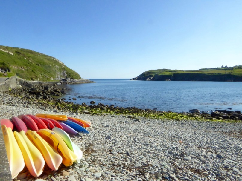
South harbour with kayaks

Just out there, in the South Harbour, we saw the basking shark leap from the water. An incredible sight!

The bed and breakfast, Ard na Gaoithe, was wonderful. Robert had told Eileen that it was my birthday – and well, would you look at what awaited us! It was the perfect place to stay – just be ready to walk the hill up to it, after a marvellous dinner at Cotter’s!

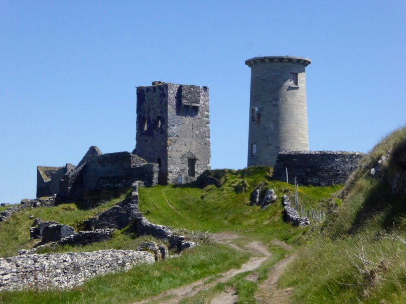
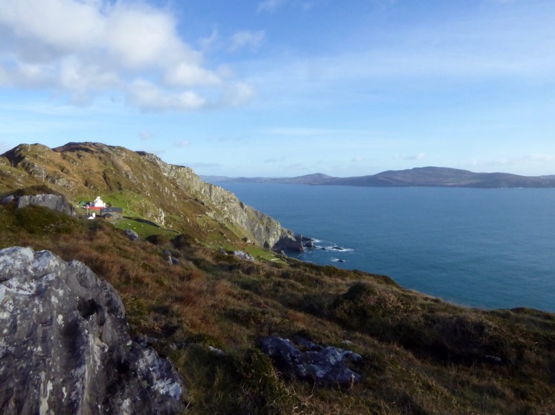
On day one we followed the way-marked trail that edges along the south side of the island. This involved a visit to the site of a Napoleonic-era signal station and the original Fastnet Lighthouse. This position for the lighthouse proved to be a major mistake, as it was so high that the light was lost in the clouds half the time. The current position, right on the Fastnet Rock, has been much more successful, and remains an iconic sight in West Cork. The remaining stump is beautifully constructed of granite blocks, while the signal tower still clings on to some of its slate covering.
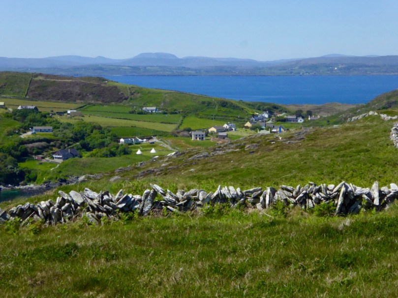
Signal Tower and Original Fastnet lighthouse

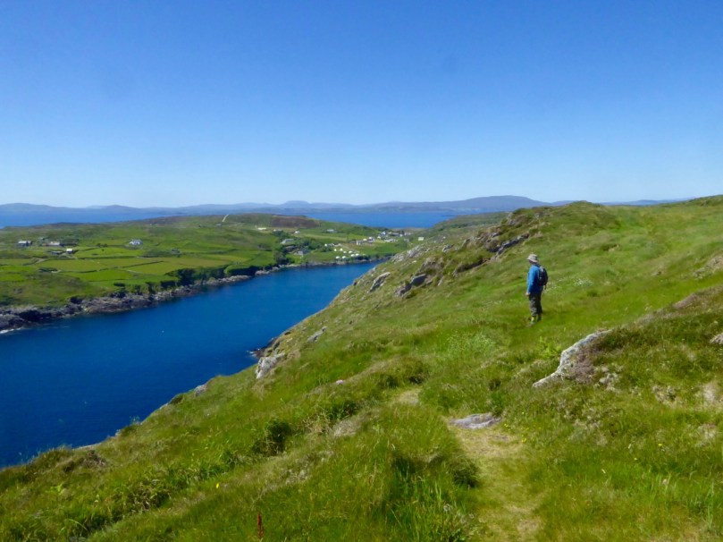
Our route took us along the cliffs and to a viewing point over the South Harbour. The sharks were ubiquitous, lazily swimming around with those enormous gaping jaws.

Shark basking

Stone Wall 2


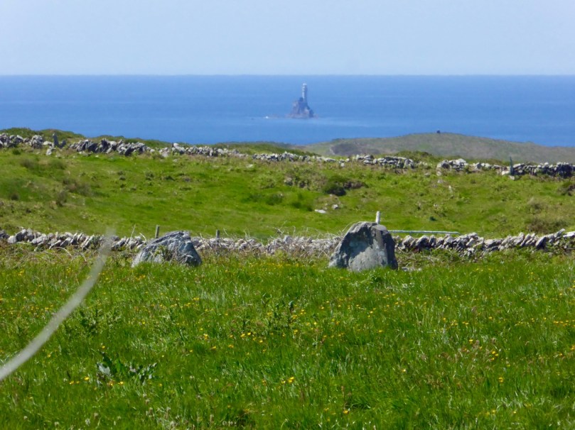
Here and there ancient field fences poked their way out of the heather, while skylarks warned of our approach and standing stones framed a distant view.

Standing Stones and Fastnet rock

Looking over the South HarbourOn day 2 we decided to make the climb to the Cape Clear Passage Grave – but I will let Robert tell that story and content myself with saying that I hope he tells you all how arduous the climb was, and how thick the gorse, so you can see how I suffer for science.

Across to the mainland

The views are immense but equally fascinating are the numerous dry-stone walls and the wild flowers everywhere. There’s still lots to explore on Cape Clear and more trips are clearly in order.

Green path

Finally, on Friday, we were invited to lunch with friends on Heir Island. Heir, sometimes called Hare, is the third largest inhabited island after Cape and Sherkin and home to a justly famous restaurant, a sailing school, the wonderful Firehouse Bakery Bread-Making course (we wrote about this in one of our very early blog posts and it’s still going strong but now booked up months in advance), and many artists.

Heir Island Boreen

Strolling along the peaceful boreens of Heir, lingering over Viv and Fran’s fabulous lunch overlooking Roaringwater Bay, and sauntering back to catch the late afternoon ferry – you adjust to island time remarkably quickly.

West Cork Islands – they will captivate and hold you. There is no escape.

Robert contemplates

The Gate to My Heart

Orchard Gate, David Ross

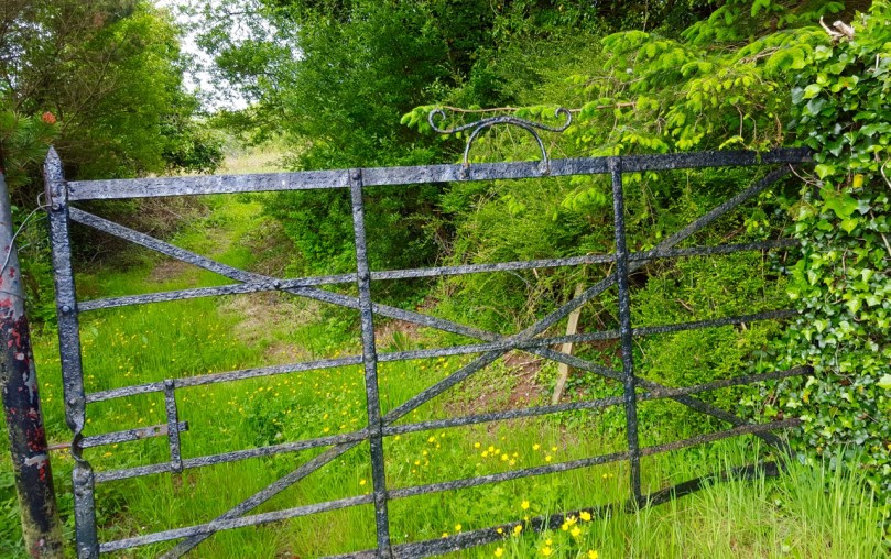
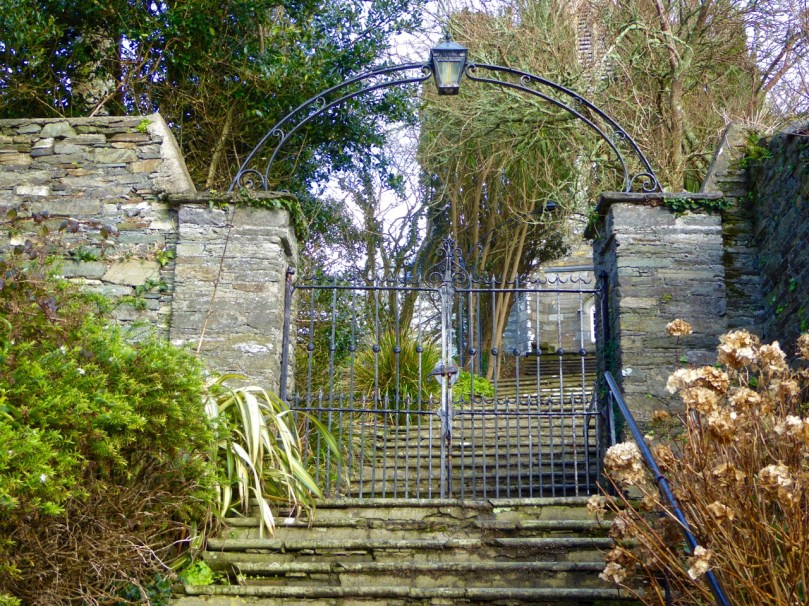
Everywhere I go in West Cork I take pictures of gates.* Most, nowadays, are galvanised metal, rather than, as in the past, forged by a blacksmith taking satisfaction in making each piece unique. Our friend David Ross of the Top of the Rock Pod Páirc & Walking Centre collects and preserves these wrought iron gates where he can. The first two photographs are kindly supplied by him. At the top is an orchard gate he found lying in a ditch and restored – note the blacksmith’s marks of an X and four dots. The gate below is also his, salvaged from the site of an old monastery in Castlemartyr.

David Ross Gate

Another friend and fellow-blogger, Pat Crowley of the encyclopaedic Durrus History, shared his photographs with us – see below. This kind of gate is called a ‘band iron trinity’ and this one was made in the 1930s. The blacksmith was an O’Donovan from Kilcrohane or Kealties.

Band Trinity Gate

Such gate-dedication is rare: large wrought iron field gates are often left to rust, or cast aside in favour of an easy-care option. But you can still find them, hanging in there, often by a thread, and doing their job. Their days are numbered so we enjoy them while we can.

P1230522


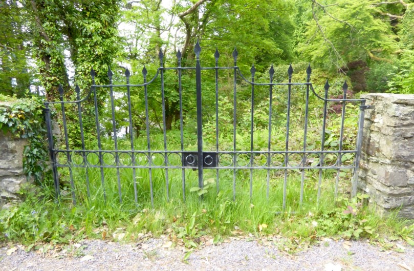
Smaller gates fare better. Perhaps maintaining them isn’t as big a commitment. Garden gates establish the atmosphere the homeowner wishes to evoke – or in the case of abandoned houses, once wished.

Elegant Gate, Ahakista


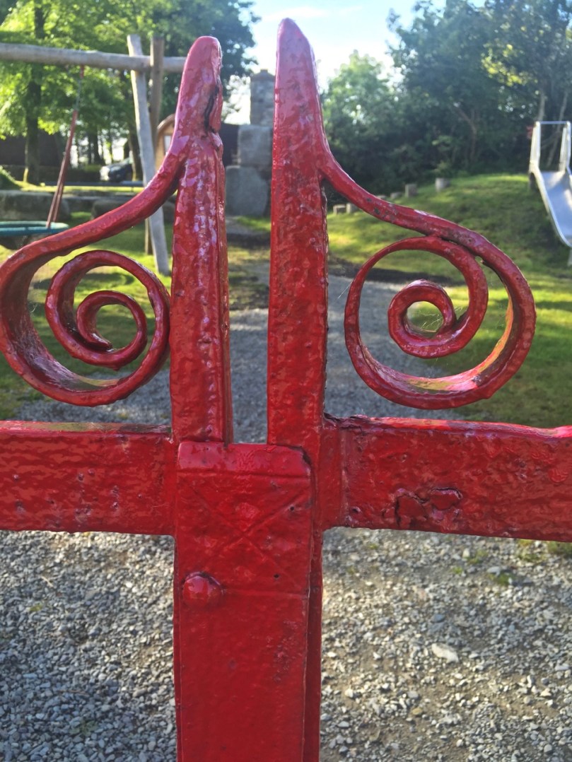
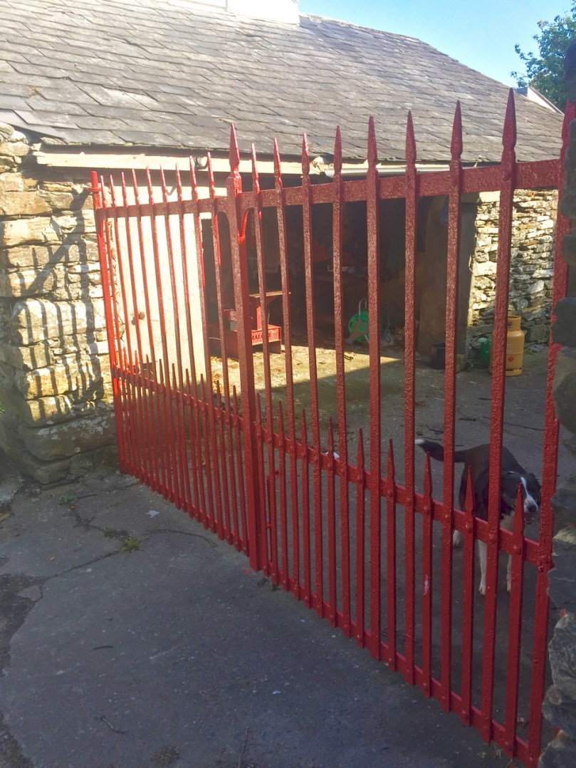
Here are details from a pair of matching red gates near us – a large entrance gate and a smaller side gate.

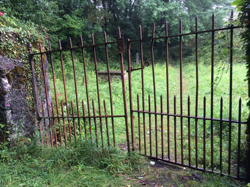
Graveyards are fertile sources of wrought-iron. The entrance gates still stand sentinel, sometimes double gates, but often single, as most coffins were shouldered in.

IMG_5390


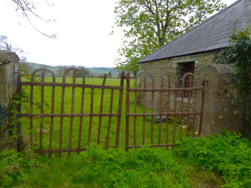
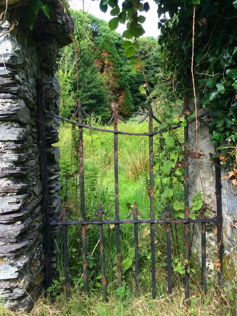
Long-disused church yards with little walls separating off the church precinct from the surrounding cemetery or from the vicarage, feature overgrown gates with fetching designs.


Castlehaven graveyardHoly wells are accessed through through special gates, many dating from the mid-20th century, when holy well sites were re-furbished.

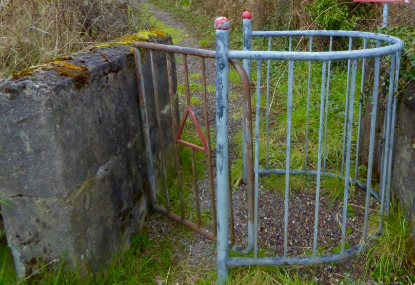
The boreens leading to the well can be accessed occasionally by edging through a kissing gate. This one is not wrought iron, but I like the little details on it.

Kissing Gate

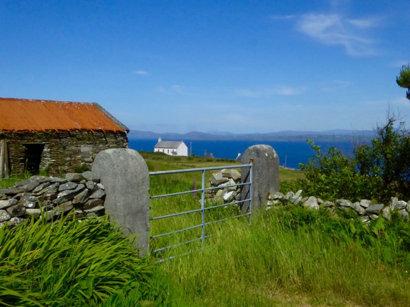
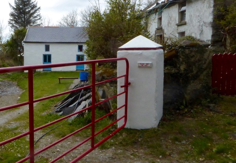
Still, the common field gate manages to establish its own character, and often acts to frame a vista across a valley, or a tantalising glimpse of old stone farm buildings. The vast majority now are galvanised metal, but some have been painted, or hung between substantial stone pillars.

green gate

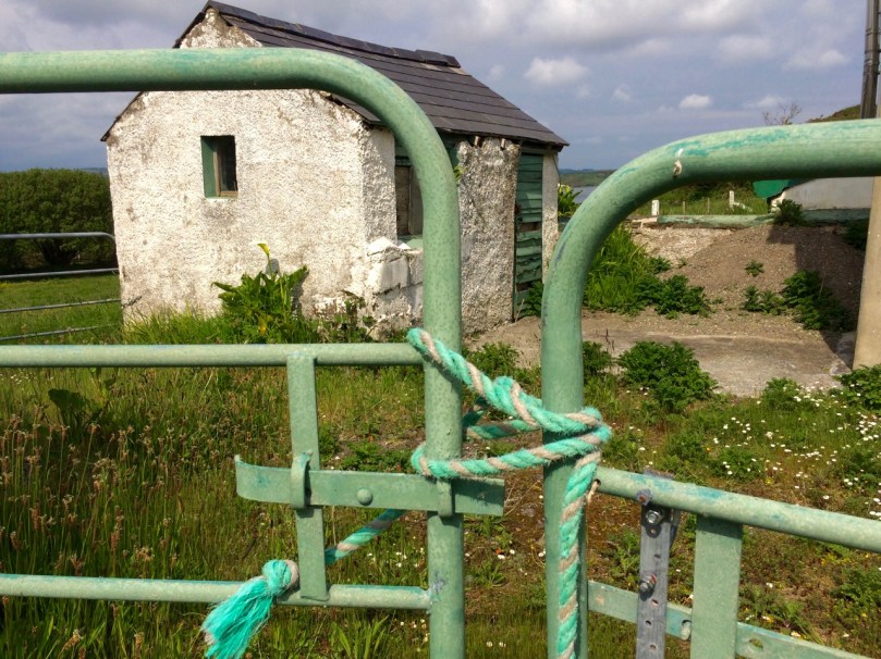
Nick's GateMost are secured using a highly technical local form of lock called the loop-a-bit-of-rope technique. Seems to baffle the cattle, who stay inside, but it’s great for your friendly wandering archaeologist wanting to investigate a pile of rocks in a field.

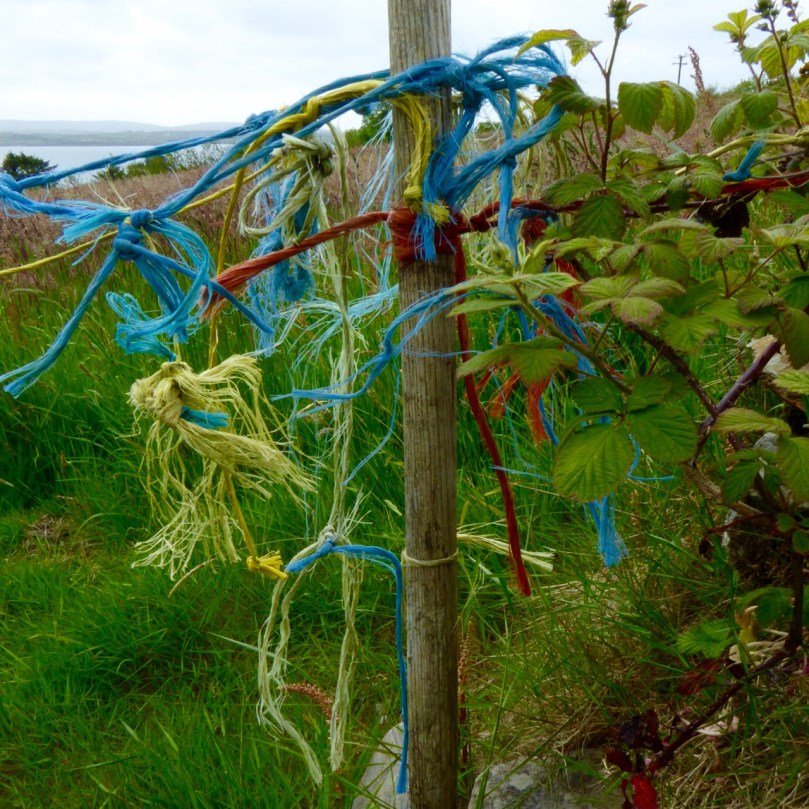
The ultimate, of course, is to dispense with the gate altogether and simply use the loop-a-bit-of-rope lock on its own.

P1060541

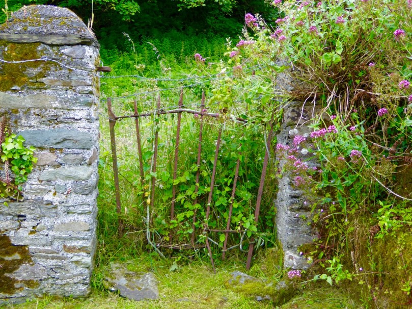
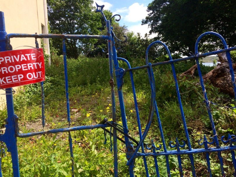
Will this gate, below, sadly neglected, be replaced with a wooden or galvanised model? Perhaps new owners will see what they have and try to salvage it. But it does look like it’s on its last legs.

IMG_8970

When we decided we need some wrought iron for our own entrance, we went to Cronin’s Forge near Durrus. Working in time-honoured ways they make gates and signs that will last the course.

Fitting to end with a church gate, as this has been a hymn to the West Cork Gate, in the form of a photo essay. This is one of my favourites, access to and guardian of so many treasures: the gates to St Barrahane’s Church in Castletownshend. Like so many aspects of this place it is elegant and unique. The photograph was taken by my 11-year old niece, Ava.

St Barrahane's Church Steps

*My apologies to those of you who followed a broken link to this page earlier. At an early stage of writing, I pressed ‘publish’ rather than save (easy to do!) and then had to delete the post. I hope you came back!

Anomalies

The cairn

What’s an archaeological anomaly? When the National Monuments Survey was being undertaken, some stone structures didn’t quite fit the description of a particular class of monument. They may have been ancient – but how ancient, and what exactly were they? The term chosen for such mysterious piles  was ‘anomalous stone group’. Here’s the definition: A group of stones, usually standing, which cannot be classified as any other known archaeological monument type on present evidence. They may be all that remains or is visible of a partially destroyed or obscured archaeological monument which may date to any period from prehistory onwards.

cupmarked rocks?

Just a leaning rock?

But it’s not the only term used for uncertain monuments: enclosure is a vague term that can mean a multitude of things, and an ‘unclassified cairn‘ can be defined simply as a heap or pile of stones. In the last few months our explorations of the Sheep’s Head have turned up several anomalies. The only thing they all have in common is their spectacular siting, leading to an ultra-rewarding field trip.

Heading towards the cairn

Hiking to the cairn

Perhaps the most magnificently situated of all is the unclassified cairn on the mountain ridge above Kilcrohane. It’s right on the way-marked Sheep’s Head Way, so it’s easy to find. While it’s described as a cairn in the National Monuments inventory, it could be as humble an object as a turf storage platform or as wonderful as a passage grave. We’ve been to it several times and always puzzled over it, but on our last visit we were alerted to a new element by Amanda and Peter.

Amanda investigates

The ‘new element’ – you have to really look!

A couple of stones had shifted, possibly in storms, and we could now delve deeper into the pile of rocks and see that one of them had a large circular opening in it. Very strange – I had never seen anything like it – and very intriguing.

Curious ‘holed stone’ at the bottom of the cairn

We noted that the highest point on Cape Clear was visible across the water, the hill on which a ‘real’ passage grave sits. Only excavation is likely to reveal the exact nature of this anomaly.

What's the orientation?

This one is called an ‘anomalous stone group’

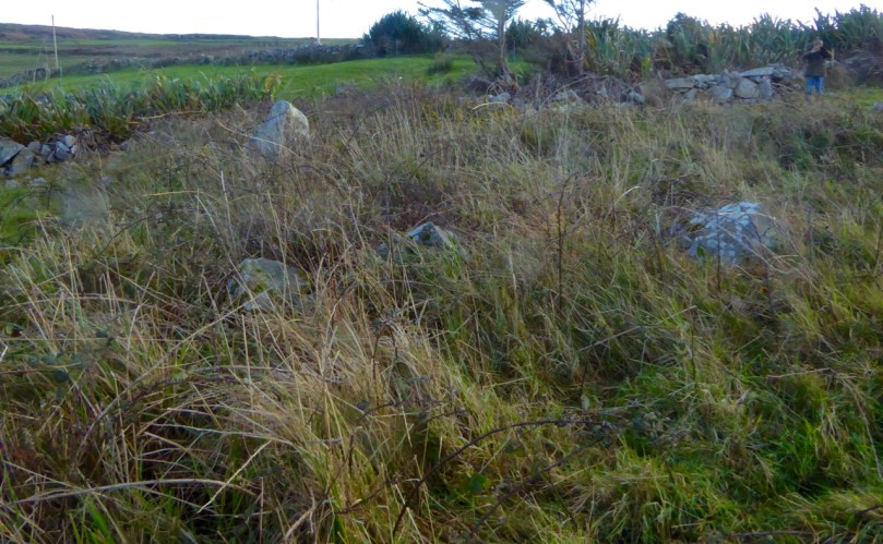
Not too far away, in the same townland but on lower ground, is an anomalous stone group. This is a strange one indeed because half of it looks for all the world like a stone circle – identical to the numerous recumbent or axial circles that dot West Cork. The other half? It’s the rock face that the stones obviously came from.

Is it a stone circe?

Could swear that’s a classic recumbent, but where’s the other half of the circle?

It’s like a work in progress. If it is a stone circle, the builders decided that half a one would do the job just fine. Indeed the owner of the land has noted several significant  sunset alignments.

possible alignments

There seem to be several alignments – this one to the Beara Peninsula

But when I asked for comments on an archaeological social network site the general consensus seemed to be that it was unlikely to be a stone circle, since the stone face obscured half the horizon. But that same stone face would have provided shelter, so the speculation in the discussion centred on this being a hut site, with only some of the stones of the outside wall remaining.

radial cairn?

This area of rough ground to the right of Robert, Peter and Amanda is labelled an ‘Enclosure’

The third site we’ve explored is described as an enclosure. The description of the site states: A circular area (diam. 10.5m) is defined by the remains of a stone wall (T 1.3m; H 0.5m) displaying traces of an inner and outer row of large stones with a fill of smaller stones. A stone slab (H 1.15m; L 0.5m; T 0.4m) narrowing as it rises stands on the external perimeter at E. There is also a standing stone a few meters to the south.

inner row?

Difficult to make out what’s here, but it seems like there’s a lot going on

This could be a radial cairn – take a look at the one at Kealkill to see what we mean. But equally, the description hints, it may have to do with field clearance. It’s almost impossible to tell a lot from the general jumble of stones and the furze and brambles that grow all over the site. Once again, however, we were rewarded with panoramic views to the Beara Peninsula. Another one where only an excavation will reveal the truth.

View east from the enclosure

And these views of the farms to the east, lit by a shaft of slanting sun

Finally, we trekked out on the Lighthouse Loop Walk at the very end of the peninsula in search of possible cupmarks, discovered by Peter and Amanda’s son.

Lighthouse trail, looking back

On the lighthouse loop trail, looking back

The cupmarks turned out, we’re pretty sure, to be natural solution pits. There were lots of them, of varying sizes, and some could only be viewed by lying on your back.

The pitted boulders

The ‘cupmarks’ are on the underside of the leaning rock

Instructive, though, as we have certainly seen cupmarked stones that don’t look a whole lot different than these ones – there’s a type of shaley sandstone in West Cork that laminates in a very similar manner when carved.

Solution pits

pits all aroundSolution pits – and modern graffiti 

In West Cork, monuments that don’t fit into satisfying categories abound – and it’s just as much fun exploring them as it is the ‘normal’ type!

tough to take

This kind of field trip is tough to take!

Slides or Jigs? Polkas or Reels?

young fiddler close

Two young musicians – from the collection of Tomás Ó Muircheartaigh, who documented life in rural Ireland between the 1930s and the 1950s. We do not know at what outdoor gathering this atmospheric picture was taken, but perhaps there is a polka or a slide being played there…

Way back in the last century (it was the nineteen seventies actually) I first came to Ireland in pursuit of traditional music. I found it a-plenty. At that time, the music of the Sliabh Luachra was very much in vogue: local sessions and Fleadh Ceols were full of polkas and slides…

Classic recordings of traditional music collected from the Sliabh Luachra during the sixties and seventies: The Star above the Garter is published by Claddagh, while the others are from the Topic Record catalogue

My post last week came to you from the City of Shrone, which is within this area, in the border country of Cork, Kerry and Limerick. The strong surviving music traditions here have an unmistakeable character – fast and lively. I was reminded of that tradition this week when I came to the wonderful Fiddle Fair in Baltimore and listened to Tony O’Connell from the Sliabh Luachra in recital with Brid Harper, a highly regarded Donegal fiddler. They are an excellent duo – here’s a little taster from that concert (Kerry Slides):

As an aspiring concertina player myself I was bowled over by Tony’s playing, especially of the quintessential Kerry slides. But what is a slide you might ask? And how do you tell a slide from a jig?

Saturday’s recital in Saint Matthew’s Church, Baltimore: Brid Harper and Tony O’Connell playing Kerry Slides

Here’s some help, extracted from discussion boards, specifically on the subject of slides and jigs:

…Uninitiated listeners and even some tune-book editors have mistaken slides as hornpipes, single jigs, polkas, or double jigs, since slides share various traits with each. Once you know a few, you realise they are distinct from any of those…

…Note that slides are peculiar to the Southwest of Ireland, and some are directly related to double jigs, single jigs, or hornpipes played elsewhere in Ireland. Musicians quite familiar with slides are generally unfamiliar with single jigs, and some otherwise respectable authorities on the slide have rashly pronounced that single jigs “are the same as slides.” We can have some sympathy with that by understanding that these musicians simply use the term “single jig” to mean “slide,” and are apparently unaware of the existence of the distinctive “single jig” rhythm in Irish music. Over the course of the 20th century the customary notation for slides shifted from 6/8 to 12/8, which I think is an improvement in accuracy…

Both these statements (from irishtune.info) tell us about the confusion between jigs and slides, but they don’t tell us exactly how you define either of them. Let’s try this, from the same source, regarding slides:

The tempo is rather quick, often in the 150 bpm range, if you were to count each heavy-light pair as a beat. But in practice each beat of a slide (counting around 75 bpm now) gets two pulses, which is either a heavy-light pair (very close to an accurate “quarter note, eighth note” distribution) or a quite even triplet – not a jig pattern. Thus if all four group-halves in a bar were triplets – which is uncommon – you’d have a twelve-note bar. The ratio of heavy-light pairs to triplets in a slide is slightly in favour of the pairs, which again clearly distinguishes them from double jigs. Most slides break the pattern once or twice in a tune by delaying the strong note for a bar’s second group until that group’s second half, creating a cross-rhythm with respect to the foot taps. Other unique characteristics of slides are not necessary additional information for identifying them – only for playing them…!

I’ve puzzled over this (and other advice) for some time: I sort of understand it, but I think it’s impossible to describe a rhythm in words… However, I was pleased to find this mnemonic for slides by the poet Ciaran Carson – it says it all:

“blah dithery dump a doodle scattery idle fortunoodle”

gougane

An evocative engraving of Gougane Barra, in the Sliabh Luachra, by artist and writer Robert Gibbings, taken from Lovely is the Lee, J M Dent, 1945

How about polkas and reels? Polkas, in particular, are popular in the Sliabh Luachra tradition:

…The polka is one of the most popular traditional folk dances in Ireland, particularly in Sliabh Luachra. Many of the figures of Irish set dances are danced to polkas. Introduced to Ireland in the late 19th century, there are today hundreds of Irish polka tunes, which are most frequently played on the fiddle or button accordion. The Irish polka is dance music form in 2/4, typically 32 bars in length and subdivided into four parts, each 8 bars in length and played AABB. Irish polkas are typically played fast, at over 130 bpm, usually with an off-beat accent… (Also from irishtune.info)

Reels are probably the most popular tune type within the Irish traditional dance music tradition:

…Reel music is notated in simple meter, either as 2/2 or 4/4. All reels have the same structure, consisting largely of quaver (eighth note) movement with an accent on the first and third beats of the bar…

fiddle fair outdoors

At the Baltimore Fiddle Fair, informal sessions are essential interludes

Definitions are all very well and these can only be generalisations. In the end it’s what is being played – and what you hear – that counts. For me, the music in Ireland is like history: it’s built into the landscape and the psyche. Irish people are survivors and have travelled all over the world and back. So has the music! This was emphasised today when we had another excellent recital in the church by Dylan Foley and Dan Gurney, fiddle and accordion.

foley gurney

They both come from the Southern Catskill Mountains in New York State. Much of the Irish music they play was learnt directly from Father Charlie Coen who emigrated to the United States from the village of Woodford in County Galway in 1955, bringing the music traditions from East Galway with him. Here’s an excellent example of the music travelling across the world and back again: Fr Coen played The Moving Cloud reel on his concertina, but his instrument had some buttons missing so he adapted it, and the adapted tune is what we heard Foley and Gurney playing in the church today. Listen first to another Fiddle Fair maestro, Noel Hill playing the reel from his 1988 album The Irish Concertina:

Now the same reel which has travelled from Ireland to Baltimore via the Catskill Mountains:

I hope you can hear those ‘odd’ notes! But there’s nothing so right or so wrong in Irish music: the grand finale for us today was a memorable concert with French Canadian fiddler Pierre Schryer, Donegal box player Dermot Byrne and Australian born guitarist Steve Cooney. They played music with an Irish bias but harvested from many traditions. It left us breathless…