Fish Palaces – and How They Worked

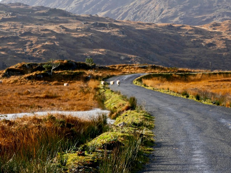
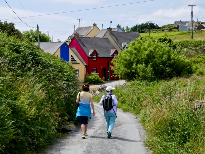
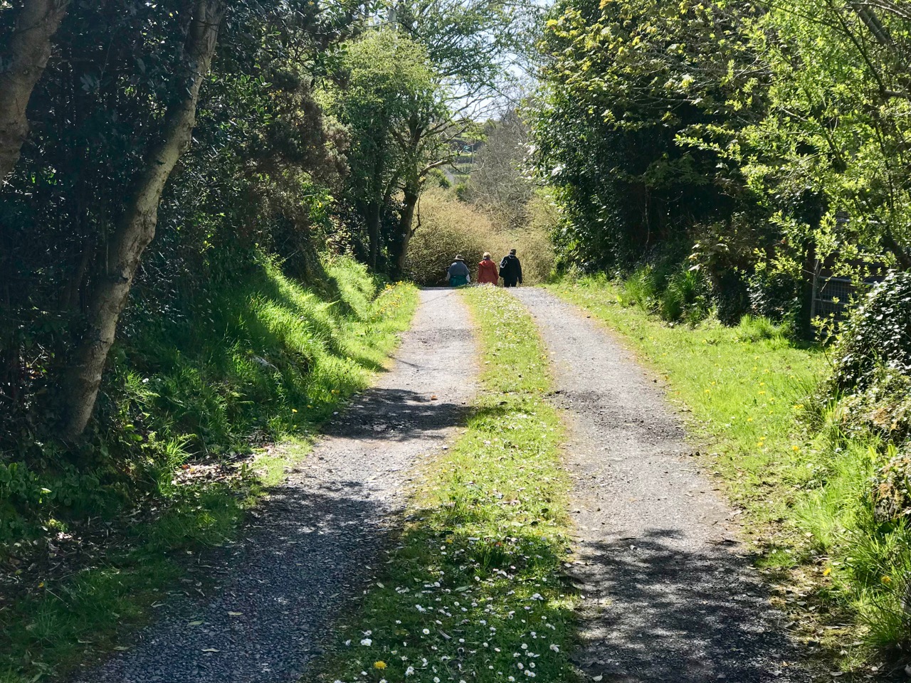
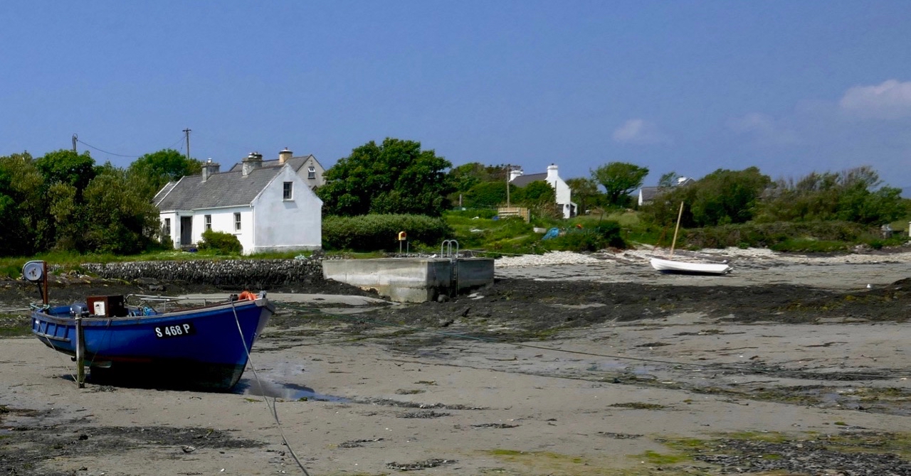
Four years ago I wrote about the fishing industry that once flourished on the shores of Roaringwater Bay (and around much of the west coast of Ireland): according to extant records it was active before 1500, and probably had its heyday in the seventeenth century, when it was heavily invested in by the Great Earl of Cork (Richard Boyle, sometimes described as ‘the richest man in the known world’). In those days, pilchards were the main catch: huge shoals of them came to the comparatively warm, sheltered waters of the islands during the summer months, along with other oily fish such as herring and mackerel. Seine boats were commonly used for this enterprise. Today, pilchards are rare: through a combination of overfishing and changing climate, the bountiful shoals no longer appear.

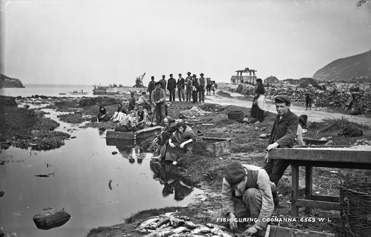
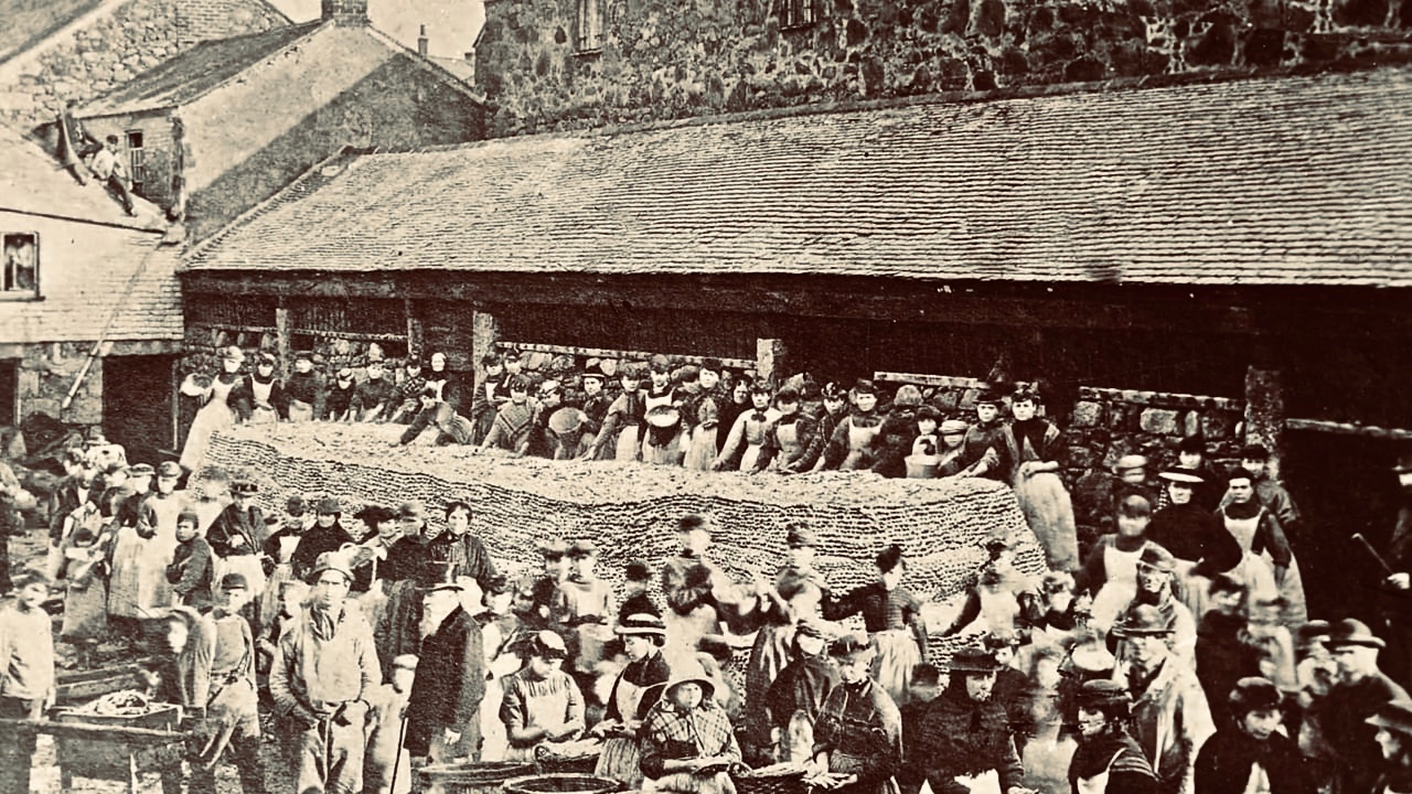
Header – pilchard curing in St Ives, Cornwall c1890: the pilchards are piled up in layers, forming the huge mound in the centre of the photograph. They are salted and weighted down. Above – curing the fish, Valencia Island, Co Kerry, early 20th century (Reddit / Ireland)

Shooting the Seine:

There were two boats per seine net, the seine and the faller. The seine boat was 27 foot long with a beam close to nine foot. The golden rule on the Northside was to never get into a boat whose beam was less than one third its length. The seine boat had five oars of about 17 foot (bow, Béal-tuile, aft, bloc and tiller oars). The crew of seven had to shoot the seine net; one man shooting the trip rope, another to feed out the bunt rope, four men rowing and the huer (master of the seine and captain of the boat) directing the operation. The faller (or bloc) boat was 24 foot long with a crew of five. Its job was stoning and to carry any fish caught. The largest load a faller could carry would be around 5,000 fish. All boats carried a Crucifix and a bottle of Holy Water.

(from Northside of the Mizen by Patrick McCarthy & Richard Hawkes, 1991)

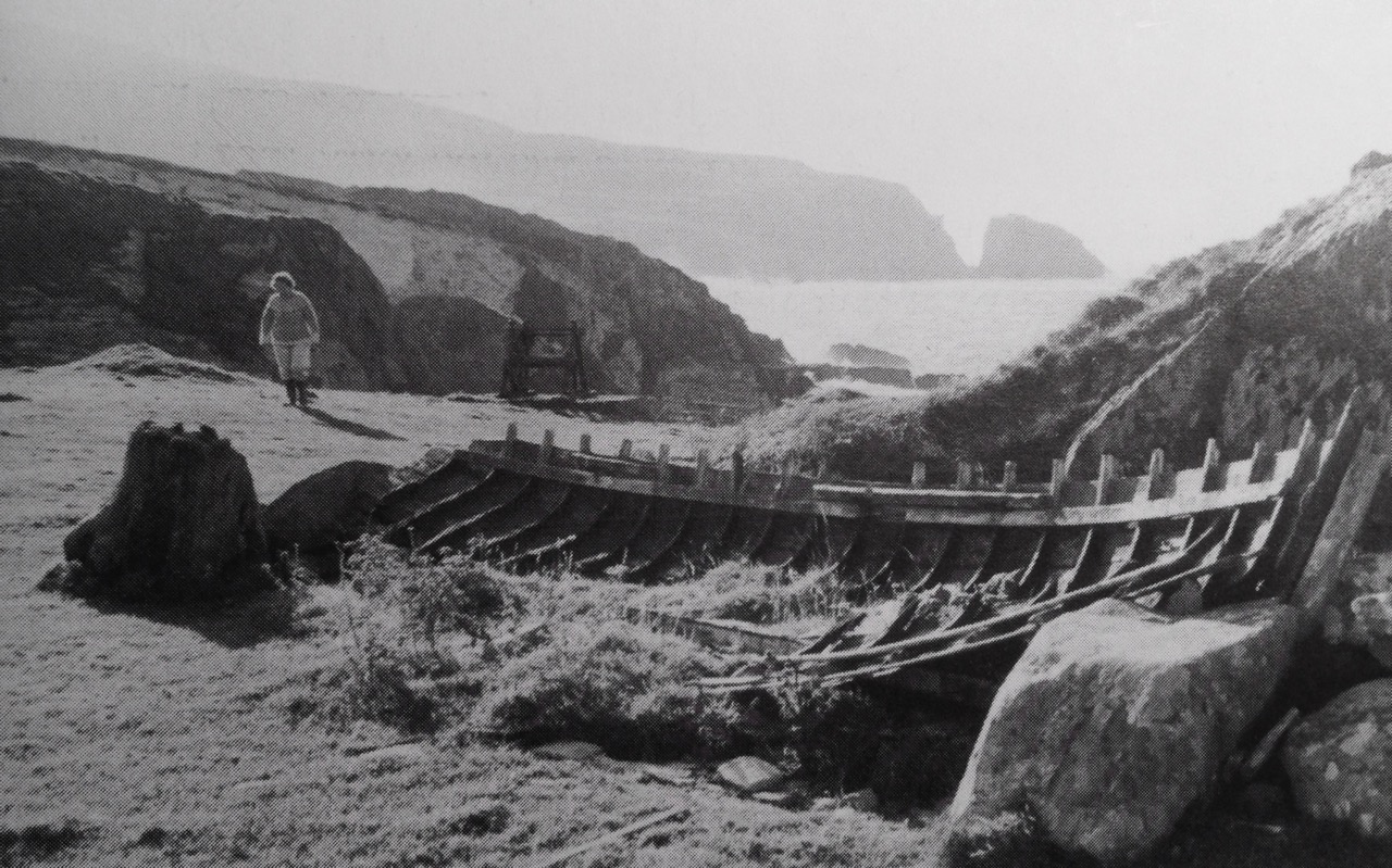
Twentieth century remains of a seine boat, from Northside of the Mizen

If the fish are gone, remains of the machinery of that industry are still to be seen. In particular, the sites of some of the curing stations – or Fish Palaces – are visible, and are recorded on the National Monuments Archaeological Survey Database. Take a look at the map below: I have drawn green pilchards to show the sites of fish palaces mentioned in the database – eleven in all on this section of the map. Also shown by red pilchards, however, are the sites of another six ‘curing stations’: these are mentioned in a long article by historian Arthur E J Went, Pilchards in the South of Ireland, published in the Journal of the Cork Historical and Archaeological Society in 1949: Volume 51, pages 137 – 157.

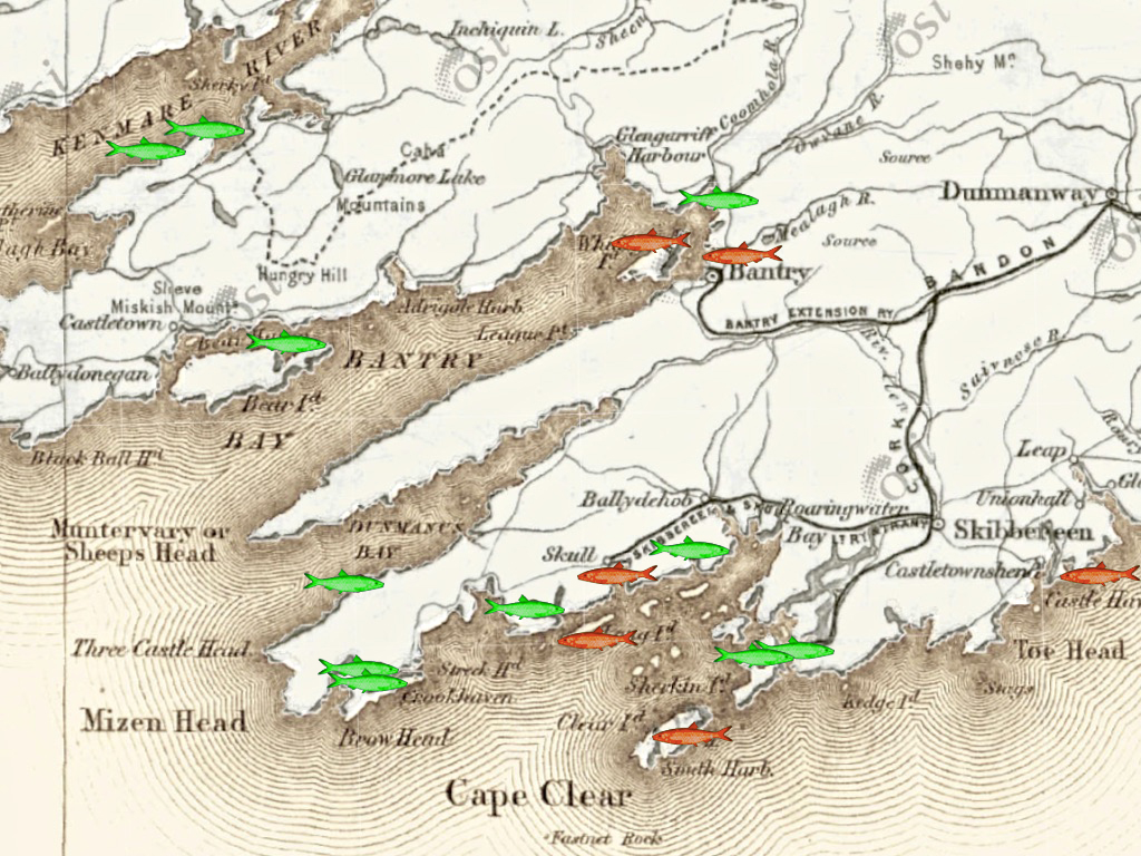
Known sites – or historical mention of – fish palaces (curing stations) in the South West of Ireland (information from  National Monuments database and  Arthur E J Went, Pilchards in the South of Ireland 1949)

The active fishing of pilchards on a large scale in Ireland has been discontinued for many years so that, unlike Cornwall, there is little left, apart from published records, to indicate its former importance. There is, however, published information as to the methods of fishing, and a few sites of old curing stations, frequently called pallices, can still be identified.

from Arthur E J Went, Pilchards in the South of Ireland, 1949

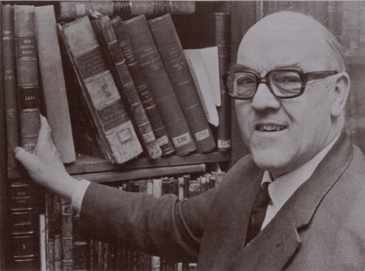
Arthur Edward James Went (1910–80), noted fisheries biologist and historian, lived at Sandycove, Co Dublin. In 1936 he was appointed Assistant Inspector of Fisheries in the Department of Agriculture, Dublin, and later was promoted to the position of Scientific Adviser and Chief Inspector of Fisheries

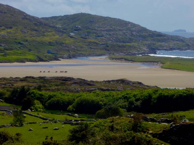
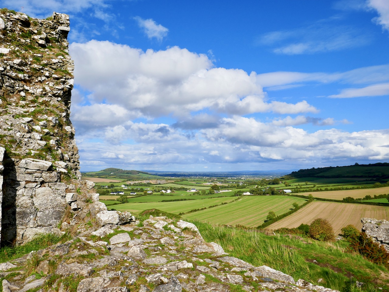
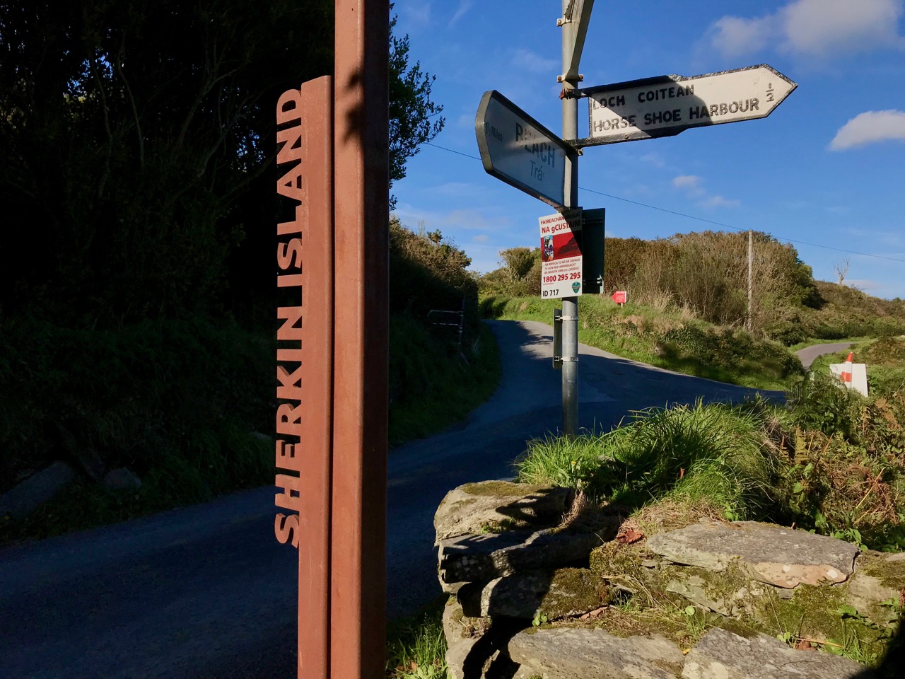
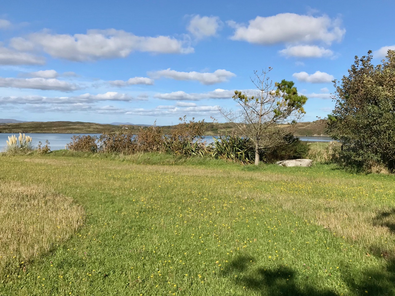
As explorers of all things historic and archaeological – particularly in West Cork – Finola and I couldn’t resist visiting some of the sites of Palaces – or Pallices – documented in these studies. We have always know about the one nearest to Nead an Iolair, in Rossbrin Cove – it’s just down the road: a perfect sheltered harbour, although it does dry out at very low tides. However, there seems to be some debate about exactly where this one is located. It would date from the time of William Hull and the Great Earl of Cork, so how much would be left after 500 years? There is a field on the north shore of the Cove with an old name: The Palleashes which, according to Arthur Went (quoting local tradition), was the site of a curing station for pilchards, operated by the ‘Spaniards’. There seems to be some difference of opinion locally as to which of the many small fields here is the actual site, although it is likely to be close to the large, now modernised quay, as this shows up on the earliest maps.

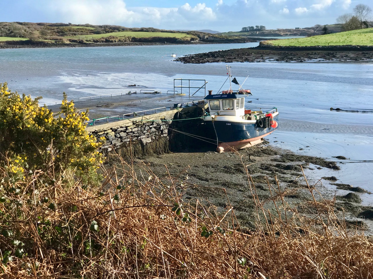
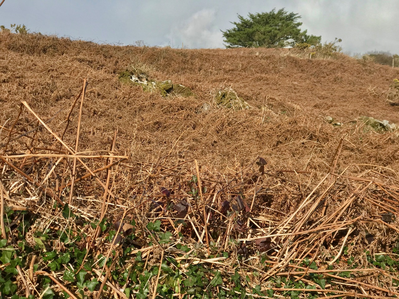
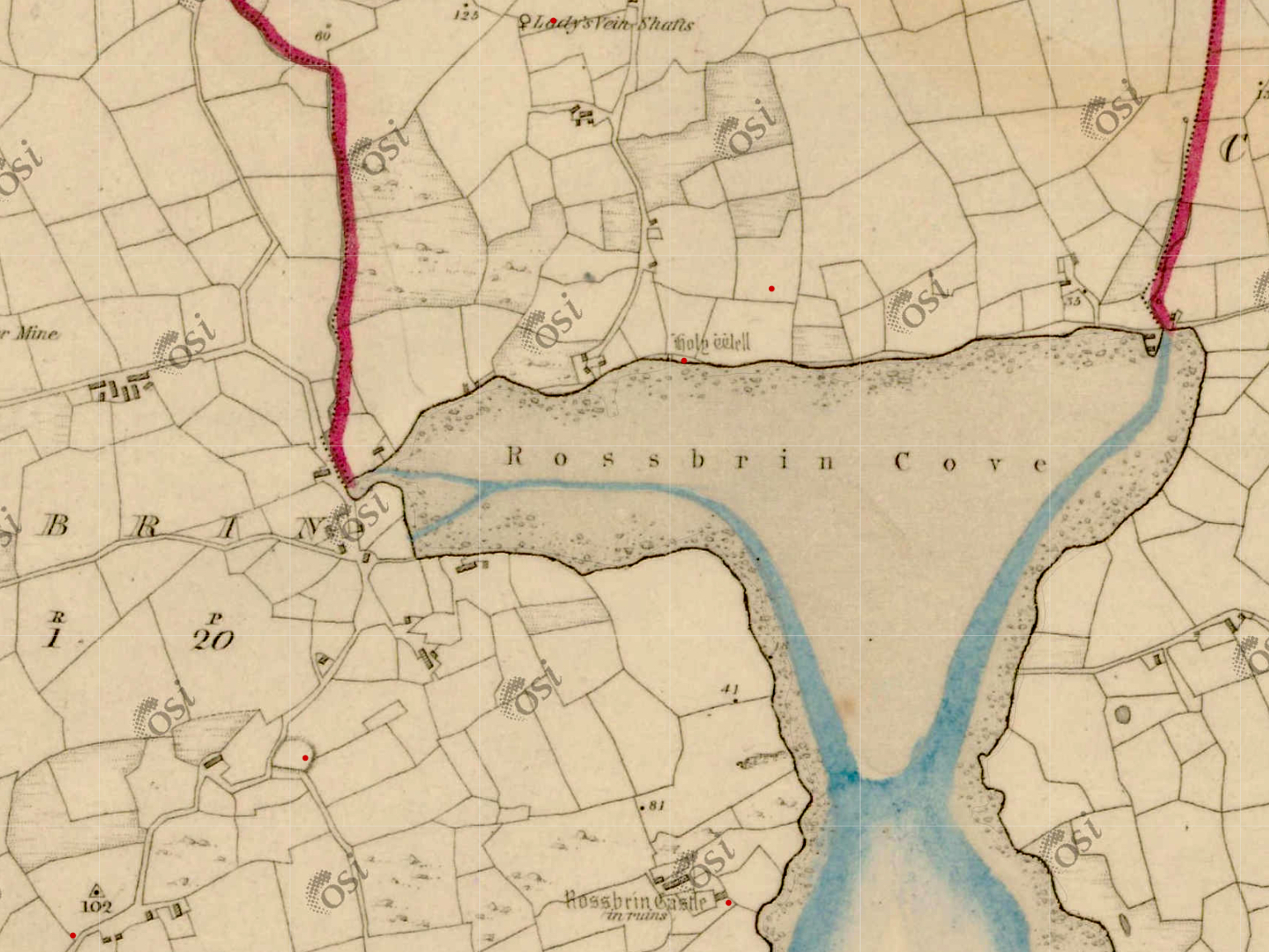
In the upper picture: the quay at Rossbrin is still used by small fishing boats today. Centre – the field above the present quay may be The Palleashes, and therefore could be the site of the medieval fish palace: there are very overgrown signs of stone walls here. Lower picture – the old 6″ OS map, surveyed around 1840, shows a lane accessing the area above the quay (to the left of the ‘Holy Well’ – that lane is no longer there today) and there are buildings close to the shore which could indicate the palace. In 1840 there was no road running along the north shore of the Cove, but the strand at low tide would have been used as a thoroughfare. Just above the ‘Holy Well’ indicated on the shoreline – and slightly to the right – is a small red dot. This is the area shown by Arthur Went as the possible site of the fish palace (and subsequently marked as such on the Archaeological Database); in my opinion it is more likely to have been directly accessed from the water.

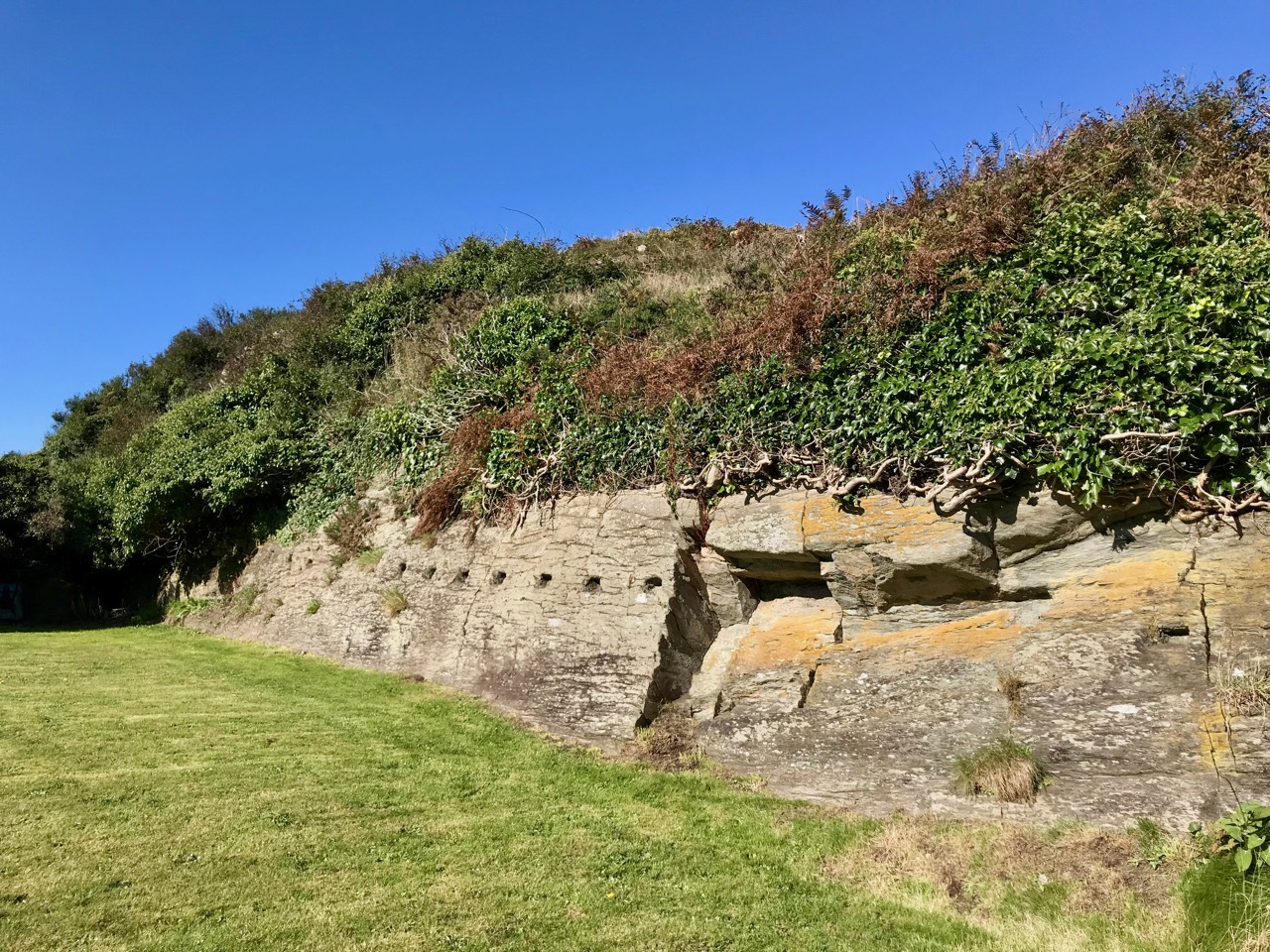
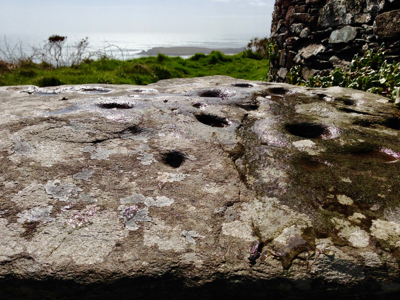
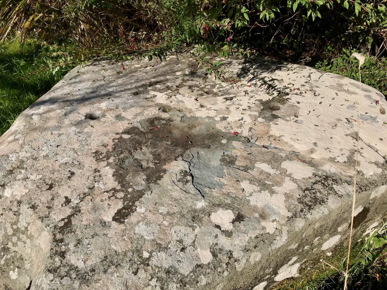
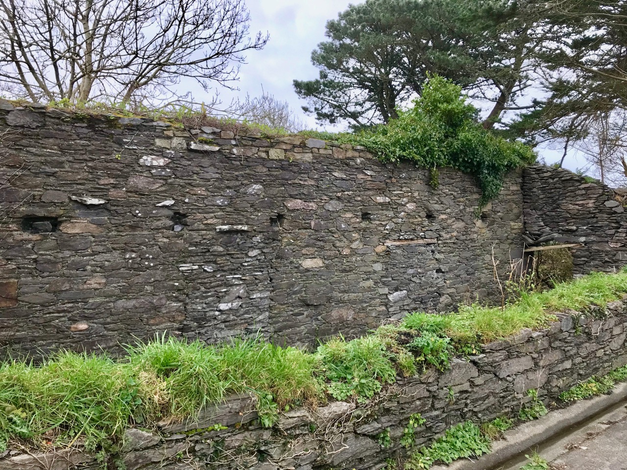
A sure sign of the site of a fish palace is a line of perforations or holes – as can be seen above at Baltimore, where a substantial curing station is recorded (although it may only date from the nineteenth century). Large timbers were inserted horizontally into these holes to form a ‘press beam’ to provide leverage for bucklers to squash out the oil from the salted pilchards, as shown in Arthur Went’s diagram, below:

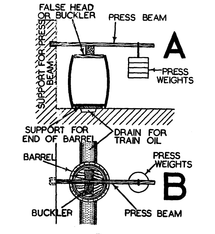
The ‘Train Oil’ – produced from the compressed pilchards – was a valuable commodity, and was collected to be stored and used for treating leather, and as fuel for lamps. As a by-product of the pilchard industry it was said to be as valuable as the fish themselves.

Palace Strand, in Schull

To continue my researches I went along to Schull, where Arthur Went mentions a ‘Palace House’ on ‘Palace Strand’ – an inlet just to the east of the main harbour. This is right beside the old railway station which was not quite the terminus of the Schull & Skibbereen Railway, as a spur went on from the station to serve the harbour itself. The station buildings and part of the platform are still there – now a private residence. I could not find anything in the area shown on Went’s map at the east end of the strand, but I did find something at the west end.

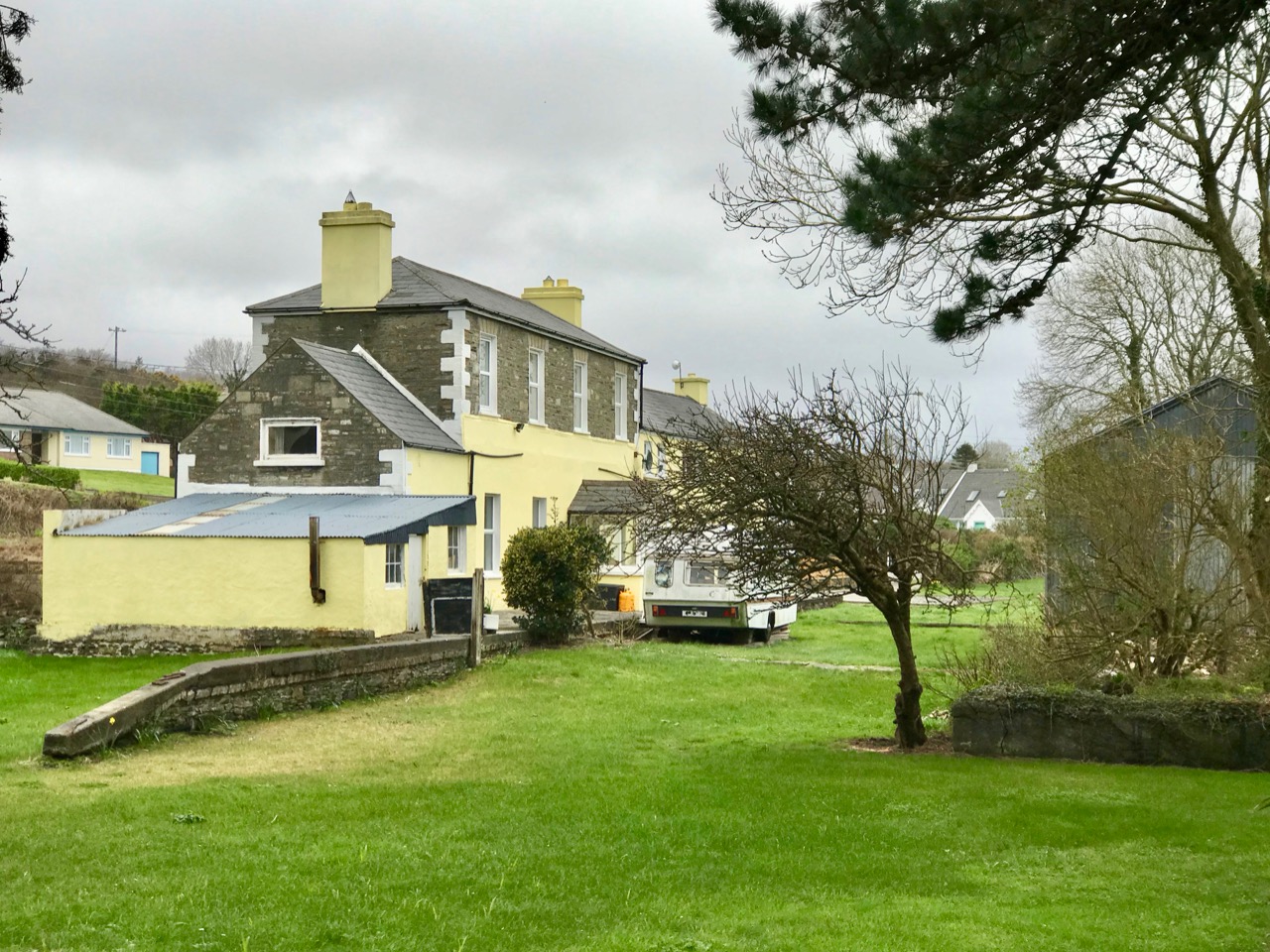
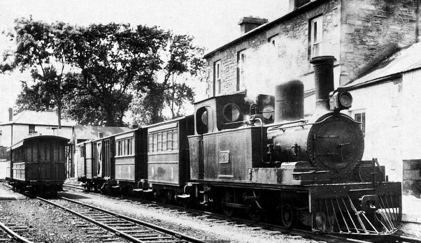
In the upper picture is a wall on the western boundary of the old station site in Schull. This contains beam holes very similar in size and spacing to those we have seen in fish palaces elsewhere: it’s very tempting to think that this wall – now part of a derelict building – may have had this purpose, as it is well situated close to the shoreline of Palace Strand. If this was a fish palace, it is also likely to date from the nineteenth century, as the early Ordnance Survey maps don’t indicate it. The centre picture shows the old station buildings today, and the lower picture taken at Schull Station in 1939 reminds us of past times: the railway closed in 1947.

This post is a ‘taster’ for a fully illustrated talk I’m giving at Bank House, Ballydehob, on Tuesday 26 February at 8pm: Pilchards & Palaces – 300 years of Fishing in South-West Ireland. It’s part of the Autumn series of Ballydehob’s ‘Talks at the Vaults’

Below – a postcard showing fish curing on Cape Clear in 1906 (from Hely’s, Dublin)

New Year Resolutions 2019

Note of explanation from Finola and Robert: the Blog has taken on a mind of its own and decided he needs to make some resolutions for 2019.  He has asked us, his slaves faithful staff, to record these, as a means of keeping him accountable. Ours not to question why, ours but to do or die, so here goes, in his own words. . .

The Black Valley, Kerry

1. Spend more time in Kerry

It’s only next door, after all, and it’s in Finola’s blood, since her grandmother came from Killarney and she still has lots of lovely family there. So I’m determined they will take me there on outings a bit more often this year. There’s an ulterior motive too – you, my faithful readers, know that I often cosy up to that cheerful little Bloguette Holy Wells of Cork: she’s running out of wells in Cork but is enthusiastic about the idea that we can go jaunting off together on Kerry adventures.

2. Incorporate more music

I have to let you in on a secret – Robert is forever promising to learn new tunes for me, but then he comes up with all kinds of excuses why he’s not getting on with it. He’s too busy, it’s too hard, it’s not in the right key, blah, blah, blah. He’s finally sort-of learned this one, after weeks. We live in the heart of Irish traditional music – come on, people!

Staff member Robert trying to get it right – it’s called Pearl O’Shaughnessy’s Barn Dance, learned from Clare concertina player Mary MacNamara

3. Get on with that Saints and Soupers story

Honestly, that Finola, she leads us deep into this fascinating study of whether or not that Fisher guy was a saint or a souper, and then she goes off on one of her tangents about stained glass or wildflowers or whatever. I’m dying to know what happens next, so I’m going to have to lean on her to put the nose to the grindstone and get back to all those Protestants and Catholics and the actual famine part.

Michael the Archangel fights the devil – a powerful good versus evil metaphor in Altar Church

4. Get out to the Islands

It’s called Carberry’s Hundred Isles, for goodness sake – we can see them from the house (like Sarah Palin and Russia). Time to travel to more of them and get to know them. 

South Harbour on Cape Clear

I’ve been polishing up my Irish (or Blirish, as we Blogs like to say) and I need the practice, so Cape Clear needs to be on the agenda. I hear they have a good Blirish program out there, so ar aghaigh linn!

Staff member Finola and her sister on Cape Clear this summer

5. Finish the Fastnet Trail walks

This is a bit of a hangover resolution from previous years when I vowed to do all the Fastnet trails, but got a bit distracted with other walks and other projects. Besides, they’re adding to them all the time so if I don’t get off my desk and get out there soon the job will just get bigger and bigger.

Kilcoe Castle can be seen from several of the Fastnet Trails

6. Find more places to have breakfast

My staff loves going out for breakfast and I must say I am very partial to a nice plate of avocado toast and smoked salmon, with a good pot of tea to wash it down (although those two insist on lattés). They took me to the Box of Frogs in Bantry recently, and despite my misgivings about the name (I had a bad experience with a toad once) I had to admit the food was excellent. But, like all the humans I meet recently, I’ve been toying with the idea of eating less meat so I will persuade them to go to Antiquity Bookshop Café in Skibbereen for their tasty vegan food more often. BUT. . . see next resolution

Nicola surrounded by her stock in trade in Antiquity, West Cork’s first vegan café

7. Read the books!

The staff keep bringing more books (especially from Antiquity) into the house and they pile up beside me, making me feel guilty that I’m not keeping up. They built a new set of shelves and they are already filled. Honestly, in this day and age, you’d think someone would have invented some kind of scanner-to-brain technology so that Blogs like me wouldn’t have to work so hard.

Just one shelf – yikes!

I have more, but the experts say not to make too many. Right, friends – a little encouragement and I’m sure I will be fine, despite all the malingering and complaining of my staff. Onwards and upwards into 2019!

Favourite Posts of 2018

At this end of the year we reflect with a critical eye on all our 2018 posts – there have been 102 of them – and select just a few which we think stand out in some way. A link is provided for each one, in case you want to have another look yourselves.

Firstly – not just one of our favourites, but the all-time most popular post we have ever published – Ireland’s Newest Stained Glass Window. Finola wrote this in January, and then went on to put together an article in the Irish Arts Review on the same subject later in the year. The window is in St John’s Church in Tralee, a Catholic church, but the project was a joint venture between the Catholic and Anglican congregations. It tells a story of reconciliation, from many angles. The window was designed and made by Tom Denny, one of Britain’s most eminent and respected stained glass artists. Tom is a direct descendant of Sir Edward Denny (1547 to 1599) who was one of the architects and enforcers of the Plantation of Munster. It’s a complex history, and this post is well worth a careful read.

Another post which proved popular was Robert’s detailed account of an archaeological site in West Cork: Knockdrum Stone Fort. This place has everything – a substantial stone structure which probably dates from the first millennium AD; prehistoric Rock Art (one of our favourite subjects – the Knockdrum example is pictured above), likely to be around 5,000 years old; fabulous views (choose a clear day) – and a solar alignment discovered in 1930 by Vice Admiral Henry Boyle Somerville, the younger brother of writer and artist Edith Somerville. In a complementary post, Finola reported on Boyle’s life and tragic death – and gave us insights into the science of archaeoastronomy, expanding on this in a Bealtaine post, following our own experience of Boyle’s discovered alignment at Knockdrum (the sun setting exactly over the fort is pictured below).

Way back in 2017 we started a series of occasional posts bearing the title . . . Off the M8 . . . We do a lot of travelling throughout Ireland (because it’s such a beautiful and historically rich country) and cover the ground between Cork and Dublin quite frequently. The M8 motorway has made this journey quite straightforward, but it has also provided the jumping off point for many an exploration to enhance the journey. One of my own favourite discovered places this year is the magical Glen of Aherlow (pictured above). We thank our good friends and travelling companions Amanda and Peter – she of Holy Wells of Cork and he of Hikelines  – for pointing us to this entrancing valley located between Slievenamuck and the Galtee Mountains in the western part of County Tipperary. We discovered there secret places and stories relating to obscure Irish Saints: have a look at the haunts of St Berrahert and St Péacáin in these posts from Robert.

When I moved from Cornwall to West Cork some years ago I was delighted to find out that our lively adopted village of Ballydehob had a great artistic heritage during the second half of the twentieth century, to rival that of Britain’s westernmost county. West Cork became a cosmopolitan centre for artists, writers, craftspeople and musicians, renowned in its day but never properly celebrated – until this year. I was one of a small group locally who decide to rectify this by establishing the Ballydehob Arts Museum (BAM): our first exhibition . . . Bohemians in Ballydehob . . . using donated artworks, ceramics, storyboards and posters, was staged in Ballydehob’s community building, Bank House, and – presided over by Curator Brian Lalor (one of the surviving Bohemians!) – was the first incarnation of the new Museum, which will be followed up by new exhibitions every year. The picture above (courtesy of Andrew Street) from my post, shows the Flower House which, during the 1960s and 70s, became an iconic focus for the town’s artistic colony.

It was a grand summer altogether, and we were out walking the roads and footpaths of West Cork as much as possible. On a fine day in May we set off to explore the Toormore Loop which is only one of an excellent comprehensive system of trails which has been put in place locally in recent years. This post – Another Grand Day Out on the Fastnet Trails – documents that adventure and, hopefully, will encourage all of you to enjoy this wonderful free resource and immerse yourselves in the nature that’s all around us.

The second most viewed post this year was Finola’s fascinating account of the Rock of Dunamase and the history that it embodies. It’s a place that, for some reason, took us a few years to get to – and it’s Off the M8! But – as you can see from the picture above – climbing the Rock will give you a most rewarding and spectacular view across several counties. The ruin on its summit is inextricably associated with the most turbulent events in Irish History – the coming of the Normans to Ireland in 1169, and the famous marriage of Aiofe (daughter of Diarmuid MacMurrough, King of Leinster) to the Earl of Pembroke, immortalised in the painting by Daniel Maclise (below, courtesy of National Gallery of Ireland). The fortification with its Great Hall on the Rock was a MacMurrough stronghold, and accordingly was part of Aoife’s dowry when she married Strongbow.

Finally (for today, anyway) we look at Finola’s post which comprehensively explores another West Cork treasure: Heir Island – a Modern Paradise (pictured above and below). West Cork has such a diverse landscape, including the inhabited islands of Roaringwater Bay, each one of which is unique. Finola teamed up with her photographer friend Trish Punch and they were shown around the island by islanders Christine Thery and Sarah Mathews, who run the Heir Island Wildlife Project. This post is a great example of how the diversity of life on the island – and here in West Cork generally – brings together so many disciplines and interests: photography, history, wildflowers, wildlife, colourful houses, and art. Everything that Roaringwater Journal tries to encompass, in fact.

West Cork Obscura – Finola’s Picks

The popular Atlas Obscura defines itself as the definitive guide to off-the-beaten-track and little known wondrous places. So we’ve captured that idea and, as our Christmas present to our readers, bring you our own carefully-curated, slightly eccentric, Roaringwater Journal Guide to West Cork’s Hidden Wonders. Robert’s selection is here. No well-know tourist spots for these posts! No car parks and visitor centres! You may need wellies for some, a good map for others, and, although all are accessible, some may require permission.Each place I recommend will link to a blog post with more information. As an example, Sailor’s Hill, just outside Schull (above) is an easy walk and look what you get at the top! 

This is the view from Brow Head, looking back towards Crookhaven, and Mount Gabriel in the distance. Brow Head is much less visited than Mizen Head, but just as spectacular

I’m going to start with some archaeology and a couple of spectacular sites. The first is the Kealkill Stone Circle – but this isn’t just a stone circle, it’s a complex of monuments that includes a five-stone circle, a radial cairn (very rare in this part of the world) and two enormous standing stones. The views are immense in every direction, and the site is easy to find.

We all know about Drombeg – and we love it when the sun goes down at the midwinter solstice, and even when it doesn’t. But fewer people know about another stone circle, equally spectacular, with a spring equinox orientation. It’s called Bohonagh and it’s quite a complex. First of all, there’s a boulder burial, with quartz support stones and cupmarks on the boulder. Then there’s a cupmarked stone, partly hidden in the brambles between the boulder burial and the stone circle. Finally, there’s the circle itself, almost complete, with views in all directions.

Equinox sunset at Bohonagh

We were lucky to have a session there one equinox, and another one with Ken Williams of Shadows and Stone. For access, park just off the main road, across from the salmon coloured house 4.5km east of Rosscarbery and walk up the farm road to the barns and from there to the top of the hill. This is a working farm – please close all gates and be respectful of animals!

Maughnasilly Stone Row broods on the hilltop

A stone row to round out the archaeology sites – this one is at Maughnasilly and I chose it because it’s been excavated, so there’s an informative sign, access is easy and it’s a beautiful, atmospheric site, overlooking a small lake. The row has been calculated to have both lunar and solar alignments.

And from the ground…

A couple of churches now, beginning with the Church of Ireland Church of the Ascension in Timoleague. This is one of those places that is dripping with unexpected stories. As soon as you go through the door your jaw will drop – the whole church, floor to ceiling, is covered in mosaic, partly paid for by an Indian Maharajah. Read the story here and here – and look carefully at the stained glass windows, some of them are among the oldest stained glass we have in Ireland. The key used to be at the grocery store on the main street, but I’m not sure where it is now, so you may have to ask around. Let us know if you find out.

The interior of the church, and one of the beautiful Clayton and Bell windows

You may wonder at my next choice – it’s not everyone’s cup of tea – but the modernist church in Drimoleague is the work of Frank Murphy, the architect hailed as Cork’s ‘Unsung Hero of Modernism’.

I love the spare minimalist space, very rare in West Cork, but it’s the stained glass windows that drew my attention. It’s not that they are particularly beautiful or skilfully done: they’re by the Harry Clarke Studios long after Harry himself had died. It’s that they fascinate me as a social document – they are, in fact, a prescription for how to live your life as an Irish Catholic in the 1950s. As such, they will resonate with anyone of my vintage. Research by the brilliant young scholar, Richard Butler, has revealed that the design was practically dictated by Archbishop Lucey, still a name to invoke an image of the all-powerful churchman of the 20th century.

And a final church, but this one strictly for the windows. (No – not St Barrahanes in Castletownsend for the Harry Clarkes – everyone knows about them already, and this is a selection of lesser-known wonders.) Do NOT go through Eyeries, on the Beara Peninsula, without stepping into the little church of St Kentigern. Here is where we were first introduced to the work of the stained glass artist, George Walsh.

The Annunciation and Nativity window

When Robert wrote his original post, we couldn’t find out much information on George Walsh, but now he has become a friend and I have written about his work for the next issue of the Irish Arts Review (due out in March, 2019) and spent many happy hours photographing his windows and his artwork around Ireland. It’s bold, graphic, modern and incredibly colourful, and the windows in Eyeries, along with the religious themes, tell the story of Ireland and the Beara through time.

Some places to visit now for a good walk or a swim. First, one of my favourite walks is to hike up to Brow Head, at the end of the Mizen Peninsula (you can drive up too, but pray you don’t meet a tractor coming down) and then walk out to the end of the Head (see the second photo on the post for the view from the top of the road). Stop first to explore the ruins of the old Marconi Station – there’s also a Napoleonic-era  signal station and a WW2 Lookout Post. Then wander through the heather and the low-growing gorse until you get to the part where the sea is crashing below, with vertiginous drops off either side. I will leave it to you how far you go from there!

Brow Head showing the signal station and Marconi station silhouetted against the evening sky

Although Barley Cove is well known, Mizen locals love Ballyrisode Beach for a swim or a lounge in the sun. White sand, sheltered bays, and water warmed by running over the shallow bay. The final little beach holds a secret – a Bronze Age Fulacht Fia or Water-Boiling Site, that Robert and I recorded for National Monuments this summer. It was an exciting find, hiding in plain sight. The beach has an association with pirates too!

Ballyrisode Beach – yes, the water really is this colour. The three sided rectangular stone thing is the fulacht fia

The final choice for a walk is Queen Maev’s tomb, a short hike up from Vaughan’s Pass car park, up behind Bantry. For this photograph I am indebted to Peter Clarke, of the wonderful Hikelines blog. He and Amanda (with whom we have explored SO many holy wells)  were our companions that day. When you reach the top there is a small wedge-tomb, but this is one place where the journey is the real story, with the Mizen, the Sheep’s Head and the Beara all spread out before you.

Photograph © Peter Clarke

I leave you with a detail from the George Walsh windows in Eyeries, together with the poem the scene is based on, Pangur Bán, written in the 9th century by an Irish  monk labouring away in a scriptorium in Europe. Here is the poem read, at a memorial service for Seamus Heaney, first in the original Old Irish and then in Heaney’s translation.

Merry Christmas from us! If you live here, get out and about this year to some of our picks, and if you don’t, come see us soon!

Chough Country

WHERE not a sound is heard
But the white waves, O bird,
And slippery rocks fling back the vanquish’d sea,
Thou soarest in thy pride,
Not heeding storm or tide;
In Freedom’s temple nothing is more free.

‘Tis pleasant by this stone,
Sea-wash’d and weed-o’ergrown,
With Solitude and Silence at my side,
To list the solemn roar
Of ocean on the shore,
And up the beetling cliff to see thee glide.

Though harsh thy earnest cry.
On crag, or shooting high
Above the tumult of this dusty sphere,
Thou tellest of the steep
Where Peace and Quiet sleep,
And noisy man but rarely visits here.

For this I love thee, bird.
And feel my pulses stirr’d
To see thee grandly on the high air ride,
Or float along the land,
Or drop upon the sand,
Or perch within the gully’s frowning side.

Thou bringest the sweet thought
Of some straw-cover’d cot,
On the lone moor beside the bubbling well,
Where cluster wife and child,
And bees hum o’er the wild:
In this seclusion it were joy to dwell.

Will such a quiet bower
Be ever more my dower
In this rough region of perpetual strife?
I like a bird from home
Forward and backward roam;
But there is rest beneath the Tree of Life.

In this dark world of din,
Of selfishness and sin,
Help me, dear Saviour, on Thy love to rest;
That, having cross’d life’s sea,
My shatter’d bark may be
Moor’d safely in the haven of the blest.

The Muse at this sweet hour
Hies with me to my bower
Among the heather of my native hill;
The rude rock-hedges here
And mossy turf, how dear!
What gushing song! how fresh the moors and still!

No spot of earth like thee,
So full of heaven to me,
O hill of rock, piled to the passing cloud!
Good spirits in their flight
Upon thy crags alight,
And leave a glory where they brightly bow’d.

I well remember now,
In boy-days on thy brow,
When first my lyre among thy larks I found,
Stealing from mother’s side
Out on the common wide,
Strange Druid footfalls seem’d to echo round.

Dark Cornish chough, for thee
My shred of minstrelsy
I carol at this meditative hour,
Linking thee with my reed,
Grey moor and grassy mead,
Dear carn and cottage, heathy bank and bower.

I was pleased to find this poem. It was written by a Cornishman – John Harris – who was born in 1820 in Bolenowe. Perhaps he was an ancestor? His father was a miner at Dolcoath Tin Mine where young John also started at the age of 10. He began writing poetry as a child, usually in the open air where he was inspired by nature. After 20 years working in the mine, one of his poems was eventually published in a magazine. It attracted notice, and he was encouraged to produce a collection, which was published in 1853. The Cornish Chough is taken from that collection.

Above – choughs over Rossbrin Cove. The wonderful header picture was kindly given to us to use in a previous piece on the birds by our friend and neighbour Oliver Nares. Oliver and Susie are fortunate to have choughs nesting on their property and keep a good eye out for the welfare of the chough families which are raised there. We don’t have choughs nesting at Nead an Iolair (which means Nest of the Eagle) but we often see and hear them over us: they are the most acrobatic and joyful of birds.

The reason I have returned to choughs today is that they were the subject of an early post which I published on Roaringwater Journal on 6 October 2013 – exactly five years ago! Choughs – Cornwall’s emblematic birds – left that county fifty years ago but returned very recently as migrants from Ireland. We consider ourselves very privileged to be living in abundant chough country.

A Walk on Sherkin Island

You can’t live in West Cork without constantly being aware of the sea – it’s all around us. And the offshore islands are always in our view as we look across Roaringwater Bay. It’s easy to get to the inhabited ones: there are good ferry services that run year round, although they can be hampered by winter storms. In this picture – above – the Cape Clear Ferry is leaving Baltimore, while the Sherkin Ferry is arriving to collect passengers for that island, including us: on a whim we went across on a wonderful warm September afternoon.

It’s a short sea voyage to Sherkin – all of 15 minutes! But it’s always exciting to be on the water. That’s the lighthouse on Sherkin in the picture above: it was built in 1885 of cast-iron construction and is now fully automated, as are all of Ireland’s lighthouses today.

We did have an aim – to find a piece of Rock Art that may be the earliest physical evidence of human occupation on the island. It’s a cupmarked stone in the townland of Kilmoon, overlooking Kinish Harbour. It was a fair walk to the west, over deserted roads and through fields. After a bit of backtracking we managed to find the stone, well weathered but with its markings still visible. It is situated with panoramic views all the way round, taking in the peaks of Mount Gabriel, Mount Corrin and Mount Kidd on the mainland: surely it must have been placed with those views in mind?

This picture shows the cupmarked stone in its present setting, just inside a private garden (if you go, please make sure you seek permission from the owners of the house!), while the one above shows the panoramic distant view which the stone commands.

Here is the surface of the stone which is heavily blotched with lichen, but it is possible to make out the well defined cupmarks: there are 14 in all. If you want to find out more about cupmarked stones and how they compare with Rock Art in general, we wrote this post a while ago. It sparked off a whole lot of debate (have a look at the comments at the end of that post) – and there is still much to be discovered in a history that may go back 5,000 years.

Our main mission was accomplished, but we couldn’t resist taking in some other historical sites while on the island. Firstly, we had a good look at the Franciscan friary – situated in the townland of Farranacoush – which has a colourful history. Here is a description from the current Irish Franciscans site:

. . . Permission for this foundation was given by Rome to Finighin O’Driscoll in 1449, but it was not until just after 1462 that the Observant friars actually arrived. The friary became the traditional burial place of the O’Driscoll’s. In 1537 the citizens of Waterford burned the building in retaliation for acts of piracy by the O’Driscolls. The great bell of the friary was on display in Waterford as late as 1615. There is no evidence to suggest that the friars were disturbed by the events of the Reformation until the island was garrisoned by the English following the Battle of Kinsale. The friars soon returned and, except at the height of the Cromwellian persecu­tion, were active all during the seventeenth and well into the eighteenth centuries. The last friar, Fr Patrick Hayes, died soon after 1766 . . .

In the picture above – taken from the OPW information board – you can see the attacks of 1537 by ‘the citizens of Waterford’ on both the Friary (in the foreground) and the O’Driscoll stronghold of Dún na Long (beyond). The castle was subsequently partially rebuilt and was garrisoned by a Spanish force in 1601. It was then acquired and restored by the Becher family in 1655 and remained in their ownership until the late nineteenth century. We went to see what remains of the castle today.

Our visit to Sherkin only took an afternoon – albeit a golden one. There’s plenty more to see there – and other islands to be investigated. And an endless exploration of history to be had in the landscapes of West Cork.