Into the Kingdom

To the Skelligs

The Kingdom? No, we didn’t go to Britain – we went to Kerry. It’s always been called the Kingdom, possibly based on ancient Irish precedents, although other theories abound. Many people think it’s because of the sheer magnificence of the scenery, and I wouldn’t disagree.

Ballinskelligs Bay

Ballinskelligs Bay. The first photograph is also Ballinskelligs Bay, with a glimpse of the famous Skelligs Islands in the background – subject of a future post, we hope!

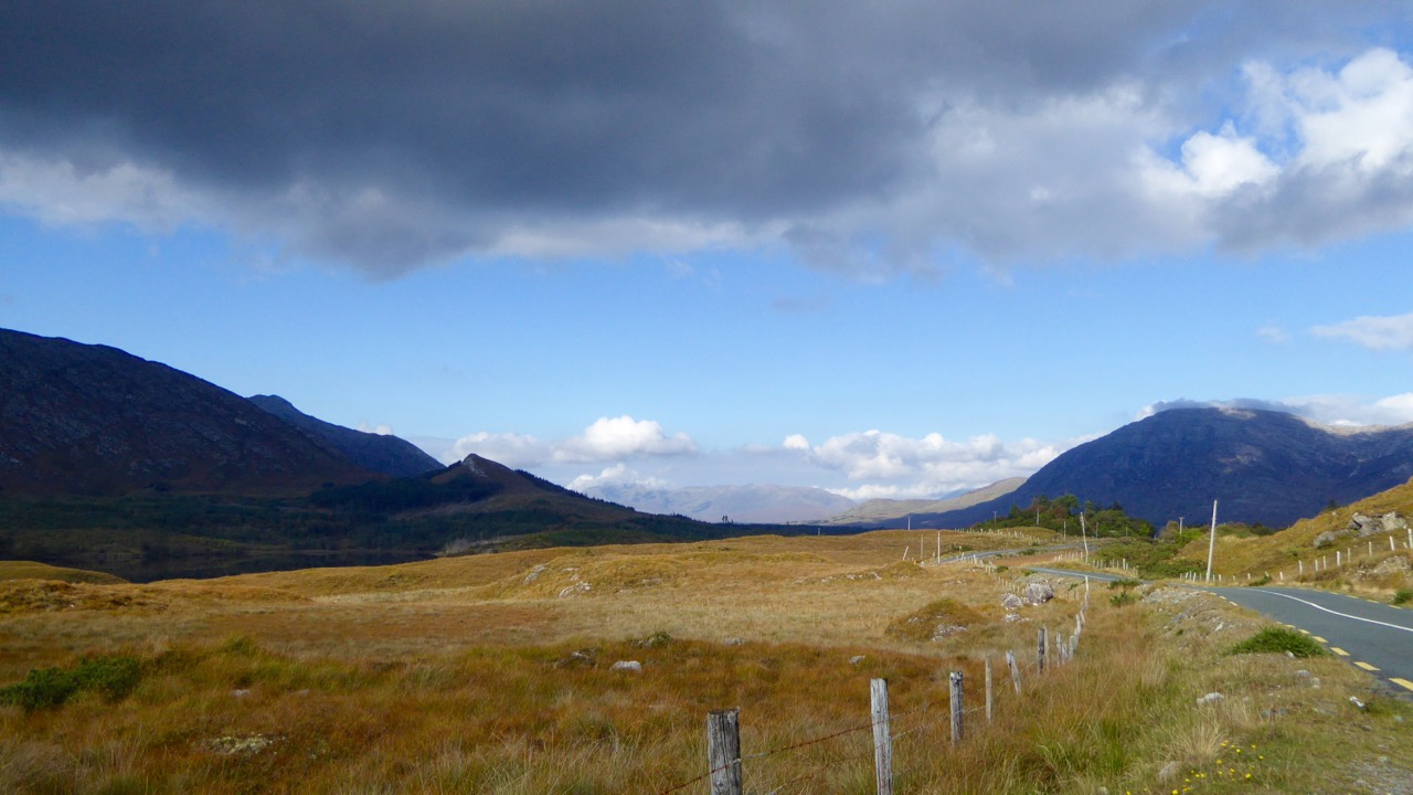
Our journey took us on the Ring of Kerry, along the south side of the Iveragh Peninsula, by the sea. This is prime tourist territory – bus after bus passed us and every lay-by was thronged with camera-wielding tourists, including us. We came back through the middle of the peninsula, through deep valleys and high mountain passes.

To Ballaghbeama

Not for the tour busses!

These are not roads that busses can manoeuvre through, so we had it mostly to ourselves, the locals, and a few tourists armed with small cars and good maps. I love this Iveragh backcountry. It’s where I spent my student days, conducting my research. I even recognised the place where I crashed my Honda 50 into a bog.

Ballaghasheen Pass

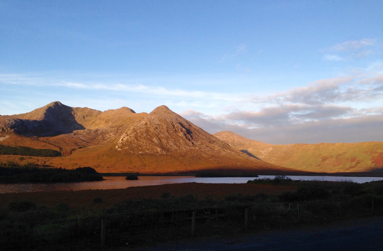
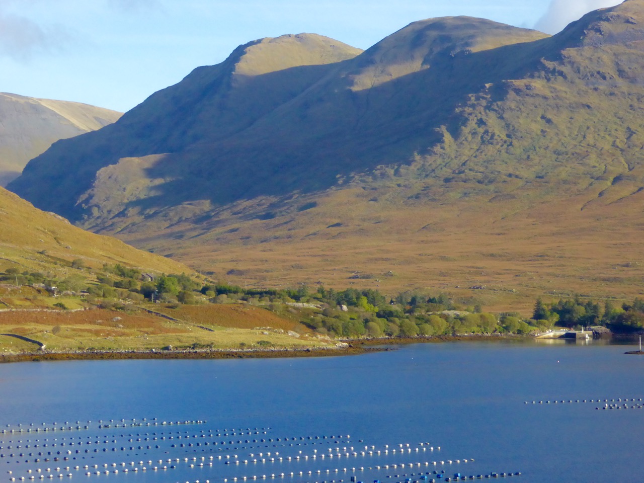
Although it seems totally mountainous, vast sheltered valleys occupy some of the hinterland of the Iveragh Peninsula  

We visited two stone forts, the mighty Staigue and the lesser-known Loher, and of course some rock art. Staigue Fort is generally reckoned to be Iron Age (about 250AD), while Loher, although very similar, was built later, around the 9th Century.

Staigue Interior and outlook

Loher Stone Fort
Staigue Fort (upper), at the head of a long valley, commands views to the sea. Loher is also strategically sited with extensive views all around.

We toured Daniel O’Connell’s House at Derrynane and took the Nature Trail walk along the dunes, using the app developed by local man Vincent Hyland.

Shoreline walk

Wild flowers a-plenty on the dunes at Derrynane. Top: Sea Pinks and Sea Sandwort. Bottom: Pyramidal Orchid and Kidney Vetch

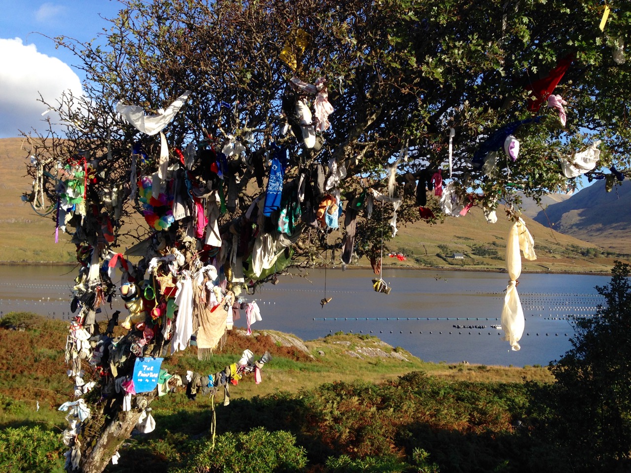
We searched in vain for the holy well devoted to Saint Crohane, patron saint of Caherdaniel – we’ll have to go back with Amanda to help us find it.

Across to the Beara

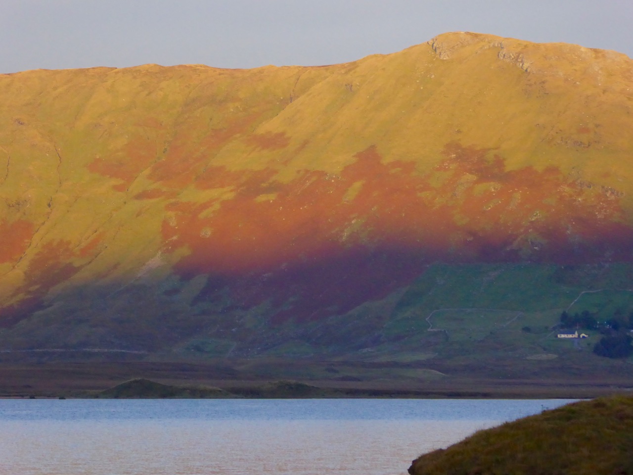
We didn’t find St Crohane’s well but when we finished our search, in twilight, this is what was waiting for us. The mountain range in the background is the Beara Peninsula in Cork

In fact, the primary purpose of our trip was to re-connect with cousins that I haven’t seen for about 45 years. The last time I saw Annie and her siblings they were kids, and we were all piled on to a donkey and cart in a vain attempt to get from Lamb’s Head to Staigue Fort. It’s a long story, but suffice it to say that the donkey came out the winner. Most of the family still live around Caherdaniel, in jaw- dropping surroundings, and we were accommodated and hosted with true Kerry hospitality.

The view from Annie's

Top: The view from Annie’s house, across to Lamb’s Head where the family grew up

Along the way we saw a house shaped like a ship (Robert has more – much more – about this!), had our first experience of bottle-feeding a lamb, and we watched Rex the sheepdog gently herd a flock of chickens into their pen for the night. We visited my cousin Betty’s grave – she died a few months ago, the heart of the family, much mourned. It was, we hope, the first of many visits, back and forth.

Abbey Island

Abbey Island, Betty’s last resting place, must be one of Ireland’s most beautiful graveyards. To access it, you must walk across the sand and keep an eye out for high tides. The original monastic site was founded by St Finian in the sixth Century, although the ruined church, Ahamore Abbey, probably dates from the 10th Century.

This post is to give you a flavour for our neighbouring county and to show you why it is justly famous for its history and archaeology, but most of all for what is surely some of the most spectacular scenery in the world.

Lamb's Head to Scariff and Deenish IslandsScarrif and Deenish are the two islands out from Derrynane Bay. Uninhabited for 40 years, they are the site of salmon farms now. We walked down Lamb’s Head to get a better view of them.

Tiny green fields

As in West Cork, everywhere in Kerry you can see the traces of tiny settlements. Abandoned long ago, possibly after the famine, each field may have provided enough potatoes for one family. Now only the sheep graze peacefully.

Ballaghbeama Gap

We headed home through the Ballaghbeama Gap. On the south side is Ireland’s greatest concentration of prehistoric rock art. We wrote about this in our post Derrynablaha Expedition.

Down from Ballaghbeama

Heading down towards Derrynablaha and home

Derrynane Sunset

It was hard to leave Derrynane!

1916 and 485

485

We’re in Dublin this week, at the height of the centenary commemorations for the Easter Rising of 1916. There is much to do and see but I’ve decided to focus on a place where the men and women who died in the struggle for Irish freedom are remembered every day – Glasnevin, our ‘national cemetery.’

Work in progress

This part of the cemetery is still a work in progress. Slowly but surely all areas are being reclaimed and restored

Glasnevin is one of Ireland’s top tourist attractions – a cemetery, imagine! This is all the more remarkable when you realise that only a few years ago it was a tangled mess of weeds and ivy with row upon row of broken and fallen headstones, neglected and unsung. Now, after an extensive restoration project there is a handsome new museum (the world’s first cemetery museum) and avenues of statuary and bowers the like of which you might see in Paris.

Glasnevin Statuary

But of course it’s who is buried here that marks it as a focus for this year of commemoration. The giants of Irish history – poets and politicians, painters and writers, priests and suffragists – can all be found here. And, most impressively, all religions. Daniel O’Connell, whose crypt and round tower dominate the scene, helped to found this graveyard as a burial place for all denominations.

Tower and Cross

Daniel O’Connell’s round tower rises above all other monuments

The history of headstone trends can be read in this graveyard too. Victorian statuary and sylvan avenues dominate the earlier periods but it was all Celtic Crosses and Maids of Erin at the turn of the century. The modern period has brought austere and understated granite slabs. 

Casey Memorial

Restored MonumentThe Celtic Revival was not just about literature – trends in art extended to gravestone designs. The top one above is the gravestone of John Keegan Casey, author of soul stirring national ballads and songs; the lower one commemorates several different patriots

Outlaws and Felons

Last year, the focus was on O’Donovan Rossa (see my posts about Rossa here and here and here). The oration at his graveside in Glasnevin was given by Patrick Pearse: it was re-printed and widely distributed and is usually credited with marking an important starting point to the 1916 Rising, one year later.

Rossa Oration

An actor re-enacts the oration given by Patrick Pearse in 1915 at the graveside of O’Donovan Rossa

Many of the participants in that rising found their final resting place here in Glasnevin, although not the leaders who were immediately executed, most of whom were buried in quicklime at Arbour Hill cemetery, in what was once a prison yard. But here are Eamon de Valera, Countess Markievicz, Thomas Ashe, Harry Boland, Cathal Brugha, Austin Stack, Sir Roger Casement, Elizabeth O’Farrell (see below) and many more. They were men and women, Catholic and Protestant: although the new state that grew from independence was predominantly Catholic, many Protestants numbered in the ranks of the revolutionaries. See the always entertaining Come Here To Me blog for a thorough investigation of this. Of all the graves the most famous belongs to Michael Collins, about whom Robert has written. Collins’ grave has the distinction of being the most visited in the cemetery, and always has fresh flowers on it. 

Michael Collins Gra ve

But the most startling and important association that Glasnevin Cemetery has with 1916 is not captured by the roll call of the leaders and foot soldiers of the IRB and Volunteers who fought in the various actions. No – the real story here is in the sheer numbers of people who died during that conflict and who were buried here. That number (so far) is 485 men, women and children.

Museum

The modern Glasnevin Museum houses displays, vast records, and a visitor centre

This number is the result of a massive research effort by Glasnevin Trust.** Here is what their website has to say about their findings:

This major research work has revealed many interesting and previously unknown facts. The majority of the dead were civilians, 54% of the total dead, caught up in the fighting. British Army dead accounted for 26% of those killed while the rebel forces had 16% of the casualties. The remaining percentage is made up of members of the Dublin Metropolitan Police and Royal Irish Constabulary. The numbers of civilians killed each day steadily increased, peaking on the final day of the rebellion 29 April when 45 died. This was also the most violent day of the rebellion during which 78 people lost their lives. 26 April, the day of the Battle of Mount Street Bridge, was the worst for the British Army losing 30 men during the fighting throughout the city. The rebels also suffered their worst casualties on this day with 13 men killed. For the police the day of the Battle of Ashbourne, 28 April, proved to be their worst.

The vast majority of those killed were buried at Glasnevin Cemetery in the aftermath of the fighting. The staff of the cemetery struggled to deal with the large numbers of bodies being brought for burial. Despite great strain they succeeded in giving all a dignified burial and recorded their details in our registers.

Celtic Crosses

If you’re in Dublin, do go on a tour of Glasnevin Cemetery. And when you’re there, stop at the new memorial to all those who died in the 1916 Rising (to be unveiled in early April), and reflect not only upon the insurgents or the soldiers and policemen, but upon the innocents. It is fitting that their lives and their deaths should also form part of what we remember and understand about that week of conflict.

Much has been written lately about the many women who played active roles in the Rising. One of those was Elizabeth O’Farrell, the nurse who carried the white flag of surrender out of the GPO – and who was almost airbrushed from history

And that planned new memorial – a ‘necrology wall’ listing the 485? It is, inevitably, controversial. Depending on what you read it is either a bewildering, ‘bizarre’ and revisionist decision, or a brave new effort to recognise all the dead equally and non-judgementally. But perhaps that is, after all, the job of a cemetery. 

One-Million-Dubliners

And if you can’t get to Glasnevin, try to see the film One Million Dubliners. It’s a brilliant, moving, evocative and beautifully made film that will show you why this historic cemetery has so rightly earned its place as one of Ireland’s major tourist attractions.

** The first photograph in this post is the front cover of the research report 1916 Necrology by the Glasnevin Trust

Beyond the Mizen: Top 14 West Cork Pics of 2015

We were heading home from Hare Island after a Fit Up Theatre Performance, when this happened

We were heading home from Hare Island after a Fit Up Theatre Performance, when this happened

Many of our top Facebook photographs this year were from the Mizen, but not all. You also liked and shared photographs that captured the essence of other parts of West Cork.

Baltimore Bay and Ringarogy Island

Baltimore Bay and Ringarogy Island

I think the Baltimore Bay one was so popular because the colours are SO west Cork. When you get blue sky and clouds, the sea turns this amazing Caribbean blue and the contrast with the green fields and wilder high ground is gorgeous.

Lighthouse Loop, Sheep's Head

Lighthouse Loop, Sheep’s Head

This photograph of our friend Susan Byron of Ireland’s Hidden Gems is one of my favourites this year because of the impression it creates of sheer wildness.

Occasionally we get lucky with the local wildlife. Ferdia, the fox, used to be a regular around our place but has forsaken us recently for neighbours with higher quality leftovers.

Bantry House in winter

Bantry House

It’s possible to get good shots of Bantry House in winter, when the trees don’t obscure it from view.

Kilcoe Castle

Kilcoe Castle is such an icon on the landscape. This photograph shows the neighbourly way it interacts with the other houses around it.

Bardic School Loop, Sheep's Head

Bardic School Loop Walk, Sheep’s Head

This tiny abandoned cottage may have been part of the 17th Century Bardic School near Lake Faranamanagh on the Sheep’s Head. We’re looking across at the Mizen in this shot.

The Beara, from the Sheep's Head

The Beara, from the Sheep’s Head

And here’s the view from the other side of the Sheep’s Head, across to the Beara Peninsula, with the instantly-recognisable bulk of Hungry Hill to the far right.

Priest's Leap Valley

Priest’s Leap Valley

The long climb up to Priest’s Leap starts near Ballylickey and ends at a high mountain pass that separates Cork and Kerry. The views are spectacular from the top, but this shot of a colourful house and farms in the valley on the way up seemed to express something typical of West Cork.

Farm, Sheep's Head

Farm, Sheep’s Head

This farm appears to be carved out of the mountain land behind it.

Barloge Bay, at the entrance to Lough Hyne

Barloge Bay, at the entrance to Lough Hyne

This was taken in November. I love the contrast of the turquoise water with the autumn colours of the bracken-covered hillside.

F

A final sunset to end this post. This was taken last February from the lay-by overlooking Roaringwater Bay on the N71. The light was extraordinary – a once in a blue moon kind of shot. The mussel beds make the water look like floating ice packs.

A big thanks to Celia Bartlett for helping us improve our photographic skills this year. We loved our workshop with her.

Happy New Year to all our faithful readers!

Up the Airy Mountain…

Shadow and light

…down the rushy glen – we daren’t go a-hunting for fear of little men! We were hunting mountains last week when we travelled up the west coast of Ireland with a visiting friend – finding some of the best scenery this country has to offer.

Connemara 2

If you look down on the island from above (as in this view from NASA, below) the lie of the land is very clear: the high points are all around the perimeters, yellow and brown in colour, with lower green plains in the centre.

nasa imageIf you lived in a country like Canada, then Ireland’s mountains should seem like mere gentle slopes. Our highest peak is not too far from us, up in Kerry, Carrauntoohil (Irish: Corrán Tuathail – this could mean Tuathal’s sickle or fang, Tuathal having been a common Irish name in medieval times) and this is only 1038 metres to the summit. However, the overriding characteristic of Irish mountains is that they often sweep steeply down to the sea or to a lough and are therefore visually spectacular in their settings.

We live in the far south-west: our mountains form the backbone of each of the peninsulas: The Mizen, Sheep’s Head, Beara, Iveragh and Dingle, largely Old Red Sandstone with some Carboniferous Limestone north of Killarney. Our travels took us up to Clare – very distinctive exposed limestone ‘pavements’ and mountain tops – and then to the complexities of granite, schists and gneisses found in the district of Connemara.

Connemara 3

Connemara fence

The four pictures above show the elements of the landscape in Connemara, Co Galway: quiet boreens, reflective water and dramatic mountains

The Irish landscape -and, particularly, her mountains – has long been the inspiration for artists and poets. The work of Paul Henry (1877 – 1958) is sparse and flat, yet expertly captures the character of the high lands of the west. It has been used over and over again in tourist advertising campaigns.

Paul Henry’s work was part of popular culture during his lifetime (above): now his art is very collectible and can be found in international galleries (below)

Killary Harbour

Killary Harbour, Connemara (above) and in Paul Henry’s landscape (above left) is said to be Ireland’s only true fjord (a flooded valley cut by glacial erosion which outlets to the sea): in the foreground are mussel ropes

irish mountain postcard

We stayed in the Lough Inagh Lodge – a comfortable hotel with great character and superb views to the mountains. There I was pleased to discover two original oil paintings by Leon O’Kennedy (1900 – 1979), a little known artist  who travelled mainly in the west of Ireland and, evidently, sold his work by knocking on doors. The hotel’s paintings might have arrived in this way as they depict local views: the prism shaped peat stacks are still very much in evidence in Connemara.

O Kennedy 1

O Kennedy 2

Connemara (which derives from Conmhaicne Mara meaning: descendants of Con Mhac, of the sea) is partly in County Galway and partly in County Mayo, in the province of Connacht. We were there only two days and barely did it justice. We intend to return and get to know it more intimately. In terms of our tour of Ireland’s mountainous districts it was the icing on the cake, but that in no way lessens the particular beauty of the other places we encountered – the strangely haunting limestone heights of Clare and the perennial grandeur of Killarney: all are experiences not to be missed.

rainbow over burren

Killarney

Limestone landscape in the Burren, Clare (top) and the lakes of Killarney, Kerry (above)

Fairy Tree

…By the craggy hillside,

Through the mosses bare,

They have planted thorn-trees,

For pleasure here and there.

Is any man so daring

As dig them up in spite,

He shall find their sharpest thorns

In his bed at night.

Up the airy mountain,

Down the rushy glen,

We daren’t go a-hunting

For fear of little men.

Wee folk, good folk,

Trooping all together;

Green jacket, red cap,

And white owl’s feather!

from The Fairies by William Allingham

Irish Roads

Heading towards the light

Driving the Gap of Dunloe in Kerry – it can only be done in winter.

To give you a flavour of what it’s like to drive in Ireland, I’ve put together a few of my favourite photographs of the roads we’ve travelled. Sometimes I wonder if we will get to the point where we take for granted the spectacular scenery which is such an everyday occurrence for us, but then we find ourselves pulling over once again to wonder at the wild landscape, the grandeur of the mountains, the way the sea cuts deeply into the sandstone cliffs, the old castles and ruins that dot the fields – and we know that we will never tire of Irish roads.

This slideshow requires JavaScript.

I’ve chosen only photographs that have roads in them, so you can get the feel of travelling in Ireland. And yes, it does rain in Ireland and the clouds come down and cover everything and then driving isn’t as much fun. Find a pub to hole up in, wait a while, and try a prayer to St Medard

Dingle

Of course some  of you, dear readers, do this every day, like we do, so tell us your own favourite Irish roads – or share a photograph on our Roaringwater Journal Facebook page if you like.

This slideshow requires JavaScript.

Obstacles are common – so don’t drive too fast along the rural roads as you never know what might be around the bend.

Tractor pace

And there’s no point in being in a big hurry…
Only room for one at a timeThere’s only room for one at a time

We do have freeways/motorways in Ireland, and tolled highways, and congested city streets with honking traffic. Our advice is to get off the highways and out of the cities as soon as possible. Get on this road, for example, that runs through the Black Valley in Kerry, and see where it takes you.

Black Valley, Kerry

Happy driving in Ireland!

By the lighthouse

Fastnet Trails: Rossbrin Loop, Part 1

A joint post by Robert and Finola

In Robert’s post about the Fastnet Trails, we introduced you to this new trail system, and in particular to one of the delightful walks – the Lisheenacrehig Loop. Today’s post is about another of the walks – the Rossbrin Loop. This walk is all on country boreens, so you can wear your ordinary walking shoes and take the dog if you like but keep him on a leash and stick to the road. You will pass other dogs on the way, as well as fields of livestock.

The high road

You can do this whole walk as laid out in the brochure. It’s just under 12km and will take you at least three hours, but probably more if you like to stop to explore, take pictures, have a chat along the way. Oh, and see where it says ‘easy grade’? Take that with a pinch of salt – this walk will give you a good work out as it takes you from sea level to 70m (230ft) and back again.

Rossbrin Trail 1

But we know that many of you like to take an easier pace and, like us, might find a 12km loop a bit intimidating, so we’ve decided to give you another option. We will lay out a 2-walk option for you, beginning with Walk 1 now, and we will do Walk 2 in a future post. We provide our time estimate for a meander rather than a march. And – a disclaimer: our suggestions depart slightly from the official Fastnet Trail and have not been sanctioned by that group. Where you depart from the marked trail, you walk at your own risk.

Walk 1: Ballydehob, Greenmount, Foilnamuck, Cappaghglass, Ballydehob

Time: 2 to 2.5 hours (with diversion)

Level: Easy but some steep stretches

Take: Binoculars and camera

Twelve Arch Bridge

Park in the Ballydehob car park just east of the river estuary and start by taking the lovely nature walk that takes you over the 12 Arch Bridge. This beautiful structure was once part of the West Carbery Tramway and Light Railway. A train ran across this bridge from 1886 to 1947 – Robert has written about The Flying Snail that traversed West Cork, but for a real flavour of what it was like read Poisson d’Avril in Somerville and Ross’s The Irish R.M. Here’s the first paragraph:

The Irish R.M.The atmosphere of the waiting-room set at naught at a single glance the theory that there can be no smoke without fire. The stationmaster, when remonstrated with, stated, as an incontrovertible fact, that any chimney in the world would smoke in a south-easterly wind, and further, said there wasn’t a poker, and that if you poked the fire the grate would fall out. He was, however, sympathetic, and went on his knees before the smouldering mound of slack, endeavouring to charm it to a smile by subtle prodding with the handle of the ticket-punch. Finally, he took me to his own kitchen fire and talked politics and salmon-fishing, the former with judicial attention to my presumed point of view, and careful suppression of his own, the latter with no less tactful regard for my admission that for three days I had not caught a fish, while the steam rose from my wet boots, in witness of the ten miles of rain through which an outside car had carried me.

Ballydehob Quay saw brisk trade in the days before the Bay silted up. The lovely old Pier House once functioned as a coal warehouse. 

Greenmount Stream

Following the walkway, you emerge by the school and turn left on to the Greenmount Road. This can be a busy stretch, so be careful along here. Once you get to the turquoise shed, turn left. Here you find yourself beside a burbling stream that empties into Ballydehob Bay at a small and picturesque pier. This and others like it were busy piers in the old days, serving the fishing boats as well as the sand boats that worked these waters, dredging sand to be used as fertiliser and building material. Nowadays this little inlet seems hardly navigable and the same blue and white boat has been moored here for a long time.

Greenmount Quay

The road climbs steadily up now past working farms. Looking back towards Ballydehob you can see the Bay and even the 12 Arch Bridge in the distance.

Pastoral

As you round a corner your view changes  and Kilcoe Castle comes into view. Now home to Jeremy Irons, who has restored it beautifully from a complete ruin, it was a classic 15th century tower house owned by the McCarthy Clan. So well was it situated and defended that the inhabitants were able to hold out for two years in the aftermath of the Battle of Kinsale (1601). Situated on a tiny island and glowing a soft amber colour, it is a beloved landmark in these parts.

Kilcoe Castle from Greenmount

Below you is a shallow bay that is a haven for shorebirds and seals. If the tide is out linger a while and use your binoculars to see what you can pick out along the tidal flats below you. If you’re lucky the seals might be out along the rocks, sunning themselves. Once underway again, you’ll pass an old cottage on the left. A recently-dug pond in its garden is already full of water lillies.

Water lillies

Continue now along the narrow boreen and brace yourself for the climb to the highest point  of the walk. No longer on leafy lanes, you are now walking on a bare plateau with panoramic views in all directions. The whole of Roaringwater Bay gleams before you. To the east, towards Kilcoe, lie the mussel beds that now dot this part of the Bay. Sherkin Island and Cape Clear are on the horizon, as is the Fastnet Rock. Ahead of you is the looming shape of Mount Gabriel, dominating the skyline as it does in so many parts of West Cork.

Fields of Cappaghglass

If you look carefully here you will see that the gorse and bracken barely conceals the outline of tiny field walls. There was a large population around here once and a thriving industry. Read Robert’s piece, Copper Country, for more about the mining activities of Cappaghglass. There are a few clues left – the stump of a large chimney that once provided a prominent landmark but that was felled by lightning can still be seen.

Rust and heather

Don’t turn left here (as the trail map wants you to) but instead continue straight on and turn right at the T junction and descend to the crossroads. From the crossroads you can go right and follow the road back to Ballydehob. But if you still have the energy and want to prolong the walk a little, there a diversion here that is worth considering. Turn left and climb the hill until the road flattens out. About 500m from the crossroads look up and to your left and you will see the silhouette of a large ring fort. A tiny green lane leads up to it between some houses but it is on private land.  

Ballycummisk Ring Fort

Irish ring forts generally date to the Early Medieval period – this one may be between 1500 and 1000 years old and would have been the enclosure of a farm house. A wooden fence on top of the earthworks would have kept wolves out and animals in. But the prominent position of this one also meant that it would have been a high-status dwelling. There are hints of a fosse (an outer ditch), which was a defensive feature, and reports of a souterrain, or underground passage, situated in the middle. The ridges of lazy beds – the traditional potato-growing grooves – cross the interior of the fort, indicating that this ground was used to feed a family until the area was de-populated in the aftermath of the famine. There is a large standing stone, known locally as Bishop’s Luck, above the ring fort. This could be Bronze Age or even older.

Textures

It’s an easy walk, downhill all the way, back to Ballydehob. You’ll be more than ready for a coffee and cake in Budds or a lovely bowl of soup in the Porcelain Room by the time you get there. Tell them the Roaringwater Journal sent you.

Wall E lurking

See you next time for Walk 2.