Monoliths, Mysteries and Marriages

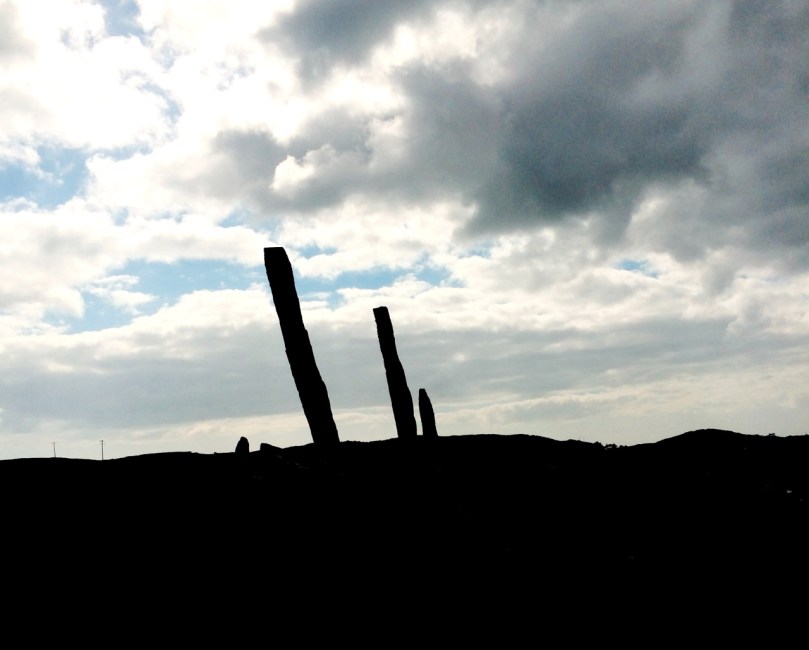
"The Fingers" on the skyline

‘The Fingers’ on the skyline

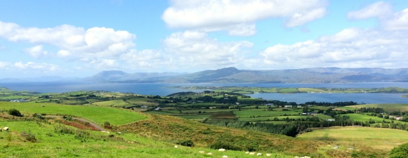
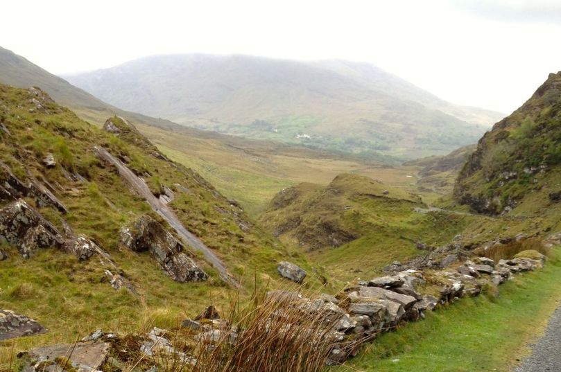
All across West Cork – in the middle of pastureland, in isolated bogs, on the tops of mountains – you see standing stones. Mostly single but also found in pairs, or rows of three or more, they are as ubiquitous as they are mysterious. A scan of the Ordnance Survey map of the valleys running eastwards from Bantry, just north of us, shows a great proliferation of standing stones, and we have been tempted into the field often to hunt for them. We usually find them, but even when we don’t the search brings us into magnificent countryside.

Standing Stone Country

Standing stone country, east of Bantry Bay

The most numerous are, of course, single standing stones. The practice of erecting monoliths dates from the Neolithic and many of the stones we see may indeed be as old as that, or Bronze Age. Some may be medieval or more recent still – local people occasionally have memories of a grandfather placing a stone to act as a cattle scratching post.

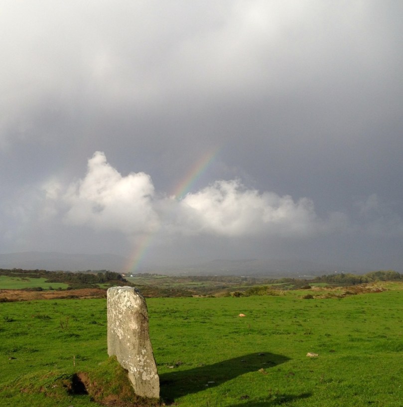
Bishop's Luck Stone - wonder what's under this one?

Bishop’s Luck Stone – wonder what’s under this one?

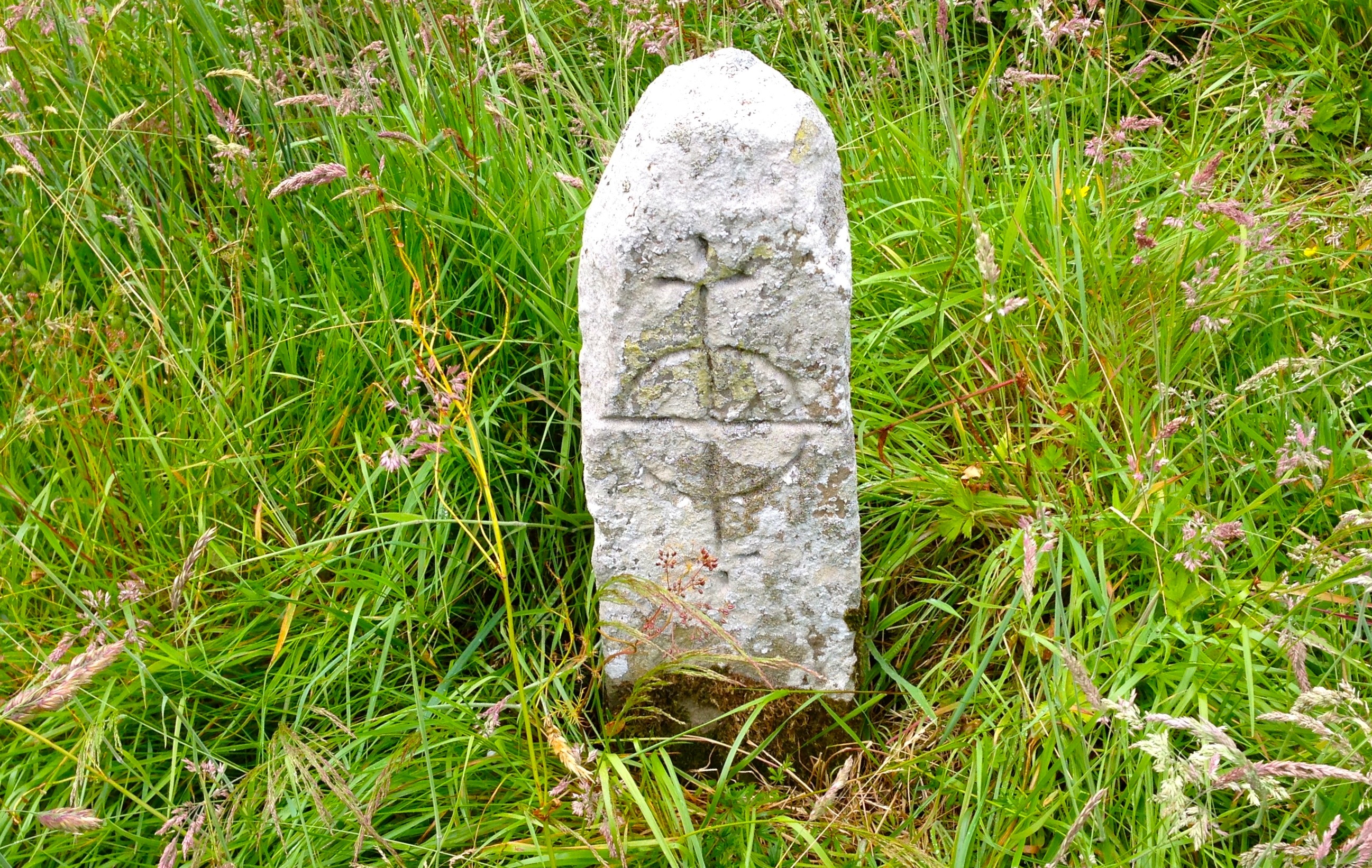
If the stone has rock art on its surface, as is the case with the Burgatia stone near Rosscarbery, for example, we can safely conclude that it’s probably Bronze Age. Ogham incisions, or an inscribed cross will assist with an Early Medieval date. But the vast majority are unmarked and their functions may have varied. Some excavated examples have yielded evidence of burials at the base, and some seem to mark boundaries or entrances to mountain routeways.

Stone pairs and stone rows often occur in close proximity to other Bronze Age monuments such as stone circles and boulder burials. Some are further away from the monument but clearly visible from it.

Like the stone circles, the pair or row has an alignment – generally northeast/southwest, and a further alignment is formed from the two to the boulder burial or stone circle.

Irish folklore is rife with stories about standing stones. Many were said to have been hurled there from a nearby mountain by Finn McCool. Kevin Dannaher in his book Irish Customs and Beliefs relates several instances of petrification. Here’s an example:

…our early saints are…credited with passing fits of choler during which several miscreants were rendered harmless…When St Fiachna discovered that a dairy woman was stealing his butter he did not hesitate to loose a mighty curse against her, which turned not only herself, but her dairy and all her utensils as well, into stone. In proof of which they are still plain to be seen close to the saint’s church at Teampal Fiachna, a few miles south east of Kenmare.

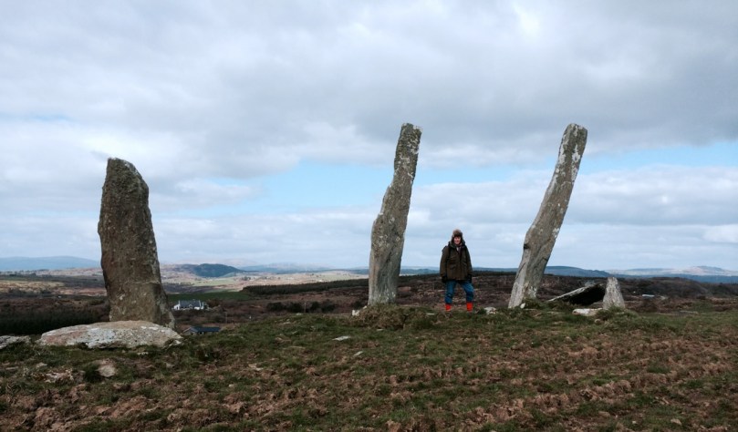
The Three Fingers at Gurranes, near Castletownshend, probably once a row of five or six stones

The Three Fingers at Gurranes, near Castletownshend, probably once a row of five or six stones

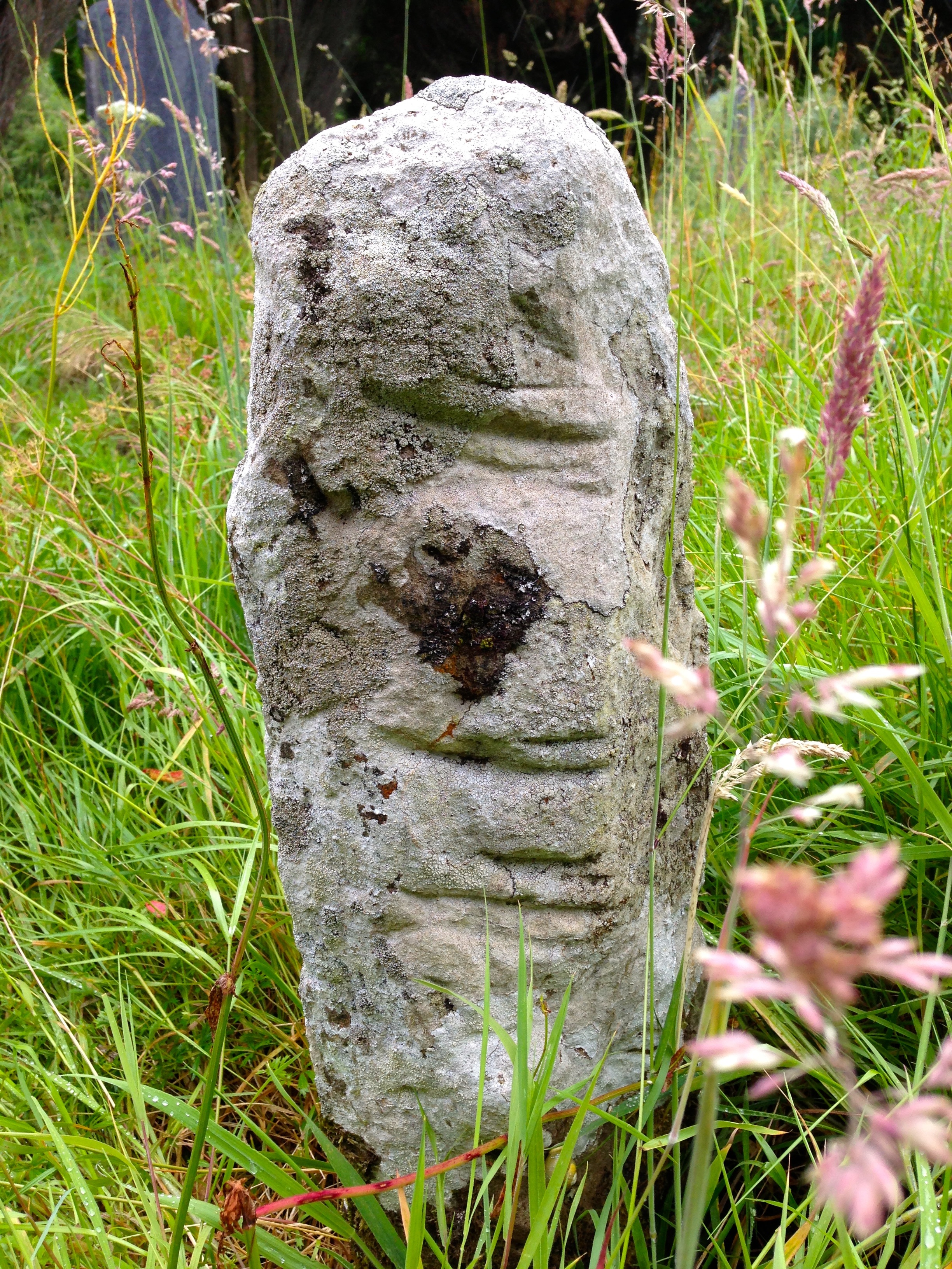
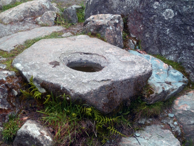
One kind of standing stone is particularly intriguing – the holed stone. Tradition has it that these are marriage stones: the couple would join hands through the hole to exchange vows. 

*Both holed stone photographs are by Amanda Clarke

Out and About with Visitors in West Cork

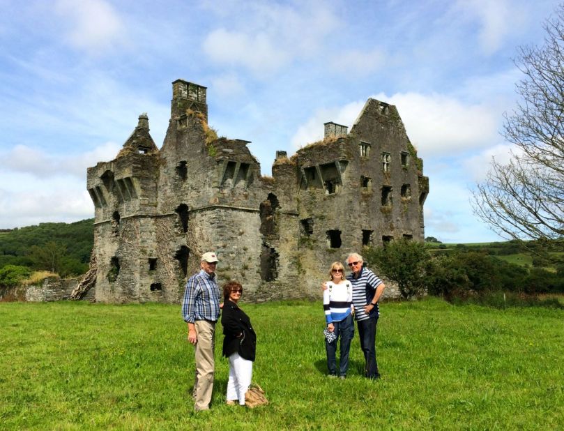
At Coppinger's Court

At Coppinger’s Court

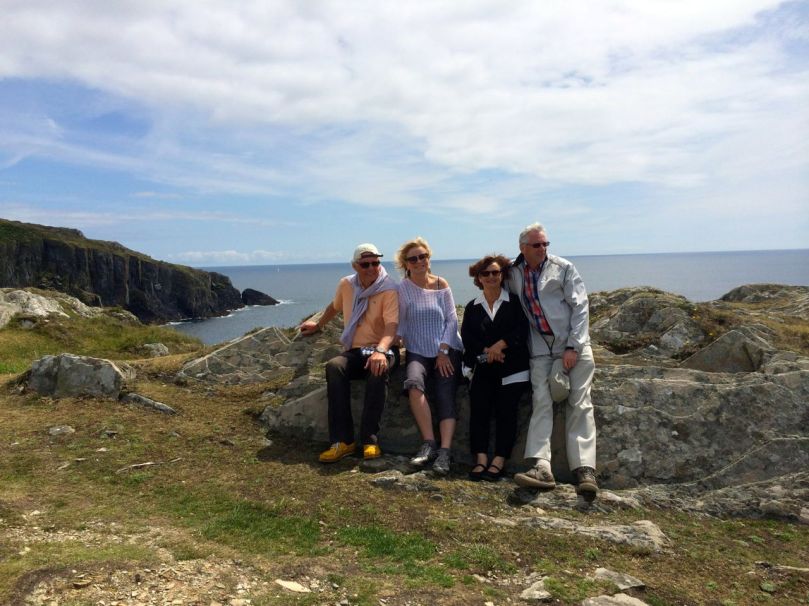
Vi and Grant and Jan and Brian came to stay last week – good friends from Canada here to see the Real Ireland. 

We had some challenges right away. First, the rental car Grant had booked was under repair and the substitute, although it nominally held all six of us, was too cramped and uncomfortable to venture too far afield. Second, muscle wear and tear issues among the group dictated that walks not be too long or arduous. 

No problem! The weather was (mostly) fine, we got in one good hike on the Sheep’s Head, and then set about discovering the delights of flatter terrain, local amenities and cultural events. Robert and I hadn’t toured Bantry House before, although we had been there for concerts. The house will be a future post in itself, but for the moment it’s worth recording that this may be the last summer to see it with its original furniture, as much of it is on the auction block later this year.
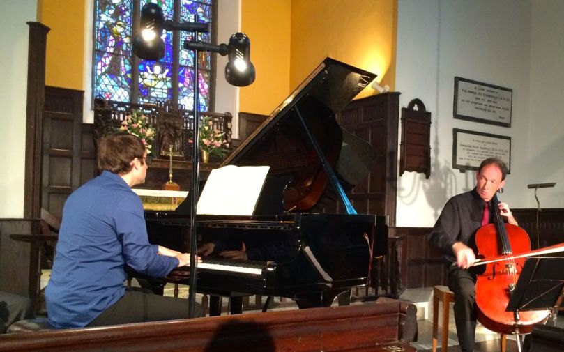
One day we spent exploring the area south east of Skibbereen. We started with lunch at Glandore overlooking the harbour, then on to the obligatory stop at the Drombeg Stone Circle, one of the better-know recumbent stone circles that dot West Cork. On to Coppinger’s Court (another subject for a full post), a 17th century fortified house and home to one of the fearsome characters in West Cork history. Back then to Castletownshend and dinner in Mary Anne’s, followed by a concert in the little church of St Barrahane’s. This was an evening of Beethoven, Debussy and Rachmaninov with Christopher Marwood of the Vanbrugh Quartet on the cello, and the brilliant young American Alexander Bernstein on the piano. It was truly a world-class performance, eliciting a standing ovation from the appreciative audience.

At Drombeg, Jan and Brian

At Drombeg, Jan and Brian

Concert In St. Barrahane's, Castletownshend

Concert In St Barrahane’s, Castletownshend

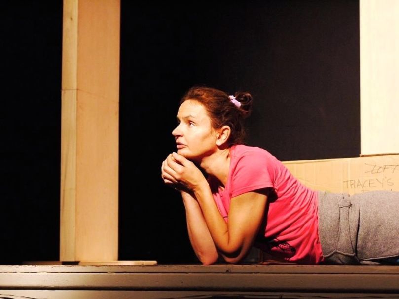
Another day, we wandered around Schull, dipping into the shops and stopping for coffee. Later that evening we attended PlayActing Theatre’s two one-woman shows in the local parish hall. Karen Minihan brought us up to date with her character, Eileen, going through a midlife crisis – it was moving, sad and funny all at once. Then Terri Leiber took us into the experience of eight-year-old Stacey negotiating the dysfunctional lives of the adults around her in 1960s Britain – a tour de force in which she played every role, with a minimalist stage set, a soundtrack from the times, and a beautiful nuanced performance.

Terri Leiber in May the Force

Terri Leiber in May the Force

Shopping at the local markets always makes food preparation easier and fresher and we all took turns. 

In Baltimore, we walked out to the Beacon, with its marvellous views of Sherkin Island and the faraway mountains of Kerry. We hope it’s a good memory to take away of this special part of Ireland. 

At the Baltimore Beacon

At the Baltimore Beacon

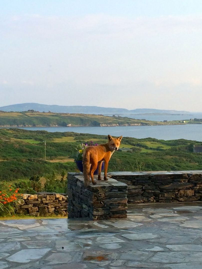
Vi and Grant, Jan and Brian – Ferdia has been missing you already!

Ferdia

Ferdia

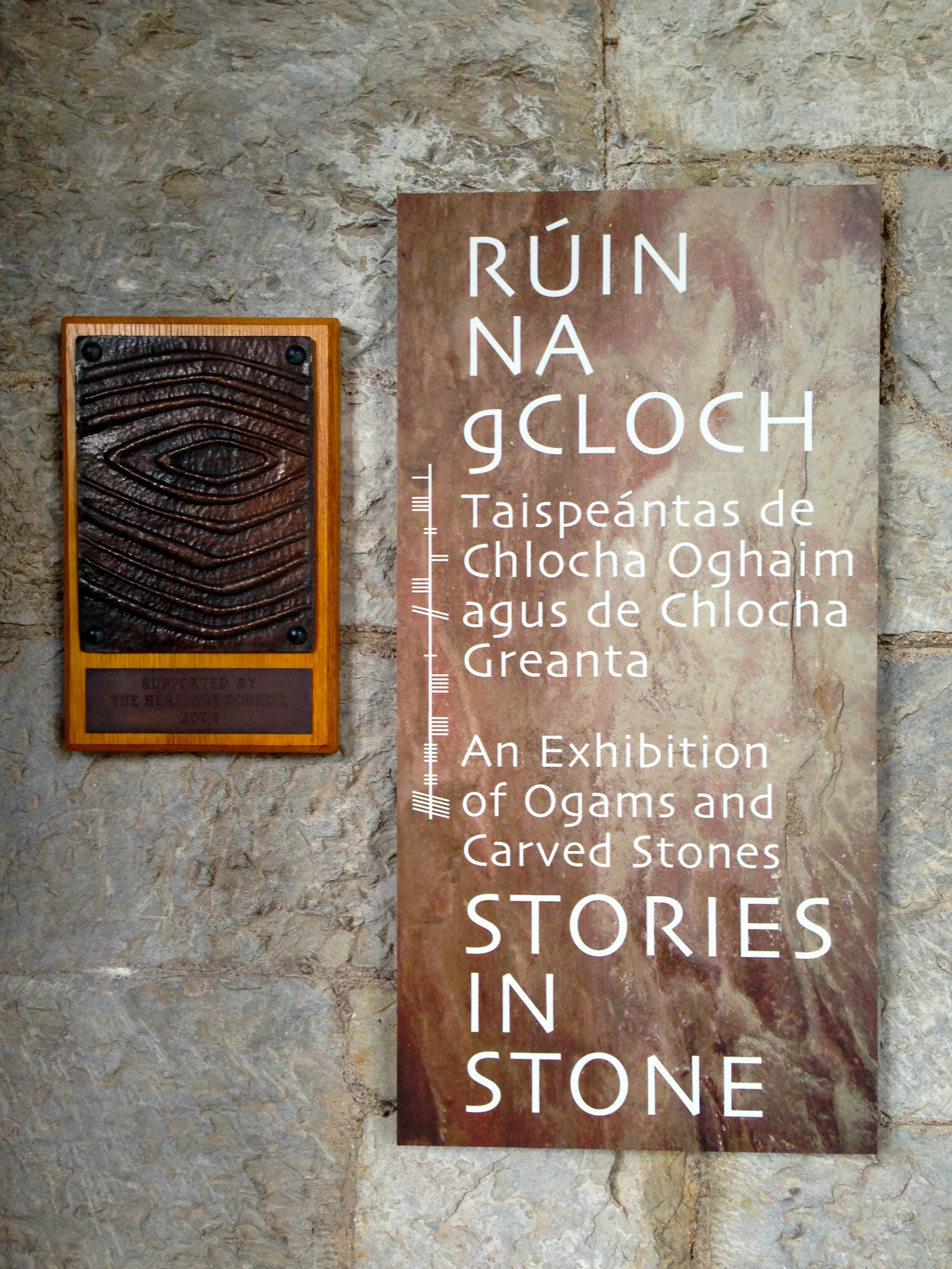
Ogham

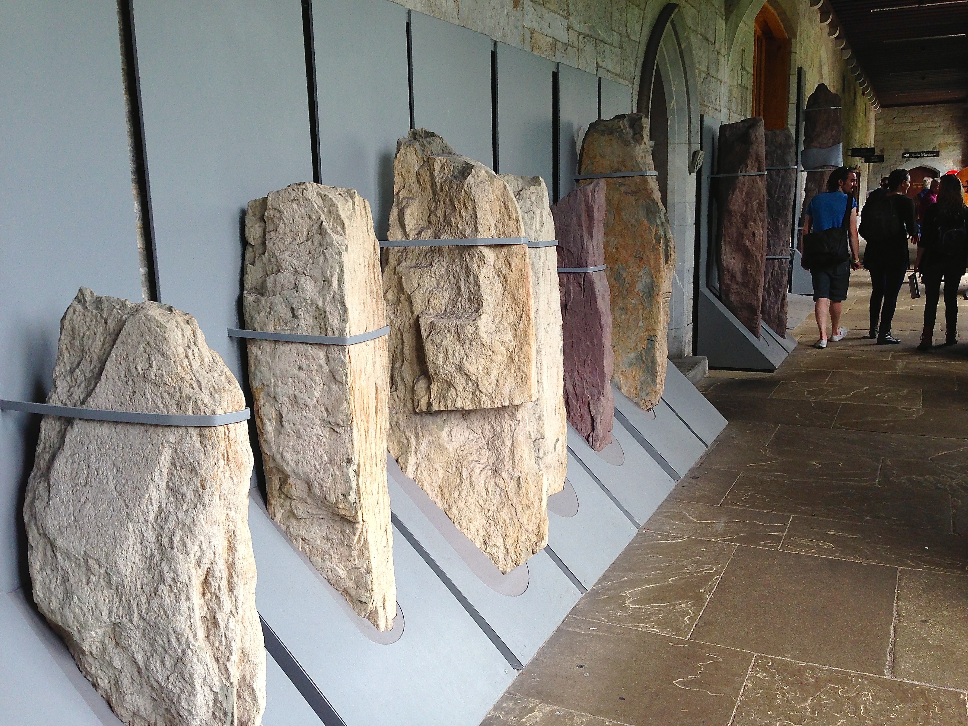
Captured! Ogham stones held in iron bands at UCC

Captured! Ogham stones held in iron bands at UCC

The Scythian King Fénius Farsaid lived at the time of the building of the Tower of Babel – some stories suggest that he had a hand in its construction. He gathered around him a group of scholars and methodically researched the new languages which were being spoken by the dispersed builders of the tower. Their work produced four languages: Hebrew, Greek, Latin and – the most sophisticated – Ogham. _ogham


Thus was the story that the bards of old related to explain the carvings on Ogham Stones (sometimes spelled Ogam but always pronounced oh-am) which are found in northern Europe, the greatest number being in the South West of Ireland.

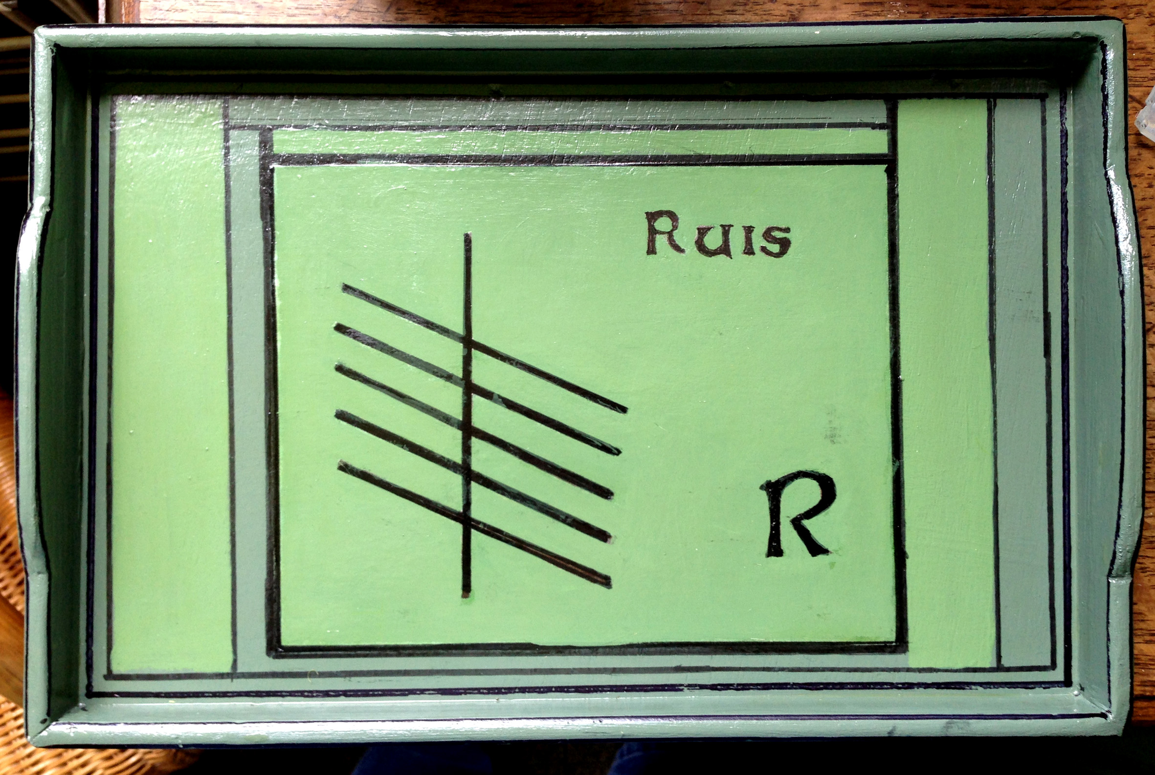
King Fénius named each of the letters of the Ogham alphabet after his best scholars – 25 in all. The ‘letters’ are in fact simple lines inscribed on stone, either on opposite sides of a vertical line or on each side of a sharp corner of stone – the position and angle of each line defining the letter. Words are read starting at the bottom, going up the left side of the line or corner and coming down on the other side, and are generally thought to represent names, suggesting that the inscribed stones are memorials.

ogham

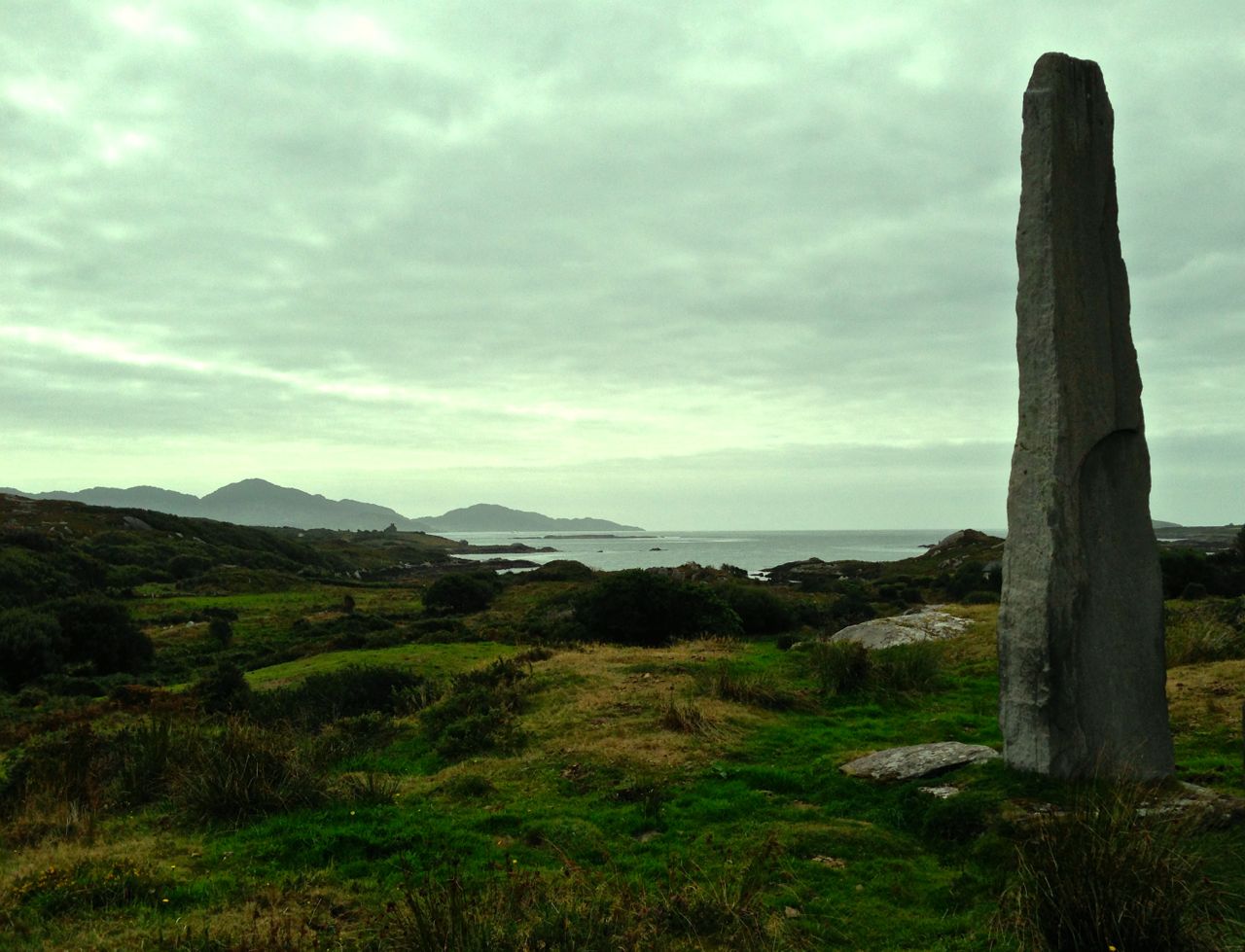
Ballycrovane – the tallest Ogham Stone in the world is in West Cork

If you subscribe to the King Fénius theory of Ogham Stones (and why wouldn’t you?) you might wonder why historians place them in the early medieval period (4th to 9th centuries) and associate them with Christianity. Many of them appear to have been inscribed on older standing stones, including the gigantic megalith at Ballycrovane, overlooking Kenmare Bay and 5.3 metres tall.

An Ogham tray by Danny

An Ogham tray by Danny

Ogham is not a forgotten language: it is a saleable item of Irishness. But, consider – quite apart from the many examples of Ogham stones which remain in the wild there are those which are kept in captivity. Take a look in the Stone Corridor at University College Cork – there is a remarkable collection there, a collection that raises questions in my mind: why have the stones been removed from their original siting? Is that an archaeologically sound thing to do – to take them from their historic context and chain them up so unnaturally in a long, dark and urban corridor? If it’s time to give the Elgin Marbles back to Athens then it’s certainly got to be appropriate to redistribute the Ogham stones (and the other inscribed stones and Rock Art that are in the Corridor) back to their natural habitats – in the wilds of West Cork… maulin

In its rightful place: Maulinward Ogham Stone near Durrus

In its rightful place: Maulinward Ogham Stone near Durrus (front and back)

corridor

Cures and Curses

Wishing Stone at Maulinward

Wishing Stone at Maulinward

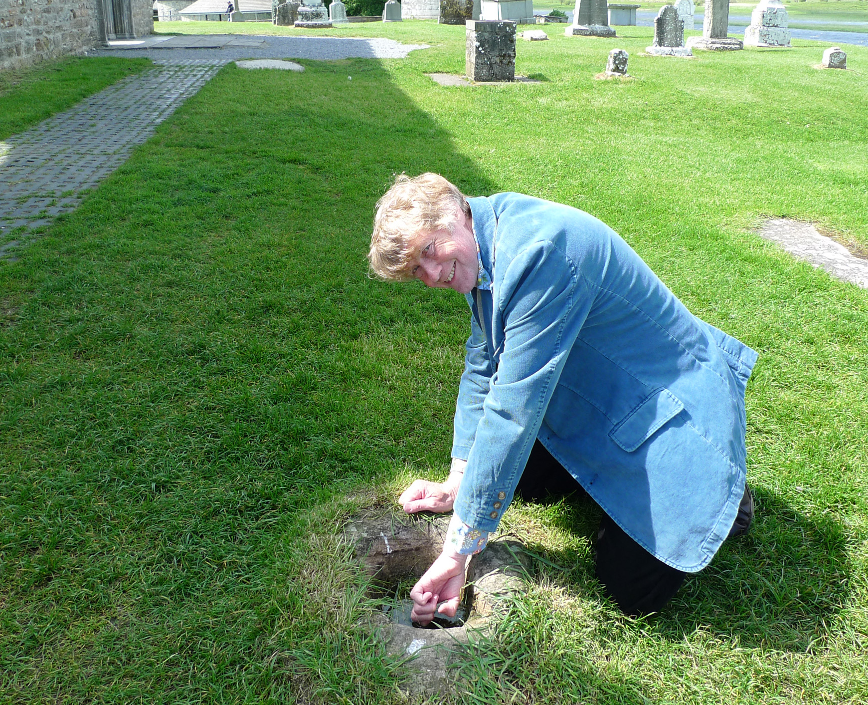
I am a firm believer in wart wells: there is one at Clonmacnoise, the holy centre of Ireland, and some years ago when I was visiting the place I dipped my finger – warts and all – in it. Within… well, perhaps it was two or three weeks… the warts had gone. The Cynics among you will be saying that they might have gone anyway, but I have had other warty experiences to reinforce my beliefs. When my daughter Phoebe was 11 years old and we were living back in Devon she had a really bad outbreak of warts on her hand. The doctor couldn’t recommend anything but our neighbour was very sure of what to do: take her to see Auntie Grace who lived up the lane. We duly knocked on Auntie Grace’s door and showed her Phoebe’s hand. “That’s alright, Dear” she said, and shut the door. That was all. But within a week (more or less) the warts had vanished completely, never to return.

Curing my warts at Clonmacnoise

Curing my warts at Clonmacnoise

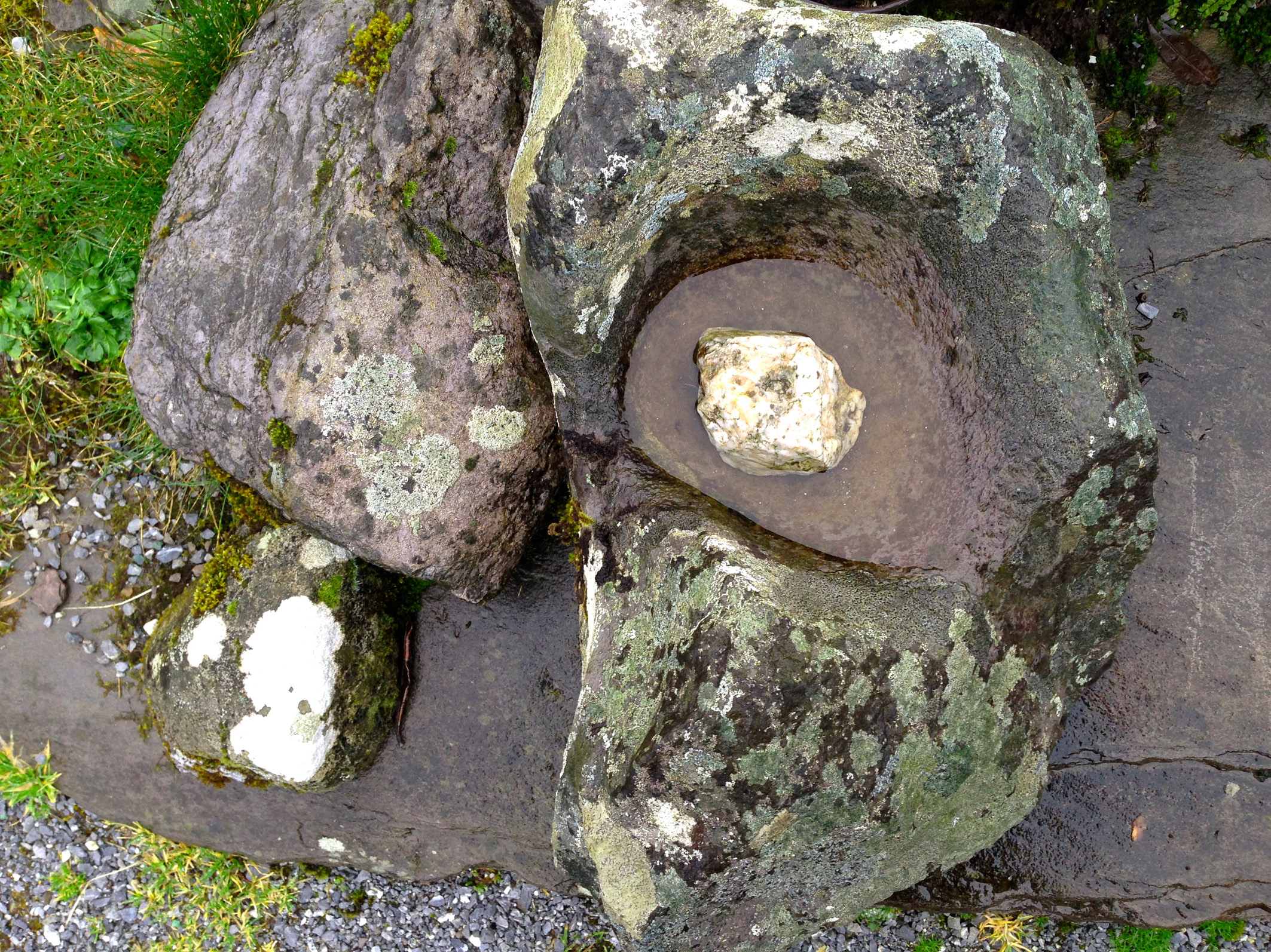
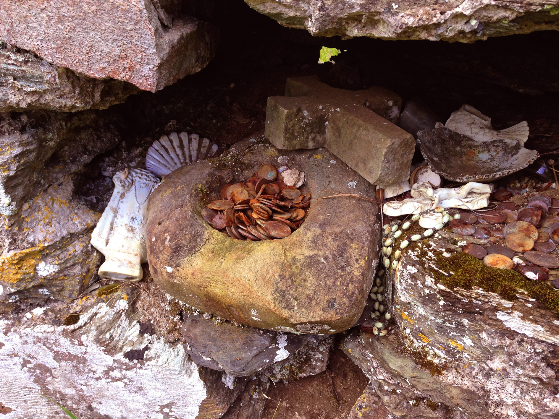
Bullaun Stones abound in Ireland. They are usually found at sites with ecclesiastical connections – as the two examples above (and this one), but this association does not reduce or affect their traditional uses: to cure or to curse. The Irish word Bullán means ‘bowl’ – a water container. At pilgrimage sites, such as St Gobnait‘s Well, Ballyvourney, the bullaun stones often hold smooth rounded pebbles – perhaps incised with a cross – which are turned around each time a pattern or procession is completed.

In the sixth century, the Council of Tours ordered its ministers “…to expel from the Church all those whom they may see performing before certain stones things which have no relation with the ceremonies of the Church…”  Such an order doesn’t seem to have prevented folk traditions of curing continuing into the twenty-first century.

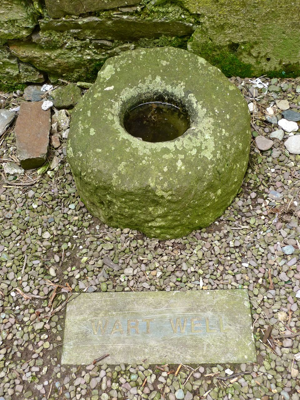
Wart Well at Timoleague Friary

Wart Well at Timoleague Friary

Traditionally, in Ireland similar stones are used for less benign purposes than curing warts or other maladies. Thankfully not in West Cork but in faraway Cavan a group of bullaun basins and stones at the ruined Killinagh Church are associated with curses, as explained here by Harold Johnston in a 1998 interview: “…if you wanted to put a curse on someone, you turned the stones anti-clockwise in the morning.” However, the curse had to be ‘just’ otherwise it came back to curse you in the evening!

An 1875 drawing of the Killinagh Cursing Stones

An 1875 drawing of the Killinagh Cursing Stones

Nearer to home, in County Cork, are the ‘cursing stones’ known locally as  the Clocha Mealachta – not in this case associated with bullaun basins but kept hidden under a slab of rock, which seems a bit sinister to me.

Hidden Cursing Stones at Labbamolaga, Co Cork

Hidden Cursing Stones at Labbamolaga, Co Cork

I prefer the legends which show bullaun stones as a force for good: in more than one location they are said to be associated with a local saint. St Kevin of Glendalough (in County Wicklow) drank every morning from the Deer Stone, a bullaun which miraculously was always filled with milk.

Deer Stone at Glendalough

St Kevin

St Kevin


Rock Art in Danger

The age-old landscape of Derrynablaha

The age-old landscape of Derrynablaha

Both Robert and I have written about prehistoric rock art several times in this Journal – here and here, here and here. Readers will know that it was the subject of my Master’s thesis in the early 70s, and that it has become a shared passion for us both as well as a retirement project. One aim of this project for me is to assess how rock art has been doing, as a category of ancient monument in Ireland, since I last studied it intensively forty years ago.

Benign neglect - rock art in a cow field

Benign neglect – rock art in a cow field

Within the archaeological community there is discussion about how best to protect rock art sites. The arguments take shape around opposing approaches: the first alternative is to promote and advertise rock art, to make it as well-known as other monuments such as megalithic tombs and medieval friaries; the second is to leave it lie in obscurity. 

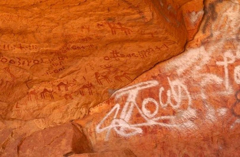
Spain has a lot of rock art, and the approach there is to encourage people to come and view it and explore it. There are visitor centres, interpretive signs, rock art trails. While the results have been positive on the whole, raising the profile of this class of site and increasing the understanding and respect of visitors, it has not been without challenges: some damage and vandalism has occurred on carved panels.

Vandalism to rock art in Libya

Vandalism to rock art in Libya

In Ireland we have taken a low profile approach when it comes to promoting rock art. Its very obscurity, the argument goes, is its protection. All known rock art sites are recorded in the database maintained by the National Monuments Service, and anyone planning on building on or developing a piece of property must check plans against this inventory. But apart from that we do not advertise the presence of rock art with signs or centres. A few are marked on the Ordnance Survey maps, but are difficult to find. The folk-beliefs of country people have helped in the past – where any prehistoric site was known it was never interfered with for fear of the bad luck that would follow. 

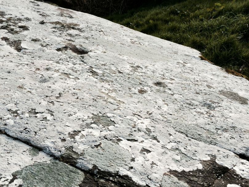
Under all that lichen lie many cupmarks

Under all that lichen lie many cupmarks

Weathering and lichen growth are not kind to carved surfaces over time and rock art in Ireland has not been protected from such natural occurences. On the  whole, however, the  fact that rock art is little known has indeed functioned to ensure that carved panels remain in place and my own sympathies would have lain therefore with the second argument.  However, times are a-changing in Ireland and I have become alarmed at the prospects for the conservation of this important prehistoric resource. I have come to believe that the more people who know about rock art, who know the locations of the rocks and can keep an eye on them, the better. 

Robert and I have spent a year now, in West Cork, visiting rock art sites and re-recording them. I have begun to understand in that time that there are two main dangers to rock art in the Irish landscape: ignorance and the economy. 

If only we'd known, we would never have built it on top of the rock art!

If only we’d known, we would never have built it on top of the rock art!

First: lack of awareness. By this I mean that in general people simply do not know that there is a class of ancient monument known as rock art. They don’t know what it looks like and don’t recognise it when they walk over it. This is not their fault – rock art can be almost impossible to see on the surface of a weathered rock on a grey day, even when you know it’s there. We have described how in one case a building was erected on top of rock art. In another case we are aware of, a piece of rock art was unrecognised and probably damaged when a homeowner erected an ornamental stone circle beside it. In both cases the homeowners would have protected the rock art had they known it was there, or understood the extent of it.

The shadows are from a newly built stone circle

The shadows are from a newly built stone circle

Second: the economy. Here, two huge threats to rock art exist. The first is in the rapid growth of forestry plantations in Ireland – a practice that is altering the landscape and obscuring what lies underneath in many areas of the country. We have experienced this first hand: rock art in a nearby townland can no longer be located in a young forestry plantation. 

The second is even more serious – the threat lies in the encouragement to farmers to improve and bring into production previously marginal land. All around us in West Cork the sound of the rock breaker is as common as the lowing of cattle. Vast stretches of rocky land, suitable only for a few sheep, are being levelled, drained and seeded. Green fields are appearing where once only scrubby grass and bog could grow.

The excavator is at the top left of the photograph

The excavator is at the top left of the photograph

We saw first hand what this could mean on a recent trip to Kerry. In the mountains above Sneem, on the Iveragh Peninsula, lies the lonely valley of Derrynablaha. It is spectacularly beautiful, but wild and remote. Forty years ago the one house in the valley was occupied by the farmer who ran his sheep on the mountain slope. That house is now in ruins: a new owner until recently simply carried on the use of the land for sheep. Imagine our surprise and concern, therefore, when, on a recent trip to Derrynablaha, we observed an enormous excavator working in the fields above the house. It had been there for some time. The ground had been levelled, all rocks and old field boundaries had been cleared away, and the land is now ready to be seeded and made into an enormous and pristine green field.

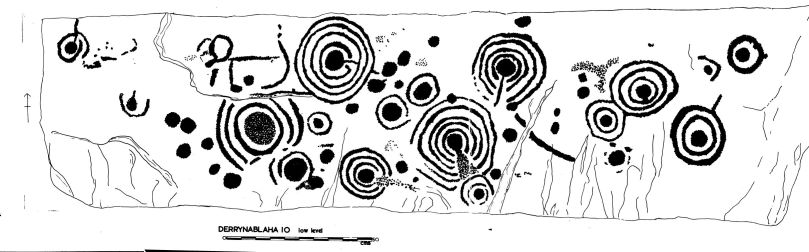
So what’s the problem with this? It’s alarming because Derrynablaha, and the neighbouring townland of Derreeny, contain the largest and most significant concentration of rock art in Ireland. Forty examples have been found and recorded so far. Some of them lie right beside the new field. An assessment by the National Monuments Service took place immediately and they will monitor closely now that they know this is happening. However, damage has already been done. Rock art does not exist in a vacuum – it is part of a prehistoric landscape and nowhere is this more so than in Derrynablaha, where the land has been lightly lived on over the centuries and where prehistoric and historic features lie just beneath the boggy turf. 

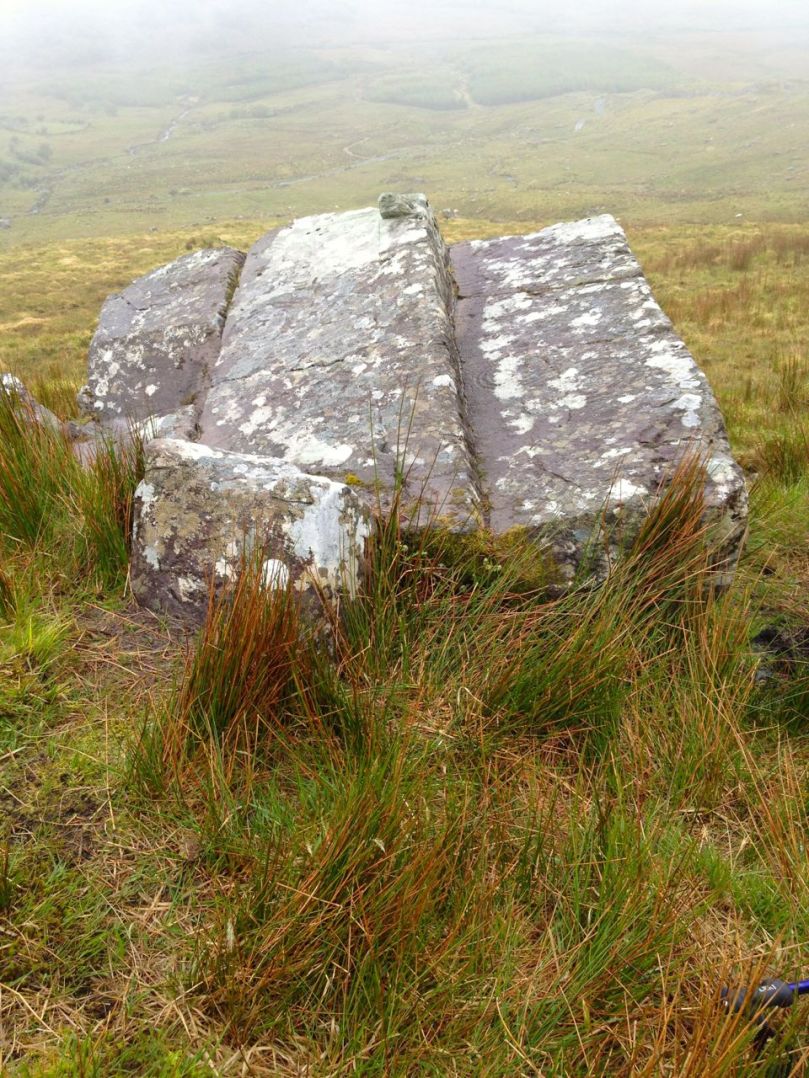
It's hard to see, isn't it? But tjis is one of the most iconic pieces of Irish rock art

It’s hard to see, isn’t it? But this boulder at Derrynablaha is one of the most iconic pieces of Irish rock art

The farmer, of course, is just doing his job. With the encouragement of the grants system he is improving his land, trying to be more competitive and hoping to pass on a viable farm to his son, so the young man won’t have to emigrate like many of his contemporaries. He is aware of the rock art and is avoiding direct contact with any pieces he knows. He needs no planning permission (a process that would have involved and alerted the County Archaeologist) to do what he’s doing.

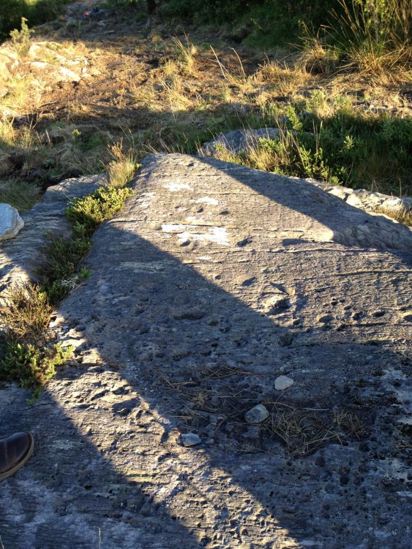
Just part of the surface of the Derrynablaha rock above

Just part of the surface of the Derrynablaha rock above

In both these scenarios – lack of awareness and the economy – the intentions of everyone concerned were honourable. But honourable intentions won’t save rock art from damage and destruction. Our only hope lies in a Save the Whales approach: the more people who know about and appreciate rock art and who are committed to helping to preserve this precious resource, the better its chances of survival will be. 

Derrynablaha - current landscape at that rock

Derrynablaha – current landscape at that rock

Mount Gabriel

Trails over Mount Gabriel

Trails over Mount Gabriel

Only a few kilometres from Nead an Iolair – as the Crow flies – sits Mount Gabriel: at 407m elevation it’s the highest piece of land in West Cork. Cork mountains are dwarfed by those from Kerry: McGillycuddy’s Reeks has the highest peaks in Ireland, at over 1,000 metres. However, our own local mountain is nevertheless impressive and on a good, clear day provides a view not to be missed – to all points of the compass.

Looking west to the Mizen

Looking west to the Mizen

I spent a while researching why a mountain in the west of Ireland should be called Gabriel. There is no received opinion about this. I suppose there’s no reason why it shouldn’t be named after the Archangel himself: after all, we have Croagh Patrick (after St P) and Mount Brandon (after St Brendan) and many others: Ireland’s landscape is alive with place-names having religious connections, although such associations are likely to be fairly young. In Irish the mountain is Cnoc Osta – possibly ‘hill of the encampment’ – so there’s no clue there.

Roaringwater Bay

Roaringwater Bay

I did find this fascinating piece from the Church of Ireland Magazine, dated 1826 – written by John Abraham Jagoe, Vicar of Cape Clear …where I have no protestant parishioners… and Curate of Schull …where interspersed amongst moor and mountain, I have fifteen hundred Protestants, to visit and oversee… It’s well worth a verbatim extract:

‘…amidst these everlasting hills arose, in peculiar prominence, Mount Gabriel. Why, my lads, said I, is yonder mountain called such an outlandish name; one would think it was brought here by Oliver Cromwell, it has such an un-Irish – such a saxon name. O! says Pat, it is a pity that the blockhead is not here to tell the gentleman the story about this, for sure and certain such poor garcoons as the likes of us know little, and care not the tail of a herring for such old stories. And who, said I, is the blockhead? O, says my friend, the blockhead is an old man living up on the mountain, who, from his great memory, his knowledge of cures for cattle, charms against fairy-struck people, experience in bleeding, acquaintance with legends about the good people, the Milesians, and Fin McCoul, is called far and near, the blockhead.

My dear fellow, will you tomorrow bring me to that man; I would pilgrimage over all the hills in Cork and Kerry to get into chat with him: says I to myself, this is just the man that I want. Ah my good friend, do bring me to the blockhead to-morrow. Why yes to be sure, – but stay, can you speak Irish? Not a word, to my sorrow be it spoken. Well then go home first and learn Irish, for Thady Mahony can speak no other language. – Well boys, can none of you (as I cannot get it out of the blockhead) tell me about Mount Gabriel; O! yes, Sir, says Pat Hayes, my Godmother used to tell me it was called after the Angel Gabriel, who came, you know, from Heaven to deliver the happy message of mercy to the Virgin – ever blessed be her name. And so on his return, as he was flying back, he looked down upon Ireland, and as he knew that in time to come, this honest island would never part with the worship and duty it owes to the Mother of God, he resolved to take a peep at the happy land, that St Patrick was to bestow for ever on the Virgin. So down he came, and perched on the western peak of that mountain; the mark, they say, of his standing is there to this day, and his five toes are branded on the rock, as plain as if I clasped my four fingers and thumb upon a sod of drying turf; and just under the blessed mark, is a jewel of a lake, round as a turner’s bowl, alive with trout; and there are islands on it that float about up and down, east and north and south; but every Lady-day they come floating to the western point, and there they lie fixed under the crag that holds the track of the Angel’s foot…’

Hidden Glen Fuschia

Hidden Glen Fuschia

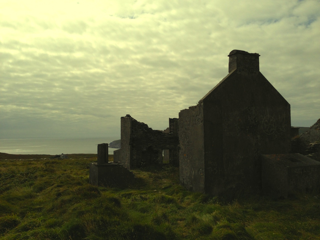
Well, there’s enough in those few lines to keep us going on field trips for some time to come! We did find, on the western slopes, a beautiful hidden valley holding the ruins of a one roomed cottage. I have convinced myself that this must have been the dwelling place of the blockhead Thady Mahony, who may once have been the keeper of all the secrets of the mountain. But we have yet to find the jewel of the lake with its trout and its miraculous floating islands, notwithstanding the Archangel’s footprint…

View from the summit

View from the summit

One other possibility for the name is a corruption of the Old Irish Gobhann – which means smith, as in a metal smith. Remember Saint Gobnaitt? She was the patron saint of ironworkers (blacksmiths) and her name is supposed to be rooted in Gobhann. There is also a Goibhniu in Irish mythology: he was the smith of the Tuatha De Danaan and forged their weapons for battle with the Formorians. So – Gobhann, Goibhniu, Gabriel…? Too much of a leap of faith? But it is known that Mount Gabriel was the site of extensive copper mining a few thousand years ago – remains of pits, shafts and spoil heaps can be seen:  so perhaps there just could be something more ancient inherent in the name.

golf ball

There is mythology attached to the Mountain: the Fastnet Rock was torn from the slopes and thrown into the sea by a giant; once we were searching for a piece of Rock Art within sight of the mountain and the landowner assured us that the carved stone had been thrown there by Finn MacCool (we didn’t find it).

giant stamp

The story about Mount Gabriel that most captures my imagination is the suggestion that the last Wolves in Ireland inhabited the rocky landscape there back in the eighteenth century (although it’s true that several other places make the same claim). Until that time Wolves were commonly seen in the wilder parts of the land and feature in local stories and folklore. Interestingly they were often portrayed in a positive way and were sometimes companions of the saints. There are very few records of Wolves having maimed or killed humans, yet in 1653 the Cromwellian government placed a bounty on them – 5 pounds for a male Wolf, and 6 pounds for a female: worthwhile prize money in those days. This encouraged professional hunters and, coupled with the dwindling forest habitats, the fate of the animal was sealed.

grey wolf

Mount Gabriel today is relatively benign, although it still has its remoter parts. The Irish Aviation Authority has kindly provided a road up to the summit, where sit the distinctive ‘golf ball’ radar domes and aerials of an Air Traffic Control installation. From these heights we can see Rossbrin Cove, Ballydehob, Schull and all the islands of Roaringwater Bay set out in a magnificent panorama – on a clear day.

iaa

Aerials and view to the north

Aerials and view to the north

Modern events have affected the mountain: a German plane crashed here in 1942, and in 1982 the Irish National Liberation Army bombed the radar station, believing that it was providing assistance to the North Atlantic Treaty Organisation, allegedly in violation of Irish neutrality.

IMG_3573

For us the mountain is a landmark and, like most of our view, its profile changes with the weather on a daily – perhaps hourly basis. As a repository of archaeology, human history, lore and nature Gabriel provides a rich resource.

Gabriel

Gabriel