Our Rock Art Exhibition!

A joint post by Robert and Finola…

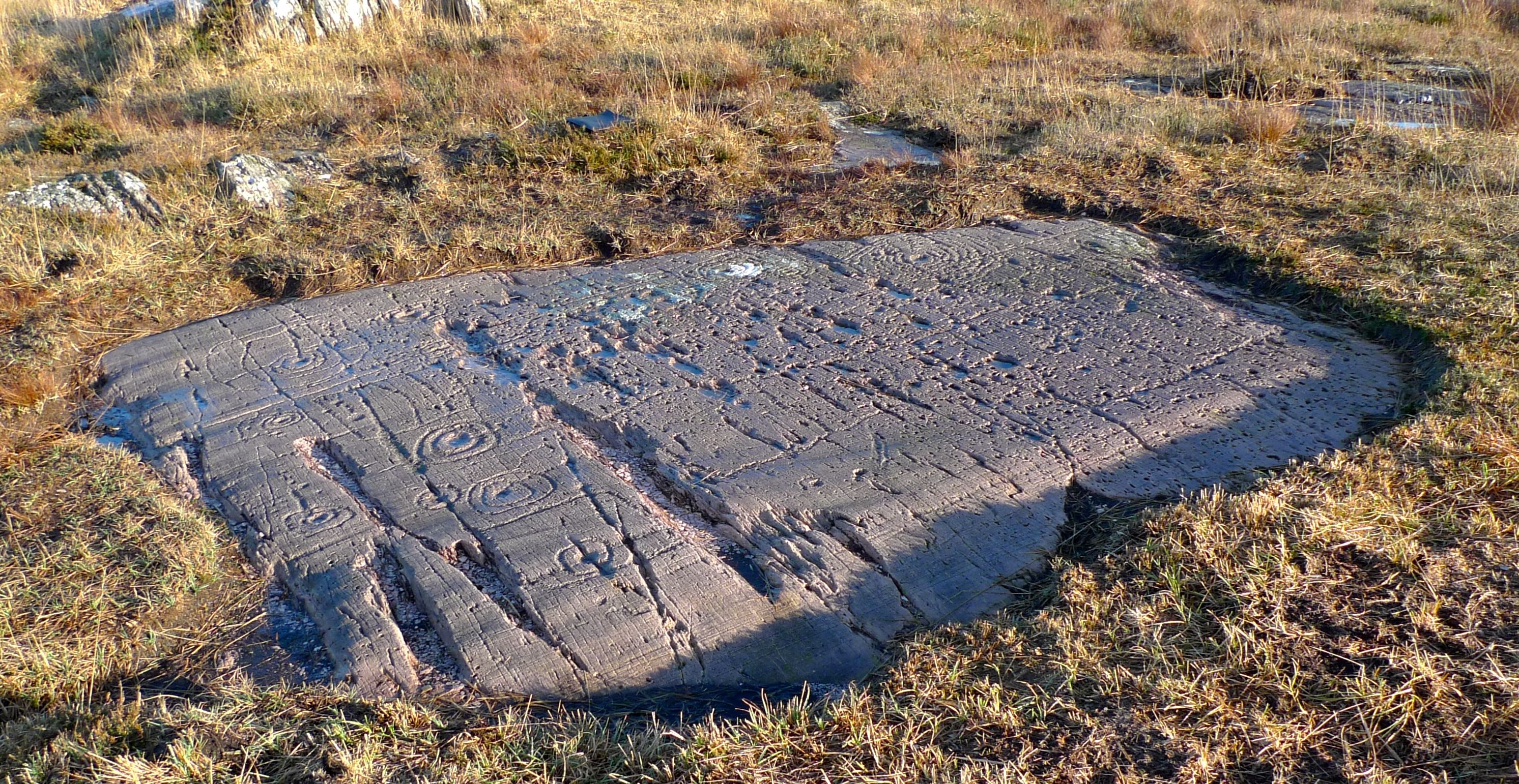
Derrynablaha A2.PC9

For all of you who are fortunate enough to live within reach of our beautiful part of West Cork we are pleased to invite you to our exhibition, which is being shown as part of the Ballydehob Art and Culture Weekend, running from 17th to 19th October. The exhibition is being held in the West Cork Gourmet Store (go left at the statue of Danno and it’s just up on the right, behind the Post Office), and it will continue to run there during opening hours for the two weeks after the Art and Culture event.

Finola studied for her Archaeology degree at the University of Cork, and her thesis was written on the Rock Art of Cork and Kerry. For her research – in the early 1970s – she travelled across the two counties on a borrowed Honda 50, visiting every piece of Rock Art known at the time, and recording each piece using a tracing technique which would not be allowed today. The thesis is a unique and valuable archive of the rock carvings, which date back anything from three to five thousand years. We believe that this is the first time a comprehensive exhibition of Irish Rock Art has been shown.

knockdrum detail.PC9

Regular readers of Roaringwater Journal know that we are still working on Rock Art: Robert has recorded some more recently found examples using a ‘non-invasive’ technique, and we are involved with CRAG – the Cork Rock Art Group – under the aegis of the University, where our aim is to produce a website which lists and illustrates all known examples of Rock Art in the west of Ireland. Eventually the work may extend further afield: there are Rock Art sites elsewhere in the Republic. Similar carvings are found on the Atlantic coast, from Scandinavia down to Iberia.

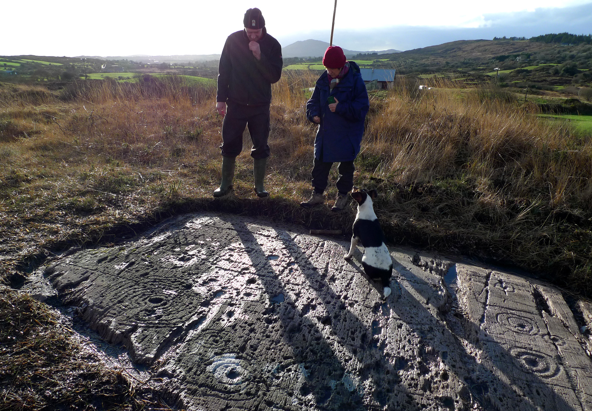
Finola, Gary and companion study the Art

Finola, Gary and companion study the Art

On Saturday 18th October the exhibition will be formally opened at 4pm, and we will be giving a talk on the subject and on our adventures studying it. Some refreshments will be on hand: please come if you can!

Title poster.PC9

Were You at the Rock?

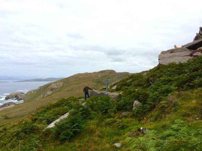
Mass rock along the Beara Way (see the look out above)

Mass rock along the Beara Way (see the lookout above)

An raibh tú ag an gCarraig? / Were You at the Rock?

nó a’ bhfaca tú féin mó grá / Or did you yourself see my love,

nó a’ bhfaca tú gile, / Or did you see a brightness,

finne agus scéimh na mná? / The fairness and the beauty of the woman?

This beautiful song speaks to a revered tradition in Irish history and folk custom – the mass rock. During the period of the Penal Laws (late 17th and first half of 18th Century) when the practice of Catholicism was outlawed, parishioners would gather at a secret location to attend mass. The priest travelled from community to community in disguise, a lookout was posted, and mass was celebrated on a lonely rock far from the reach of the law. The song encodes the message that the people still find ways to attend mass, despite the harsh prohibition against it.

Mass rocks are often in remote locations

Mass rocks are often in remote locations

Dr. Hilary Bishop, in her excellent website Find a Mass Rock says, “As locations of a distinctively Catholic faith, Mass Rocks are important religious and historical monuments that provide a tangible and experiential link to Irish heritage and tradition.” She also points out that, because of the imperative for secrecy, mass rocks are difficult to find. We certainly experienced this when we set out for a day of mass rock hunting recently. Working from a list generated from the National Monuments Service database we spent a day on the Sheep’s Head and the Mizen and had trouble finding all the rocks on the list. One, if it was still there, had disappeared under impenetrable layers of gorse. A second rock was last recorded in the 1980s: residents were no longer familiar with it.

Beach Holy Well and mass rock

Beach holy well and mass rock

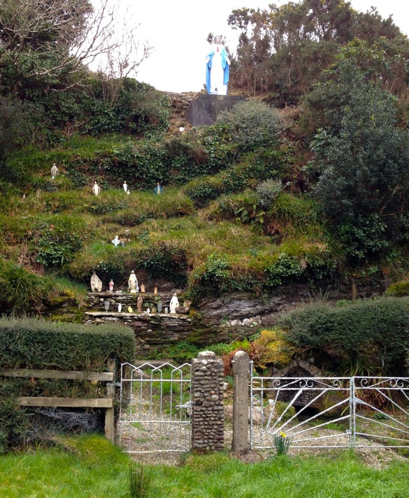
Knowledge of mass rocks has passed down from generation to generation. In the deep countryside, the sites maintain a mystique and a sense of the sacred. Last year we wrote about the mass rock and holy well at Beach, where Mary conjured up a blanket of fog to confuse the English soldiers and allow the priest to escape. At Beach and at our first stop, the mass rock at Glanalin on the Sheep’s Head Way, mass is still celebrated occasionally.

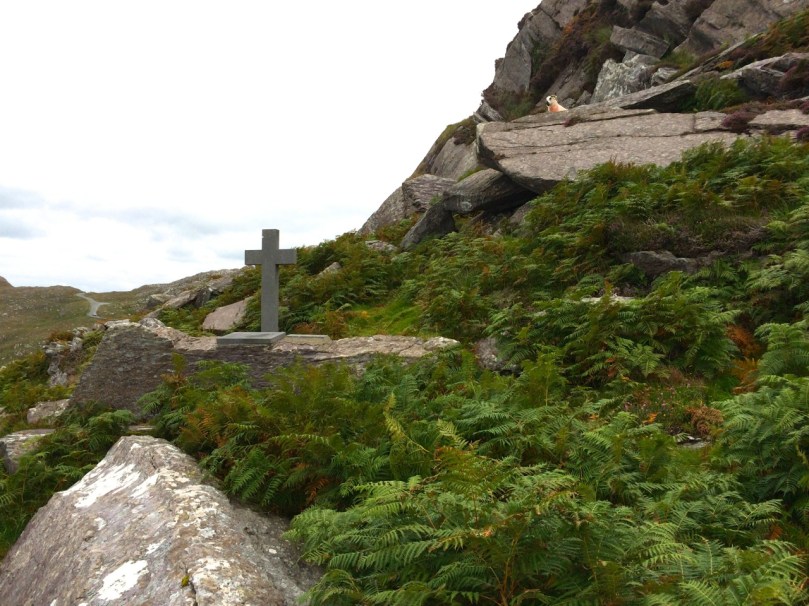
The Glanalin rock, and the one we visited on the Beara Peninsula, are good examples of the remote locations typical of many mass rocks, high on a hillside or hidden in an isolated valley. You can picture the procession of worshippers, in ones and twos, slipping silently through the bracken, pausing to make sure they are not being watched, climbing higher, following an overgrown trail, arriving at the meeting place where the hushed crowd awaits the arrival of the priest.

Beara mass rock

Beara mass rock

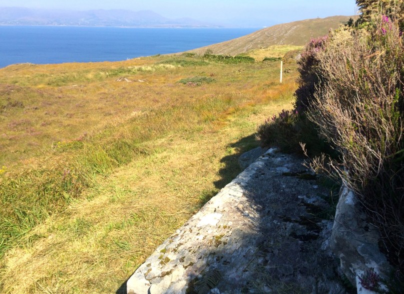
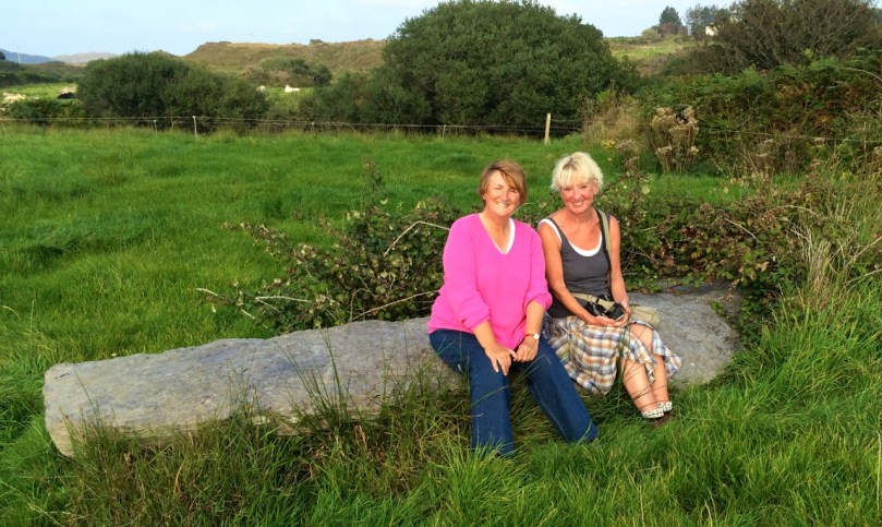
One of the rocks we found looked for all the world like a fallen standing stone – and that’s probably what it was. (I wonder if I should go to confession, though – I’m sure that sitting on a mass rock would qualify as at least a venial sin.)

Fallen standing stone?  Mass rock? Both?

Fallen standing stone? Mass rock? Both?

A mass rock that is easily visited is the one at Cononagh Village, right at the side of the main road into West Cork, the N71. This site is beautifully maintained – Cononagh is obviously proud of its heritage: signage and flowers invite the passerby to take a closer look.

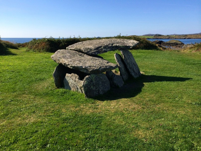
Another easily accessible site is Altar, at Toormore. This is a wedge tomb, probably over 4,000 years old and excavated in 1989. It remained in use through the Bronze Age and into the Iron Age. Dr. William O’Brien, in his book on the archaeology of County Cork, Iverni, says of this site: “…over time this tomb came to be regarded as a sacred place, housing important ancestral remains in what was a type of community shrine.” How fitting, then, that the flat capstone of the Altar wedge tomb became, in the Penal Days, a mass rock. And how intriguing to think of the continuation of this sacred space over the course of thousands of years.

Altar Wedge Tomb, later used as a mass rock

Altar Wedge Tomb, later used as a mass rock

Holy Relics + Masons’ Marks

tabern

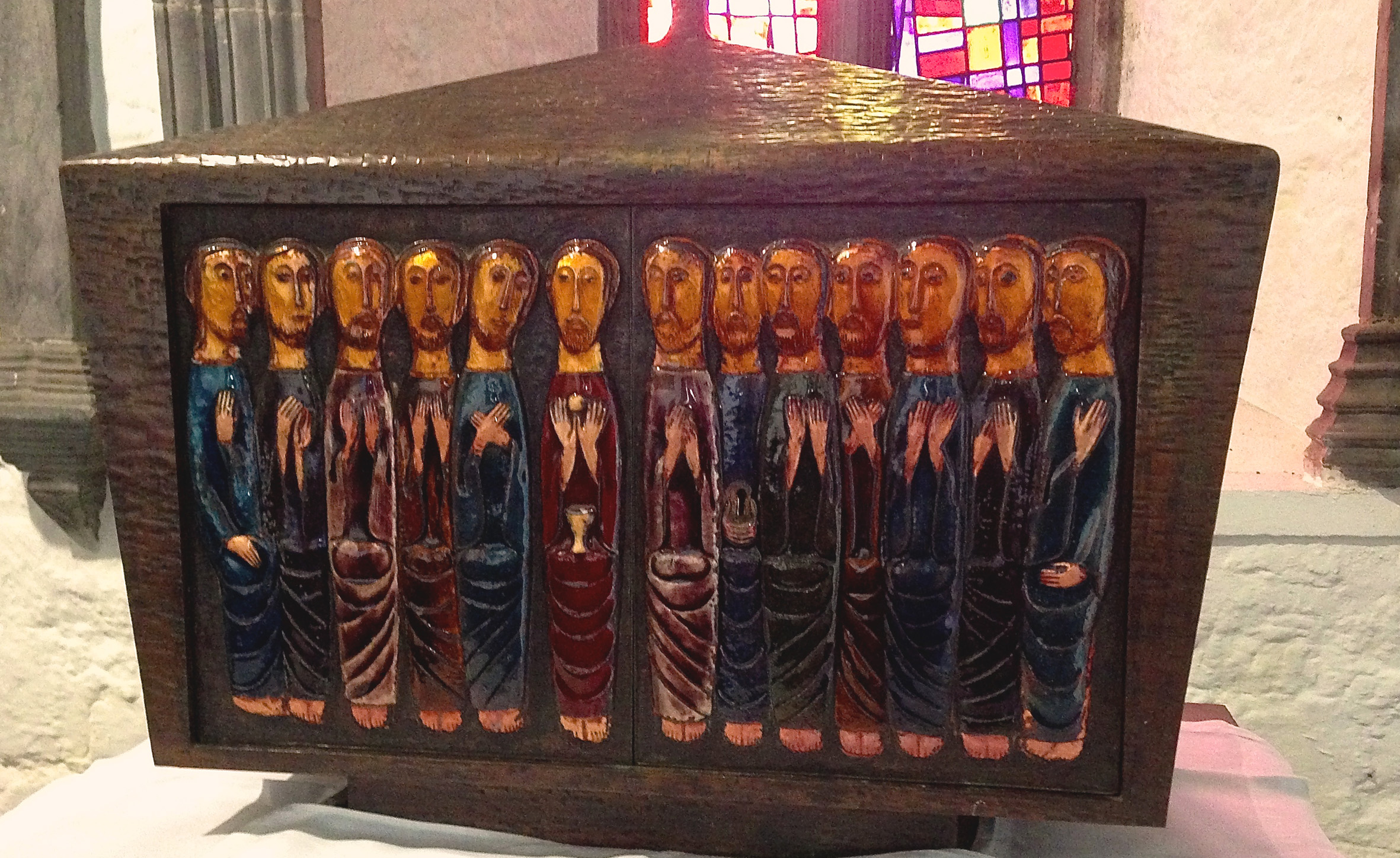
Modern Tabernacle at Holy Cross

Ireland is full of surprises. We are always coming across unexpected feasts for the eyes and the senses: often this arises from simply looking at the map for names that might hold a promise of history – or just ‘story’ – and head that way. Returning home from Dublin recently we diverted into Tipperary, for an investigation of the name Holy Cross.

the Abbey 2

The medieval abbey occupied an extensive site beside the River Suir

What we found was a thousand years of turbulent Irish history: a ‘Celtic’ hermitage dating from the first millennium became a Benedictine Abbey in the second, was refounded as a Cistercian Monastery in the twelfth century by a King of Limerick, Domhnall Ó’Briain, went through Henry VIII’s decimation of the Irish religious houses in the 1530s but survived as a pilgrimage centre until the Williamite wars of 1690. (Incidentally, in my anxiety to try to understand the fine detail of Irish history around this time, I discovered that the Protestant King William’s campaigns in Ireland were funded by Pope Innocent XI to the tune of 150,000 Scudi, which in today’s money is around four and a half million Euros! Can someone explain, please?) By the beginning of the 18th century Holy Cross was in ruins and, like so many other destroyed sites, the remains of the Abbey became a local burial ground.

Following the Reformation the Anglican Church of Ireland became the established church and the entire population – overwhelmingly Catholic – had to pay tithes to the Church of the Ascendancy. English Prime Minister William Gladstone declared “My mission is to pacify Ireland” on being elected in 1868, and his Irish Church Act became law in 1871. This disestablished the Church of Ireland: no-one paid tithes thereafter, and Catholics were free to worship wherever they wanted. At the same time ruins such as Holy Cross became scheduled National Monuments ‘…to be preserved and not used as a place of worship…’

The ruins of the abbey became a burial ground

The ruins of the abbey became a burial ground (Bartlett)

http---www.tara.tcd.ie-jspui-bitstream-2262-40632-1-ertk2528

A rare fresco - depicting a hunting scene - was found in the church

A rare fresco – depicting a hunting scene – was found in the church

On the 50th anniversary of the Dáil, on 21 January 1969, special legislation was enacted to enable Holy Cross Abbey to be restored as a place of Catholic worship: the only exception to the 1871 Act ever granted.

Now, in the third Millennium, Holy Cross is fully restored as a functioning Catholic Church and a pilgrimage centre which, every September, hosts around 65,000 pilgrims.

Why do so many people come to Holy Cross? Possibly because it was important enough, originally, to house a relic of the True Cross. In 1586 the English antiquarian William Camden wrote of the ‘…famous abbey to which the people still come to do reverence to the relic of the Holy Cross…’ He went on to say ‘…It is incredible what a concourse of  people still throng hither out of devotion. For this nation obstinately adheres to the religion of superstition of their forefathers…’  This relic disappeared in the 1630s.

After the restoration of the church in the twentieth century an authenticated relic of the True Cross was provided by the Vatican, and placed on display there. Unhappily, in 2011 masked raiders descended on Holy Cross and, using angle grinders, hammers and screwdrivers, stole the relic. The story has a happy ending however, as it was duly recovered the following year and was safely back in place when we visited.

Reliquary containing a fragment of the True Cross displayed in the North transept

Reliquary containing a fragment of the True Cross displayed in the North transept

There is an intriguing piece of folklore surrounding this building. An English prince of royal blood – the Good Woman’s Son – came to Ireland to collect Peter’s Pence (a tithe) but was murdered and buried in a wood near the Abbey. Following a vision, a blind monk discovered the boy’s body and carried his ring to his mother, the Queen. In gratitude she presented to the Abbey a large piece of the True Cross which had recently come to England.

pictures

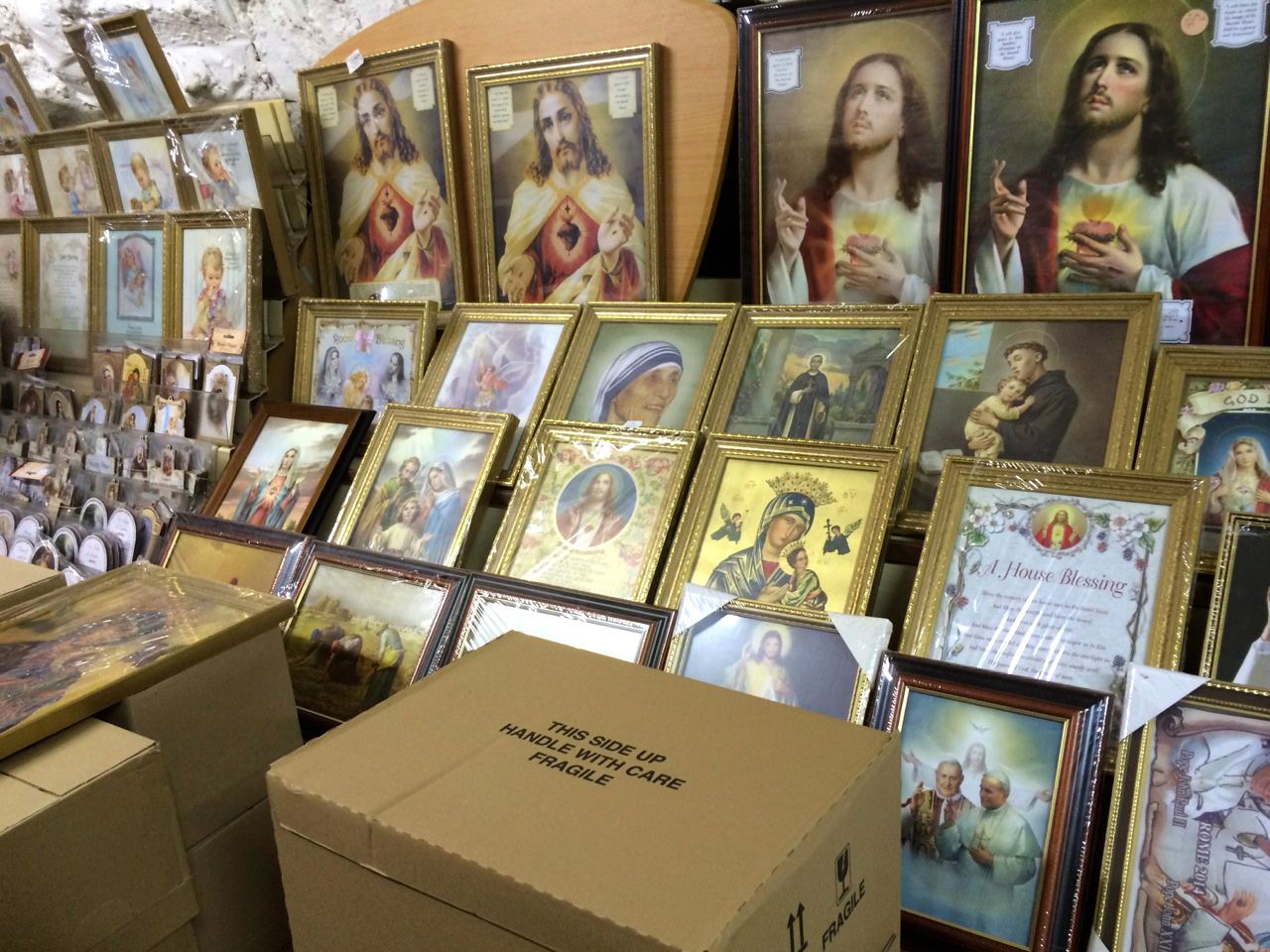
The Abbey Shop


Equinox Adventure

equinox

September 21st – the Autumn Equinox. Day and night are exactly the same length. This event must have some significance for any society which watches the sky. We can never know for sure, but it does seem possible that the enigmatic stone structures we find out in the remote landscapes of Ireland: megaliths, circles, stone rows and – dear to us – Rock Art, could have been inspired by celestial observations.

the rock

Bronze Age carvings at Derreenaclogh

Finola put up a post on the Spring Equinox at Bohonagh, and we have written about the Spring Cross Quarter (Imbolc). We are fortunate that today’s weather has been idyllic – cloudless and with a clarity of light – so we headed out to Derreenaclogh to watch the sun setting. We have studied this rock in depth, throughout the year and in all conditions. Our work has produced a detailed measured drawing of the intricate markings on the surface, carved by our ancestors perhaps three or four thousand years ago.

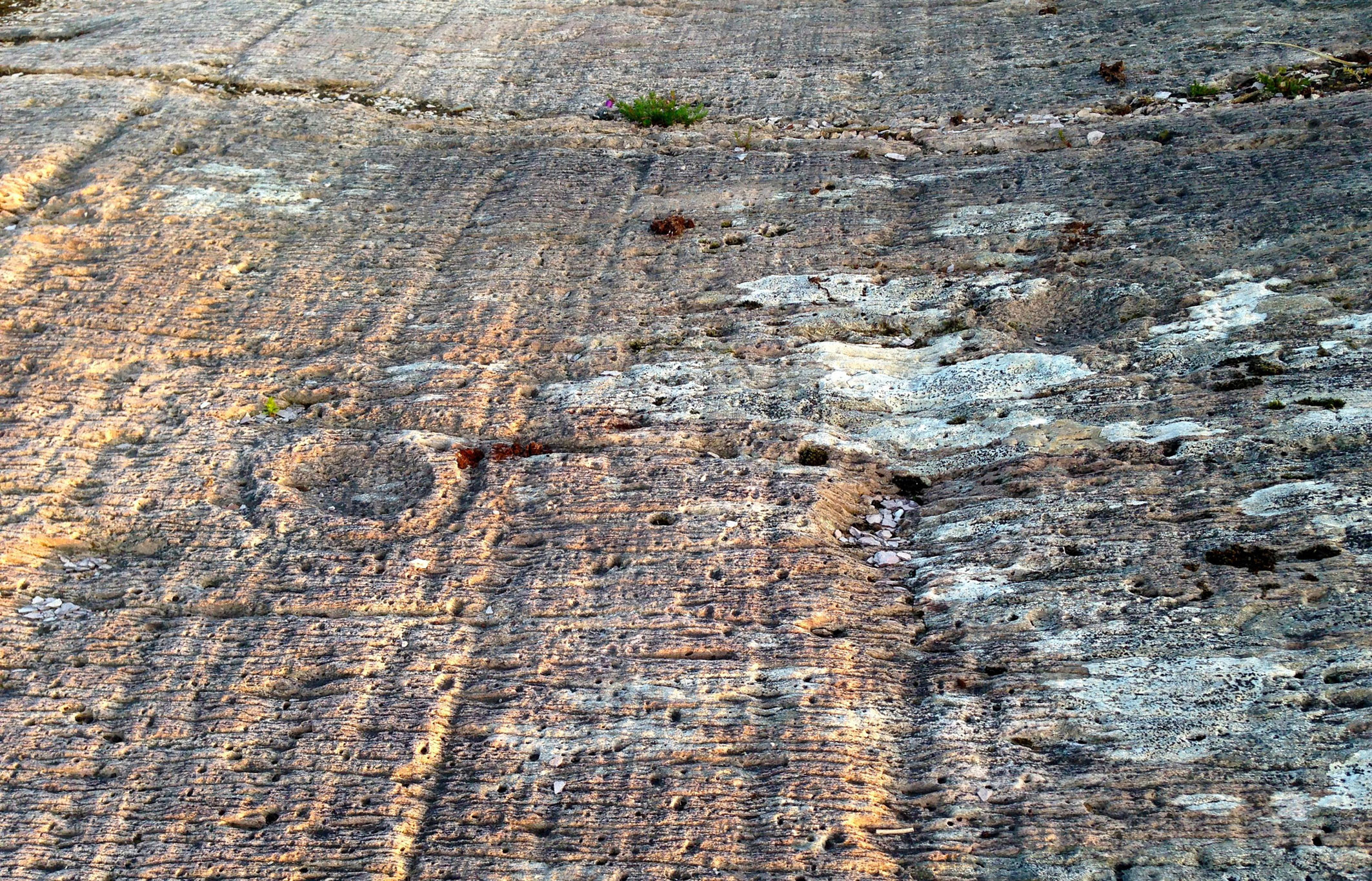
During our many visits we have noted – but perhaps neglected – the other carved rock at Derreenaclogh, which is situated only a few metres to the east. This has suffered considerable weathering and surface erosion which the first rock escaped, somehow or other, by being preserved for years – centuries – perhaps millennia – under a covering of soil and furze. Nevertheless, today the very faint markings seemed to be more alive – as if the low sunlight on this evening was exactly right for observation. We could see marks on this surface we had never made out before. Derreenaclogh Number 2 deserves a detailed study of its own – something else to keep us busy for a while!

Heavily weathered motifs on Derreenaclogh 2

Heavily weathered motifs on Derreenaclogh 2

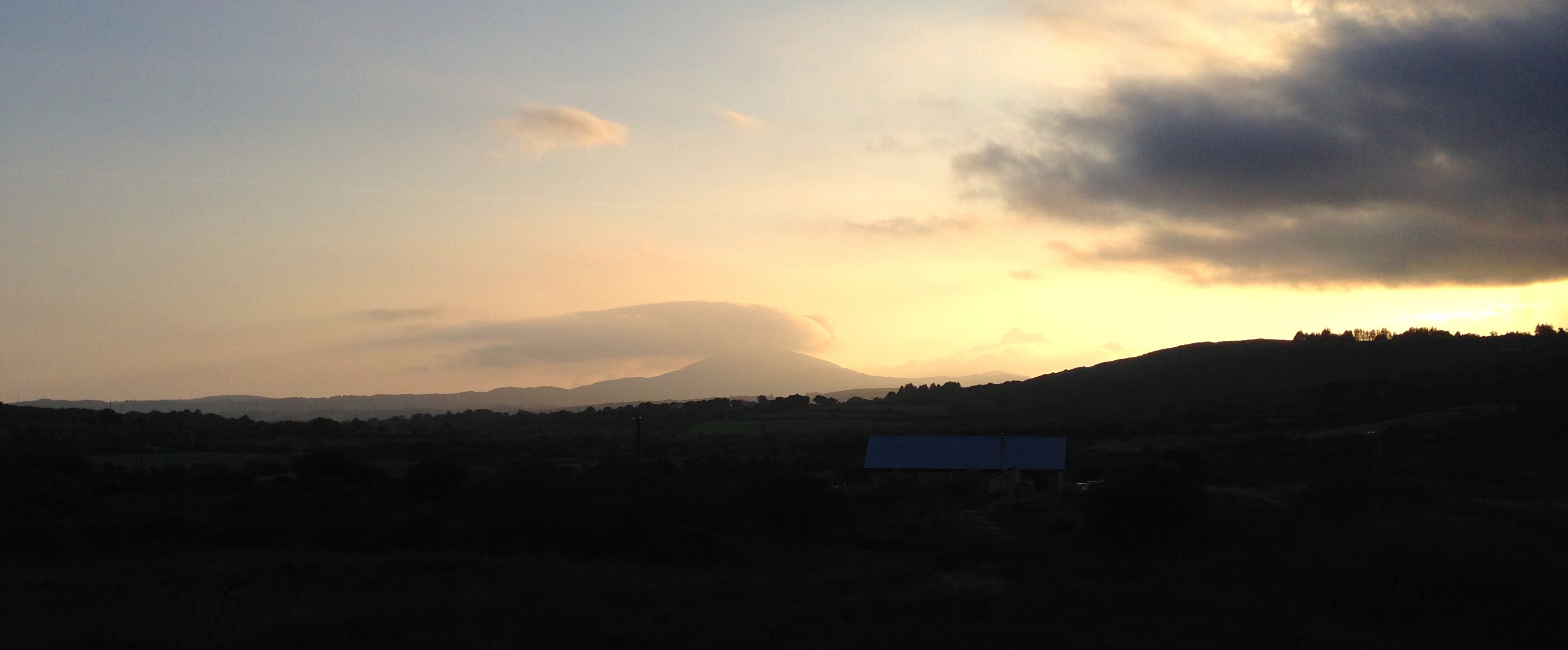
The sun duly sank below a hill – not a particularly significant part of the horizon. Mount Gabriel, meanwhile, further to the south, gathered some rather spectacular clouds around itself: it could be that this landscape profile is a sunset marker at another calendar point. We did see that the ‘ray’ on the large motif with eight concentric circles seemed to be aligned with the setting sun – could that have been important?

It was such a beautiful evening that wherever that sun had landed, or whatever alignments may or may not be visible, we would have been perfectly happy. As we made our way back to Nead an Iolair we said to ourselves – again – that this West Cork scenery is unbeatable: we are so fortunate to be immersed in it.

Mt Gabriel


Beara – the Lie of the Land

On the north side of the Beara, looking across to the Kerry Mountains.

On the north side of the Beara, looking across to the Kerry Mountains

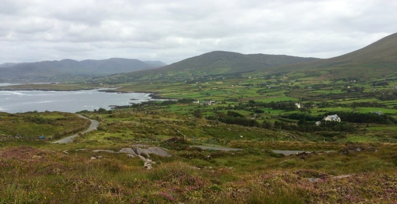
The Beara Peninsula is the largest and perhaps the wildest of the three West Cork Peninsulas. (See last week’s post for the map.) Two mountain chains, the Caha Mountains and the Slieve Miskish Mountains make up the spine of the Peninsula. You can traverse it via the spectacular Healy Pass, which runs from Adrigole north to Lauragh. On this occasion, because we had limited time, we confined ourselves to driving the main coastal route and to getting the general lie of the land. This meant we missed out on several landmarks – Bere Island, for example, and Dursey Island, besides the Healy Pass – so of course we must go back soon!

Near Cod's Head

Near Cod’s Head

After the inspiring piano recital by David Syme, described last week, we stayed overnight in Allihies and enjoyed an excellent dinner in O’Neill’s pub. The local Gaelic Football team had won a championship match that afternoon and the town was celebrating well into the night. Our first stop the next day was the Allihies Mining Museum. Housed in an impressively converted old Methodist Chapel, it tells the story of copper mining on the Beara, evidence of which can still be seen in the vicinity.

Note the green copper veins on the cliff face

Note the green copper veins on the cliff face

From there we carried on to the Cod’s Head, through a small pass which brought us out to a jaw-dropping vista across Coulagh Bay to Kilcatherine Point, and beyond to the Mountains of the Iveragh Peninsula in Kerry. We took the time here to hike up a waymarked trail that brought us up to breathtaking views high into the mountain slopes, home of purple heather, enormous boulders and curious sheep.

The sentinel

The sentinel

Eyries village is a pure delight: a riot of colourful houses and sleepy streets. We stopped at Ms Murphy’s traditional shop for tea and delicious sandwiches, strolled along the main street taking pictures and chatting to friendly residents, and finally by chance dropping into the startlingly beautiful St Kentigern’s church.

The north side of the Peninsula offers glorious vistas across the Kenmare River (an enormous sea inlet but called, oddly, a river). We took the coastal route from Kilcatherine to Dog’s Point and back to Ardgroom and on to Lauragh – lovely villages with seaside settings.

Mountain and sea

Mountain and sea

We stopped to visit the Cailleach Beara, the Hag of Beara. A powerfully symbolic site from Irish mythology, this rock is associated with many legends. People leave votive offerings – coins, rosary beads, a set of old glasses, shells and ribbons in honour of the spirit of the ancient goddess. Our next stop was the Ballycrovane Ogham Stone – the tallest in the world, and still in the wild, as Robert was glad to note.

Alright – so we have our bearings now and we’ve scratched the surface of this fascinating part of West Cork. Look out for future posts on the Beara – we can’t wait to return!

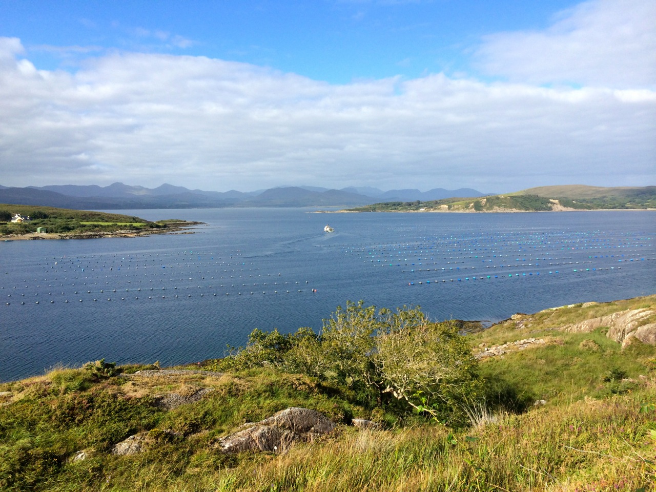
Beara mussel beds

Mussel beds, looking out to the Kenmare River

In Search of Ghosts

ruin

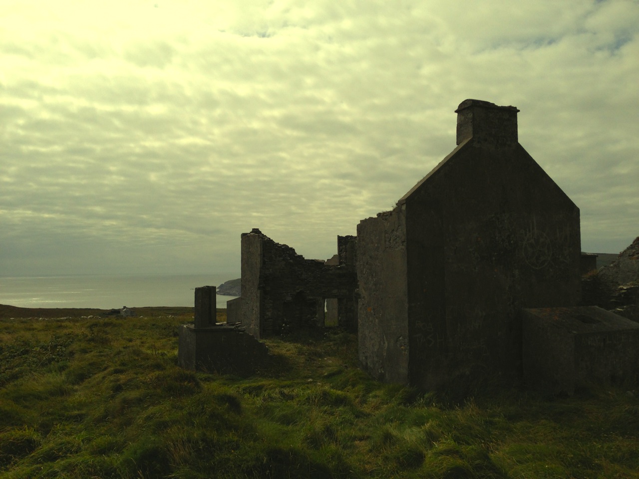
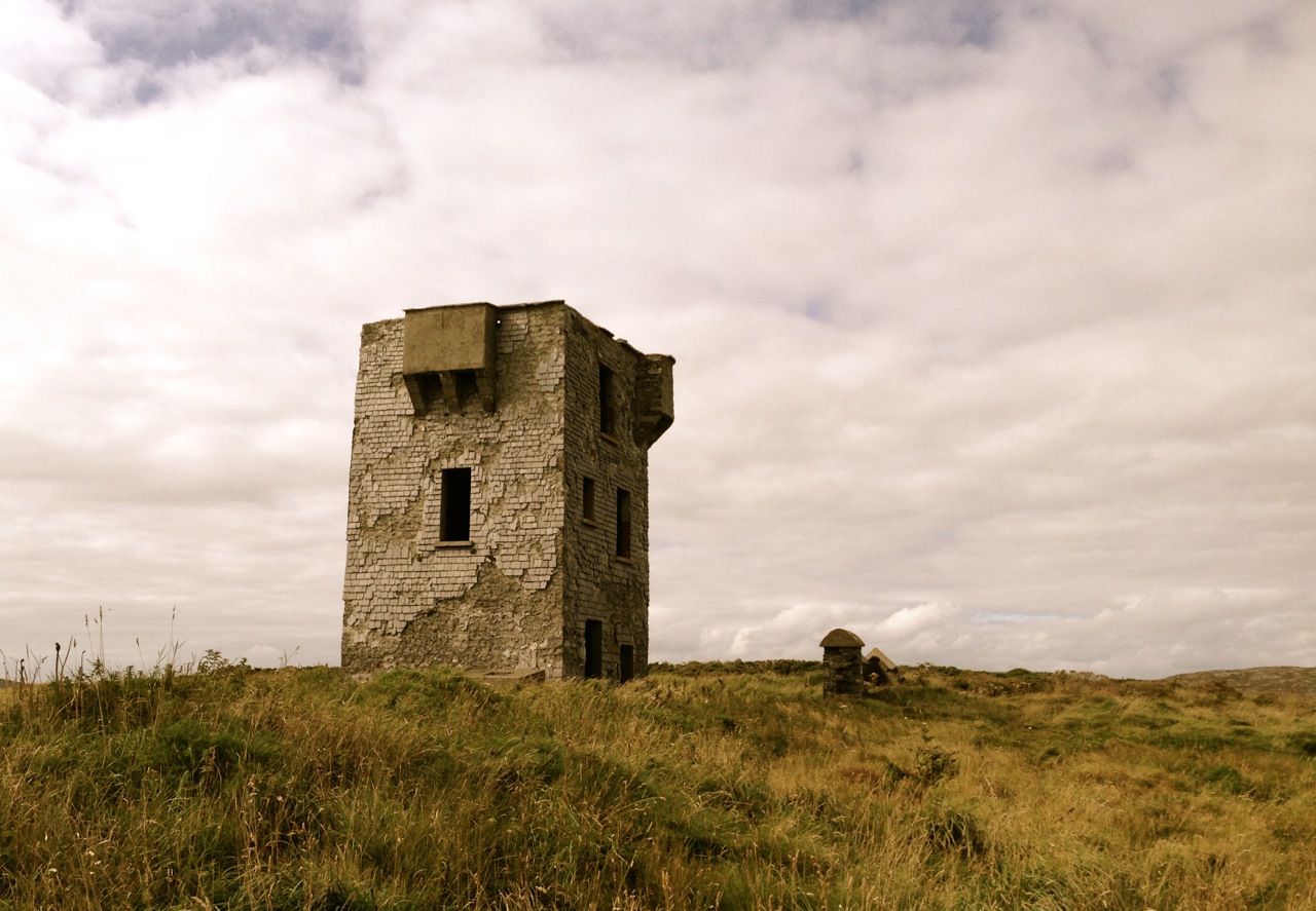
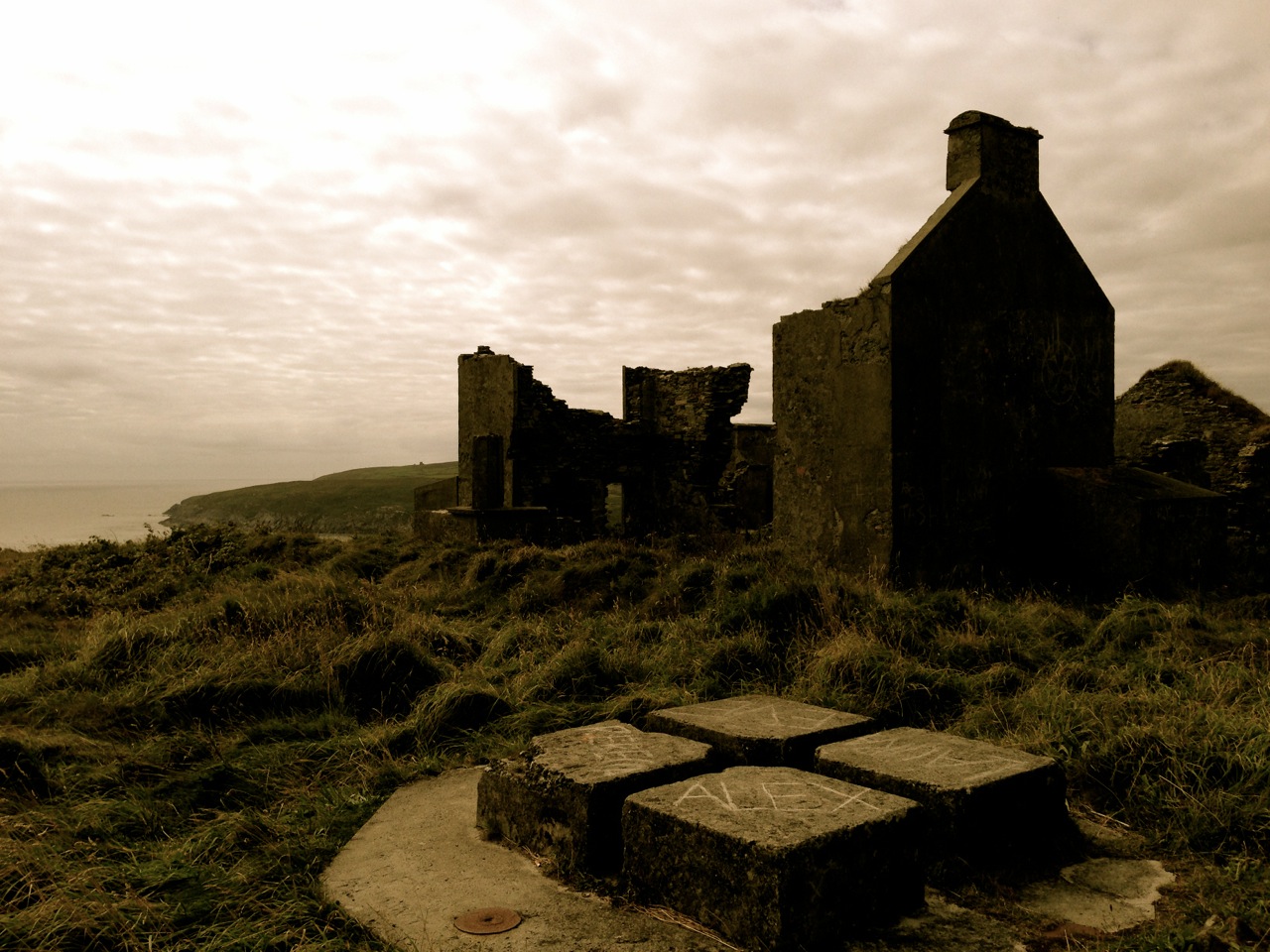
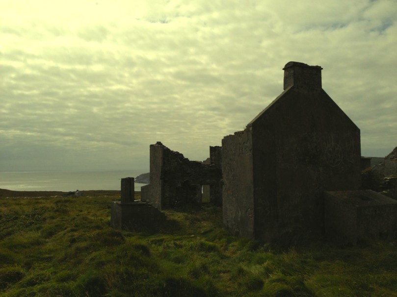
Lonely and wild – Brow Head is the most southerly point on the mainland of Ireland. There are ghosts here: ghosts of ancient people who created the stone monuments, perhaps 5000 years ago, that are now inundated by every tide in the bay at Ballynaule below this Irish ‘Lands End’; ghosts of early farmers who began to lay out field boundaries criss-crossing this windswept promontory; ghosts of the defenders of an empire who feared a French invasion that never happened; ghosts of the prospectors who sunk two shafts – now barely protected by rusting wire – during the nineteenth century copper mining era; and, lastly, ghosts of the pioneers of our own digital age, represented in the brooding ruins that crown the hilltop here above West Cork’s remotest village, Crookhaven.
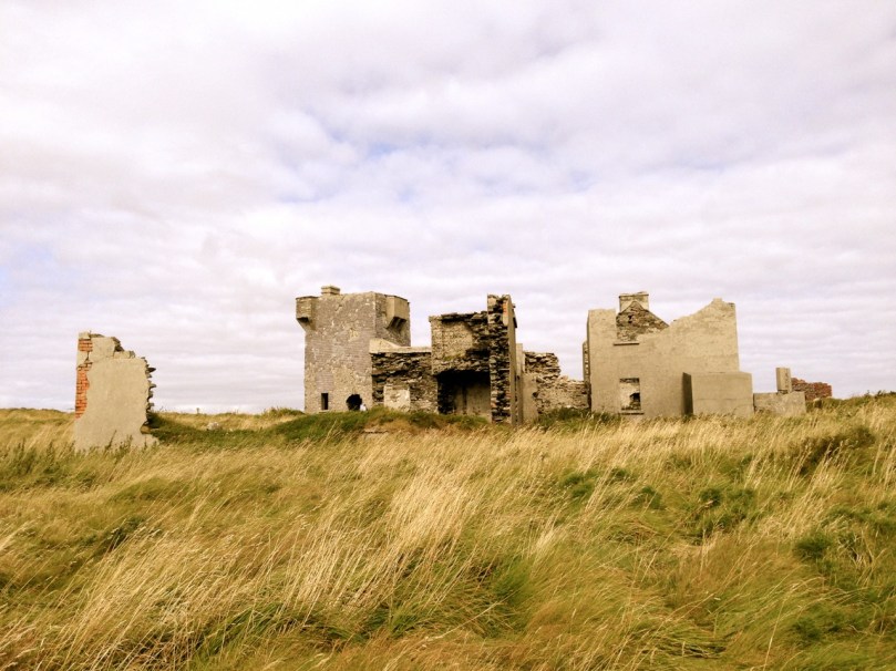
Brow Head - haunt of ghosts

Brow Head – haunt of ghosts

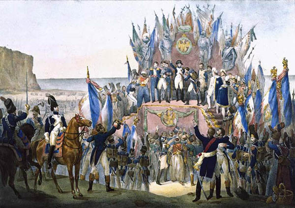
Charles Motte

Napoleon setting his sights on the British Empire 1804 (Charles Motte)
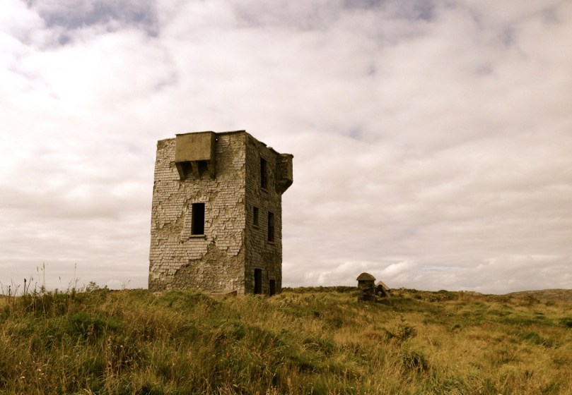
Facing up to Napoleon: Brow Head Signal Tower, built in 1804

Facing up to Napoleon: Brow Head Signal Tower, built in 1804 in anticipation of a French invasion

We can be very specific about one ghost: Guglielmo Marconi – born at Bologna, Italy, on April 25, 1874 to Giuseppe Marconi, an Italian country gentleman, and Annie Jameson, daughter of Andrew Jameson of Daphne Castle, Enniscorthy, County Wexford, Ireland. The Jamesons were and are renowned distillers of Irish Whiskey. It’s reasonable to say that Marconi was an ‘Irish Italian’, and that heritage was reinforced when in 1905 he married Beatrice O’Brien, daughter of the 14th Baron Inchiquin. Marconi’s fame is that he pioneered the commercial application of electromagnetic waves – or Radio.

Marconi - wishful thinking!

Marconi – wishful thinking!

At the age of twenty one, Marconi was able to demonstrate to his father how, without any visible physical link (without wires), he could transmit dots and dashes through the rooms of their home in Pontecchio. “…When I started my first experiments with Hertzian waves…” he is quoted as saying, “…I could scarcely believe it is possible that their application to useful purposes could have escaped the notice of eminent scientists…” His parents used their influence to help him travel to England to meet the Engineer-in-Chief of the British Post Office with the result that in 1896 Marconi obtained the first ever patent in wireless telegraphy.
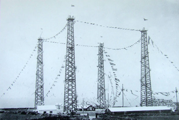
Signal Station at Poldhu, Cornwall, 1914

Signal Station at Poldhu, Cornwall, 1914

Marconi’s ambitions started in a room in Italy: by December 1901 he was able to send messages from Poldhu, Cornwall, to St John’s, Newfoundland, a distance of 2100 miles – an historic achievement. In his attempts to bridge the Atlantic with Radio waves he had explored the west coasts of Britain and Ireland for suitable telegraphic locations. One of his destinations was Crookhaven, which he visited many times – using the Flying Snail en route!
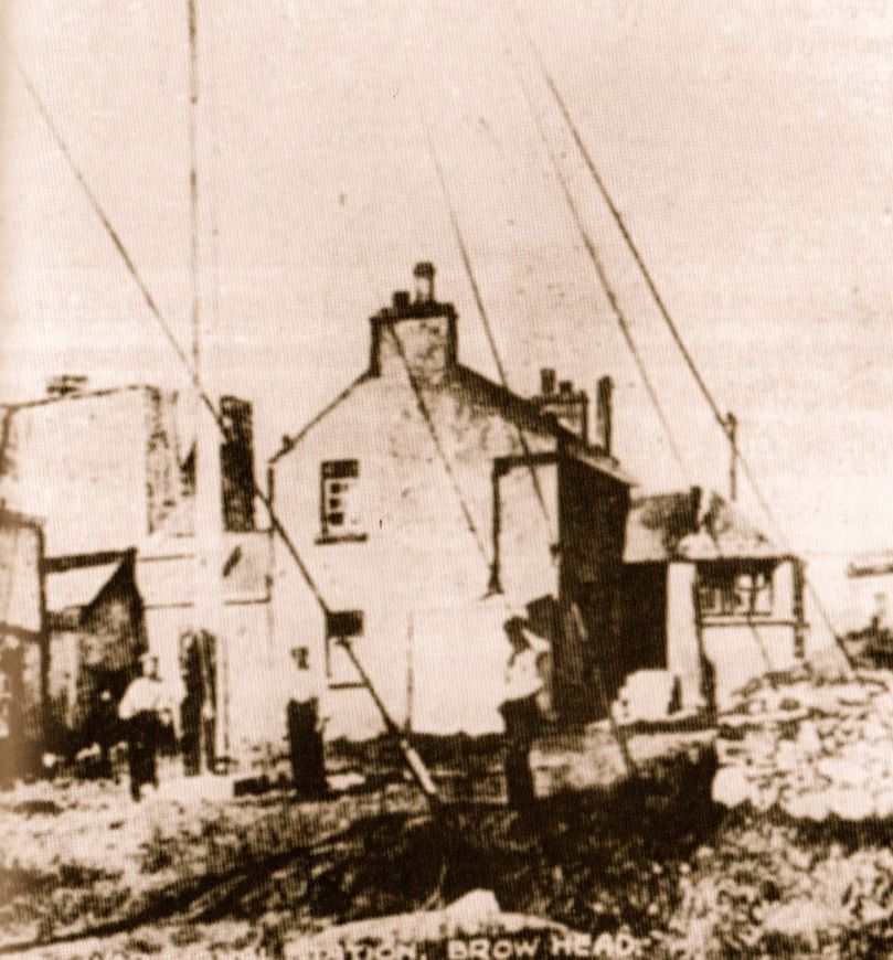
The Marconi Wireless Telegraph Station at Brow Head - exactly 100 years ago

The Marconi Wireless Telegraph Station at Brow Head – exactly 100 years ago

Brow Head was one of a number of transmitting stations set up by Marconi and it got off to a flying start soon after opening in 1901 when, in the presence of Marconi himself, Morse signals were received from Poldhu, 225 miles away. The fact that the Atlantic gap was conquered only a few months after this shows the rapid pace of developments at that time.
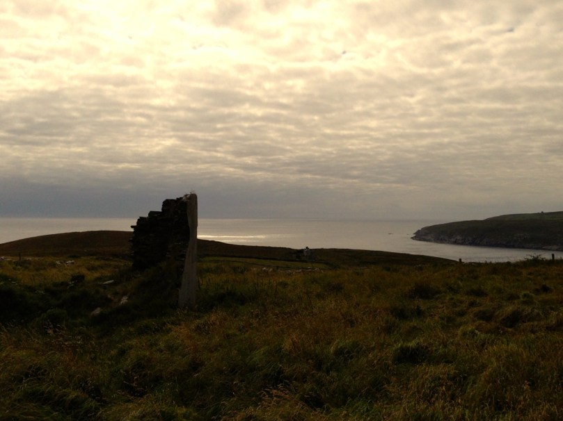
Calling America...

Calling America…

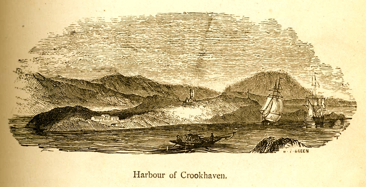
The village of Crookhaven had long been the first and last port of call for ships going between Northern European ports and America. Over the centuries ships stocked up here with provisions before tackling the open sea. Because of this, the major shipping lines had agents here. Reuters and Lloyds had flag-signalling and semaphore equipment on Brow Head to communicate with the maritime traffic, superseded by the telegraph station. At the end of the 19th Century it was said that “…you could cross the harbour on the decks of boats…” Up to 700 people are reputed to have lived in the area at that time: now, Crookhaven has a permanent population of no more than 40. An article written by one of the telegraph operators in 1911 summarises:

…As Crookhaven is the first station with which the homeward bound American liners communicate it is naturally a busy station. By the aid of wireless all arrangements are made for the arrival of the ships, the landing and entraining of the passengers and mails, whilst hundreds of private messages to and from passengers are dealt with. Messages are also received from the Fastnet Lighthouse, which is fitted with wireless, reporting the passing of sailing ships and steamers. These messages are sent by vessels not fitted with wireless by means of signals to the Fastnet, thence by wireless to Crookhaven, whence they are forwarded to Lloyds and to the owners of the vessels…
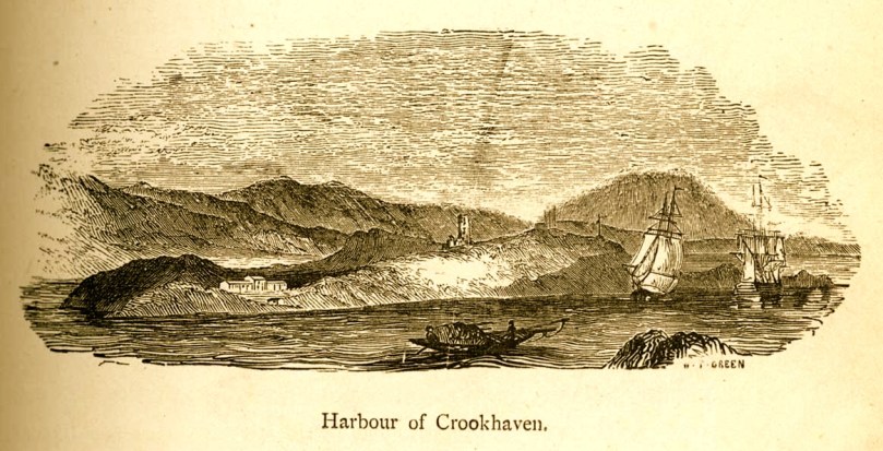
Engraving by Mary Francis Cusack, 1875

Engraving by Mary Francis Cusack, 1875

We have some first hand accounts of the workings of the signal station in its heyday from the handwritten log books of Arthur Nottage – for many years landlord of the Welcome Inn at Crookhaven – who died aged 90 in 1974. In 1904 he arrived in West Cork (from England) to work on a shift basis with one other man as Marconi telegrapher at Brow Head. Until 1914 he operated the Morse code apparatus with a salary – generous for the time – of £1 per week.
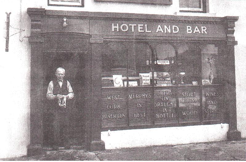
Arthur Nottage of Crookhaven

Arthur Nottage of Crookhaven

A hundred years ago telegraphy had advanced to such a stage that it was no longer necessary for stations to operate close to the shipping lanes, and small, isolated sites such as Brow Head were closed down. Legend has it that in 1922 the Irregulars destroyed the buildings during the Civil War.
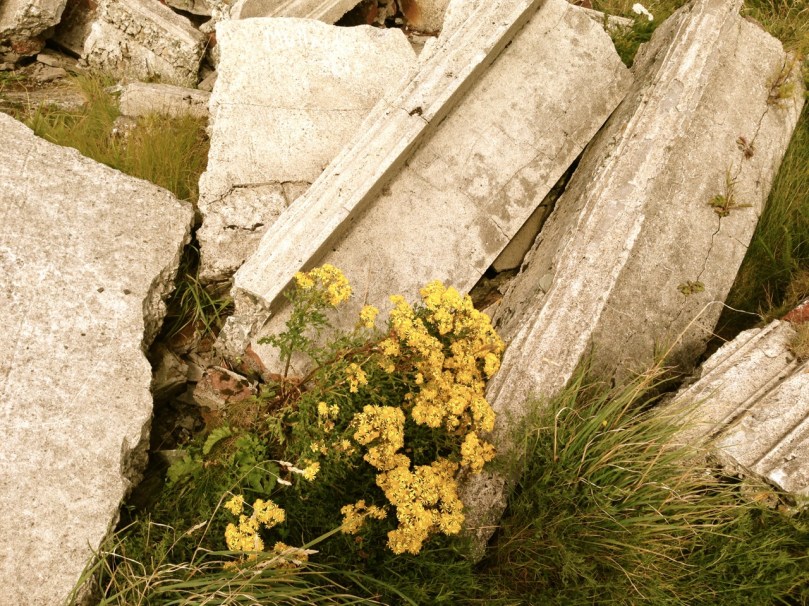
Becoming Archaeology: the ruins on Brow Head today

Becoming archaeology: the ruins on Brow Head today

Finola and I have both been inspired by the landscape and atmosphere of this Atlantic frontier. It’s a place we will return to. All West Cork landscapes are impressive, but this is a place apart. If you want to feel at the end of the world, walk here: you won’t meet many others, even in the height of the visitor season. Perhaps that’s because it’s haunted – but in the best possible way. Like so much of Ireland the world has come here – a mark has been made – memories have been left behind. Now, you hear the ghosts in the ever-present currents of wind and surf.
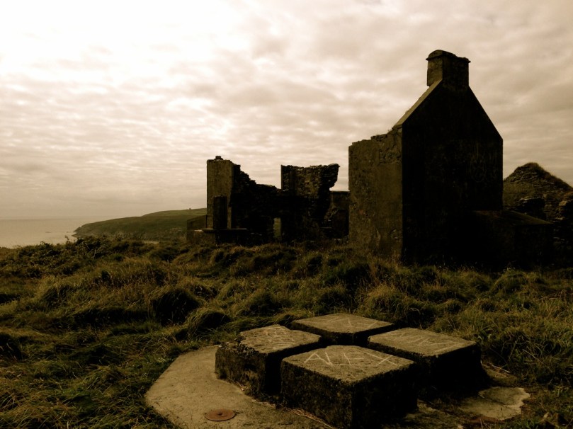
Base of Marconi's mast at Brow Head

Base of Marconi’s mast at Brow Head

(I am grateful to Michael Sexton and the Mizen Journal (Number 3 1995) for many fascinating items on the Crookhaven Telegraph Station not recorded elsewhere.)