An Excursion to Dunboy

We have often visited the Beara Peninsula: it’s not too far away and makes a good day’s outing for us. Have a look at some recent posts here and here to get the feel of the geography. Yesterday we had a mission – to discover more about Donal Cam O’Sullivan Beare (1561 – 1618) and his connections with Dunboy Castle, over by Castletown-Bearhaven – often known as Castletownbere or just Castletown – in the far west of County Cork.

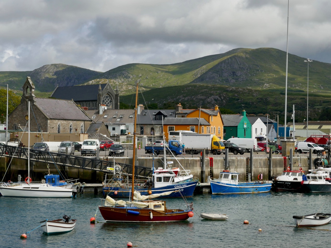
Our first stop was at the bustling harbour of Castletownbere which sits at the foot of the Caha Mountains. …Where land and sea collide, untamed beauty abounds… – that’s the apt heading on the website of the town’s Development Association, and it most certainly seems a lively and flourishing community, a good base from which to explore the wealth of history and archaeology on the Beara. Daphne du Maurier’s novel, Hungry Hill, is set in the area and is a family saga loosely derived from the history of the Irish ancestors of du Maurier’s friend, Christopher Puxley.

We paused only for a much-needed coffee and a quick look in the Sarah Walker Gallery (precariously and picturesquely situated on the end of the town’s slipway – it’s the white building in the picture above) before setting out to find Dunboy. I had read a little of the history of the place, and knew that it had been a centre of rebellion following the Battle of Kinsale in 1601 – 1602, when allied Irish and Spanish forces were defeated at the culmination of the Nine Years War between England and the Gaelic lordships.

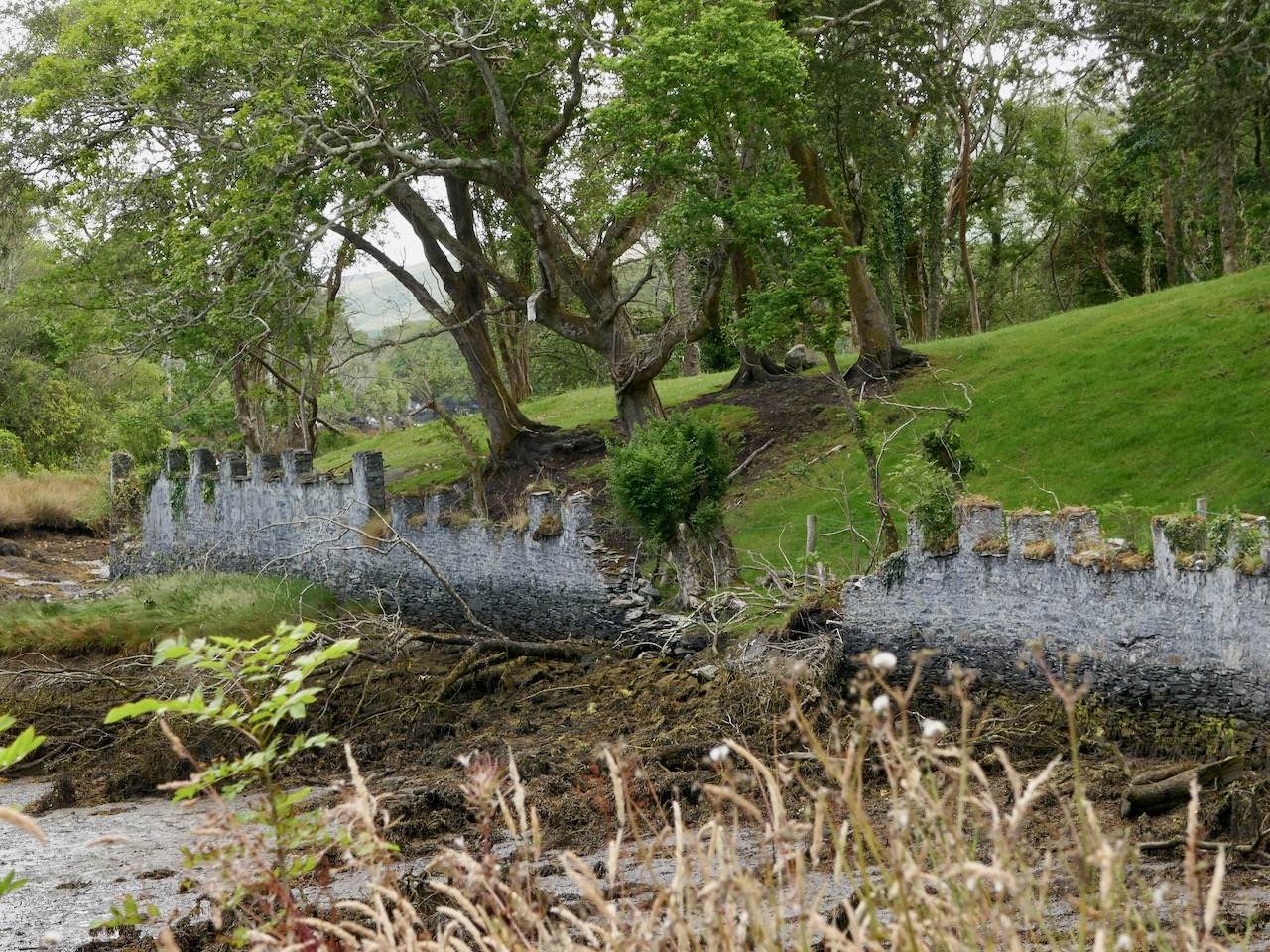
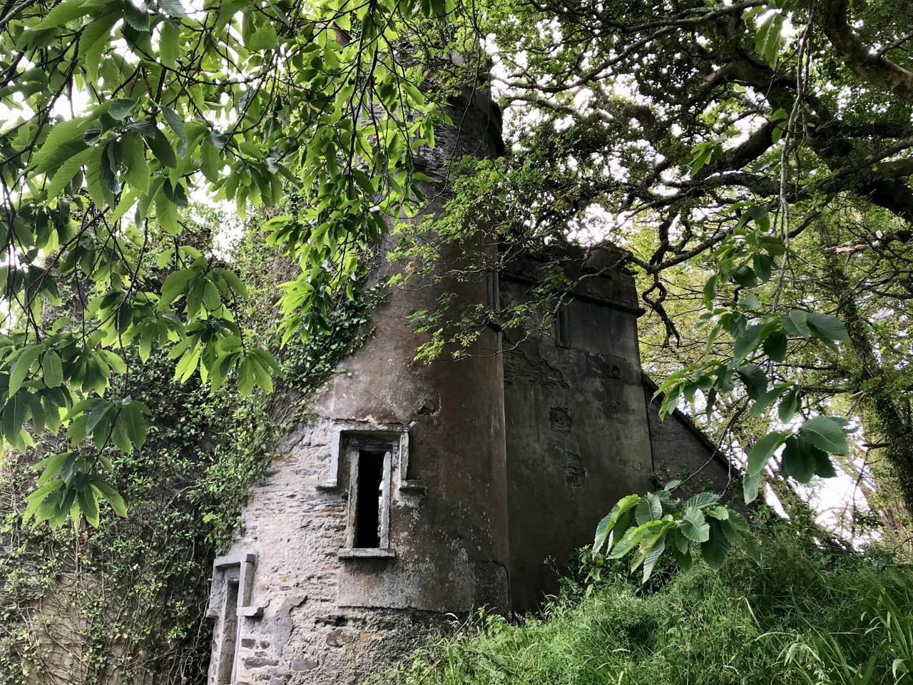
At the edge of the Dunboy Demense are traces of a castellated sea-wall and a gatehouse (above).  The territory was a stronghold of the O’Sullivan Beare clan leader, and was built to guard and defend the harbour of Berehaven. Its presence enabled O’Sullivan Beare to control the sea fisheries off the coast and collect taxes from Irish and continental European fishing vessels sheltering in the haven. It was also a centre for trade to and from the continent. In the aftermath of the Battle Of Kinsale Donal Cam O’Sullivan Beare’s followers retreated to Dunboy Castle, which was considered an impregnable stronghold.

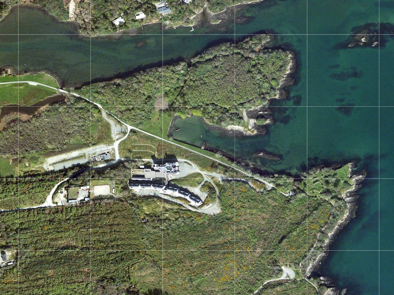
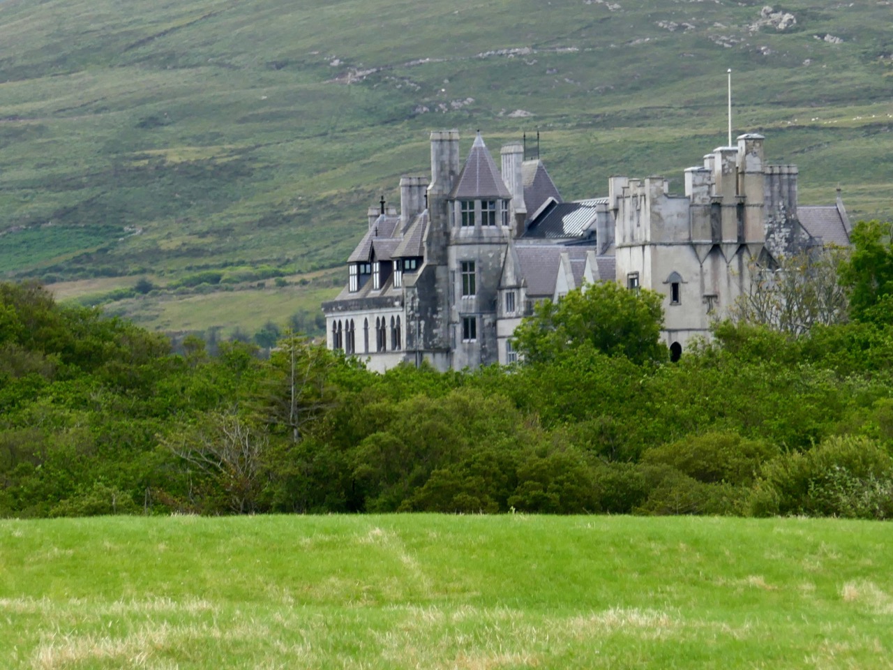
The 25″ historic Ordnance Survey map (upper picture) shows the location of the O’Sullivan Beare fortress, circled in red. Don’t be confused by the ‘Dunboy Castle’ label: this is a later building added to an existing tower house that stood on the hill above the promontory. The estate came into the hands of the Puxley family who invested significantly in the Allihies copper mines in the 19th century. The development in the centre of the aerial view above is Puxley Manor, and is a 21st century incarnation of the huge neo-gothic family mansion created by the family, which was burnt out by the IRA in the 1920s.

These pictures show the mansion after its destruction and today. In the lower photograph you can see the original tower house in the foreground: the buildings were fully restored as part of a high-profile ‘Celtic Tiger’ project to create a 6-star hotel which could have brought employment and significant economic benefits to the area. Unfortunately the project collapsed before completion, and the future of this decaying leviathan is uncertain.

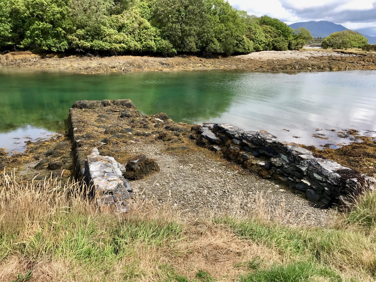
We could only look in awe at the very evident and lavish quality of the restoration and development, even in its present state, and speculate how its fortunes might have fared in more stable times. But all this was a bit of a diversion, as our goal was a much less audacious – but far more historically important – site: the original ‘Dunboy Castle’. We followed the trackway along the inlet, which looks as though it was artificially constructed to form a quay serving the demesne.
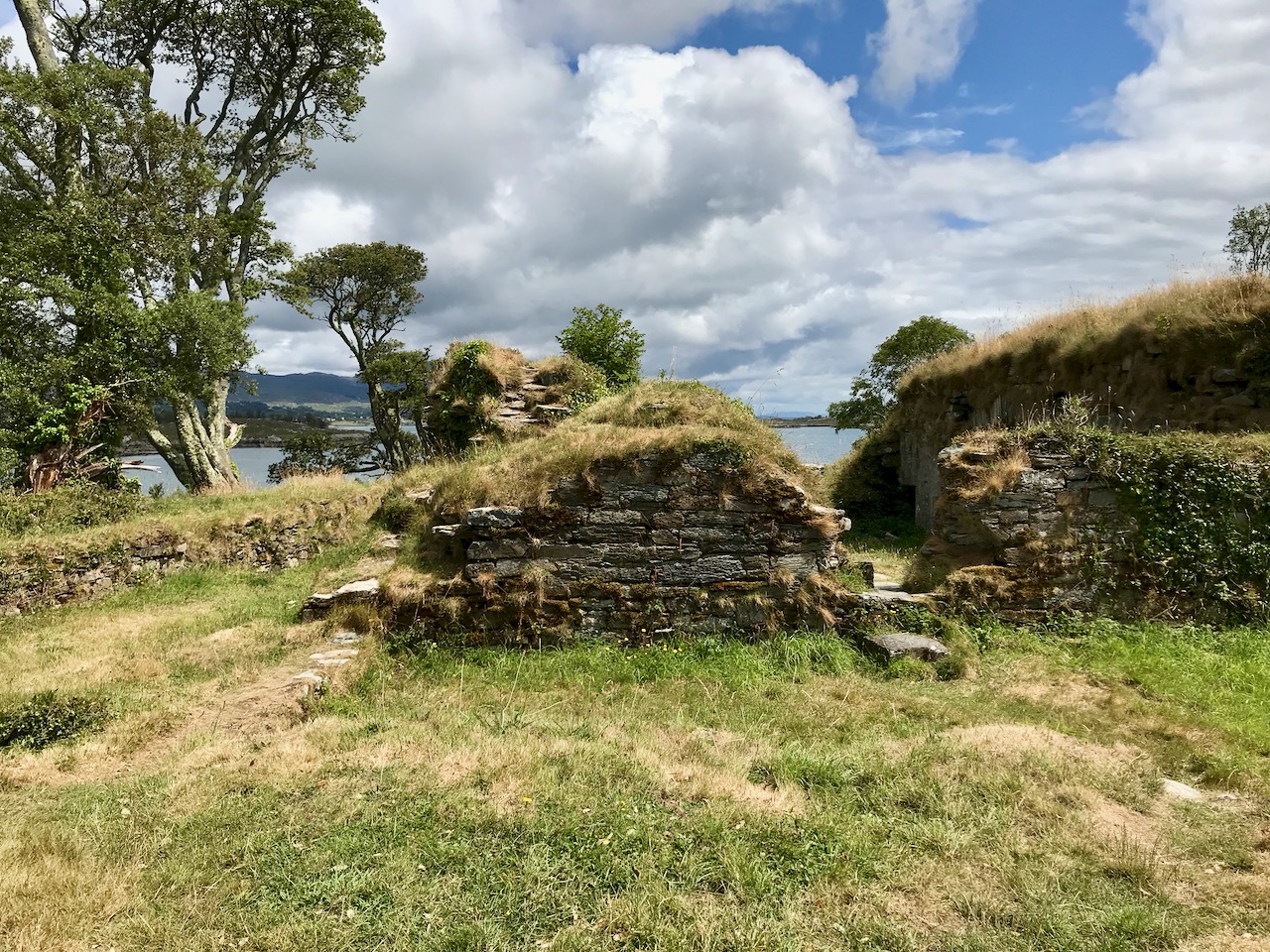
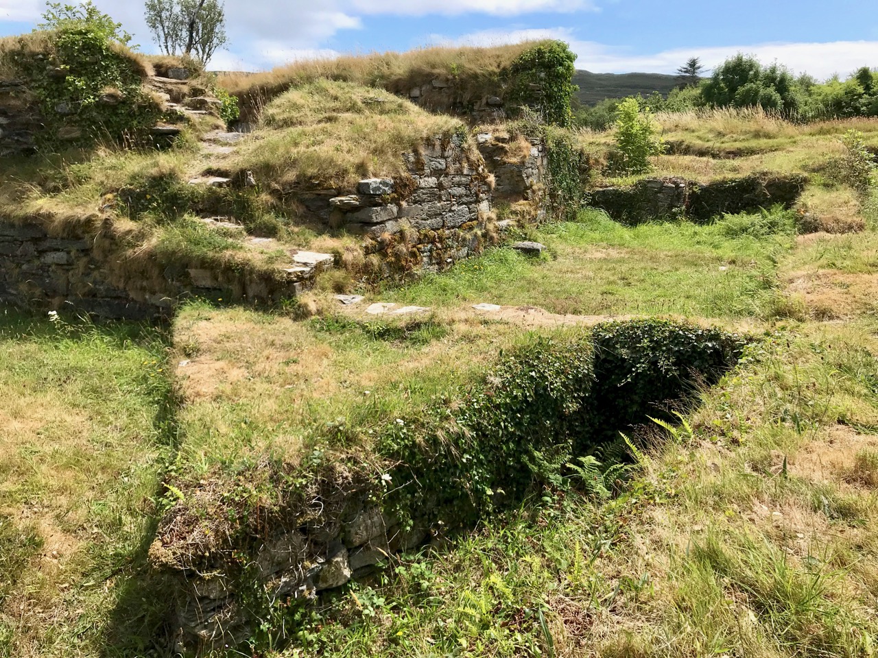
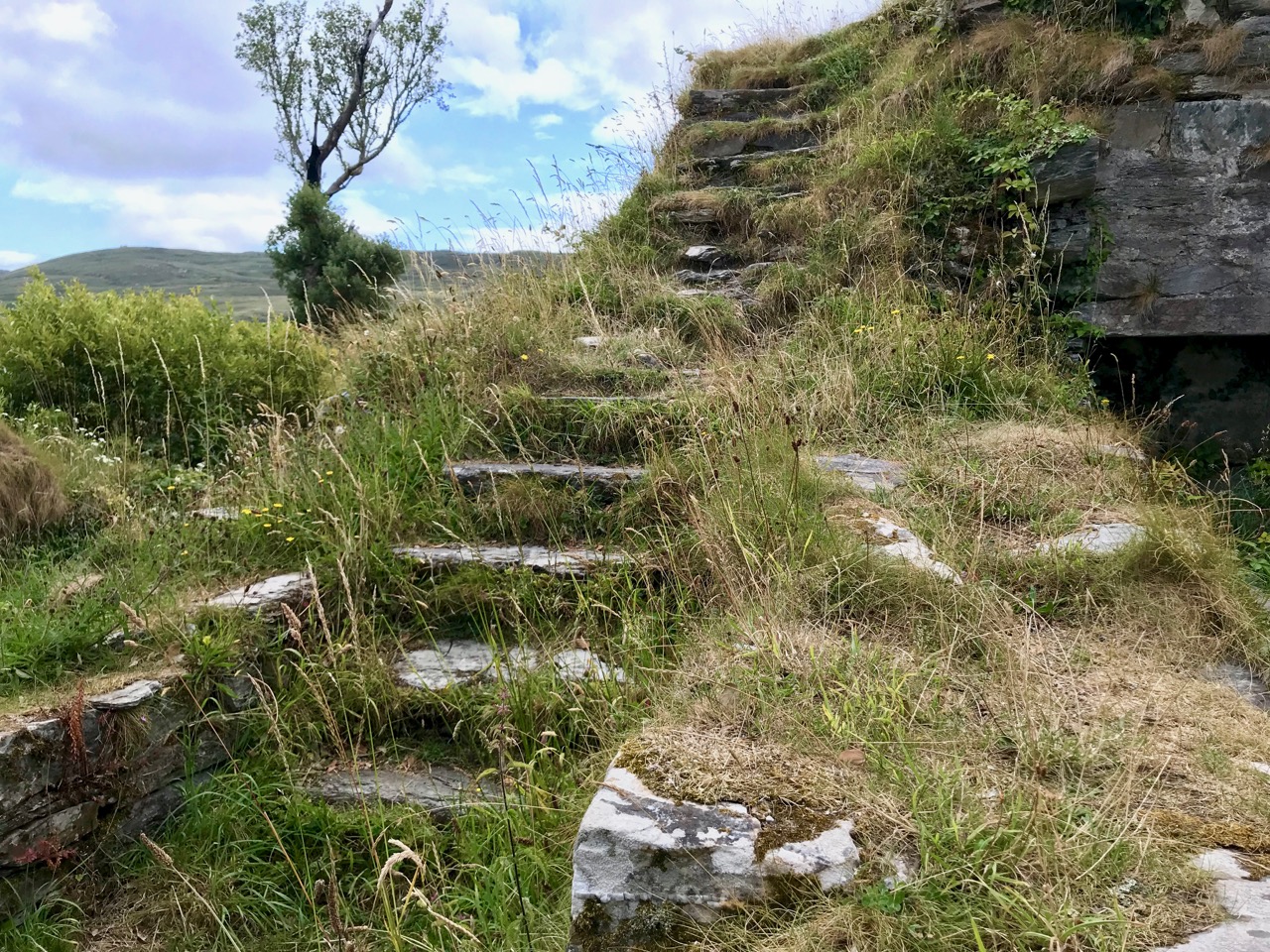
The ruin itself is unassuming: thick stone walls barely a few metres high. However, the ground plan is clear to see – a typical ‘tower house’ design with splayed openings and steps contained in the thickness of the outer walls. Also visible in the surroundings, however, are the clear ‘star’ shapes of an enclosure, complete with salient angles. These outer defences, reminiscent of ‘star-shaped forts’ evidently date from Cromwellian times, constructed after the castle was destroyed.

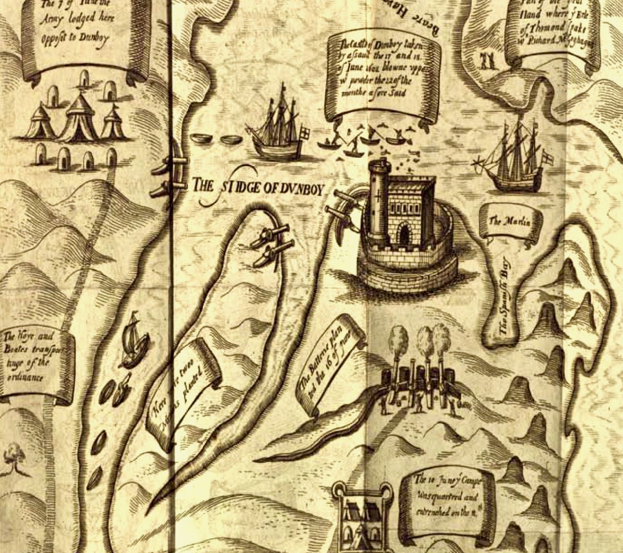
These ruins conceal an unhappy tale. At Kinsale the clan chiefs had been joined by a large force of troops sent by King Philip III of Spain, who considered that a federation with Ireland would assist his aspirations against Elizabethan England. After the surrender, a number of O’Sullivan followers retreated to Dunboy, where they found the small Spanish force stationed there  preparing to hand the castle over to the queen’s Lord Deputy, Mountjoy. O’Sullivan overpowered and disarmed the Spaniards and later released them to return to Spain, having kept kept all of their arms, ordnance and munitions. Inevitably, an English force under George Carew set out for Dunboy: it is said that this force numbered between 4,000 and 5,000 troops. O’Sullivan Beare established defences at the castle, but set off himself with most of his own army to consolidate in the north of the Beara Peninsula. Only 143 of his men were left behind at Dunboy, together with Friar Dominic Collins to look after their spiritual welfare. The siege of Dunboy began with an artillery bombardment by land and sea. Owen O’Sullivan of Carriganass, a cousin of Donal Cam, had allied himself with the English and informed them of a weak point in the castle walls. The guns were directed to that point, and the walls were eventually breached. After a ten day siege, Dunboy was reduced to the ruin we see today.

Above is a wonderful graphic illustration of the Siege of Dunboy Castle from Pacata Hibernia or A History of the Wars in Ireland during the Reign of Queen Elizabeth first published in 1633. Only 72 of the Irish defenders survived the siege: they were all hanged, including Friar Dominic Collins. Most of the hangings took place in the bustling square of Castletown-Bearhaven, close to where we had enjoyed our coffee at the start of our excursion.

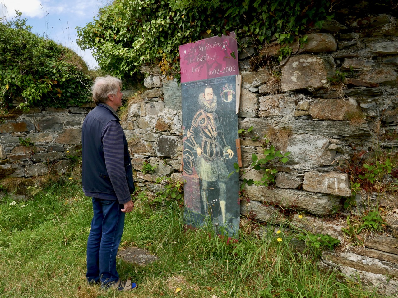
Here I am meeting Donal Cam himself in the ruins of his former stronghold. My account of the Siege of Dunboy is a very condensed version. Much more has been written about the details. As for O’Sullivan Beare, he eventually embarked on a long march to Leitrim with a thousand of his followers – but that’s a further unhappy story, best kept for another day!

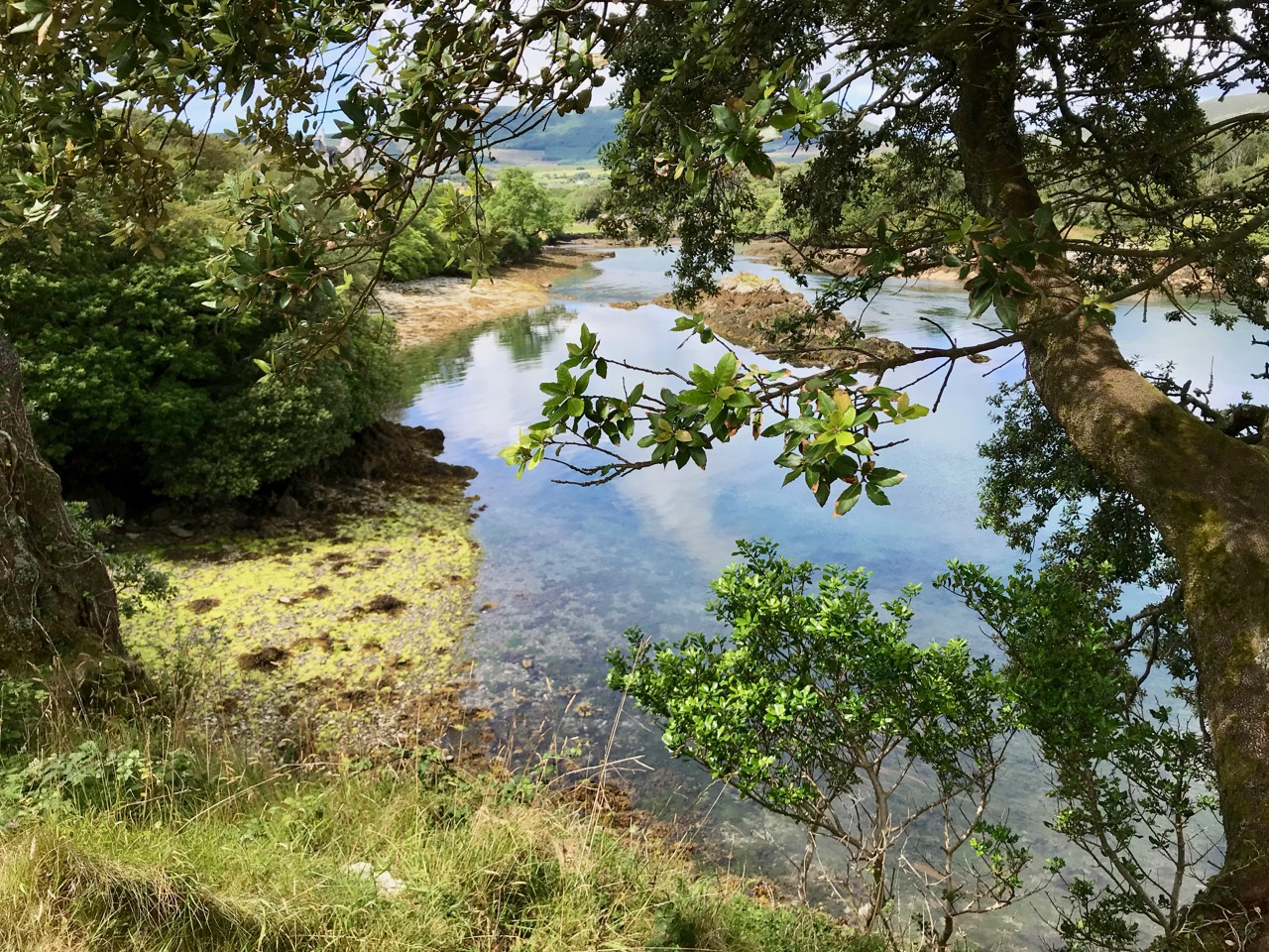
Dunboy Castle and its immediate environs are publicly accessible and there is plenty of parking within easy reach. We finished our day on the Beara by following a rural loop walk from the castle ruin back to the gatehouse – about 5 kilometres in idyllic surroundings.

Irish Immersion!

We traversed the Dingle Peninsula on the way to our week-long ‘Irish Immersion’ course. Our route included the Conor Pass (above) – possibly Ireland’s highest mountain pass with a summit of 456m: not to be missed, as the views from it are spectacular in all directions. Do be careful, though, as it’s included in the list of ‘the World’s most dangerous roads’. That’s because in places it is only a winding single track, with the way almost tunnelled out of steep rock faces: don’t try it in a bus!

Once over the pass, however, it’s plain sailing and sunshine all the way down to Dingle itself, a busy waterside town (which sells the best ice-creams!),  where we stayed while we were on our course. Here’s the view from Coastline House, our very well-appointed B + B:

So why would I want to learn the Irish language? And how easy is it? The answer to the second question is: it’s fiendishly difficult – especially for an ear that’s been attuned to English for a lifetime! But – here I am in my eighth decade, an Irish citizen and a permanent resident of West Cork – so what would be more natural (and good for the ageing brain) than being able to communicate in the native tongue? Finola, of course, learnt Irish right through her schooldays (it’s been compulsory since the founding of the Irish State) and can hold her own in conversation, but she wants to improve her knowledge and took a course at a higher level: I was in the raw beginners’ class, together with our good friends Amanda and Peter Clarke, with whom we enjoyed great craic in our free time.

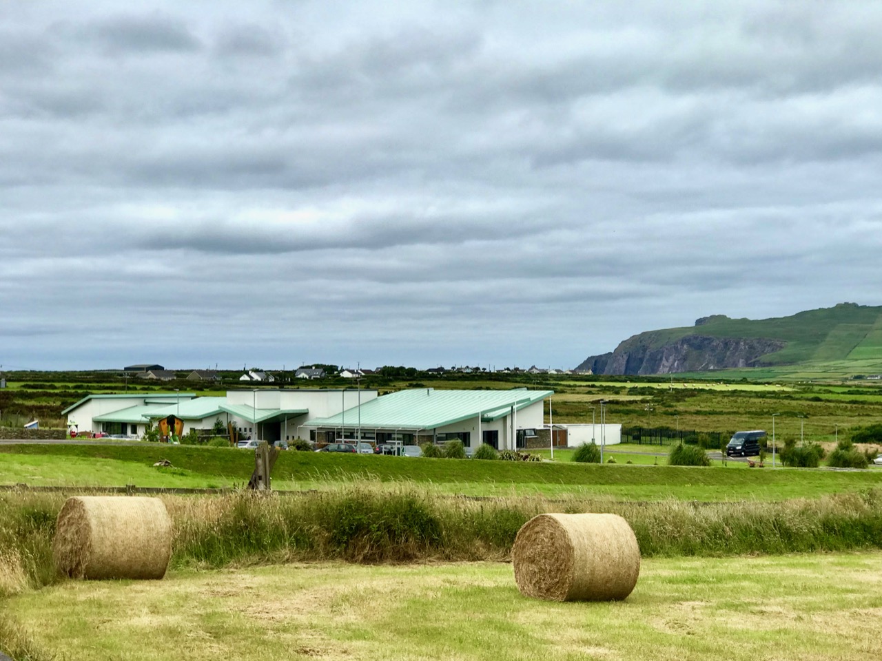
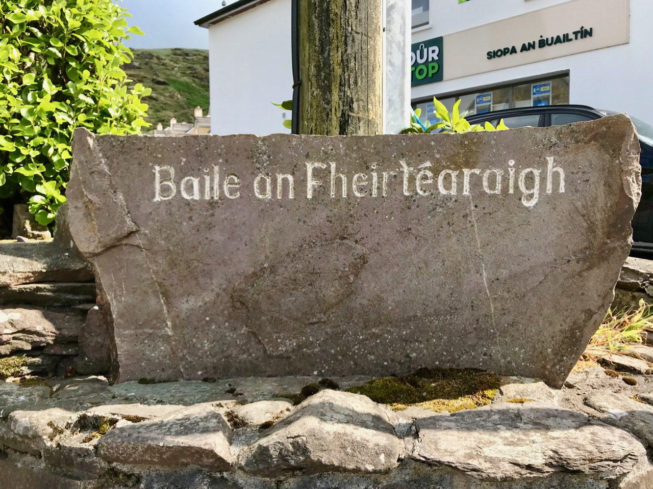
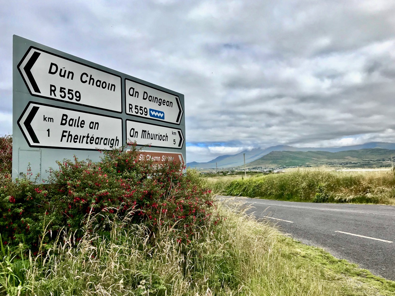
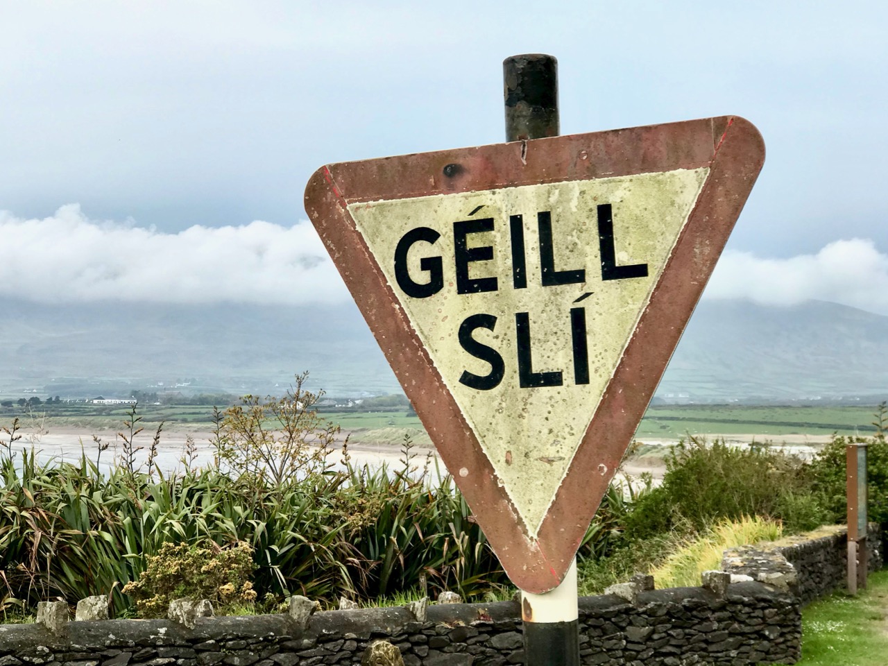
The western part of the Dingle Peninsula is a Gaeltacht area: that means it is a place where Irish is the dominant language; all street signs, traffic signs etc are in Irish only; anyone in shops, businesses etc is likely to speak in Irish, and there are a number of schools where teaching is all in Irish. Our courses were based in Baile an Fheirtéaraigh (in English it would be known as Ballyferriter) – to the west of Dingle town (which is, in Irish, An Daingean). You can tell from many of the photographs in this post how stunningly beautiful the landscape is in this part of Ireland. The upper picture above shows the very fine school building of Coláistí Chorca Dhuibhne, which hosts all the Irish classes. The ones for adults are run by the Oidhreacht Chorca Dhuibhneyou can find all the details here if you’ve a mind to give it a try yourself.

It’s a different world in the Gaeltacht areas: can you guess what the sign above is saying?

You ought to know, also, that the Gaeltacht area here is known as Corca Dhuibhne, which translates literally as ‘the seed or tribe of Duibhne’ and derives from the clan who anciently lived in this part of County Kerry. Try saying ‘Corca Dhuibhne‘ . . . How did you get on? This is what I should have heard:

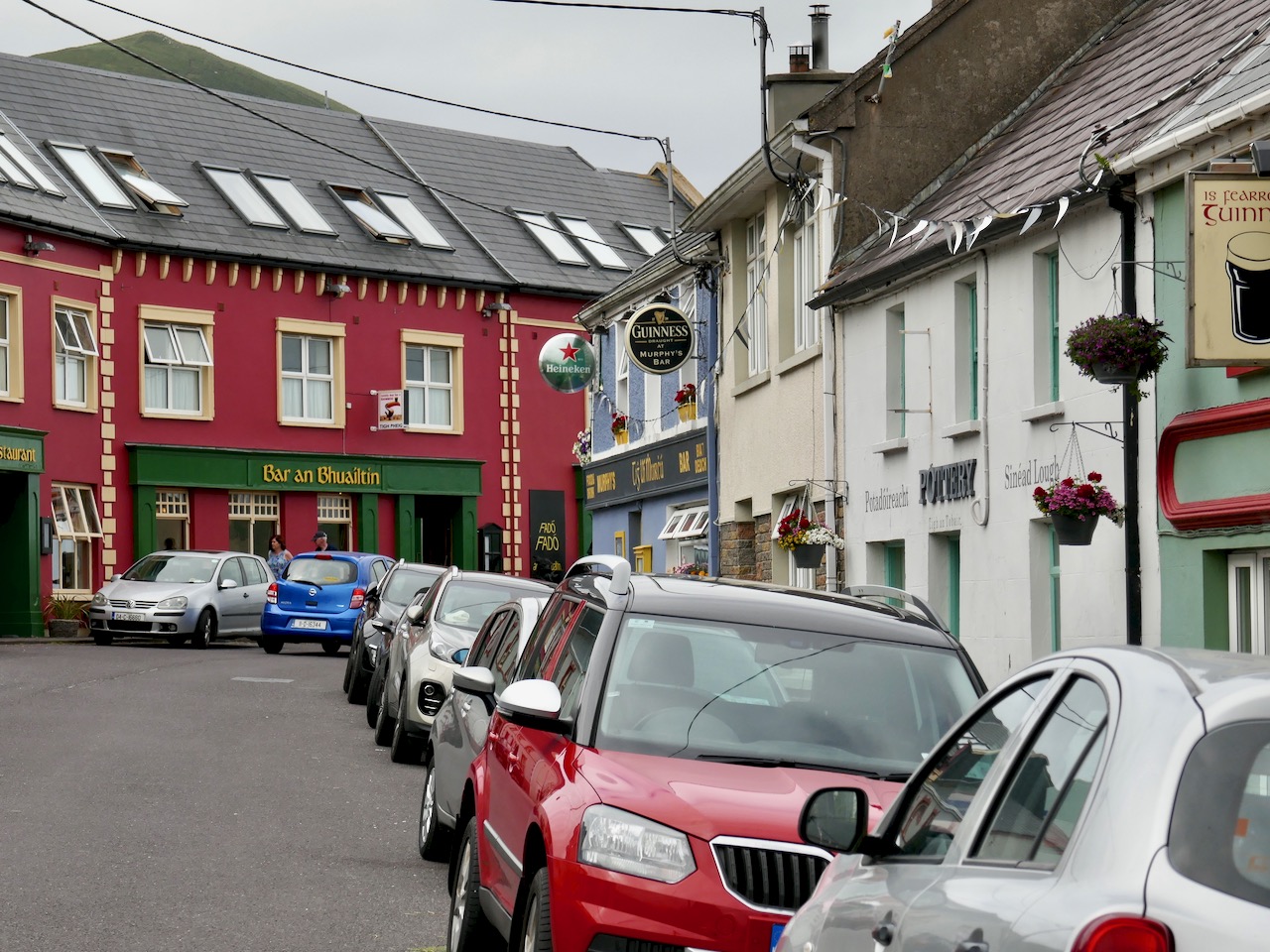
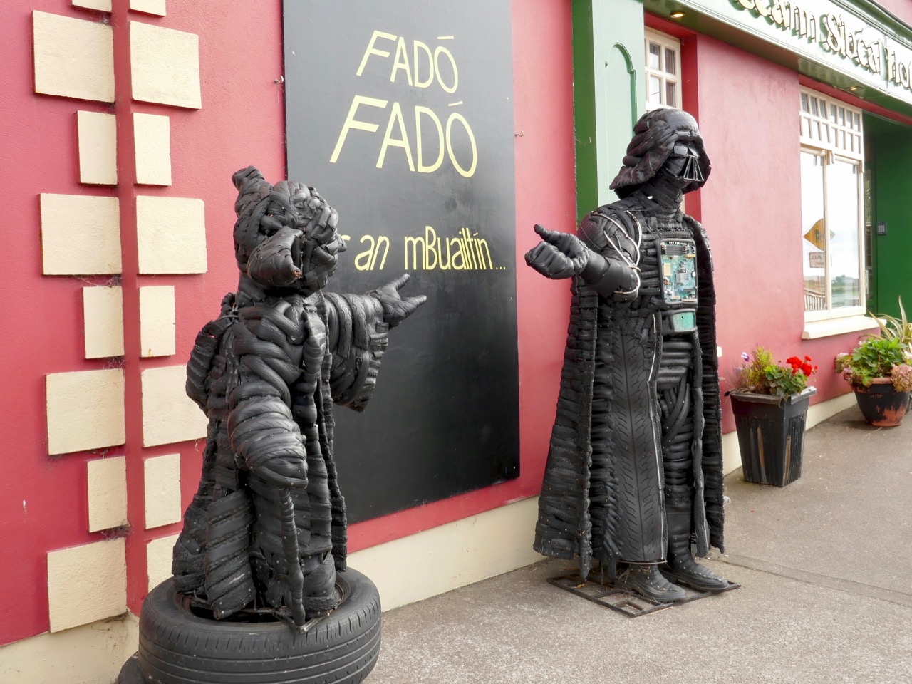
Above – streetscapes in the lively village of Baile an Fheirtéaraigh (Ballyferriter). Note the signage in the upper picture. The lower picture will be self-explanatory to Star Wars fans: the film series is set “A long time ago in a galaxy far, far away….” – Fadó Fadó is the Irish way of beginning a fairy-tale, meaning literally “long long ago….”. And – just to confuse you (and me) – Ar an mBualtín means “in Ballyferriter”! I know – I just told you that the town is Baile an Fheirtéaraigh in Irish, but the townland is known as an mBuiltín, which is in fact another way of describing a “booley” which, you will no doubt remember from my post here, is the place where cattle are taken up to the hill pastures in the summer. So, all things Irish are often not straightforward. Just to explain a connection: parts of the latest Star Wars episodes have been filmed on the promontories above Ballyferriter – a great ‘selling point’ for the local tourism industry!

Green roads lead to the hillside pastures which dominate the Dingle Peninsula

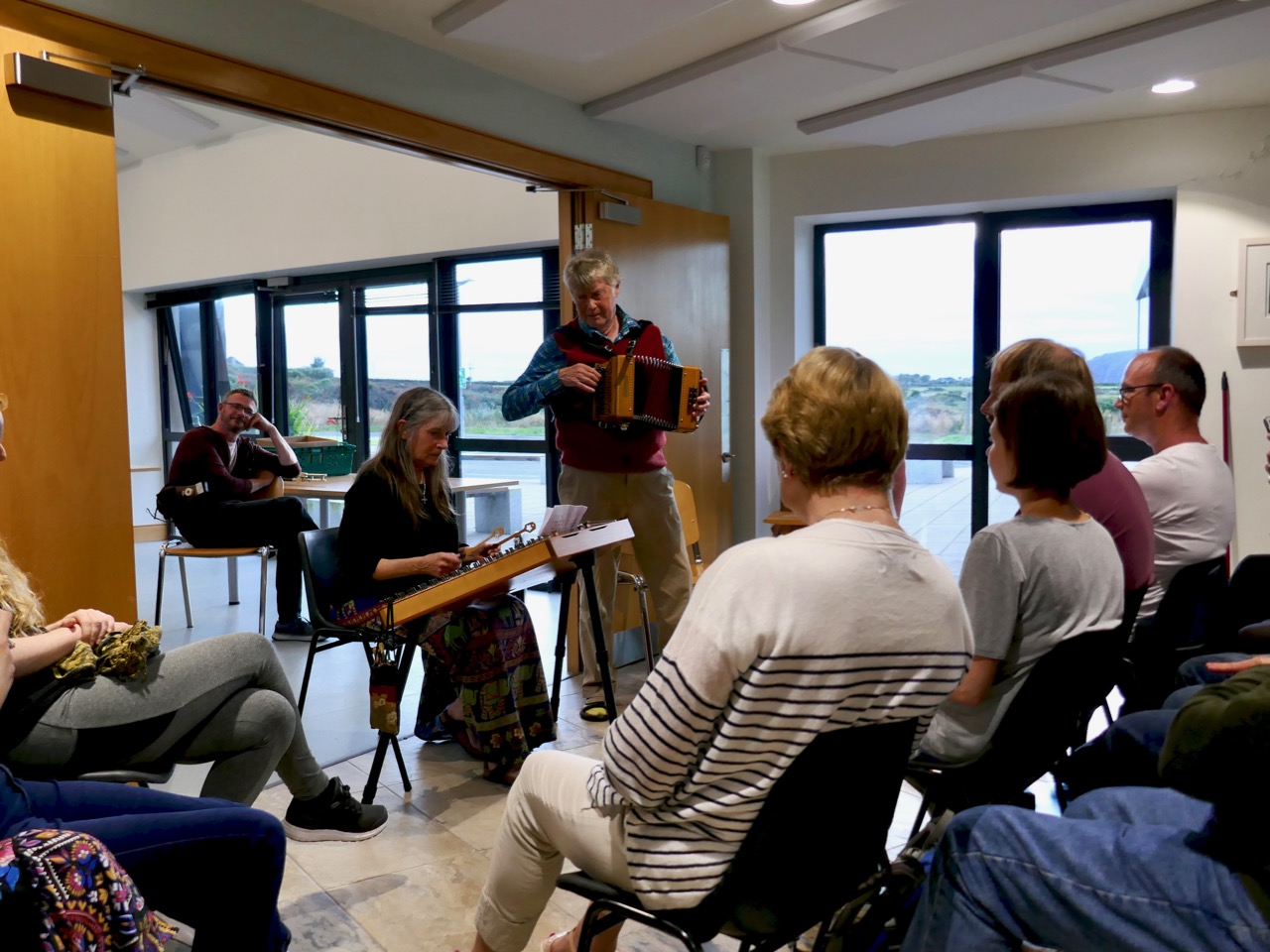
Our course was taxing, and I have the greatest admiration for our múinteoir (teacher), Caitríona Ní Chathail – a wonderful lady of infinite patience, and great enthusiasm for the language which she shared with us throughout the six days. We were allowed some treats – Caitríona took us out on a walk and introduced to us some of the history of the area (kindly, she spoke bilingually); on one evening we were given a talk on archaeology by Isabel Bennet, the very knowledgable curator of the museum in Baile an Fheirtéaraighand on the final evening we combined our various talents to give a concert to all the students, Oíche Airneáin – literally a “night of visiting”, and we each had to introduce ourselves in Irish!

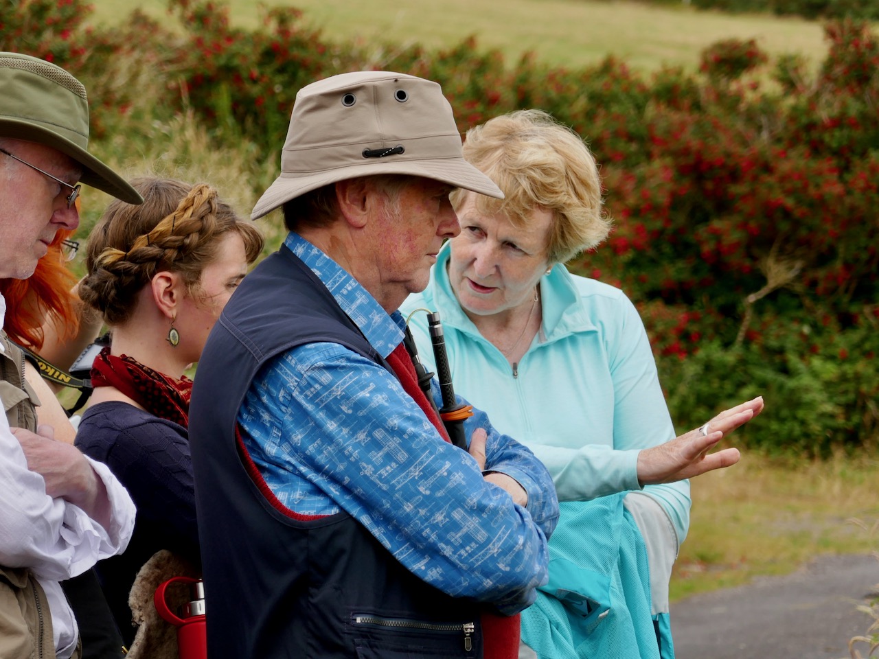
Upper – Caitríona’s history walk around the locality; lower – my contribution to the Oíche Airneáin was some tunes played with Christy Martin on hammered dulcimer. Christy, a fellow student, is a professional travelling musician from California

How do I feel after the course? Exhilarated by the experience of having concentrated for a week on one fundamental aspect of Irish culture, but daunted by the very long path upon which I have embarked – and uncertain as to how to make sure to build on that grounding. One thing that impressed me above all is the obvious passion that the people of Baile an Fheirtéaraigh and Coláistí Chorca Dhuibhne have for their particular Gaeltacht: Caitríona made sure that we realised that the Irish which she taught us is specific to Corca Dhuibhne: each of the Gaeltacht areas has its own dialect, although – whichever version of Irish you learn – you will be understood by speakers from the other areas.

Traditions and stories are abundant in the Corca Dhuibhne Gaeltacht: upper picture – the Wren is hunted on the Peninsula at Stephen’s Day (26 December), and I caught a glimpse of some ‘straws’ hanging behind a door: part of the costumes worn by one of four ‘Wran’ groups who keep the tradition alive in Dingle. Lower picture – two of many gullauns (standing stones) dating from ancient times and which remain in the landscape of the Peninsula: the backdrop is Mount Brandon, named after the 5th century saint – Brendan – who discovered America long before Christopher Columbus!

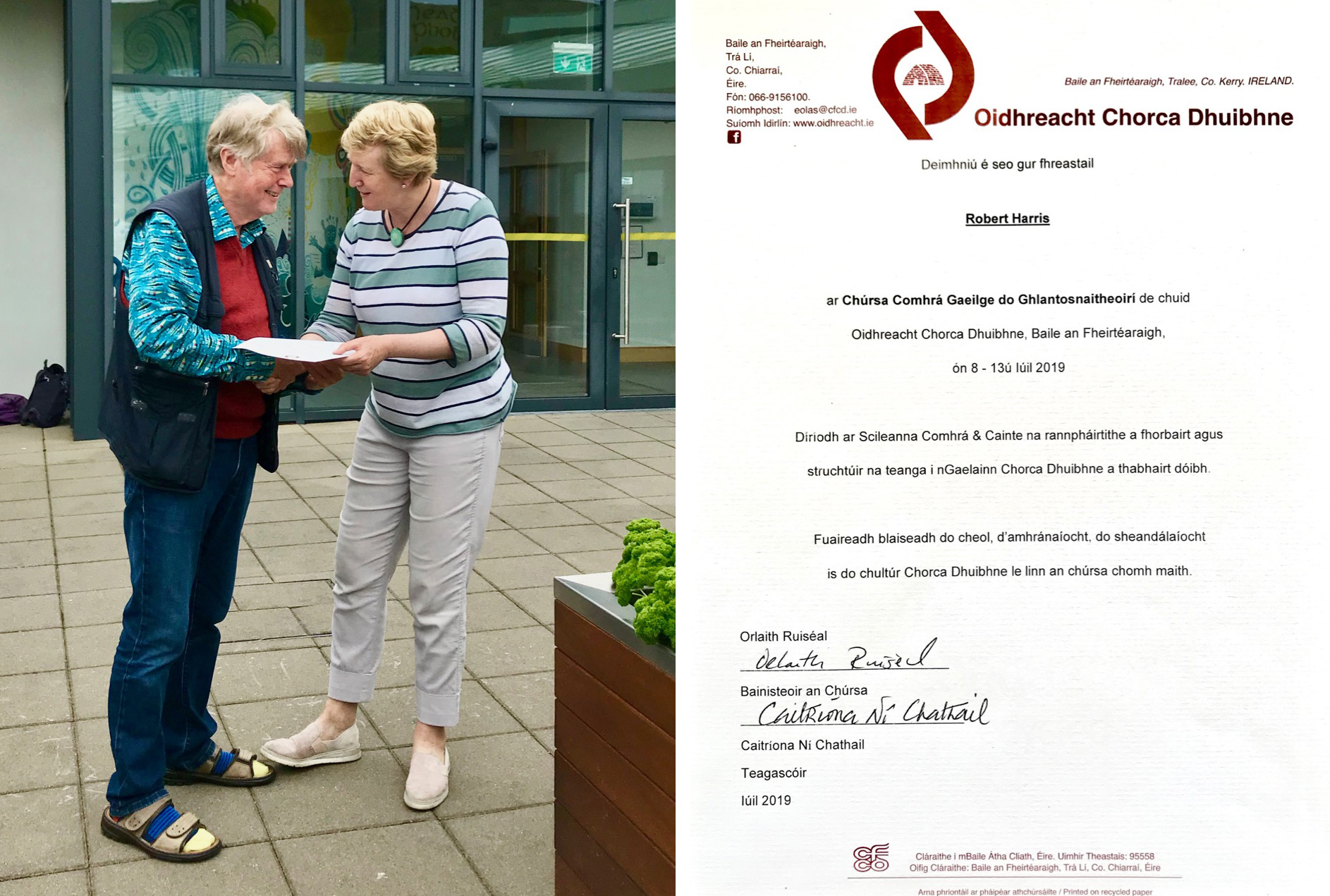
I was pleased to be presented with a certificate by Caitríona at the end of the course! We all had one, and mine will serve as a reminder of the intensive week. Hopefully, it will also serve as an incentive to delve further into the mysteries of Gaeilge. I am already determined to revisit the wonders of Corca Dhuibhne as soon as possible!

A Lost Cross-Inscribed Stone – Found Again!

An exciting discovery by Robert has led us on yet another journey – this time to the Dingle Peninsula in the Early Medieval period. But the journey started in Adare Manor and I don’t think it’s finished yet. Let me explain…

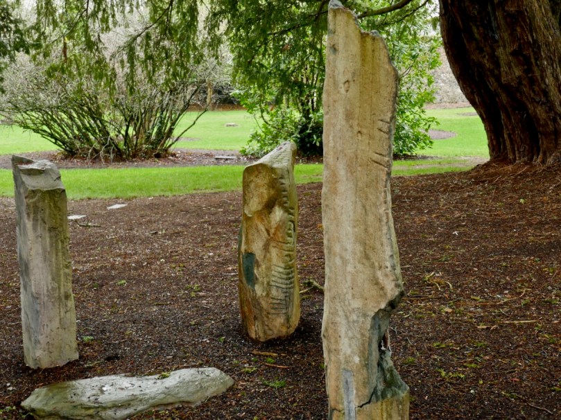
Our Christmas present to each other was a two night stay in Adare Manor – a favourite place full of history. Robert has written about a previous stay there when he was overwhelmed by the Gothic architecture and I wrote about our falconry experience. This time, we spent much time wandering the extensive and beautiful grounds. There’s a small grove of trees between the house and the golf club and this is where the Adare Manor collection of Ogham stones are located. These fine examples of Ogham, all of which came from Co Kerry originally, have been located at the Manor since the early nineteenth century. In recent years the grove has been cleaned up (older photos show it to have been quite overgrown and brambly) and the stones themselves have been straightened and cleaned. (Read more about Ogham in this post from a few years ago by Robert.)

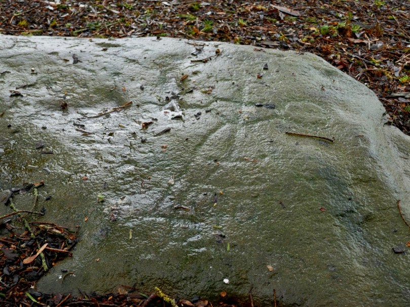
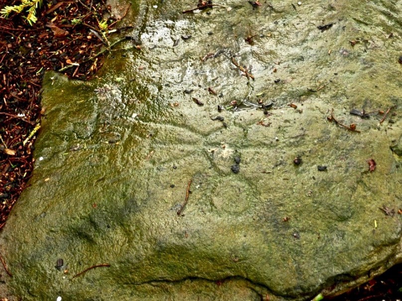
Robert spotted a flat slab lying in the ground among the stones. He has developed a keen eye for anything resembling a carving (remember his find at Inish Beg?) and called me over to look more closely. We took several photographs, trying to get the best light to show up the carvings – a difficult task underneath the trees. It was obviously something, and vaguely reminiscent of Early Medieval (or Early Christian as it used to be called) carvings we had seen elsewhere, but odd and indistinct.

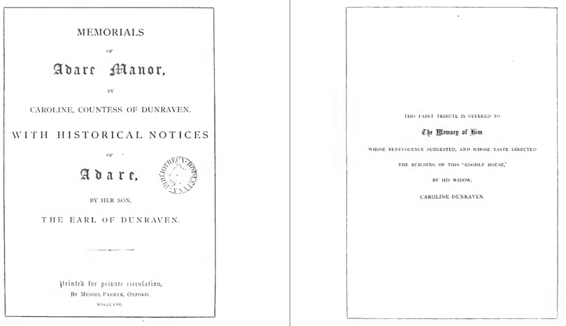
Noting that there was no record of anything except Ogham stones at this location in the National Monuments inventory, I sent photographs to Chris Corlett, an archaeologist with the National Monuments Service and an authority on the Early Medieval period. He responded that he was pretty certain it was from that period and forwarded the correspondence to Caimin O’Brien, the NM archaeologist with responsibility for Limerick. That’s where we started to get some answers. Caimin immediately recognised the carving from an 1865 book!

The book is Memorials of Adare Manor by Caroline, Countess of Dunraven (it’s available online at that amazing resource, archive.org). Caimin sent me a screen print, from which it was obvious that this was the same stone. The Dunravens, like many educated people in the nineteenth century, were interested in antiquities of all sorts. They are referenced here and there as ‘rescuing’ ancient artefacts and stones from damage, and Lady Dunraven goes to some pains to explain that none of the pieces that ended up in the museum at Adare Manor were in situ when they were acquired.

Four cross-inscribed stones are described in the book, all of which came from the Dingle Peninsula in West Kerry, or Corca Dhuibhne, from the area around Ballyferriter, west of Dingle. It’s an area that is unusually rich in Early Medieval sites – Reask, Gallarus and Kilmalkader are only three of the well known monastic ruins. Of those four stones, three are now back in West Kerry and on display. Until we found it, however, nobody had any idea what had happened to the fourth stone!

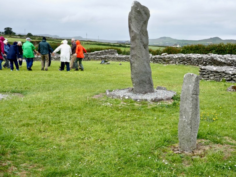
Imaged above and below are the cross-inscribed pillar that came from Reask in the early 1800s – and returned there in the 1970s

The late Tom Fanning excavated the Reask site (Riasc, in Irish) in the 70s and it is now a monument in state care, carefully reconstructed to suggest what an early monastic site would have looked like. One of the Adare stones had come from Reask and it was sent back to the reconstructed site “. . .through the kind offices of Lord and Lady Dunraven.” My photographs are below, but if you want to see it in 3D, click here.

A group of Americans were enacted some kind of ritual at the Reask monastic site when I was there. There was a lot of shouting about darkness and light and and dancing in a circle

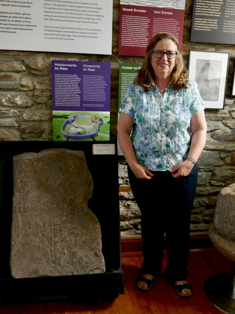
Two others of the original four also arrived back in West Kerry and are both now at the Músaem Corca Dhuibhne in Ballyferriter, under the knowledgeable care of Isabel Bennett, the curator, pictured below with the second cross-inscribed stone). I am assuming that the stones were returned at the same time as the pillar now at Reask. Isabel has poured over all the available documentation but, like me, she can’t quite figure out when or why the transfers were made.

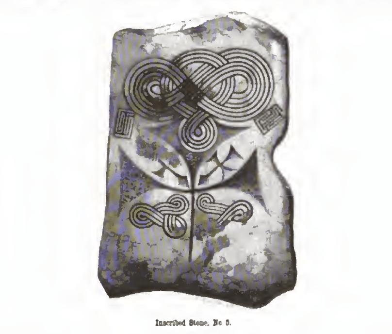
The more elaborate of the two came from Reask, but may have been considered too worn to be displayed outdoors. I give Lady Dunraven’s drawing below (although I am not sure who actually did the drawings – it may have been our old friend George Victor du Noyer). You can view a 3d rendering here.

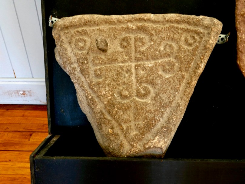
The smallest of the stones (below) is triangular in shape and came originally from the townland of Killvickadownig, a few kilometres south of Reask, near Ventry. There’s a faint carving of a cross on the back, but the front bears a lovely four-armed cross with curled ends. The stone appears to have been detached or broken off from something else.

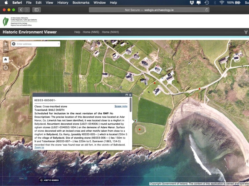
But our piece, the Adare Manor cross-inscribed stone, where did it come from and why is it, alone of the four, still at Adare? Well, it appears from Lady Dunraven’s account that the stone came from Ballydavid (Baile Daith), not too far from the other stones, and ‘close to a ringfort.’ Caimin has now uploaded the record (screenshot below) with a provisional original location near the only ringfort in Ballydavid, but noting of course that the stone is located in Adare Manor.

I can find no explanation as to why this stone was left at Adare Manor when the others were moved. It seems that the Reask pillar was located among the Ogham stones also, while the other two may have been indoors. Perhaps our Ballydavid slab was covered in moss and brambles to the extent that it was simply overlooked. Whatever the reason, I am glad to have been part of the rediscovery of this curious stone. I never cease to be amazed at the variety of forms these early cross slabs take, and this one is certainly unusual. While a cross shape forms the upper core of the carving, the central part reminds me of the monks’ habits that you see on occasional high crosses, such as the ones at Kilfenora. But what about all those squiggles at the bottom? I can make no sense of them.

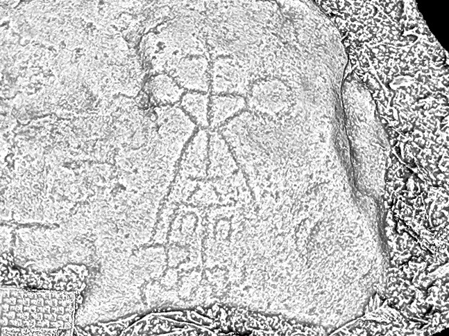
Nick Hogan of the Dept of Archaeology at University College Cork had graciously taken the images I sent and turned them into a 3D rendering: the image below is a still from that process. My photogrammetry skills need refining but he still managed to create an image that is clearer than any photograph.

A close-up of the carved area. The grid at bottom left is part of a scale-arrow

There are still unanswered questions in this story, but the biggest unanswered question – Where is the fourth stone? – has at least been answered.

Still from a 3D render of the cross-inscribed stone

It’s been a fascinating bit of detective work to piece the story together and many people have contributed their expertise generously, particularly Chris Corlett, Caimin O’Brien, Nick Hogan and Isabel Bennet, while Sarah Ormston of the Adare Manor Hotel facilitated our access to the slab for recording purposes. Our thanks to all of them.

Industrial Archaeology in Crookhaven

Roaringwater Journal has featured Crookhaven many times. This far south-western outpost of Ireland has layers of history: thousands of years ago people lived in this area and made marks on the rocky landscape while countless generations of seafarers forged a ‘haven’ from the naturally sheltered ‘crook’ of land upon which the settlement is based. Even into the twentieth century pioneering technological advances were being made in Crookhaven: in the early 1900s Marconi sent some of the world’s earliest radio communications from Brow Head to vessels in the Atlantic shipping lanes.

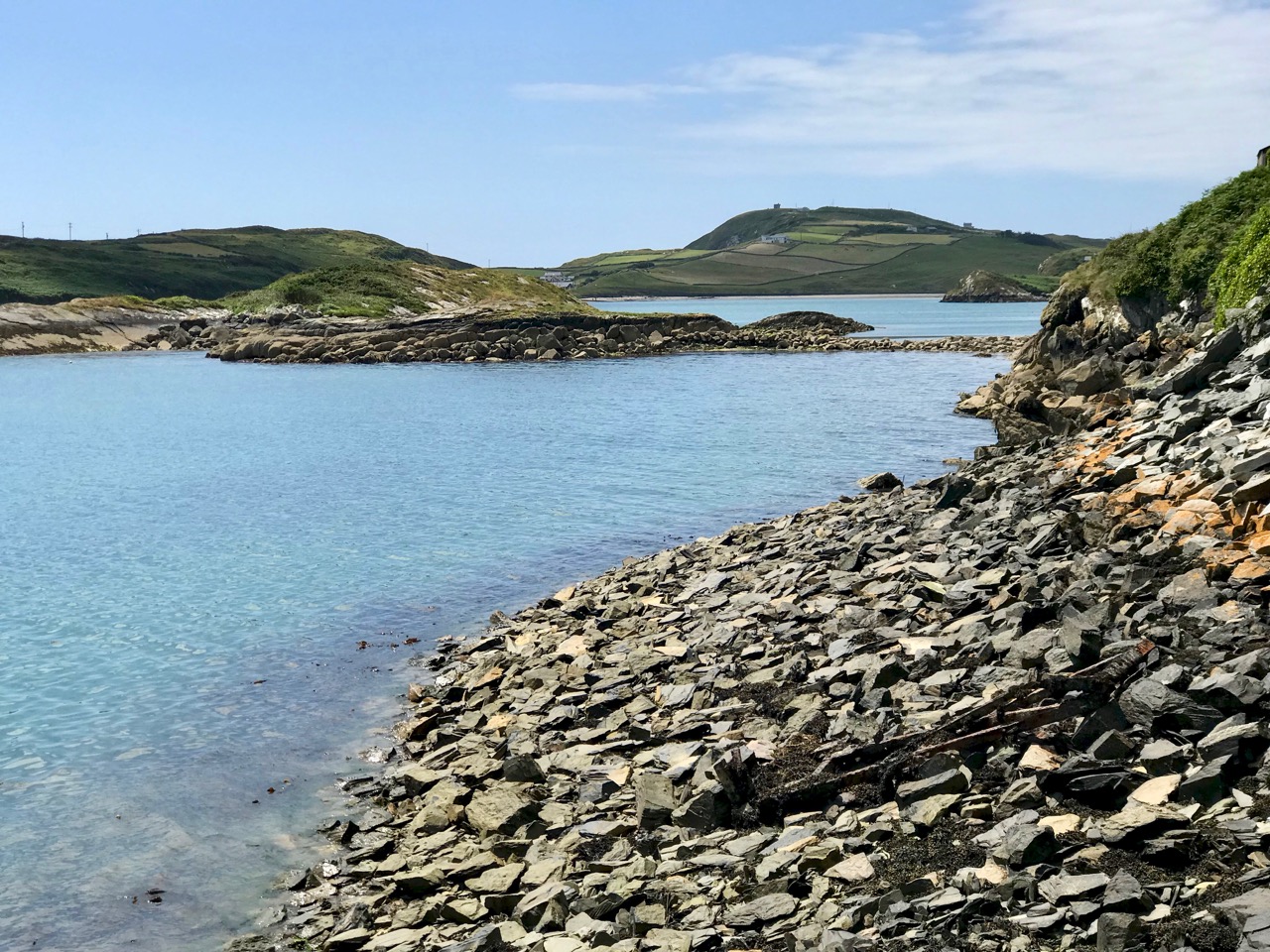
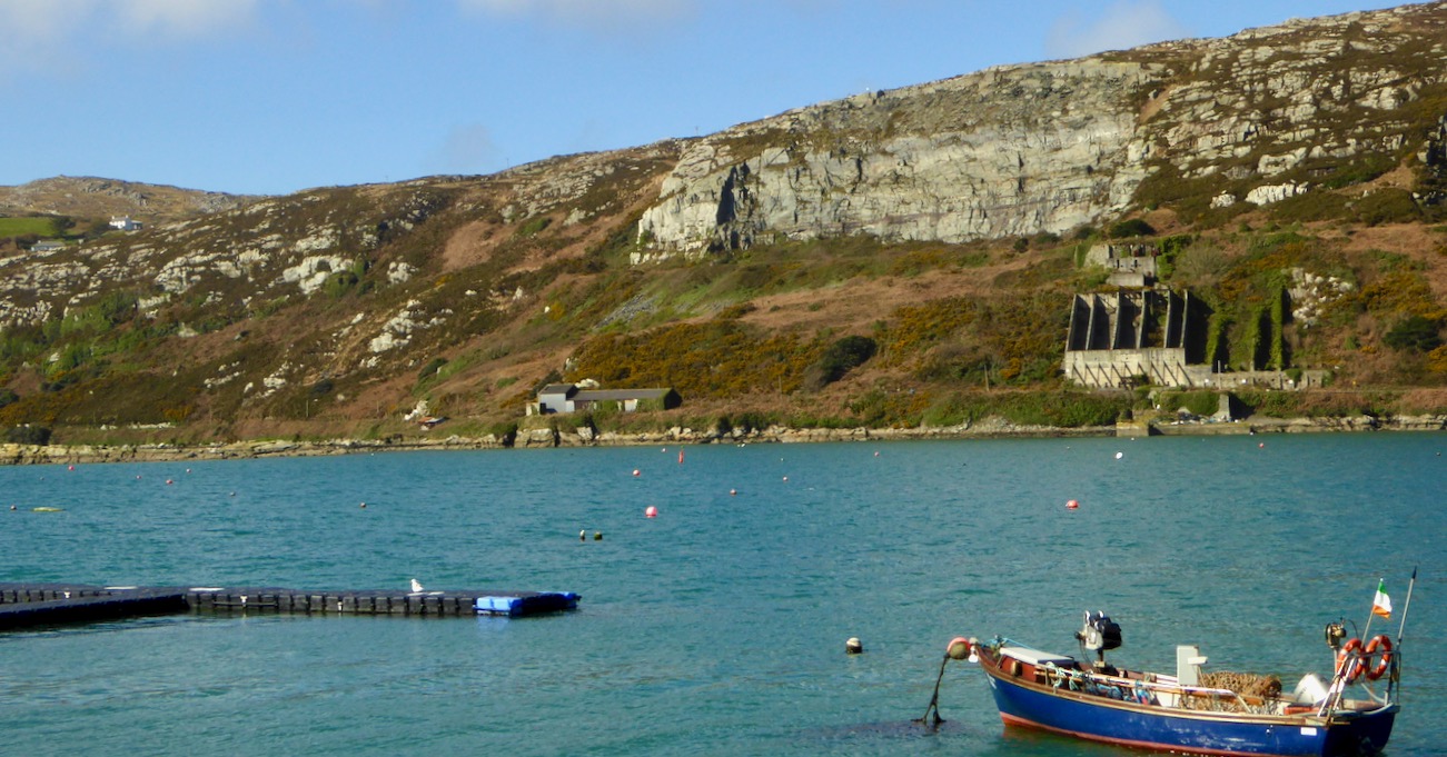
Header – the ‘old quarry’ dominates the landscape to the north of Crookhaven Harbour. Above – looking across the harbour from the ‘quarry quay’ towards Brow Head, one of the scenes of operation of Marconi in Ireland

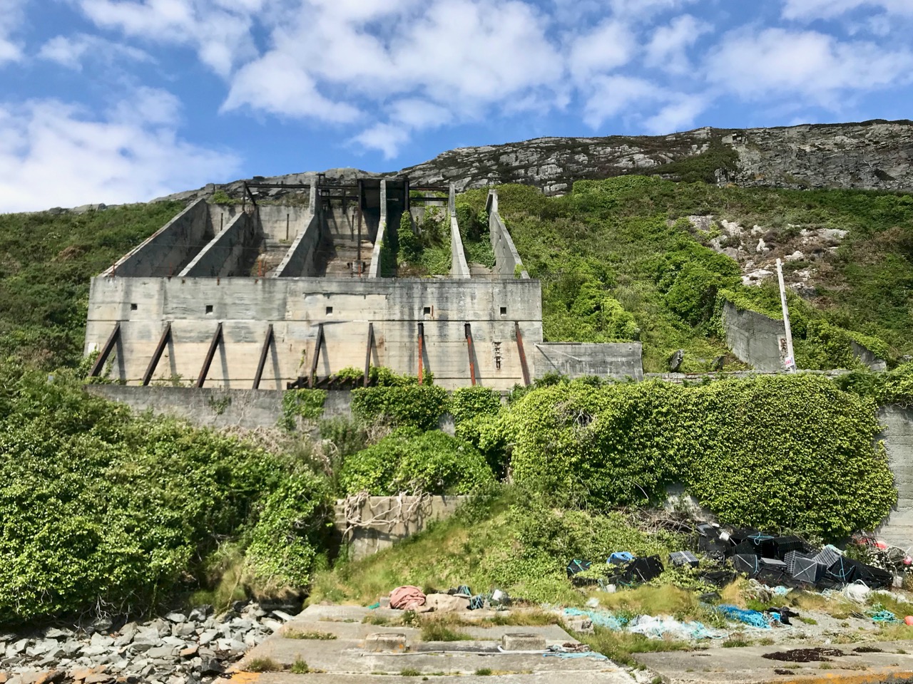
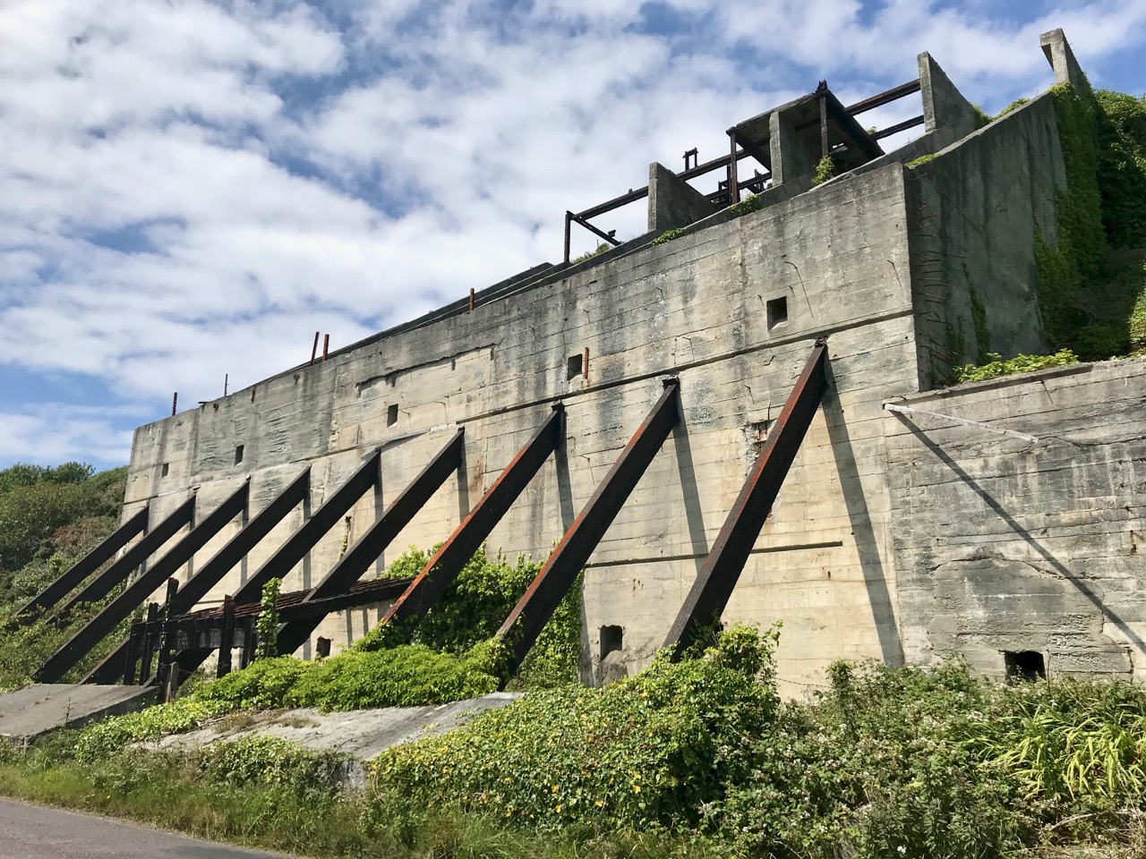
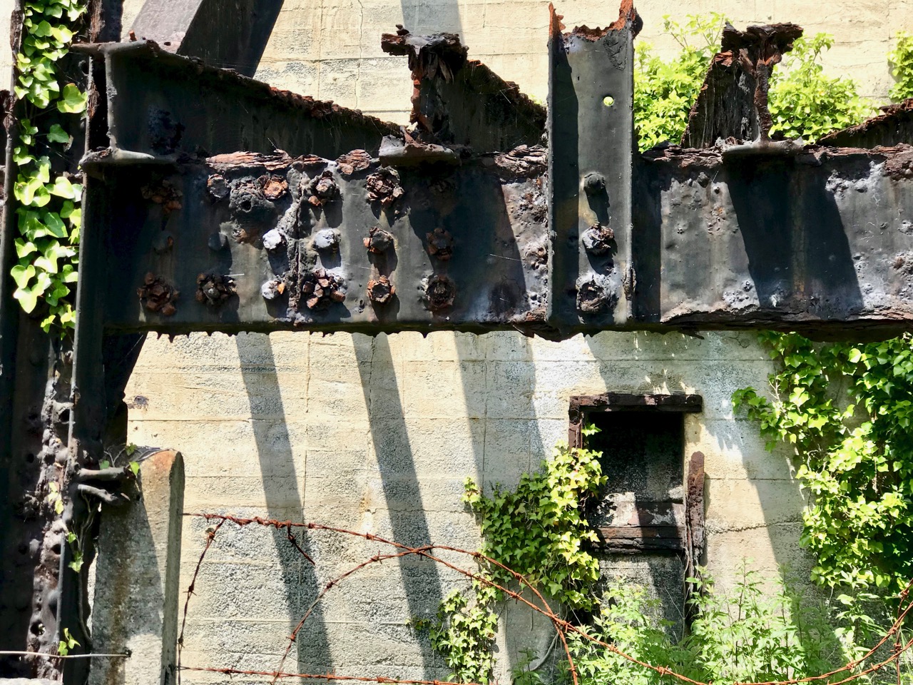
I am fascinated by all traces of industrial history: for me it’s ‘modern archaeology’: some of it might survive long enough to puzzle historians of the far future. I couldn’t ignore, therefore, the huge steel and concrete structures which line the R591 road which approaches Crookhaven when travelling from Goleen. They are built into the hillside above the road, and tie in with a substantial stone quay which has been constructed below it.

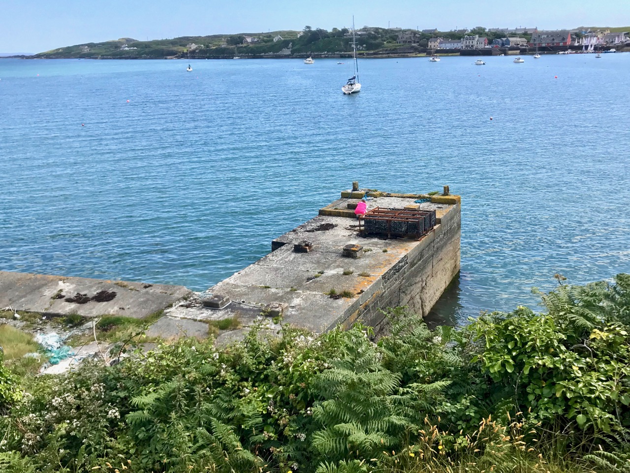
The quay which was presumably built to serve the quarry to the north of Crookhaven: the village can be seen across the water

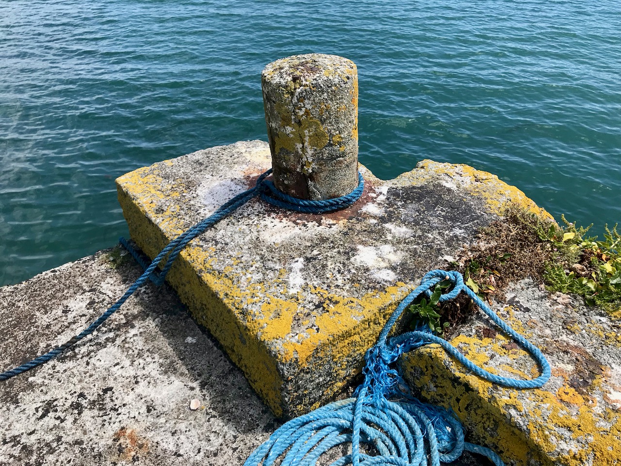
Looking at the construction of this quay, and particularly the wear on the masonry steps leading down to the water, it would be reasonable to assume that the quay predates the concrete and steel structures which abut the road above it – by a long way. You might suppose that such significant edifices would have a history attached to them which would be easy to find, either from local informants, or in written or electronic record. However, I have so far drawn a blank. Well – not quite: there are countless identical references in contemporary accounts of Crookhaven to ‘…the old roadstone quarry on the side of the mountain, which provided metalling for the roads of Wales until 1945…’ I did find one variant, a caption to a general view of the area: ‘…Looking up to the roadstone quarry along the north shore of Crookhaven Harbour. The quarry was a source of gravel for Welsh tarred gravel roads until the 1930s…’

The quay below the ‘roadstone quarry’ is a paradise for industrial archaeologists and photographers! It must have had generations of users, up to fairly recent times, all of whom have left behind traces of their presence, but no solid history. I’m hopeful that readers of this post might be stirred to recall stories or memories – or even point me to some documented history to explain the provenance of this little piece of the complex West Cork jigsaw. *In fact, I have received information since this post was published – see the last paragraph.

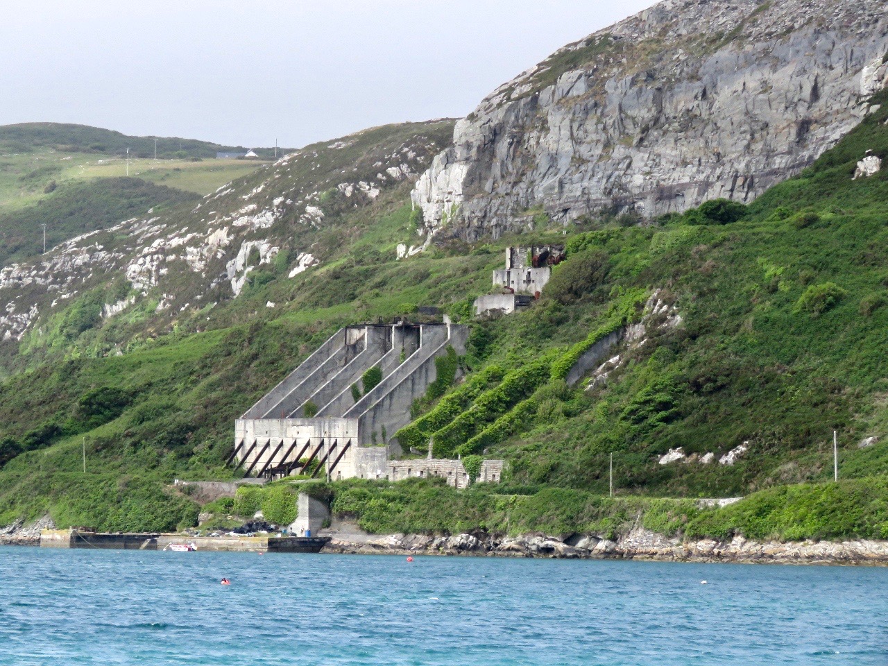
I’m borrowing this photograph of the Crookhaven quarry from the log of the MV Dirona, with thanks to Jennifer and James Hamilton, who hail from Victoria, British Columbia and are currently cruising the world in their Nordhaven 5263 vessel. They explored the south west coast of Ireland in June 2017 and, from the water, took this perfect view of the quay, the ‘roadstone quarry’ and the mountain face above it, from which the stone has been extracted. The rock face could have been worked for stone before the 20th century, although we don’t have hard evidence for this: in September 1846 a road was proposed between Rock island and Crookhaven, and the county surveyor provided an estimate of £1,857. Prior to this, the road which had been built by Richard Griffith, civil engineer for Munster, extended as far as Rock Island, and passage from there to Crookhaven itself could only be made by water. The 1846 road is today the R591 which passes below the quarry. It would be reasonable to suppose that locally available stone suitable for roadmaking could have been used, and the quarry may have had its origins at this time. The construction of the adjacent quay could have been contemporary with this early use of the quarry, but the huge concrete and steel structures we see today are certainly an incarnation of the quarry workings in the early 20th century.

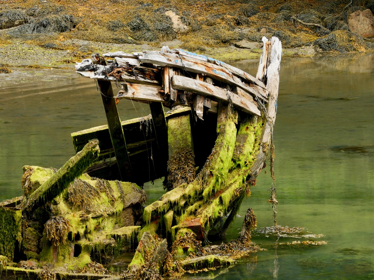
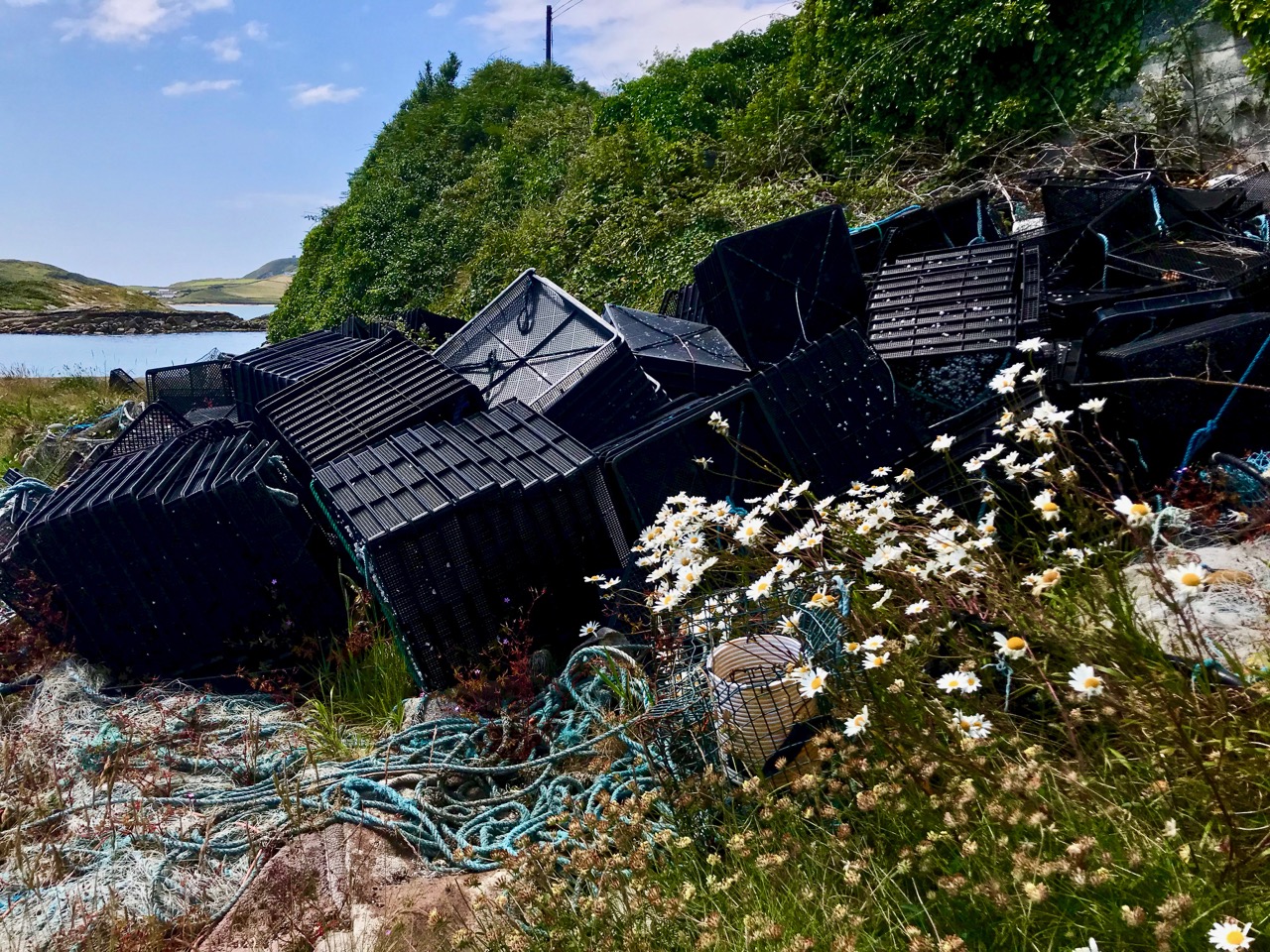
One of the fascinations of old industrial sites is the way they are taken over by nature if left relatively undisturbed. This one is no exception. There is a monumentality here which is being eroded and softened as time goes by. What does the future hold? Interestingly a -presumably serious – proposal was made in a not-too-long-ago iteration of the Goleen & District Community Council Development Plan:

PROPOSALS

2.24 The old roadstone quarry-works at Crookhaven Harbour should be developed as an amenity – perhaps a hotel with a restaurant with observation deck at the top…

Hmmm… notions of grandeur there, perhaps – and little regard for practicalities, but it shows the power of imagination! I think it’s far more likely that the area will remain in its present state for many years to come and, perhaps, attract a level of ‘industrial architecture tourism’. Incidentally, it’s not too far away from the site of a fish palace run by William Hull and the Great Earl of Cork in the early seventeenth century: the remains of this are there to see to this day, although almost entirely returned to nature.

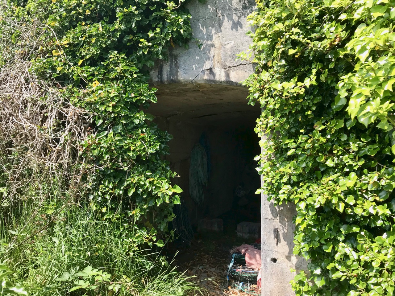
Below – a now impassable tunnel under the road connects the quarry workings with the quay; nature entangled with the leftovers of human activity

NOTE: in 2020 our friend, local historian and expert photographer John D’Alton of Schull has contacted Roaringwater Journal with some updated information about the Crookhaven quarry. John tells us that the quarry was never owned by the Roadstone Company. That was incorporated in 1949 by the Roche brothers who operated out of Dublin from the 1930s, but never operating this far south and west. John also adds that the company that operated the Crookhaven quarry was the Browhead Granite Company Limited, incorporated in London in 1917. The quarry opened for business in 1928 and closed in September 1939. It was this company that contracted for the construction of the impressive structure still there today. The company exported stone to various ports in England in particular, London especially, and Ipswich, among others, supplying stone for road surfaces. The Granite company was a successor to the Browhead Copper Mining Company that despaired of finding copper in mineable quantities in far West Cork. Interestingly, the structure is one of the earliest examples of this type of reinforced concrete construction in the country, the original Mizen (Cloughan Island) Bridge being another.

Many Thanks, John, for finding and sharing such detailed information which has been lacking until now!

Endpiece – the old workings and quay are directly opposite the centre of Crookhaven – here’s a view towards the quarry from the village:

Archaeology, Art and Architecture at the Blasket Centre

Funny how you see different things every time you visit special places. The last time we were at The Blasket Centre on the Dingle Peninsula, a couple of years ago, I immersed myself in the stories of the writers and the Island way of life, which is, after all, the focus of the exhibitions. Given that a visit to the Island itself can be difficult, calling for fine weather conditions, the exhibition is very well done and illustrates well the hardships and perils faced by Island people, as well as their depths of warmth, poetic language, stories and daily tasks. This time, I was equally struck by the building itself, and by the art at its core.

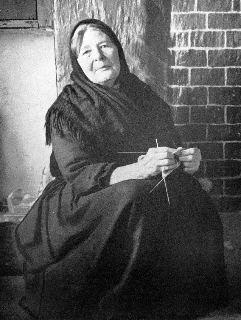
An Muircheartach’s photograph of Peig Sayers, one of the Island writers and the bane of many a struggling Irish Language student (hand up!) forced to study her stories

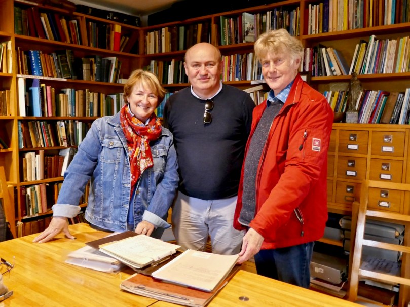
We had a particular reason for going there last month. Readers will remember my post about Lee Snodgrass, a respected and loved local archaeologist. She and her partner, Paddy O’Leary, had undertaken an archaeological survey of the Blaskets in the 1980s, and their original papers, notes and photographs were still among her possessions. With the blessing of her family, I arranged to deliver them to the Blasket Centre, and that happened last month.

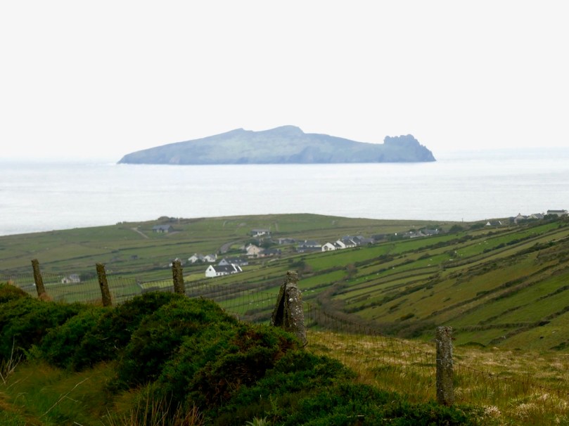
One of the Blasket Island, Inish Tuaisceart, know as An Fear Marbh, The Dead Man, for its distinctive shape

We were welcomed by the Director, Lorcán Ó Cinnéide (below). He was genuinely delighted to receive this package, since it contained information on all the Blasket Islands and not just the Great Blasket, which has naturally received most attentions. The materials will now be catalogued and go into the Centre’s extensive archive, which is available to study on application.

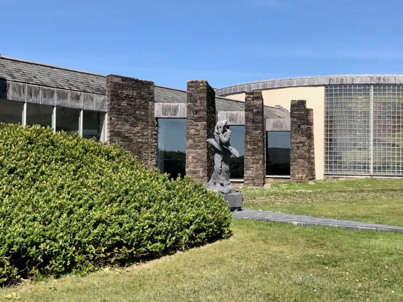
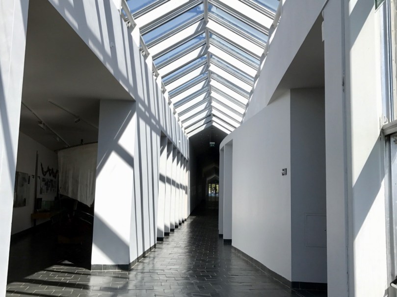
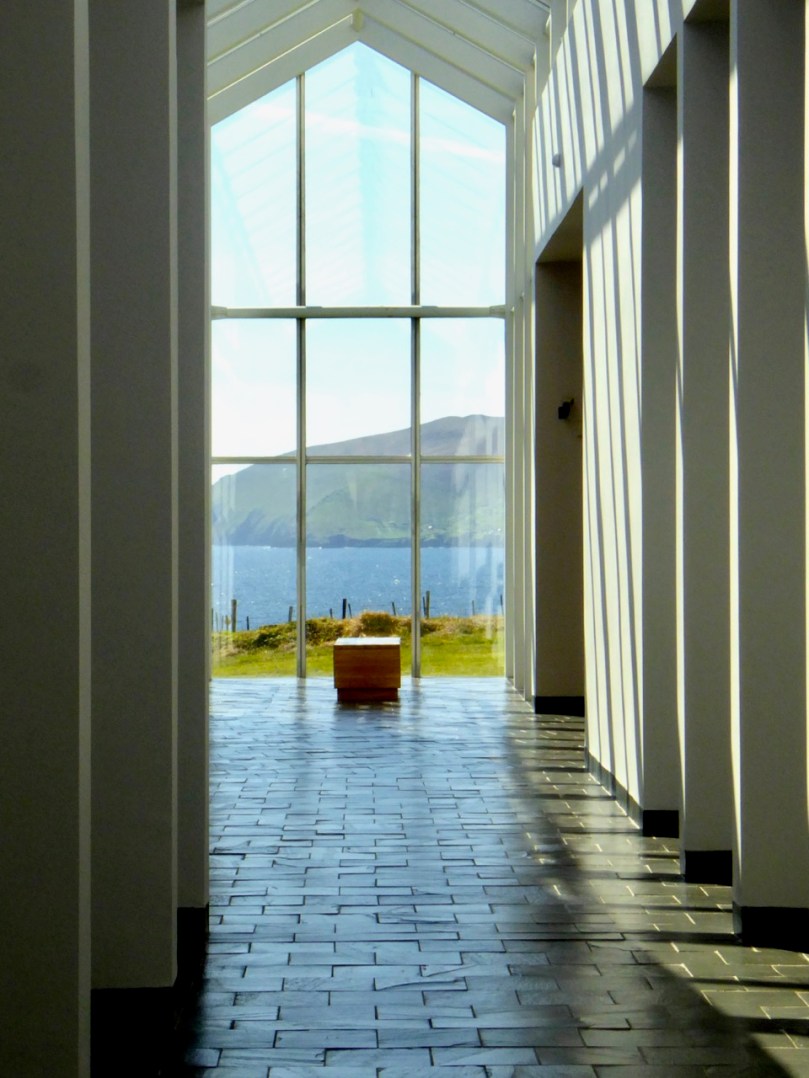
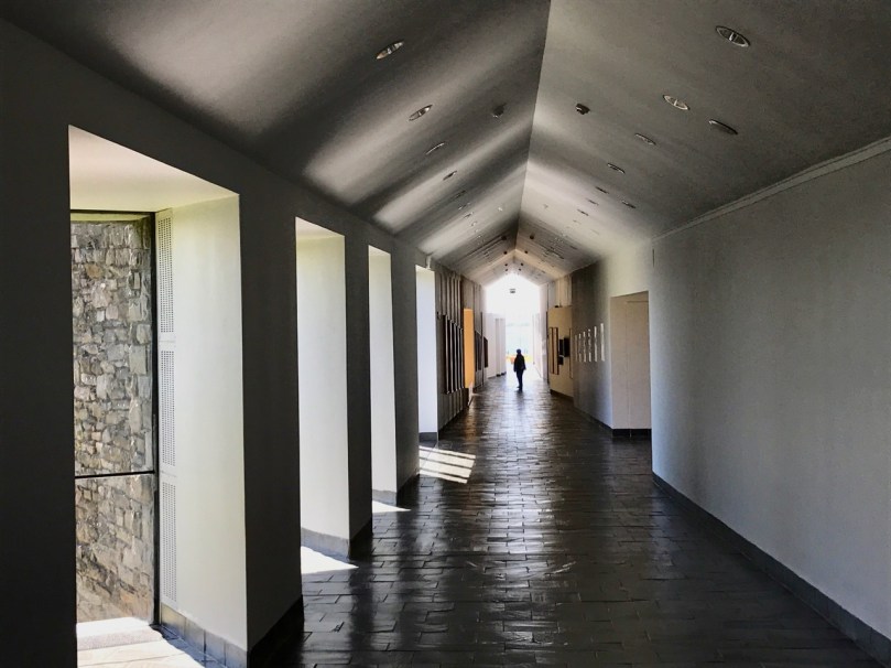
That pleasant task done, we had time for a wander around the Centre and a closer look at the architecture and the art. Robert, a modernist, was very impressed with the design of the building, opened in 1993. All the exhibits inhabit pods off a long central corridor which leads the eye down to a huge end window with a view of the Great Blasket. In this way, it reminded us of the Lexicon Library in Dun Laoghaire, although that’s a much larger building.

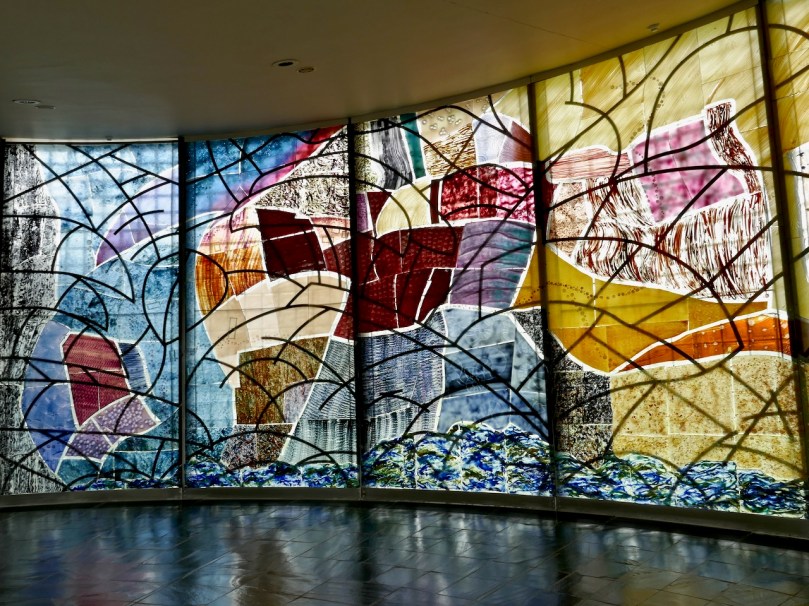
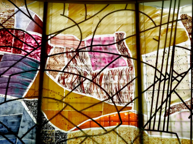
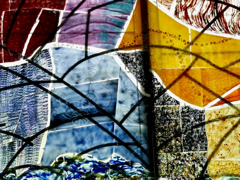
The reception area is circular and contains a striking, enormous and very beautiful glass installation by the artist Róisín de Buitléar, in collaboration with Salah Kawala.

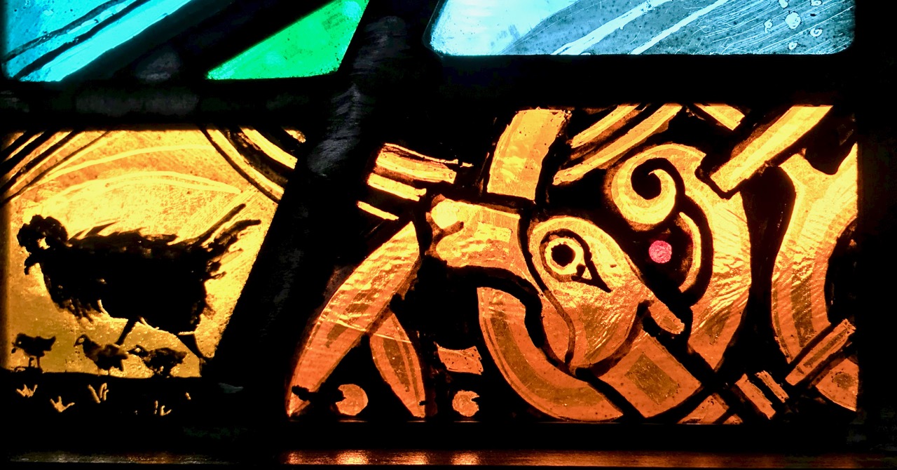
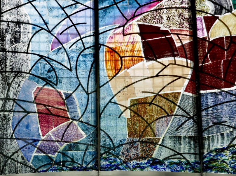
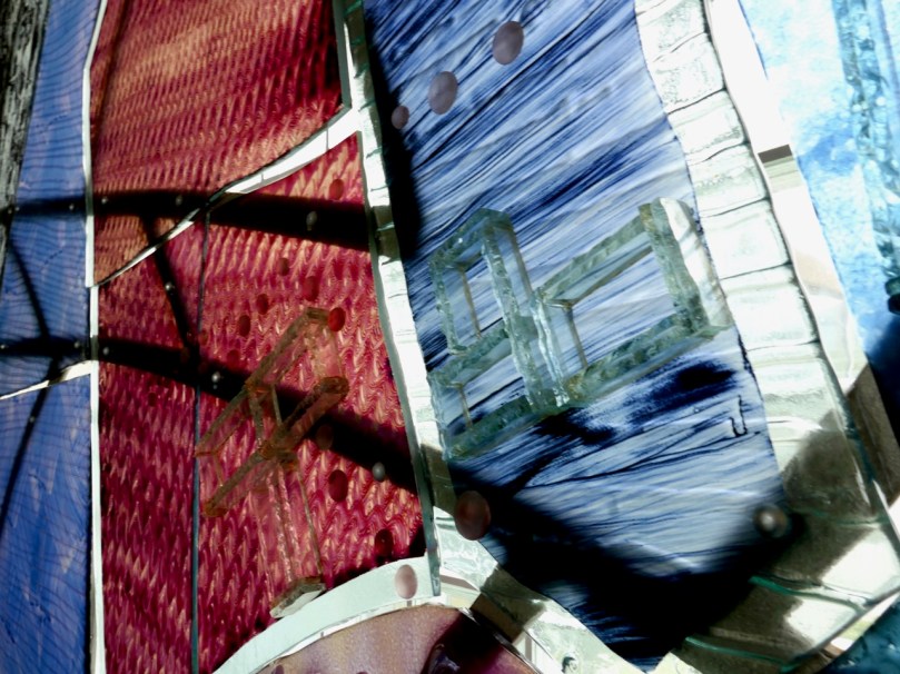
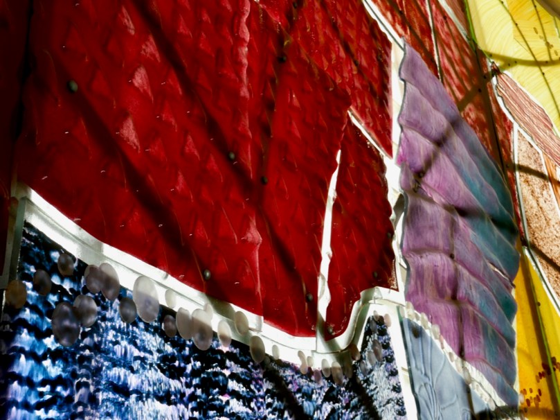
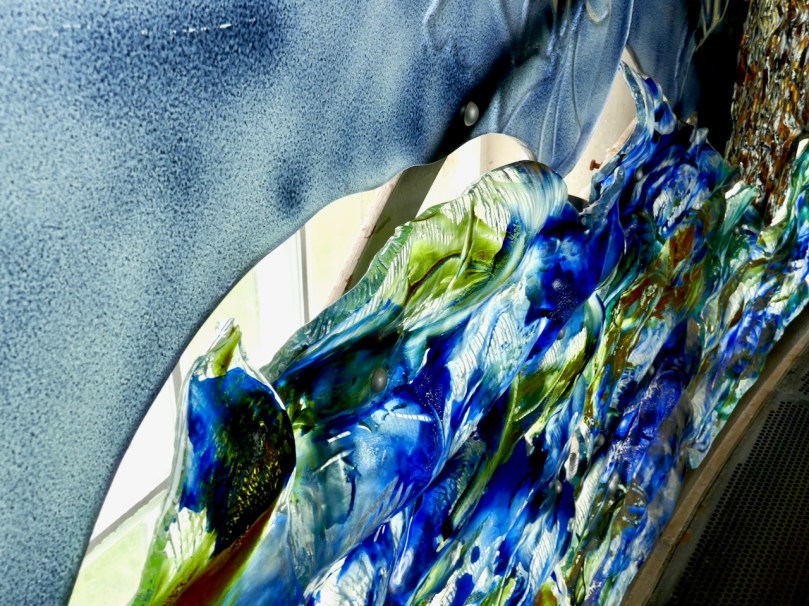
This is not stained glass per se: a plaque explains the process: The panel is composed of over three hundred pieces of plate or window glass. They were each painted with enamel which was then baked into the surface. To complete the process, each piece was textured by melting it in a special kiln in a process known as ‘slumping’, Three and half tons of glass and three tons of steel have been used. It took almost a year to make.

The piece depicts Island life, based on de Buitléar’s extensive research. The steel framework is used imaginatively to form the shape of the currachs, or naomhógs (pronounced nave-ogues) as they are called in West Kerry on one end of the panel (above), and of oars leaning against a wall on the other end (below).

In between are the houses (rectangles of glass superimposed on the panel, above), the fields, and the meandering paths (the glass dots) that the Islanders took to the sea, to the fields and to each other’s houses. De Buitléar explains: Each field is given a colour and texture and some contain symbols associated with them. These include corn stooks and fossil markings, while others are inspired by the texture of bog plants, turf sods, cliffs, the beach and the sea.

As our readers know, I look at a lot of stained glass, but I have never before seen a glass and steel art installation quite like this. Using thoroughly modern technology, but age-old techniques, de Buitléar has depicted Island life in a sumptuously colourful and jaw-droppingly beautiful artwork which greets visitors and sets the tone for what is to come. Gazing at it, and listening to the soft cadences of staff members speaking in Irish behind me, I was transported.

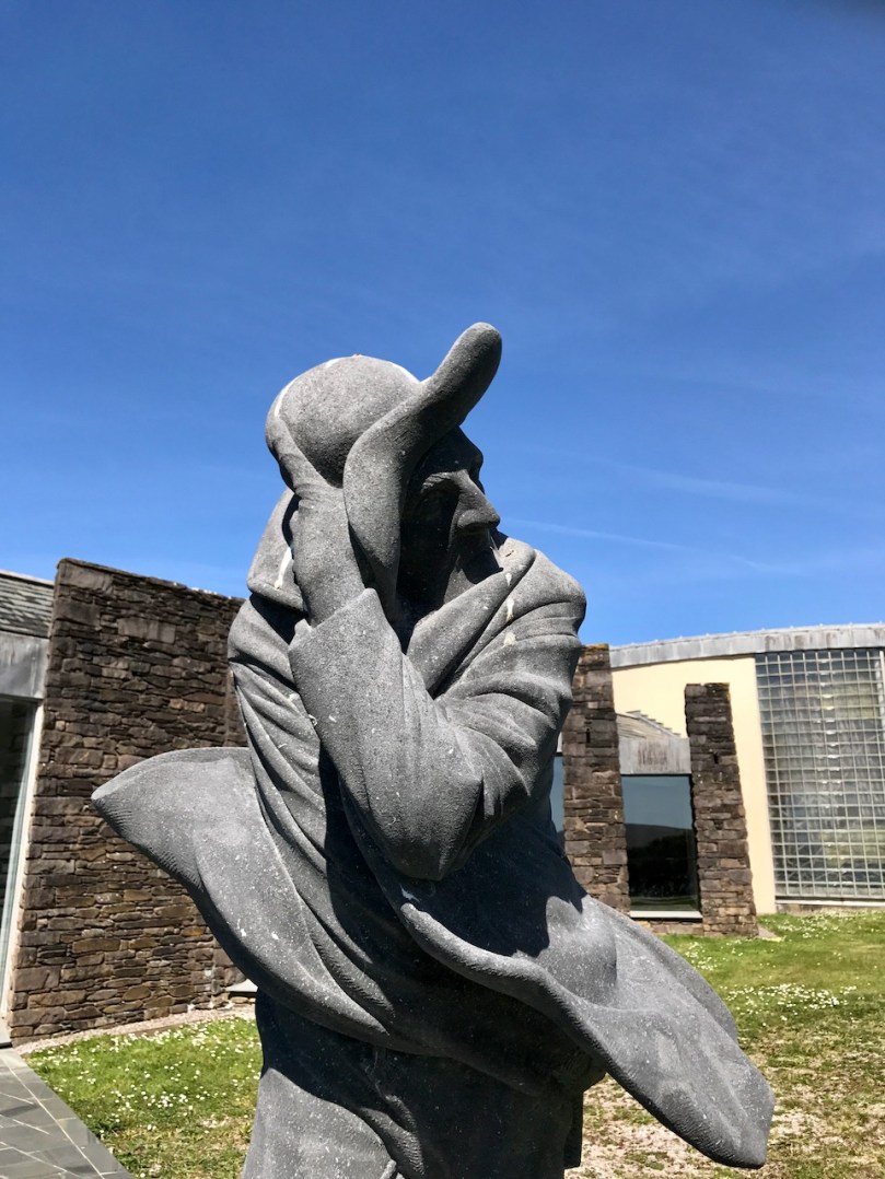
There are several more pieces of art in the Centre, but I will make special mention of just one, located outside. Here we find Michael Quane’s Islandman. An t-Oileanách (The Islandman) by Tomás Ó Criomhthain was published in 1929 and is a classic of Irish literature. Whether or not it is a great book is a matter of some debate (see this Irish Times review, for example) but it is certainly an important one.

Quane’s piece shows Tomás braced against the wind – a wonderful, human take on a true man of the outdoors. Michael Quane, by the way, has featured in Roaringwater Journal before – take a look at this post by Robert.

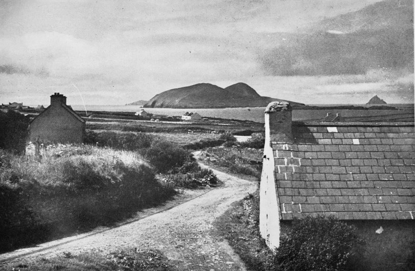
Ó Croimhthain (Prononouced O Cruh-han) is buried nearby – within sight, indeed of the Blasket Centre and his statue. Here is An Muircheartach’s photograph of his final burial place with the Great Blasket as the backdrop. The text that accompanies this photograph says (my translation): Go Farraige Síos: Down to the Sea. The Blaskets lying out there quietly in the sea, The Tiaracht Lighhouse on its right side, the Old Dunquin Graveyard directly on your left if you were standing there, and the man who made Blasket life famous, Tomás Ó Criomhthain, lying in it waiting for eternity.

The Blasket Centre is a full sensory experience. I have only touched on small aspects in this post. You must see it for yourself. Of course, if you can get out to it – don’t forget a trip to the Great Blasket itself. We hope to do this ourselves this year so look out for that post.


Off the M8 – Kilree Monastic Site

Kilree is possibly the most perfectly contained and atmospheric site you will visit in Ireland. I defy you not to be enchanted with its leafy depths, its air of antiquity, and evidence of continued use. (I would also vote for Monaincha in Tipperary, a site that deserves its own post one of these days).

When you’re travelling from Cork to Dublin it’s easy to leave the M8 at Cahir and travel cross-country to join the M9. There are numerous sites to visit if you take this option: most recently we have written about Fethard and its Medieval Walls, but we also did a post about Kells Priory a long time ago (The Hallowed Fortress) and it remains one of our favourite sites and one of the most impressive monastic sites in Ireland. And don’t go without your copy of Ireland’s Ancient East by Neil Jackman – it’s our constant companion and a great resource. It’s available on Amazon but why not patronise your favourite bookstore?

Kells Priory, just up the road from Kilree and one of Ireland’s most impressive religious complexes

It’s a great contrast to Kilree. If you haven’t been to Kells Priory yet, try to take them both in, in the same day. What you will see is a typical example of an Early Medieval Irish monastic site (Kilree) and an excellent example of a large 12th to fifteenth century Augustinian Priory built to withstand the turbulent history of Kilkenny in those centuries. The monks in Kilree were living the life of Irish monastics in a pattern set down in the 6th century, while the Augustinians were mainstream European clerics invited over by the Normans.

Inside Kells Priory

The other things about Kilree is that it’s unspoiled (except for one thing – I’ll get to that later) and in Ireland, that means that the farmer who owns the land is using it. There’s a Bull sign on the gate and indeed there he was, with all his frisky bullock friends. We thought our chances of crossing the field were slim, but two friendly ladies on horseback offered to draw the attention of the cattle away from us so off we dashed while they were distracted, not giving much thought to how we might get back again.

Having charged off down the field after the horses (which were on the other side of the hedge) the bullocks, followed at a dignified pace by the bull) ended up beside the high cross so we decided to leave well enough alone and not venture over to that quarter. A distant shot will have to suffice for this post, but you can see excellent images of this cross at the Irish High Crosses website, and we thank them for that since this is the closest we will get for the moment.

But there was so much to see within the monastic enclosure. First, the round tower – it is missing its conical cap but apart from that it’s complete and in good shape. Brian Lalor, in his book The Irish Round Tower, assigns it an 11th century date based partly on the simple doorway. The arch, he points out, has been cut from the soffit of a monolithic lintel which is now cracked.

Crenellations were added to the top in later medieval times (you can see them in the first image) – the tower must have been renovated for some kind of defensive purpose at that time. When the Ordnance Survey folks came around in 1839 it was possible to climb to the top by means of rope ladders. There is no access now, apart from by the rooks and crows who have left evidence of their prodigious nest-building.

Lalor also points out that the round tower is perched on the circular boundary wall of an old churchyard which probably represents the position of the inner rampart of the monastic enclosure. What did such a monastic enclosure look like? I’ve used an illustration from a marvellous book called The Modern Traveller to the Early Irish Church, by Kathleen Hughes and Ann Hamlin (second edition, Four Courts Press, 1997). The site illustrated (Nendrum, County Down) was enclosed by three circular walls, a not-unusual configuration although one and two enclosing walls are also found. There is no real evidence left at Kilree for a second or third wall, but the location of the high cross indicates the likelihood of an outer wall.

The church is of an early form, rectangular, with antae at either end. To understand how this fits in with the architecture of the period, see my post Irish Romanesque – an Introduction. The nave, or main part of the church probably dates to the 10th or 11th century, but a chancel was added later, probably in the 12th century, by means of an inexpert Romanesque arch, which eventually had to be shored up with an even more awkward-looking inner arch.

Upper: East wall with buttresses added in 1945; Lower: The earlier Romanesque arch is clearly visible above the later one

The whole place was repaired by the Office of Public Works in the 1940s and it was they who built the buttresses which have successfully kept the east wall from falling down.

Upper: Looking through the linteled doorway into the nave and the chancel beyond; Lower: Looking towards the nave from the chancel. The chest tomb is on the right

There are several thirteenth to fifteenth century cross slabs within the church but the seventeenth century chest tomb just inside the chancel is the most interesting.

It’s hard to decipher as it’s faded and covered in lichen, but here is the description of it taken from the National Monuments listing:

Latin inscription, in a margin around the edge of the upper slab, was transcribed by Carrigan as, ‘Hic jacet Dns. Richardus Comerford quondam de Danginmore qui obit [date left uncut] et Dna Joanna St. Leger uxor eis pia hospitalis et admodum in omnes misericors matron quae obit 4 die October A. 1622’ and translated as, ’Here lie Mr. Richard Comerford, formerly of Danganmore, who died [left blank] and Johanna St. Leger, his wife, a matron pious, hospitable, and charitable to all, who died Oct 4th, 1622’. The front slab. . . is decorated with the symbols of the Passion flanked with stylised fluted pillars which taper towards the base. The symbols from dexter to sinister include a ladder, entwined ropes, a spear, dice and a seamless garment, 30 pieces of silver and beside them a bag with two straps, a cross ringed with a crown of thorns, a heart pierced with nails and pierced hands and feet above and below this, a scourge on either side of a plant, a cock on a three-legged pot, a sword, a chalice, a hammer, and pincer holding 3 nails and two sheaves of wheat. 

Can you recognise the details from the NM description?

Outside the church, the graveyard is quiet and picturesque, but I couldn’t help noticing the absence of vegetation of any sort. Older photographs I have seen show a covering of grass, and I suspect that somebody has been in here with the Roundup – I told you I would get to the one problem I have with this site, and this is it. It may be historically and archaeologically fascinating and important, but the ground itself is a dead zone – no biodiversity here. And that’s a pity because there was a swarm of bees about to settle in one of the trees. They will have to look outside the site for pollen.

We saw many old gravestones, dating from the early eighteenth century and into the current day. But the one that caught my eye was this one – all the instruments of the passion clearly carved for John Brenan, who died in 1772. Can you recognise and name them all?

I know you’re wondering how we made it back across the field. Well fortunately, the cattle stayed over by the hight cross and we sneaked back across without attracting their attention. I can’t decide whether their presence added to the experience or not, but it certainly made it more exciting, even though we didn’t get to see the high cross up close. Kilrea is a very special place, I think. I am hoping that next time we go back the grass will have been allowed to grow again.