First Foot

‘…According to local folklore the first foot was planted on Irish soil at Donemark on the shores of Bantry Bay in 2680 BC…’
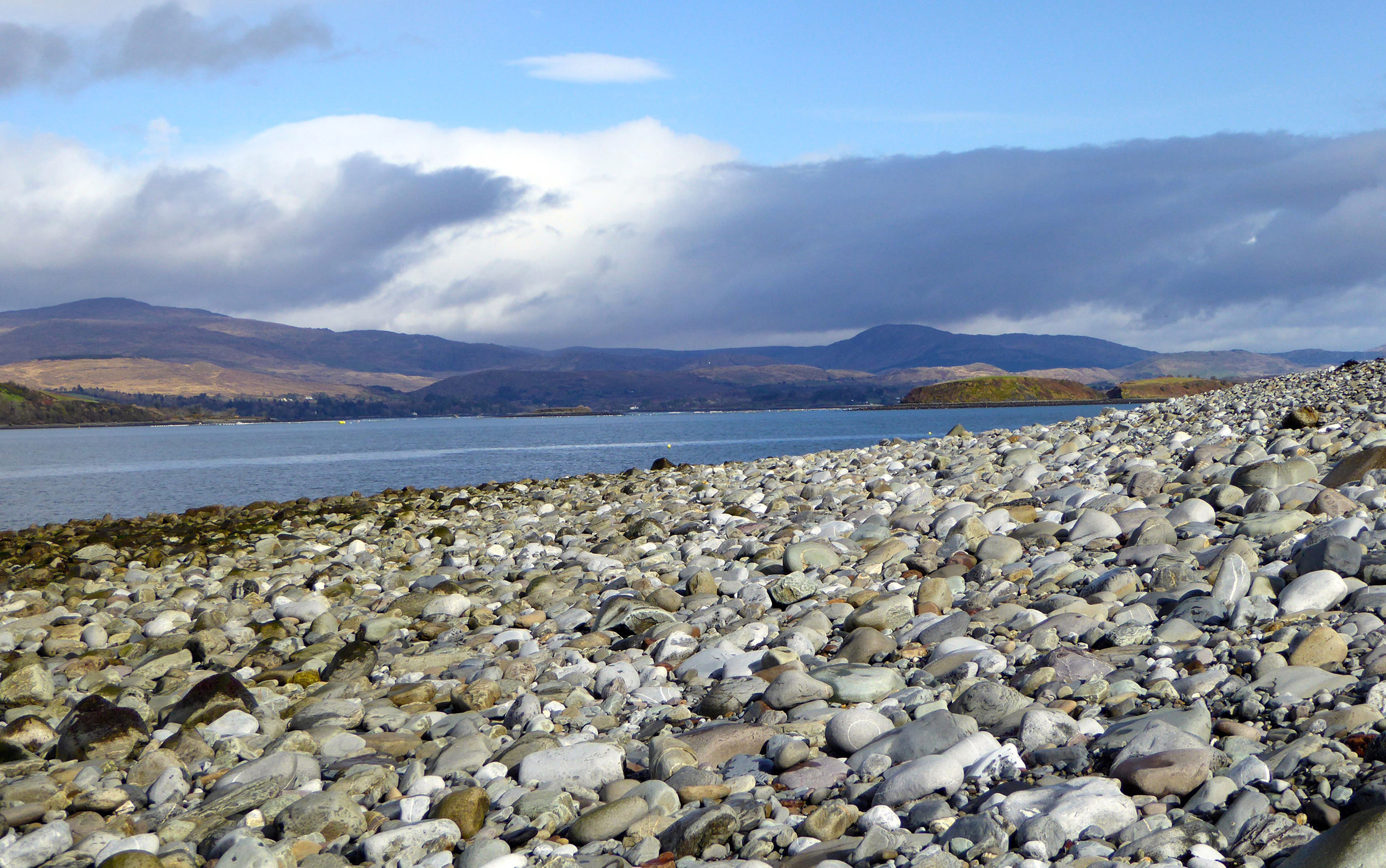
Ireland's first arrivals passed by this pebble beach on their way to Donemark

Ireland’s first arrivals passed by this pebble beach on their way to Donemark

This statement (from Fuchsia Brand’s leaflet on Heritage) was guaranteed to send me scurrying for my history books. And – yes – I found many references to the event: an event which, to my mind, was surely one of special significance for Ireland: the first human ever to have set foot in this land – it must have deserved commemoration… Surely, there must at the very least be a plaque marking the spot? For a moment I wondered if this could be the long sought explanation for the enigmatic piece of Rock Art that’s on display in Bristol’s Museum & Art Gallery – the carving is about the right age…
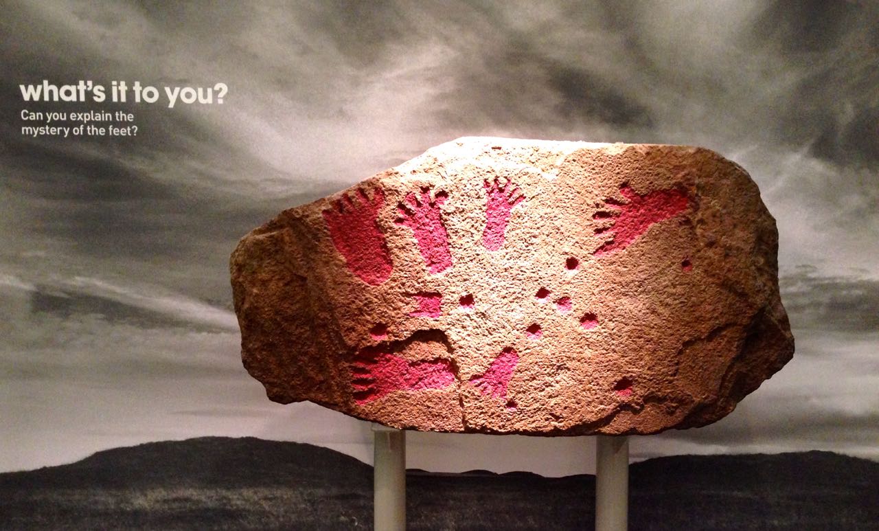
Bronze Age Footprints in Bristol's museum

Bronze Age Footprints in Bristol’s museum

So, a similar example of Petrosomatoglyphia is what I was hoping to find on the shores of Bantry Bay, a mere stone’s throw from our home here in Cappaghglass. But – before that expedition – let’s just go back to the history for the moment. Back – in fact – to the Lebor Gabála Érenn (The Book of the Taking of Ireland), which was written down in the 11th century and – allegedly – based on earlier source material. It takes a bit of wading through: I used a commentary edited and translated by R A Stewart Macalister and published by the Irish Texts Society in Dublin in 1938, but it’s well worth the effort. There’s a lot I had never understood before about the earliest history of the people of Ireland.

lebot gabala book frontispiece

It’s a long story… The book is a collection, in five protracted parts, of all the poems and traditions which had been written and learned by the Bards, telling the history of their nation. There’s a lot of repetition: like the Gospels there are several versions of each episode and it’s a bit dizzying to try to get a clear overall picture of events. So, settle down and imagine the visiting Bard you have given hospitality to in your tower house on a winter’s night is regaling you with tales of your ancestors.
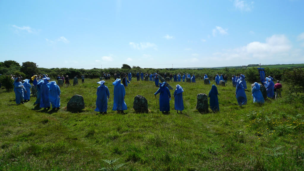
A Meeting of Bards (at Boscawen-Un Stone Circle, West Penwith, Cornwall

A Meeting of Bards (at Boscawen-Un Stone Circle, West Penwith, Cornwall)

Everything has to go back to Noah, who was only allowed to take with him on the Ark his own sons and their wives. One of his sons, Bith, had a daughter – Cesaire (or Cessair). As she had to stay behind so also did her father, but they built their own ships, three of them, and set sail with two other men and a large company of women, looking for a land which ‘knew no sin’ because it had never been populated: there they would settle and aim to re-found the human race in a green and fertile place. Their voyaging took them to many parts of the known world and they came eventually to the north of Spain – which we know today as Celtic Galicia. Cesaire knew that this wasn’t the Utopia they were seeking but she climbed to the top of a very tall tower and, in the far distance, she spotted Ériu – ‘…where no evil or sin had been committed, and which was free from the world’s reptiles and monsters…’

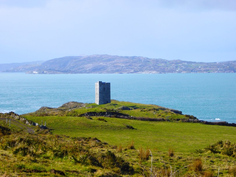
Cesaire would have needed a tower like this to catch a glimpse of Ireland from northern Spain...

Cesaire would have needed a tower like this to catch a glimpse of Ireland from northern Spain…

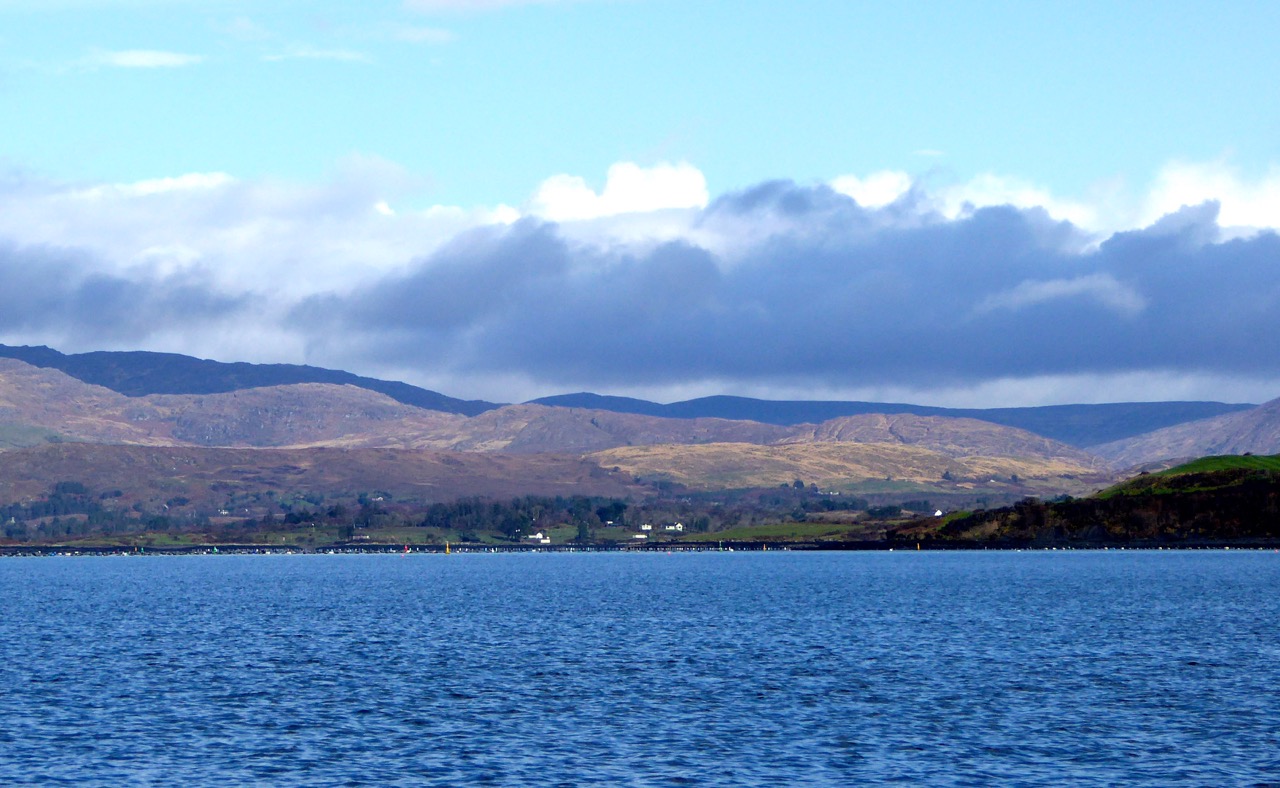
And so it was, forty years before the Great Flood engulfed everything, Cesaire’s expedition sailed up to the mouth of the Mealagh River, passing on the way the most beautiful landscapes they had ever seen – landscapes that we are fortunate to see every time we set out to explore our own new horizons.
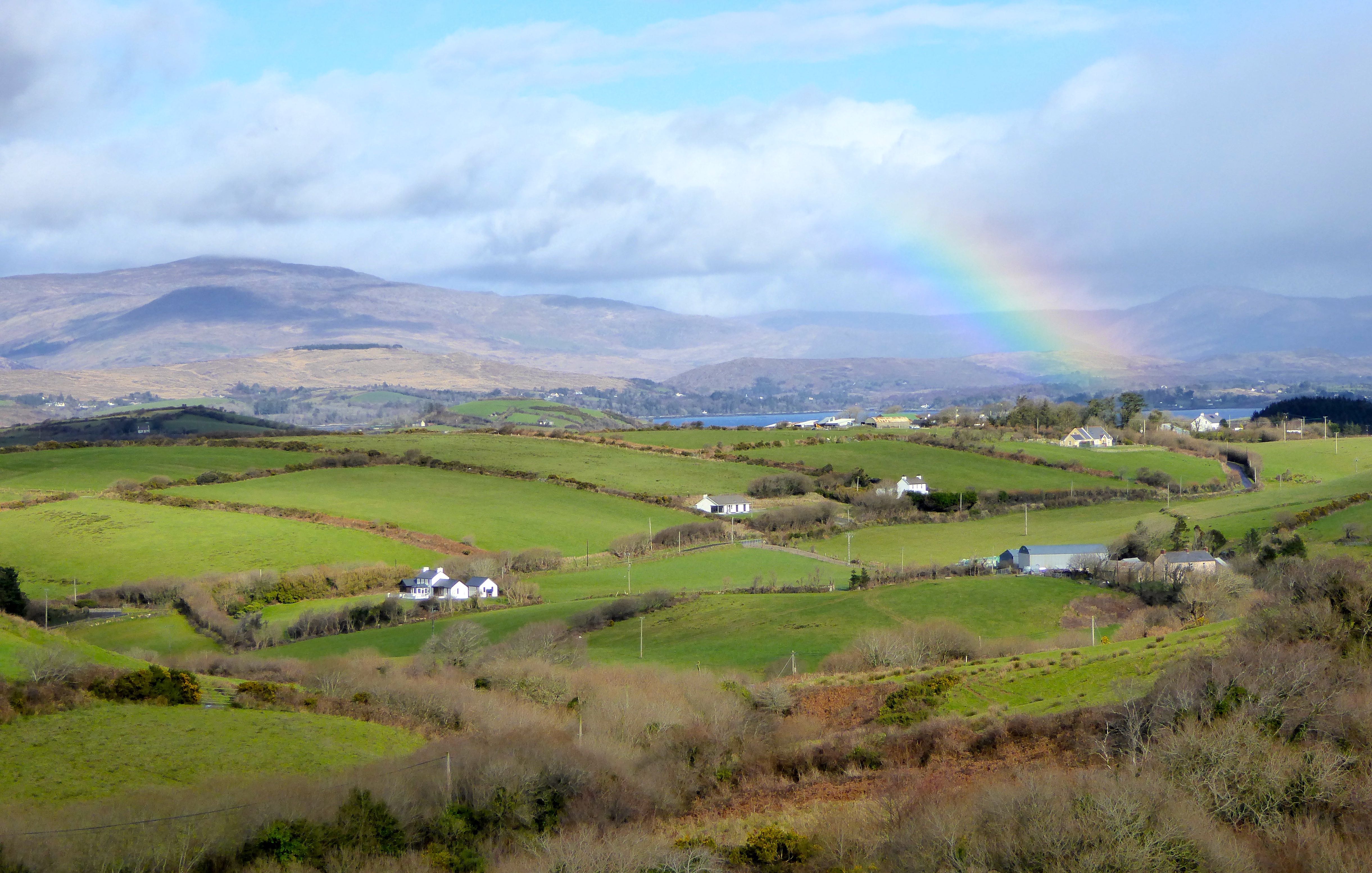
Bantry Bay - the landscape today

Bantry Bay – the landscape today

Now it was time to glimpse for ourselves this remarkable site – Dún na mBarc – the place of the boat – (Donemark -Dunnamark Townland) in the parish of Kilmocomogue. We drove up the unremarkable N71 through Bantry town and turned in to its attractively situated golf course, then made our way down to the shore. Disappointingly, that is also unremarkable: it’s got a brooding, although not unattractive atmosphere about it. We came there at low tide and saw mud-flats – alive with foraging birds, including a very fine Old Nog – the huge stones of a disintegrating quay, and distant views to the Sheep’s Head and Beara Peninsulas.

Landing Place? At Donemark

Landing Place? At Donemark

Old Quay at Donemark

Old Quay at Donemark

.

Alas, there were no footprints, no plaque, no signification of the very important history of this site: there was only our imagination to fill in the gaps. I could envisage Cesaire’s Bronze Age boat (only one survived the full journey) making its way up the azure waters admiring the emerald green of the landscape and passing by some of Ireland’s most dramatic scenery. They landed on ‘…a Saturday, the fifteenth day of the moon at Dun na mBarc…’

Kerry Mountains

Mountains of West Cork

We did find a single commemoration of this event: in the tranquil gardens of the National Learning Network Centre, which is not far from the mouth of the river. It is a work of art, made in 2013 by the students of the Centre, under the guidance of Michael Ray and the auspices of the West Cork Arts Centre – you may remember both from this recent post. Voyage of Stories’  recalls that pioneering arrival in the form of a boat sculpture made of steel, copper and glass and set up over a pool. The glass tiles tell of invasions and emigrations both ancient and modern in Irish and English. It’s a good way to commemorate the journey and those early settlers, we thought.

'Voyage of Stories' at Donemark

‘Voyage of Stories’ at Donemark

Now, Finola – at my side and wearing her Archaeologist’s hat – is tutting at my unquestioning acceptance of the dating of this milestone in Ireland’s history, bearing in mind that the passage graves at Newgrange, Knowth and Dowth appear to be some 5,000 years old and – she says – there were people living in Ireland earlier than that! But my view is that there’s history, and there’s story… Well, perhaps history is always someone else’s story but give me a good tale any day, especially one woven with adventure and romance and told at the fireside.
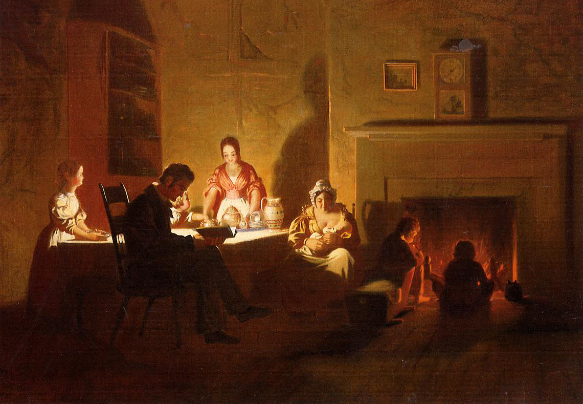
Family Life (Caleb Bingham 1845)

Family Life (Caleb Bingham 1845) New Orleans Museum of Art

So now you know all about Cesaire, who was the first to step from that frail vessel which had travelled all the way from Egypt in those far off days. But perhaps I should also tell you a little more: the three men on that voyage faced the prospect of serving no less than fifty women between them if they were to populate this new land. The Lebor Gabála Érenn is quite frank about this: ‘… Ladra, the pilot, from whom is Ard Ladrann named he is the first dead man of Ireland before the flood. He died of excess of women, or it is the shaft of the oar that penetrated his buttock. Whatever way it was, however, that Ladra is the first dead man in Ireland…’ while Bith – Cesaire’s father – was already aged before the voyage and also passed away soon after. That left one man – Fionntán – who was so frightened by the prospect of facing all those women alone that he ran away and hid in a cave. There he changed into a Salmon and survived the Flood which, sadly, overcame Cesaire and her companions. The shape-shifting Fionntán went on to live for five and a half thousand years (by my reckoning that means he’s still alive!) and recorded all of Ireland’s history (including at first hand the account of Cesaire’s voyage) – which he then taught to the Bards of Ireland so that it would be taken out into the world…

But all that is for another day!

made harbour

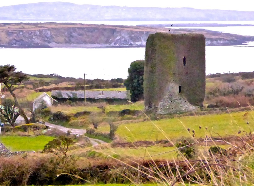
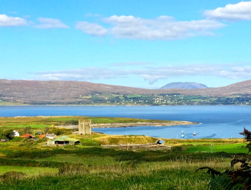
When is a castle..?

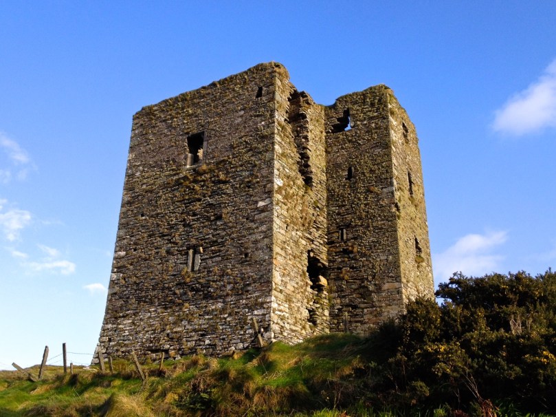
Leamcon Castle

Leamcon Castle (Black Castle)

…not a castle?

Answer: When it’s a Tower House. Maybe.

Harold Leask first published his classic Irish Castles in 1941, and it was subsequently revised and reprinted several times. My own copy was bought in the late 60s and accompanied me to Canada and back. Leask’s book was the first comprehensive work on the subject – a work of erudition but thoroughly readable with charming pen-and-ink illustrations. 

Leask insisted on the use of the term tower houses for small simple castles and described them thus:

They are simple oblongs with four walls, subtly battered, rising sheerly from a bold base-batter, to parapets which are crenellated in the Irish fashion. A small turret, at one corner, generally above the staircase, rises to a greater height than the rest of the building, while within the parapets are the two gables of the roof. Very often a small machicolation projects from the parapet and commands the entrance doorway below…

Ardintenant Castle

Ardintenant Castle (White Castle). It sits on top of an earlier ring fort.

In researching for this post the other main source I consulted was a doctoral thesis by Mark Wycliffe Samuel, The Tower Houses of West Cork. More recent (1998), it concentrated on the castles of this area and is packed with detail about the ones we see around us here in Roaringwater Bay and on the Mizen Peninsula, from Baltimore (Dún na Séad) in the east, to Cape Clear Island (Dún an Óir) to the south and Three Castle Head (Dunlough) to the west.

Dunlough Castle, known as Three Castle Head

Dunlough Castle, at Three Castle Head

These simple towers were quite different from the enormous and elaborate military castles that cemented Anglo-Norman power all over Ireland after the invasion of 1169, such as Trim in County Meath, or Cahir in Tipperary. Tower houses were built in what Leask calls a ‘great building revival’ from about 1440 into the 1600s. In what may be the forerunner of the European Grants system, Leask says many of the earliest ones were built as ‘£10 Castles’. A statute of 1429 offered every liege man of our Lord the King…who chooses to build a castle or tower sufficiently embattled or fortified..to wit twenty feet in length sixteen feet in width and forty feet in height or more, that the Commons of the said counties shall pay to the said person to build the said castle or tower ten pounds by way of subsidy. Although this statute seems to have been applicable only in certain counties (mainly around the Pale) it established a pattern for tower building which was adopted, with variations, all over Ireland.

Dunmanus Castle

Dunmanus Castle

The Roaringwater Bay and Mizen towers fit this pattern very well. They were not, however, built by the Anglo-Normans – West Cork was too remote and beyond their reach. They were built by the great Irish chiefs of the O’Mahoney, the McCarthy and the O’Driscoll clans and probably replaced earlier strongholds such as promontory forts (as at Dunlough), large ring forts (Ardintenant) and stone forts/cashels (such as the one at Knockdrum). These chiefs became wealthy through their control of the fisheries, through piracy, and through tribute exacted from those who occupied their traditional territory. At least one of them (Rossbrin) became famous as a centre of learning and scholarship during this time. Of the ones I will describe in this post, all are situated at the sea. or close to it, with commanding views over their territory and sometimes within sight of each other.

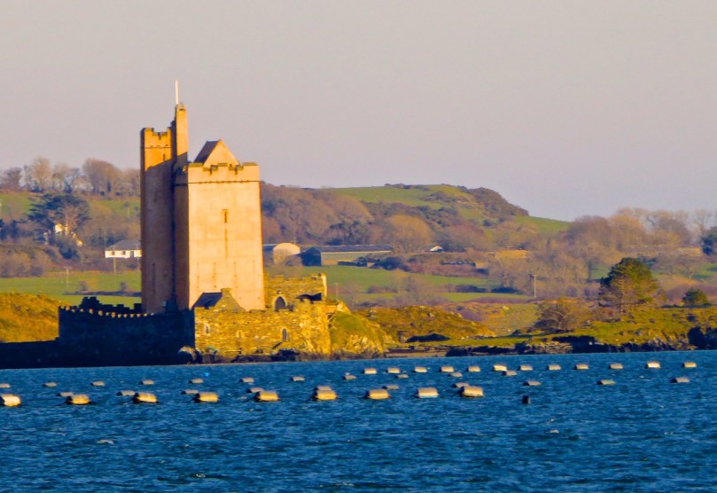
Leamcon, known as Black Castle

Leamcon, known as Black Castle. Notice the base-batter in this picture and the first one below.  The lowest level is the widest (battered) with the walls sloping in above this base

The power of these great Irish households lasted until the 1601 battle of Kinsale when the Irish forces under Hugh O’Donnel and Hugh O’Neill (with Spanish help) were defeated and an enormous re-conquest and re-colonisation began under Elizabeth and continued unabated under the Stuarts and, most disastrously, under Cromwell.

Each tower in this area was built in the same manner, which Samuel refers to as the Raised Entrance type of tower. There were two entrances, one on the ground floor and one on the first floor. The ground floor room was for cattle and the doorway was therefore as wide as would admit a cow.

A glimpse inside the raised entrance at Ardintenant

A glimpse inside the raised entrance at Ardintenant

The raised entrance (directly above it, or staggered to the left or right) was only wide enough to admit one person at a time – a defensive feature. This entrance either led into the first floor room or (since the ground floor room could have a lofty ceiling) onto a landing where a staircase led up to this room and then continued up through the wall (usually the thickest wall of the tower) to the upper floors. The first floor room was mainly used for storage and had either no windows or very small slits.

Dunmanus, with its additional turret. The top windows were always the largest.

Dunmanus, with its base-batter and additional turret. The top windows were always the largest

The second floor room was often the principle chamber, where all the main activities of the family took place – living, eating, meeting, administrating, celebrating (music and poetry were highly prized by these chieftains). If there was a third floor it contained the solar, or private chambers for the women of the household.

Barrel vaulted ground floor room at Dunmanus. Note access to stairwell.

Barrel vaulted ground floor room at Dunmanus. Note access to stairwell.

Construction techniques varied – some were superbly constructed of cut stone while others used a lot of rubble to build up the insides of walls. Putlogs, or holes where scaffolding timbers were insert, are clearly visible in several of the towers. The lowest floors were of course the thickest – the base-batter provided a solid foundation and the walls sloped inwards from it. The top of the tower allowed for thinner walls, and therefore also bigger windows (although none were large).

A garderobe (toilet) was a feature of the top two floors, with a chute out to the outer walls. In towers with additional turrets (Kilcoe, Dunmanus, Leamcon) the garderobe and sleeping chambers were sometimes contained in that turret, or the spiral stairs wound up through it. While most towers had stone spiral or straight staircase, some appeared to access each floor by means of ladders – there is no evidence for permanent wooden staircases.

The ground floor room (the byre) was often vaulted and this feature is still clearly visible in the most intact towers. Above that, the floors were of timber, sometimes with trapdoors for lifting up supplies. Presses (cupboards) consisting of niches in the walls may have contained lanterns or have been used to store valuable items.

There were no fireplaces in these towers. Fires were lit on flagstones laid on the wooden floors and the smoke rose to the tall ceilings and escaped out the small windows. In addition to this level of discomfort there is a contemporary account (quoted by Leask) which describe the primitive living arrangements in some of the towers: They have little furniture, and cover their rooms with rushes, of which they make their beds in summer and straw in winter. They put rushes a foot deep on their floors and on their windows [embrasure floors?], and many of them ornament their ceilings with branches.

But not all chieftains lived in a primitive way. Samuel uses the available evidence to construct a picture of life at Togher, one of the towers he studied, and it’s not hard to picture Fineen O’Mahoney, Scholar Prince of Rossbrin, in such a setting.

We can form a picture of the principal chamber in use: Tadhg an dúna or Togher’s principal chamber was probably furnished with imported furniture, pewter plate and cutlery and was panelled with ornately carved timber. His family, his bard, …clerk, lawyer, priest and physician, as well as members of the derbfine [extended clan] such as cavalrymen could eat there. They could sit with the chieftain to one side of the principal salt cellar, while others sat ‘below’ it… Servants prepared food out of sight ‘below stairs’. Bardic musicians, soothsayers, gamblers and others would be admitted as honoured guests, but the household ward and servants ate in the kitchen/ward room.

Although its name means Fort of Gold, today Dún an Óir on Cape Clear Island looks remote and forbidding

Although its name means Fort of Gold, today Dún an Óir on Cape Clear Island looks remote and forbidding

Similarly, Dún na Séad (Fort of the Jewels) Castle in Baltimore, seat of the wealthy O’Driscolls (they also had Dún an Óir (Fort of Gold) on Cape Clear Island), was

a centre of administration for trading activities and collection of taxes from foreign traders frequenting the port. In the middle and later-middle ages therefore, the O’Driscolls enjoyed a prosperous lifestyle. Lavish gatherings took place in the ‘great hall’ of Dún na Séad castle and a well-documented feast in 1413 is said to be one of the earliest records of people dancing in Ireland. This documentary evidence is supported by archaeological finds from recent excavations of the Dún na Séad site, which reveal the presence of late twelfth to fourteenth century pottery from the Saintonge region of France, and reflect the lucrative trade links between Baltimore and Europe at this time.

Dún na Séad Castle, Baltimore

Dún na Séad Castle, Baltimore. Note corner machicolation.

Defensive features were built into all the towers. Besides raised and restricted doorways and hard-to-manoeuvre narrow or spiral staircases, all had a roof ‘wall walk’. Three of the towers (Dún an Oir, Kilcoe and Leamcon) are either inaccessible or accessible by a bridge and there is evidence that connecting ground was deliberately demolished to accomplish this. Windows were small and could be boarded up. Projecting machicolations, especially above entrances or at corners were used, as can be seen at Dún na Séad Castle in Baltimore. Crenellations (notched or serrated ramparts) look like our traditional ideas of battlements. At Kilcoe they may have helped that castle withstand over a year of attack and siege after the Battle of Kinsale.

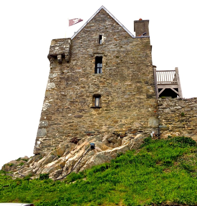
Kilcoe Castle. Note crenellated battlements and pitched roof.

Kilcoe Castle. Note crenellated battlements and pitched roof

So, should we call them Tower House, or Castles? How about £10 Castles? Archaeologists and historians prefer the more exact phrase tower houses, but castles they are on the maps and in our everyday speech. And if, like us, you are lucky enough to have one in your view, castles they are in our hearts and minds.

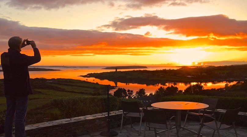
Our view to Rossbrin Castle

Our view to Rossbrin Castle

A Lick of Paint

blue long distance

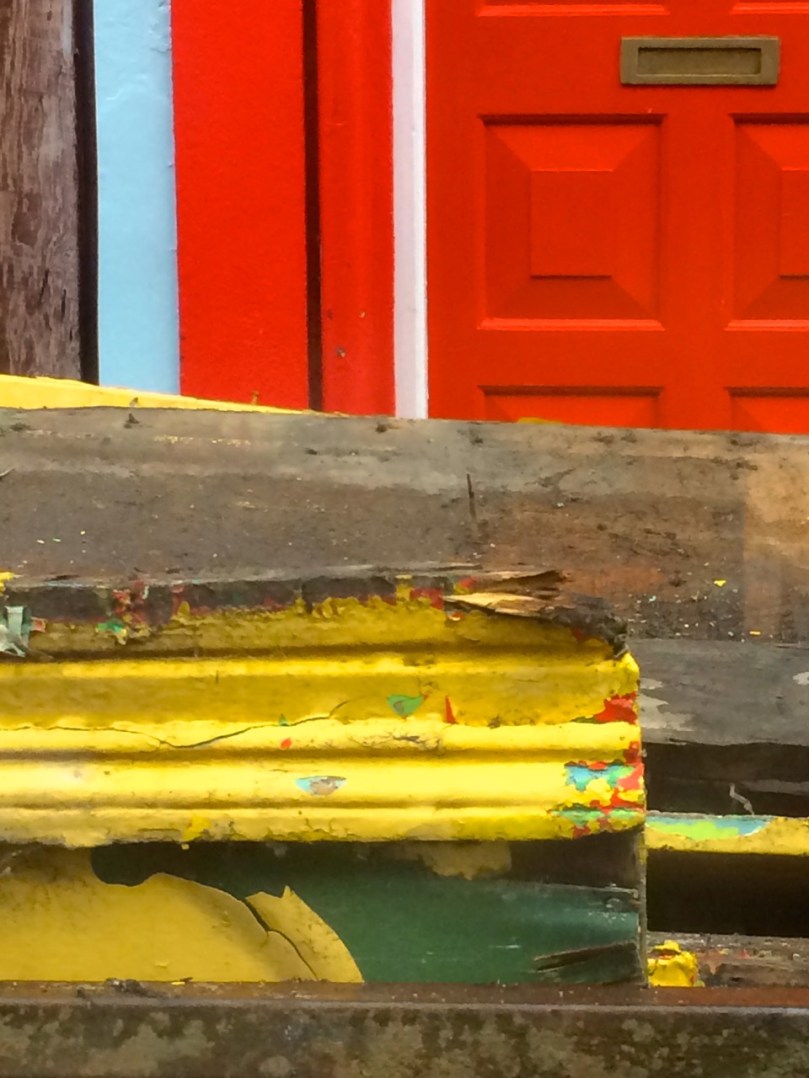
What does it mean to say that a house is “set well into the landcape?” On the West Coast of Canada, where I used to live, it usually meant that a house was invisible, often made of wood and blending into the trees. But here in rural West Cork, buildings are more assertive – we ARE the landscape, they seem to say, or at least an important part of it. Therefore we should stand out and be seen. Part of being seen, for many houses in the countryside, is choosing a bright colour. Ah sure, they say, all it needs is a lick of paint.

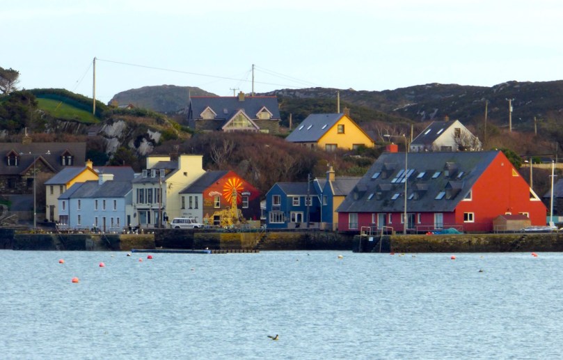
Crookhaven

Crookhaven


I’ve written before about the colourful towns and villages dotted all over Ireland. Coming around a bend in the road and catching sight of a village is a cheering experience: flashes of colour spread in a line across a backdrop of green fields or rugged mountains. But colour isn’t confined to towns – farmhouses in the deep countryside can suddenly demand attention – pops of colour in a predominantly green terrain. 

Blue seems to be a favourite – and we are not talking here about a pale blue or grey blue. No – duck egg or cobalt blues predominate. The blue is weathering and fading a bit in the house below but it still packs a punch in its isolated setting.

Sometimes blue is used on one side of the house only, or on selective aspects – a gate post or a shutter.

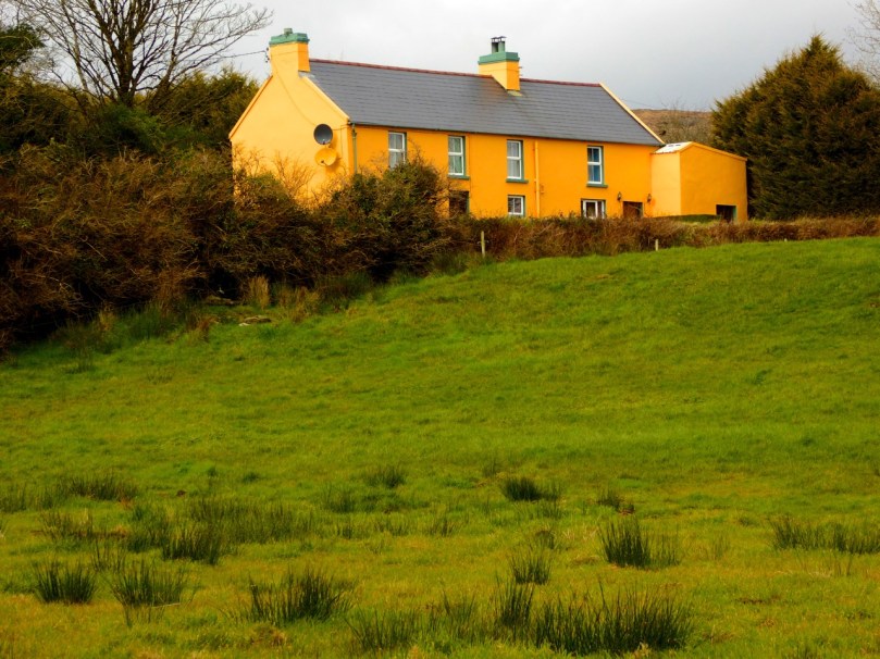
One of my favourites is this house, the colour of a ripe apricot. It is visible from a long way off and always seems to be incandescent on its hillside, as if permanently lit by a setting sun. Close up, I found it has jade green trim, making it even more handsome than it appears from a distance.

apricot distant

That colour is also one of the most recognisable in West Cork because it’s the colour of Jeremy Irons’ Kilcoe Castle. When the castle was being rendered, Irons used a lime mortar in order to waterproof the masonry: the mortar has a distinctive peach tone. Although controversial at the time, it is fair to say that West Cork folk have come to enjoy the sight of this wonderful restored 13th Century castle permanently glowing on its tiny island.

Kilcoe Castle

Kilcoe Castle

Pinks range from soft and pastel to the colour of fuchsia.

I particularly like the pink-on-pink trim of the farmhouse below left, and the candy-coloured house with its blue trim.

Yellow shows up well against a green hill. The first house below belongs to our friends the Camiers, who run the marvellous Gortnagrough Folk Museum. The second one is on the Sheep’s Head (photo by Amanda Clarke).

There are shades of salmon and coral that seem to suit old houses very well. Left, below, is the old school house in Rossbrin, now a private residence, and right is the Ballydehob Rectory, particularly attractive with its green trim.

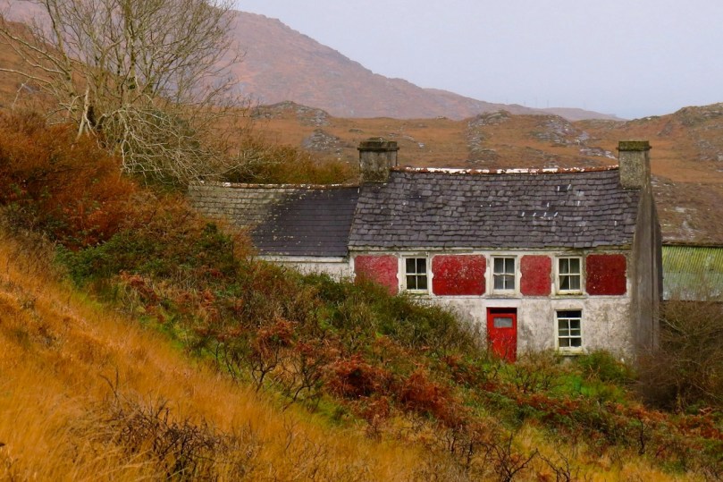
I’ve found red to be reserved mostly for doors, trim and spot colour, but my friend Amanda Clarke found this old farmhouse on the Sheep’s Head. Take a look at her site, Sheep’s Head Places for examples of vernacular farm buildings. 

Old farmhouse, Sheep's Head

Old farmhouse, Sheep’s Head*

Renovations never stop – I did wonder what colour this one would end up. Now I know!

Going through the spectrum

Going through the spectrum

But this one, unless miracles happen, will see no more paint. Then again, it’s right beside a holy well, so maybe…

Generations of colour

Generations of colour

 *Many thanks to Amanda Clarke for the use of the asterisked photographs

Wedge Tombs: Last of the Megaliths

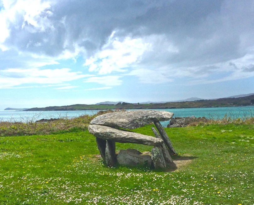
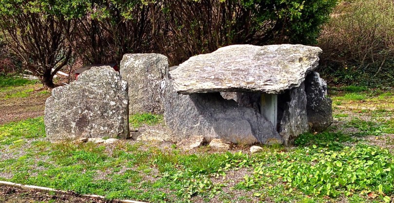
Altar Wedge Tomb on The Mizen Peninsula

Altar Wedge Tomb on The Mizen Peninsula

In Ireland, the tradition of building megalithic (mega=large, lithos=stone) structures that included chambers to house the dead (such as the Boyne Valley Passage Grave complex, or the Court Tomb of Creevykeel) belongs to the Neolithic period, which ended around 2500 BC. About this time, a new style emerged of stone ‘galleries’, oriented towards the setting sun. Their distinctive shape – narrower and shorter at the eastern end – gives them their common name, wedge tombs. This tradition appears to have flourished for about 500 years.

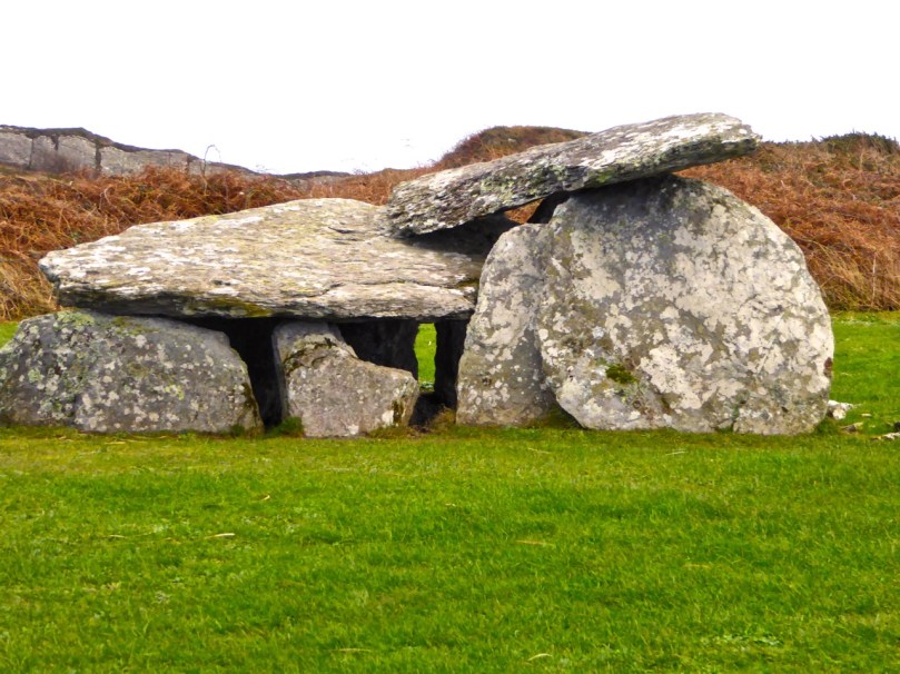
Altar, side view

Altar, side view

In other areas of Ireland wedge tombs were often covered by a mound, but there is little evidence for this in West Cork. The closest parallel to wedge tombs outside of Ireland are in Brittany where allées couvertes date from this period. They are associated in some parts of Ireland (although once again not in West Cork) with Beaker pottery, a distinctive kind of vessel widely distributed across Western Europe. This was a time in which the population was expanding, farming practices were intensifying and a brand new technology was being introduced – it was the dawn of the Copper Age. Thus, we can speculate that wedge tombs mark the confluence of two forces: the new continental technologies of pottery and metalworking and the indigenous tradition of erecting megalithic chambered tombs.

Wedge tombs occur mostly in the western half of Ireland, including many in County Clare such as the Parknabinnia tomb pictured below.

 The largest wedge tomb in Ireland is near Fermoy, north of Cork City. It is typical of many Irish wedge tombs in featuring double walling, evidence of a surrounding cairn, and a sealed end chamber. Interestingly its name, Labbacallee, means the Hag’s Bed – the hag, or wise woman crops up frequently in Irish mythology.

In contrast to Labbacallee, wedge tombs in West Cork are generally smaller and simpler, comprising only one chamber and lacking a covering cairn. However, the distinctive wedge shape is preserved along with one other defining feature: wedge tombs are invariably oriented towards the setting sun. The funerary rite was that of cremation. Votive offerings of white quartz pebbles and small deposits of metal have been found in excavations.

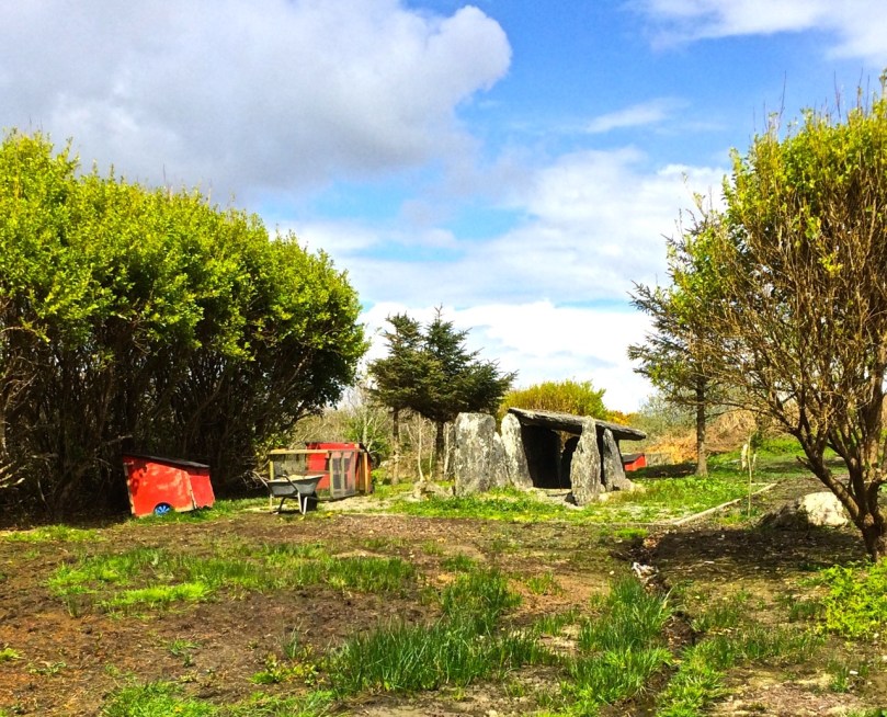
Toormore wedge tomb,  now in someone's garden

Toormore wedge tomb, now in someone’s garden

Prof William O’Brien has excavated wedge tombs in West Cork and studied them, and the culture in which they were built, extensively. Here’s what he has to say, in his book, Iverni, about the society that produced them:

Whereas monuments like Newgrange could only have been built with a large organised input of labour over a long period, the building of wedge tombs was undertaken by small kin groups…This was a small scale society, comprised of local, clan-like groupings…The tomb was a type of shrine, sanctified by an association with ancestors and used for periodic offering and sacrifice to supernatural powers.

A striking aspect of Neolithic, Chalcolithic (Copper Age) and Bronze Age monuments in West Cork is their consistent orientation towards solar events such as sunrise and sunsets on the equinoxes, solstices and cross-quarter days (see our post on Bohonagh stone circle, for example). In this regard, wedge tombs are remarkably consistent in being oriented towards the West. Here’s O’Brien again:

Wedge tombs served as funnel-shaped openings to the Otherworld, facing the descending or setting sun to emphasise the symbolic dualism of light/life and darkness/death.

Toormore, side view

Toormore, side view

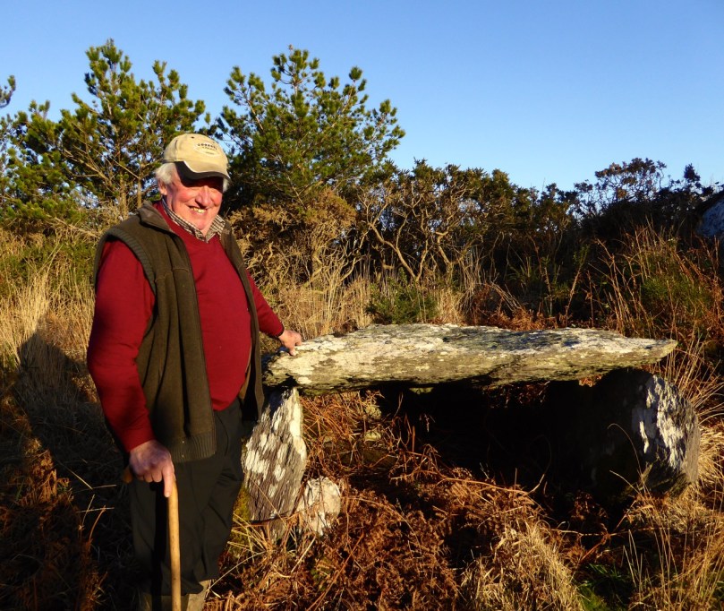
Looking for a wedge tomb closer to home, we set out yesterday to find the nearby Kilbronogue site, using the information from the National Monuments Service as a guide. We have found in the past that the mapping of sites is not always accurate and after an hour or two of tramping through a large and very muddy area with a helpful neighbour and his son we had to admit defeat – either the map was wrong, or the monument had disappeared in the recent fieldwork by a digger. Desperately hoping it was the former and not the latter, we found out who owned the land and went to call on him today. Stephen Lynch turned out to be a friendly, cheerful and very knowledgeable organic farmer – he assured us that the tomb would never be damaged in any way and not to worry, he would take us to it. Whew! Half an hour later we were trudging up a path that Stephen had had cut through his ash plantation – on we went and suddenly there it was in front of us – a classic wedge tomb, oriented to the west, built with large slabs that may have been cut from the rock face behind it.

Kilbronogue wedge tomb with its guardian, Stephen Lynch

Kilbronogue wedge tomb with its guardian, Stephen Lynch

Stephen told us the tomb had been used as a mass rock in penal times and that the Protestant farmers who owned all the farms that bordered on the rock had cooperated in allowing the masses to take place – an indication, Stephen said, of the long tradition of friendship between Catholic and Protestant farming families in this area. As with the Altar wedge tomb, also used as a mass rock, we marvelled at how a sacred site, built at least four thousand years ago, would retain its aura of veneration over the millennia, to be used again for religious purposes in the historic period.

Kilbronogue, side view

Kilbronogue, side view

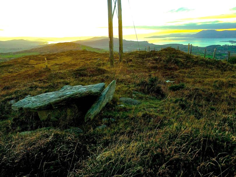
Perhaps the most spectacularly situated wedge tomb we have been to is high on a hill overlooking Bantry. This one is known as Queen Medb’s Tomb and from it there are expansive views of the Beara, Sheep’s Head and Mizen Peninsulas. Climb up to it on a clear day, as the sun is sinking into the sea: in the presence of such awe-inspiring scenery you will find yourself contemplating how the mysteries and the wonders of Irish history and prehistory are written on its landscape.

Queen Medb's Tomb

Queen Medb’s Tomb

Your Favourite Posts of 2014

Cape Clear Harbour

Cape Clear Harbour

What were your favourite Roaringwater Journal blog posts of 2014?

Our blogging software provides a running count of visitors to Roaringwater Journal and it’s always fascinating to see which ones receive the most views. Some of them are our own favourites as well, and some can attribute their high numbers to being re-blogged by others, or to being shared on social media. So tell us, Dear Reader – did the software capture it – or do you have a different favourite from our top posts of 2014?

From the Whiddy Island high point

From the Whiddy Island high point

The top two posts of 2014 were the ones we wrote about our trips to Cape Clear and to Whiddy Islands. We loved our time on the islands and intend to go back often – our enthusiasm probably shone through. But it may also be that islands hold a mystique for us that is hard to define – out there in the dawn mist, mysterious and peaceful, whole worlds unto themselves. The islanders of West Cork are worried at the moment by cuts to their development officer funding, and need all the support we can give them. So if you live here, or are planning a trip, include one or more of these beautiful islands in your plans.

Timoleague Friary

Timoleague Friary

Next in popularity was our post on the Timoleague Friary. It’s an iconic piece of West Cork history and architecture – the only sizeable medieval religious ruins we have, perched on a picturesque estuary of the Arigideen River.

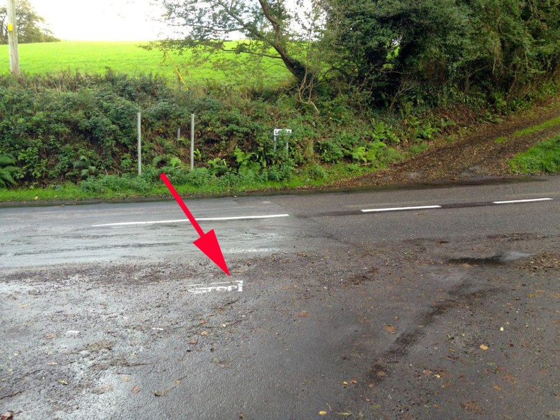
I've learned to look carefully for road signs

I’ve learned to look carefully for road signs

Finola’s frustration at the inflexible regulations that treated her like a novice driver, despite forty years of driving experience, must have struck a chord with you. Maybe you dropped by Driving Home the Point to sympathise with her plight, or maybe it was to chuckle over the numerous example of the routine flouting of the Irish rules of the road, or the bemusing driving conditions of many rural roads.

Evans of Bantry

Evans of Bantry

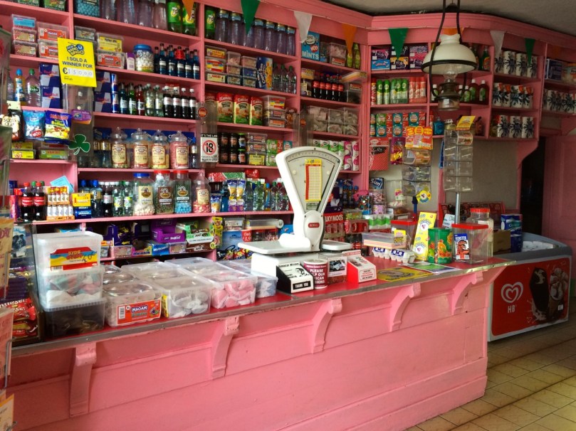
We have enormous nostalgia for the things we remember from our childhood, don’t we? In that vein, it’s not surprising that Shopping for Memories was such a popular post. These lovely old shops evoke a time when a whole variety of shops lined the main streets and our mothers went from the butchers to the greengrocers to the chemists to the haberdashers and, if we were lucky, to the sweet shop on a daily basis.

Carraig Abhainn Gardens

Carraig Abhainn Gardens

But sadly, the numbers of these old-fashioned shops are dwindling. This year we said goodbye to Wiseman’s in Durrus, no longer able to compete against the hardware shops of Bantry. Fortunately, their wonderful Carraig Abhainn Gardens are still open behind the shop – and our description of this hidden gem was one of your favourite posts of the year.

A group of posts on festivals came next. We wrote about the question our friends asked us when we decided to move here, What on earth will you find to DO? We answered in a series of posts describing some of the local events and festivals we have taken in this year – the Ballydehob Jazz Festival and Arts and Culture Festival (which included our own Rock Art Exhibition), traditional music Festivals in Baltimore, Bantry and Ballydehob, and a host of musical and theatrical events. One day all of you retirees out there are going to discover that moving to West Cork is the best decision you can make!

The next group of posts centred on the Mizen – the Mizen Magic posts where we concentrated on aspects of the Mizen Peninsula that delight us – the Beaches, Brow Head, the Butter Road, Mount Gabriel, the Gortnagrough Folk Museum, and the history and archaeology of this beautiful part of Ireland.

How are ye?

How are ye?

In fairness, like, it looks like ye would have enjoyed our take on how to speak like ye’re from West Cork. Those little posteens made you happy out.

Ye must be a fierce active crowd altogether because you really got a kick out of Finola’s description of her day of sailing and (perhaps her personal favourite in the activities department) her moonlight kayaking on Lough Hyne.

Happy New Year from Robert and Finola!

Happy New Year from Robert and Finola!

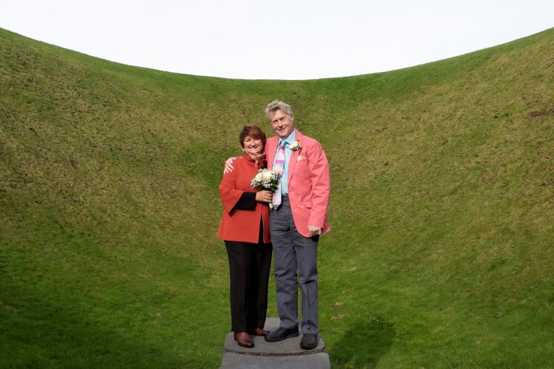
And our own personal favourite of 2014? Robert’s post on the Sky Garden, of course! If you haven’t read it yet, you’ll have to do so to find out why this was the highlight of our year in West Cork.

Mizen Mission

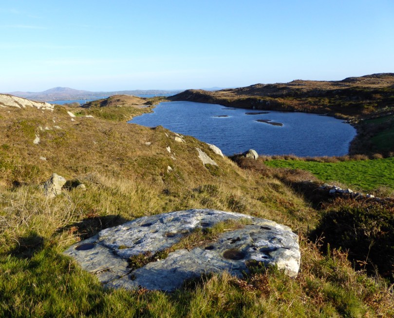
Tooreen Lake

Tooreen Lake

A joint post by Robert and Finola…

Finola

According to the forecast today could be the last fine day of 2014, so we decided to make the most of it and set off on a mission. And what a day it was! Cold, yes, but with that brilliant light that only happens on crisp winter days.

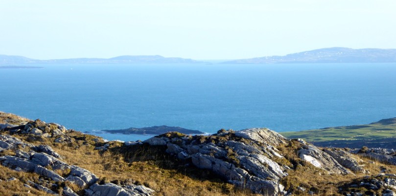
Looking across Roaringwater Bay

Looking across Roaringwater Bay

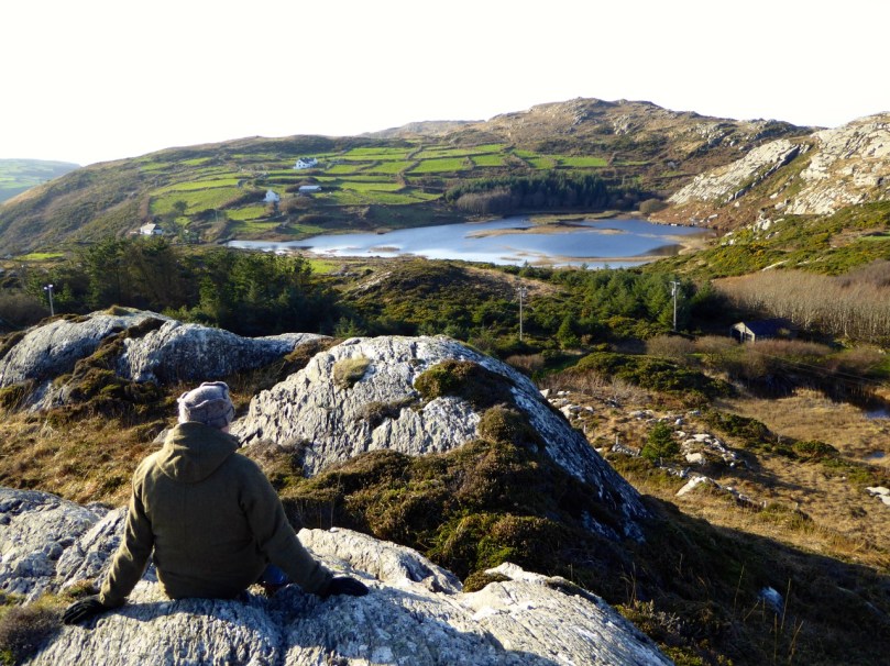
Our mission? it was to find a piece of prehistoric rock art I had last visited over 40 years ago in the townland of Castlemehigan, near the end of the Mizen Peninsula. But once in the vicinity of Castlemehigan we couldn’t resist continuing to the end of the tiny road, which climbed up the rocky hills on the northern side of Crook Haven. Parking the car, we climbed to the highest point we could find. We’re used, by now, to the jaw-dropping views around here, but even by Mizen standards, this was something special. 

Crookhaven Village

Crookhaven Village

South of us, across the Haven was the village of Crookhaven nestled in its protective harbour. Looking north we could see across the Sheep’s Head to where the unmistakeable outline of Hungry Hill loomed on the Beara Peninsula. To the west was the White Strand and Brow Head, crowned by the historic Marconi telegraph station and to the east was the whole of Roaringwater Bay: Cape Clear Island, Sherkin, Baltimore, and the ring of hills that run down to the water.

Back in the vicinity of the rock we knocked on the door of a farmhouse to ask directions and permission. Often when we do this we are met with a blank look – not every ancient monument location has survived in the folk memory of the local residents. But this time we hit it lucky, with Florence O’Driscoll – ah yes, he knew it – the mass rock is what we were looking for. I showed him a picture of the rock and he confirmed that was the one, it was on his land and he would take us there.

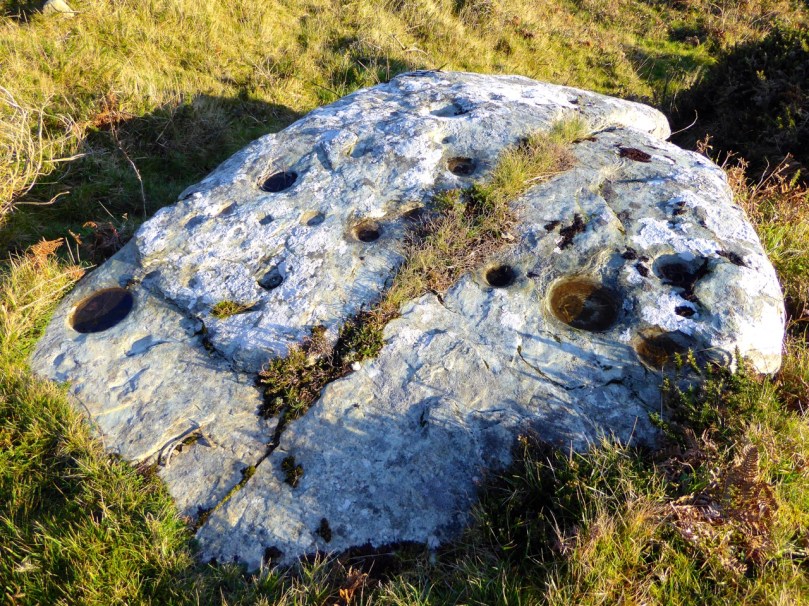
Castlemehigan Rock

Castlemehigan Rock

My write-up and drawing of the time brought back some memories of an unusual rock with very large depressions, almost more basins than cupmarks. I also had a very clear recollection of being taken to the site by Bernard O’Regan, a local (and well-remembered) amateur archaeologist who was very helpful to me at the time. Because the rock was very overgrown, he had arranged to have it cleaned for me and when we arrived there were two men on top of the rock hacking away the gorse and heather. Nowadays, rock art specialists abide by an ethic of zero surface contact – no clearing or scrubbing allowed!

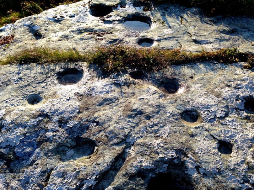
Castlemehigan rock surface

Castlemehigan rock surface

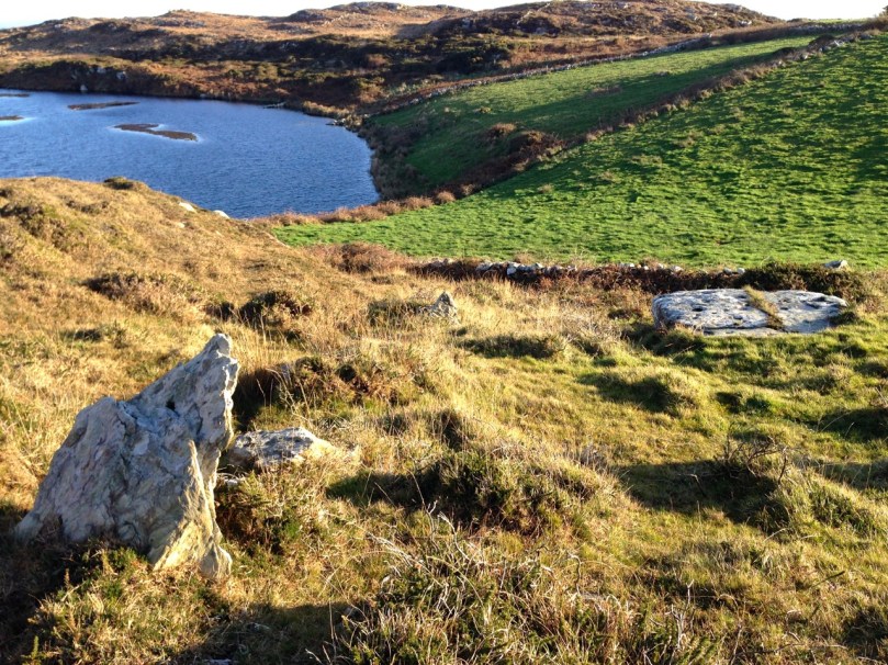
Although this rock lacks any of the circles, grooves and lines that add interest and appeal to many panels of rock art, it is special in other ways. Several of the cupmarks are unusually large, and one is basin-shaped (that is, with straight sides and a flat bottom).

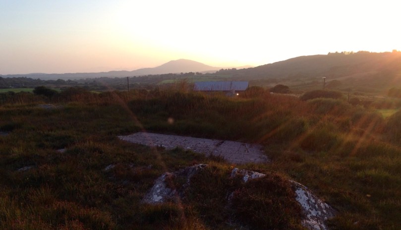
Oriented to Mount Gabriel to the east

Mount Gabriel clearly visible

Some cupmarks appear to run in rows and the rows run in specific directions – one line of cupmarks run directly east/west pointing at the lake that lies about 100 meters away at the bottom of the field. Another line pointed to Mount Gabriel, about 15 kms away on the distant horizon. The two large basin-like depressions are directly north/south of each other.

row of cupmarks

Row of cupmarks

What could be a standing stone is located a few metres away.

Standing stone?

Standing stone?

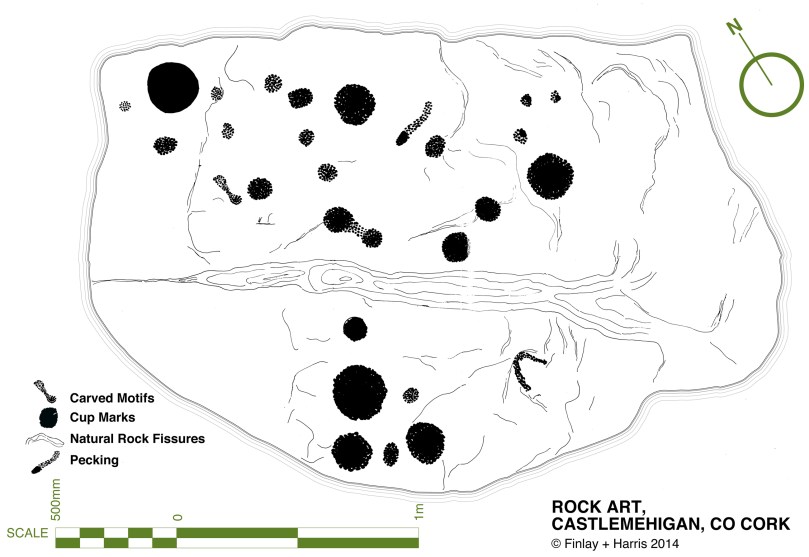
In comparing my original drawing, done 42 years ago, there wasn’t much I would change. Some cupmarks appear to have pecked areas between them which conjoin them in a dumb-bell motif. My original decision was that there were two dumb-bells, but perhaps now I would be tempted to say there were three or even four. However, this just illustrates the subjective nature of the recording process. Especially where lichen obscures the surface, decisions like this come down to professional judgement and experience: drawings can differ from one recorder to another, or even from one visit to another when lighting conditions show up more or less of the carving detail.

Original drawing, updated by Robert

Original drawing, updated by Robert

Robert

This earthfast boulder is a beautiful object – not least because of its setting. I love these Mizen landscapes – they have a very particular character. Large areas of rock outcrop are interspersed with the tiniest fields, tracks and bog. Here there are lakes close by – once natural features, they have been turned into reservoirs to serve local communities. The marked rock overlooks one of these – this one supplying nearby Goleen.

Mount Gabriel clearly visible from the Derreennaclogh stones

Mount Gabriel clearly visible from the Derreennaclogh rock

This example reminds me in some ways of the Derreennaclogh rock – it’s of similar size and shape. Also, at Derreennaclogh Mount Gabriel is prominent on the western horizon, and we’ve been told that the setting sun towards the short end of the year appears to ‘roll’ down the slope of the hill at times. At Castlemehigan the rock also looks out to Mount Gabriel – this time to the east. This is a relatively isolated piece of rock art: the nearest recorded example is at Cooradarrigan, on the far side of Schull. It’s tempting to think that the flat, table-like surfaces of both Derreennaclogh and Castlemehigan were considered significant to those ancient people – who made them notable by marking them – because of their settings which relate to unmistakable landscape features. Otherwise, one might question why large areas of flat rock surface in the immediate vicinities – ideal for carving – have apparently been left untouched.

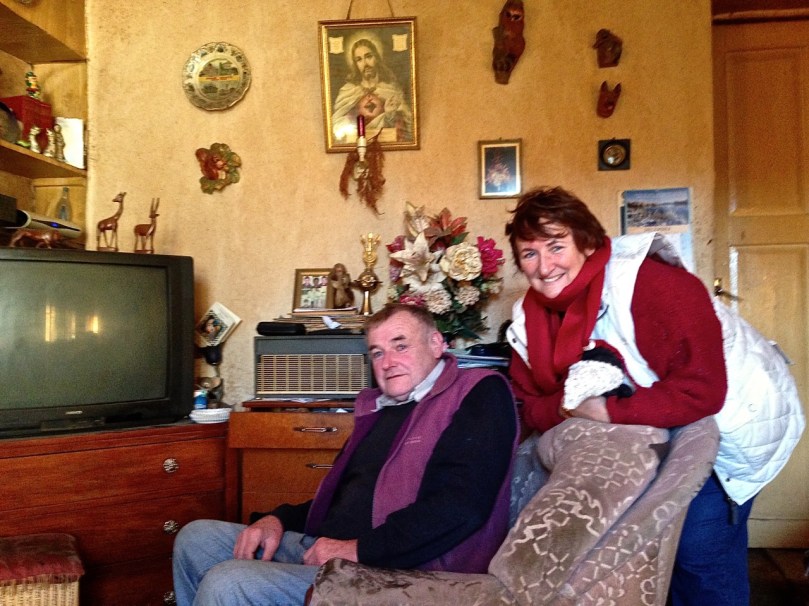
Florence and Finola

Florence and Finola

Florence O’Driscoll, our guide on this expedition, proved to be a fund of information. He had farmed the land which had been his father’s before him. Finola must have met his father when she explored the rocks over forty years ago. Florence carried the stories of the rock from his father’s generation, and probably from generations before that. He told us that the rock had been used as a mass rock in penal times – and that the hill above it was known as Cnocan an Aifreann (the hill of the mass): there is what certainly appears to be a cross carved into the rock surface, close to the large basin (Finola did not record this in her original drawing – she will add it when we update the records). Florence told of the time that the ‘Tans’ (the Black-and-Tans) caught red-handed the Priest celebrating the mass: the Priest threw the crucifix into the lake below the rock (the lake was then smaller than it is now). Ever since then, says Florence, the lake has never run dry – and never will.

Look for the possible cross carving on the right

Look for the possible cross carving on the right

It’s interesting that stories carried through local tradition pay no heed to time or history. They don’t need to: the ‘story’ is a part of the rock, as much as the carvings are. Florence told the tales as if they had happened yesterday. I hope they will continue to be told as long as the rock continues to display its enigmas.

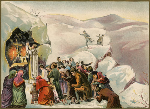
Mass in penal times (Maggie Land Blanck Collection)

Mass in penal times (Maggie Land Blanck Collection)